Wednesday 1 December 2021 - Hardknott to Seathwaite Tarn
(See end of article for map of route)
I have not previously activated Pike-O-Blisco (G/LD-024), so with the start of the winter bonus season I decided to walk a circular loop, including Hardknott (G/LD—034), Harter Fell (G/LD-028), Coniston Old Man (G/LD-013), Pike-O-Blisco (G/LD-024) and High Raise (G/LD-019). It has been a couple of months since my last trip out camping.
Setting out on the morning of Wednesday 1 December, I cycled up into Eskdale, stopping at the shop in Gosforth to buy a bottle of water. The previous few days had seen some stormy weather. Storm Arwen had brought down many trees the previous weekend. The forecast for the next few days was rather mixed, with the potential for 40-50mph winds on the summits at times, and freezing temperatures. With snow and ice forecast I was carrying full winter gear – ice-ace and crampons – along with a four season tent (Hilleberg Akto), and PHD sleeping bag. With three days of food (and some to spare) the bike was quite heavily laden.
I locked the bicycle to a signpost at the foot of Hardknott pass, next to the cattle grid. I quickly changed out of cycle shorts and into walking gear while standing behind a wall. With change from cyclist to walker complete, I started walking up the road to the top of Hardknott pass, it was about 1015 GMT.

Ascending HardKnott Pass
The weather was not too bad – wind was 20-30mph at the summit of the pass, with occasional light rain showers. Heading off road at last I headed up the steep, muddy bank that leads north towards Hardknott Gill. Stopping at the gill I drank some water before continuing north, following a clear trod that contoured around one of the many craggy knolls that make this a confusing area to locate the summit.
The last time I activated this summit was at about 1600hrs in early December 2020, with snow underfoot and in partial darkness. The going was much easier this time, and the visibility was good too. The view down the Duddon valley towards Morecambe bay was full of autumnal russet browns and deep greens. I could trace out my intended route for the next two days, following the skyline to the east.
A last climb up a steep and greasy grassy bank took me to the summit, marked by a small cairn. I was carrying a fibreglass pole and flowerpot antenna, but the wind had picked-up and it was now raining, so I opted to try with the handheld and RH770. I wasn’t sure if anyone would be listening at 1130 GMT on a Wednesday, and this summit does not have a great take-off.

rainbow over Hardknott summi

View from Hardknott to Harter Fell
First to respond to my CQ was 2E0MIX giving me a 59 report, followed by G4ZRP, G6AEK/M and MW0ISC to qualify the summit. Three more contacts were made – I was pleased to make seven contacts in total from this summit, at this time of the day/week. At the end of the activation a rainbow emerged, hanging over the upper Esk valley.
The route back to Hardknott pass was easy going, a clear track then carries across Peathill crag and onwards to Harter Fell. The is a pleasant trek, with lots to see – the path hugs the upper edges of some woodland before making across some boggy terrain below Demming Crag and eventually a final slog over some rocky ground to the summit of Harter Fell. This is a craggy summit topped with a trig point.

Panorama from Harter Fell (Click for full panorama)

Wedged against a rock, preparing to activate
Again opting to use the handheld – wind speeds with 40mph or so – I prepared the radio /logbook while wedged against a rock, and then climbed up to the trig point to call CQ at 1305 GMT.
I was pleased to hear 2E0MIX respond first again, followed by 2E0LDF, M0LJL and G7CDA to qualify. A total of 12 contacts were made over a period of about 15 to 20 minutes. It was really rather cold, standing exposed next to the trig point, and I was glad to step down to where I had left my bag.

CQ SOTA, SQ SOTA!

Munching on some flapjack I headed down off the crag, heading ESE towards the Duddon valley. The descent was trickier than anticipated, with some loose scree sections around Maiden Castle and Mart Crag. This was presumably once heavily forested as the steep path is complicated by numerous old, slippery tree roots. The Dunnerdale forest was entered, and the Duddon crossed by a small footbridge at SD234988.

Heading down off Harter Fell - the dam of Seathwaite tarn can been seen middle centre
The next phase of the walk was to take me up to Seathwaite tarn, it was around 1500GMT, with sunset at about 1550 GMT. The route up to the tarn (actually more of a reservoir) is board and easy to follow. A good camping spot at SD243987 was tempting (I camped here last December) but I wanted a head start tomorrow morning so continued .

Sunset over Black Combe
The sun was setting behind me as I walked along the north side of the tarn, the path being clearer and easier underfoot than I recalled from previous outings, At the head of the tarn the path takes a long detour to cross the feeding river and avoid some boggy ground. I decided to take a short cut across the bog and attempt to cross the river. A depth gauge showing the river as being 7-feet deep was some dissuasion but I found a narrow part that I was able to easily vault across.

Sunset over Seathwaite tarn
I pitched the tent at SD326499, an elevation of 380m, just as the last rays of sunshine died away. The wind was around 30mph with stronger gusts, and bitingly cold. I had expected this area to be more sheltered from the north-easterly wind. Dinner consisted of dehydrated potato hot-pot followed by flapjack.

Thursday 2nd December 2021 - Seathwaite Tarn to High Raise
I was awake by 0700 GMT the following morning, to make the most of the daylight hours. The wind had remained strong and gusting throughout the night – I was thankful of having earplugs to get a good night sleep.

Camping at Seathwaite tarn - ridge of Coniston Old Man in background
I was on the move by about 0820 GMT, after thawing my shoe laces and emptying ice-slush from my water bottle. Fortunately I had remembered to sleep with my Sawyer water filter inside my sleeping back – they are destroyed by allowing them to freeze-up. The sky was clear and the ground frozen – it looked like the day held great potential.
The path heads up steeply alongside Far Gill to Goat’s Hawse. It is a hard slog to begin the day. The ground was frozen but footing felt secure. Cresting the hawse revealed the view out to Morecambe Bay and Lancashire. The path now heads eastwards for the final 150m of climb, care was required as the path was frequently covered in ice – but not sufficient to don crampons.
On reaching the summit ridge I was created by a very harsh north-easterly wind, gusting over 40 mph. With temperatures sub-zero, the wind was extremely chilling. The ground was frozen hard, but dry and ice-free and the last few meters to the summit cairn were gained easily.

Summit trig point on a clear morning
Sheltering from the wind, behind the cairn I setup to use a Yaesu VX8 and RH770 antenna, expecting a good few contacts from this vantage point I called CQ at 0915. First to call in was G7CDA followed by GW4ZPL and G4VFL, and then the radio went quiet. No further calls came for a couple of minutes, I needed just one more contact to qualify. G7CDA called in again to say he had ‘phoned G1OHH, who shortly after called in to give a fourth contact. This was followed by 2E0LDF/P on Wainwright Cat-Bells (experiencing a similarly biting wind to myself) and then 2E0MIX.
I waiting a few more minutes in case of any other calls, and then made move northwards. The sky was clear blue, and the views stretched out to Northern Ireland, SW Scotland, The Pennines and Lancashire. Across to the west, Harter Fell looked closer than my previous afternoon’s efforts suggested. Far below I could see the place Ihad camped the previous night, at Seathwaite tarn

Seathwaite tarn far below

Scafell Pike G/LD-001 (and Hardknott at left)
After crossing Levers hawse I followed a trod along roughly the 750m contour, avoiding the worse of the wind that the ridgeline above was exposed to. I was soon descending the slope to the summit of Wrynose pass (elevation 393m) where I paused for a break. It was just after 1100hrs and I edited my alert forward by half an hour for Pike-O-Blisco.
Refreshed by a short break I headed up to Red Tarn and turned off for the rocky climb to the Pike. It was here that I met the first other walkers since I had started out the previous day (and the last I would meet for the rest of the walk).
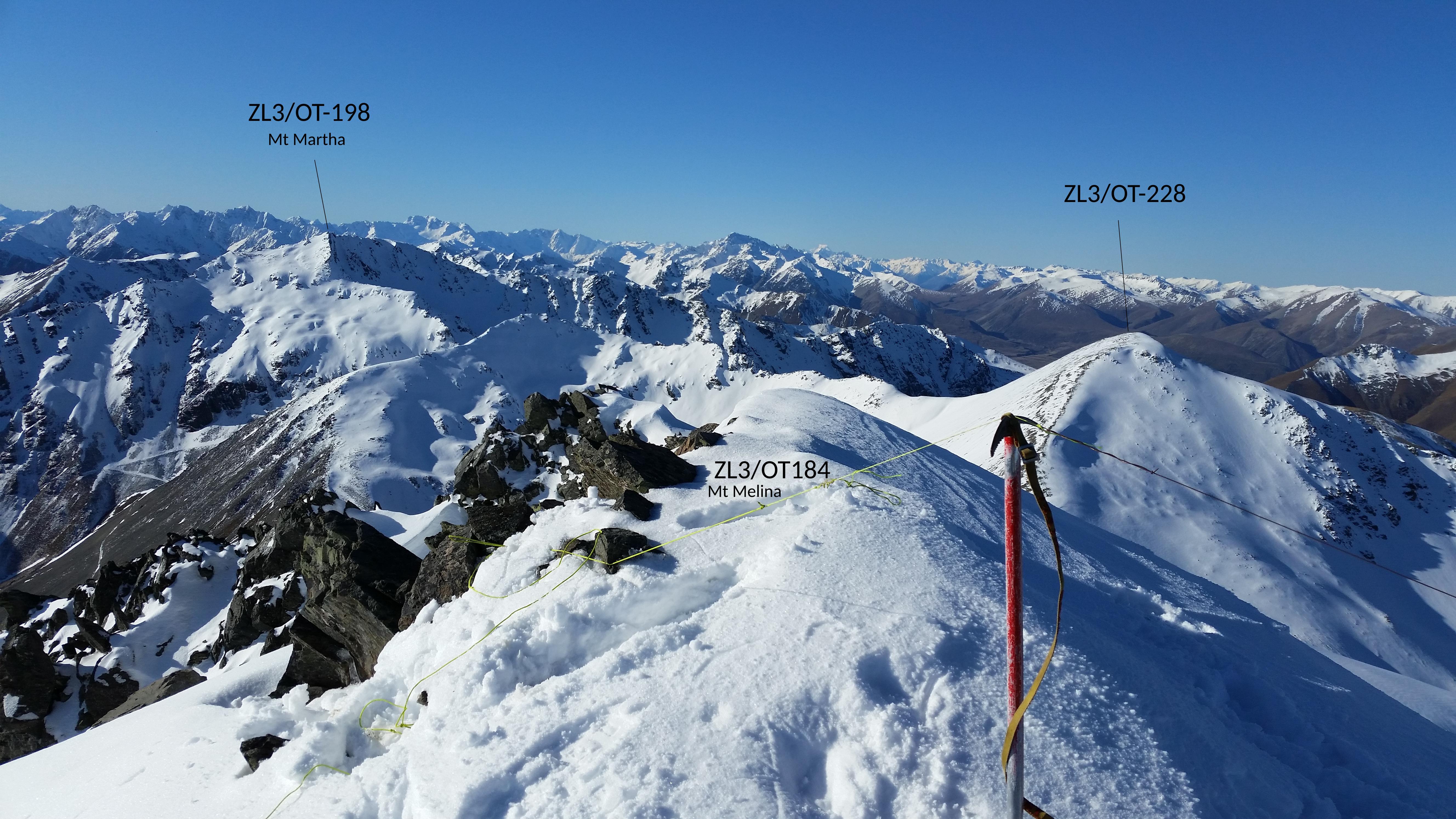
Making use of the fibreglass pole and flowerpot antenna I called out on 2m from the summit cairn at 1230BST. First to respond was G7CDA followed by GW4ZPL. G6AEK and G1OHH. I managed a total of 15 contacts including a summit-to-summit with G3TQQ/P on G/LD-050 (Gummers How) and GW8NZN/P on GW/NW-044.

Langdale far below - activating Pike-o-Blisco
With the sun shining and the wind having dropped, it felt relatively mild atop the summit, and I spent a good half-an-hour or more enjoying making the contacts. The view into Langdale and across to Windermere was remarkable.
Conscious of not burning too much daylight, I set off from the summit at about 1315hrs, heading back the way I had came, from Red Tarn. The descent into Oxendale included some icy sections requiring great care, and I was pleased to reach the valley floor. A wide level path took me around the base of Bow Fell and into Mickelden.

n a summers day, this place s very busy! Not a soul to be seen today.
This is the popular starting point for day treks out to Scafell Pike – I am always surprised how many people choose this long route to climb Scafell Pike. However, not for my the steep climb to Angle tarn, I was heading up to Stake Pass to a spot I have camped at many times before.
It was 1500 hrs when I started the ascent, with the blue sky having being lost to cloud cover – a front was moving in. I hoped the weather would hold for a couple more hours to allow an ascent of High Raise.

Ascending to Stake Pass
Atop the climb the path winds through a bowl of grassy drumlins. This is a lovely time of day to be out on the fells. All is quiet, nobody around and a sense of true wildness. Part way along the pass I veered off the path to head due east to a camping spot alongside Stake Beck at NY269089, elevation 500m.
With tent pitched I emptied as much luggage as possible into the tent, and set-off for the summit (double checking I had not left the radio behind). It was now 1630 GMT, and the sun had properly set.
The is a climb I have done many, many times, and is a good path provided you ignore the markings on OS maps which will lead you astray. The last red glow of the sun could be seen in the west and the lights of Keswick to the north. To the south a single small light could be seen heading up what I assumed was Scafell Pike.

Night time activation of High Raise
The summit shelter appeared out of the darkness and I headed inside. It was now 1710 BST and I thought sure of making a good few contact. First to respond was G4WHA followed by G7CDA and G1OHH, and then all went quiet. I had raised a spot by SMS, and continued calling for a few minutes. I was so very pleased when 2E0MIX called in, to qualify the hill. G4YTD gave me a fifth contact and I hung around for a couple more minutes but heard nobody else.
It is rather odd that the two hills I assumed to be easiest (Coniston Old Man, and Haigh Raise) provided most difficult.
The climb back to my tent went very quickly. It was a relief to find my tent again – there is always a nagging doubt that it might blow away and then I would spend the night searching in circles for it.
The wind had dropped to almost nothing, and although it was cold I was able to sit outside my tent and cook (pasta-a-la-Salmon). As I tidied away the cooking gear a few flakes of snow started falling, and I headed inside the tent at about 1830 GMT.
The wind picked up over the next couple of hours, and heavy rain/sleet fell at times. I woke periodically in the night to hear the collected sleet avalanching down the outer wall of the tent.
Friday 3rd December 2021 - High Raise to Hardknott

The sleet had mostly stopped by morning, and the wind was fairly slack in this location. Despite the 500m elevation this is a well sheltered spot, with the surrounding drumlins protecting the tent.
Tent packed away, I was off just after 0800 BST, heading off along the south side of Langstrath to Angle Tarn and then over ore Gap (on the north side of Bow Fell) and down Yeastyrigg Gill.

Heading up to Ore gap

Angle Tarn Viewed from ore gap
I have not been down here for a coupe of years, so I stopped to explore abandoned shepherds refuge at NY238061) (marked incorrectly as a sheepfold on OS maps) – I always hope someone will restore this to become a small bothy.

Potential bothy (Hardknott and Harter Fell are the hills in the background)?
The valley of Ling Cove beck feels wonderfully wild and rarely trod, with many boulder-strewn hillsides to explore. My pace was quickening now as I headed into upper Eskdale. The north side of Hardknott was in view, giving me a good perspective on the summit I had activated 48 hours earlier. The Esk was in good flow and I paused frequently at each of the many waterfalls in this area.
At 1300 hrs I reached the road at the foot of Hardknott, delighted to see my bicycle still securely locked. It was good to shift my pack from tired back to bike rack and begin the ride home.
Equipment
My equipment list has been supplemented by the following new additions for this walk:
Titanium toilet trowel
Tegera 297 Gloves
Tegera 517 Gloves

The ride home

©Crown copyright 2021 Ordnance Survey. Media 018/21
Click for full map - I can’t work out how to stop the forum cropping the image to a fixed shape!