SOTLAS feature update: New map, photos, drawing...

Hello SOTA friends,

I’ve added a few new features to SOTLAS – some of them have been requested by users, and a few more came from my own to do list. As not all of them are obvious, this post explains what’s been added in the past few months.


:world_map: New map with more detail

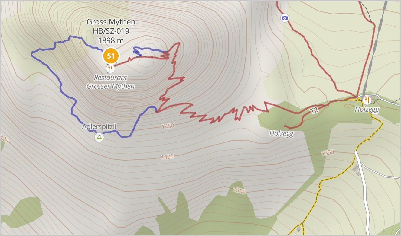
The global vector map has been re-rendered with new settings, so that trails show up earlier (i.e. in lower zoom levels). Also, hiking difficulty information based on the SAC scale is now included where available in OpenStreetMap – some regions have this on almost all trails, others almost nowhere. The values and colours are, in a nutshell:

T1 (yellow): easy trails, minimal hazard, no special equipment or hiking boots needed
T2-T3 (red): mountain hiking, fall hazard possible, sturdy boots recommended, trail easy to find
T4-T6 (blue): alpine hiking, exposed terrain, scrambling or simple climbing may be needed, trail may not be visible on the ground, special equipment may be necessary
(exact definition may vary by area and OSM author; not all trails are annotated with the sac_scale tag)

You can show/hide the difficulty information using the Screenshot 2020-04-30 at 20.16.39 button at the left of the map.
Rendering the vector tiles for the whole world from raw OSM data took about 60 days of CPU time on an 8 core machine.


:national_park: Photo uploads

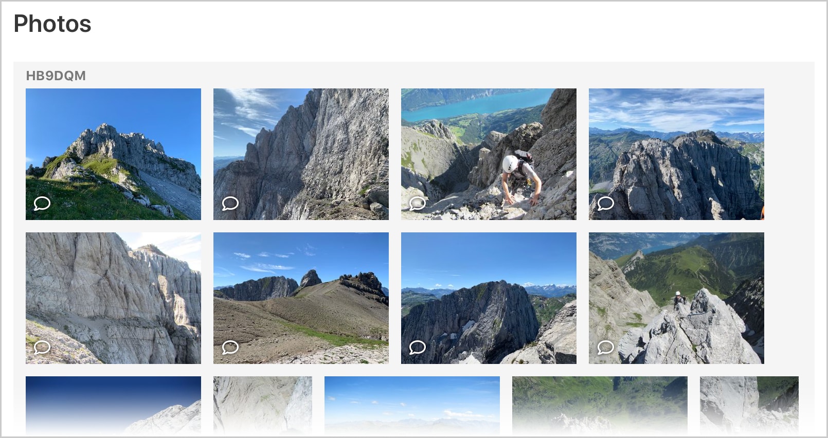
You can now upload photos of your ascent/activation on any summit page for everyone to see. Simply log in with your SOTA SSO account, go to the desired summit page on SOTLAS, and drag & drop the photos from your computer to the target area, or browse for them. You can also upload photos directly from your mobile phone.

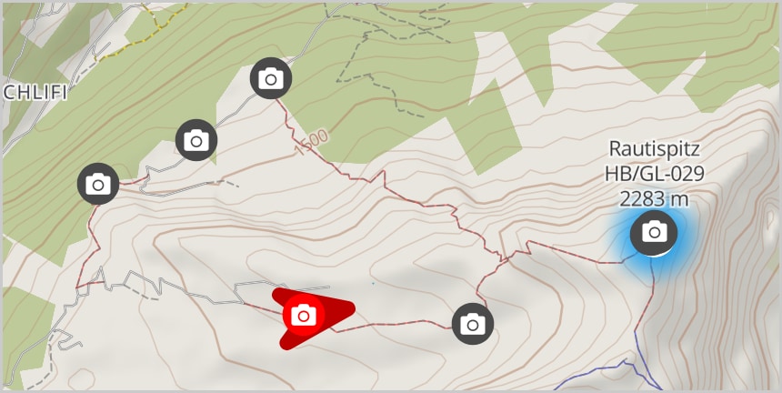
If you upload original photo files from your camera and had GPS turned on while taking the photo, with a good GPS signal (i.e. accuracy better than ± 100 m), then your photos will also show up on the summit page’s mini map, so other activators can see exactly where the photo was taken and in which direction the camera was facing. If your camera is not that fancy or the metadata (Exif tags) got stripped by editing, you can also enter the coordinates manually after uploading.

By default, photos are ordered by the date/time they were taken, but you can reorder them manually. You can also add a description to each photo.


:pencil2: Drawing on the map (with elevation profiles)

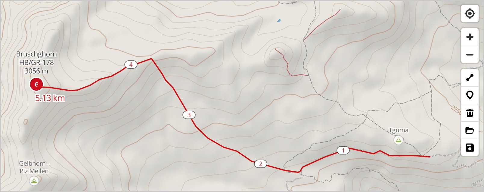
You can now draw points and lines on the map using the tools at the right side of the map. Drawings can be saved to a GPX file, and you can also load a drawing from an existing GPX.

Selecting a line that you have drawn will show an elevation profile. This is based on freely available global DEM data with a 3 arc second horizontal resolution (roughly 90 meters), so the true elevation of pointy peaks may not be accurately reflected in the elevation profile. Hopefully it will still be useful for some purposes.


:gear: Other minor improvements

Cloning spots/alerts

Screenshot 2020-04-30 at 20.36

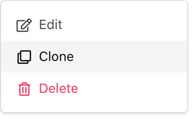
You can now clone an existing spot of yours and enter a new frequency while keeping the other information, and you can also create a spot based on an alert.

New settings page Screenshot 2020-04-30 at 20.45

There is now a settings page where you can change the units, switch the map server and set a default comment for spots/alerts.

S2S display in activator QSO log view

When viewing activator logs, S2S QSOs are now automatically annotated with the other summit reference from an S2S log entry that matches the (approximate) time, callsign, band and mode.

Map download button

The current map view can now be downloaded as a PNG (download button Screenshot 2020-04-30 at 21.05.29 on the left side of the map).

Sound on new spot

You can have the spot page play a sound (SOTA in morse) when a new spot arrives that matches your filter criteria.


That’s it for now. Let me know what you think!

73,

Manuel HB9DQM

57 Likes

Hello Manuel,

i have been using the photo function for a few days now. A great thing, thank you for the implementation!

73 de Marcel DM3FAM

1 Like

Hi Manuel,
Thanks fer nice features
73 de Franz ON9CBQ / DL3RBF

1 Like

Great addition to the SOTA universe! Thank you for all your work on SOTLAS. One question though…How do you pronounce “SOTLAS” and what does it stand for? (I guess that is two questions…)

73,

Dave, AE9Q

1 Like
1 Like

Hello Manuel
Superb tool and the new features simply are stunning.
THANK YOU!

1 Like

As Guru has already answered, SOTLAS stands for “SOTA Atlas”, and so I would pronounce it like the “Sot” in SOTA + the “las” in “atlas”. It’s a bit of a tongue-twister, but the combination of SOTA + Atlas was too good to resist :smile:

Really good update Manuel, well done. Seeing the paths and trails at lower Zoom levels is excellent. Rendering the tiles is quite an operation!

73 Gavin
GM0GAV

1 Like

Manuel, the addition of the trail marking feature is something I particularly was hoping for – thanks! I have a particular route in the Italian Alps in mind for it. Unfortunately that visit had to be postponed due to COVID-19, but that just gives me more time to get familiar with the features!
tnx & 73,
Scott WB8ICQ

1 Like

Hi Manuel

Is there a limit on the number of photos or file space a user can add ?

I added a few without a problem, then it did the upload but does not complete to display them in the photo list for the summit.

I guess there should be a limit otherwise the server storage could be overwhelmed.

73 de

Andrew (G4VFL)

1 Like

Bravo Manuel !
I discovered options few days ago and I want you to say “MERCI BEAUCOUP !”
73 Roger

1 Like

Hello Andrew,

There is no set limit; we rely on user discretion as to what is a reasonable number of photos per summit :wink:

I’ve so far uploaded up to 20 photos at once without any problems. Which browser/version/operating system are you using? If you think it’s related to the files themselves rather than the number of them, then please send me some of the problematic files so I can debug. But in general, SOTLAS should accept any valid JPEG or HEIC/HEIF file, and so far 20 different people have successfully uploaded photos.

Don’t worry about the server storage, there is space for several hundred thousand photos, and more is easily and cheaply added if necessary.

73,

Manuel

1 Like

Manuel,

Thanks for the updates to this great program!

Note: I tried a couple of uploads and it appears that it is removing the minus sign from the longitude on my pictures. I went in and manually added them back in. Have you or others tried an upload with negative longitude? The original files appear to have the correct exif location data. Here’s where I added them, though I have already edited them to add the minus back (thanks for having the edit feature!). SOTLAS

***Update: exif bug fixed…see below…uploads with negative longitude work FB now. ***

Thanks! Jim/K7MK

1 Like

Manuel, big thanks also from my side.
Very nice features!

Added pictures from todays activations incase someone wants to see the feature in action:
https://sotl.as/summits/OE/OO-275
https://sotl.as/summits/OE/OO-368

73 Joe

4 Likes

Thanks for the report, Jim! There was a silly typo in the Exif parsing code, and of course I didn’t test with photos from negative longitudes :wink: This is now fixed.

1 Like

Manuel,
Thanks for the quick fix!!! Works perfect now for those of us on the “minus side” of things! 3rd picture uploaded with no problem" SOTLAS
73, Jim!

1 Like

sotlas us it , love it !
Thank you !

73! Ivica 9a6cw

1 Like

Hi Manuel, really good. You know what you are doing.

73 Gilbert

1 Like

Hello Manuel

Thank you for giving me something to do during lockdown (and more map choice also)… Great job…

73 Phil G4OBK

Example:

https://sotl.as/summits/OK/JC-086

1 Like

Hi Manuel,

As I am uploaded a number of images without coordinates it is a bit cumbersome to get the coordinates from for exampel. openstreetmap or so. Would there be a way to pick the coordinates from the sotlas map. So a button next to the image coordinates to click on the map?

73 Joe