The vector-based summit map that I published on my personal website a few months ago (see thread SMP patching - #14 by HB9DQM) has become quite popular. Inspired by the feedback, I have been working on an enhanced version, extending it with many features to quickly and easily discover information about summits and activators from the database.
The result, which I call SOTLAS (for SOTA Atlas), is now in a state where it can be unleashed on the general public. So, without further ado, here it is:
A reasonably modern browser and device are required. Some screenshots are at the end of this post in case you cannot (yet) access the site for some reason. It is a Single-page application (SPA) built with modern web technologies, meaning that most of the application code is loaded and cached in the browser the first time you load the site. This may take a moment, but once loaded, switching between pages should be pretty fast.
The map tiles are hosted on my server in Switzerland, so users outside Europe may experience some delays in loading the map. If anybody has a server on another continent with 300 GB of SSD to spare, please let me know
Feature highlights:
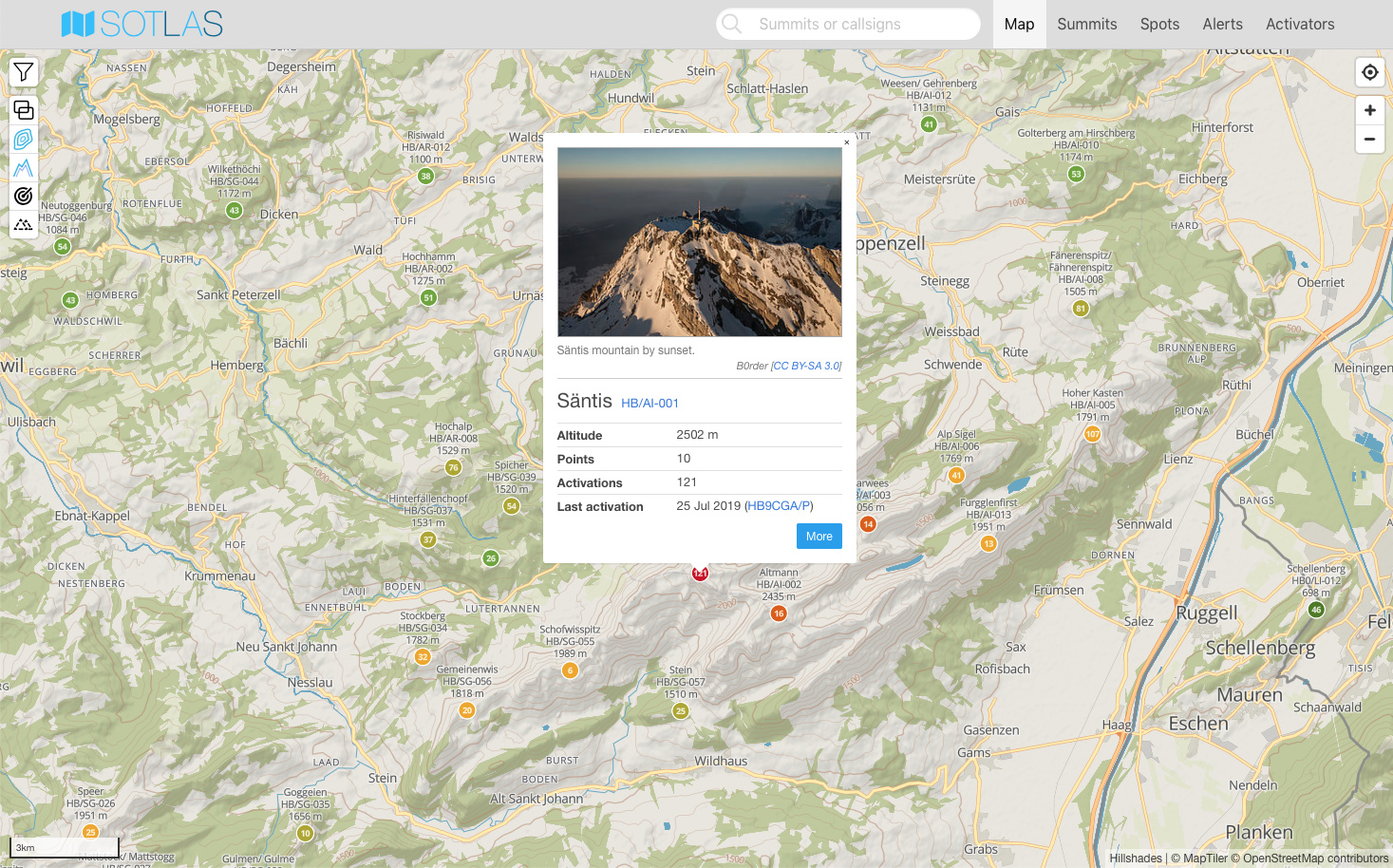
Worldwide summit map based on vector tiles (OSM data), with filter options (number of activations, activated by etc.) and display of recents spots
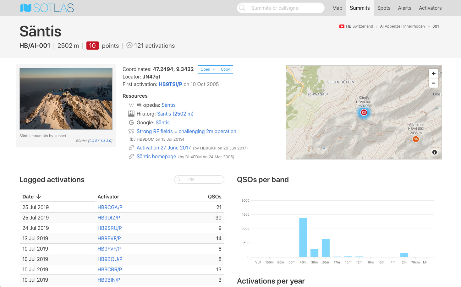
Summit browser with information from the SOTA database (including articles/links) and Wikipedia
Search for summit names, references or callsigns in the navigation bar
(try entering only part of a callsign or a summit name, or leaving out umlauts etc.)
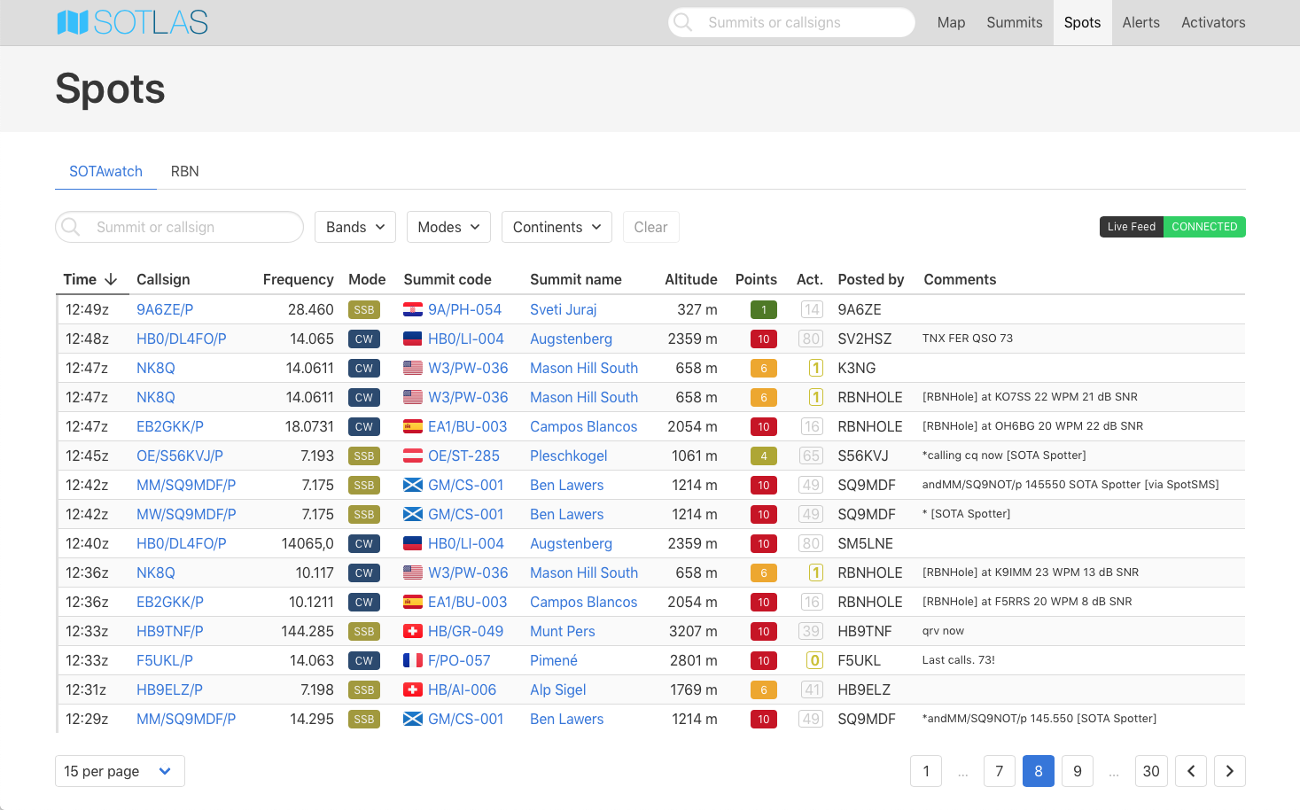
Live view of SOTAwatch spots without having to refresh, with filter options by band, mode and continent
Live view of RBN spots from registered SOTA activator callsigns, or from ongoing spotted/alerted SOTA activations
Alert list
Activator details with last spots, statistics and a list of all activations
Responsive design for mobile devices
I hope that this new resource will prove useful, and intend to extend it with more features in the future. Feedbacks and bug reports are welcome, either here or via email to mk@neon1.net.
I’ve only just started looking but I’m very impressed so far.
I like how I can bookmark on my browser a zoomed-in view of my local summits and they are nicely colour-coded by summit points and clickable for more info.
Thank a lot Manuel for this great tool. The previous version was working fine using Chrome on my Android phone. The new version does not show any map. The summit markers and the rest of the interface is there. Any idea?
Strange is that in a new inkognito tab it works fine.
Hello Joe, your browser may have cached some map tiles from the old page, which uses the same map server, but with a different CORS header setting. Try clearing the cache in Chrome on your phone (see Clear cache & cookies - Android - Google Account Help).
Oh, I forgot to mention a little hidden feature for those who are accustomed to imperial units: simply click one of the altitude labels, and the units will switch from meters to feet (or back) on the whole site, and this setting will be remembered in the browser.
I cannot decide if I’m more amazed by your climbing skills or by your web programming abilities. You are making truly great contributions to the SOTA movement in the both areas. Congratulations, Manuel!
It’s another big thumbs up from me. What a great app! Together with SOTAMaps we are very fortunate to have two very useful resources in the SOTA community.
Thanks Manuel for all your efforts in creating this.
Many thanks for giving me a simple but comprehensive map system for my phone. I struggled with the SOTA3 SOTA maps and was swapping about to Toppo and Street maps to get something I could use in planning when no computer was available. Now, Problem Solved. I am grateful.

 !!!
!!!