Sit down with some tea, beer or a malt. This is a long read.
Tops Activated
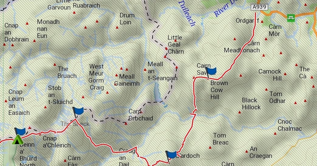
GM/ES-023 Brown Cow Hill 829 m, 4 points
GM/ES-015 Cullardoch 900 m, 6 points
GM/ES-006 Ben Avon (Ben A’an) 1172 m, 10 points
GM/ES-004 Beinn a’Bhuird 1197 m, 10 points
GM/ES-011 Beinn a’Chaorainn 1083 m, 8 points
GM/ES-017 Creag Mhor 895 m, 6 points
GM/ES-010 Bynack More 1090 m, 8 points
GM/ES-002 Braeraich 1296 m, 10 points
GM/ES-009 Sgor Gaoith 1118 m, 10 points
55 miles / 88 km walked. 15,800’ / 4800 m ascent
Background
I’d actually been avoiding activating any of these peaks this year, hoping that I’d have a chance to do an overnight hike and string at least some of them together into a route. That opportunity presented itself when Mo announced that she and her sister were taking themselves off to Edinburgh University outdoor centre in Glen Feshie near Aviemore for a three day yoga and well-bieng retreat.
My initial plan was to hitch a lift from Mo to Glen Feshie and walk home, or as close to home as I could get. However, the event timings were revised and Mo wouldn’t be arriving at the centre until 4pm. I decided to reverse the route and Mo would drop me off at Cock Bridge at 8am so that I could have three full days. It was actually a more appealing option - I mean who wants to end an epic hike on Brown Cow Hill?
Day 1 Friday 27th August 2022
It was 0810 (All times BST) when I was eventually dropped off. I knew it would take me roughly two hours to ascend and find the top of Brown Cow Hill, initially on Land Rover tracks, then attempting to find a narrow path up through heather and peat hags, leading to the long and broad table-top summit.
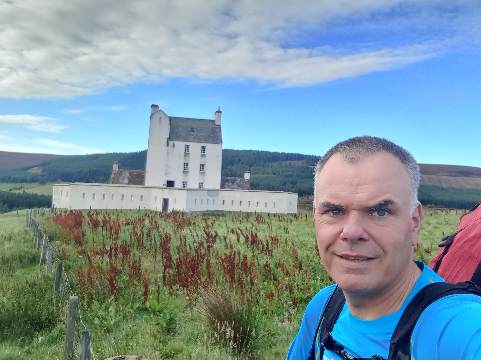
just after setting off - passing Corgarff Castle
As usual, I didn’t find the track and ended up ascending further east than usual. This worked though - I avoided the peat hags and soon found an ATV track that took me to the summit plateau. There’s a new fence here but it has a gate.
I re-arranged the small cairn to allow my mast sleeve to drop in and then hoisted the Carbon6 and 41’ random wire. A 15’ counterpoise trailed along the ground, both connected to my elecraft KX-2 via a 9:1. I’d repeat this set up throughout.
You never know what you’re going to get on 40m SSB these days. Thankfully this was a good one. 22 QSO’s in the VK Port-a-log in no time at all. When that dried up, I dropped the wire, leaving it on the ground and hitched my 2 m slim-G to an upper section of the mast, raising it again to try for Simon @GM4JXP. As it happened, Hibby in Aberdeen @MM0RFN nipped in first. Both Ops. were aware of my plans and were determined to work me on 2m throughout.

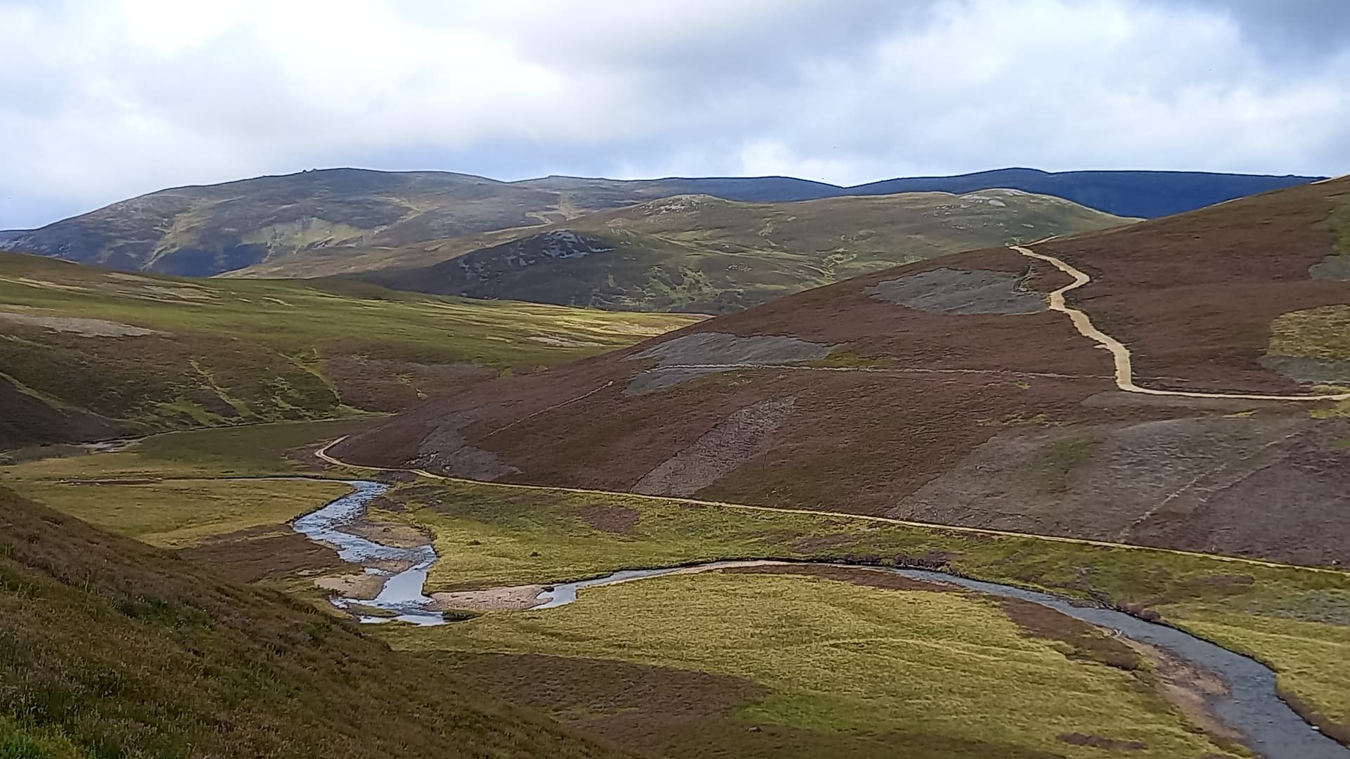
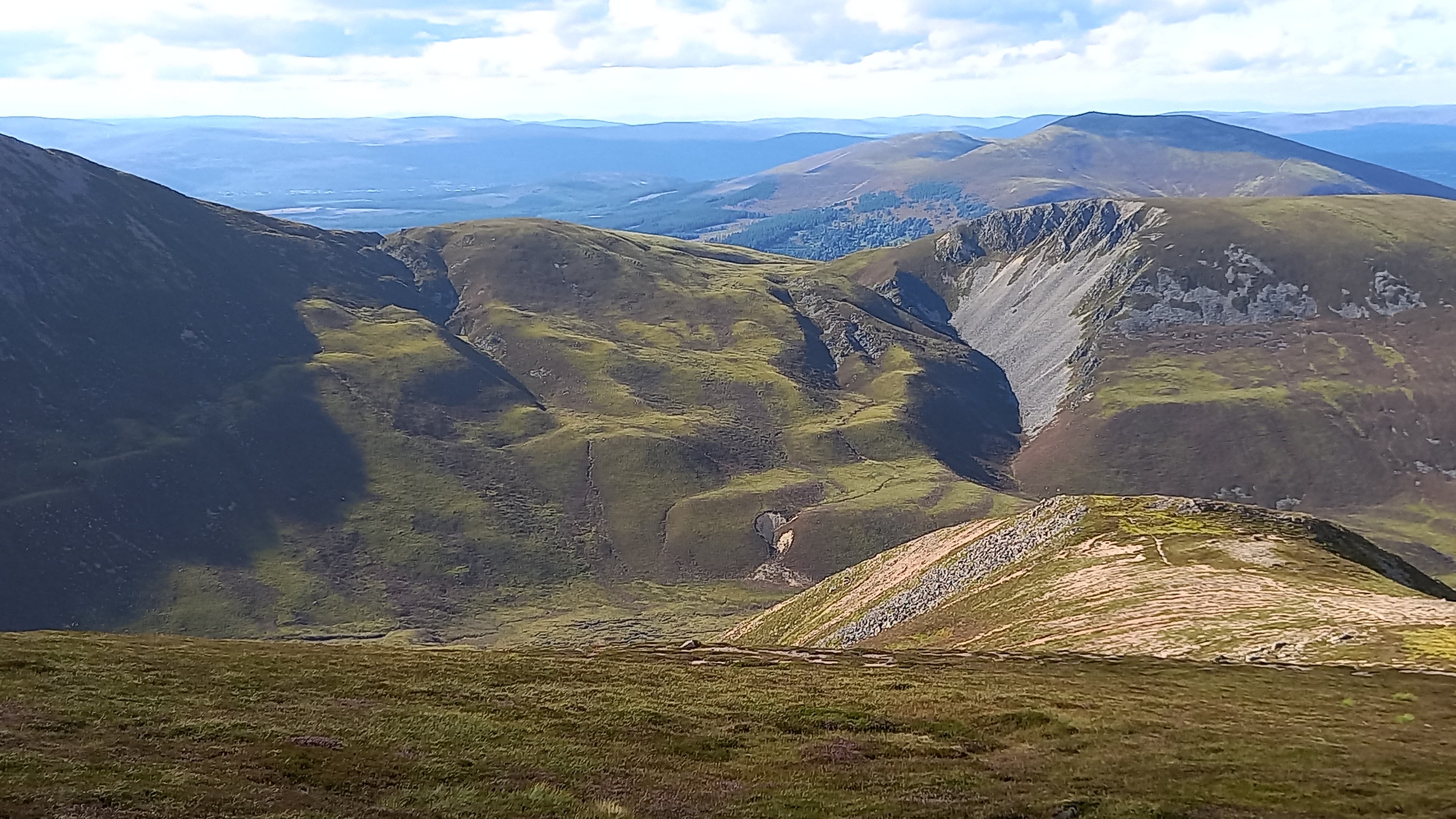
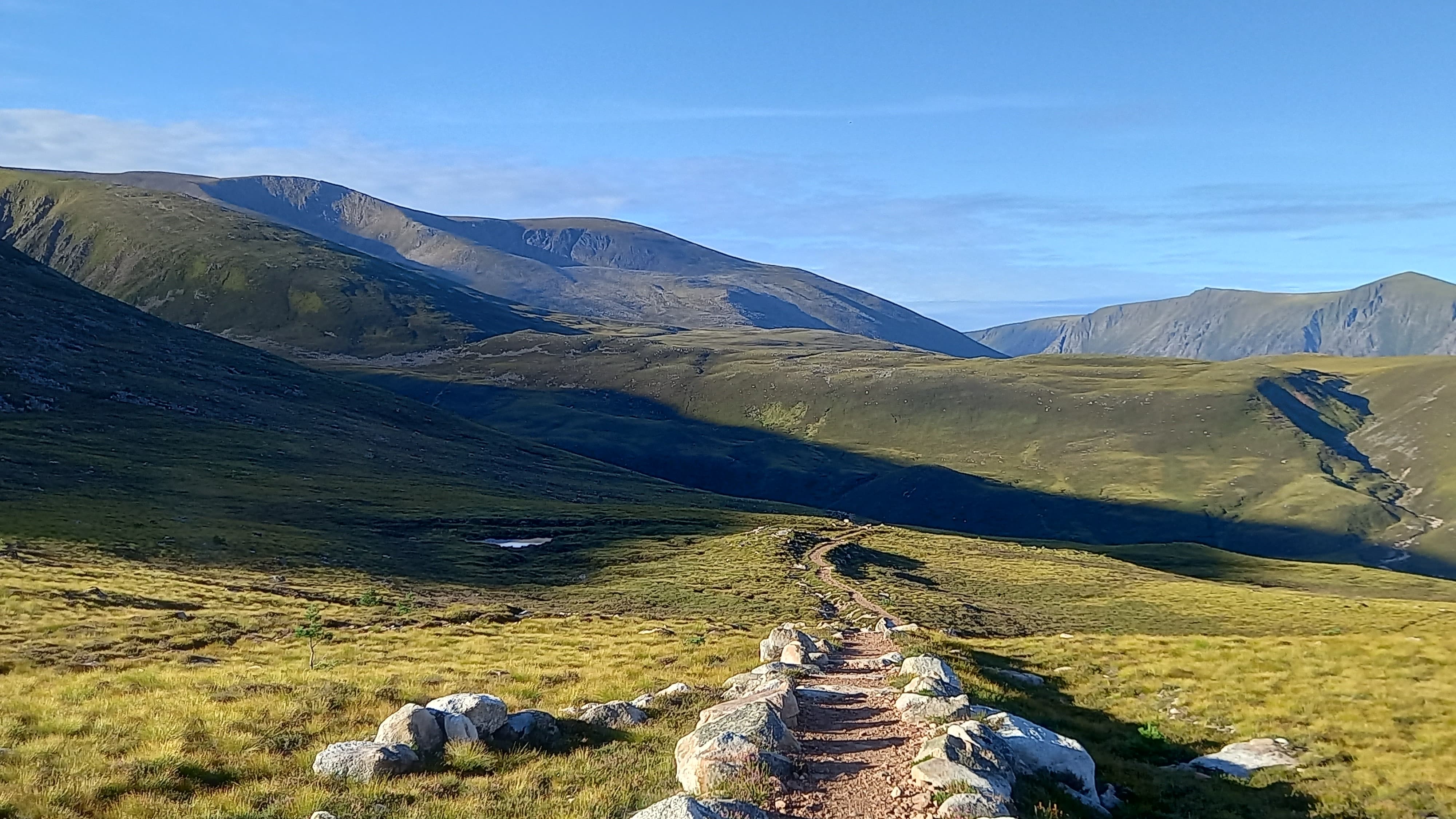
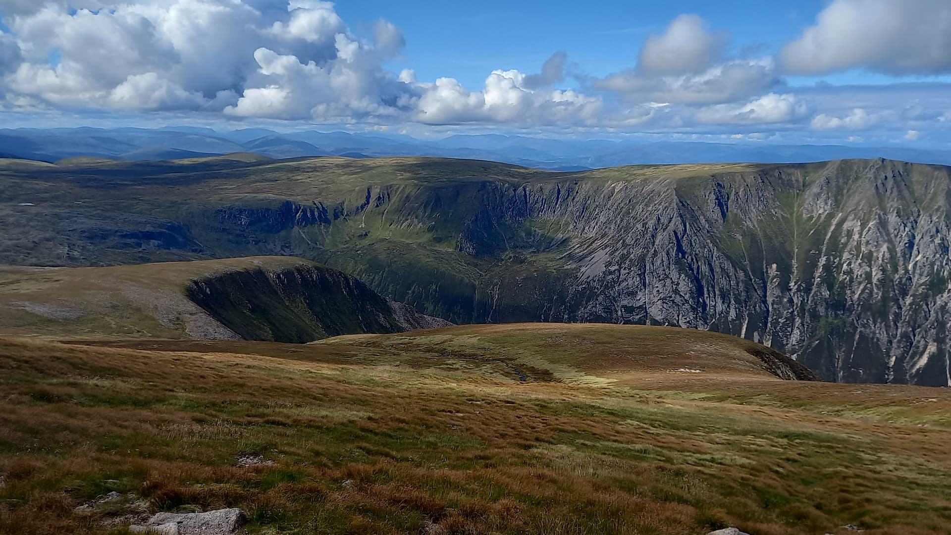
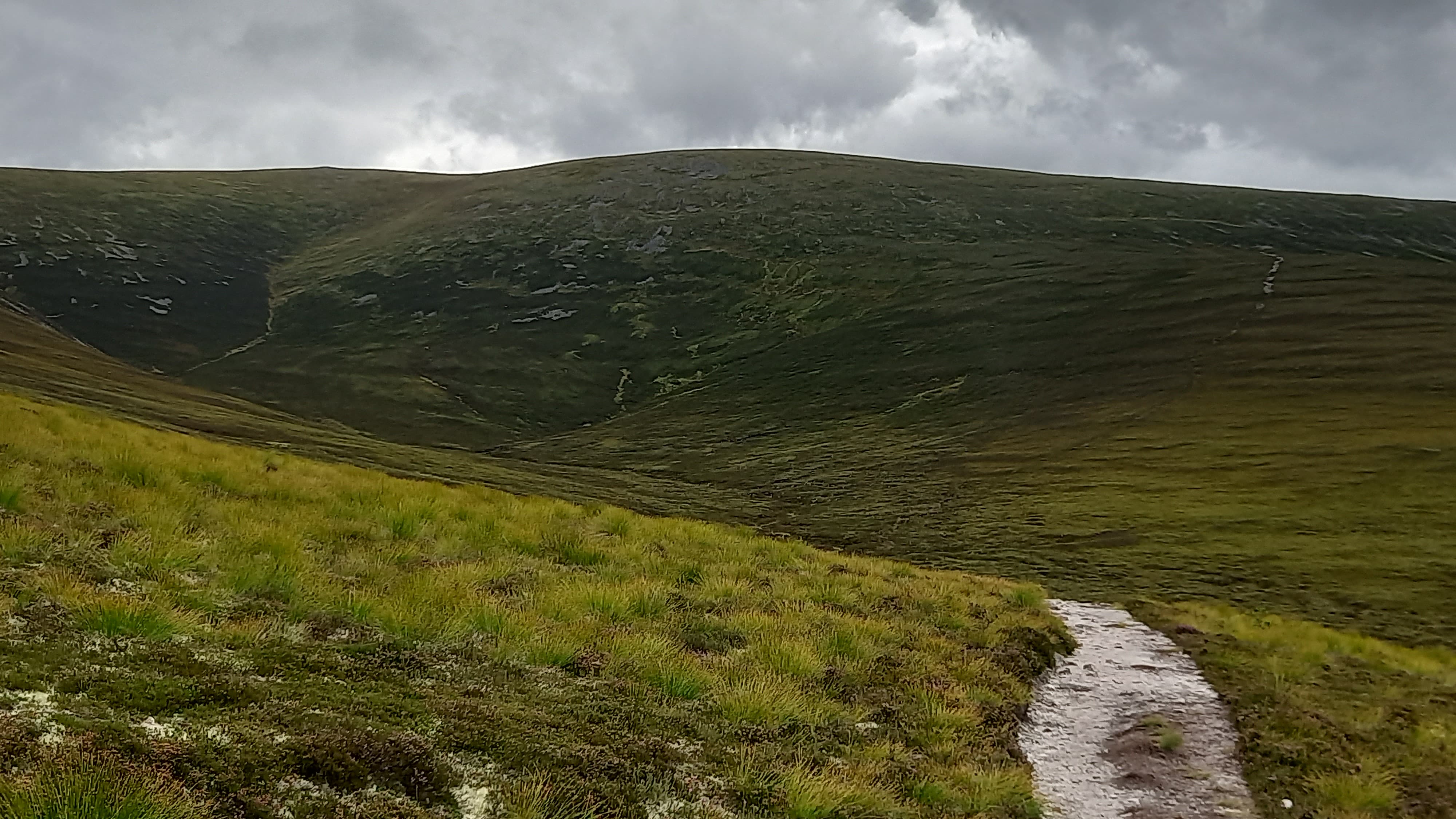
south west from Brown Cow Hill - Cullardoch above the cairn, sprawling Ben A’An to the far right
I was packed up and on my way at 1040. Cullardoch was clearly visible, as were a cluster of rain showers moving around it. Ben A’an had been in cloud but it seemed to be slowly clearing.
Initially, following the plateau further west avoided broken round and then a turn south took me to the top of an estate track that dropped into the remote Glen Gairn. The map showed a bridge and indeed there was one. Crossing it took me immediately on to a steep vehicle track that ended below the eastern shoulder of Cullardoch. Thereafter a faint path took me to a deer fence with a nearby gate and on to the final steep push towards the summit of Cullardoch.
crossing the River Gairn, Ben A’an tor just visible. The estate vehicle was the only sign of human life I saw all day
looking up Glen Gairn towards Ben A’an
Showers still moved around as I set up. I recall Gavin @GM3GAV writing that the trig point central hole remained open, a point I’d not noticed last time up here but one I was eager to make use of today. Use it I did, and at 1305 I keyed the mic., calling CQ on 40m. Eleven stations responded this time. I then did the quick swap to 2m, working Hibby, Simon and one other Aberdeen station, around 95 km to the east.
On Cullardoch and still dry at this point
I was fairly optimistic at this point. Still on time, missing the showers (that hadn’t been forecast) and managed to find tracks to ease my passage up Cullardoch. The next section would be more problematic. I had to drop north west back into Glen Gairn, head west for a few km and then decide whether to use a glen or a broad ridge to ascend towards Ben A’an.
As it happened, the track down to the glen was initially a good one, however it petered out to a grassy line and then virtually a deer track However, it did take me to the bridge marked on the map and this in turn took me to the narrow and rough path which would take me further west up the wild glen in search of a Ben A’an ascent route.

crossing the River Gairn for a second time, in rain and gloom
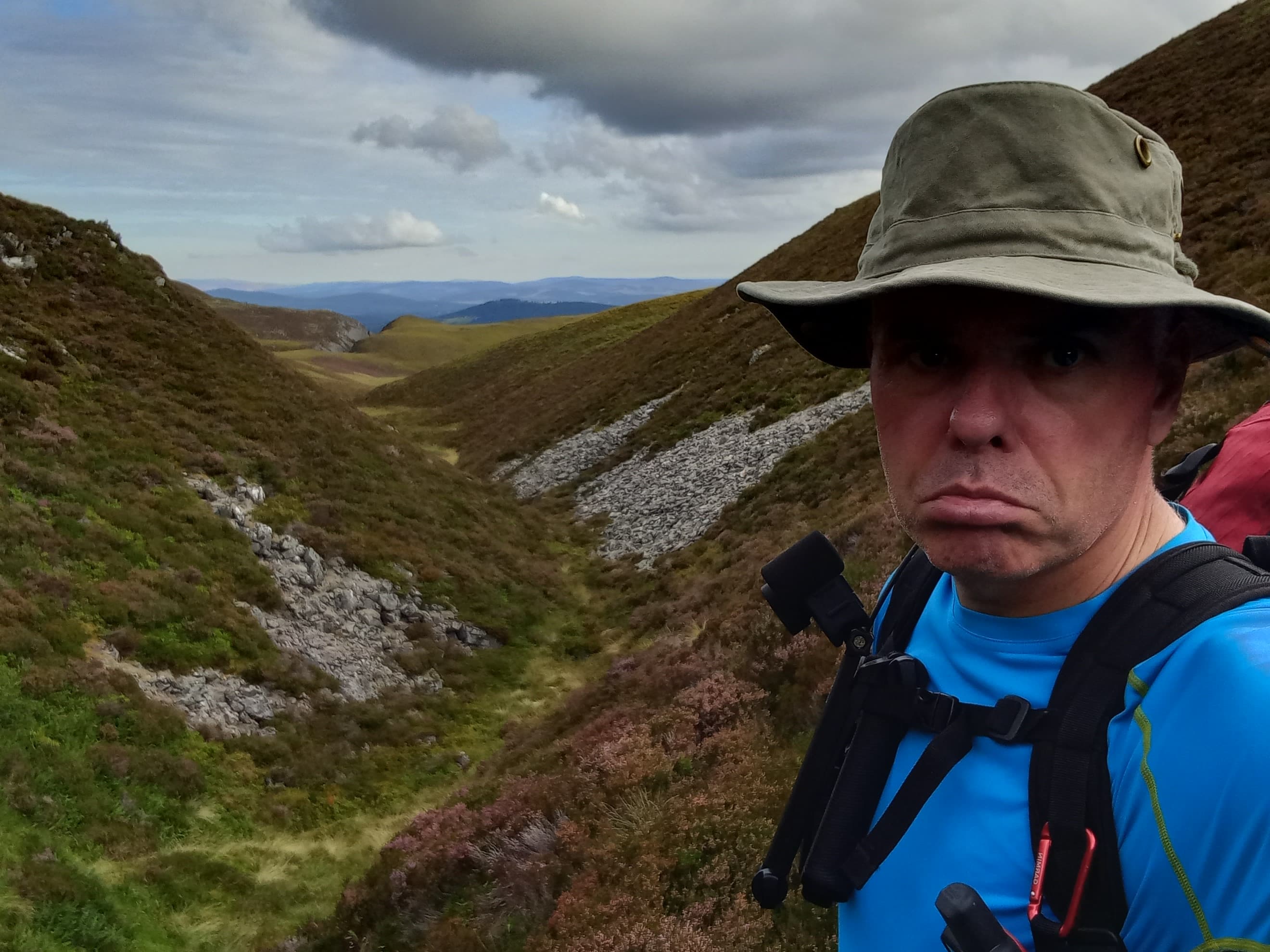
It was now raining. Heavily. There was little wind and I correctly judged that any shower which passed over would be slow moving. After a few km I stopped to check the map on my Garmin GPS. I’m so glad that I did! I was standing at the exact spot that a path diverged north to follow the Allt an Eas Mhoir (stream) up a glen. I hadn’t seen the path on the ground, but as soon as I saw it on the GPS it became visible to my eyes. Easing rain brought midges out, so I didn’t hang around. Up the path I went.
It was rough and initially hard to discern, however the line improved further up, although it remained rough. Eventually it passed close enough to the stream that I could stop for a fill-up and some snacks. A few midges were also consumed.

wolfing down some tuna rolls that Mo had made for me
The path ended as the stream diverged into smaller ones and the glen opened out onto the upper slopes of the mountain. I ascended what looked like a grassy slope, however this turned out to be a jumble of boulders barely covered in moss. No fun with a 12 kg pack.
Soon enough - a view. The showers had cleared and blue skies hinted. Unfortunately, I’d need to drop to cross a high stream and then ascend steep slopes to finally reach the summit tor.

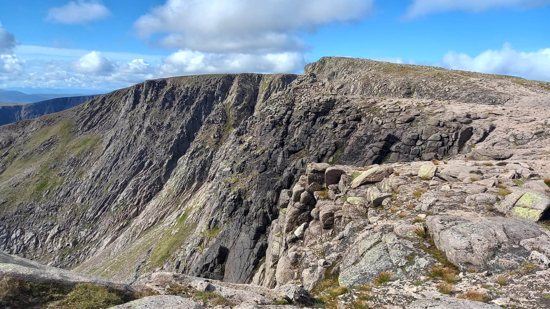
below the highest of Ben A’an’s many tors
An objective of this trip was to activate from the true top. The AZ just extends to the sloping ground to the north of the tor and I’d used this before for HF. From the very top, HF would be problematic, so VHF was the plan.
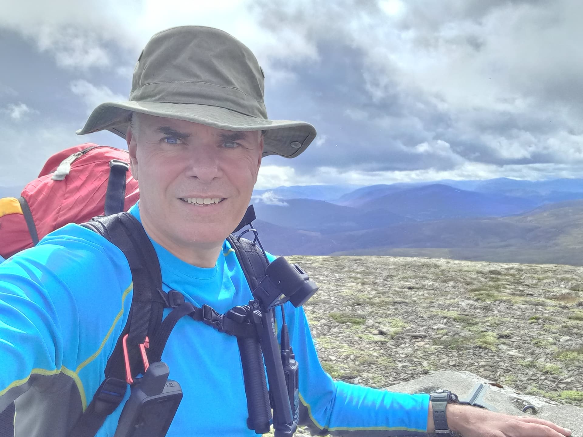
Scrambling up a wet but grippy granite chimmney took me to easier ground and the summit block. I hoisted the mast and slim-G straight out of the rucksack, the weight of the sack wedged between my legs enough to hold it steady. The warm sun started to burn the moisture from the mountain all around me, raising a thick mist. It was 1645 now.
I was looking forward to this one. 10 points on offer and a good VHF take-off all round. I wasn’t to be disappointed. A mini pile-up with 10 QSO’s in 20 minutes, including an improbable summit-to-summit with Graham 2M1GPR, who was on GM/WS-149 over in Torridon to the north west, some 140km away. 5 w at each end both into half-wave antennas.
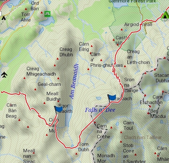
I was aware of how cold I was getting, so layered up a bit before descending the tor via an easier route and then heading off west for the short-ish walk over to Beinn a’Bhuird, initially flat across the plateau, before descending to The Sneck (a high col) and then up a steep path.
I needed to pick up 2 litres of water for my camp. Unfortunately none was to be found en-route and convinced that I wouldn’t find anything on top of Beinn a’Bhuird, I dumped my pack at the Sneck and headed downhill for a couple of hundred metres. Eventually I found an embryonic stream gurgling out of the hill. The cloud was clearing, partially revealing Beinn a’Bhuird’s vast corries.
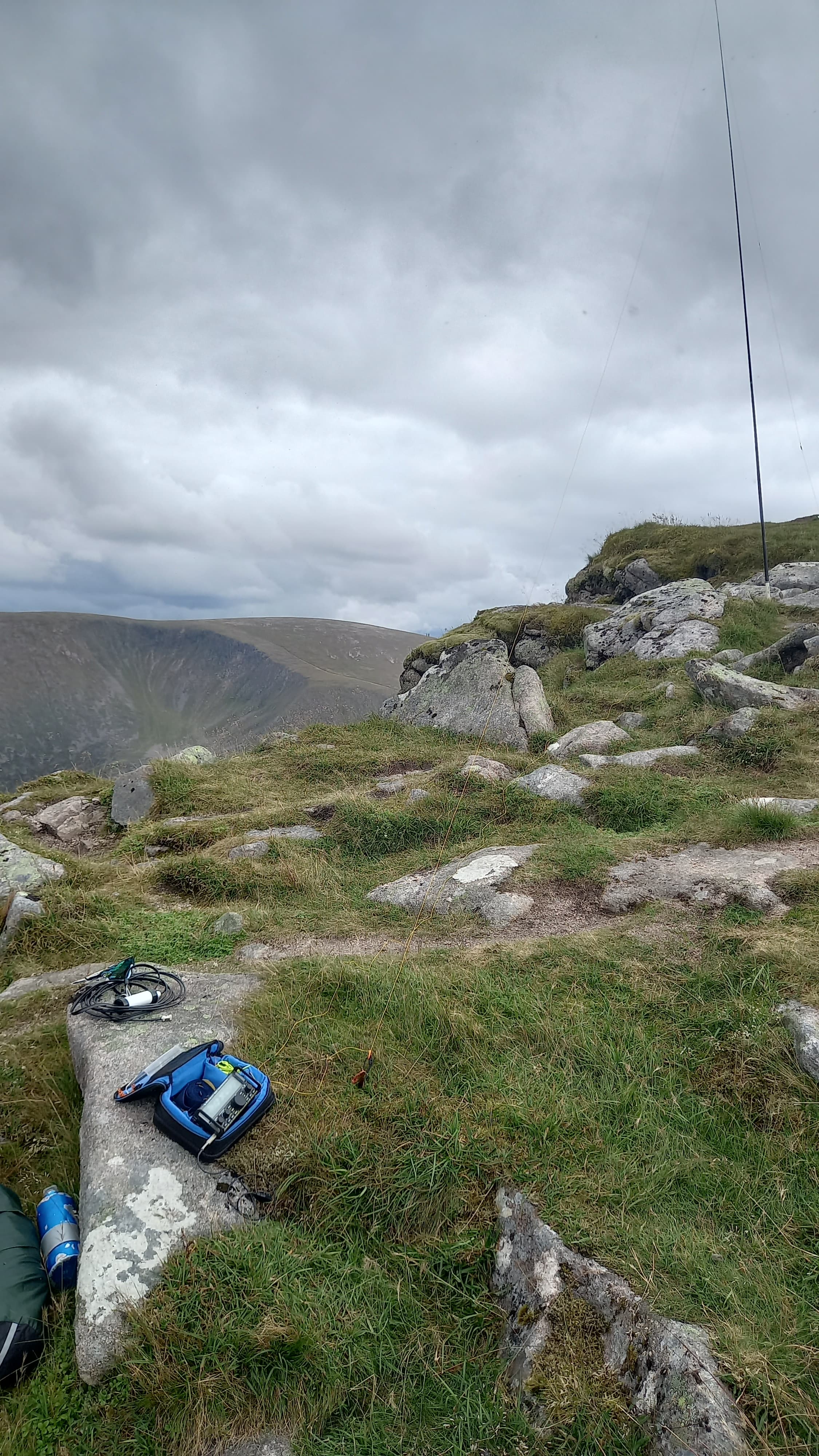
The Sneck and the way up to Beinn a’Bhuird, the summit obscured by cloud
On reaching the plateau I found, of course, plenty of running water. On a previous ascent this had been a snowfield, so I excused myself and continued up to the summit - one which was obscured in a thick mist.
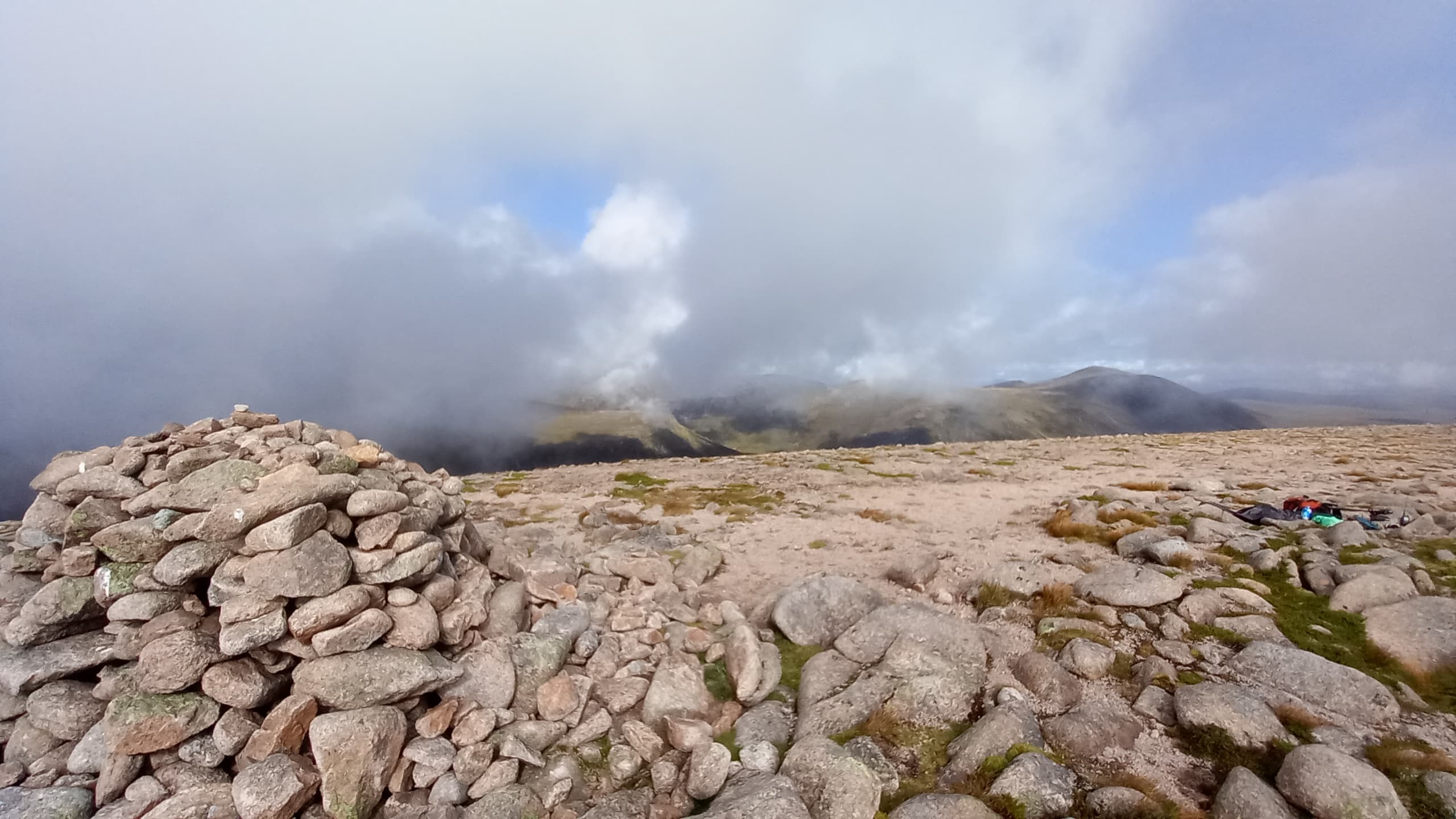
Again, the mast went into the cairn rocks. Only, this time the rain came on. I was fully exposed. Keeping the KX2 in the carrying case, I quickly connected the wires and got my spot away. In my rush I neglected to take out my back up note pad and kept the log on VK Port-a-log, which almost saw me come undone. I couldn’t keep the screen dry in the driving rain, nor the radio for that matter. Huddled over both, I hoped for a very quick activation and indeed it was, with 6 QSO’s in short shift and then a couple of un-answered CQ’s alowing me to shut down the station free of guilt.
Beinn a’Bhuird. A spectacular viewpoint, but not this evening
It was now 1930. I’d planned to drop west from the plateau, still maintaining altitude, but hoping to find grassy ground for a camp. With 100 m visibility and continuing heavy rain, I saw little merit in continuing with this plan. The tundra landscape on the summit consists of granite soils and sub-arctic flora. Spotting a gravel patch free from tusocks some 10m from the cairn, I decided that would do.
Putting a tent up in the wind and rain usually results in wet everything, especially a small back-packing tent. Things didn’t go too badly and I was soon inside along with a dry sleeping mat and sleeping bag. The rain continued and the wind strengthened. I started to debate the merit of camping at 1197 m!
A hot drinking chocolate soon raised my spirit. A beef stew followed by a rice pudding, both from Expeditionfoods.com, were quickly consumed. It was 2030. It still poured down and wind still flapped at the tent. With little else to do, I turned in for the night.
Day 2 - Saturday 23rd August 2022
At 0700 I peeped outside the still very wet tent. Sunlight. I emerged to an inversion as the sun rose in the sky. This was unfortunately short lived as the heat from the sun again raised a mist and I was soon enveloped in cloud. Experience told me that it would remain until 1000, as long as the sun prevailed.

The summit camp - morning
After a breakfast of overnight oats and hot chocolate, I reluctantly donned my still wet trousers and then packed up the sodden tent. Of course, everything was much heavier now and I really felt the extra weight as I hoisted up my sack.
What followed was a GPS led tramp over the high plateau, always heading generally west towards my first summit of the day, Beinn a’Chaorainn, some 5 km distant. I’d hoped for pleasant alpine grasses and the like. Instead I was rewarded with boulder fields and a soggy watershed. Tricky to navigate in the mist without being able to see the bigger picture. Eventually though, the ground rose in front of me and I climbed the sub-top of Beinn a’Chaorrain, but only enough to allow me to skirt around to the col leading to the summit slopes of my objective.
cloud clearing all around Beinn a’Chaorrain
I think I apologised to Ken @G0FEX for being an hour late! Ken didn’t mind. Nor did the eighteen other stations I worked between 1029 and 1040 that Saturday morning. By the time I’d finished, the cloud was clearing and by the time I’d packed up and commenced my descent to the north I could see my other objectives for the day - Creag Mhor and Bynack More, the former hardly discernable as a summit from this altitude, appearing as flat as a pancake, and the steep eastern slopes of the latter filling me with dread.

Bynack More left, deceptively flat looking Creag Mhor right

Cairngorm itself in the distance (non-SOTA)
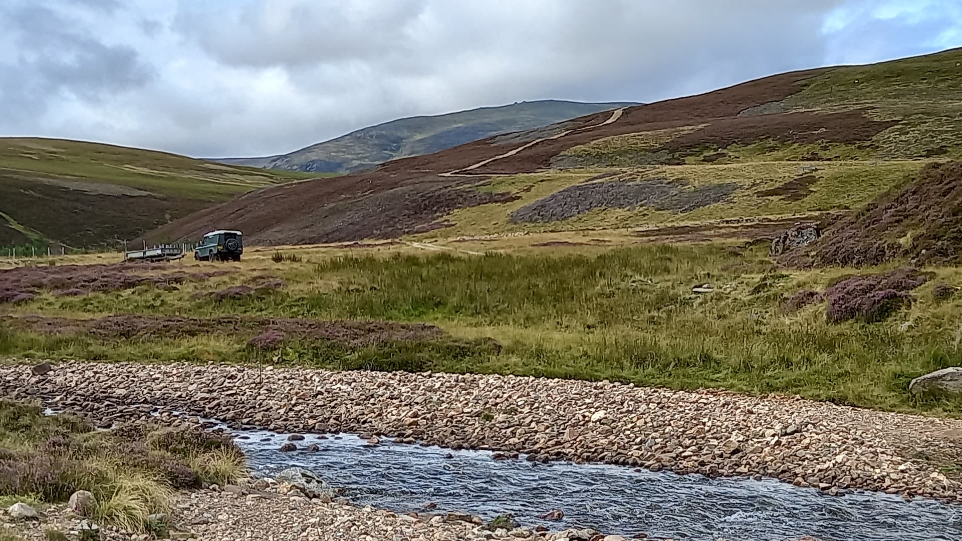
The long drop north ended at the River Avon (A’an) and its notorious ford. I’d never managed across here before without removing boots and wading. The ford had been in the back of my mind since starting to plan this trip. High water could mean the end of the expedition and a long, long walk out along the river valley, all the way back to Cock Bridge.
Well, I’ve never seen it so low. I was across in seconds, using large blocks as stepping stones. Happy Days!

reaching the surprisingly low waters at The Fords of Avon
Outside the nearby refuge a group of London lads told me that they were on their first Cairngorm expedition, having just purchased a load of gear before coming up the road. They had already lost two of their team to midges whilst camping at Corrour bothy the previous evening. They told me they were heading over to Ben Macdui GM/ES-001. I did wonder why they were on this side of the river but left them to it.
My route to Creag Mhor took me initially up the decent path through the pass between Creag Mhor and Bynack More, however I soon had to leave this and head up initially steep and heathery slopes, which soon gave way to easier walking on short vegetation. I reached what I thought may be the summit, only to see it revealed before my eyes, still some 1 km distant.

Creag Mhor
It was around 1300 by the time I eventually got there and got set up. A contest was just begining and I’d been keen to get the activaton done before it started. However, the 40m band was experiencing afternoon doldrums and I was lucky to get four in my log, with the summit to summit to David M(W)0JKS from GW/NW-026 being the highlight. Another trip objective complete. This was a new summit for me.

pleasant operating conditions but poor 40m band conditions from Creag Mhor
The way over to Bynack More was still undecided. Dropping straight into the glen followed by a direct ascent was one brutal option. Heading NW to pick up the nice ‘official’ path that ascends Bynack More would be easier on the lungs but much longer. I still hadn’t decided by the time I reached the path through the glen.
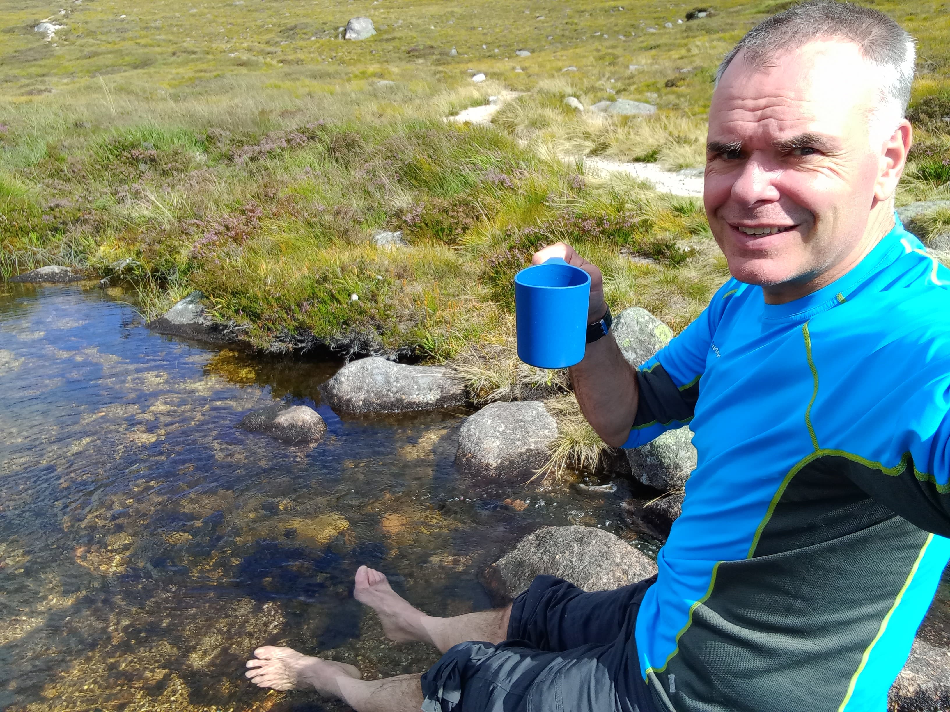
I decided to stop for a proper break where the path crossed the Allt Dearg burn. On went the stove and off came the boots. Over a cup-a-soup and some snacks whilst cooling my feet in the burn, I looked up and could see the Barns of Bynack on the skyline. I’d never visited these tors. A direct ascent to them would be steep but the slopes above would take me directly to the summit at a lesser angle. It was decided.
a late lunch
It transpired that the ascent wasn’t so lung-bursting as I had feared, the ground being so steep, the heather so long, the mosses so slippy, that every step and foothold gained was the result of carefully planning and execution. Only when the vegetation yielded was I able to move fast enough to get my heart racing.
steep slopes of Bynack More
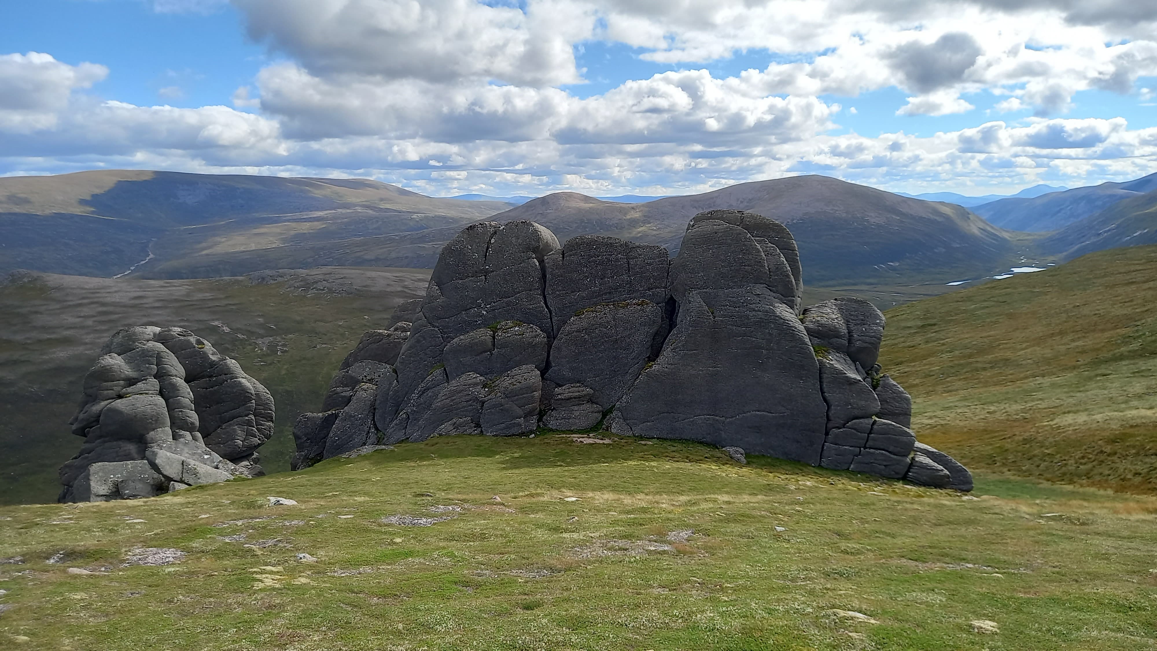
the Barns of Bynack, looking back to Beinn a’Chaorrain, and Beinn a’Bhuird to the far left
Midges greeted me at the summit, so I quickly got on with setting up the 2m station, straight from the rucksack. A tweet, a spot and a whatsapp got me noticed and I got four logged in six minutes, including a chap who told me he hadn’t used his 2m set for fifteen years, until today. (He’d also chase me tomorrow!) Any plans of going on HF were quickly abandoned due to midge annoyance levels, as well as what I could now see lay ahead.

the rapid qualification of Bynack More on 2 m FM
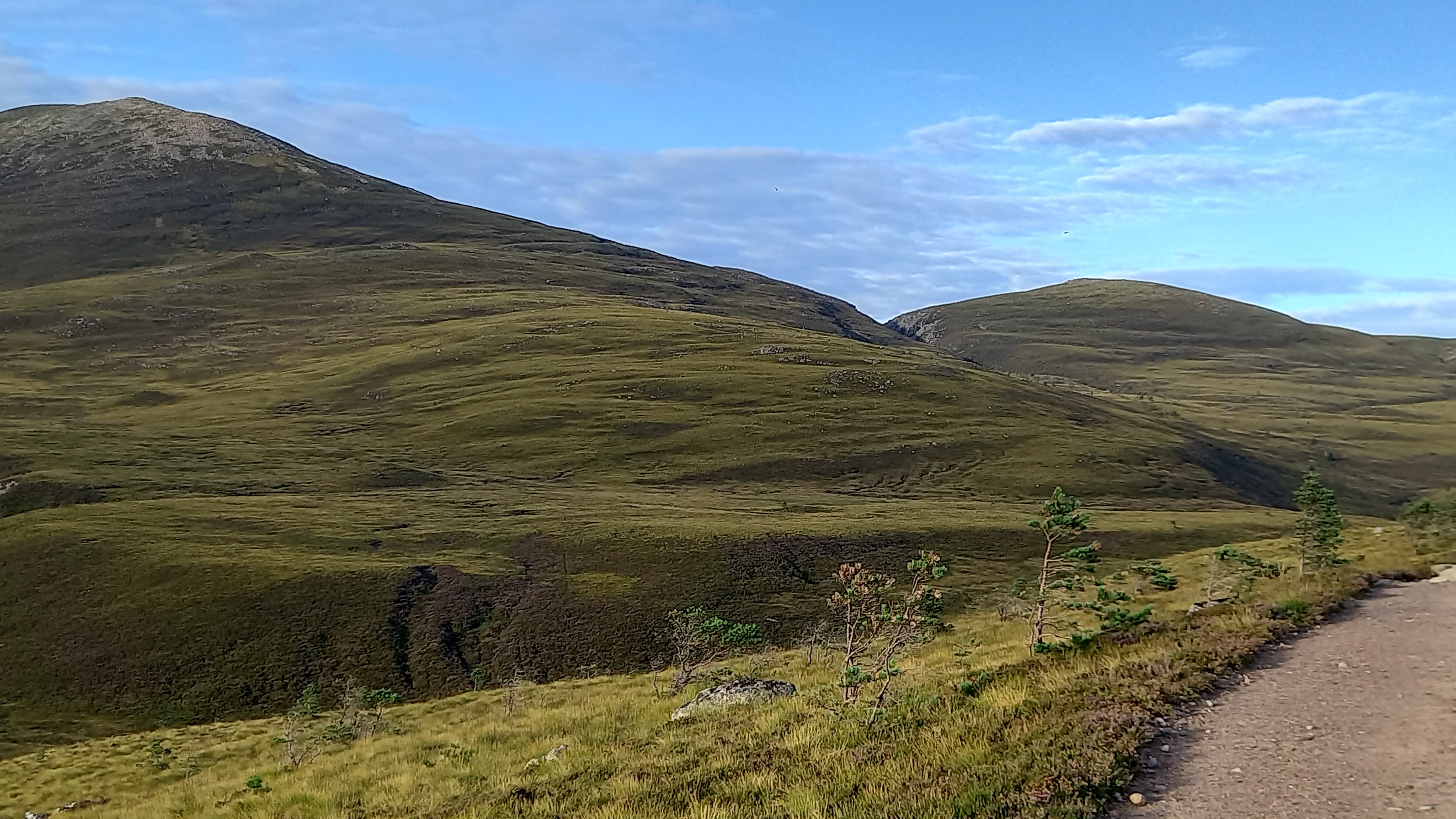
I needed to unlock a route towards tomorrows two summits and the final descent to Glen Feshie. I would potentially have to cross some really high ground, ie Cairngorm summit via The Saddle; an improbable route that would involve a steep descent into the Lairig Ghru pass. The alternative was to head towards the lower of the two ski centre car parks at Coire na Ciste. This involved climbing Bynack More’s subsidiary top and then a long drop into Strath Nethy. Crossing the strath would then take me steeply up to the lowest point in a long ridge at 737 m. The ski car park and hopefully a camping spot lay 1 km to the west of here.
The descent to, and ascent of Bynack Beag was straightforward. A reasonable path became a rougher path and eventually led down to the strath. At all times I could see the ascent ahead of me. At no point did I see a track or a simple route. A golden eagle swept through the strath beneath me and soon soared above, having caught an up-draught. I’d later hear fledglings screeching from a nest high in crags.
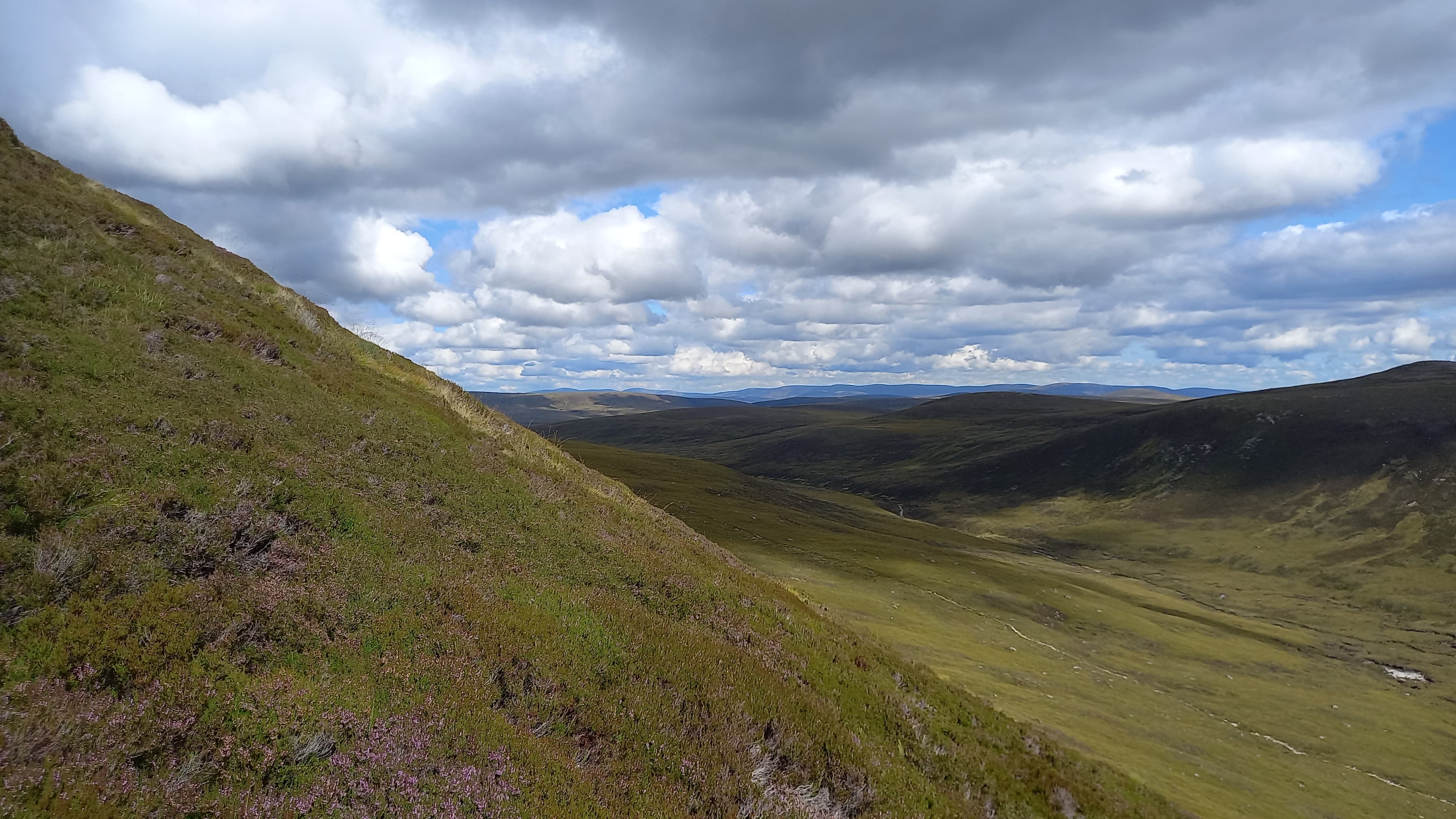
down to Strath Nethy and up the other side
The Nethy was crossed with ease, as was a hidden stream right at the foot of the climb. Initially the ascent was as steep as Bynack More and as problematic. The angle soon eased, but the heather remained long. I headed for a feint reindeer track which seemed to ascend one of the messy ridges. I made the mistake of following this track for too long on reaching the top of the climb. It sensibly contoured around, avoiding rougher and rockier ground. By the time I realised this, I was 1 km further north than I should have been. Mistake no. 1.
When I finally took out the GPS and started studying the map, I chose a line that would take me over a shallow ridge and then a long descending SW traverse down towards the ski car park area. Mistake No. 2.
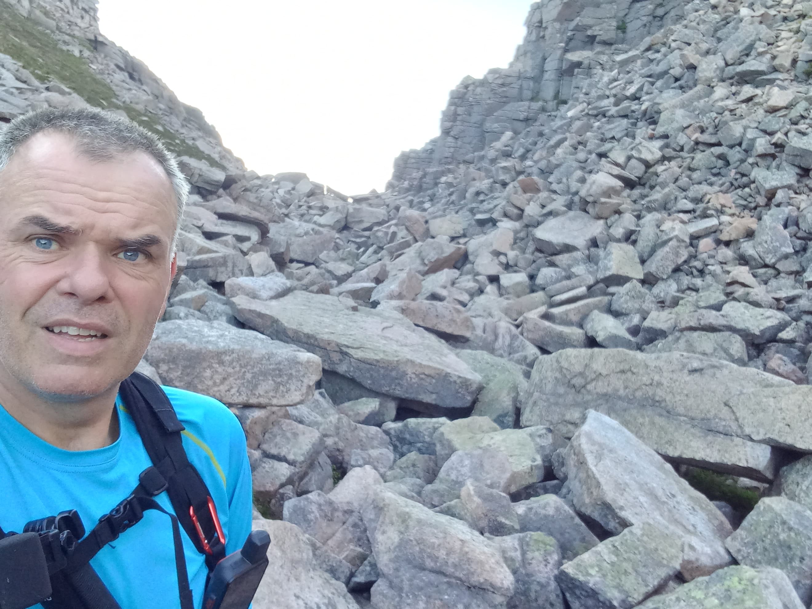
What I’d assumed was a ridge was in fact a gully. A dry one, which is unusual. I think that because there wasn’t a stream shown on the map, my eyes & brain had inverted the contours and turned it into a ridge.
a tired me in a gully
Gully crossed, slope ascended, contoured and eventually descended, and I was finally approaching the shores of Lochan na Beinne, still 1 km from the car park. However the temptation of a mossy patch of grass (that would have been a bog in any other weather) was too much. I downed tools and set up the tent. It was 1900.

I’d camp at the left (north) end of Lochan na Beinne, the ski car park a comfortable distance beyond
My evening routine was identical to the previous one except that a spicy beef chilli replaced the stew. A decent 4G signal revealed a mixed forecast for tomorrow. A cloudy morning followed by a showery afternoon. That coupled with the almost 30 km I’d have to hike across two of Britains highest peaks, as well as transverse the high plateau and the Great Moss didn’t fill me with confidence. I drifted off to sleep full of self-doubt.
Day 3 - Sunday 29th August 2022
I’d brought forward my alarm by an hour. I was up at 0600, fed and packed by 0630. The skies were clear, the morning still and my pack light at last. A combination of consuming the majority of the food and wet camping gear drying out. Things felt good. I’d go for it!
I was soon at the ski car park. It was filled with rows of camper vans. Once free to park, but due to increasing popularity, now controlled by a barrier and keypad. One chap was walking a dog. He looked over but didn’t greet me. A different breed of outdoors person then.
I descended the ski road for 1.5 km; the only tarmac I’d set foot on in three days. From there I was following the “trade route” up Braeriach - the one that originates in the Sugar Bowl car park. I’d have to traverse the Chalamain Gap to then descend into the Lairig Ghru before starting the ascent of Britain’s third highest mountain.
a descent path leading towards the Chalamain Gap, a distant notch in the slope ahead
in the Chalamain Gap
after the Gap, the path descending towards the Larig Ghru. Braeriach slopes up the the left. Sgor Gaoith to the far right
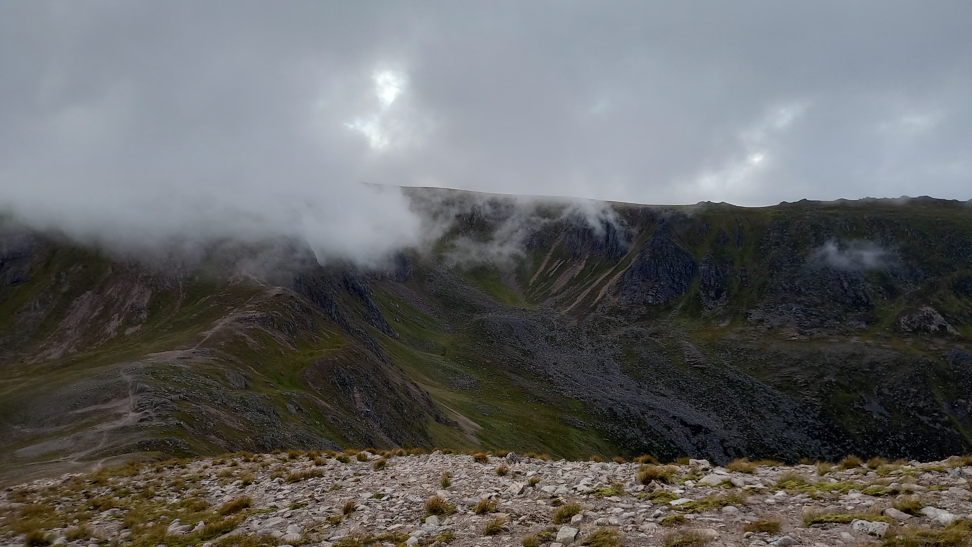
I never look forward to the Gap. In winter it can be banked out and trivial, although it caught out and killed 5 RAF climbers in an avalanche a few years back. In summer it is a boulder field. Some are the size of a car.
The Gap behind me, an unwelcome descent took me into the narrows of the Lairig Ghru, where I stocked up with water and spoke to a couple of backpackers, the whole time being consumed by midges. The midges followed me up me initially steep but well constructed path. Once out into the open sunshine, I think a hot and sweaty me was too much for them. When the ridge levelled off beneath a further bouldery climb, I stopped for a second breakfast.

flapjacks at 9am
At this point I realised I’d be running behind schedule today. Not an issue, as Mo had told me not to hurry. However, I was hoping to have some summit to-summit time from one of my tops with the youtube gang of James and Chris. It now looked like I’d be somewhere in between summits at the appointed time of 1300.
The boulders slope was simplified thanks to a faint path up the edge. This was followed by a flatter section and I at last felt that I was getting somwehere. Nope - still two slopes to ascend and two false pleateux to traverse. When I did finally approach the top, and the edge, the reward was tremendous. I instantly remembered why this was one of my favourite summits.

left of the Larig Ghru - Carn a’Mhaim. Then to the right, Cairn Toul

one more slope and then the summit
summit cliffs of Braeriach
I’d walked 14 km by the time I reached to the top at 1045, about 45 minutes behind the plan. Last time up here, I’d miraculously qualified the summit with a 2 m handheld plus whip and that was mid-week. I was keen to see how a better aerial would fare.
Eight stations went in the log in just under 10 minutes. Unfortunately I didn’t get a QSO with Simon on this occassion. I suspect the bulk of nearby Ben Macdui along with his valley location didn’t help. Mallaig and Edinburgh stations made the log, as well as Jack @GM4COX near Glasgow, for a quick natter and his Complete.
happy 2 m times
I forced down some food and a litre of water and then headed off in the direction of the highest source of the River Dee. It was the general direction I needed to be taking to my final summit, just 5km away line of sight but an 11km walk around the rim.
Flat granite stones soon gave way to grassy ground. Eventually I climbed past a damp patch of grass, the map telling me this was the highest source of the Dee. For a time after I made great progress across wonderful alpine grasses, these eventually descending south west towards the Great Moss.
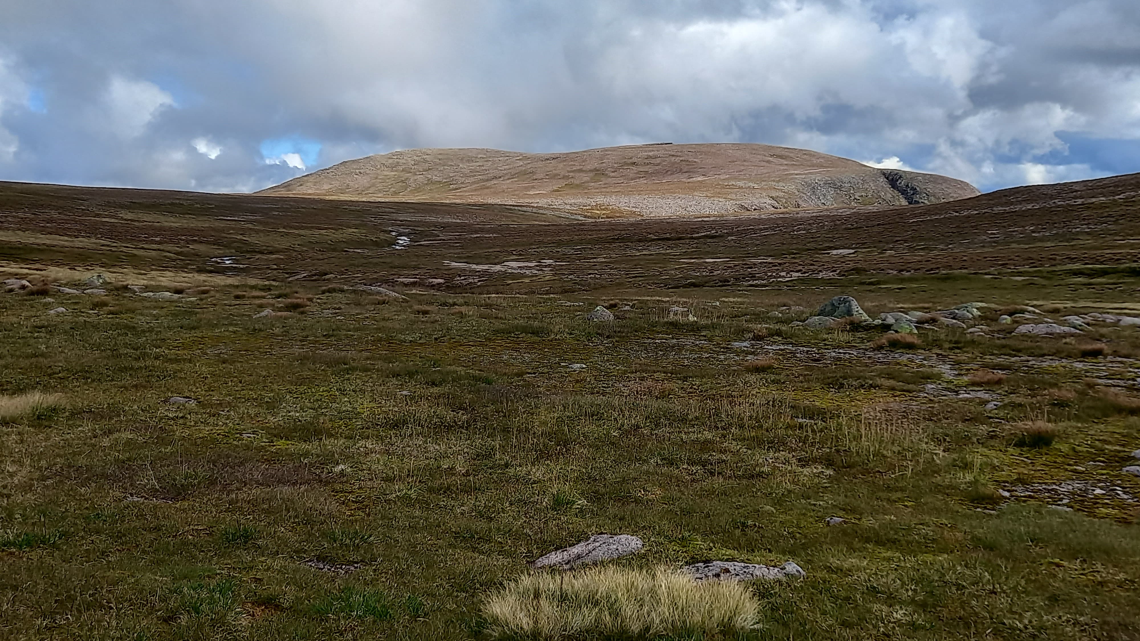
looking back across the plateau to Braeraich
across to Sgor Gaoith, my final summit
On my previous crossing of the moss, I’d strayed too close to the edge and found myself in really rough ground, endless streams, ridges and bouldery slopes. This time, determined to miss these, I took a much longer arc, crossing to the south of Loch nan Cnapan, crossing the 876 m spot height and amost touching the end of the vehicle track that approaches the western end of the moss. I took lunch with the vehicle track in sight, with just 3.5 km remaining to walk.

typical Great Moss terrain, Sgor Gaoith still distant
pools aplenty, but dry ground to be found
Finally, heading north. Dry hags and tussocky grass gave way to smoother slopes and a narrow stalkers path hugging the edge of the cliff. I summited at 1430, about 90 minutes later than initially planned, all that time ago. Objective No. 3 was a fail - the Youtubers summit party.

on the final approach to Sgor Gaoith

summit selfie, looking back over to Braeriach
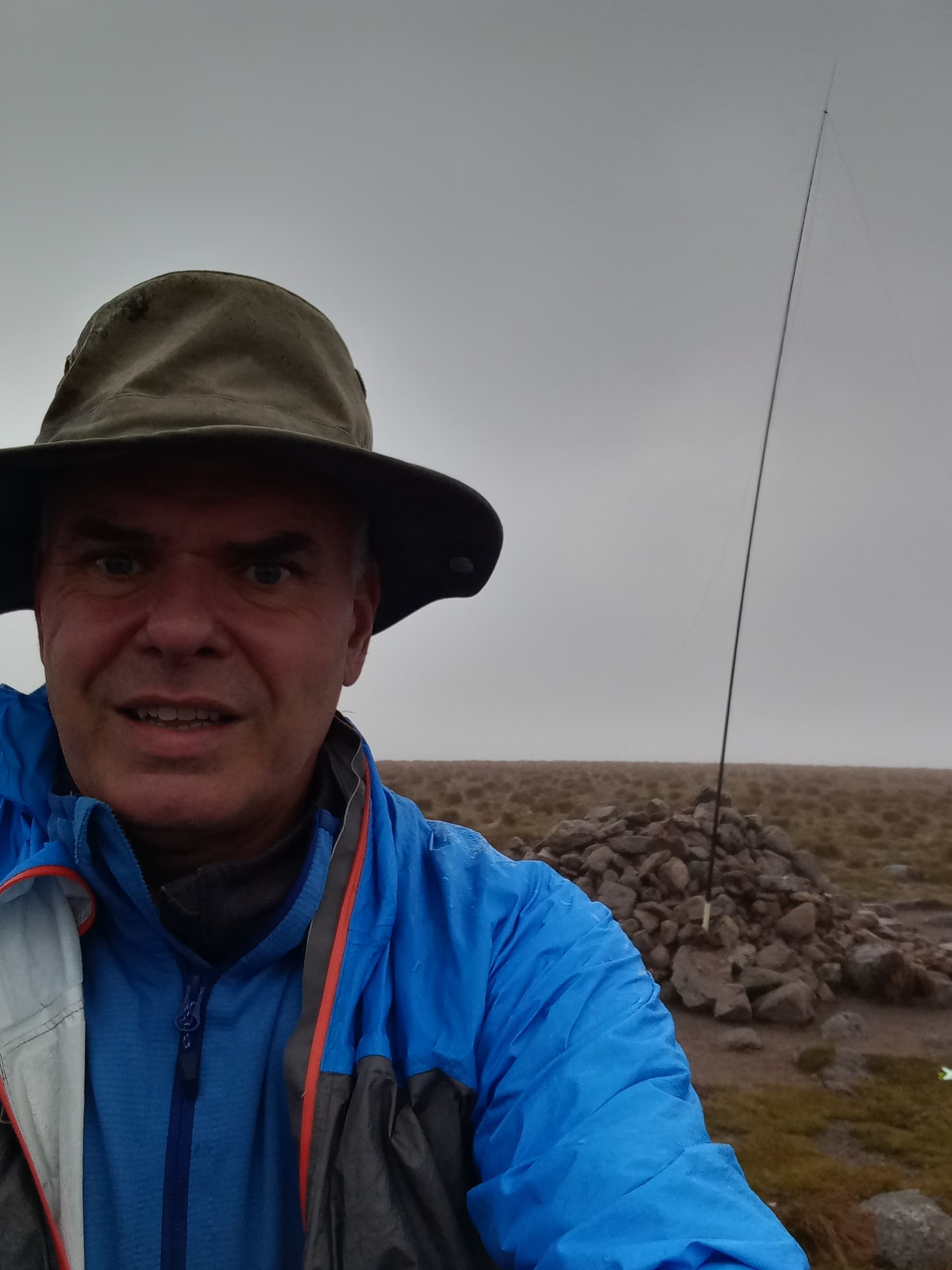
It’s a small summit area and popular, so I moved off to the side, still hopeful of a quick set up. A slot in rocks provided the answer and the mast was quickly erected. This determined my operating position, one which was unfortunately sheltered from the light breeze and the home to many midges. For the first time ever I had to don my midge net. It made reading buttons, displays, phone screens etc very difficult to say the least!
HF station on the summit of Sgor Gaoith
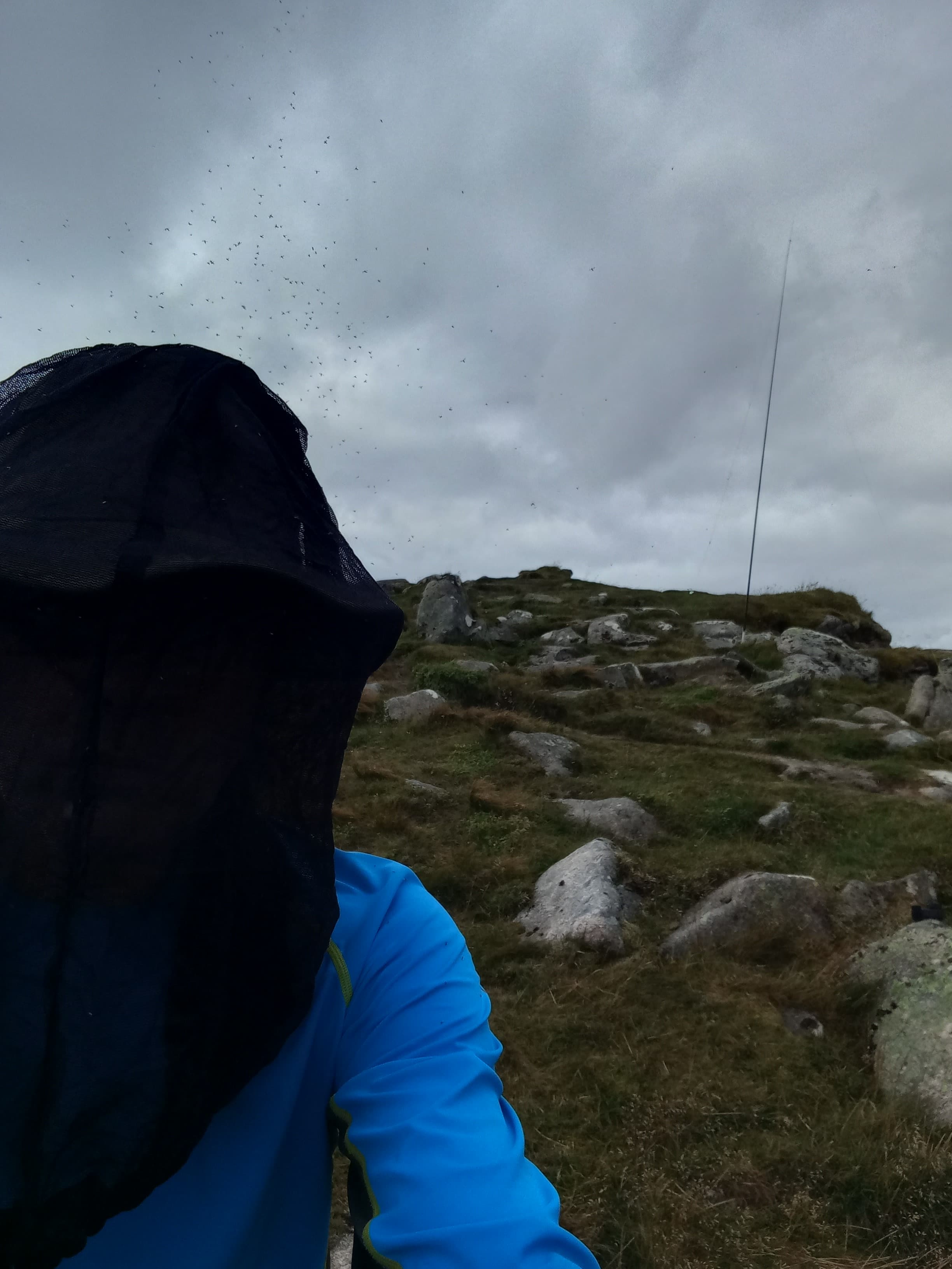
I didn’t realise how bad the midges were until I saw this photo
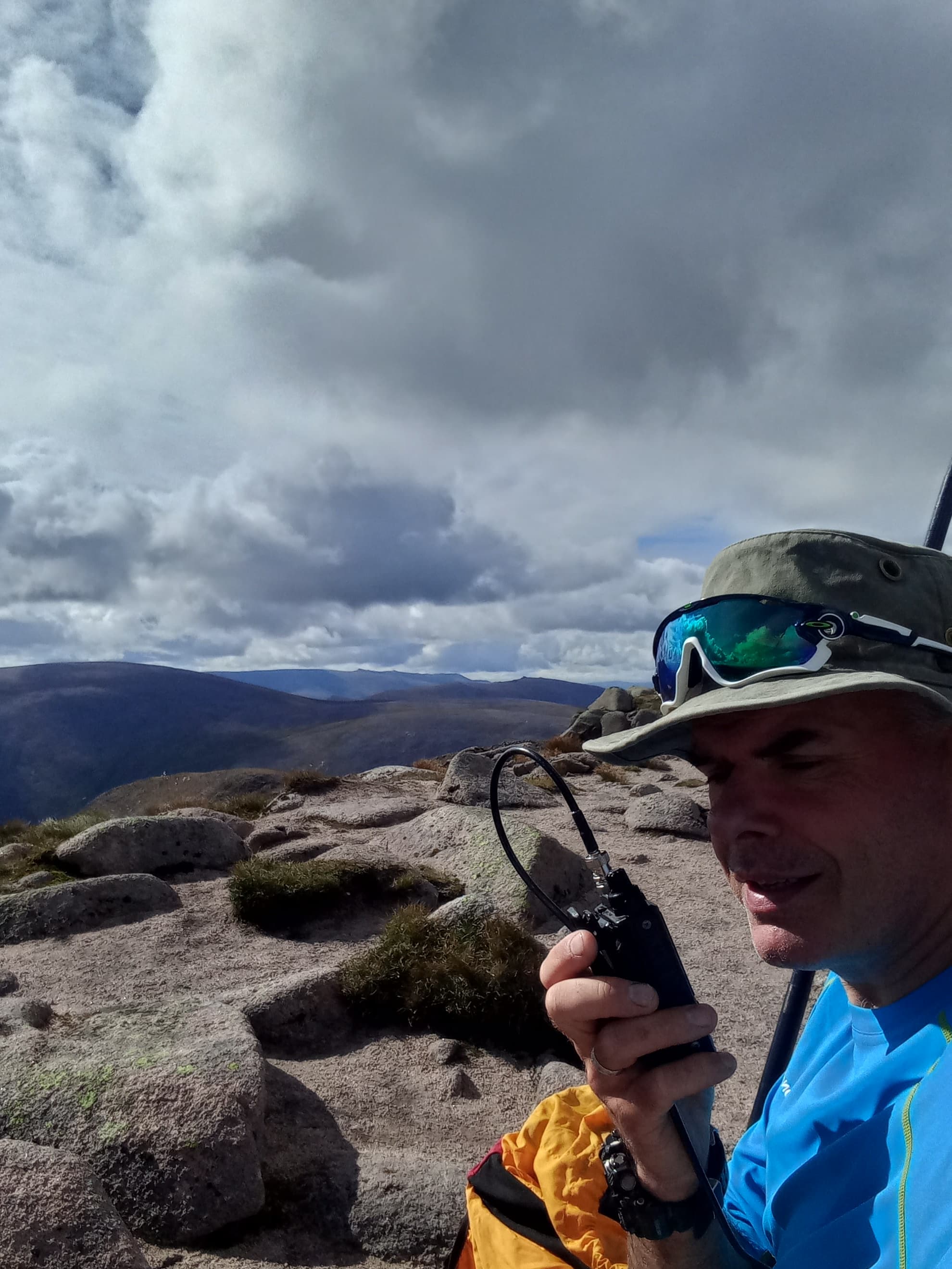
On 40m, I got eight in the log, with @2E0FEH Karl being the one that qualified the summit for me and gave me the full 72 points for the outing. I was glad it was Karl, as he’d chased me throughout. I was elated but the job wasn’t done. I’d promisd the 2 m crew some QSO’s so I quickly reset for VHF and put another four in the log, not all the ones I was expecting however. I think I was just too far from Aberdeen at this point.
It was 1504 when I shut down, 1515 when I left the top and 1516 when I removed the midge net. I dropped like a stone from that summit. The well constructed but sometimes eroded path contouring around the north side of Sgor Gaoith and a neighbouring top before eventually steeply descending through Scots Pine woods to the valley floor and car park.
the descent. The pimple towards the left is the summit of Sgor Gaoith
Mo awaited. She’d fallen asleep in the car waiting for me - her relaxing yoga weekend proving all too exhausting for her. It was 1700. I was exactly an hour late.


 I’m finding my new KX2 very good on battery life when pushing 10w out on summit! One battery lasted me all day last Saturday pushing the full 12w out - a cracking little portable radio for the money! Hope your still liking the slim-g, need to get more on VHF up in GM land!