After my previous outing I had only three summits remaining to complete my activations of all of the North Pennine region, namely Great Shunner Fell (G/NP-006), Kisden (G/NP-026) and Hoove (G/NP-024). All three summits lie in a west to east line along Swaledale.
One slight twist to my personal challenge for SOT: I am trying to activate all SOTA summits in England via human powered transport. I don’t have any specific rules for my challenge, and am happy to use public transport to get to the rough area of a group of summits. The main objective is to prove it is possible to activate all summits without owning a car.
I hatched a plan to cycle along Swaledale, activating the three summits, and to then cycle across to the North Yorkshire Moors in order to start activating the G/TW region.
So on Thursday afternoon 22 May 2025, I found myself on an evening train bound for Kirkby Stephen, along with my touring bike. I spent the journey looking out of the window to identify summits I had activated a few weeks ago – Cold Fell (G/NP-020), Dufton Pike (G/NP-027) , Cross Fell (G/NP-001) and Mickle Fell (G/NP-002). Eventually the train pulled into Kirkby station and I alighted at about 1920 BST. As the class 158 DMU pulled off towards Garsdale Head, I looked up towards Nine Standards Rigg (G/NP-018), the cairns on the summit were clearly visible against the blue evening sky.
After checking my panniers were all secure, I headed off down the station entry road onto the main A-road to Kirkby, but soon turned off to head through Nateby and start the climb up the pass towards Swaledale. My bicycle was heavily loaded, including around 3.5 litres of water. We were at the end of a prolonged spring dry spell, and I quite expected many of the upland streams to have dried-up, so wanted to ensure I had enough water to last me until the next morning.
This is a pleasant climb that I had last done in April, when I had ticked-off six summits on a short cycle tour that took me down to the southern end of the Dales. Back in April I had set off a little earlier, and climbed Nine Standards Rigg in the evening. Tonight, I had considered walking up Great Shunner Fell from the top of the road pass, but due to a train cancellation I was later than expected and so decided to do the summit the following morning.

Back in Yorkshire again
At the boundary between Cumbria and Yorkshire, I turned off the road and headed to the same camping spot I had used in April. The grass was a bit longer, and the ground much drier than April; the air was full of the sound of lapwings and curlews. Cotton grass covered much of the ground, with the little white heads of fluff bobbing in a gentle breeze. My tent was quickly pitched and my sleeping stuff moved from my pannier into the shelter.
All set up for the evening, and with no need to cook (I had dined courtesy of Marks and Spencer in Carlisle) I went for a short walk towards Nine Standards Rigg. I was curious if the stream I had used for drinking water on my last visit in April was still running. As I expected, it was completely dry, and I walked up the stream bed for some distance exploring the eroded rocks and looking for gold nuggets. It really was a glorious evening, with a deep blue sky and the sun setting over the Eden Valley. Looking around me, all I could see in every direction was the rolling hills of the Pennines.
Walking back to my tent I investigated some of the limestone pavement that covers this area, inspecting a number of crevices and declivities that dropped into the underworld. The cotton grass was tinder dry; indeed it’s an ideal form of tinder although I eschew the idea of lighting fires anywhere on UK hills. There is simply no need, this is the UK not Hudson Bay. I was glad to not need to use my stove as the ground and grass were hazardously dry.
At my tent I inflated my sleeping mat, a new thermarest NeoAir Xlite NXT to replace the one that burst on this very spot in April. I was hoping for a more comfortable night than last time.

Dried-up stream bed

Evening sunlight with Nine Standards Rigg in the background
I soon dozed off, looking forward to an adventurous day to follow. I awoke several times in the night as the temperature dropped, and noted ice forming from condensation on the inside of the tent fabric. I was using a summer setup consisting of a LanShan 1 Pro tent and a PHD Minimus sleeping bag. This combination is only really designed for temperatures down to about 5 Celsius. My Kestrel weather metre told me the temperature was dipping below -2C. I donned a down shirt and thermal leggings, and pulled on a wooly hat to add some warmth. I then brought my Sawyer Squeeze water filter into my sleeping bag to avoid it freezing and went back to sleep.
The sun woke me at about 5am, and I lay in the tent scraping ice off the canvas. The LanShan is a single wall tent, and so prone to condensation, which is fine if you actively deal with it using a small absorbent towel or similar. As the sun rose the warmth gradually heated-up the tent, and it was with some reluctance that I eventually wriggled out of my sleeping bag. Breakfast consisted of a hunk of Bryson’s fruit bannock and a tunnocks wafer washed down with water.
The tent was soon taken down, and panniers repacked, I then wheeled my bicycle the short distance back to the road. The time was a little later than I would have liked, already approaching 0800hrs, I had dozed longer than intended.
The next few miles are wonderful rolling cycling, especially on such a sunny spring morning. The road took me down to Keld, with the SOTA summit of Kisden rising ahead; Rogan’s Seat (G/NP-014) to the left and Great Shunner Fell to the right. The camp site at Keld looked busy, with the late spring bank holiday weekend approaching. I was glad to have had the peace and quiet of a wild camp.
I locked my bicycle to a post at the hamlet of Thwaite at 0850 BST, and changed into walking mode, double checking that all my radio gear had been moved from panner to backpack. The route up Great Shunner Fell (G/NP-006) followed a broad track at first, before becoming paving stones; this was part of the Pennine way which is typified by the emplacement of paving stones to mitigate erosion of the peat bog. The going was easy, and I had plenty of opportunity to look westwards and survey the route I had taken over the pass yesterday evening, I then looked across to the Buttertubs pass which I had cycled over the previous month. The a car windscreen glinted in the sun as it wove its way up the pass in the distance, it was a lovely sunny morning with a fresh breeze.
I was pleased to find a substantial cross-shape shelter at the summit, and hurriedly unpacked my radio gear. After raising a spot on SOTL.AS for 2m FM. G6LKB was first to respond to my call at 1004 BST, followed by Dave, G6AEK. I have often chatted with G6AEK during my overnight camps on Seatallan (G/LD-025), so it was good to catch up with him. Dave explained that he had only three G/NP summits left to chase following a recent QSO he had made of me when I was on Mickle Fell earlier in the month; one of those three outstanding fells was my next target, Kisden. After checking how long it would take me to get across to Kisden, Dave decided he would drive out towards Kirkby Stephen to be sure of making the contact on 2m FM. Kisden is an odd hill, sitting at the top of Swaledale and with a much lower elevation than the surrounding hills, making it quite difficult to chase/activate.
After speaking with Dave, I was called by M7RFB in Nunthorpe (spoiler: this was to become the destination of my cycle ride this weekend). The contacts on 2m dried-up and I switched to HF CW. I was using an EFHW, a QMX and a BaMaKey TPIII. The EFHW was set up on a 6m telescopic pole, with guy lines holding it in position. It felt luxurious to be able to sit in the shelter and operate rather than be exposed to a cold and windy hilltop.
The RBN quickly picked up my CQ call and spotted me on 40m, ON7ZM called first followed by 2E0AGB, MI0SRR and G3TZA. I was then called by HB20SOTA on the summit of HB/BE-173 i n northern Switzerland. Having now qualified the hill, I started looking for other summit-to-summit contacts and called EI6FR/P on EI/IE-039 and EI/G0KPE/P on EI/IW-075 in the Wild Nephin National Park. Pleased with my haul of contacts on the first hill of the day, and conscious of not wanting to hang around too long, I disassembled my antenna and packed away the radio gear at 1045BST ready to head back to my bicycle.

Simple setup of QMX, BaMaKey and USB powerbank

Operating an EFHW from the summit shelter
Back at the bicycle I didn’t bother to change into cycling mode, and just rode the few hundred metres into Thwaite wearing walking shoes and trying not to slip off my pedals (Crank brothers Eggbeaters - certainly not made for normal shoes). Arriving in Thwaite, I couldn’t resist the opportunity to take lunch at the tearoom. Lunch consisted of a pint of lemonade and a sausage bap, served at 1209BST. I wolfed down my lunch, keen not to keep Dave waiting too long.

Lunch
I locked my bicycle to a telegraph pole (how appropriate), after checking that the bitumen coating was not going to contact my leather Brooks saddle. I then hopped through a gap in the wall and started following the path up Kisden; this again is part of the Pennine way and so provides a clear route. The summit route soon deviated from the Pennine way and headed up a steep grassy path onto the summit plateau, where a thrash through around 1km of heather was required to gain the summit.
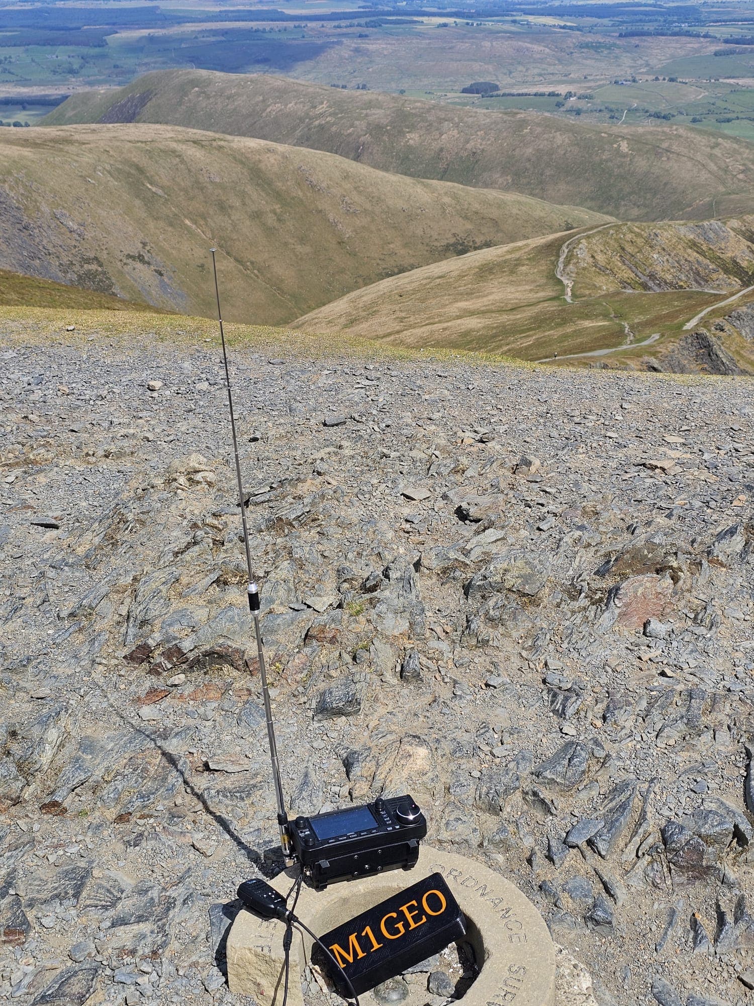
Reaching the proper summit was worth it, to find a substantial cairn and excellent views of the surrounding SOTA summits. A couple of large rocks provided the ideal seat for an activation. I called out for G6AEK on 2m at 1330 BST and was delighted to hear him respond immediately. We chatted for a while, reflecting on his remaining two required summits, Rogan’s Seat and Rombald’s Moor. Next on 2m I spoke with M1GEO/P, on his way up Blencathra; I was able to call him again before I left my summit to achieve a summit-to-summit contact.
As I had anticipated it was not possible to get the four qualifying QSO on 2m, and so I set up for HF CW. This sort of occasion was the main reason I started to learn CW 3 years ago, with the idea that I could carry a small CW only radio when backpacking or cycle touring. I think what had also attracted me was a desire to be able to understand the messages being exchanged on the lower portion of each band, and a general fascination with the fact that one could become fluent in CW.
First to call was G3YPE on 40m followed by DC8YZ, DJ5AV, F8DGF and then on 20m, SP9TEM. My antenna was not set up very well, and I didn’t spend too long looking for further contacts so at 1410 BST I closed down and began packing away. As I descended I enjoyed the views of the River Swale and the look ahead towards my next hill. The sky had started to cloud over a little, and the forecast change in the weather was almost upon us, wind and rain were forecast to start moving in over the next day or two.

Summit of Kisden


Operating from the summit cairn

heading back into Swaledale
Back down in Thwaite I ordered another pint of lemonade, it seemed to be going down nicely. I used the opportunity to change into my cycling shorts in the tearoom toilets. Fully refreshed I got back on my bicycle and headed off along Swaledale.
The next few miles of cycling were lovely, winding along the river and looking across at river cliffs, rolling hills and the occasional bridge taking me across the Swale. I arrived in Reeth at around 1630BST, just in time to catch the shop before closing. I stocked up on water (still assuming that streams would be dry) and provisions, and treated myself to a rum-and-raisin ice cream. Reeth was quite busy, and I always feel that the centre of the village, a large village green, is spoiled by becoming a large car park on most summer days. Nevertheless I enjoyed sitting for a while, watching a warm afternoon transition to evening.

Low water level in the River Swale
I have cycled through Reeth many times, it forms a bit of a cross-roads, with routes in all directions. I lingered a while, knowing that the next stretch of road was all uphill, although as the shopkeeper remarked to me “every direction is uphill from here, lad”.

Re-supplying in Reeth
At about 1700BST I pushed away from Reeth and headed into the most gloriously named Arkengarthdale. The road undulates for a while, providing some softeners for the hill ahead. I sped past “The CB Inn”, not sure that a licenced amateur would be welcomed and imagining being chased off by a group of Teamsters. Soon after this point the route splits with one road heading up to Tan Hill (famed as the location of the highest pub in England) and the other, my route, heading to Barnard Castle via the pass over a shoulder of Hoove.
Charles Bathurst, Lord of the Manor in the 18th Century, gave his name to the CB Inn. He opened out many new lead mines and his initials were stamped on the pigs of lead. Arkengarthdale itself was named after Arkil, the son of Gospatrick, who ruled before the Conquest. It was originally called ‘Arkil’s Garth’. The Bathurst family owned Arkengarthdale for generations.

Not sure what kind of welcome I would receive
The road climbs up steeply from this point, heading up to a height of just over 500m. Coming at the end of the day, I focussed on trying to go as slow as possible so as not to burn-out before the summit. I kept pushing back on the temptation to attack the climb, trying to keep a slow and steady rhythm while guzzling Jelly Babies.
At the top of the pass a track of yellow stone chippings leads off towards Hoove, raising hopes of an easy route. I wheeled my cycle along the track, which petered out after about 100m, turning to tussocks of grass. I laid my bicycle down in the grass and switched to walking mode again, the time was about 1830 BST.

Back into walking mode, bicycle taking a rest

Attack of the Autons
I headed off into the heather moorland, trying to pick an easy route, but finding little in the way of tracks. After about 1km the figure of a lady emerged from the moorland, dressed in tweed, and a wooly hat but with oddly bare feet. She turned out to be a mannequin, scaring raptors away from the nesting grouse. The moorland around here had many such figures, rather like villains from a Doctor Who episode guarding access to my final summit of G/NP.
Descending into a shallow col, I was delighted to pick up a faint track, servicing a line of grouse butts. The track crossed a small stream, which I was pleased and surprised to find was in fine flow, presumably it provides some considerable impediment in times of wet weather. The last 30 or 40m of ascent was over trackless heather, when I eventually gained the trig point.
Although fairly average in terms of height and features, Hoove turned out to be a fine hill on which to end my G/NP activations. The view out over the A66 looked towards the northern marches of the Pennines, while to the east and north east the ground dropped away to the vale of Mowbray between the Yorkshire Dales and Yorkshire Moors. To the south, the hills seemed to roll forever.
I called out CQ on 2m using my FT70D and RH770 at 1908 BST, and M0TLX was first and only to respond. I looked around on the band and heard M7RFB in a QSO, since I had spoken to him earlier in the day from the summit of Great Shunner Fell, I interrupted his QSO and asked if he would kindly work me again. This gained me two further QSOs (M7RFB and 2E0FAU) along with a very pleasant chat for 10 minutes. No further stations were heard on 2m, and so I moved onto HF CW. Satisfyingly, the central pipe of the trig point was open, and provided a most excellent support for my telescopic pole, allowing me to speedily set up for HF CW. First to respond was ON7ZM as my fourth contact, followed by ON7GO and DP5XL. I find chasers become quite sparse about tea-time, and today was no exception, with DP5XL being my final contact. With Hoove now activated I had completed G/NP.
I took a few minutes to look out across the view and listen to the sounds of the moorland. The weather had been gradually closing in all day, and rain was forecast to arrive at about 2000 BST, so I didn’t want to hang about too long, but I also wanted to take in the moment.


Convenient operating position on the trig point
I soon packed away my gear and started heading down, after a few paces I realised that in front of me lay the A66 and I was surely heading in the wrong direction. How easy it is to become disorientated, and I am glad I caught myself before any descent had been made.
I retraced my steps to the grouse butts and then followed the track until I decided its course was too southerly to be of benefit, and so headed back over the rough moorland to find my bicycle. The wind was picking-up, with wind speeds over 30 mph forecast, so I thought it wise to find some shelter. I explored around the summit of the pass for a while, and found a likely spot around 20m down the lee side. I then cycled down the road a little and explored the forestry plantation, just to be sure that a perfect camping spot was not missed. Forestry rarely provides good camping spots, and today was no exception, but at least I was now sure I was not missing out on anything. Back up the road, I removed panniers and ported my bicycle to a spot in the lee of a hump, on sloping rough grass.
My indecision over camping spots meant it was about 2100 BST by the time my tent was pitched. I tend to forget the time on these light summer evenings. Fortunately the forecast rain had not started yet and I set about carefully boiling water for my dinner. Before lighting the stove I poured plenty of water on the surrounding grass, and took great care to not leave the stove even for a moment. Tonight’s meal was a dehydrated ration, Curry Fruit Rice, which was pleasant enough and supplemented with a malt loaf for dessert.
As I sat in the doorway of my tent, the rain started, and so I drew inside for the night. The damp weather meant that a much milder night was due than yesterday. I was pleased with the shelter afforded by the hillock behind me, and found a restful night’s sleep. I woke up in the early hours to drops of water splashing on my face. Rain was pummeling the fabric of the tent, and causing condensation to be knocked-off the inner and onto my face. This was easily solved by drying the fabric with my absorbent towel again. This is just a fact of life for single wall tents, you are bound to get condensation problems occasionally and it is best to be prepared to deal with them rather than fret about perfecting ways to avoid the condensation. My sleeping bags all have properly waterproof fabric outers, and I keep all my kit in dry bags during the night.

resting spot for the night
Morning arrived too soon, and I was glad to find that the rain had abated. I pushed away on my bicycle at 0800hrs again, ready to ride across to the Yorkshire Moors. The Moors were visible as a shadow on the horizon, and I was looking forward to be making this ride. Many times I have cycled across the Pennines to Richmond and seen the Moors on the horizon, but turned north to Northumberland and Scotland, planning at some point to cycle across the Vale of Mowbray. The trouble is that the Moors always look like a dead-end on a map with the Durham coast industrial areas to the north and the Humber to the south.
The route started with a long sweeping descent to the A66, getting a few quick miles in the bag straight away. I joined the A66 near Barnard Castle and followed the mostly dual carriageway until Scotch Corner. After navigating the large roundabout I pulled into the services, planning to buy some Percy Pigs at M&S. The hustle and bustle was a bit of a contrast to the last couple of days, and not to my liking, so I turned out of the services and headed to the small village of Middleton Tyas and Moulton. I stopped at a lovely bus-stop/library/shelter for a second breakfast of banana bread.


Good riding on the A66

Second Breakfast at Moulton
I continued on eastwards and joined up with a couple of cyclists out for a Saturday ride, we chatted about bicycles, cycle touring and other exploits for a while until our routes parted and I reached the A167 (Northallerton to Darlington road). The Moors were drawing closer, and I could start to make out some features on the Cleveland hills. This was quite a rewarding cycle ride, having my destination in clear view and gradually drawing closer.
Passing through a series of small villages the road signs started to change, no longer pointing pack to Richmond but instead giving distances to Northallerton, Thirsk and Yarm (wherever that is!). The A19 soon loomed ahead, with the Cleveland hills now within touching distance, after a short stretch on the A172 I turned off to Carlton in Cleveland and crossed into the North Yorkshire Moors National Park.

made it across to the Moors
I stopped at a pub at Carlton for a spot of lunch. I ordered a cheese and pickle baguette, expecting some delightful ploughmans style lunch; instead, I was confronted with an absolute monstrosity. The baguette consisted of grated cheese mixed with pickle, and then grilled. Who-on-earth grills pickle? Is this some sort of delicacy local to Cleveland? Needing the calories I ate it all up, helped by a pint of lemonade.

Disgusting, but full of energy
After lunch I was back on the bike and headed up the steep hill to reach a point where Wainwright’s coast-to-coast crossed the road, heading up Cringle Moore G/TW-002. I locked my bicycle to a fence, changed into walking mode and headed up the hill, following a string of coast-to-coasters and day walkers. The fine bank holiday weather had brought out plenty of walkers. This is an easy climb and the summit was rapidly reached. A call on 2m at 1335BST immediately yielded a response from G7SXR followed by a summit-to-summit with M0RWV/P on the adjacent Urra Moor G/TW-001. A QSO followed with M7RFB and then after calling out for a few more minutes M0ALA called in, allowing me to qualify the hill.

Summit of Cringle Moor, a simple 2m FM activation

Back at the bicycle
With the hill qualified I decided to head off rather than attempt a CW activation, as I still had a long day ahead. The descent was quick and fun, and I was soon back cycling.
As I cycled southwards to round the end of Cringle Moor, I was surprised how few SOTA summits were in the area. To the west the 400m summit of Whorlton Moor is curiously not a SOTA summit despite the deep vale separating it from Cringle Moor. I often find myself checking maps to work out which Marilyn hill is attached to if it is not a SOTA, in the case of Whorlton Moor I’m not so sure. Turning north again at Chop Gate I headed to the hamlet of Urra and again locked my bicycle (to a telegraph pole again). I was low on water so nipped into the front garden of a cottage to make use of an outside tap.
A bracken bordered path took me up a steep escarpment onto the heather clad moorland of Urra Moor. I followed a clear footpath along the top of the escarpment which took a rather indirect route to the summit, detouring a kilometer or two to join the Cleveland way. The broad way then lead me to the summit where I called CQ at 1630 BST on 2m FM and was rapidly called by M0XLZ/M (with whom I later QSO’d with from home a couple of days later) followed by G7SXR, M0ALA, G0WVY and M6AAJ, I had a pleasant chat with M6AAJ who was preparing for a portable outing himself, and currently assembling the appropriate equipment.

**Following the Cleveland Way up Urra Moor **

Simple 2m activation under grey-ing sky

Just what you want to read when about to head off-trail – Lyme Disease, Louping Ill, Tick Bourne Fever and if that doesn’t get you, the snakes will. Its grim up north.
Pleased to have qualified the hill I headed off on a more direct route through the heather. A public information sign on the Cleveland way told me of the fact that the moor was “heavily tick infested”. I never walk in shorts, and always have long trousers tucked into socks with copious application of insect repellent. My trousers are also pre-booked in permethrin.
I headed down the route of a small stream starting at Maiden Spring, rapidly reaching the escarpment I had ascended earlier, and then dropped back down to my cycle. It was now about 1730 BST and I sat for a while to work out my forward plan.
The village of Great Broughton, a few miles north, looked like a good option for dinner. The map also showed a camp site in Broughton which I could check out, otherwise I would head around 10 miles further east to camp on a fell road near to my next target of Giborough Moor (G/TW-003).
Great Broughton turned out to be a disappointment, with only posh pubs that I didn’t fancy (too expensive, and too time consuming), so I continued the extra few miles north to Stoke sley where I had more success. I was also able to stock up on water and treats for the final leg. The weather had properly changed now, with the occasional rain shower dampening the evening.
I retraced my ride to Great Broughton and noted the campsite as looking rather poor, and possibly not open to tents; although, my mind was already set on camping out in the wild. So I continued my easterly course following a heavily undulating road through Battersby and Kildale. The road opened up, with moorland around me. A stiff wind was now blowing and I wanted to find some shelter for my tent, but nowhere seemed quite right. Running out of options before reaching the trailhead for tomorrow’s walk, I eventually settled on a spot that would offer some modest shelter. It was now after 2030hrs, and I really wanted to get my tent up.
The tent was pitched rapidly, and due to the slope of the land I had to pitch broadside to the wind so that I could lie down without rolling down the hill. I donned my earplugs and settled in for a windy and rainy night.

**Too (opposite) gradient warnings on one sign - this is tough cycling country **


A moderately sheltered spot after a night of wind and rain
The following morning was surprisingly dry and bright. The wind was due to increase further through the morning, reaching in excess of 50 mph on the summits, so I was glad to have only a single hill to do today, Gisborough Moor (G/TW-003). The tent was unpitched and I was on the move before 0600 BST, cycling a few hundred metres to park my bicycle at a copse of Scotch pine trees on the outskirts of the village of Commondale.
I set off up the track towards North Ings farm, and eventually found myself ascending the moorland. The wind was indeed quite brisk , but nothing problematic and this was an easy climb. As I reached the summit area, I looked out to the north-east and spied the coastline around Saltburn-on-sea. I was delighted to have reached the North Sea, having started my outing in Cumbria.
The time was about 0700 BST when I called CQ at 2m, with no respondents, not unexpected at this time of day on a Sunday. I switched to HF CW, and 40m yielded calls from ON7ZM, F5MOU and F5MAI. I then worked a contest station, F5IN, to qualify the hill. Hanging around for a while I also worked TM4ZZ and DF1LX. As I started to close down my station I finally managed a 2m contact with 2E0WRY at 0737 BST.

Activating Gisborough Moor

The North Sea
All-done, I headed back down the path, moving quickly as I now had a train to catch: the 1015 from Nunthorpe to Carlisle. By about 0830 BST I was cycling away down the road, making much quicker progress than the previous evening. Turning a corner, I found myself part of a Sunday morning time-trial event, with cyclists bearing numbers passing me at intervals and giving me a good pace to follow.
I needn’t have worried, and pulled into Nunthorpe at about 0930 BST, giving time to visit the convenience store adjacent to the station. I then changed into a clean t-shirt that I had been carrying for the train ride back (a complement to anyone sitting in the same carriage as me, after having worn the same cycling jersey since Thursday evening) and prepared for the train journey.
This had been a fantastic walk / cycle / camping / radio outing. There is something special about using a tent as a means of transport. What I mean, is that it was thanks to my little tent that I could cycle into the evening each day and stop exactly on my route with no detours or backtracking. The addition of SOTA to my cycle touring has added a whole extra facet of enjoyment. SOTA has ensured I spend more time at each location, rather than whistling through. For example, I’ve cycled through Arkengarthdale many times, but SOTA provided my the encouragement to stop at the summit of the pass and explore the nearby summit of Hoove.

heading home
The following six activation reports describe my human-powered completion of G/NP. I have now activated G/LD and G/NP, and will be turning some attention to G/SB and G/SP.
Cross Fell (G/NP-001) and Burnhope Seat (G/NP-003) by bicycle
A walk across eleven Yorkshire Dales SOTA summits