Switzerland is administratively subdivided into 26 cantons, a form of mini-state with relatively high sovereignty. Extending across the north and south side of the Alps, these cantons encompass a great diversity of landscapes in a small area. This is reflected in the elevations of their highest points, which span from 516 m to 4634 m.
Having unintentionally visited some of these cantonal high points during SOTA activations, in 2018 I set myself the goal of visiting all of them. This has become an increasingly popular mountaineering objective, with a number of reports of completed or at least attempted projects on the web. Naturally, SOTA would have to be part of the game: I wanted to not only visit, but also activate each cantonal high point, if at all possible.
It turns out that 19 of these high points are proper SOTA summits (one of them, Säntis, is shared between two cantons). Two more are not SOTA summits, but a summit of the same name is nearby, although technically located in a neighboring canton. Four more cantons can be activated with GMA, and only one canton’s highest point (Geneva) is so completely not a summit that it does not even qualify for GMA. So we end up with 24 distinct summits that can be activated.
16 of them can be visited as part of a hike on regular, marked trails. 7 more are proper alpine tours that involve extensive travel over crevassed glaciers and also some scrambling and climbing up to grade III. The remaining three are in between, without any substantial glacier travel, but still in precarious terrain, and with some climbing required, so they could not be classified as hikes.
My project was completed recently, on August 20, 2020 with the activation of Rotstöckli. It took 4½ years overall, and involved 6 SOTA first activations. In this post, I would like to take you on a little “Tour de Suisse” of the cantons and their highest points.
My thanks go to Matt @HB9FVF, Christian @HB9GIN, Clemens @HB9EWO and Martin @DK3IT, who have been part of the team during one or more trips, and who made it possible for me to reach the more difficult summits in this project that cannot be done alone.
This is another example of how SOTA can be a motivation to get out and explore one’s country. Without SOTA, I would never have taken on this project ![]()
73, Manuel HB9DQM
 Aargau (AG) – Geissfluegrat 908 m
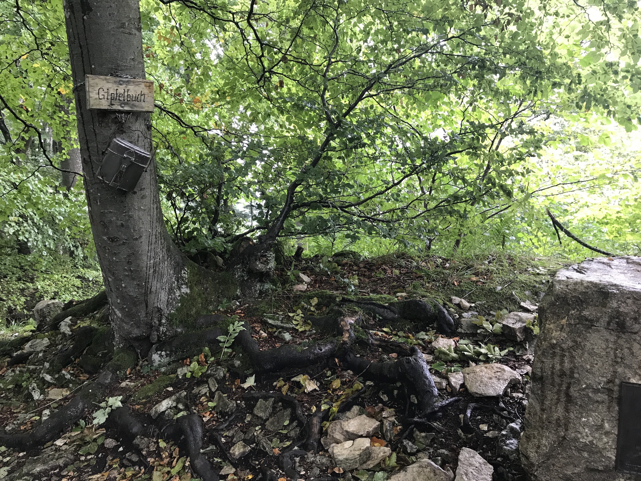
This cantonal high point is located deep in the woods and is not the highest point of the ridge. It can be easily reached by a short walk from the nearest road. Nevertheless, it is equipped like a proper alpine summit, with a summit book inside a mess tin. Pretty cute! The SOTA summit that marks the highest point of the ridge (Geissflue HB/BL-007) is only a few minutes away.

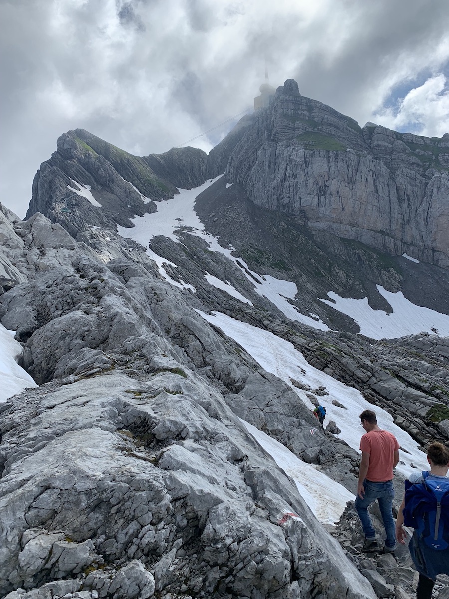
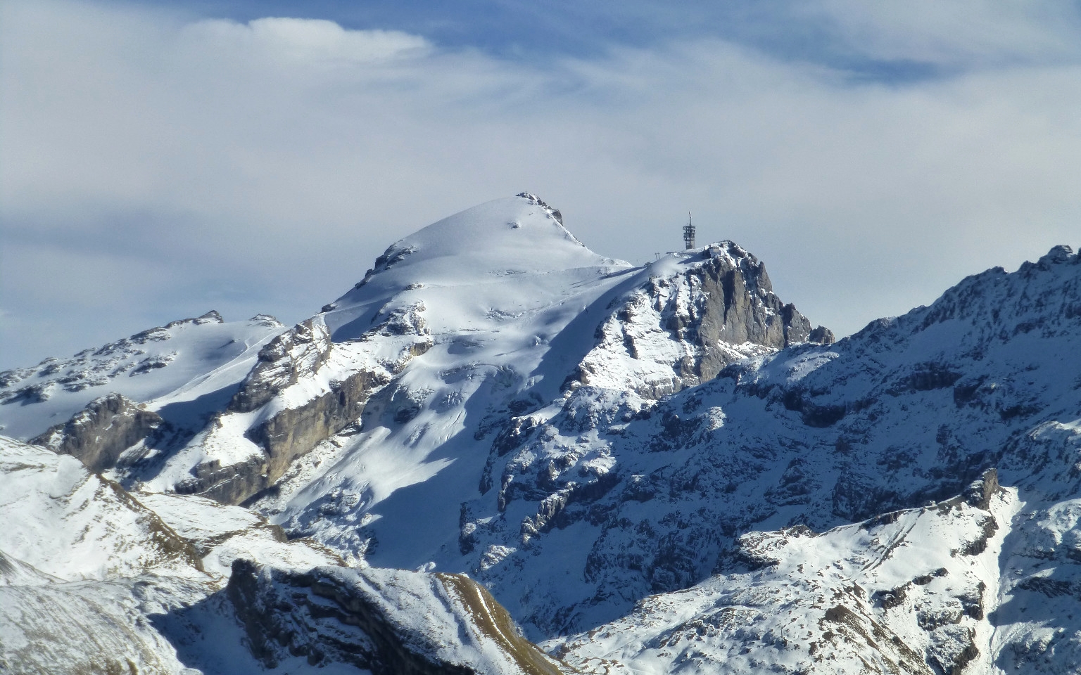
 Appenzell (AI/AR) – Säntis 2502 m HB/AI-001

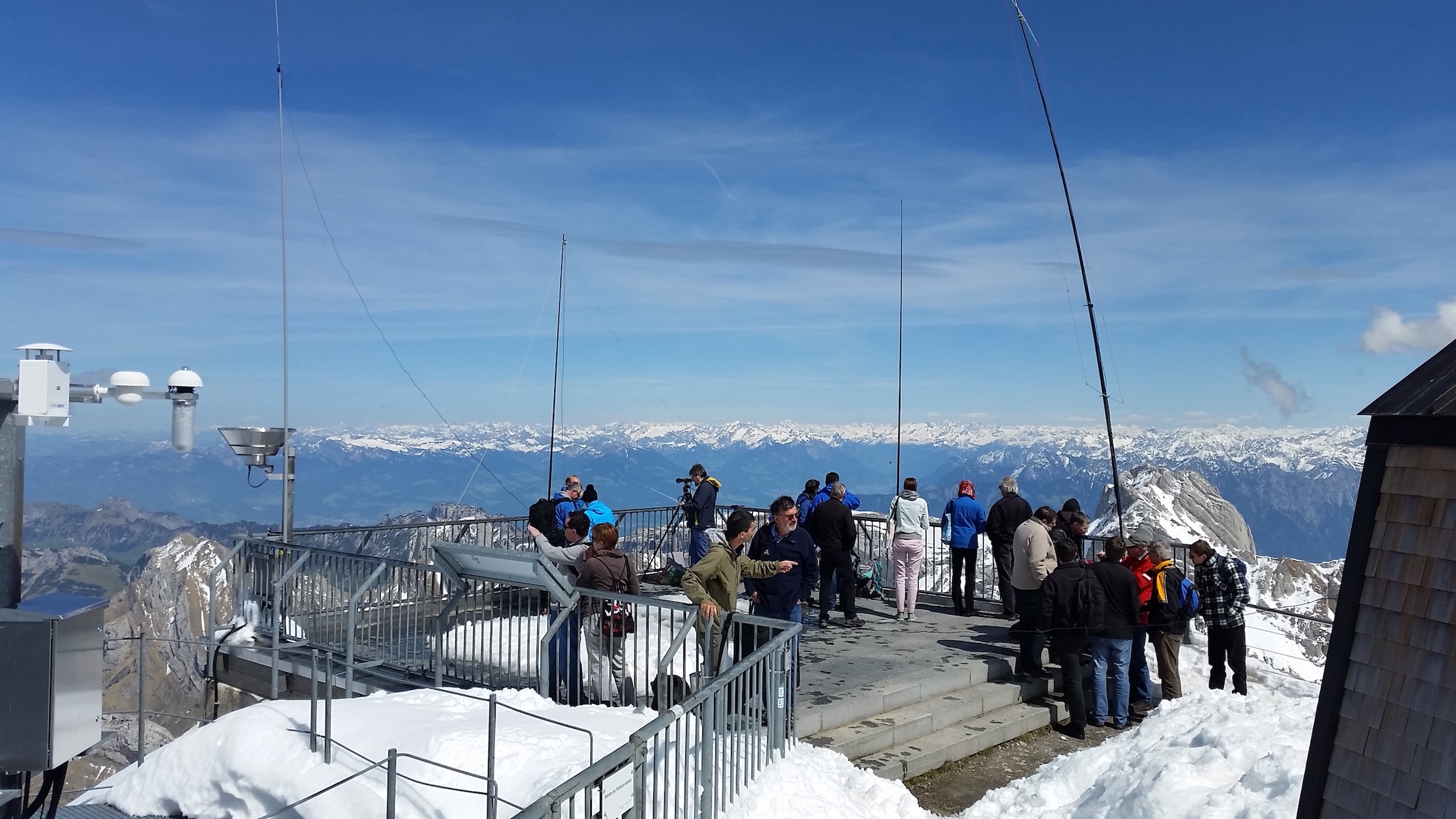
First image credit: B0rder / CC BY-SA (Deed - Attribution-ShareAlike 3.0 Unported - Creative Commons)
A highly visible landmark due to its exposed northerly position, shared between the cantons of Appenzell Innerrhoden, Appenzell Ausserrhoden and St.Gallen (but not the highest point of the latter). If the weather allows it, six countries can be seen from its summit. The powerful broadcast transmitters with several hundred kW of ERP on the summit create a challenging environment for VHF amateur radio gear. Only very few HTs work here without additional filtering.
The summit can be easily reached by cable car, or by various hikes of medium difficulty (T3) taking three hours or more. I have visited this summit several times, usually by cable car, but once also on foot so as to reach it “by fair means” for the project.
 Basel-Country (BL) – Hinteri Egg 1169 m HB/BL-001
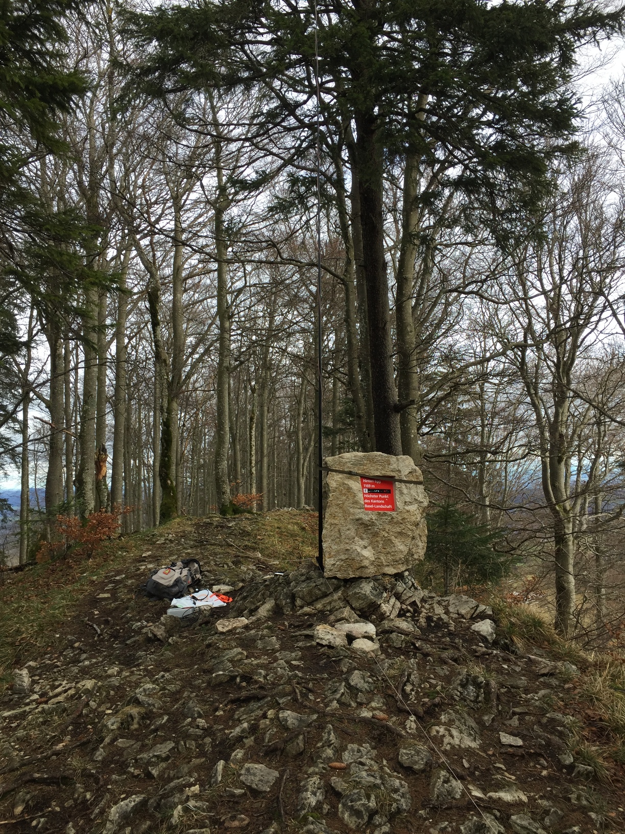
In the woods, almost no views – but the picturesque valleys and towns around it make up for that. The summit is reachable in less than an hour from the top station of the only cable car in north-western Switzerland, located at a mere 928 m, or from a road near Vogelberg HB/SO-008.
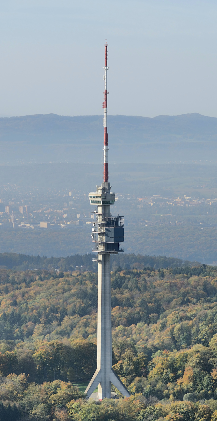
 Basel-City (BS) – St. Chrischona 522 m HB/BS-001
First image credit: Taxiarchos228 / CC BY (Deed - Attribution 3.0 Unported - Creative Commons)
This summit, which can (almost) be reached by car, is home to a 250 m tall communications tower (Swisscom-Sendeturm St. Chrischona - Wikipedia), the tallest free-standing structure in Switzerland. Unfortunately the SOTA summit reference had to be retired due to insufficient prominence, but I activated it before it was retired. The photo shows the view from the conference room near the top, which HB9SOTA visited in 2017 as part of a guided tour by Swisscom.
 Berne (BE) – Finsteraarhorn 4274 m HB/VS-010

Finsteraarhorn is the most prominent peak of Switzerland (P2280), and the third most prominent of the Alps. It can be seen from wide parts of the country, and correspondingly, the views from its summit are superb. It is located in one of the most remote areas in the Alps and can be reached with a PD II grade alpine tour of about 4-5 hours from the nearest hut. However, to reach the hut, another 6-8 hours of glacier travel are necessary. Accordingly, it usually takes at least three days to reach this summit and to return from the vast glaciers surrounding it.
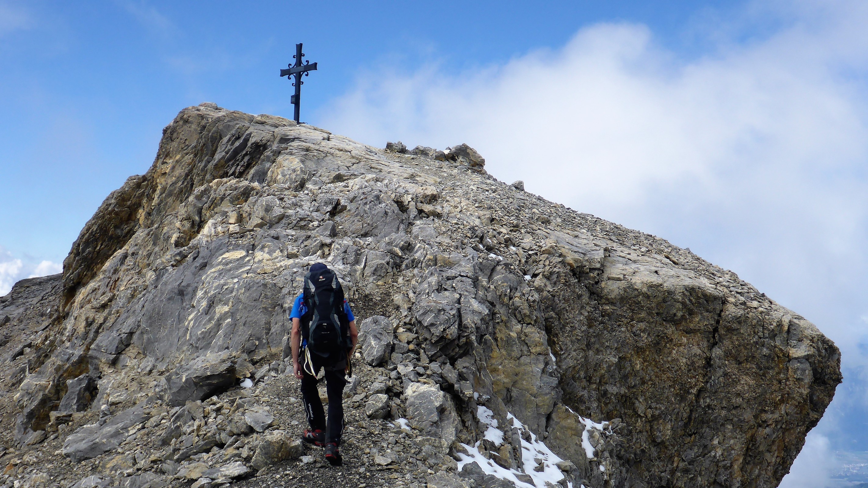
 Fribourg (FR) – Vanil Noir 2389 m HB/FR-001
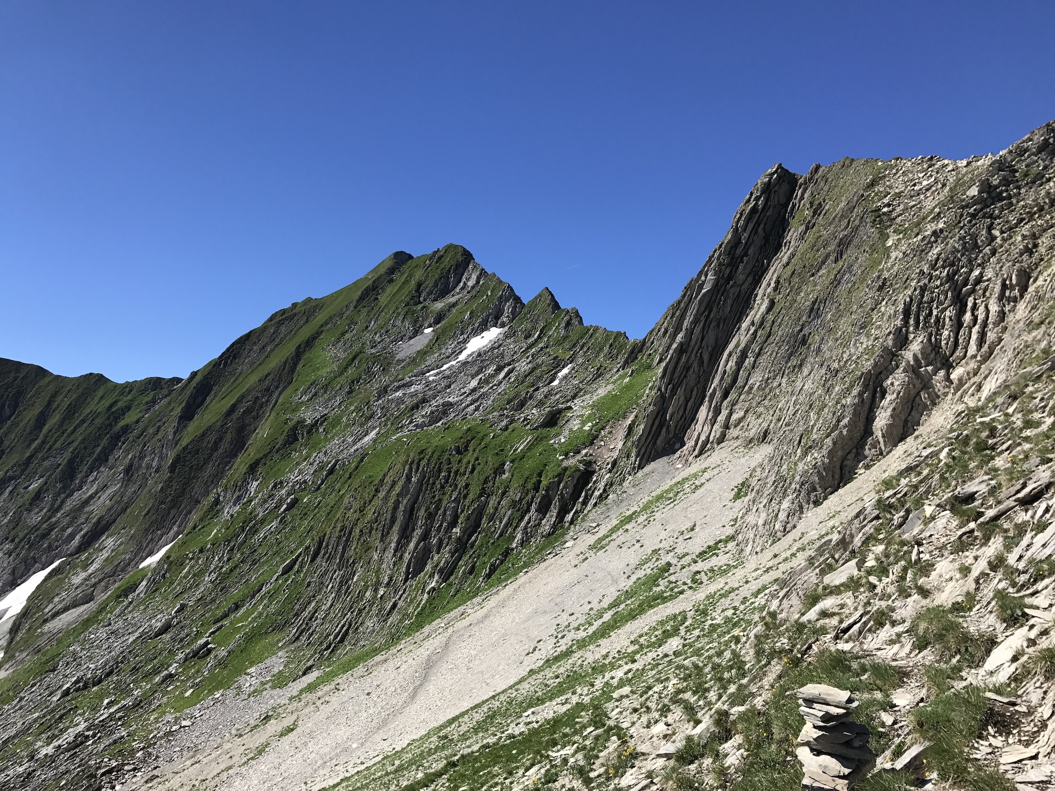

A typical prealpine (= alpine foothill) summit. Official hiking trails lead to its summit from two sides, both of them quite steep and exposed (T4) and taking about three hours. The name has nothing to do with vanilla – “vanil” means “rock” in the local dialect.
 Geneva (GE) – Les Arales 516 m

This is not a summit, but simply a boundary stone along a road marking the border with France. It does not qualify for GMA and is the only cantonal high point that cannot be activated. I visited it by public transport on a rainy day with my partner and did some shopping in Geneva – the complete opposite to a SOTA activation (but also nice for a change)!
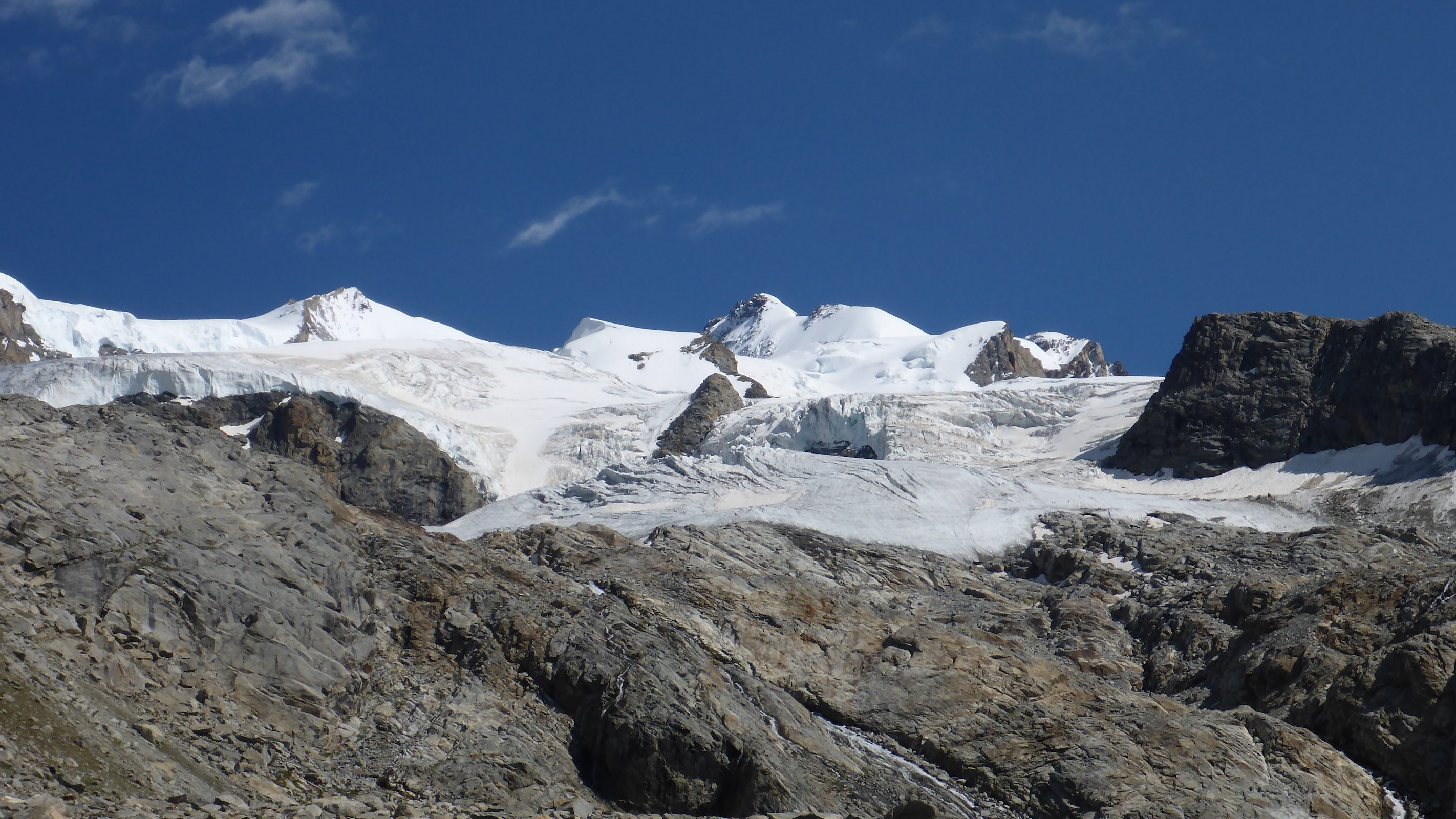
 Glarus (GL) – Tödi 3614 m HB/GL-001
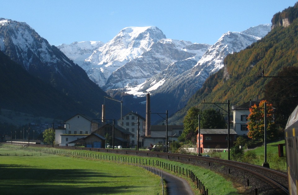
Tödi is a vast mountain massif with three principal peaks. The highest of them, Piz Russein, is also the highest point in the canton of Glarus. Towering 3000 m above the Linth valley, Tödi looks quite impressive from there. The normal route (PD grade) takes about 5-6 hours from the Fridolinshütte (hut) over the Biferten Glacier. Another 4 hours are needed to reach the hut from the nearest public road.
A detailed report of our ascent and activation can be found here:
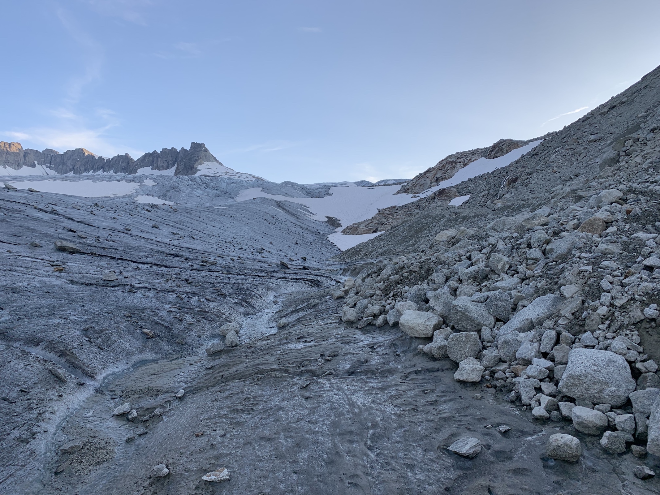
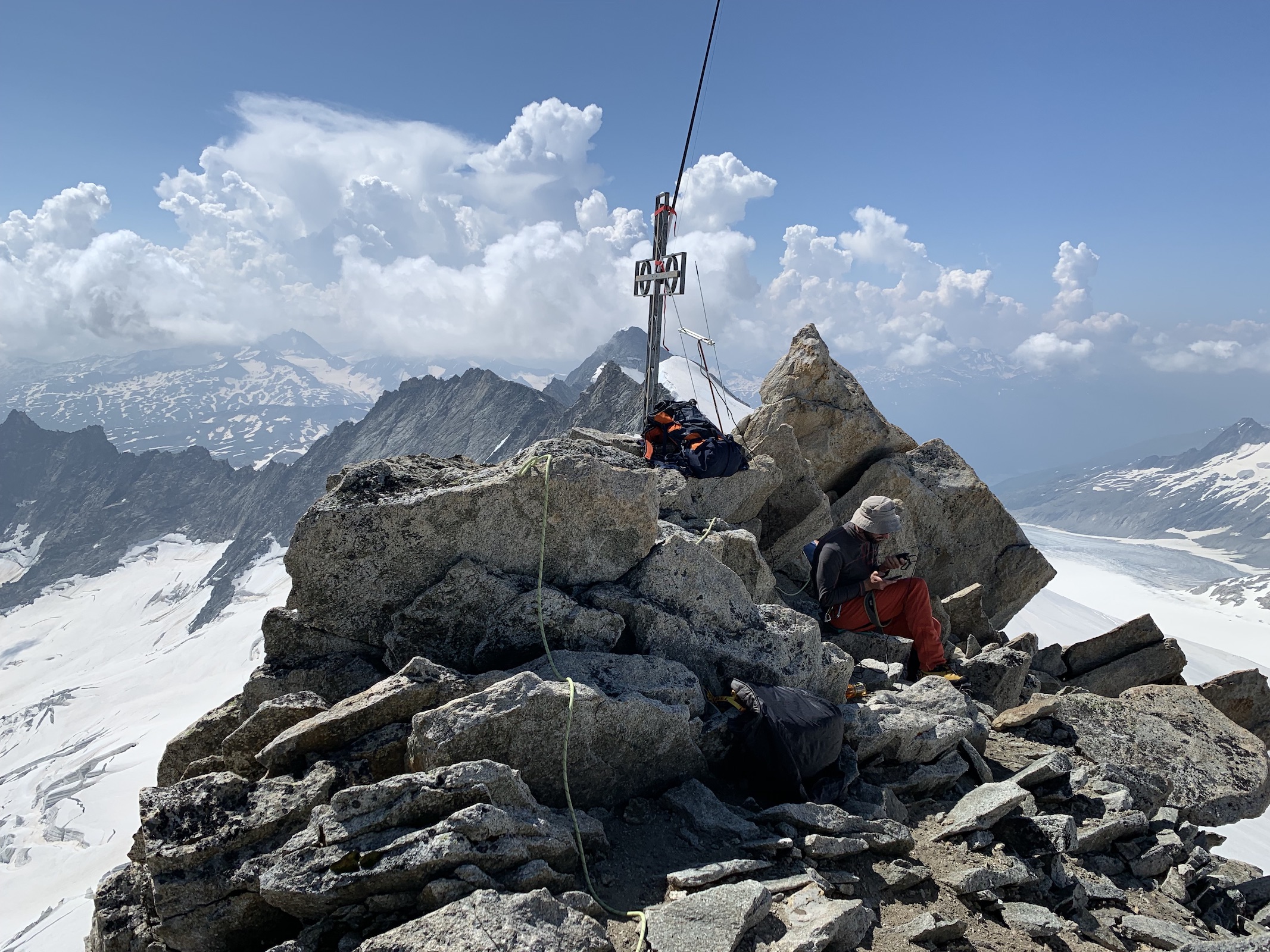
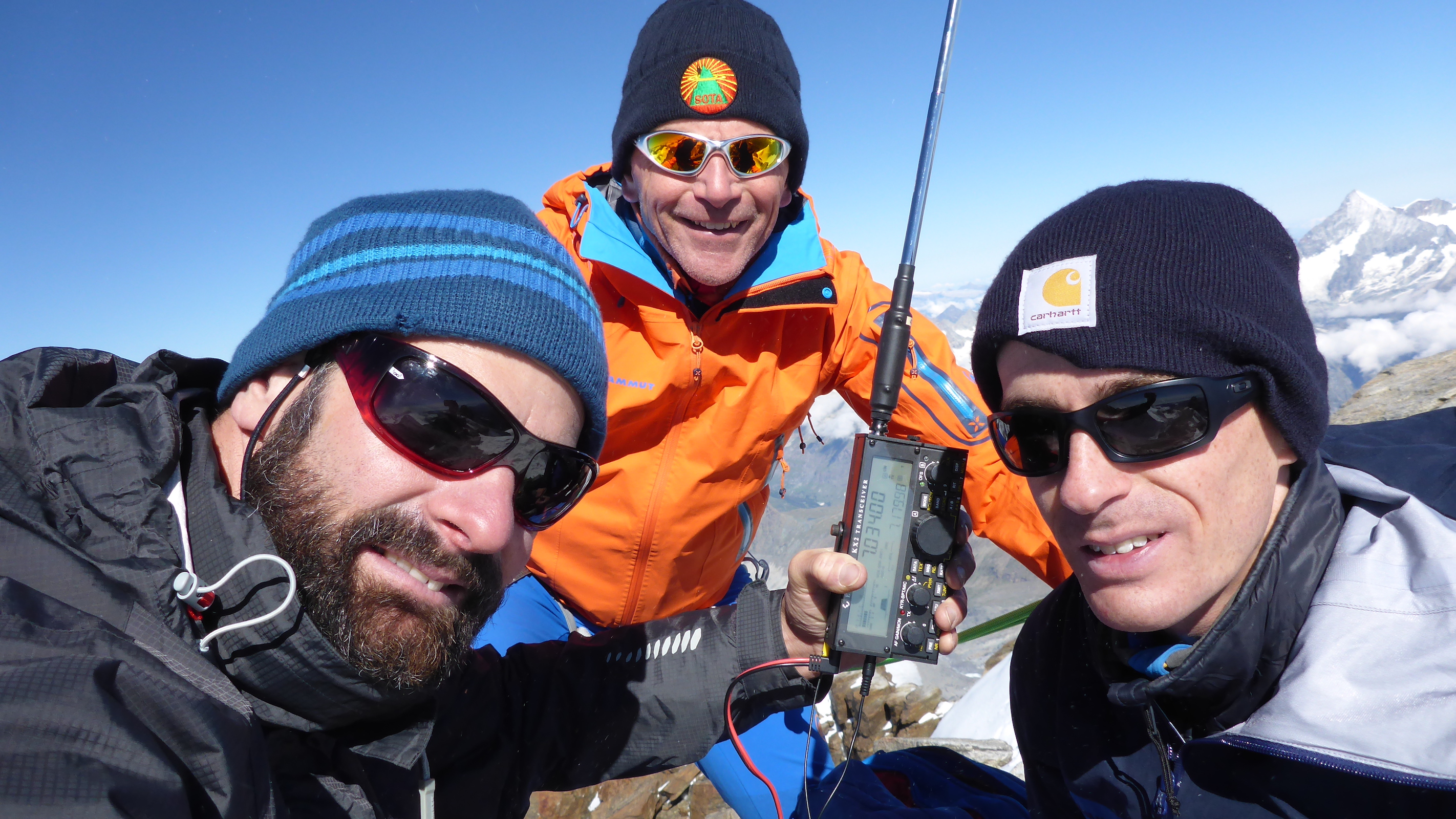
 Grisons/Graubünden (GR) – Piz Bernina 4049 m HB/GR-001

The highest summit and only four-thousander of the eastern Alps, as well as the most topographically isolated of Switzerland. While the summit is reached relatively quickly (PD II, 2 hours) from the Rifugio Marco e Rosa hut, getting to the hut from the Swiss side takes about 5-6 hours (PD+ II) of travel over a deeply crevassed glacier.
 Jura (JU) – Mont Raimeux 1302 m HB/JU-001
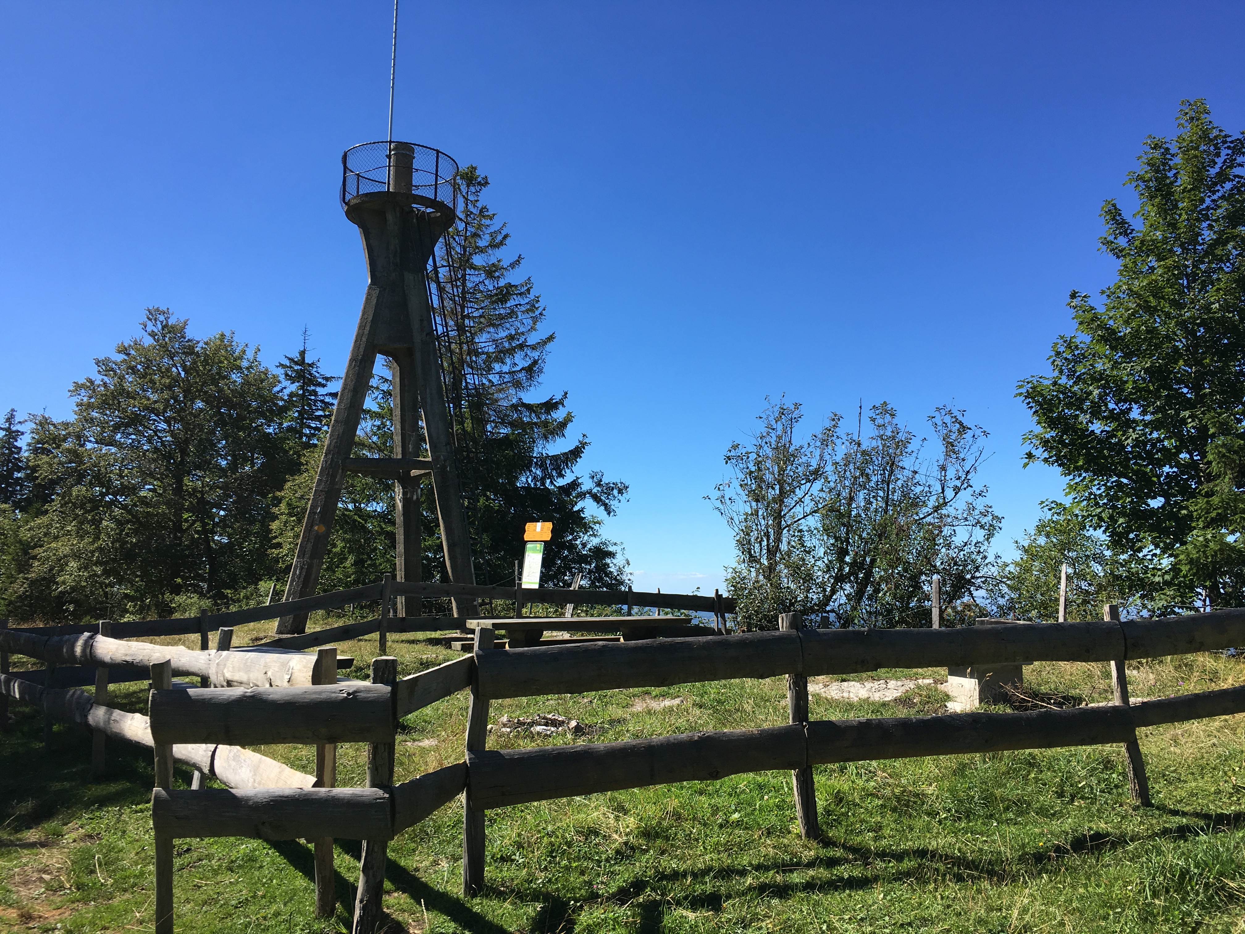
The highest point of the “youngest” canton, which was formed only in 1979 by splitting off from Berne, can be reached in about 10 minutes from the nearest public road. It has a lookout tower built in 1902 whose access is probably not compliant with contemporary public health and safety regulations…
 Lucerne (LU) – Brienzer Rothorn 2348 m HB/OW-010

This very popular summit can be reached both with a nostalgic steam train, and by cable car. Or it can be hiked “by fair means” in about four hours from the lake shore of Brienz 567 m, as was my option with my partner in spring last year. There is a restaurant/hotel at the top.
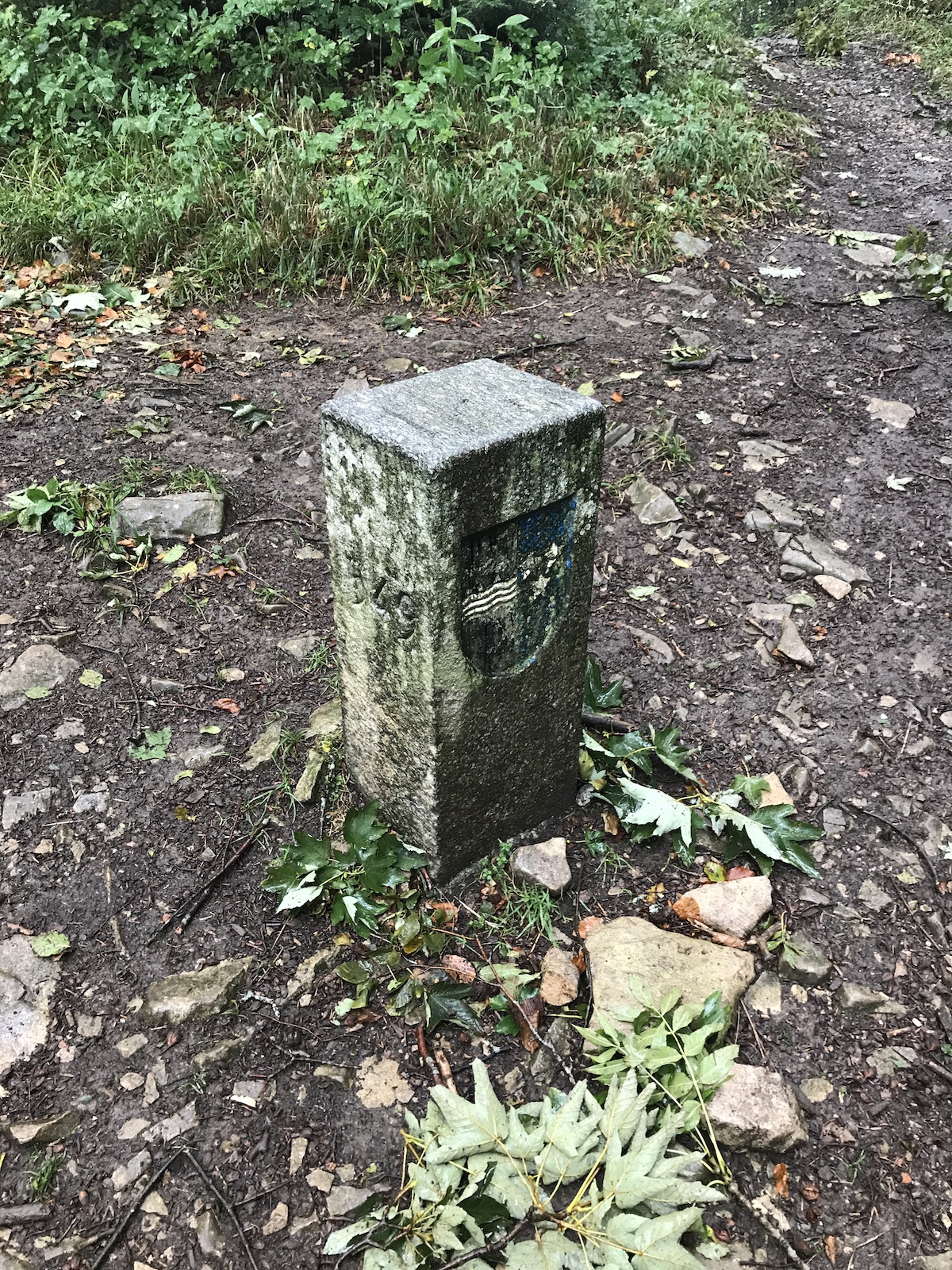
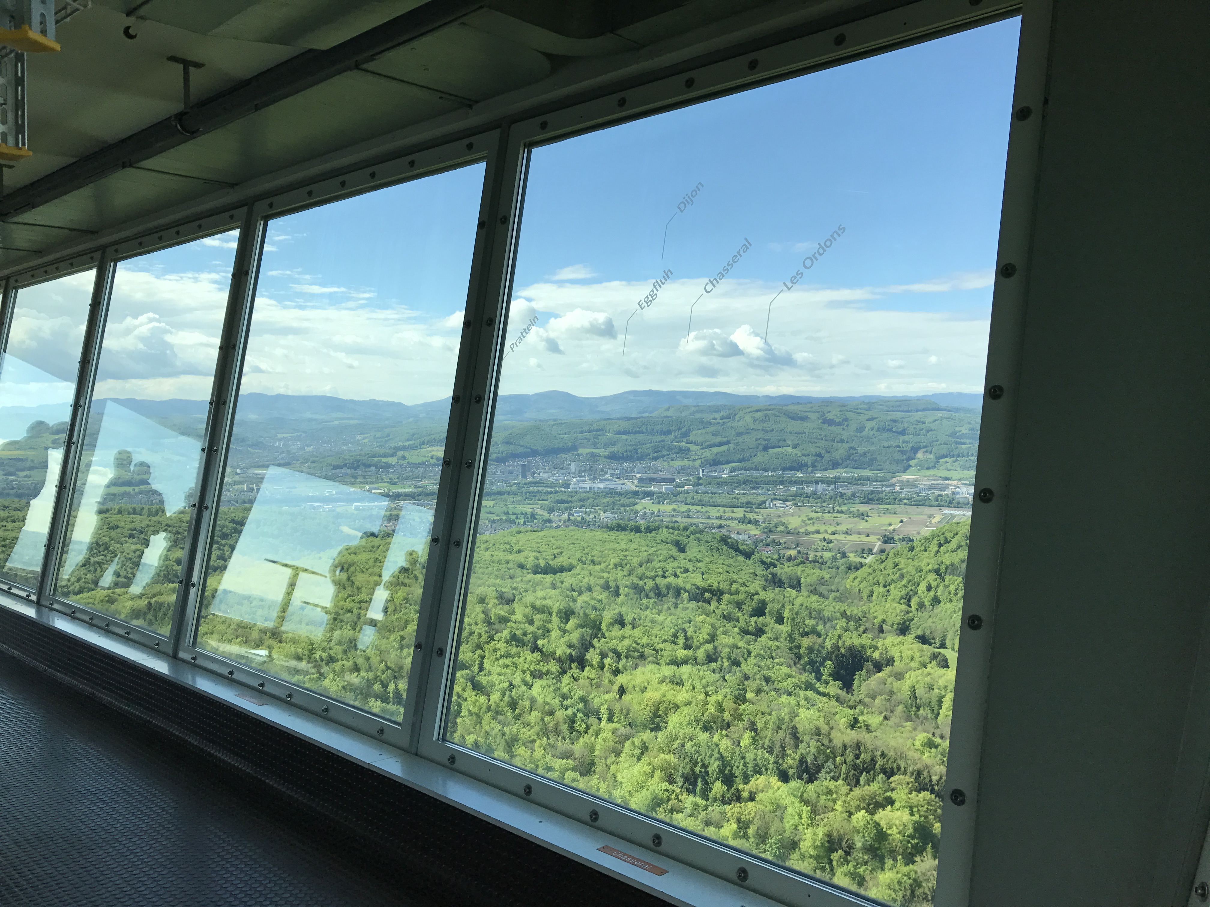
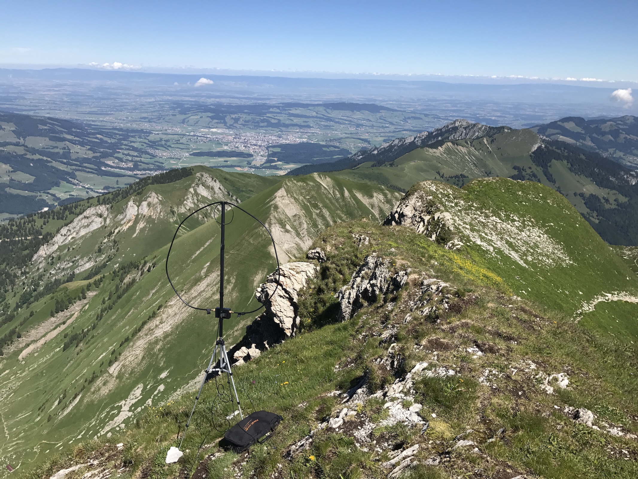
 Neuchâtel (NE) – Chasseral Ouest 1552 m

The highest point of the canton of Neuchâtel is simply a boundary stone in a meadow about 50 vertical meters below the summit of Chasseral HB/BE-104. The latter is a prime lookout spot, owing to its isolated location in the Jura Mountains, and offers excellent views. Well, in theory at least – both times that I visited Chasseral, visibility was near zero (and the first time there was a 100 km/h snow storm going on). Chasseral can be reached by car in summer.
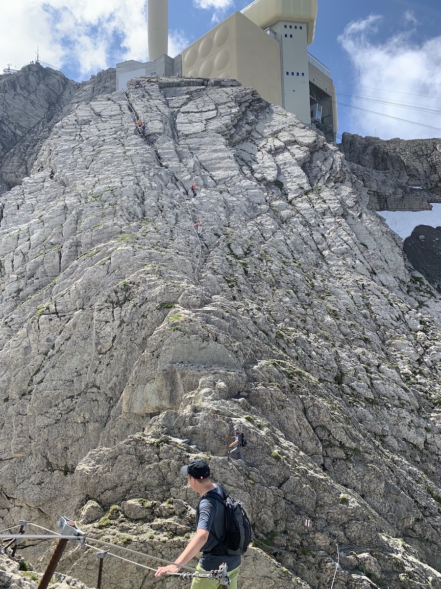
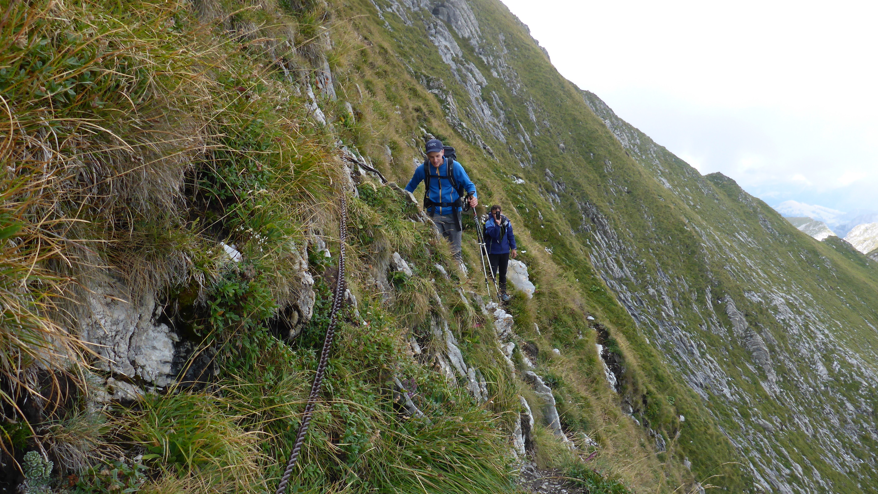
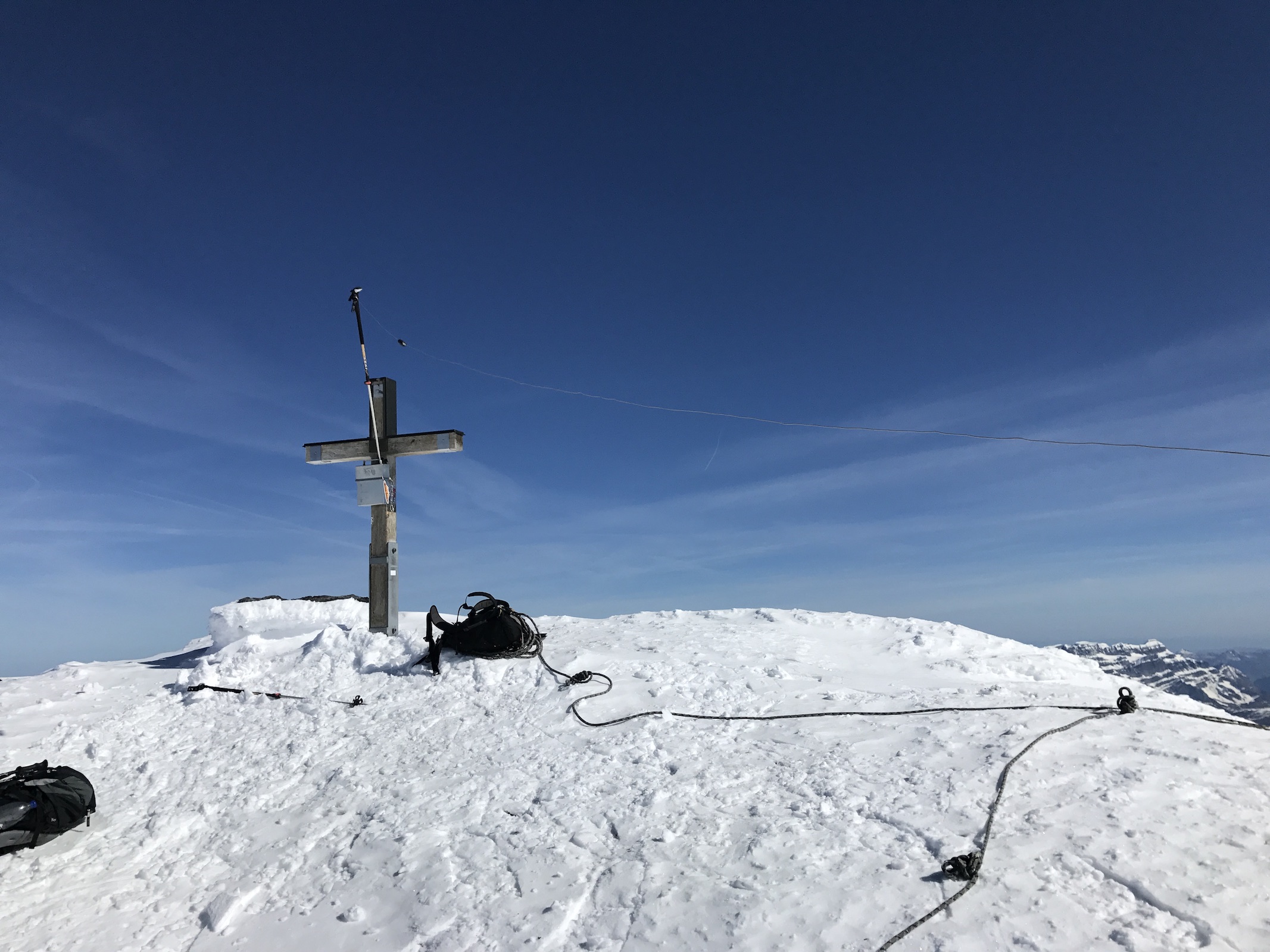
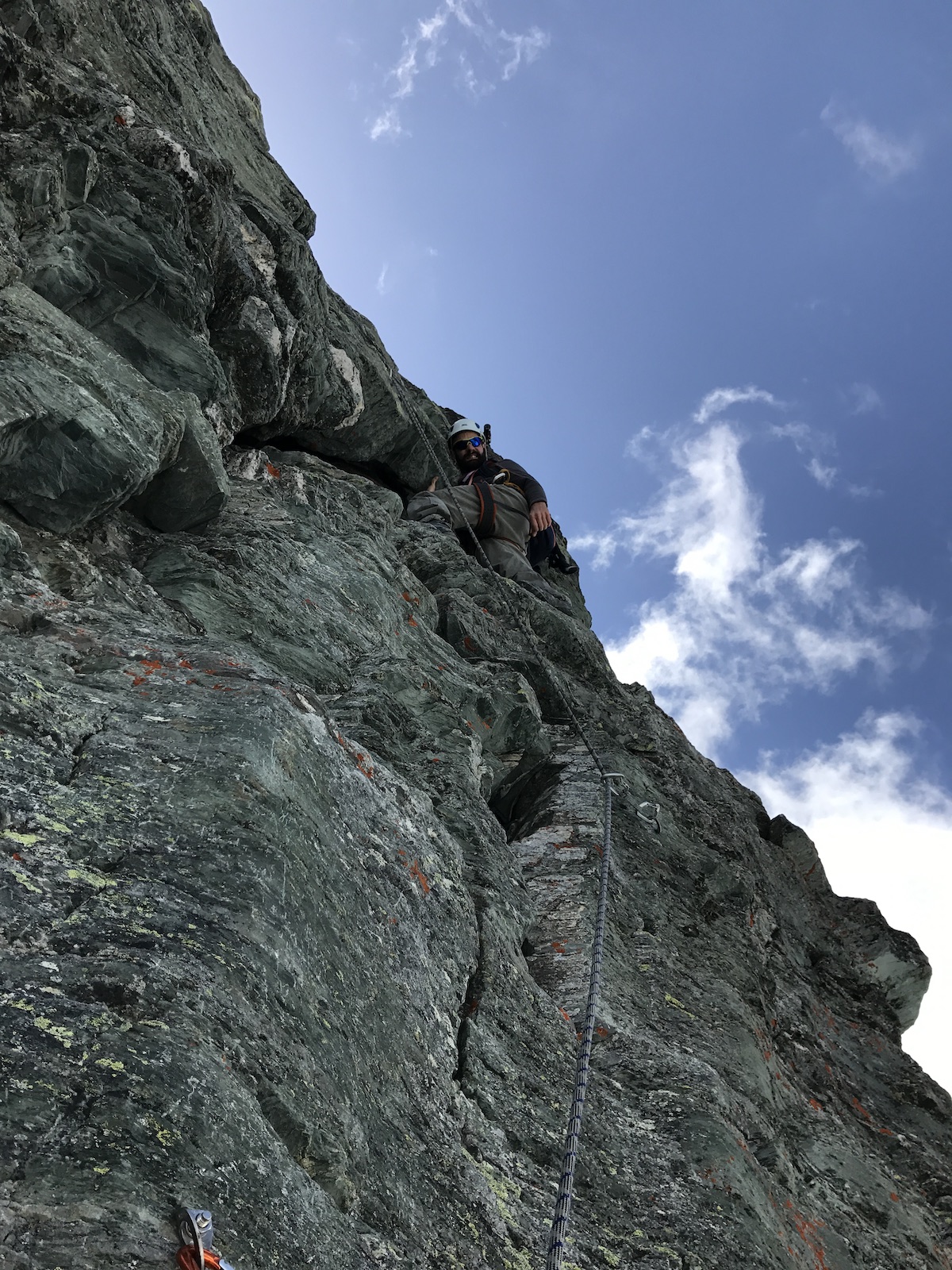
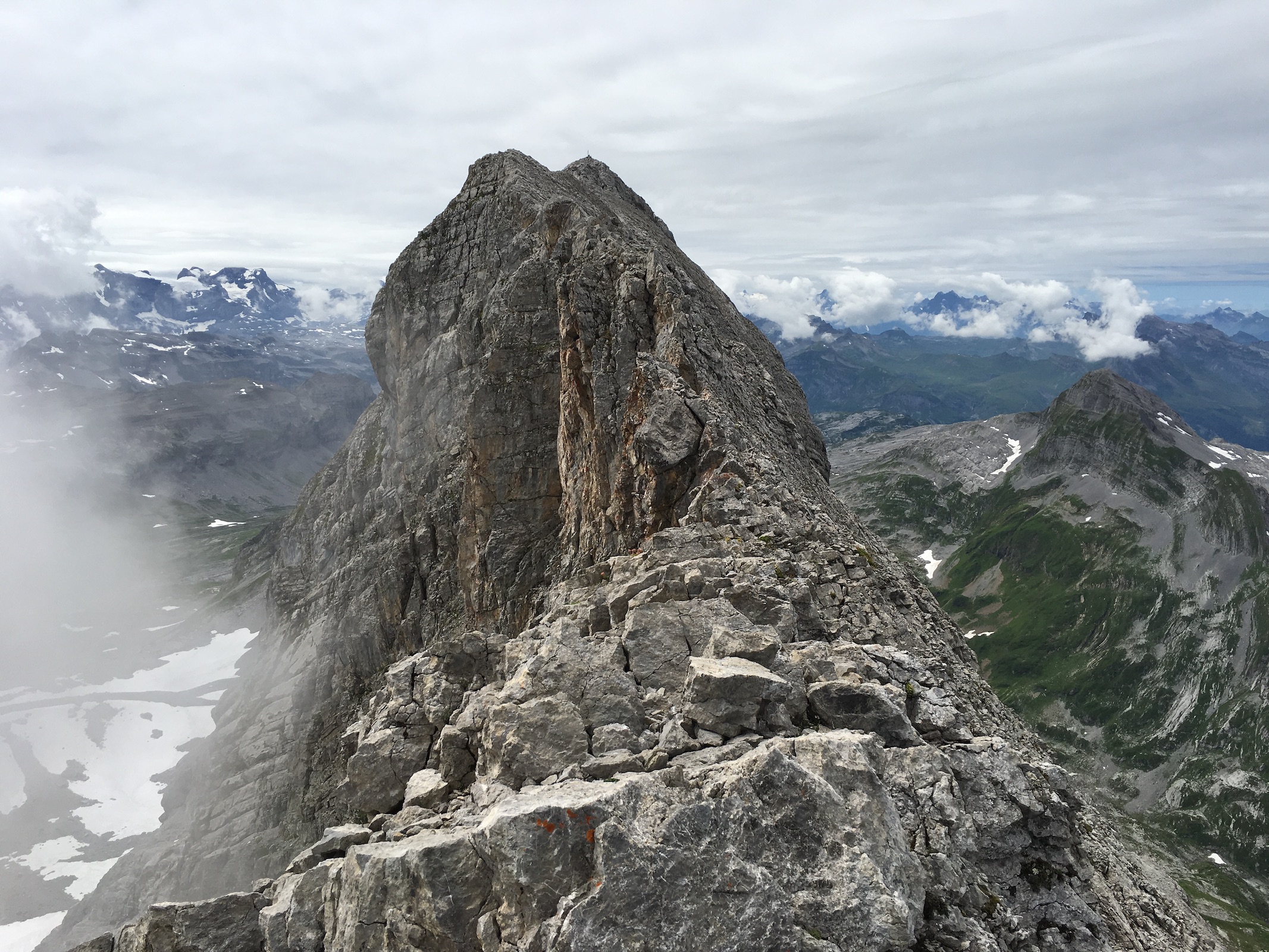
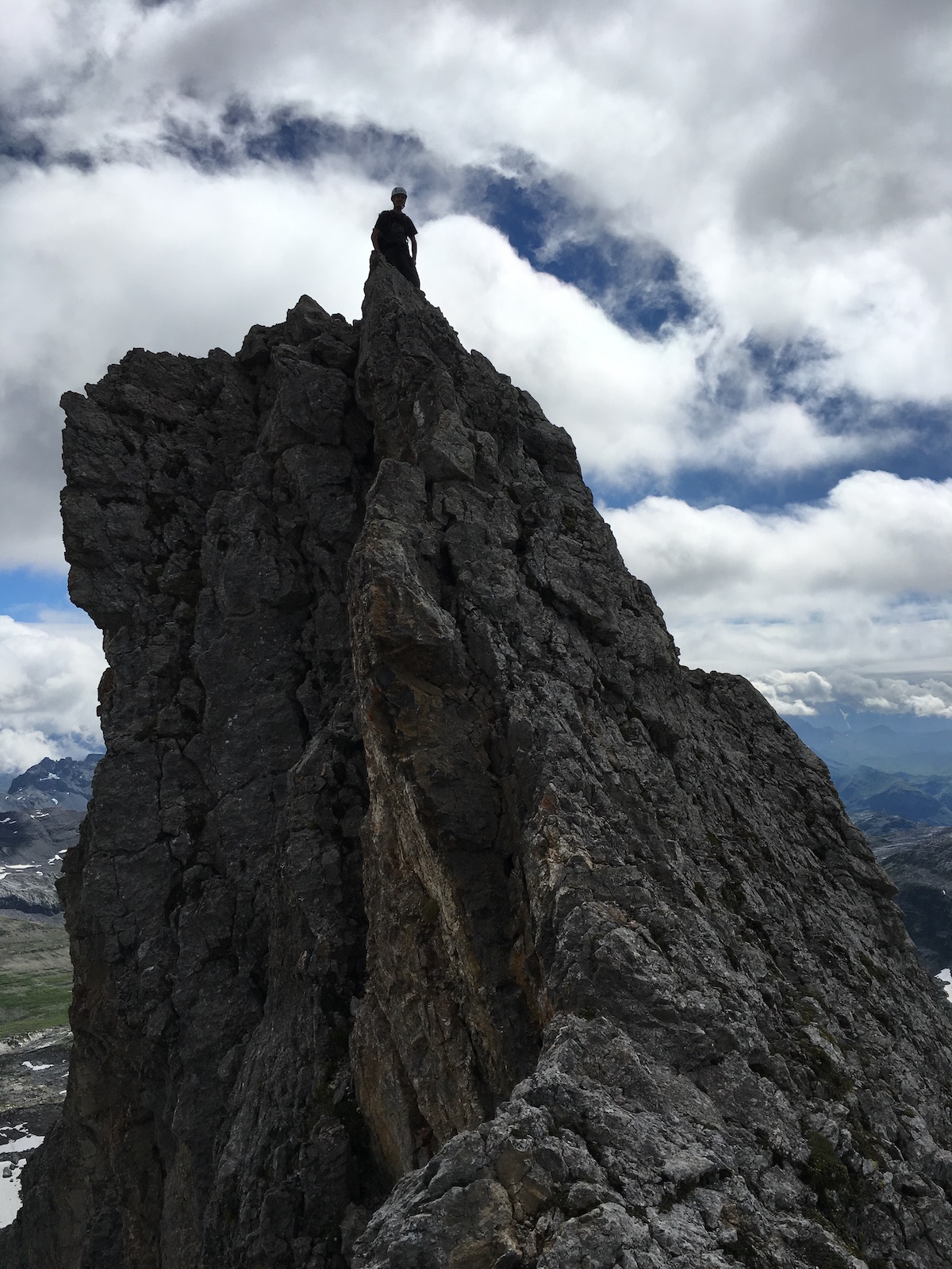
 Nidwalden (NW) – Rotstöckli 2900 m (GMA HB9/NW-1003)
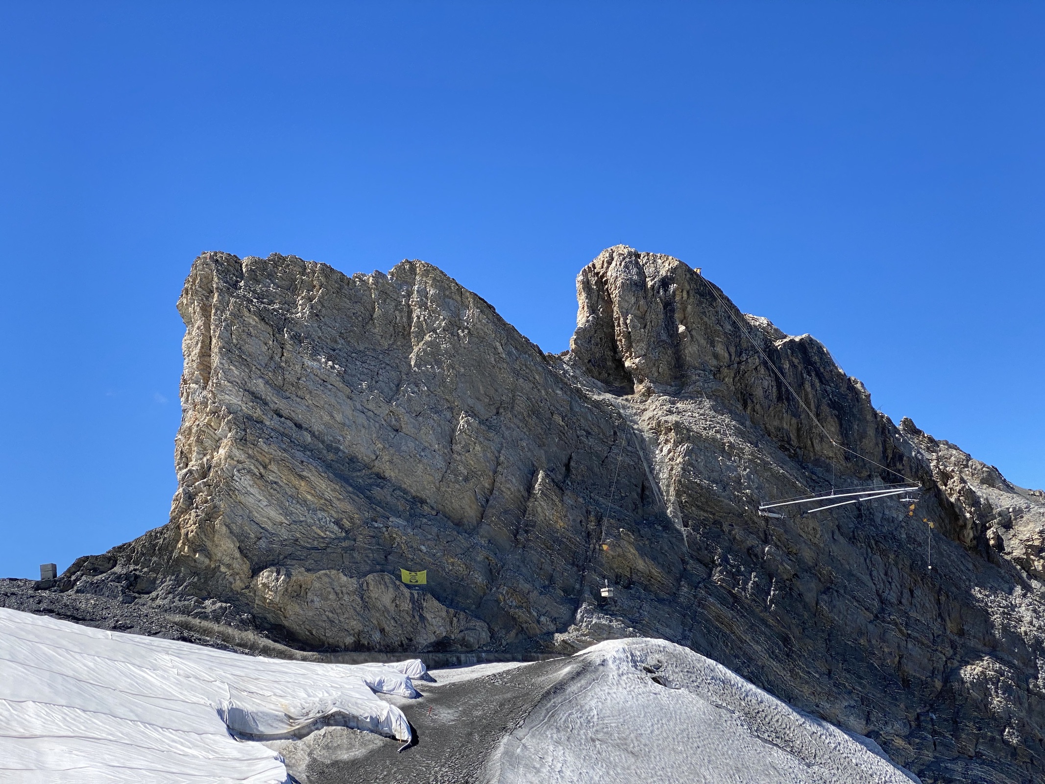
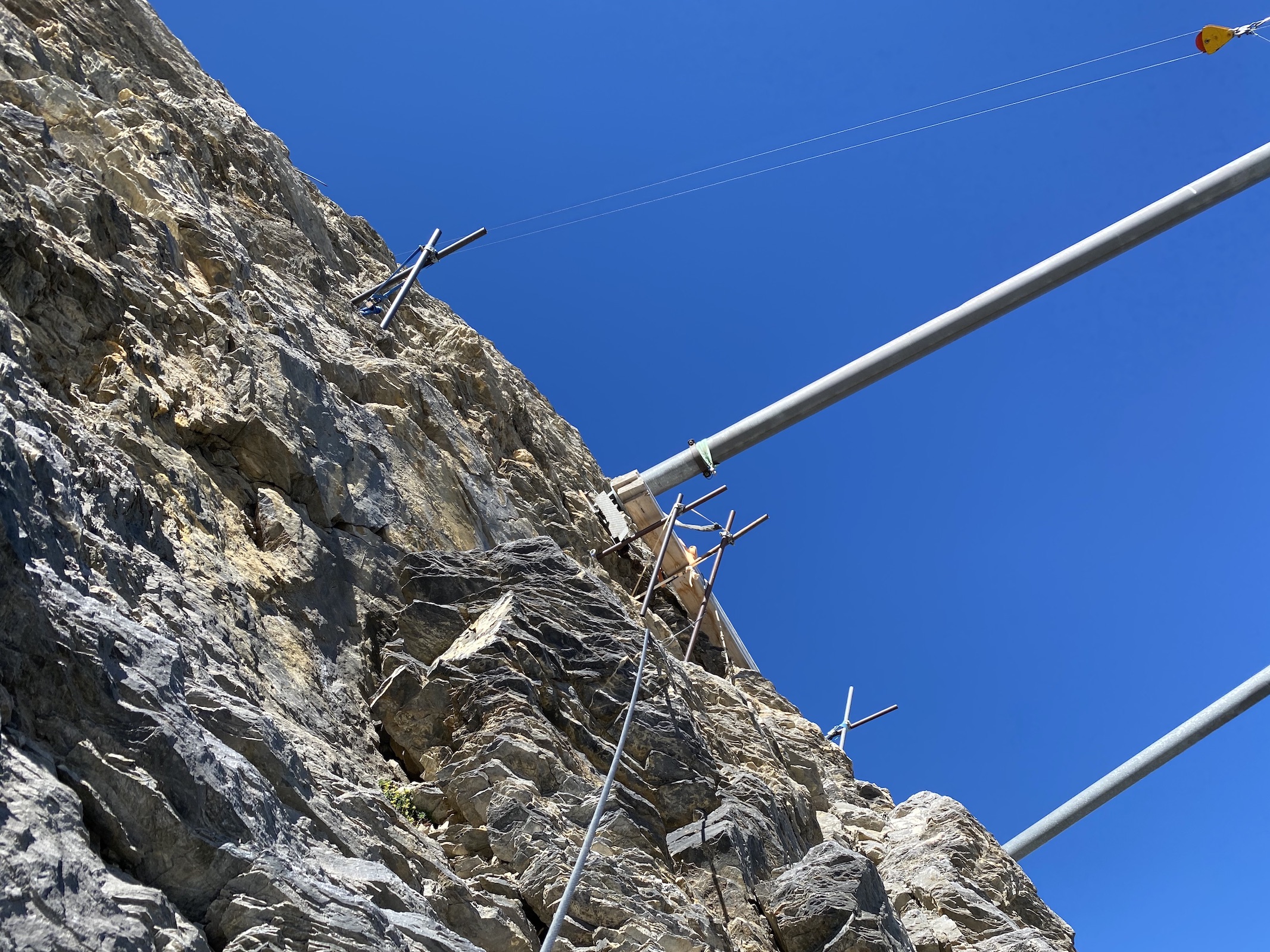
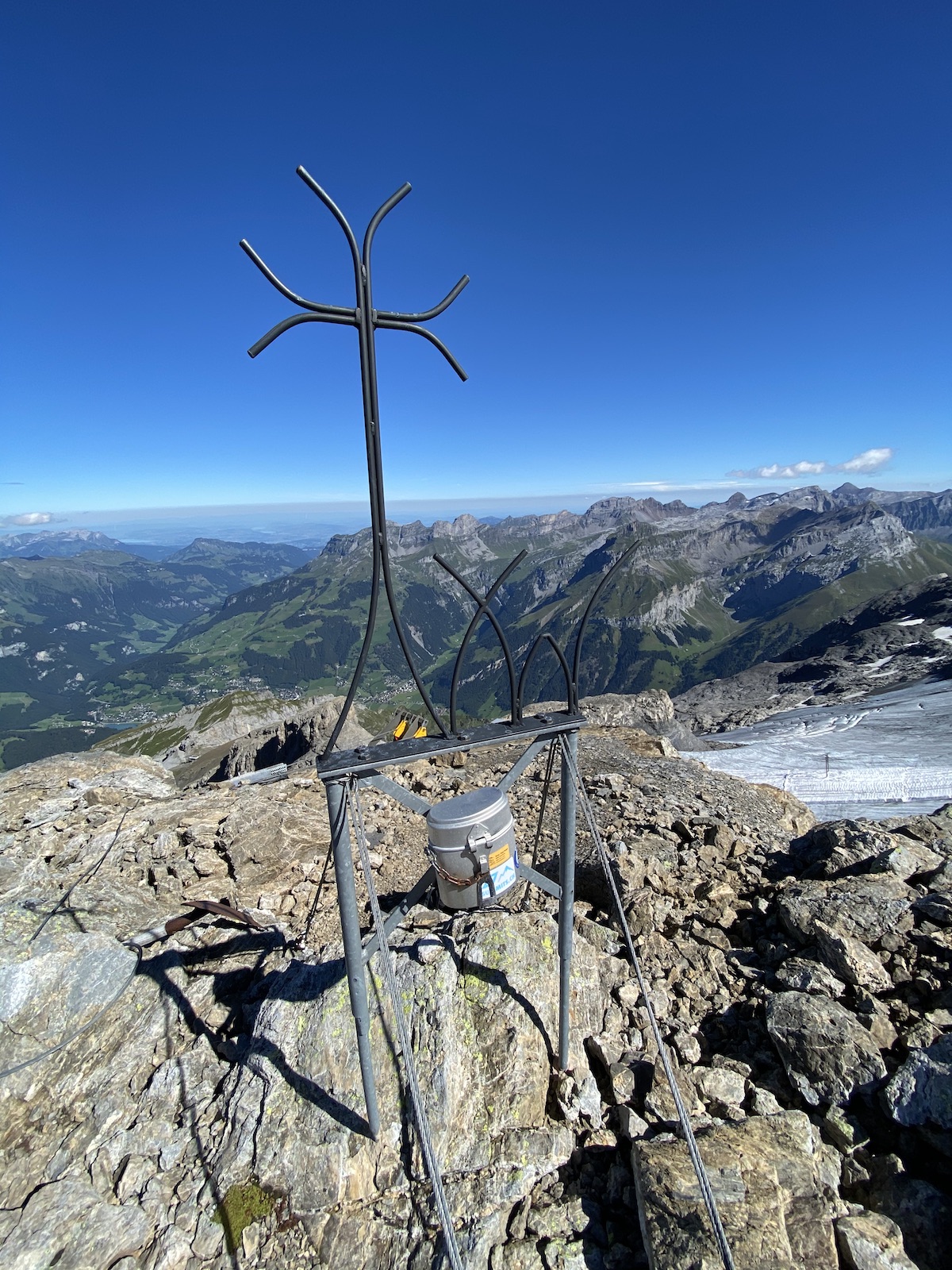
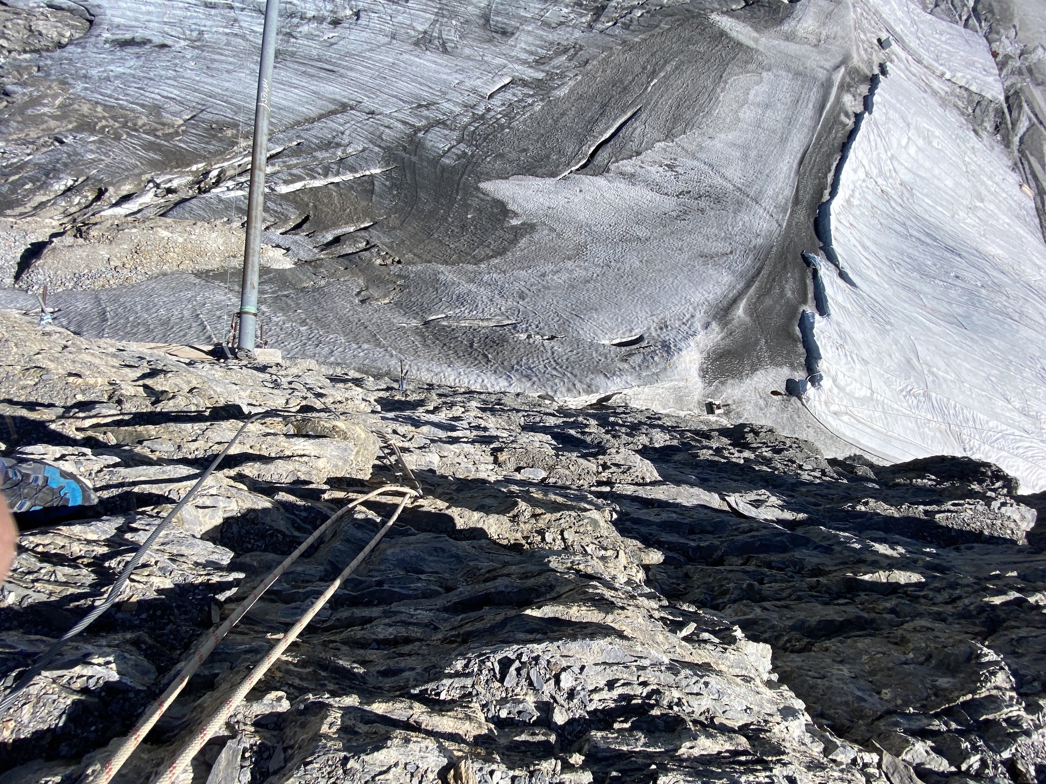
Poor Rotstöckli leads a shadowy existence below its mighty parent Titlis, and were it not for the fact that it is the highest point of a canton, it would probably not be visited more than once a year. Nevertheless, it is a peak not to be underestimated due to the brittleness of its rock. The installation of a rudimentary via ferrata in recent years has made what was once considered one of the most difficult and precarious cantonal high points safer to access (K4, III). Rockfall is still a major problem, especially when multiple persons are climbing.
Due to its proximity to Titlis, it is not a SOTA summit, but can be activated with GMA.
 Obwalden (OW) – Titlis 3238 m HB/OW-001
First image credit: CARLO FEDELE BARRI / CC BY-SA (Deed - Attribution-ShareAlike 3.0 Unported - Creative Commons)
Titlis is visited by more than a million (!) people per year, at least during normal non-Corona times. Tourists from all over the world, and in particular from India, flock to its summit (or at least the top station of the cable car at 3032 m) in a rotating cable car. Some of them experience snow for the first time in their life on the glacier at the top – a wonderful moment to witness. The actual summit can be reached with a 45 minute hike from the cable car top station. In late summer, the ridge is usually snow-free. I last visited Titlis on foot after climbing Rotstöckli.
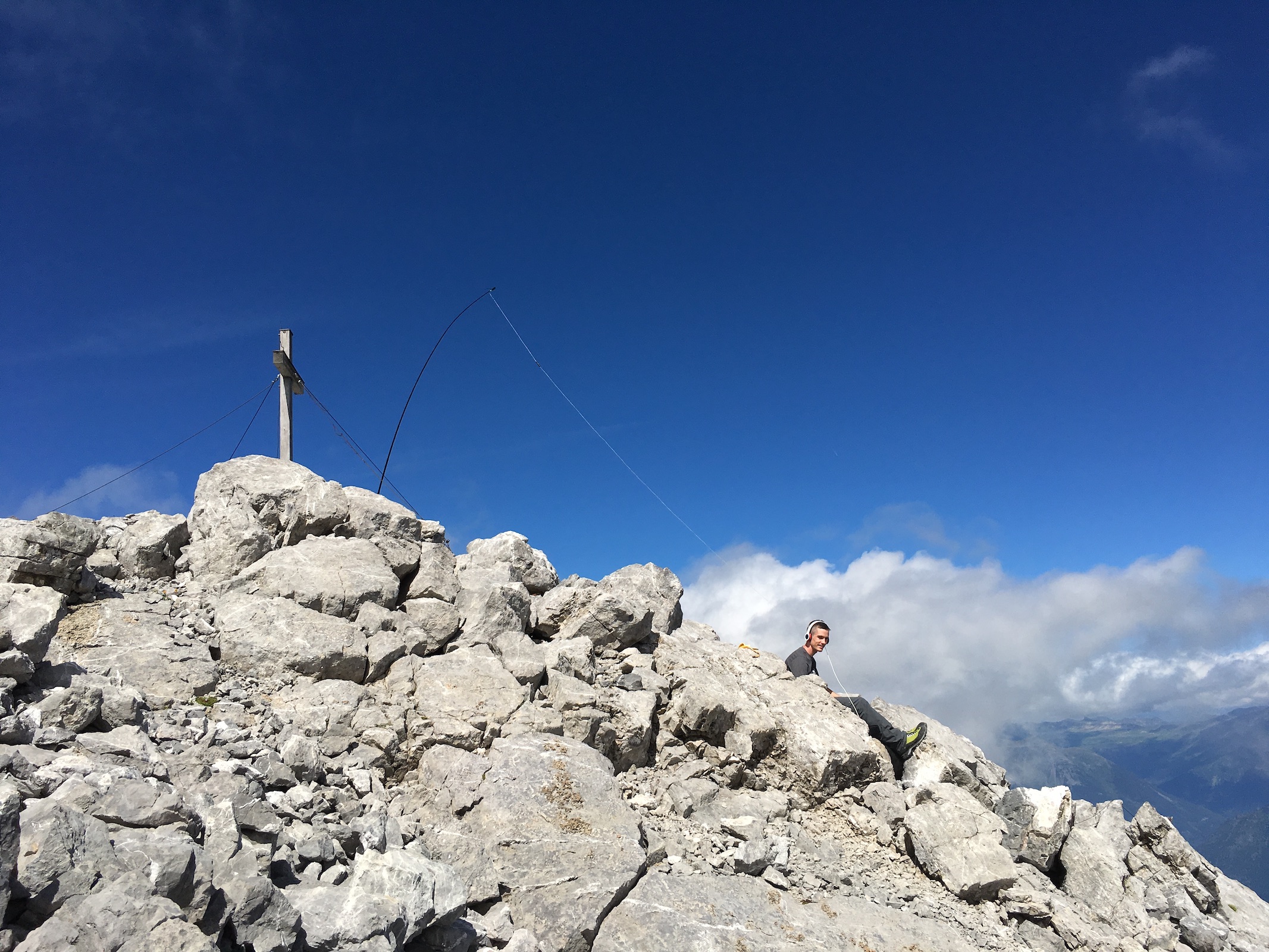
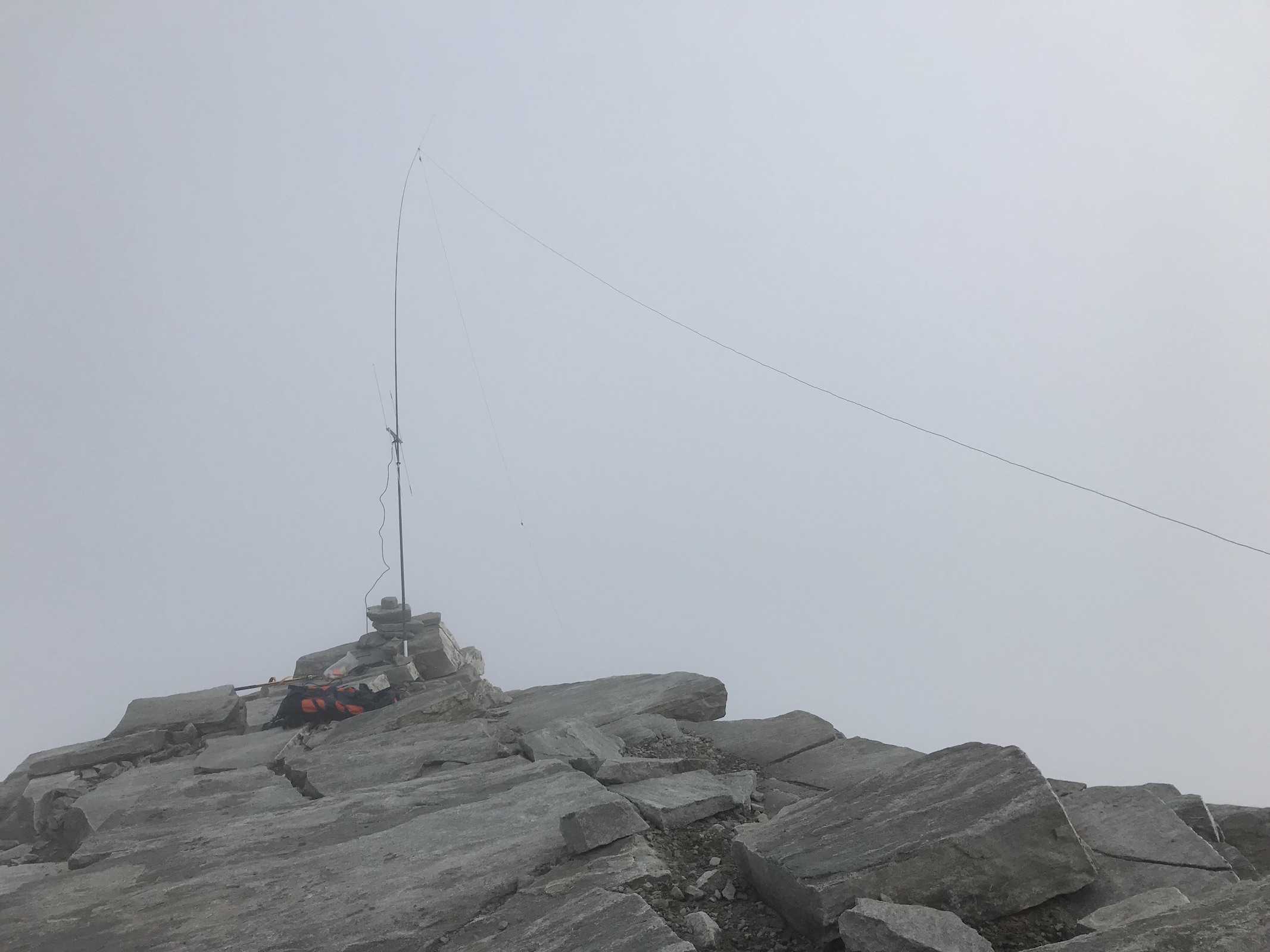
 St.Gallen (SG) – Ringelspitz 3247 m HB/SG-001
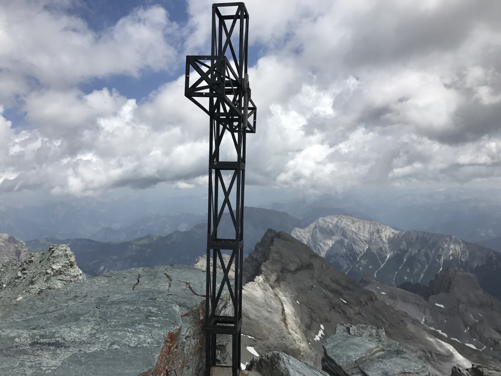
This remarkable summit is reachable by multiple routes, all of them quite long and with arduous terrain. The shortest route takes about five hours from the nearest road. The summit is a tower about 15 m high and requires some climbing (III).
 Schaffhausen (SH) – Hage 912 m (GMA HB9/SH-001)
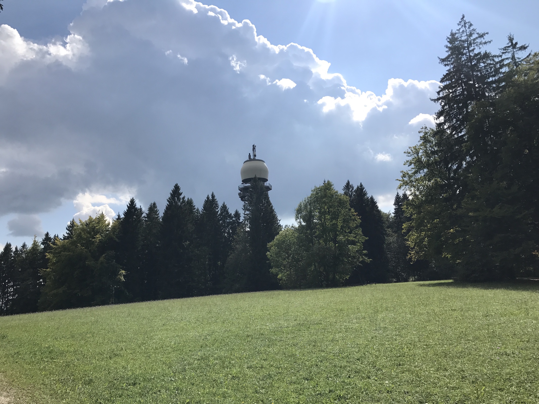
This summit has a 40 m lattice tower with a viewing platform, adorned with a radome of the Swiss Army. Due to the proximity of DM/BW-235, Hage is not a SOTA summit. I visited it by bike from home and activated it with GMA.
 Schwyz (SZ) – Bös Fulen 2801 m HB/GL-014
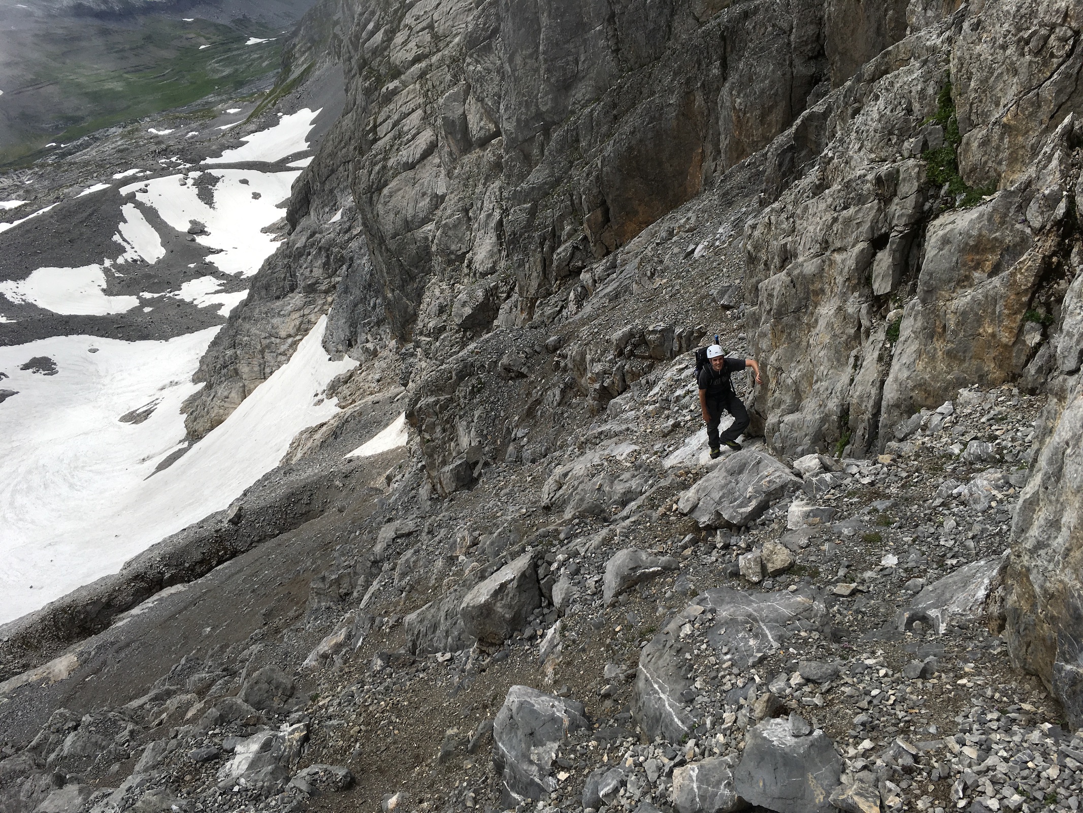
The name of this summit can be literally translated with “Bad Foul”, a testament to its dubious rock quality. The normal route involves steep scree, followed by simple (II) but very exposed climbing/scrambling in loose rock on the ridge.
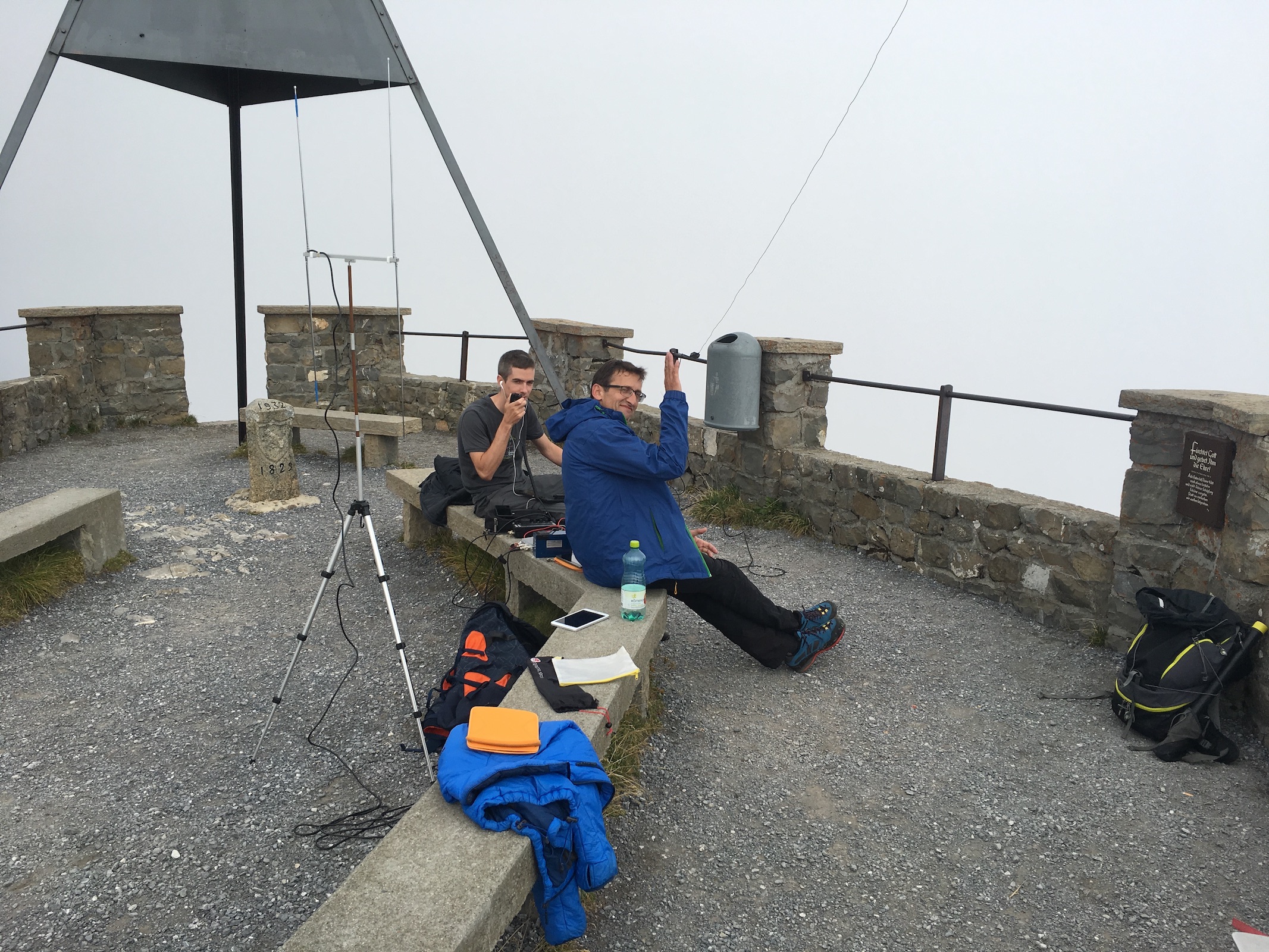
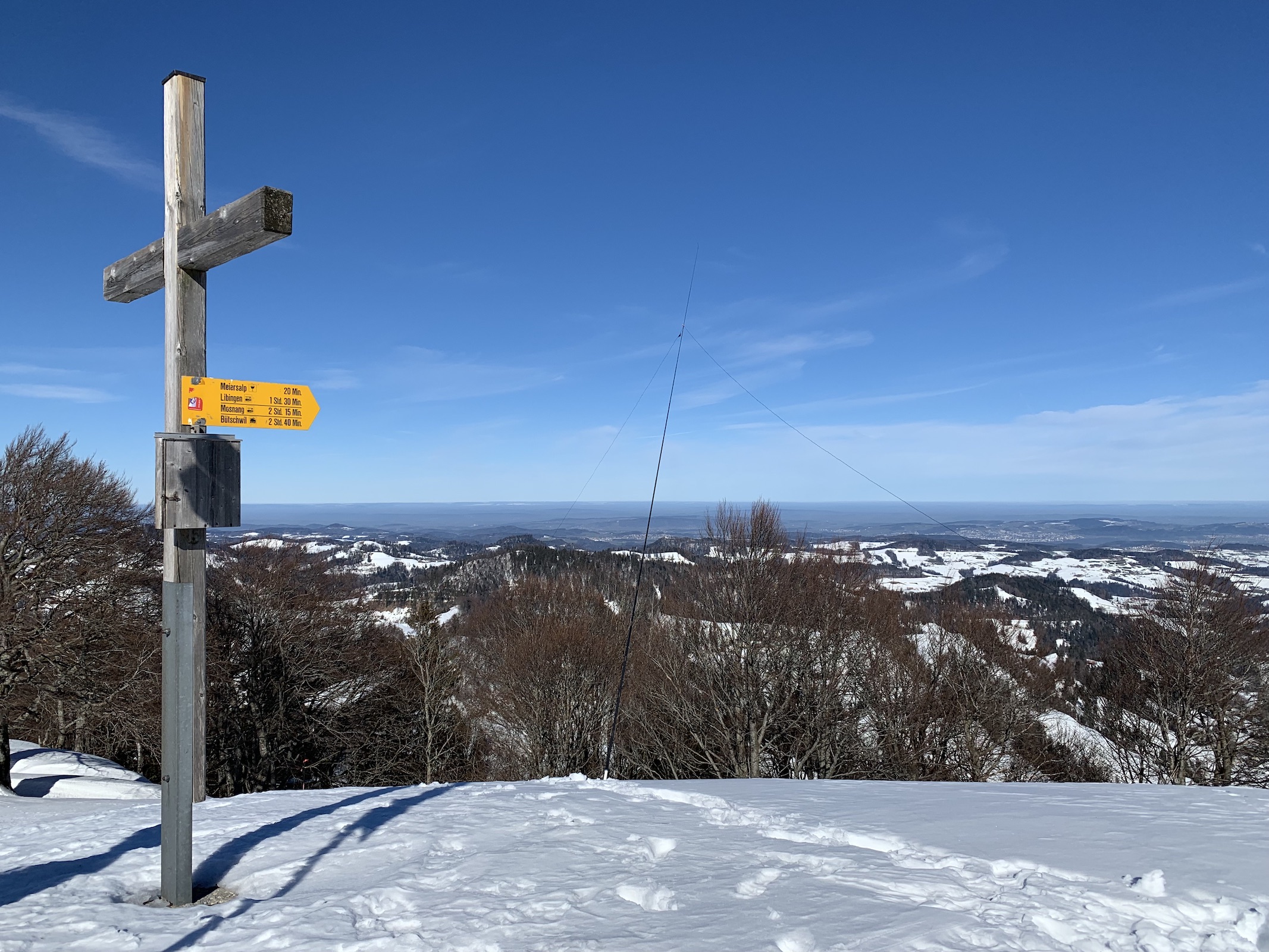
 Solothurn (SO) – Hasenmatt 1445 m HB/SO-001

A very nice summit of the Jura Mountains, with plenty of space – the perfect place for a SOTA activation. It is reachable within 15 minutes from the nearest (unpaved) road and offers views of almost the entire Swiss Alps, and even Mont Blanc.
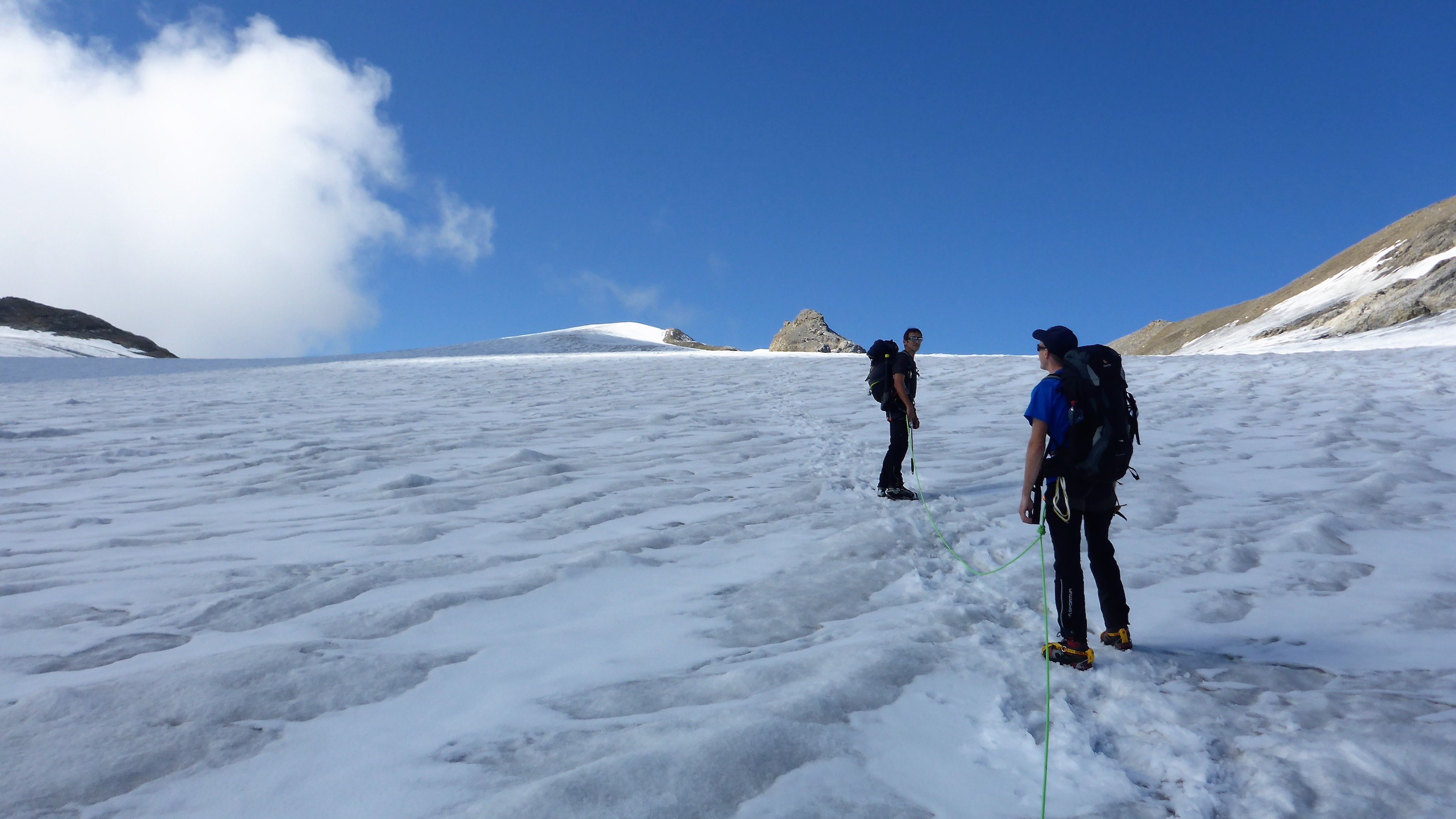
 Ticino (TI) – Adula/Rheinwaldhorn 3402 m HB/TI-001
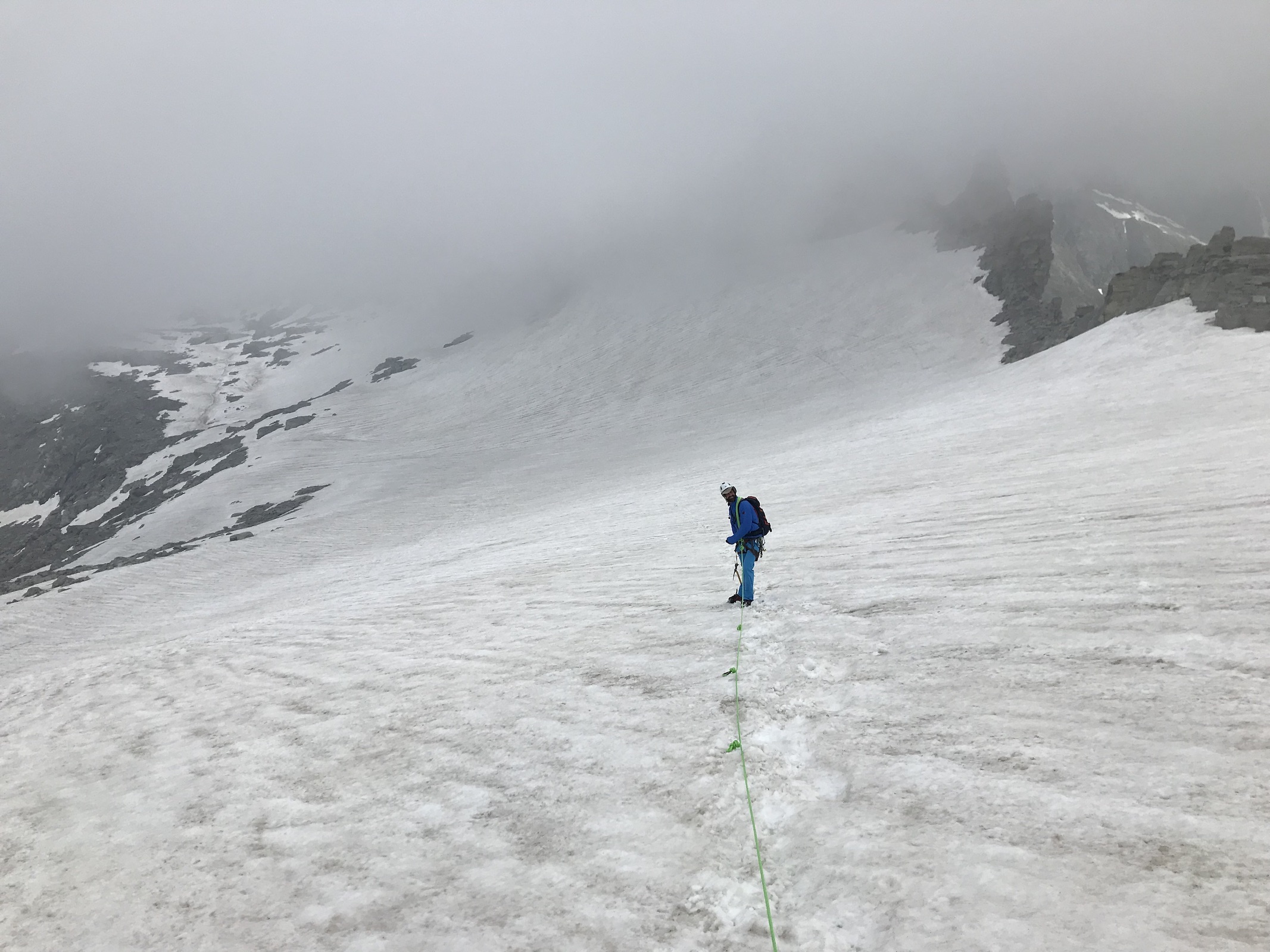
A pretty dominant peak that separates three language regions (Swiss German, Italian and Romansh). The normal route takes about four hours from the nearest hut and is an easy glacier itinerary without any climbing (F).
 Thurgau (TG) – Groot 991 m (GMA HB9/TG-1001)
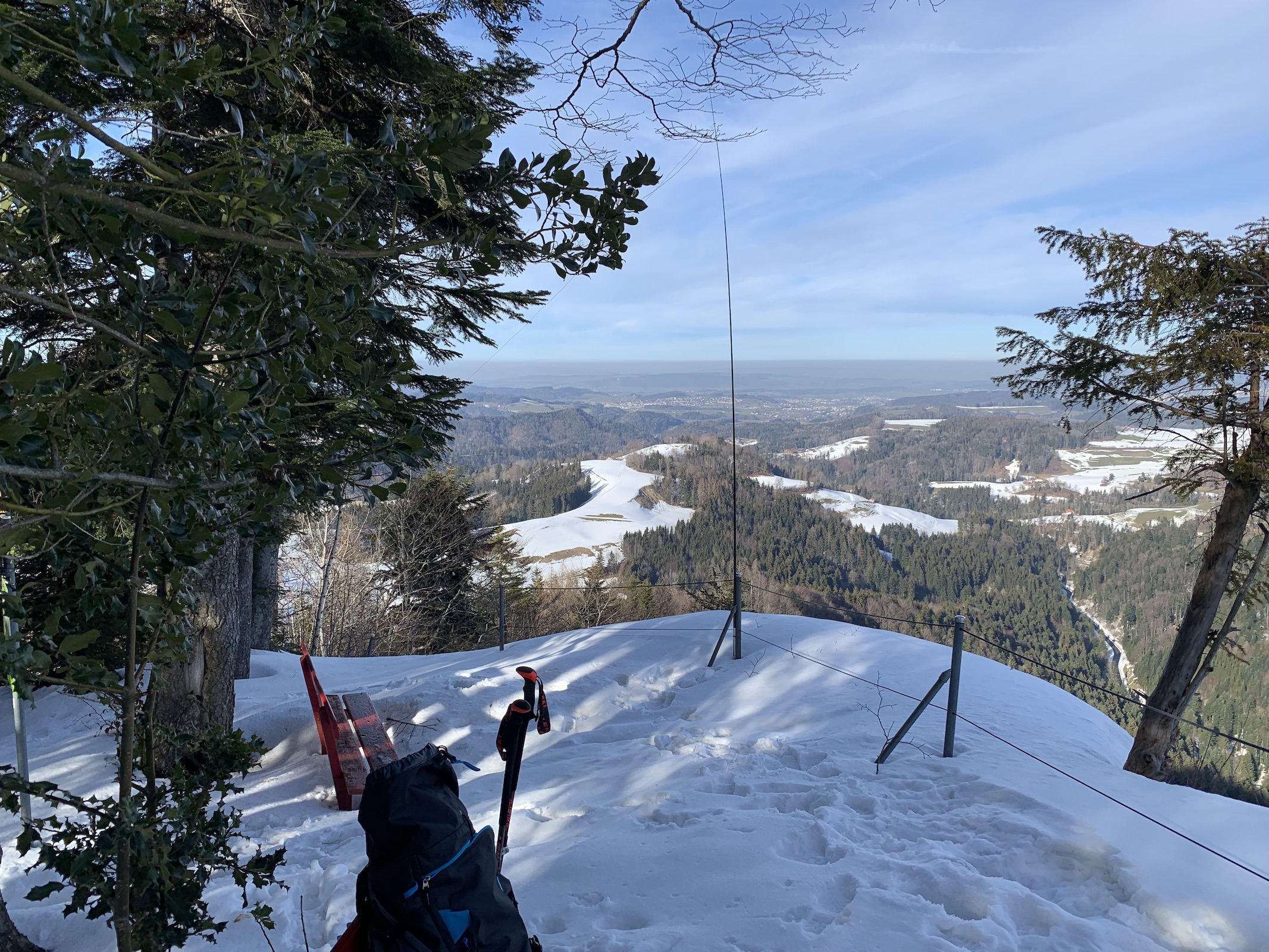
Not much to say here – this point is located on a wooded ridge, easily reached with a 45 minute hike from the nearest town. Perhaps remarkable is the fact that the neighboring canton of St.Gallen snatched the actual highest point of the ridge (995 m) about 25 meters away from poor Thurgau!
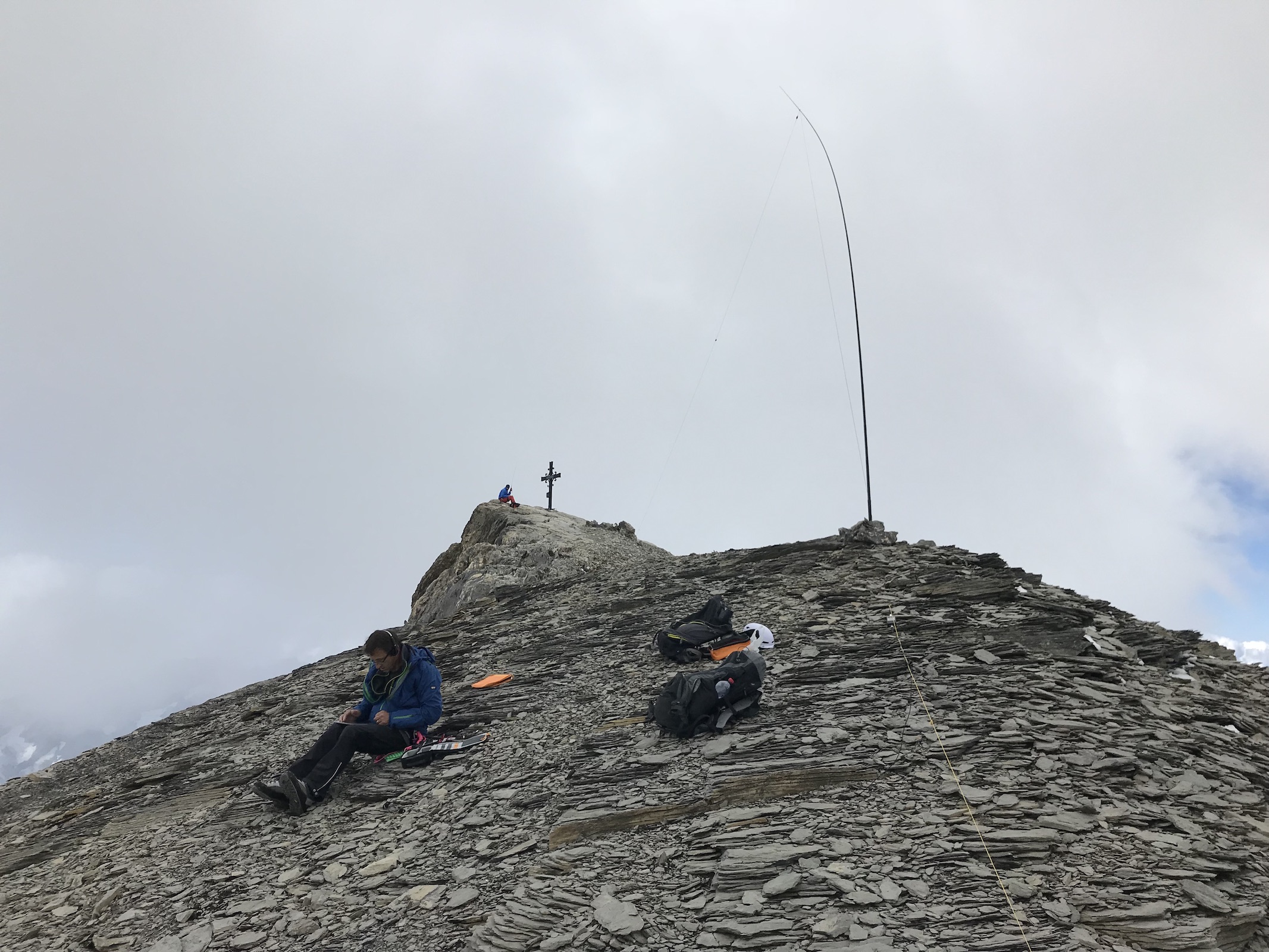
 Uri (UR) – Dammastock 3630 m HB/UR-001

Reachable in about five hours from the Furka pass road in a technically easy (F) but long (20 km round trip, 1400 m ascent) glacier itinerary. The crux is right at the beginning: a kiosk blocks access to the end of the Rhone glacier. During opening hours, tourists can pay to get access to an ice cave in the glacier. When the kiosk is closed (as it would be in the early morning hours when it is reasonable to start a trip like this), there are only two options: a) climb over the roof of the kiosk (II), or b) waste 100-150 meters of ascent to circumvent it on a trail high above.
 Vaud (VD) – Sommet des Diablerets 3210 m HB/VD-001
The Diablerets (“abode of devils”) are a huge ice-covered mountain massif, culminating at the Sommet des Diablerets. Thanks to the Scex Rouge (“Glacier3000”) cable car, it only takes about two hours of glacier travel to reach the summit. One needs to climb down along a fixed rope to get onto the glacier, and of course this glacier, though relatively gentle, also has some crevasses.
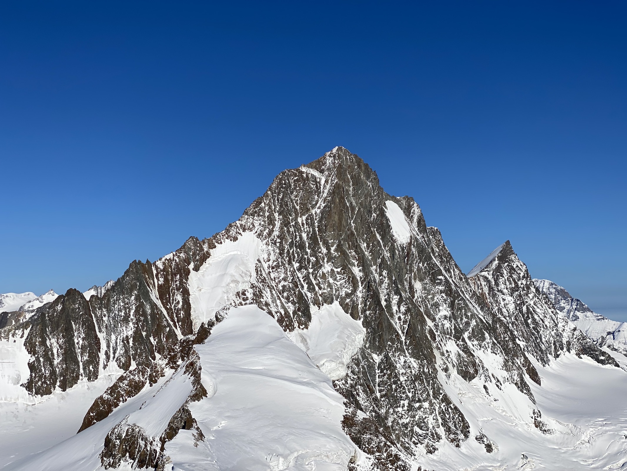
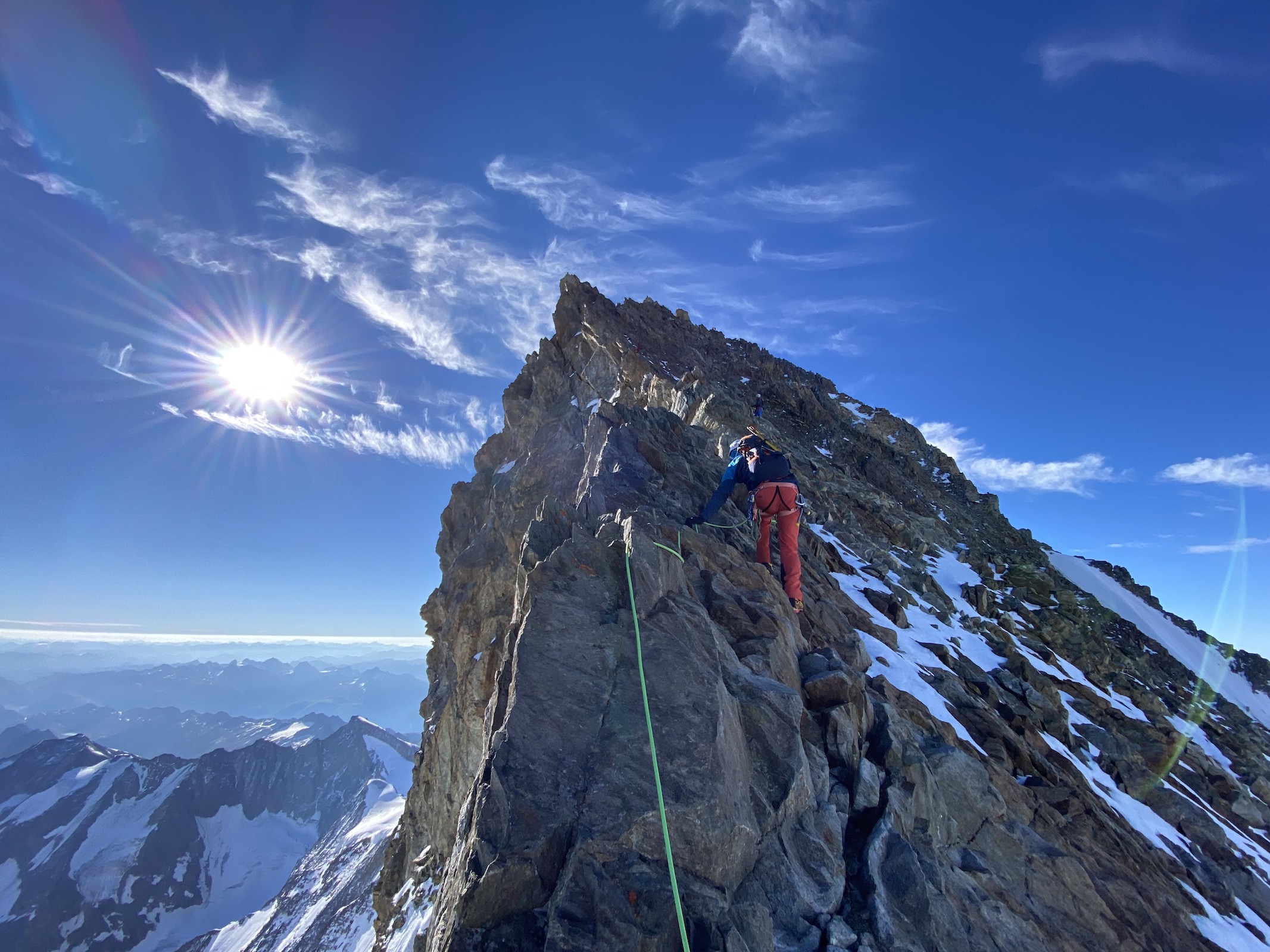
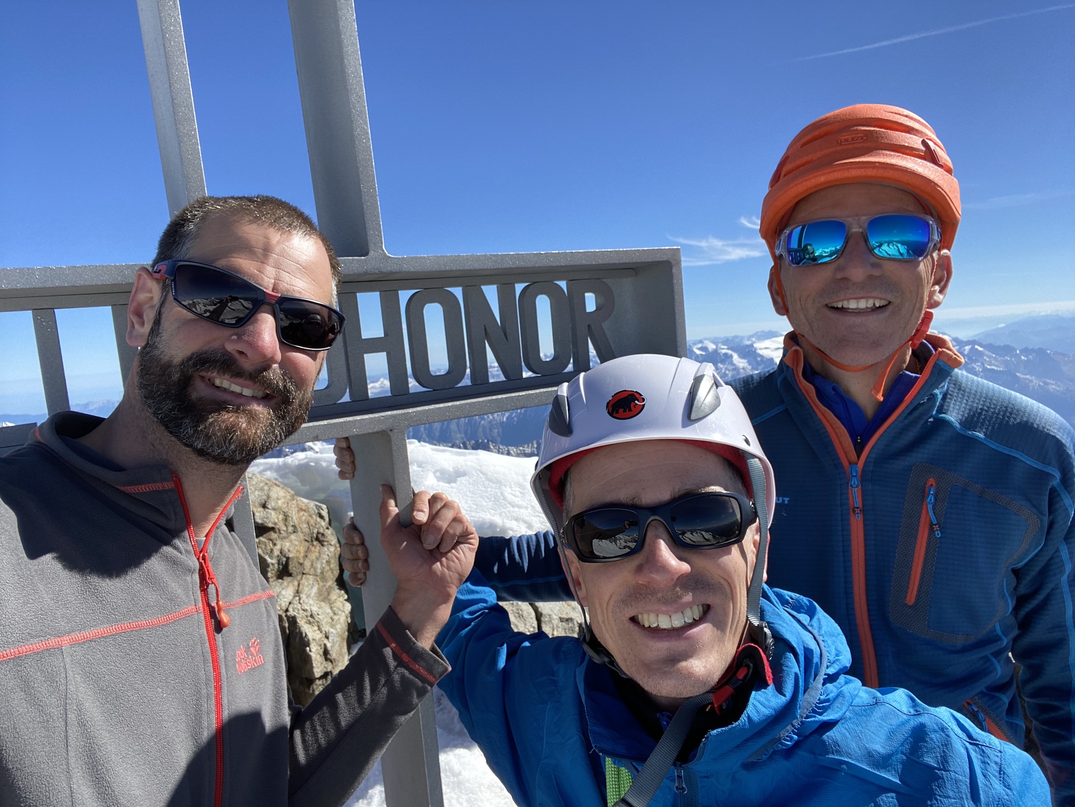
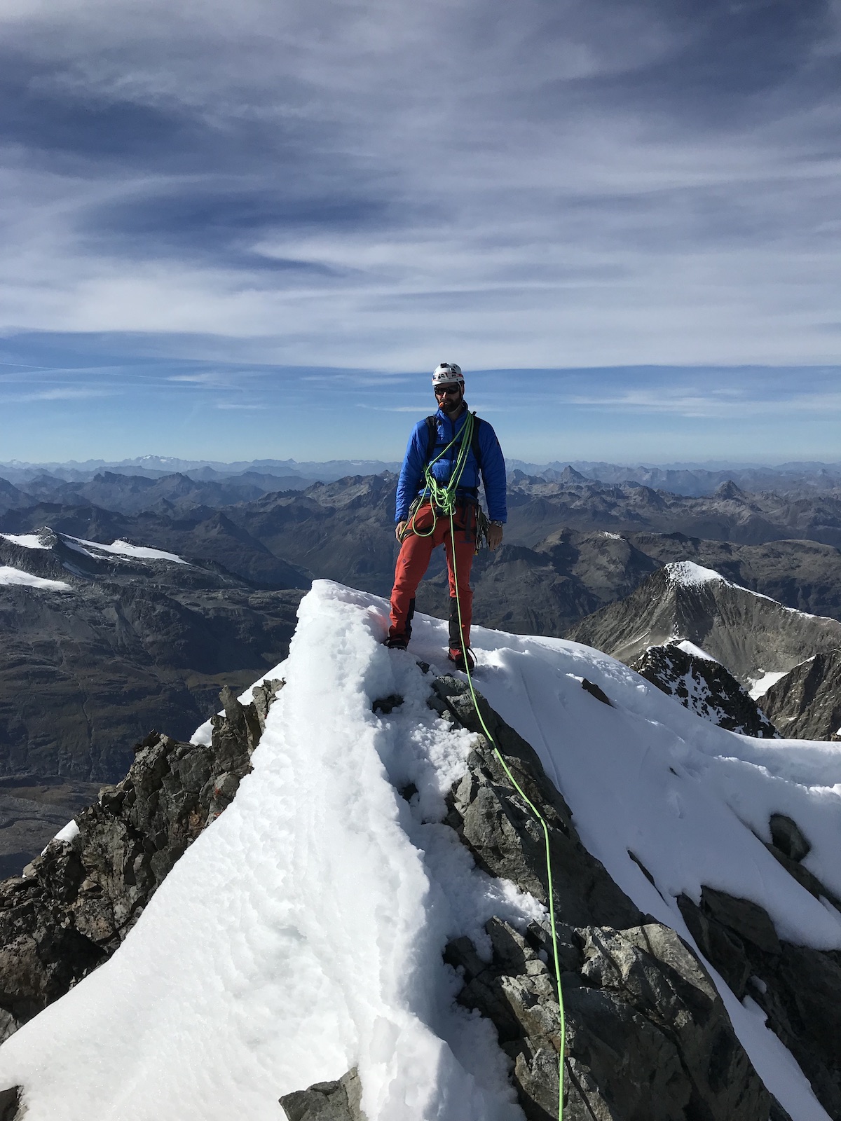
 Valais (VS) – Dufourspitze 4634 m HB/VS-001
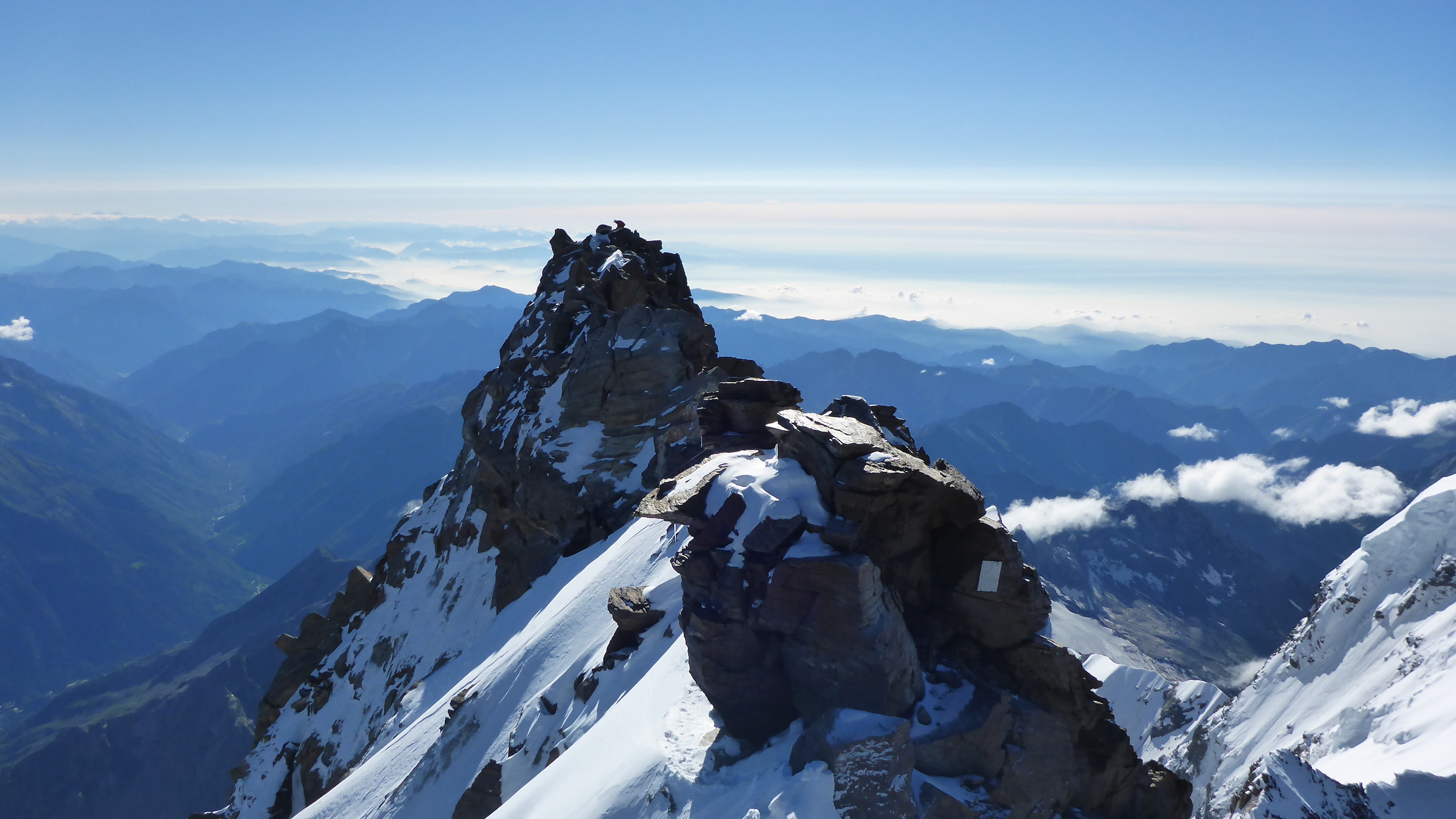
Culminating point of the Monte Rosa massif, and the second highest summit of the Alps. It is also the highest point of Switzerland. The normal route leads from the famous Monte Rosa hut to the summit, taking 6-7 hours and involving a 1880 m ascent as well as some climbing/scrambling on the exposed west ridge (AD- II+). The hut itself is reachable in about 3-4 hours of challenging hiking after taking a cogwheel train from Zermatt.
A detailed report of our ascent and activation can be found here:
 Zürich (ZH) – Schnebelhorn 1291 m (GMA HB9/ZH-1001)
A nice summit, easily reached in an hour or two via one of four different ridges, in summer or winter, on foot, with skis or snowshoes. Owing to the proximity of the major urban centres around Zurich, one is rarely alone here. Deprived of its status as a SOTA summit (formerly HB/ZH-001), all one can do is hit the air with a GMA reference.
 Zug (ZG) – Wildspitz 1579 m HB/ZG-001
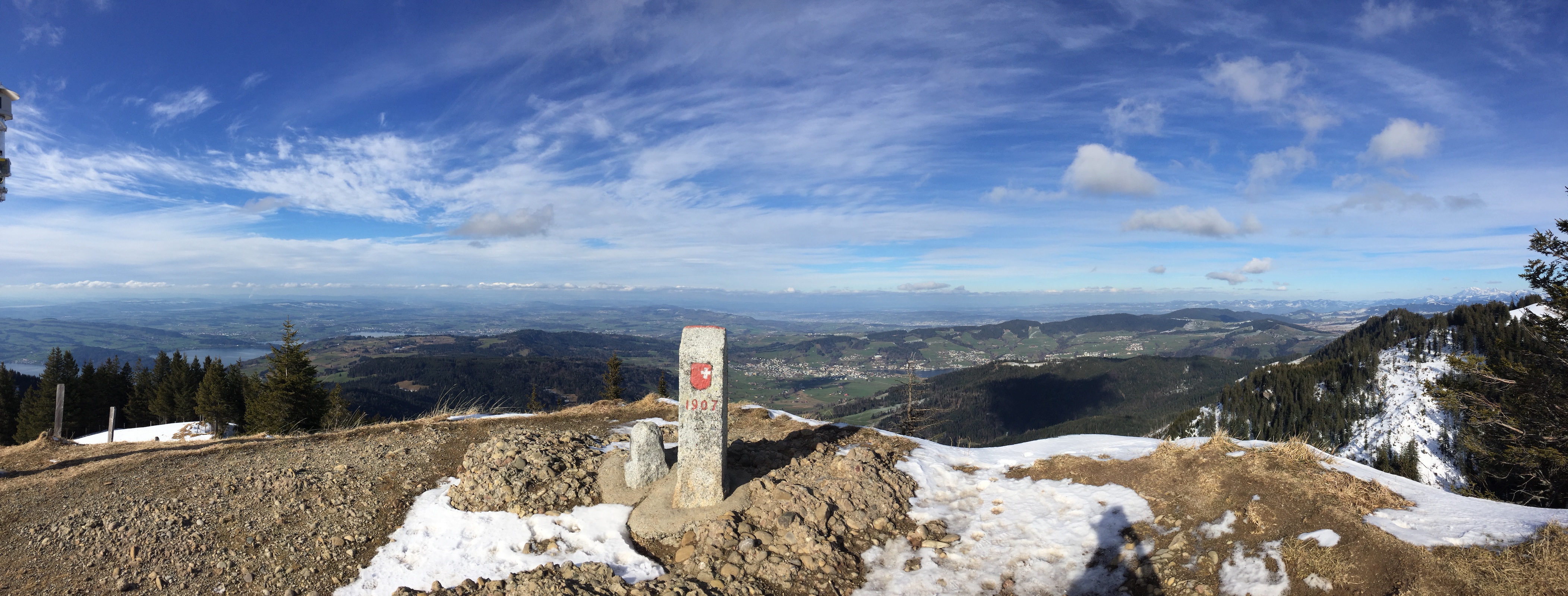
Site of a massive landslide that occurred in 1806, completely destroying two villages and killing more than 400 people. The summit can be reached in a bit more than half an hour from the nearest road, has plenty of space for a SOTA activation, and even a restaurant slightly below the summit.
Note: due to the rule in the HB9 ARM that summits on a cantonal boundary get a reference of the smallest (by area) bordering canton, the SOTA references do not always reflect the canton of the highest point.


