Awesome resource and tons of work! I have uploaded photos to every location I have gone (and almost all have tracks as well). Very well done!
73,
Mike AC0PR
Awesome resource and tons of work! I have uploaded photos to every location I have gone (and almost all have tracks as well). Very well done!
73,
Mike AC0PR
Hello Manuel,
Any chance to add the elevation to exported .gpx file?
Thanks a lot!
73 de Joe
Hello Joe,
Your wish is my command – done! ![]()
73, Manuel
Manuel,
Excellent 
After force reload the page the feature worked.
Now planning gets even easier.
Thanks a lot 
73, Joe
Hi Manuel,
Another little thing for your bug list (or not ? )
Thanks
73 Joe
Neither bug nor feature, just laziness on my part ![]()
This has now been fixed/improved (for the case where the cover photo has been uploaded by a user, rather than obtained from Wikipedia).
73, Manuel HB9DQM
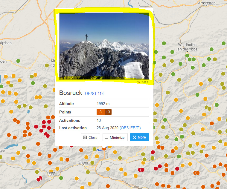
Thanks Manuel. Same issue on the small image on the map on clicking the summit.
I would suggest to open the summit page on click of the photo?
73 Joe
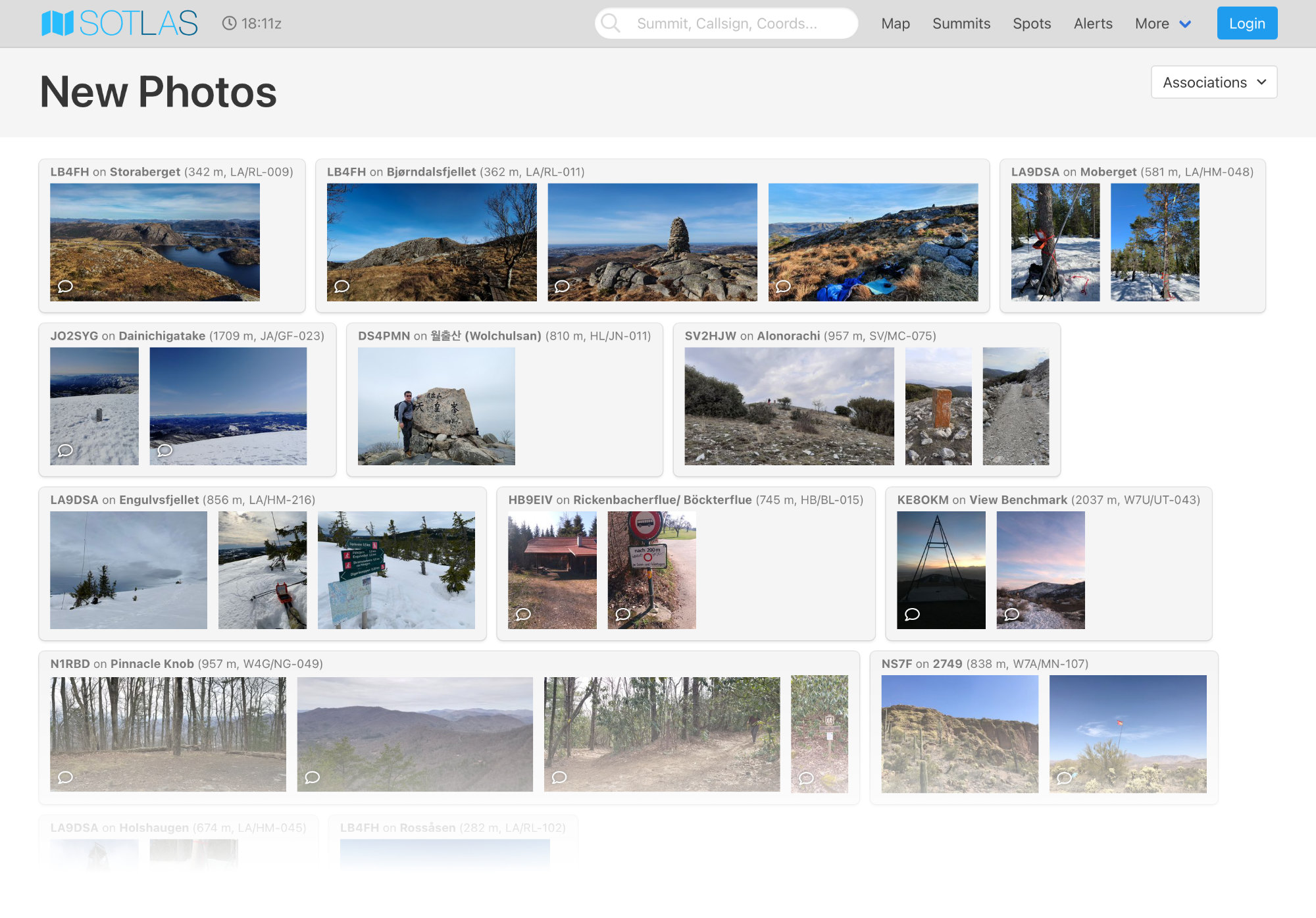
The photo upload feature in SOTLAS has proven to be very popular, with a few dozen photos from all over the world being uploaded every day.
To showcase the new photos, I have added a “New Photos” page to SOTLAS (SOTLAS). By default it shows photos from all associations, but it is possible to filter it by association.
Other changes in the last few months:
If anybody knows where to find the terms of use for the CalTopo WMTS service (https://caltopo.s3.amazonaws.com/topo/{z}/{x}/{y}.png), then perhaps the CalTopo map could be added to SOTLAS as well.
Thanks Manuel for the great features and service for the SOTA community.
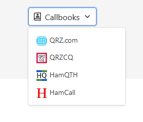
And I guess this is also new at the callsign page:
73 Joe
Great work !! Tnx for all of your time you spend to do that …
73
DD6FM - Marco
Hi Manuel @HB9DQM
First, thanks for HB/GR-010 this morning, sorry I called you Mark by mistake 
In Sotlas when I open one activation log, all France flags aren’t displayed !
Maybe I’m wrong and it’s my PC fault 
73 Éric
Bonsoir Éric,
Thanks for the QSO today! No worries about the name 
The French flags show up fine on my computer. Try clearing your browser cache, perhaps something has got stuck in there.
73,
Manuel HB9DQM
Merci Manuel
Clearing the cache worked thanks
73, Éric
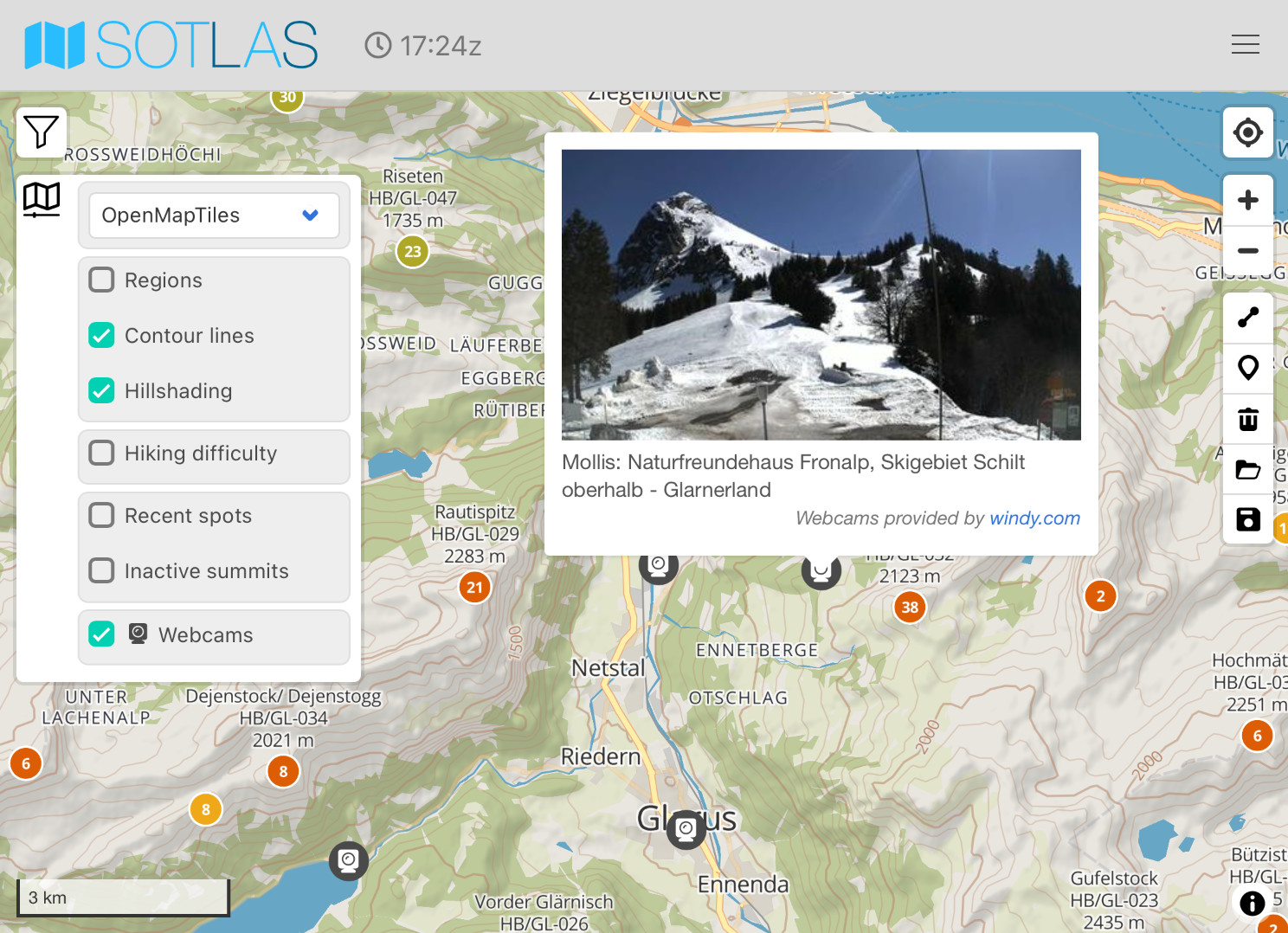
Spring has sprung in this part of the earth – the snow is melting, but there’s still a lot left to melt! The time has arrived where the primary question when contemplating a SOTA activation is: Will hiking boots do, or do I need snowshoes/skis?
Webcams can help answer the question, and to make them readily accessible, I have added a webcam layer to https://sotl.as, fed with worldwide webcam locations from windy.com.
Simply enable webcams in the map options menu. Unfortunately the direction that the cameras are facing is not available from the data source, or it would be even easier to identify the desired summit in the image.
When one thinks that this is the perfect tool, you add a feature that makes it even better.
Thanks a lot for your great effort!
73 Stephan
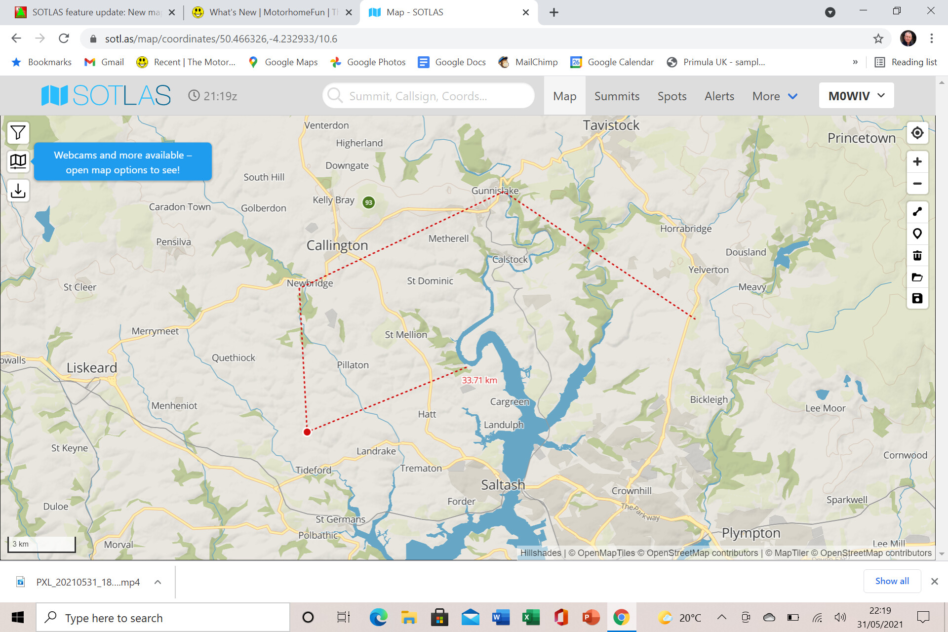
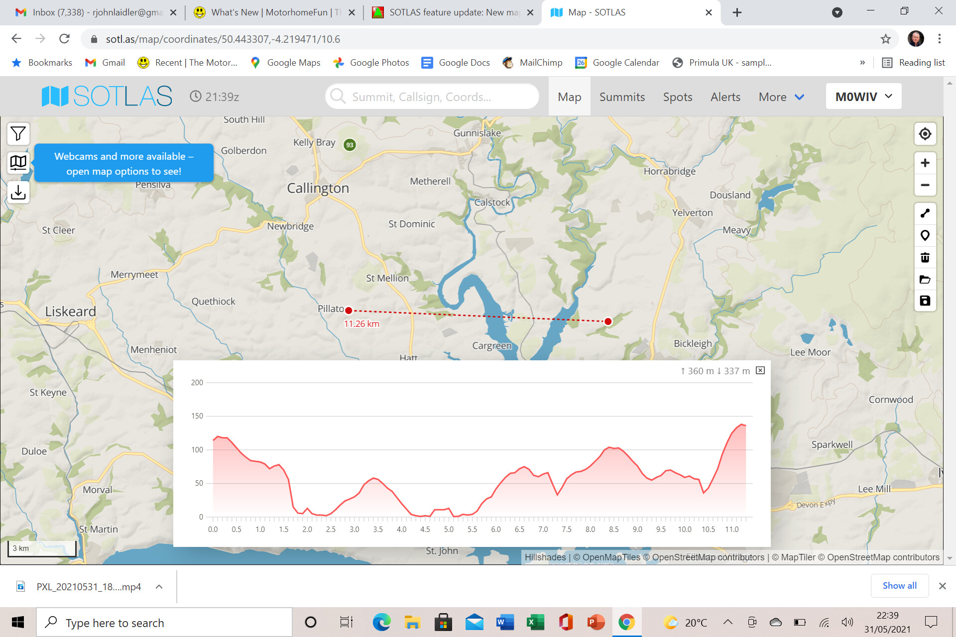
I try to draw on the map to enter a track. But there are no tools on my map. What can I do?
Tnx for the SOTLAS,
73 Chris
To entering a new gpx track: This still needs to be done on sotamaps.org .
sotl.as will take it from there.
But for drawing on the map John has pointed it out already. After drawing hit the enter/return key to show the elevation profile.
Maybe try to force reload the page or clear the browser cache.
I got it, tnx for your advices.
73 Chris