SOTA on Pillar G/LD-006 (Spaniel on the air…again?)

(Sorry - long post and spoiler all OK but sore…)

Well somehow the stars aligned and Dad managed to get a 2 day pass (It was a 3 day pass but sons job application (He got it) and French GCSE’s soon stopped that…., so it was one night away in the Lakes and the plan initially was to stay in the camper overnight at Nether Wasdale and to “do” Seatallan one day (A hill I have never climbed) and the Illgill Head the following day. I have really enjoyed reading about the epic adventures of Ben and Frazer so decided that if I tried hard I could get Pillar as well so I had completed all the 8 pointers in the Lakes.

I parked at a Motorhome Aire (£15-00 for a tap but a very nice view and very quiet) slightly later than planned and set off walking a bit later than than the 9-30 planned start. The start of the walk was fairly good and as I started the steeper ascent up Seatallan my son rang to tell me he had got the job offer (They rang the day after the interview, not good for the nerves….) .

Seatallan G/LD-025 is a nice hill to walk up with nice views of the lakes on one side, and a nice view of a nuclear reprocessing plant on the other side…Both 40m and 2m were well behaved and I managed several contacts including a S2S. Woody joined in again (apologies). I notice that by the time I got to Seatallan I was already an hour behind my planned time, but as sunset was 20-30 and the weather was great I pressed on.


Seatallan

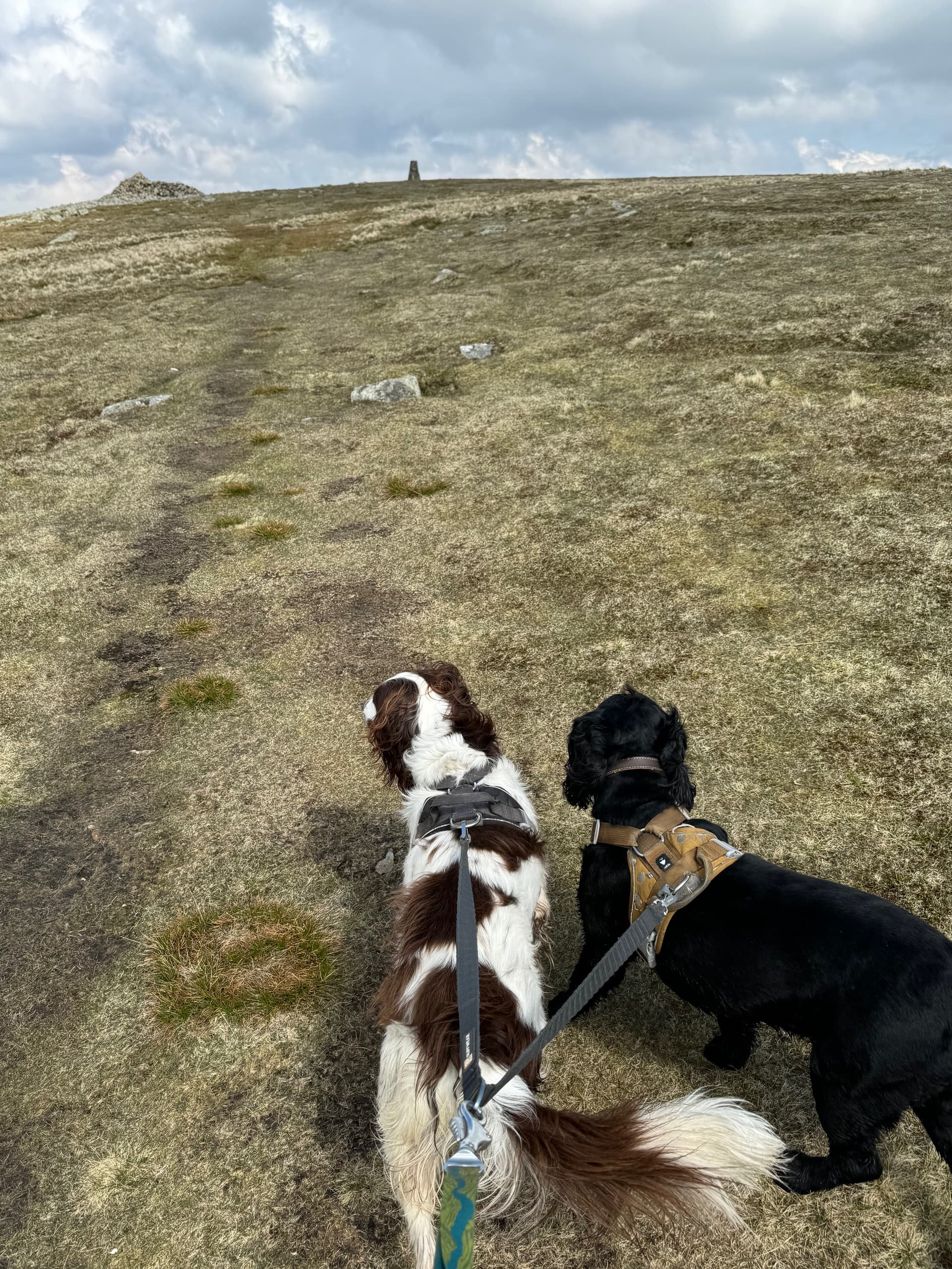
My planning had indicated the existence of a track / path of sorts skirting Haycock and Scoat Fell and the route planner which I have previously found tolerably accurate suggested 2 hours. It took me nearly 3, and the path generally wasn’t and it seemed quite hard work gaining the height up to the ridge. Indeed it was such hard work that I didn’t double check the map and added a short detour via Red Pike, adding another 15mins and quite a bit of energy! It is 31 years since I last was up Pillar and as the name suggests it was slightly scramblier that I remembered, or perhaps it was having two canine companions who were actually very good on the very steep ground, meekly following my route choice. By the time I spotted for Pillar it was 16:40.


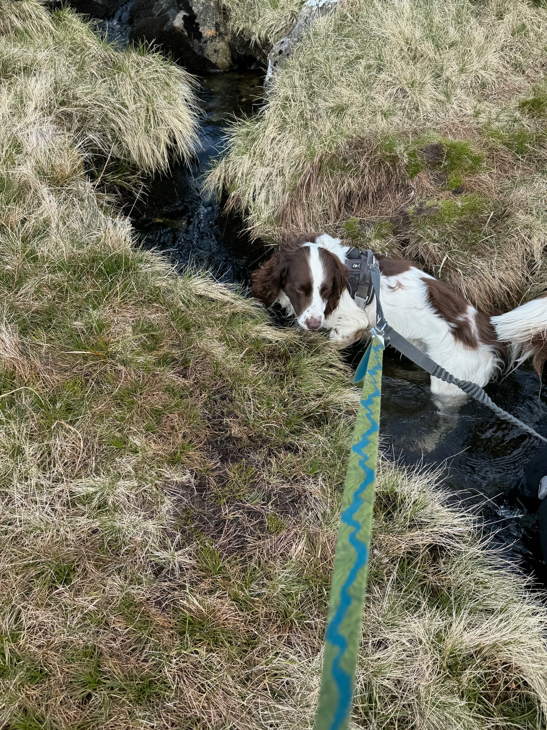
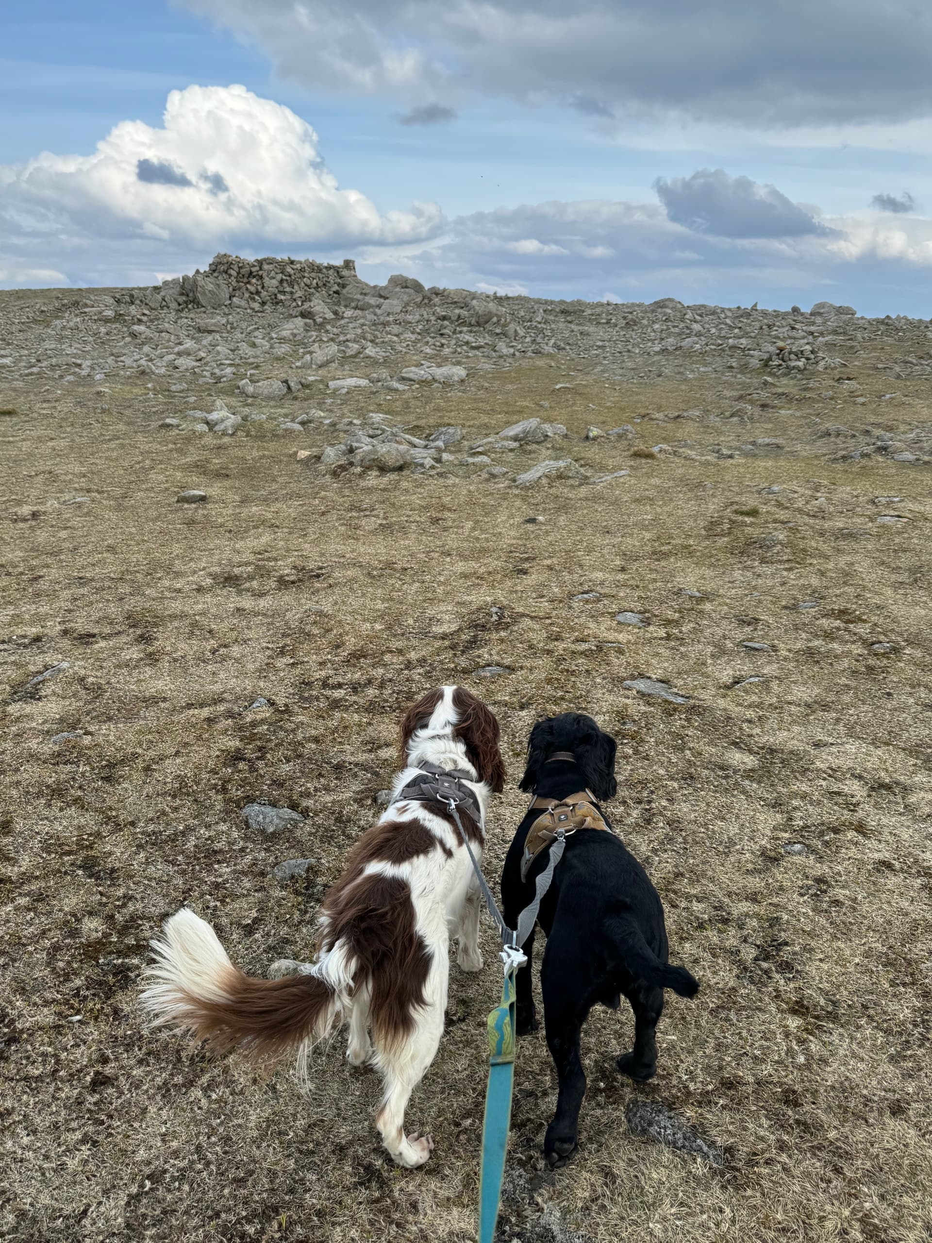
Woody cooling off in a stream.


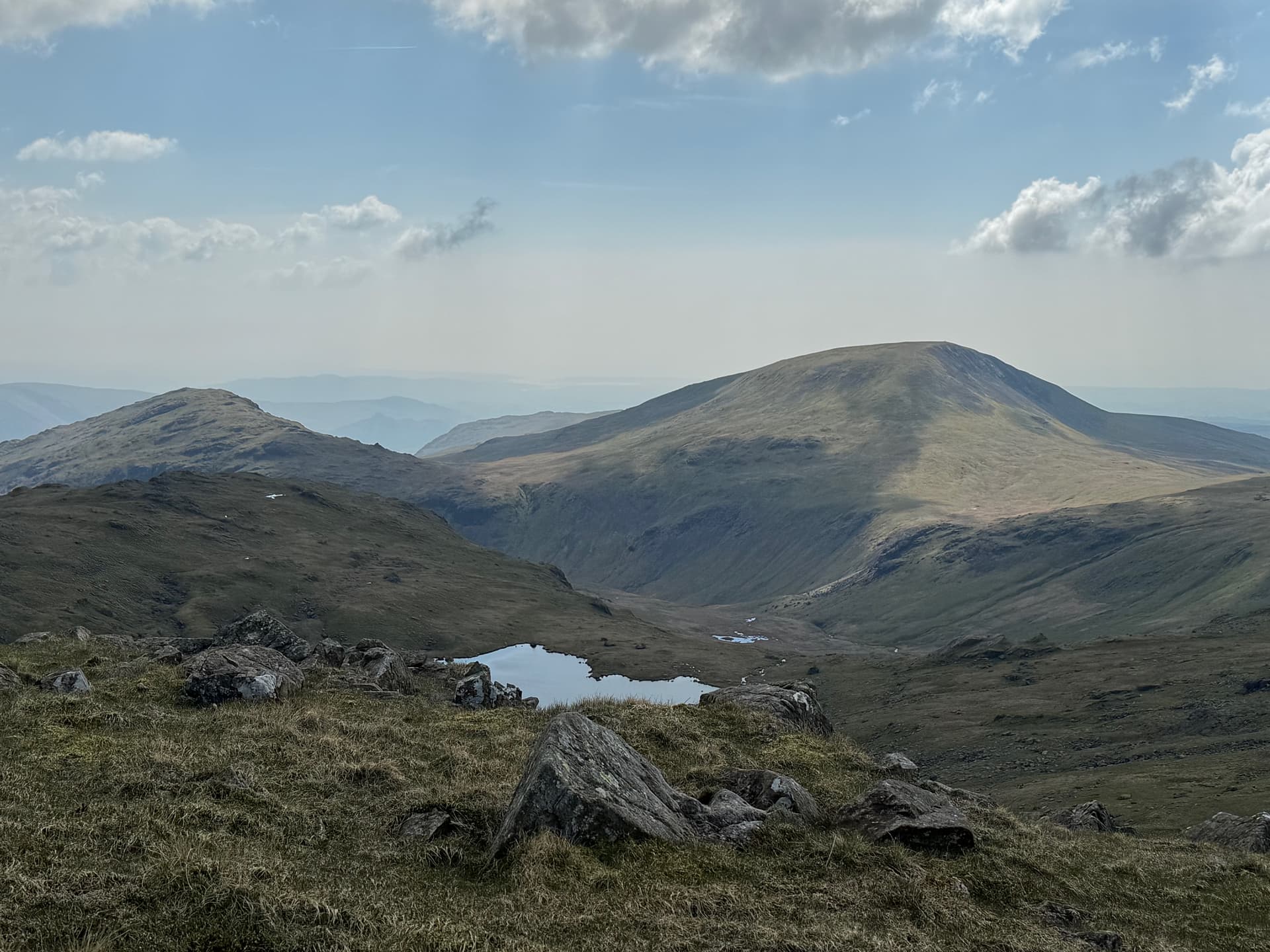
Seatallan from the side of Scoat Fell with Scoat Tarn. No obvious path!

Radio didn’t go well on Pillar, I managed one contact on 40m (Thanks Esther), It seemed to a be quite long skip but thankfully I did qualify on 2m. Packing up was a bit problematic. Jet (Cocker Spaniel) tends to spin in circles when he is excited - like packing up and the prospect of a dog treat. All well and good, but not when he was in the middle of two feeder cables which he managed to wrap around himself.


Pillar

I had a couple of plans for a descent route, if the path up was OK (which I was not expecting) I was going to descend the way I came up, just skirting Seatallen, but given that the path was not great that didn’t seem a good choice. Plan B was the descent down the scree at Wind Gap - again not great with the dogs and tired legs so went for the longer, steadier route via Back Sail Pass, which would have the advantage of passing the Wasdale Head Inn.

I left the summit just after 5 and guessed that I’d make it to the pub for about 6-30, have a quick drink before starting the 7km trek down the road back to the van. I didn’t make it until 7PM and worryingly developed a bit of cramp in my thigh. Two (very) swift pints of weak lager shandy, a pack of crisps, a packet of expensive dog treats and 15 mins later it was time for the (long) walk down the road.

The walk down the road was generally uneventful apart from a battered old car, which appeared to be full of stuff and couple who pulled over for advice. “Which one is Scafell Pike?” They asked. I Pointed upwards in the direction of Mickledore. Is there a campsite at Wasdale? Yes there is but I think (know) it is fully booked…. About an hour later, just past the two vans parked after the “No Overnight Parking” sign with the box of lager stuck out the back I was treated to the spectacle of the people I met in the battered black car attempting to pitch what appeared to be a gazebo amongst the rocks. “Is it a long walk up Scafell?” They asked as I trudged past. Possible future recipients of the Darwin Award…?

I see from the tracking that I managed about 5km/hr and finally arrived back at the van just before 9PM, just about in the light, some 11hrs 30 mins since I set off. It would be fair to say I was knackered. I did manage a shower, a cold lager and some tea, but didn’t think I would be walking much the following day. There was no phone signal, but I sent some messages explain I was safe on the inReach. I think the family were more concerned about how well the dogs were…… They were tired but fine.

On Thursday morning the alarm went off at 6-10 AM which was a bit frustrating as I thought I had disabled it. After staggering out the van it was quickly apparent that I wasn’t going to be doing much walking, more a sort of stiff stagger. I did take the dogs out and in some ways was quite relieved to see that a) It was really windy and would have been rough up a summit and b) There were a lot of cattle with calves across the path I would need to access to climb Illgill Head so the main excuse for my cancellation - being knackered was not needed.

Thoughts … well more of a brain dump…

  • It was always going to be a long walk, and I was probably a bit optimistic about my walking speed. At other times of the year with an earlier sunset it would not have been a safe route (for me). I’m still not sure if I should have turned back after Seatallan.

  • I should have been more careful with my navigation between Seatallan and Scoat Fell. It is quite complex topography and being tired I should have used the opportunity to check the route more not less!

  • The dogs were well hydrated, but I drank all of the 2l of water I took with me. With hindsight It would have been better to stop at the top of Black Sail Pass and filter some water (I carry a small squeeze filter) than it was to press on.

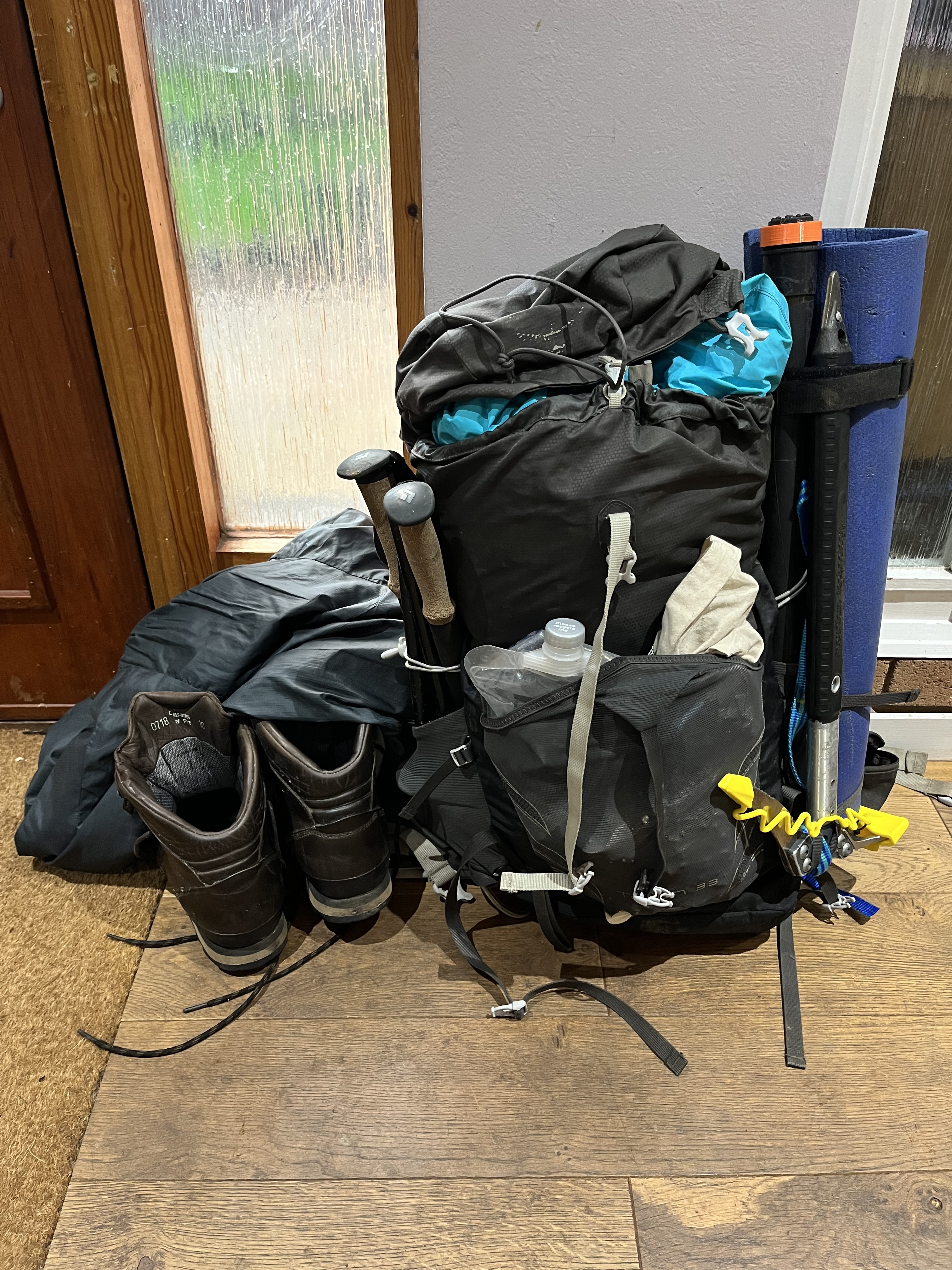
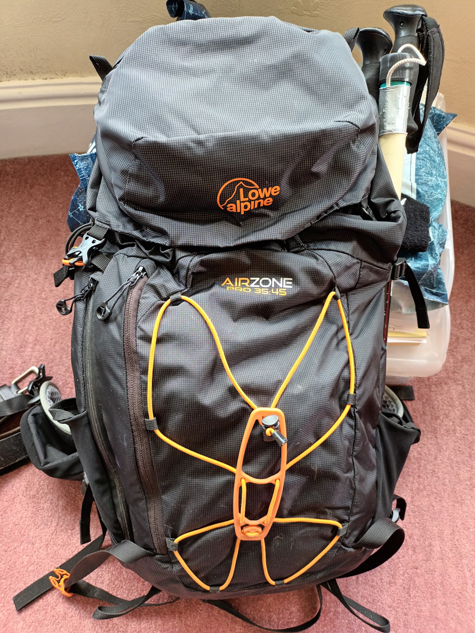
  • I need to re-visit the contents of the rucksack - it is probably time to review what I am carrying. My 2m J Pole ladder line is robust, but probably too heavy. The FT270 again is robust but heavier than some of the other HH I have. It would have been better to laminate a single sheet of printed OS Map than carry the two laminated explorer maps (The walk is on the edge.) … Do I really need a spare battery for the KX2? Is it worth carrying a packet of hydration salts if I get dehydrated again? (I’ll add a post with some weights and what I decide to drop)

  • It was warmer than I expected - I could have carried less layers. (Even allowing for getting stuck on the hillside I still had more than needed).

  • Im 61 not 21 and my recovery time is longer, however Woody and Jet (4 and 5) seemed to be fine!

  • The 7km road walk from Wasdale Head was beautiful as we headed towards sunset, but it did seem a very long way.

  • The camper was brilliant, staggering through the door to a warm shower, a cold lager and homemade lasagne was great.

  • The dogs are fitter than I am - although it was noticeable that Woody was much quieter by the time we reached Pillar. They are both asleep behind me as I type….

  • I have 13 LD summits still to activate, the biggest being High Raise, although Hard Knott is probably harder to reach without driving up the pass. (I don’t really want to drive up Hard Knott - even in a car due to other traffic and there is no way I would attempt it in a van). Thoughts anyone? My current idea is walking from the Eskdale campsite…

  • The InReach mini I carry was really useful to keep the family in touch as there was no signal as soon as I got into a valley (EE). If I did have an accident and it wasn’t on the top of a hill with coverage it may be a life saver…

  • I don’t like the InReach software, it took me ages to get the tracking off the device. Two pieces of software just to connect and sync and a web interface (complete with error messages) that I have to re-learn every time I visit. Almost as intuitive as Reverse Polish notation or managing to get a NHS GP appointment. The device and safety it adds is brilliant, in my view the website isn’t.

  • My watch (Suunto) tries to measure my exercise. It has Low, Inactive, Moderate, Vigorous and Intense. I now know that I don’t want to see intense again….


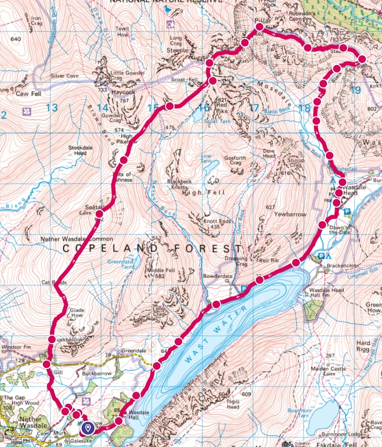
(25km 12220m ascent)

22 Likes

Many thanks for a super report and photos Paul. An outing not for the faint hearted - well done indeed! When I saw you were planning these two summits as a pair my immediate thought was “What!!! Paul’s obviously much much fitter than I am.” There’s one shed load of kilometres between them and having experienced many inter-summit routes that have not turned out as expected, I hoped you wouldn’t have any issues.

Oh yes, that describes the situation to a tee.

Coming off Pillar into Black Sail Pass was certainly the best option. I quite enjoyed that descent when I activated Pillar with Paul G4MD. We stayed overnight at the hut which was a different experience to our usual Travelodge. Very enjoyable and it enabled us to activate High Stile G/LD-012 the following day for a very memorable outing which completed G/LD for us.

Hmm, very remiss of you not to offer them your flipflops to make the climb a success. :joy: Don’t you just wonder what (if anything) goes through the minds of some people.

73, Gerald

3 Likes

Great report Paul, and thank you for being candid. SOTA isn’t always perfect and wonderful, the mountains can be challenging, I think in essence, that’s why we go.

Well done on your achievement, you fought the battles and actually won. It sounds like a great adventure!

Vy 73,

Colin

3 Likes

A great write up Paul. with some nice pictures too.

2ltrs of water in the Lakes sounds a lot of weight. I’ll get slated for stating this but I rarely carry much if any water in the hills. The mountains provide a perfect filtration system. What did the dogs drink?

Dave

3 Likes

I do check the map to make sure the dogs can drink. There is the odd hill like Skiddaw which seems to lack streams and then I carry even more……

2 Likes

Update…

I have been sat with a set of scales and a spreadsheet to try and reduce the weight of the rucksack… I know there are many that would suggest becoming more proficient in morse and cutting down on the rig… but I still prefer speech…

So my attempts to reduce the weight…
Rucksack. The large 70l sack is sensible in winter as it allows multiple layers and a shelter but it is heavy. I’m going Rucksack shopping for a medium sized summer pack and I think I can save about 1.3Kg! Other changes - Printing the right bit of the map and laminating it (I only use it as a backup anyway) 375g, lighter weight first aid kit 240g, spare KX2 battery - so far never needed 145g, the bag containing the 2m J pole antenna (I can use velcro to keep it tidy) 85g and finally taking the FT4 rather than the FT270 (I know it isn’t as good in terms of strong signal rejection) another 100g. So far this amounts to 2.25Kg less to carry. I’ll also play around with a lighter weight microphone for the KX2 as 150g seems heavy… I can also take a lighter weight waterproof rather than the relatively heavy Paramo but that is harder to get on the scales… Only one addition - I’m going to try some hydration salts as I’m fairly sure I got dehydrated and that might be linked to cramp that appeared on the descent - and went away after a lager shandy and a pack of crisps…

Thanks for all the comments, It was an enjoyable walk - well apart from the last 9 km and probably the biggest change I could have made would have been to start even earlier so there was less pressure of wanting to get off the road before dark… 73. Paul

7 Likes

I prefer my larger rucksack to my smaller one. Even though the latter is much lighter and the contents will also be much lighter I find the large rucksack much more comfortable because it has a hip strap and so carries the weight on the hips instead of the shoulders.

Unfortunately you don’t seem to be able to get medium sized rucksacks with a hip strap. They have waist straps which are no good for carrying weight.

1 Like

Hi Paul,
Nice report - great read. no matter what my age, I also have days were I look at a map decide its reasonable and then bite off way too much for me to chew with a long painful walk back or bail out to deal with !

I agree - can be a real problem when you have two mouths to water ! I was caught out on the grey corries two weeks ago - everything frozen even for the dog and i didn’t bring a stove. Hardest bit is trying to tell a spaniel to drink up from a small puddle when you know whats ahead…

Made a huge difference for my pleasure critically looking at everything and asking if i can do better. and trying to keep my pack weigh down, especially if multi-daying. All i can say is i learnt the hard way to find a rucksack that is dead comfy on your back before low weight. I really like the Osprey Talons for single day (33L i manage most stuff) and i have a ULA Circuit for multi-day. Absolutely hate rucksacks with pockets and zips, love ones with a great big hole to throw everything in.

3 Likes

… I was looking at the 36l Talon but I’m going to try it on before buying…

1 Like

Top rucksack. I can fit winter mountain gear (usual stuff including shelter, axe, crampons), and my lightweight radio stuff (EFHW, pole, Xeigu x6100, battery, headphone) into mine:

3 Likes

Small rucksacks with hip belts. Looks like a good choice. They are expensive but Osprey seems to be a well regarded brand.

2 Likes

Unfortunately that’s life now @G4TGJ Richard, you need to pay for quality and comfort. I have the Osprey Tallon 30 pro, and it is amazing! So light weight, fits everything in for a full days hike, even a camp over, and is water resistant :+1: happy days.

Great report and images @G4IPB Paul, really enjoyed the read! Pillar is one of my favourite summits in the lakes, I did it as a triple (Great Gable, Kirk Fell & Pillar). Looking forward to a catch up in a months time :grinning:

73, Ben
GW4BML

2 Likes

I bought this one a few years ago. IIRC it has a similar spec and price to the Osprey.
I chose it because it has an adjustable length back plane, which allows the straps to come straight forward over my shoulders and down the front, rather than up, then over and down.
I find it very comfortable and stable.

1 Like

70l wow! Does it double as a survival bag?

My largest is 30l and I use it only if I need a tarp or rarely a one-man tent (e.g. for SOTA ‘events’ in bad weather). For a day-trip activation I can get everything (just) into my 20l rucksack including extra layers, over-trousers, gloves, 340g Terra Nova bothy bag …. Did I mention the radio gear, pole etc.

IMHO 2l of water is an overkill. Even in mid-summer I carry only 1l of water (in rucksack side pocket), 0.5l in winter [On warm days I deliberately over-hydrate on the drive there and keep water in the car for my return]. I’ve only once run out of water (on a very hot day) and resorted to drinking (untreated) water from a G/LD beck not far from the summit (having first checked for dead sheep upstream). And actually, it probably would be safe to drink from the fast-flowing parts further down. Mountain streams collect so much run-off from the sides, not just from up-stream, the diluting effect would render drinking nasty pathogens unlikely unless a dead animal was immersed close by.

I resent sharing my bottled (tap) water with my (cocker spaniel) dog and usually there’s somewhere for her to drink. I carry a small rubber dog bowl just in case her tongue is reaching the ground

I’ve a spreadsheet with every item I would ever carry in the first column and their individual weights in the 2nd. column. Then I have six headings (and columns) for the main activation types I do. I tick [check] each cell as appropriate to include any item and the spreadsheet automatically calculates the total weight for each activation type. I’ve found this invaluable to seeing where the bulk of the weight is coming from and to ‘tune’ the list for minimum weight.

3 Likes

When I started in SOTA, I was quickly encouraged to do two things by Richard G4ERP… the first was to prepare an itinerary for the day, particularly when doing multiple summits and the second to prepare a spreadsheet for everything I would be carrying. Such a measure has allowed me to determine the reason for “mission creep” as my backpack inevitably slowly increased in weight.

I’ve started using a Sawyer micro filter for additional water which has allowed me to carry less during warm weather, though this does require consideration of the proximity of water courses as Paul did prior to his outing.

2 Likes

I have a second (Excel) spreadsheet for single (or two) summit activations.

It has a separate page for all the summits for each region (G/LD, G/NP, etc) that I activate regularly. It has drive times (based on Google Maps or actuals) and ascent times (based on OS Maps app or actuals) [although some never-activated summit entries are still blank].

I put in my departure time and it calculates on-summit arrival time (for posting my SOTA alerts), parking duration (useful for parking charges) and total away-time (useful for sweet-talking my wife about when due home).

It’s been pretty reliable and notwithstanding unforeseen events (like road closures) I’m usually on summit within +/- 15 minutes of my alert times.

3 Likes

… how do you fit the spare lucky anvil in? …

I must admit I probably carry too much… There is a balance between carrying enough stuff if something goes wrong, and carrying so much stuff it makes it more likely that something will go wrong!

I knew that I was pushing it for the walk I planned - but the end of the walk was on very easy terrain (a road…)

3 Likes

Well, I’ve posted a few of my itineraries in various threads from time to time. My most extensive was for 5 summits in G/SC back in October 2008, though on that occasion I ran ahead of schedule all day and shoehorned a 6th in at the end. The itineraries have proved really useful over the years in determining what can be achieved, particularly for multi - day outings where long travel distances from / to the home QTH are required on the first and last days. The main time failures have been in assessing times between summits on foot, so I err on the safe side now. Better to be early and activate through an alerted time rather than be late.

3 Likes

I have the same, very useful - helped me reduce weight of my pack but most importantly it is a checklist I use every time I need to pack the van, pack for a multiday trip in scotland or similar.

For me this depends. I always draw water from the hills in Scotland, south of the border only in a “tight spot”. As a result I end up carrying less if i know there are places to draw.

But there are routes where I need to carry lots more than 1L and several where I have run out: Grey Corries I ran out two weeks ago carrying 2L in winter conditions. I needed a stove or a descent to replenish, which i didn’t fancy. Summer traverses like Liatach or Beinn Allign I would replenish to 2.5L when the burns get weak, and even then, in last summers heat wave, I ran out on Beinn Allign. Similarly some grassy ridge traverses require allot in a summer dry spell, it can catch you out.

2 Likes

Well I now have a smaller sized rucksack, and a smaller bank account balance too. After failing to find what I wanted at the right price in Keswick I made a detour with my daughter up High Rigg G/LD-044. It was very nearly a fail. I managed 2 contacts on 2m (It isn’t a good hill for 2m being surrounded by bigger hills. 40 seemed a bit strange so I got my daughter to look up Solar Ham to find out there had been a large X flare earlier. No contacts at all on 40m, so I moved to 20m where I scraped 3 more contacts. Nothing on 10m either.
Am I right in thinking that the flare caused a big increase in D layer absorption wiping out 40m, but not having as much absorption at a higher frequency hence getting a bit of shortish skip on 20m?
Anyway thanks to those chasers I could hear. The next stop was Ambleside where Gaynor’s had what I wanted (36l Osprey Talon) at what I considered to be a reasonable price… Now the re-packing begins! 73. Paul

3 Likes