An Sgarsoch GM/CS-024
Carn an Fhidhleir (Carn Ealar) GM/CS-027
Beinn Bhreac GM/CS-045
Beinn Dearg GM/CS-023
Beinn Mheadhonach GM/CS-051
Carn a’Chlamain GM/CS-031
I’d been thinking about Beinn Bhreac for a year. It had only been activated once. Then Gavin did it. It’s in the middle of nowhere but can be reached from the south and possibly included in a climb of Beinn Dearg. I’ve been up Beinn Dearg twice already (pre-SOTA days) and really couldn’t face trudging up that track and over the bleak moor again. So, I came up with an alternative plan.
Tuesday 12th July
1400 BST
I set off from Linn of Dee on my bike, heading firstly to White Bridge along the River Dee and then down to the (under restoration) Red House Bothy, following the Geldie Burn. It was a hot afternoon and I had the factor 50 sun cream on. Very windy though, so I made slow progress with a heavy load on my back.
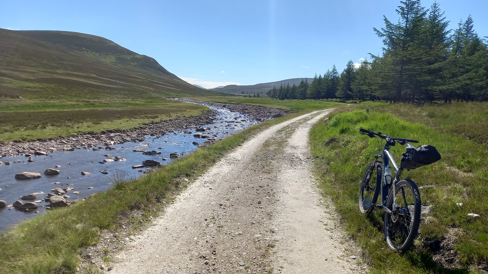
The Geldie Burn
I ditched the bike in the heather at the confluence of the Geldie Burn & Allt an t-Seilich (burn). and set of on foot, past the new bothy and up the lonely Glen Geldie, heading for the ruins of Geldie Lodge.
Time passed quickly and I made good progress up the track. The three notable water crossings proved trivial - the rivers are very low at the moment.
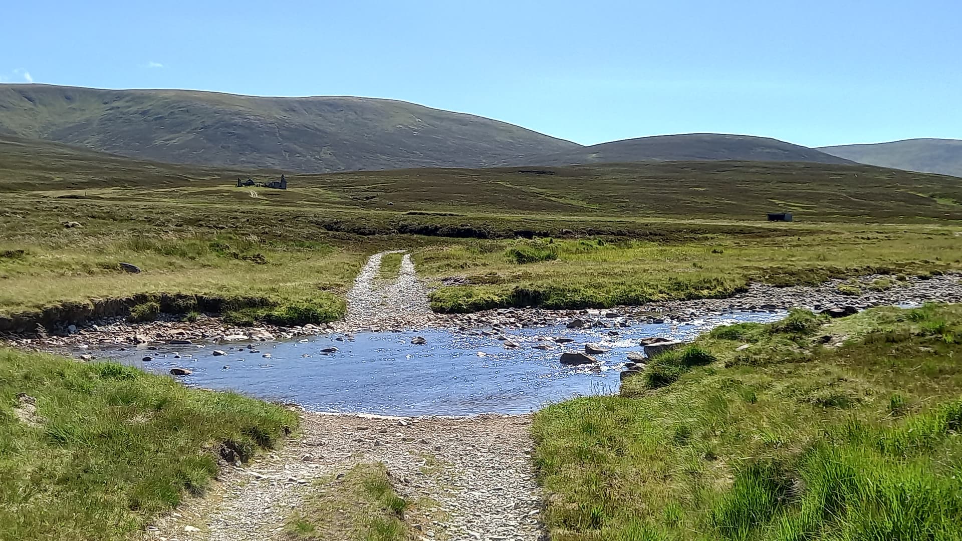
crossing the Geldie Burn, ruined lodge, & An Sgarsoch behind
A decent but narrow stalkers path kept me parallel to my first summit for the next few km. I knew from a previous trip there was a small cairn and even narrower path which would lead me directly up the north slopes of An Sgarsoch GM/CS-024. I found it easily enough, but soon lost the path in the long heather.
small cairn, smaller path
I collected 2 litres of water from the last burn I thought I might see for a while and then headed up steep slopes, eventually popping out on top of An Sgarsoch.
It was 1745 by the time I was QRV on 40m. High SFI and high K was potentially going to be an issue on this trip and so it proved to be. I made four contacts on 40m and after a further two un-answered CQ’s, I packed up.
Carbon 6 pole, EFHW 40/20/15/10m antenna
The walk over to Carn an Fhidhleir (Carn Ealar) GM/CS-027 took me initially south westwards over grassy slopes, joining a path that was at first good, then intermittent, then not at all. Across the watershed, which was dry, but with water soon flowing on either side, and up steep grass, heading north west. Again, there is a path here. I just couldn’t find it coming from this direction.
Looking back towards An Sgarsoch
north east to Cairn Toul and other Cairngorm summits
I repeated my set up from the last summit. Given the band conditions, a good multiband antenna seemed like a sensible option. QRV at 1930 on 20m this time and another four contacts. I don’t want to it to sound like I got four and then shut down my radio, but on a big hike like this, after a couple of CQ’s without response, it’s obvious there’s no pile-up there and it’s time to move on.
Carn an Fhidhleir (Carn Ealar) GM/CS-027

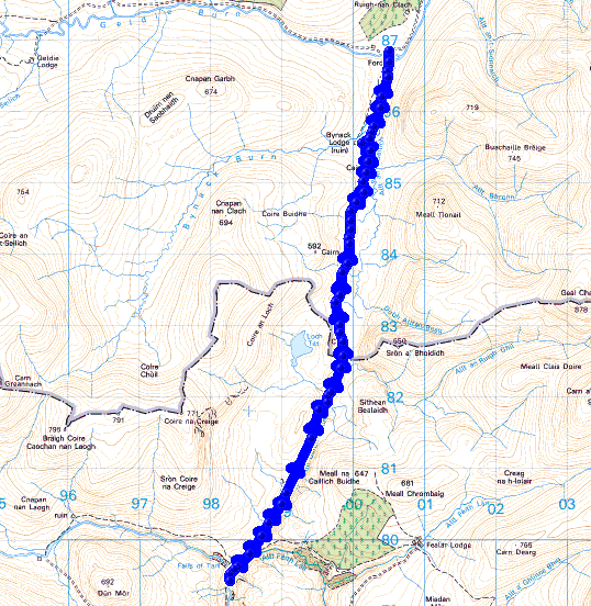
Red House bothy to An Sgarsoch GM/CS-024 and Carn an Fhidhleir (Carn Ealar) GM/CS-027
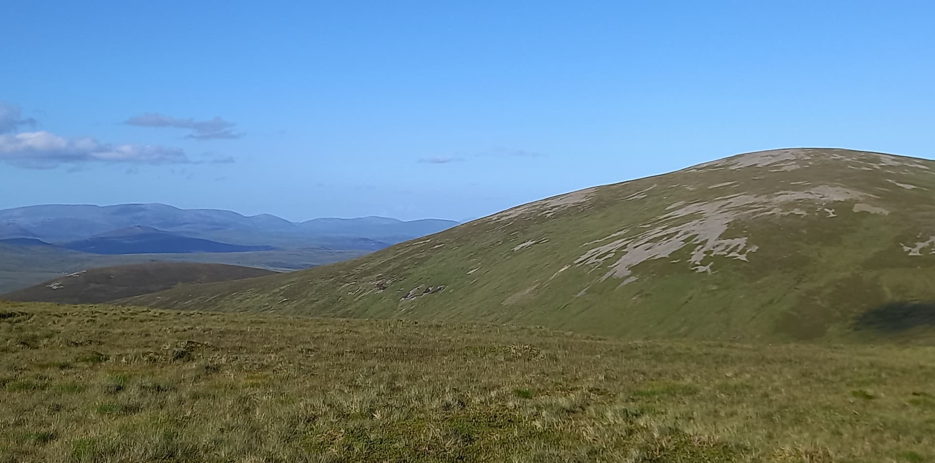
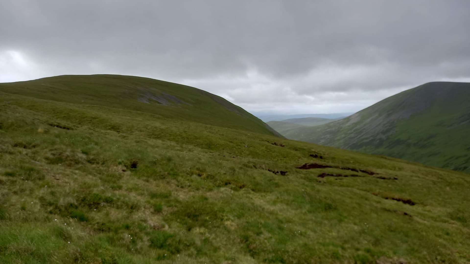
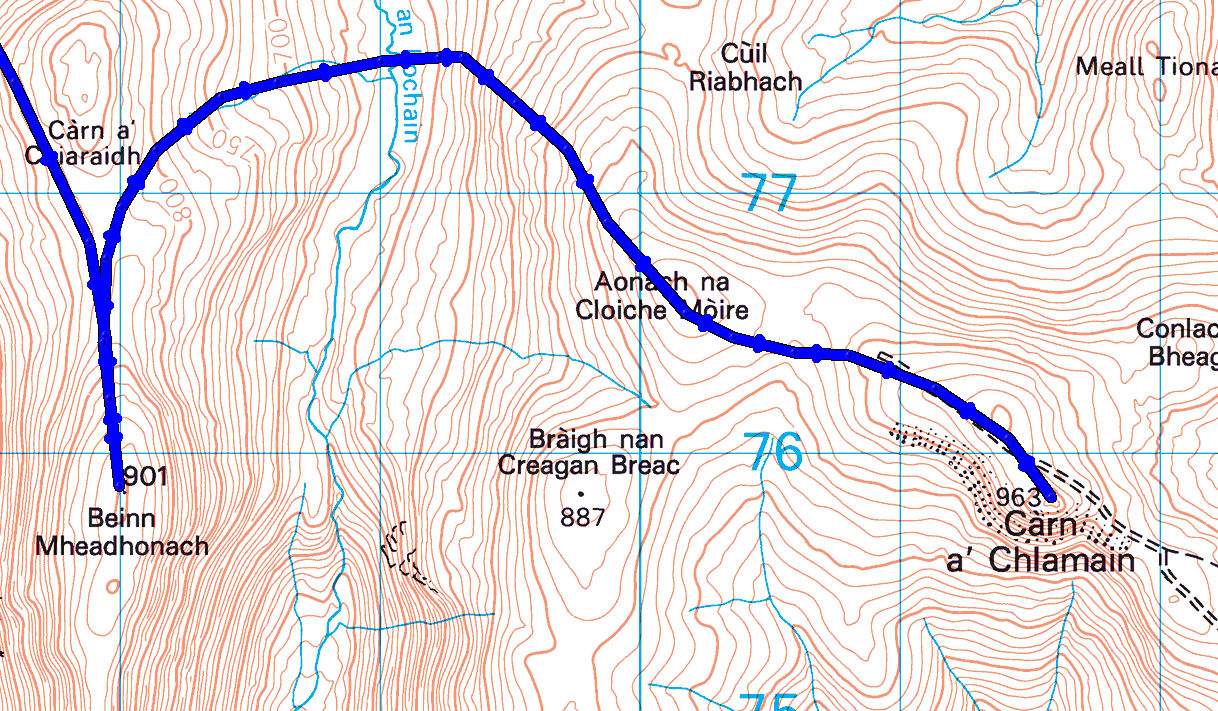
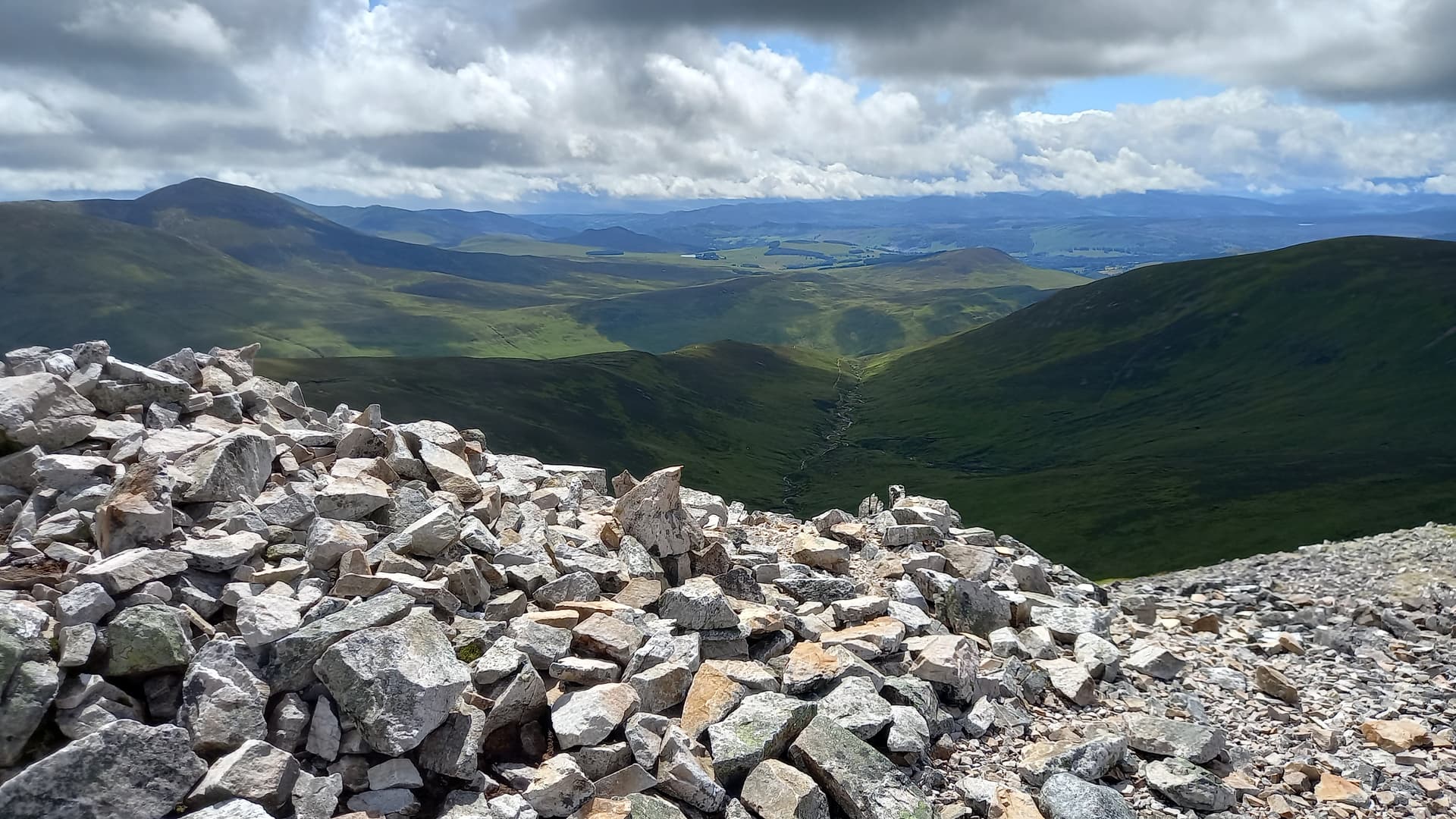
Now - into No Mans Land. It was around 6.5km across to Beinn Bhreac. Not in a straight line, as I didn’t want to lose too much height and I also wanted to avoid the numerous peat hags I could see ahead of me as I descended.
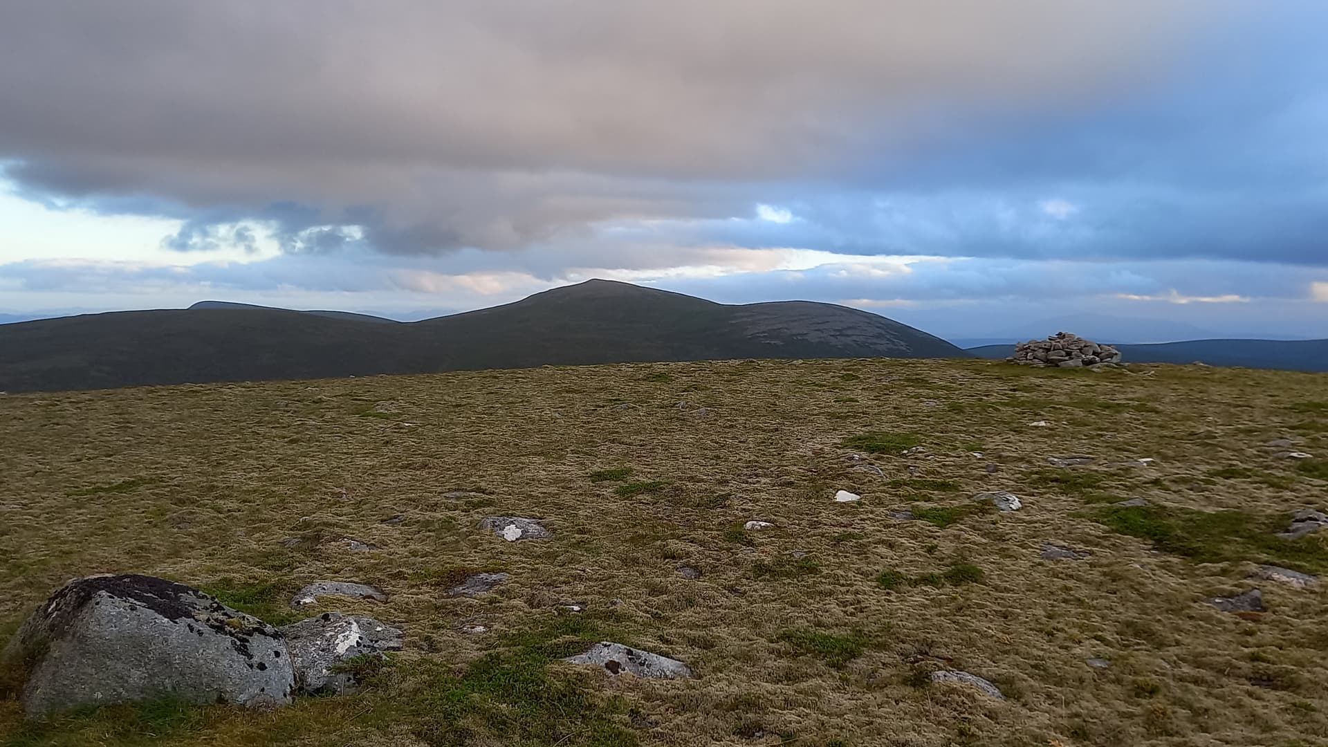
the way to Beinn Bhreac GM/CS-045 with Beinn Dearg extreme left
I dropped down a path initially, across a nice grassy col and then the ground became progressively rougher, with heather, tussocky grass and small pools. The watershed was crossed without difficulty - again running water available to either side - and I commenced the initially steep ascent of Beinn Bhreac.
Soon I was on easier ground. The sun was low in the sky now, the wind still strong, but much cooler, particularly when the sun dipped behind the ever increasing cloud cover. I summited Beinn Bhreac at 2110. It was getting cold. I was getting cold.
Beinn Dearg from Beinn Bhreac
Same set up as before. QRV 2130. 15m first - nothing. 20m - two contacts. 40m, another three. That would do!
Surprisingly there was a 4G signal up there, although I had to toggle off and on the data every time I wanted to use it. I had time to check the weather forecast. Tomorrow’s had gone from a dry & windy morning to a wet and windy day. Not good! I had planned on sleeping on Beinn Bhreac, however the change in forecast and miniscule summit cairn had me heading down and looking for shelter.
This I found around 2230. I was at the lowest point between Beinn Bhreac and Beinn Dearg without entering peat hags. A nice person-sized bit of flat grass and short heather. By 2300, I’d set out my bag, had a hot drinking chocolate, some malt loaf and was ready to turn in. Alarm set for 0530. Oh, I made some experimental overnight oats (porridge, raisins & water in my mug).
Wednesday 13th July
A good nights sleep. Every time I’d open my eyes, I’d seen daylight - well grey skies. That’s just how it is at this time of year. It never really gets properly dark. I was pleased to see it wasn’t raining, so I clambered out of my sleeping bag and got a brew on. The oats were fab, as was the drinking chocolate. I was on my way by 0610, very aware of the long road ahead.
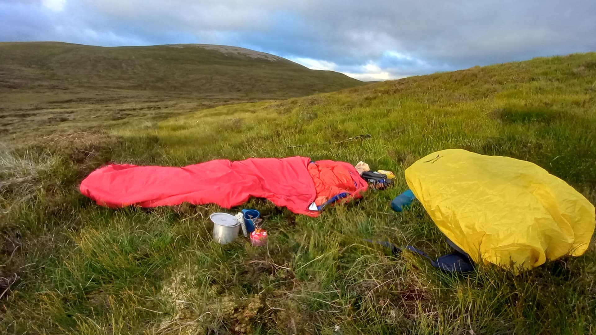
the bivi or bivouac
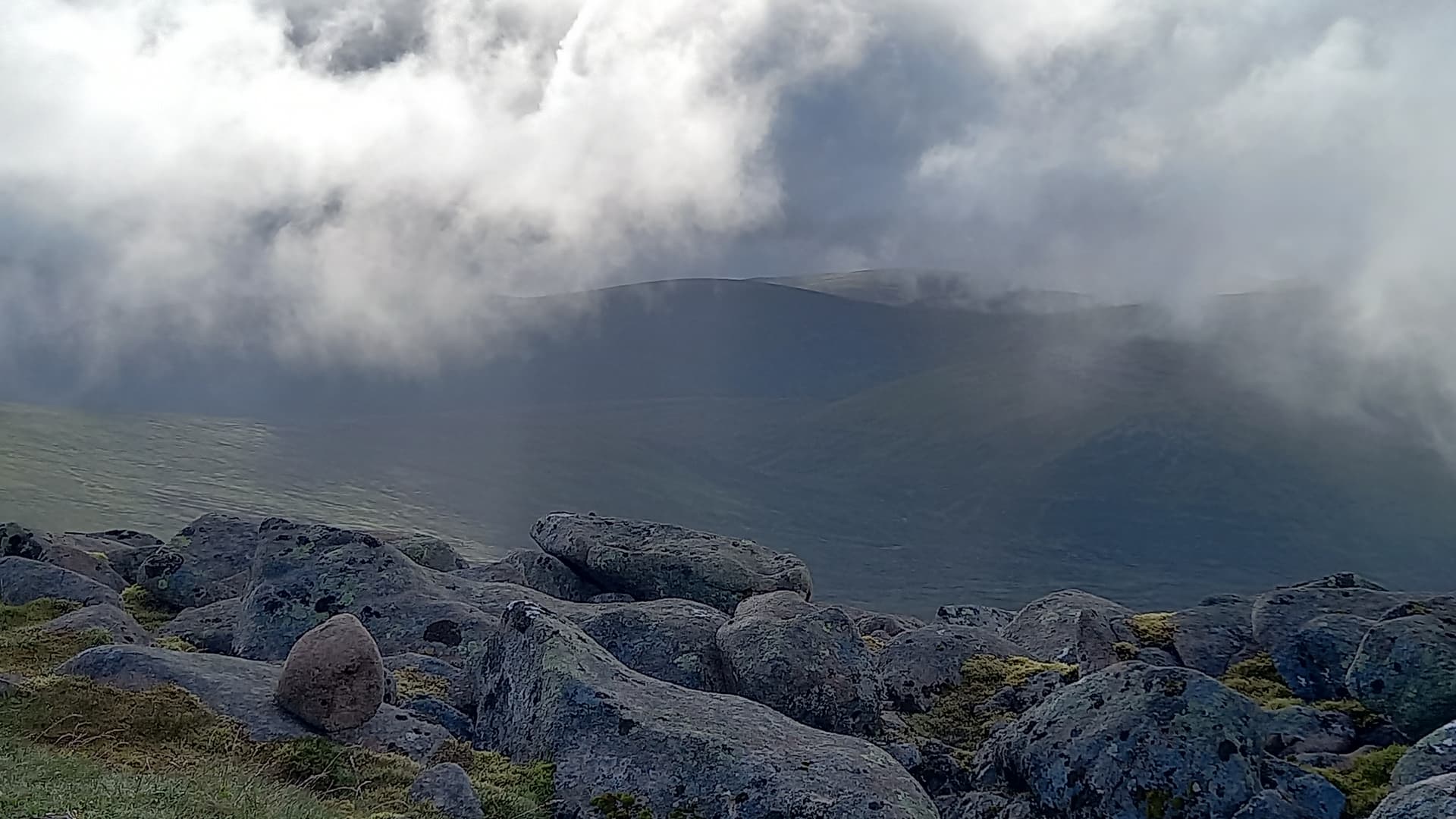
I ascended the north ridge of Beinn Dearg. Soon, cloud came over and a constant drizzle of rain fell. This was compounded by an ever strengthening wind. As I approached the mist-bound rocky summit, it was blowing a gale across the upper slopes. On reaching the shelter, I actually sat for around ten minutes, absorbing the situation and not really sure what to do next. I’d messaged Ben @GW4BML on arriving at 0730. He asked when I’d be QRV, to which I replied “8am”. He told me to get a move on!
The carbon mast plus EFHW combo fell over at the first attempt. Nothing was guyed. Everything was jammed in boulders. For the second attempt - more boulders and I tied the top of the antenna to the mast, which looked like it would hold.

contemplating life at the top of Beinn Dearg GM/CS-023, not realising the WX was clearing over
my view from the summit shelter
Anyway, I got seven in the log on 40m and none of them were Ben! He could hear my Chasers, but not me.
By now it had cleared and I could see the way across to my next objective - Beinn Mheadhonach GM/CS-051. My plan was to leave Beinn Dearg the same was I had approached - to the north and then peel round east and then south. This would avoid losing too much height and, you guessed it, more hags. Now I had vision, I decided to stick with that plan.
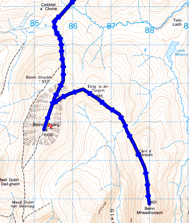
up to Beinn Dearg GM/CS-023 and on to Beinn Mheadhonach GM/CS-051
The walking was via path at first, then deer track and finally over open slopes. I’d continually seen the prints of a solitary red deer since yesterday evening and I really felt like I was following in its way around these hills!
Soon, I was climbing the western flank of Beinn Mheadhonach. I felt more relaxed walking today. Yesterday I was on a mission, knowing I had a long way to go, three summits to activate and shelter to find, all before dark. Today I was keeping a pace that didn’t have me breathing hard and generally allowed me to soak in more of my surroundings.
climbing Beinn Mheadhonach GM/CS-051
Beinn Mheadhonach GM/CS-051 wasn’t quite as windy as Beinn Dearg. Just as well, as there were few rocks on the summit and the smallest cairn imaginable. Band conditions seemed better today, so I went for the simpler and quicker set up, a 41’ random wire, inverted V, with 17’ counterpoise on the ground. Fed straight from the KX2 and putting the radios internal tuner to work.
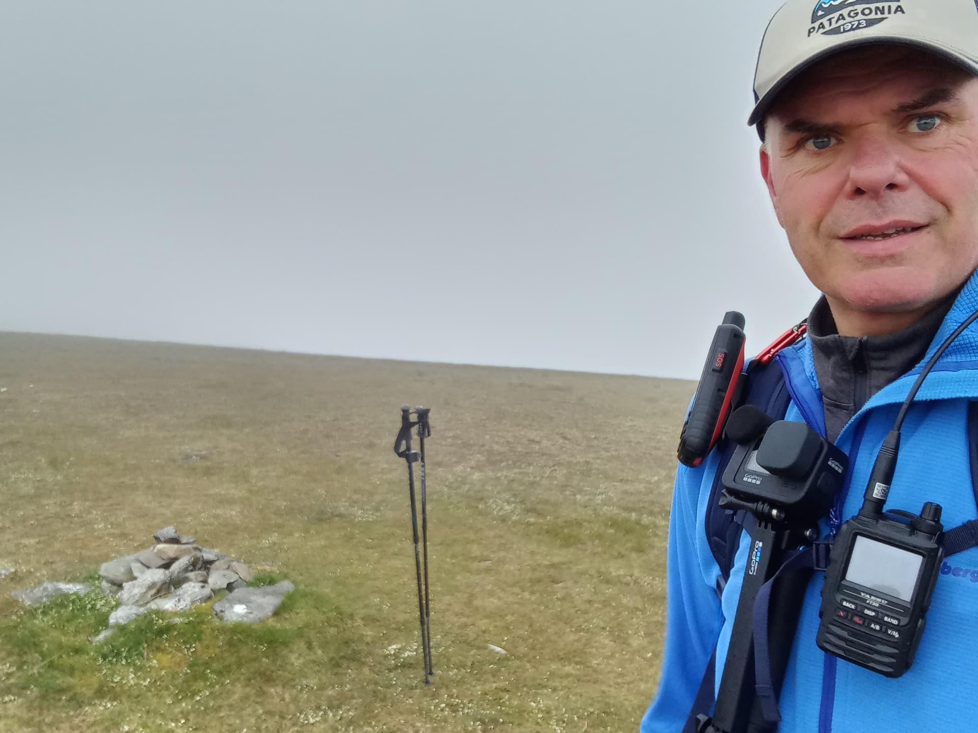
Beinn Mheadhonach GM/CS-051 and the World’s smallest cairn
And work it did, I made ten contacts, including @IK2LEY and indeed Ben this time too! I was QRV from 1021 to 1027 BST. It had clouded over as I was on the summit, however it soon cleared as I headed off - north again, on another big loop, towards my final summit Carn a’Chlamain.
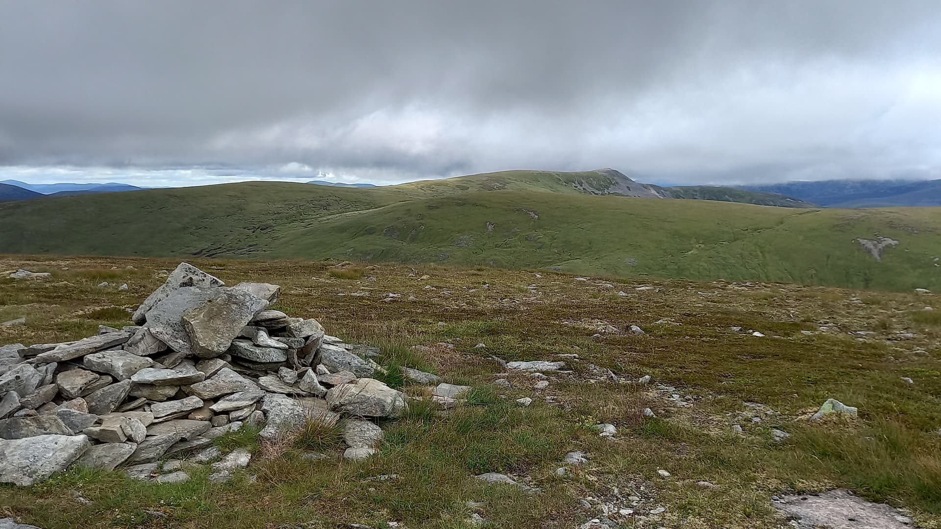
Carn a’Chlamain GM/CS-031 from Beinn Mheadhonach, the 300m drop not evident in this photo
I was getting hungry. I hadn’t actually stopped for a meal yesterday, just munching rolls and oat bars on the hoof. As soon as I dropped out of the wind and found shelter, I boiled up some water and enjoyed a beef stew followed by the stodgiest chocolate pudding and chocolate sauce I have ever eaten. Still, 1000kCal on board. Enough to power me for a bit.
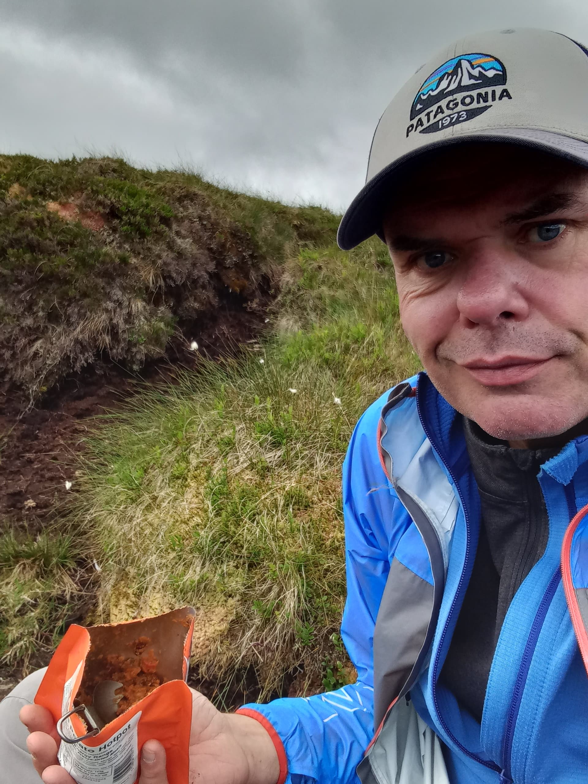
Lunch at 1115, however I’d been up nearly six hours and climbed two peaks
I could see the Feith an Lochain (river) meander through the valley below. It looked like it may involve a wade. On approaching, I could see it was slow moving and deep, however, I took the chance to leap off a high grassy bank to shingle on the other side, propelled by my pole. All good.
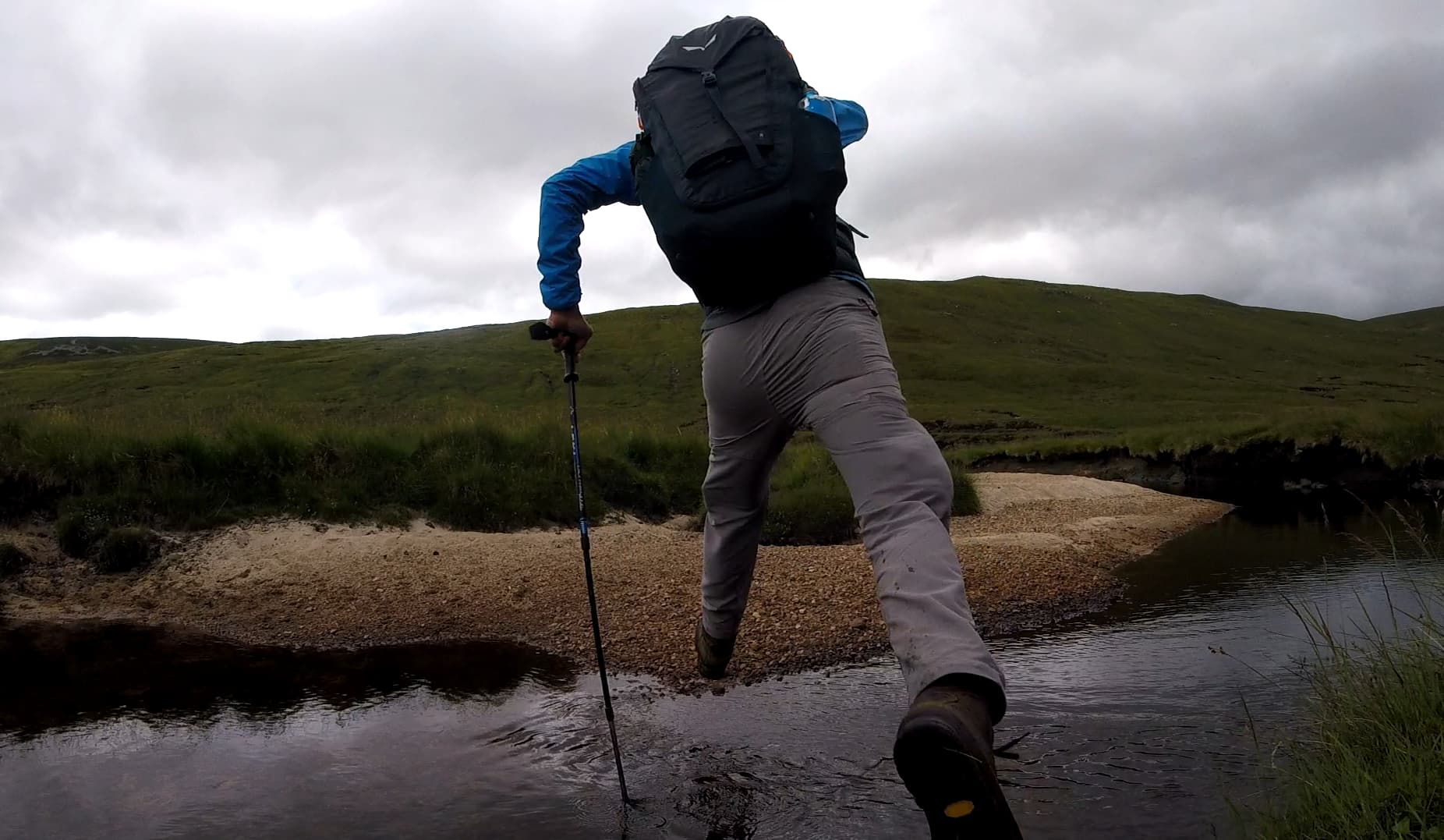
the leap
across to Carn a’Chlamain GM/CS-031
Safely across the river, steep grassy slopes quickly elevated me and soon deposited me on the col which would lead eastwards on to the rocky summit slopes of Carn a’Chlamain.

approaching the summit of Carn a’Chlamain GM/CS-031
I arrived at the top into a much increased wind speed, and once again, sat pondering for a couple of minutes. I was in front of a cairn which was only large enough to shield me if I didn’t move an inch. The summit area was composed entirely of shattered rock. The wind howled around me.
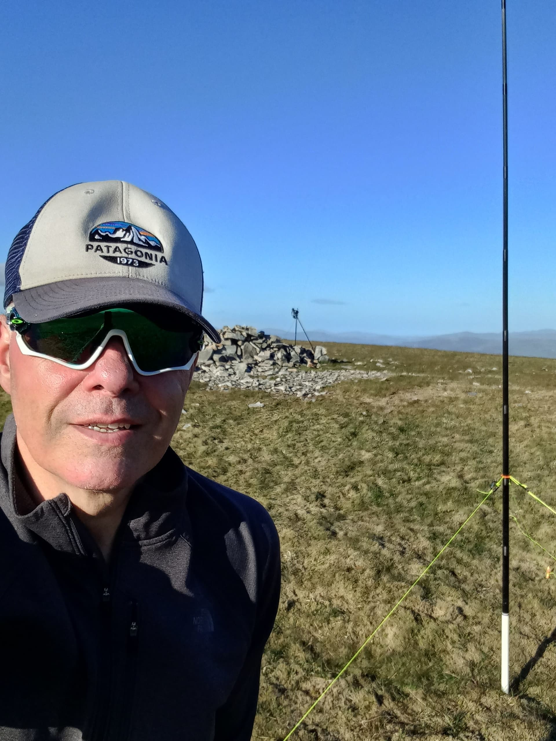
Ok, I’d better get this done. I set off down the north slope for a few metres, pole and sleeve in hand. I half rammed the sleeve into the rock and then spent a few moments building a cairn like structure around it. In went the mast and I hoisted it to its full height, having already tethered each end of the wire antenna. It held - the force being split between the cairn and the feeder end of the aerial wire. That SotaBeams yellow wire takes some beating!
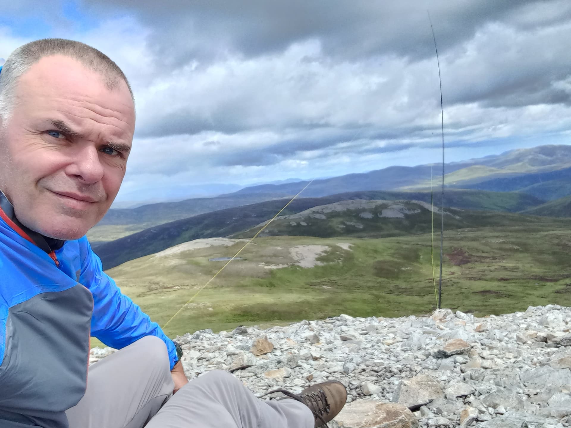
antenna in the air, ready to go!
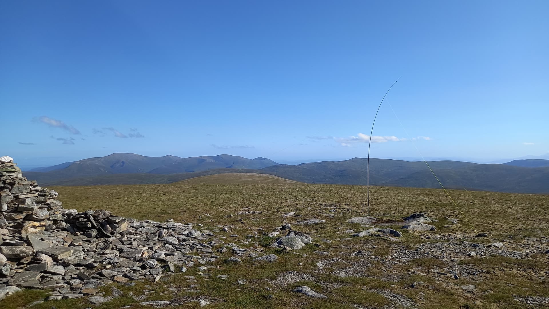
I was QRV at 1326. My first CQ went unanswered, as did my second. Then a wall of sound! A massive pile-up. I worked station after station and it seemed to go on for ever. Eventually, things calmed down and I had a brief chat with Ian and then Esther @GI0AZB and @GI0AZA to finish off. Twenty one stations in fifteen minutes. Wow! What a finish. I quickly packed up and then realised what an outstanding viewpoint this was.
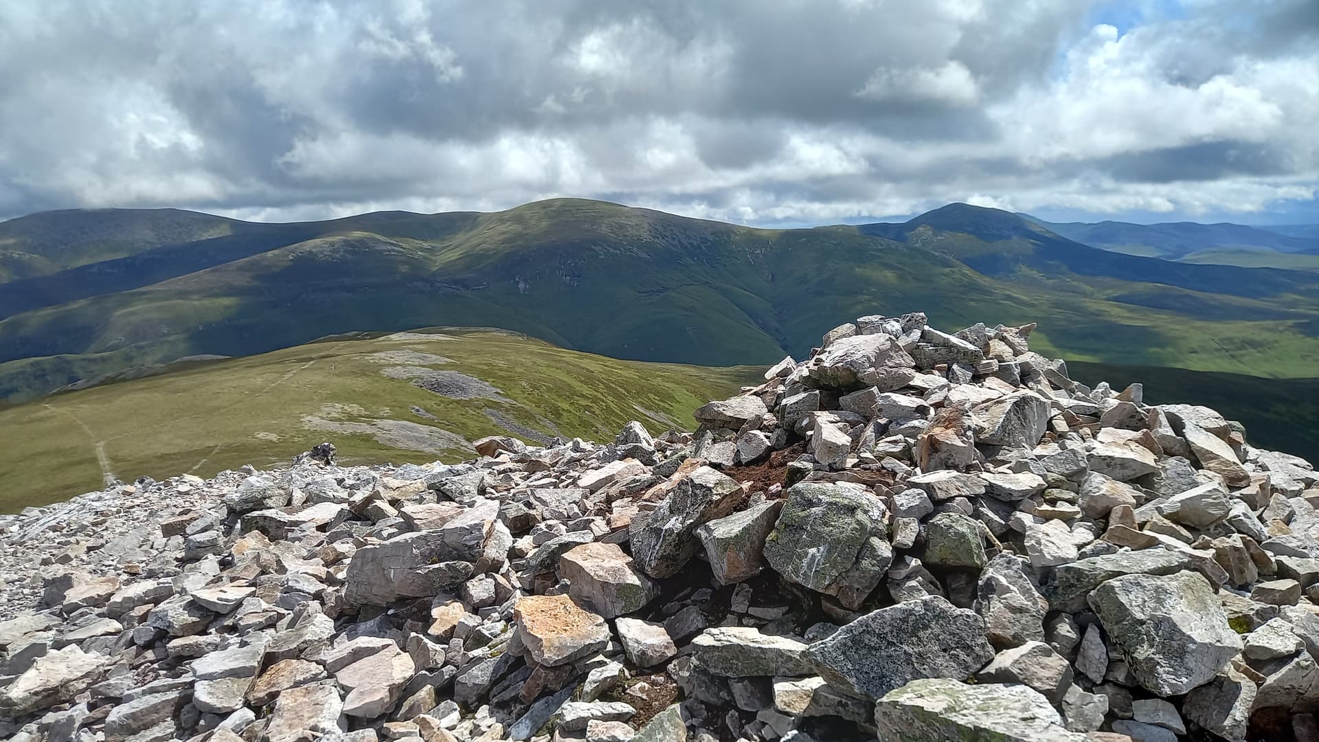
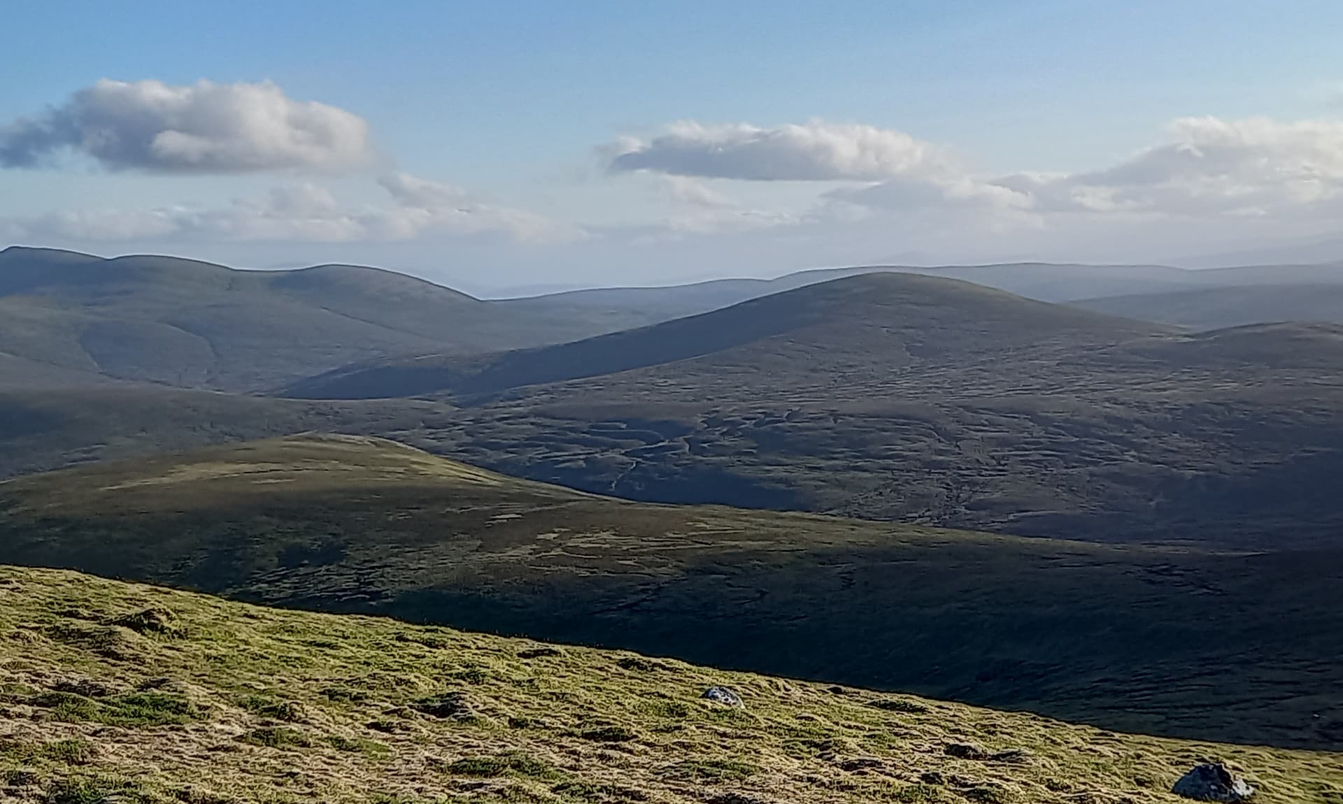
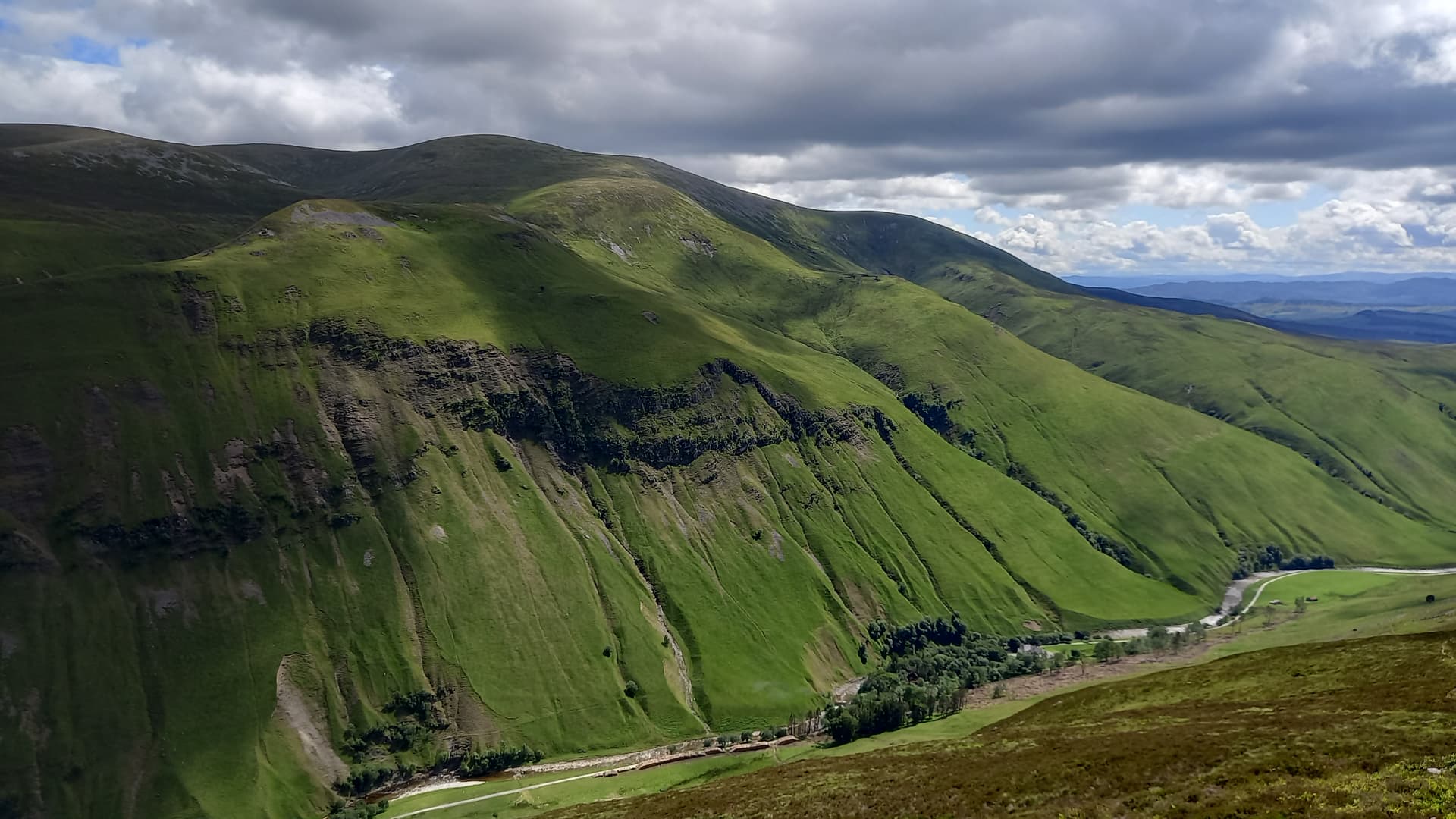
over to the Beinn a’Ghlo group
down Glen Tilt
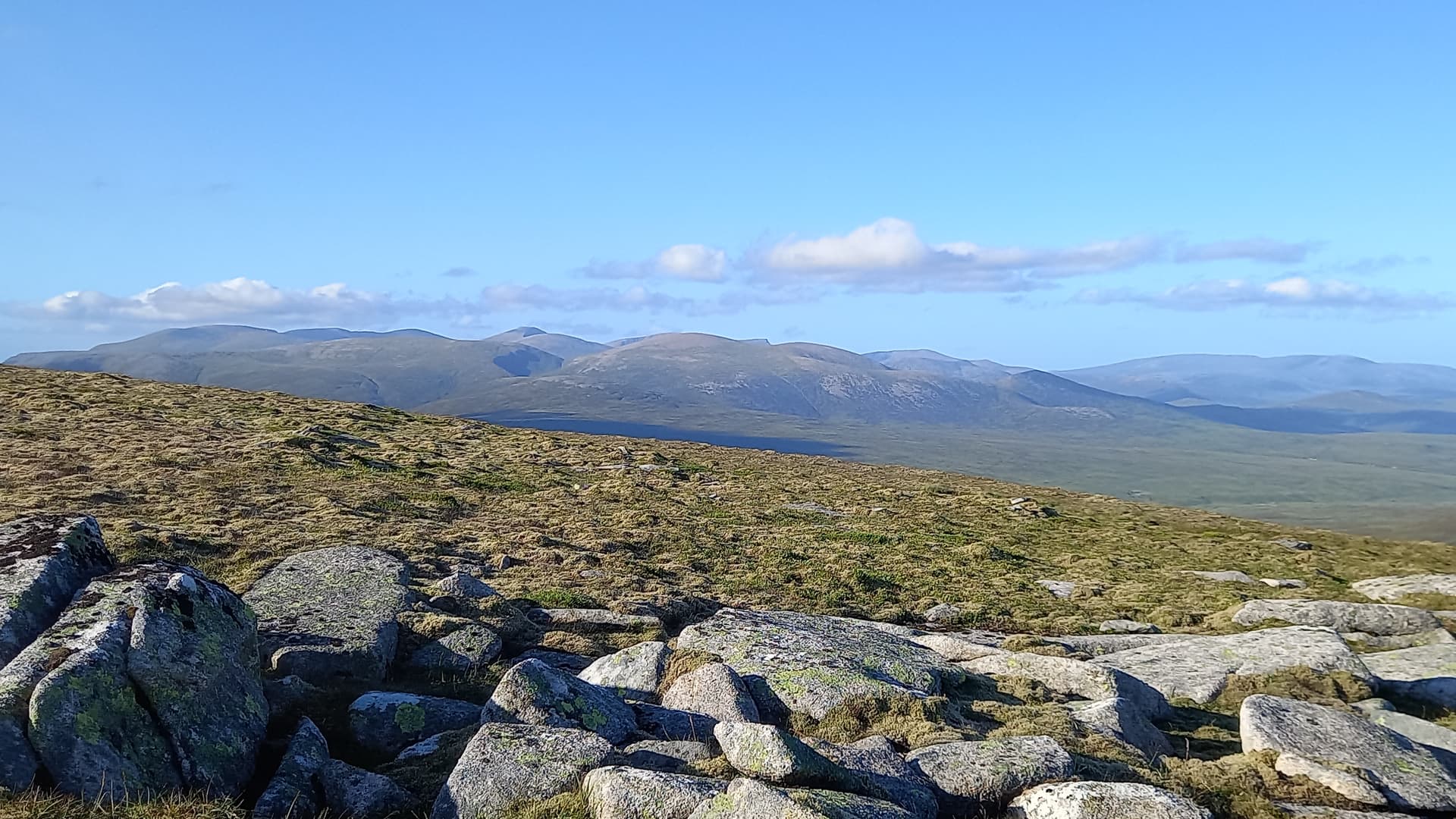
I also realised how far I was from home. I’d started my expedition in the Cairngorms - in Deeside. I now had clear visibility of the mountains of the Central Highlands, Schiehallion, the Ben Lawers group and more. I’d better get moving on…
The plan was to descend the winding stalkers path to the east, which would deposit me in Glen Tilt for a long but straightforward walk back to my bike. I actually had to walk for around 2.5km before I could see Glen Tilt. It didn’t disappoint, not from this altitude.
first view of Glen Tilt
I’d walked the length of Glen Tilt previously - from Deeside to Blair Atholl, so I knew what to expect. Except, I’d forgotten it was uphill in today’s direction. My start point was 300m ASL, the head of the glen 500m ASL.
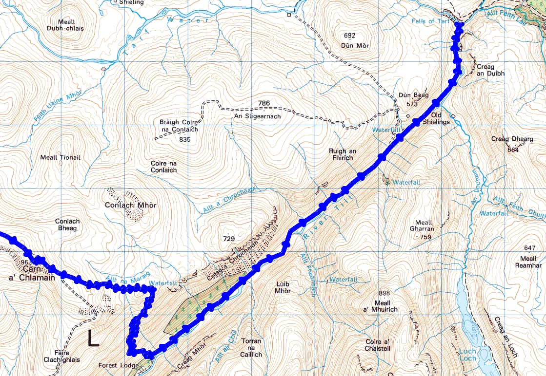
Carn a’Chlamain to Glen Tilt
I plodded on, initially on good vehicle track, then rough cart track and finally footpath. In my mind, I’d set a virtual milestone at the bridge over the Falls of Tarf. A wonderful spot, where I could grab a break. I eventually got there at 1700, around three hours after leaving my summit.
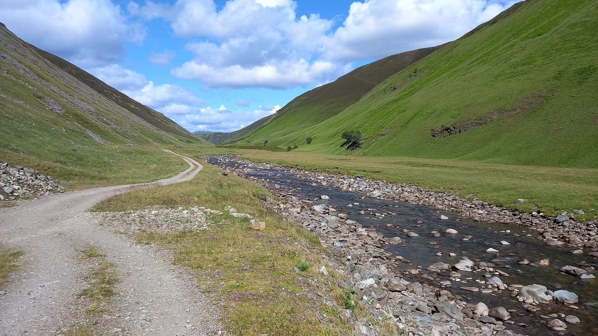
in Glen Tilt
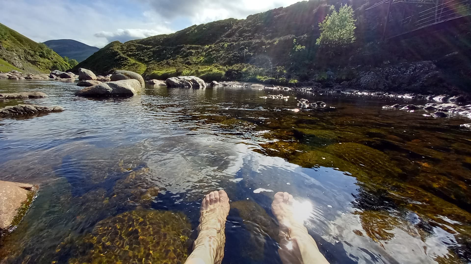
I flopped onto the grass, ripped off my boots and socks, soaking my feet in the waters whilst taking on some sugar and fluids. I still had a wee bit to go. My damp socks, laid on warm rocks, dried almost instantly. It had become a rather warm and sunny afternoon.
the Tarf water meets the Tilt
After fifteen minutes of rest, I got my self organised and plodded on up the glen. The sides of the glen became lower as I gained altitude and eventually the River Tilt headed off up a side glen, leaving me with just a stream. Soon, I was out of the glen and at the watershed. The path climbed along the side of the hill and my beloved Cairngorms came into view - but still a long way off.
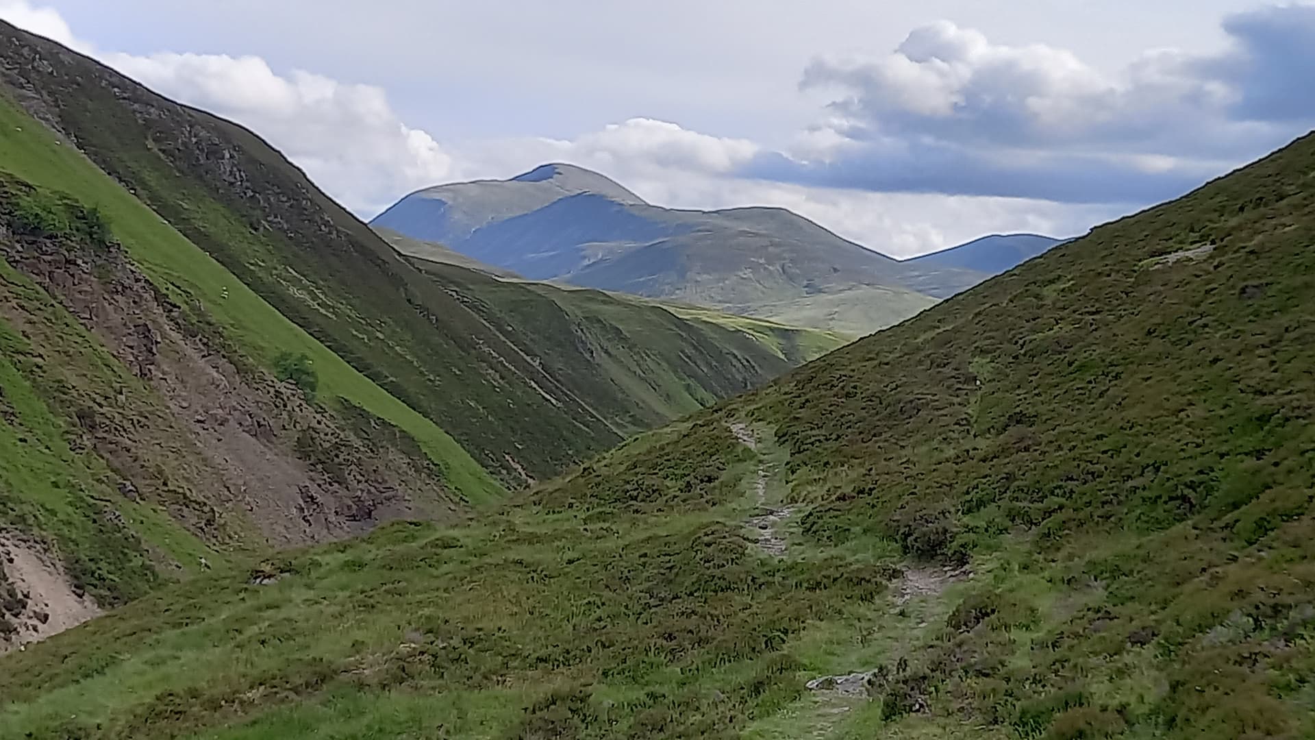
looking back south from the upper glen
upper Glen Tilt
Finally, the track dropped and followed a new river - this one heading north. I passed the ruined Bynack lodge, forded the river, walked a bit and then forded the Geldie Burn for the second time in two days. I was back at the bike. Fifteen minutes after that I was back at Linn of Dee and the Land Rover. The time was 1945 BST. I’d travelled around 50 miles / 80km.
I was desperate for fish and chips. On reaching Ballater, I could see the Chipper was queued out the door. Fifteen minutes later and back home, there was no food prepared, as Mo was still making her way back from a business trip to Birmingham. So, beans on toast, beer, cheese & biscuits it was. In that order. Then bed. For a big sleep. I’d tell Mo my stories in the morning. Oh, and on that note, I’ve another story to tell about this trip! Tomorrow though.
EDIT
Some things I saw in Glen Tilt & Some thoughts on kit
At one with nature #1
I’d been walking up the glen for almost an hour when I came upon a group of people. I could see folk on the bank ahead of me and two people on the track. One was wearing a hi-viz waistcoat. She came walking down to me with a purpose. My mind raced. The last thing I wanted to hear was the track was closed or there was a diversion.
She told me there was filming ahead and would I like to read some information about it, which was attached to the rear of her waistcoat.
“Yes”.
I was getting ready for a battle with this girl when she would eventually tell me I couldn’t pass. I half read the script - something about at one with nature - while I glanced over her shoulder. There was a naked woman on the hillside and a naked chap wandering about with a rucksack on. There was a cameraman and another person, both dressed.
“Can I walk up the track?”
“Yes, if you’re game!”, came the reply.
I pulled the brim of my cap down and headed along the track, looking at the surface of the road. “What I don’t see won’t hurt me”, I thought. I didn’t look back.
At one with nature #2
I reached a part of the glen where the river and rough track were really hemmed in by the steep V of the glen sides, it was almost like a gorge at this point. Warm sun washed into the base of the glen. Long grasses were full of colour from numerous wildflowers. The place was buzzing with insects, birds and the sound of crickets. It was a mini-paradise. I wish I could have lingered.
Kit - my thoughts
The Elecraft KX2 radio. Six summits activated and still pushing out 10 watts on it’s original battery. I did carry a spare.
The antennas. EFHW (67’) and 41’ random wire. Got better results with the less efficient 41’ wire, which seems to prove that band conditions are everything with QRP SOTA.
Camping gear - 4 season Rab down bag, borrowed Mo’s Mountain Equipment thermarest style mattress (smaller than mine) and a Terra Nova gore-tex bivi bag.
Vango copy of an MSR pocket rocket stove, complete with half full 100g cartridge (we’ve worked out that one of these tiny cartridges will boil water for fourteen cupsfulls). Aluminium pot, handle, spork, fire steel.
Food was a Soreen malt loaf, some tuna rolls Mo made for me, various oat bars and two mains, two puddings from expeditionfoods.com. These are expensive, but super light, quick to re-hydrate and tasty. I only used one of each.
I carried a small first aid kit, lightweight waterproof jacket and lightweight hooded warm layer. My thought was that if anything really bad happened to me, I’d climb inside the sleeping/bivi bag.
My pack weighed 10kg, excluding water, which was carried in a very old 1 litre sigg bottle. I carried two collapsible bottles, which were filled when I thought I’d need a longer range between fill-ups.
It all went into my 36 litre Salewa pack. On last years bivi trip, my pack weighed 18 kg, so a considerable improvement.
I think that’s about it. Thanks for reading.
73,
Fraser MM0EFI

 glad I managed one of your logs.


