After the previous Friday’s outing I thought I would try something easier, and opted for Muncaster Fell (G/LD-059).
It’s a simple walk - arguably the simplest SOTA in the Lake District - but somehow I managed to mess it up! Unknown to me, the obvious summit (the one containing the trig point) is the now deactivated G/LD-055, whereas the current SOTA summit - G/LD-059 - is the somewhat less obvious summit (but 0.7m higher).
Not having checked the finer details before the activation, it appears I was on G/LD-055 during my activation, but erroneously claimed it to be G/LD-059.
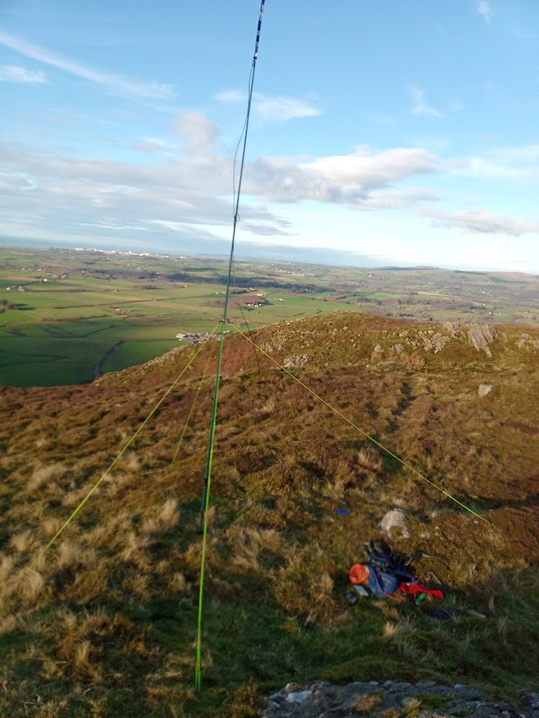
Still, it was a lovely morning, with the FT-818 working well on 2m to give me 8 QSOs including a S2S with @G7KSE on Skiddaw. Just a pity none of them count!
So if you were one of the contacts - @M5TEA, @2E0MIX, @G1PIE, @G1OHH, @GM4WHA, @GW4ZPL and @G4ZRP (plus @G7KSE mentioned above) - then I’m very sorry but I’m afraid your contact with me will not count towards your chaser or S2S points.
Apologies for the mix-up, and thanks to 2E0MIX and G4VFL for pointing it out to me, else I would not have realised.
I’d be interested to know if there are any similar SOTA summits in the lake-district (or indeed, elsewhere in G, GW or GM land). I’m aware trig point often don’t mark the highest point of a summit - but are there any others on a subsidiary summit outside of the activation zone?
Yes, I’m sure there’s lots of others, and you won’t be the first or last to get caught out!
Off the top of my head, I can think of Hay Bluff trig point, which is just outside of the AZ for Black Mountain GW/SW-041. I’m certain there’s loads of other examples, though i can’t just bring them to mind atm.
Your activation and QSOs will still be valid for the Wainwrights on the Air (WOTA) award scheme - http://www.wota.org.uk - despite not being valid for SOTA, as the listed outlying fell in WOTA - LDO-103 - is still the one with the trig point.
I’m not good on topology but is the deactivated summit still in the activation zone of the new one [being only 7m below it]? If it is, you would still have qualified the summit.
I had to triple check this back in January when activating the new SOTA but still wanting to visit the deactivated SOTA summit to ‘bag’ it as a WOTA. Little effort as both summits are so close.
I’m not aware of any other summits in the Lake District like Muncaster Fell, that’s just pure bad luck not coming across this issue in the annals of SOTA Reflector.
I’ll take off the chase from the database, no worries. See the summit brain stories post for lots more info to make you feel better about such a non-obvious mistake.
Tom, I can see why the new summit was taken to be a Marilyn [since the recent more-accurate survey found it to be a few metres higher] and why the ‘old’ summit was declassified as a Marilyn [as it is now a ‘daughter’ of that Marilyn]. And hence the SOTA reclassification.
However, I don’t think your conclusion follows. Are you saying the old summit is definitely not in the AZ of G/LD-059? If so, please explain why?.
Or, are you saying the contacts aren’t valid [for qualifying the summit] because the wrong SOTA reference was given [online or over the air]?
Mark, your answer isn’t clear to me. Are you arguing a non-qualifying of the summit because the wrong SOTA reference was used or because the old summit is not in the AZ of the new one.
If it’s the latter, I’m waiting for someone to explain why.
I often activate not on the summit [e.g. too crowded, too exposed to the weather] but on a nearby ‘bump’ and still well in the definition of the AZ.
Sorry Andy, basically the difference in height between the two summits means that when you are on one you aren’t in the activation zone of the other, and the summit you are on has been declassified.
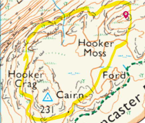
Looking at the map in detail I can see it now in this case: the highest contour line that encloses both is 200m and the new summit’s height is 232m. So the difference (32m) is greater than 25m vertical height given in the AZ definition.
The activation zone is enclosed by a contour line 25m below the summit. From the map shown above, it doesn’t look as though you could walk from one peak to the other without crossing that notional contour line. It is the coll between them that means they are not both in the AZ.
As I was trying to get to sleep last night, I realized my way of deciding whether any desired activation spot is in the AZ or not using the Muncaster case, was a bit faulty.
You have to ask, could I have walked here from the summit without dropping more than 25m in height? So, start with the summit height [let’s take the Muncaster Fell case, 232m] then look on the map for, or imagine, an encircling contour line 25m below it [at 207m ASL in this case]. I used the 200m contour line [as shown on the OS Map] for my calculation above whereas the 207m line [probably not shown on any map] is the one to use.
In walking from the new Muncaster SOTA summit to the old one you don’t have to cross the 200m line [as I implied] but you definitely have to go below the 220m and 210m contours [and cross them again going up to the old summit]. So, you drop at least 22m. And I suppose you must be losing at least another 3m in height somewhere in the middle near Hooker Moss – thereby leaving the AZ.
The moral of the story is – unless you can or want to pour over detailed maps before or during your activation - don’t stray very far from the summit.
The crow flies straight from Hooker Crag to Muncaster Fell Andy. It galled me to have to return there to activate the new summit, but it had to be done to re-complete England - as did the onerous trip to visit DC-008 Hensbarrow Beacon near St. Austell after they built the china clay heap way higher than the trig point and DC-004 became DC-008.
The moral of the story is to do your homework before embarking on an activation! Don’t take anything for granted, go to the summit page and look at the map, read any information that other activators have added to the page - in the case of Muncaster Fell there are two useful write-ups. That page is there to help prevent mistakes and provide guidance. One further point, though: the routes taken in the write-ups are not necessarily the best ones to take, often there are several choices, so study the map and use your judgement.
I would like to explain to you all who are querying why the SOTA reference changed from G/LD-055 and to G/LD-059 when the new summit was found to the higher than the trig point. This is because the trig point and the new summit are not within the activation zone of each other, if they were within the activation zone of each other I would not have changed the SOTA reference, only the summit position. When I first found out about this change, I was unsure from looking at the maps whether or not the trig point and new summit were within the activation zone of each other as the col height from looking at the contour lines could have been anywhere between 200m and 210m meaning that the col could have been between 21.4m and 31.4m lower than the trig point and 22.1 and 32.1 lower than the new summit. Luckily the RHB surveyed the col height which was found to be at 201.1m so therefore 30.3m lower than the trig point and 31m lower than the new summit meaning the trig point and new summit are not within the activation zone of each other so this was why the SOTA reference changed. Some more information about the col height and drops from both summits can be found here Mountain Search. Here’s a link also to the original thread in regards to this SOTA reference change also New G summit - #12 by M0HGY.
On September 24, 2022 during my activation of G/LD-059 I made contact with Matthew @M0MZB - the originator of this post.
We started chatting about the location of the new summit; a non-descript location signified by a large boulder.
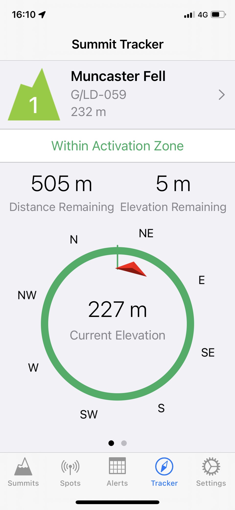
Out of interest, on my way back, I walked to the old summit and whilst standing behind the trig point looking at the new summit, my SOTA Goat app stated I was ‘Within Activation Zone’ with a distance of 469m between me and - 7m below - the summit.
I tend to walk to each summit and once arrived determine the best operating position.
But this shows not to soley rely on an app to determine whether you are in the AZ or not!
Referring to an earlier thread, Sota Goat uses a rule of 25m within 1km to define the AZ - there are clearly cases where the terrain can beat that rule so it’s not definitive.