Not the words I’d use to describe it ![]()
1 Like
Within 1km? Do you mean it considers any vertical height less than 25m of the summit that’s within 1km horizontal distance of the summit as being in the AZ regardless of topology?
As a game I sometimes walk to and fro at my frequently-visited summits to try to get a zero, zero reading on SOTAgoat [i.e. horizontal distance & vertical height from the summit]. Coming back to the same position a few times the readings are usually +/-3m of each other, which is consistent with what the GPS org say: “GPS-enabled smartphones are typically accurate to within a 4.9 m (16 ft.)”
I’ve never needed SOTAgoat to get me to a summit but it’s useful for knowing when you are in the AZ.
1 Like
But only if the summit matches the inaccurate view of what it thinks is the summit AZ. I know Andy that you know what you are doing despite doing your best to convince us otherwise ![]() However, for people new to SOTA or who cannot navigate or never checked a map before leaving for a summit, it’s dodgy that apps like this don’t give a big “YOU MAYBE IN THE AZ, PLEASE CHECK” warning.
However, for people new to SOTA or who cannot navigate or never checked a map before leaving for a summit, it’s dodgy that apps like this don’t give a big “YOU MAYBE IN THE AZ, PLEASE CHECK” warning.
I can think of a few GM and G summits where it will tell you are in the AZ when you are not and not in the AZ when your are ![]()
1 Like
Hi Andy, [assuming this is not one of your subtle wind-ups and taking your words at face value] I can assure you that I’m not trying to convince you or anyone else of anything [like I’m more stupid than I really am. Don’t consult my wife]. I’m also not trying to advocate the use of SOTAgoat or similar apps.
Quite the contrary, I like to think I am guided by the evidence and my ears [eyes?] pricked up when I read Rick’s @M5RJC brief statement suggesting a limitation with SOTAgoat. Unfortunately, he didn’t give a link to the “earlier thread” hence my request for clarification.
His statement and yours (“the inaccurate view of what it thinks is the summit AZ”) could be true but I prefer to modify my behaviour (e.g. stop using SOTAgoat) based on hard evidence not opinion. If you know more, please take the time to give / point to it.
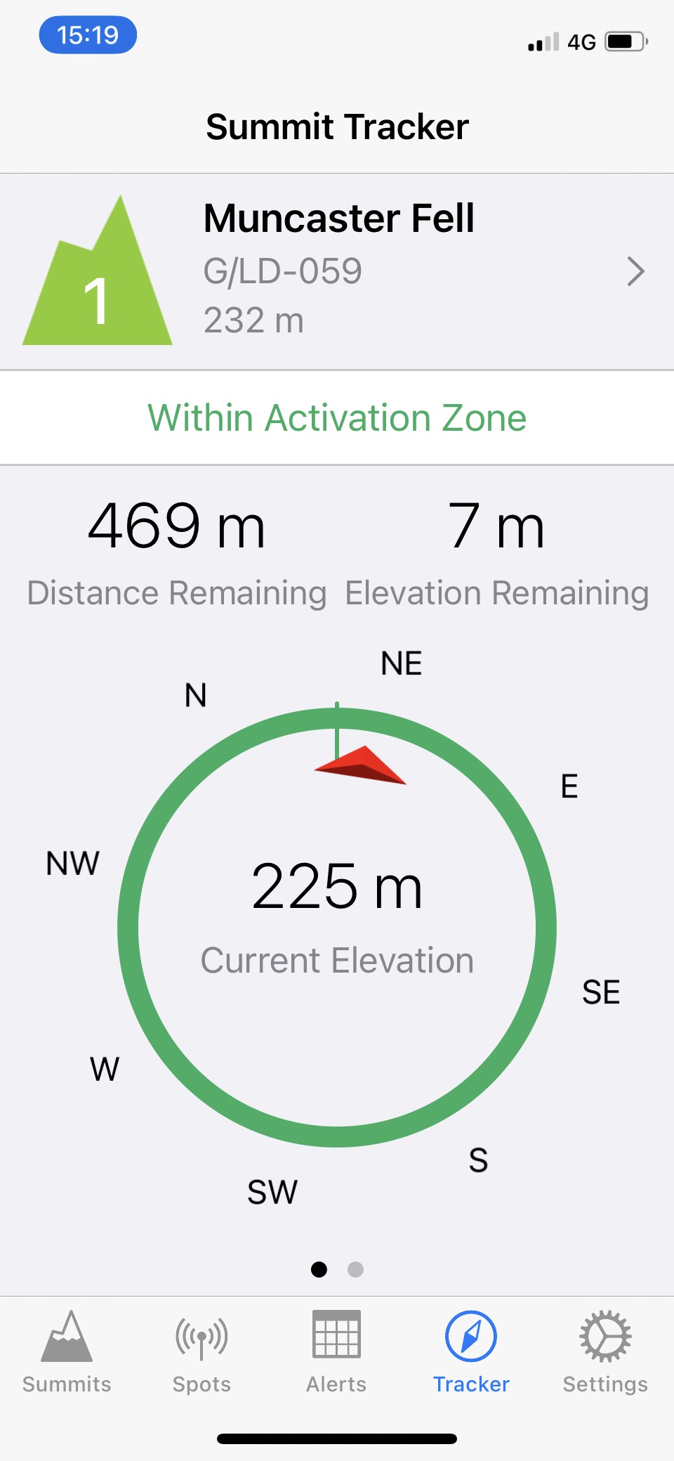
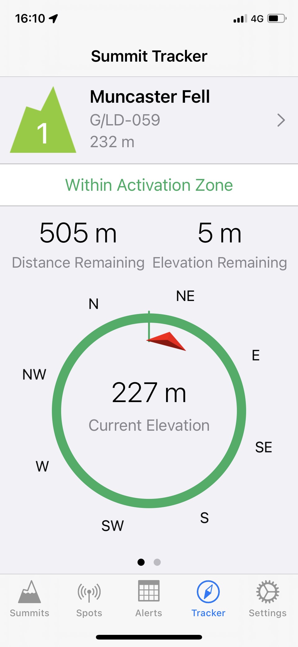
P.S. I’ve been thinking recently of doing Muncaster (G/LD-059) again. It would be interesting to see if SOTAgoat thinks it / I am in the AZ when standing at the WOTA summit trig point.
I doubt very much you will be in the AZ when at the original WOTA summit Andy due to the Hooker Moss col. How accurate will your SOTAgoat be on the day? It might tell lies. You best walk between them and take readings as you go, but you might get wet feet.
73 Phil
Here is the earlier thread:
1 Like
Hi
That’s how I understand it - link to original discussion is here
https://reflector.sota.org.uk/t/let-sota-goat-guide-you/22487/11
Rick
Oops sorry Adrian got there first
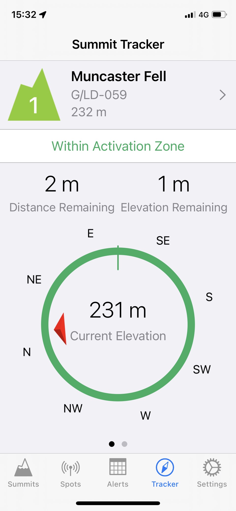
Please see my screenshot of the SOTAGoat app a few posts above. I was standing at the trig point as described.
I don’t rely on the app for navigation, but take a screenshot when at the summit. I do not care whether the GPS accuracy of my phone is 5 metres out; I will be at the summit.
The issue is that the app tells me I am in the AZ, whilst I am not.
There may be a hand full of summits in G/GW where there may be an issue with a false positive.
Also, it did not seem the drop was 25 metres between the old and new summit. Again, best to rely on more accurate instruments to make that judgement.
I always make sure i am at the summit first and then determine where to operate from.
People should be aware that in some cases - as with this one - the SOTAGoat app could give a false positive as its determination is purely on distance to and absolute height difference with the summit, rather than taking into account what is in between you and the summit.
73, Robert
2 Likes
![]()
2 Likes
Hi Robert
It’s also worth noting that the altitude accuracy of consumer GPS is much less than the positional accuracy
Rick
1 Like
It does… the restoration of this 2yr old thread is precisely the fact it says that when you are at the trig point.
1 Like
Yes, sorry Robert, I must have glossed over the paragraph in your earlier post, i.e. that you’ve already done that ‘test’ with SOTAgoat and I don’t really need to repeat it. It reinforces the point that non-pointy summits with undulating topologies can have complex shaped AZs so great care is needed when operating down from the summit itself.
1 Like
For clarity:
On the way to the summit (near but not at the old summit):
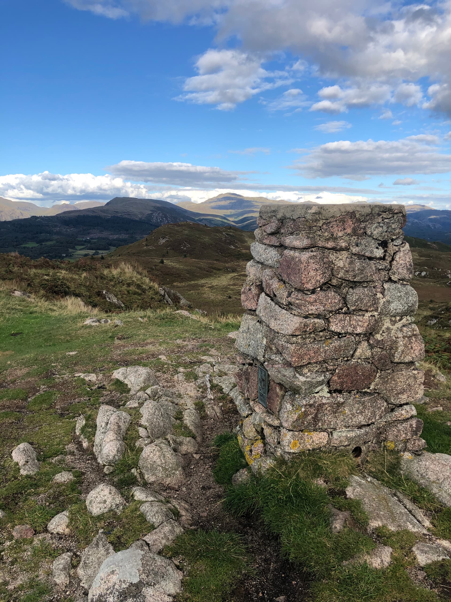
At the summit (G/LD-059) :
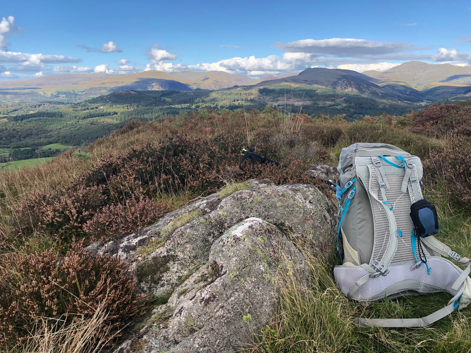
Looking towards the old summit from G/LD-059:
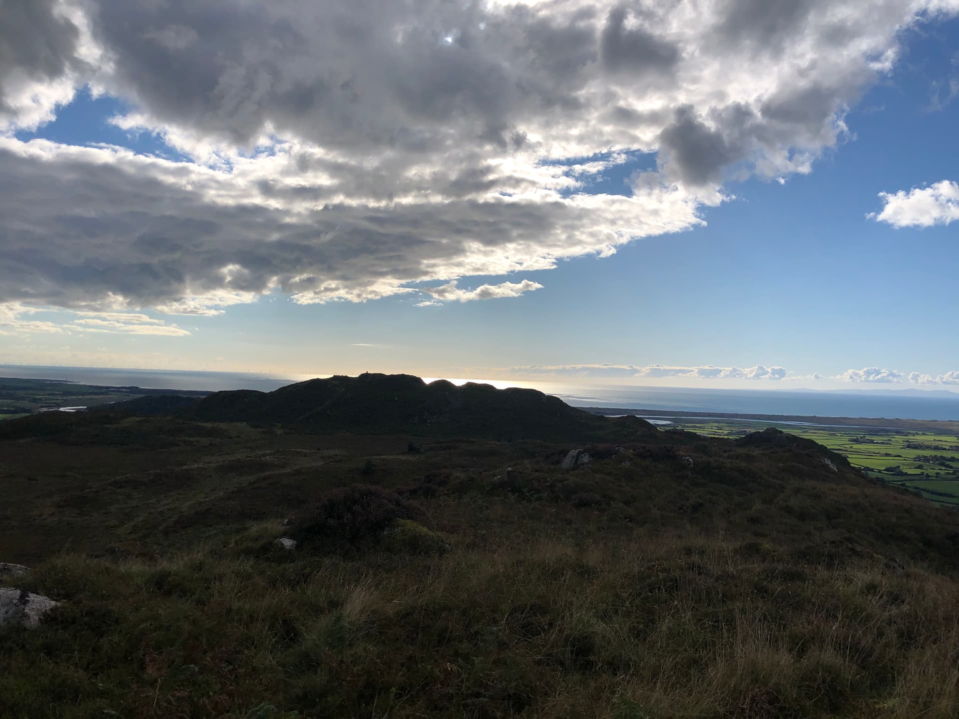
Standing behind the old summit trig looking towards G/LD-059:
…thanks for highlighting this as Muncaster Fell is on my “To do” list and depending on lots of things I might visit in the next couple of weeks, and climbing to the right summit is probably quite important. I think I would have carefully checked it first… I do use the SOTA Goat app not really the navigation bit - usually for spotting and double checking the summit reference!
So … which other “G” summits have a trig at nearly the top but outside the AZ or “twin peaks” where it is less than obvious which one is higher? Tarn Rigg Hill? G/NP-012 (I think the trig point there is in the AZ as the col seems to only be 20m lower) . This is mainly so I don’t make any mistakes… Thanks Paul
1 Like
What I want to know is why you only posted those rather nice photos now! ![]()
1 Like
To everyone that believes that old summit G/LD-055 might in in the activation zone of the not so new summit of G/LD-059, please refer to my post on this thread back in December 2020. The RHB did a proper survey of the col between these 2 summits and it was officially confirmed that the col was more than 25m below both summits. Please do not always rely on apps that may tell you different as they are not fully accurate.
Jimmy M0HGY
G - Association Manager
2 Likes
I would note that the old summit is a much more pleasant place to sit than the new summit. Lovely green grass, and a trig point to attach antennas to. It would be much preferred if it really was in the activation zone
The new summit is an indistinct patch of heather, and looks nothing like a summit should!
Such a shame that the col is so inconveniently a few metres too deep
1 Like
I didn’t think the world was quite ready yet to be exposed to a summit with such innate beauty. ![]()
1 Like
I do agree with you there Matthew, the old summit is much more pleasant then the new summit, so is therefore a bit inconvenient that the survey proved for the new summit to be higher and the col to be more than 25m below both summits. This survey also meant that we would be my Tom @M1EYP had no longer activated all the G (England) SOTA summit and we had to make a trip to the Lake District one weekend 5 years ago to get this new summit activated, but we included a couple of nice G/LD SOTA summits during that weekend though.
Jimmy M0HGY
1 Like