My name is Archie, I live in the Kyrgyz Republic and operate with the call sign EXØQKT. As you know, it is a mountainous country with many peaks. I would like to become an administrator in this country, but I need help with marking the peaks and mountain systems.
The thing is that the old instruction to create all the coordinates on the map no longer works on Windows 11 computers. I would like to have a clear instruction, relevant today, or other help from you in creating SOTA in Kyrgyzstan.
Thank you very much if you can find time to contact me.
Based on requests from other countries that want to join the SOTA programm the main issues is the availability of accurate maps. Especially for naming summits but even more important to apply the 150 m elevation prominance rule.
This meas that all qualified summits in a region need to be made available. Cherry picking just some summits is not done anymore as far as I understand. But starting with one region is an option. But I guess you are probalby already in contact with the MT.
And in the post by SQ9MDN there was another valid point that this likely will require a team for motivated region managers and assoziation managers to get things prepared. Month of map work and preperation ahead…
I wish you all the best and looking forward to another assoziation to visit
Your efforts are most appreciated.
I visit your beautiful country on a regular basis.
Next time in September. We have a cooperation with the kstu in Bishkek.
I always wanted to be on the air from the issyk kul area.
Maybe you can help me who i have to contact for a licence.
Sota in Kyrgyzstan would be fantastic.
Thanks for sharing your videos Archie, they are awesome! Hope to catch you on the air sometime.
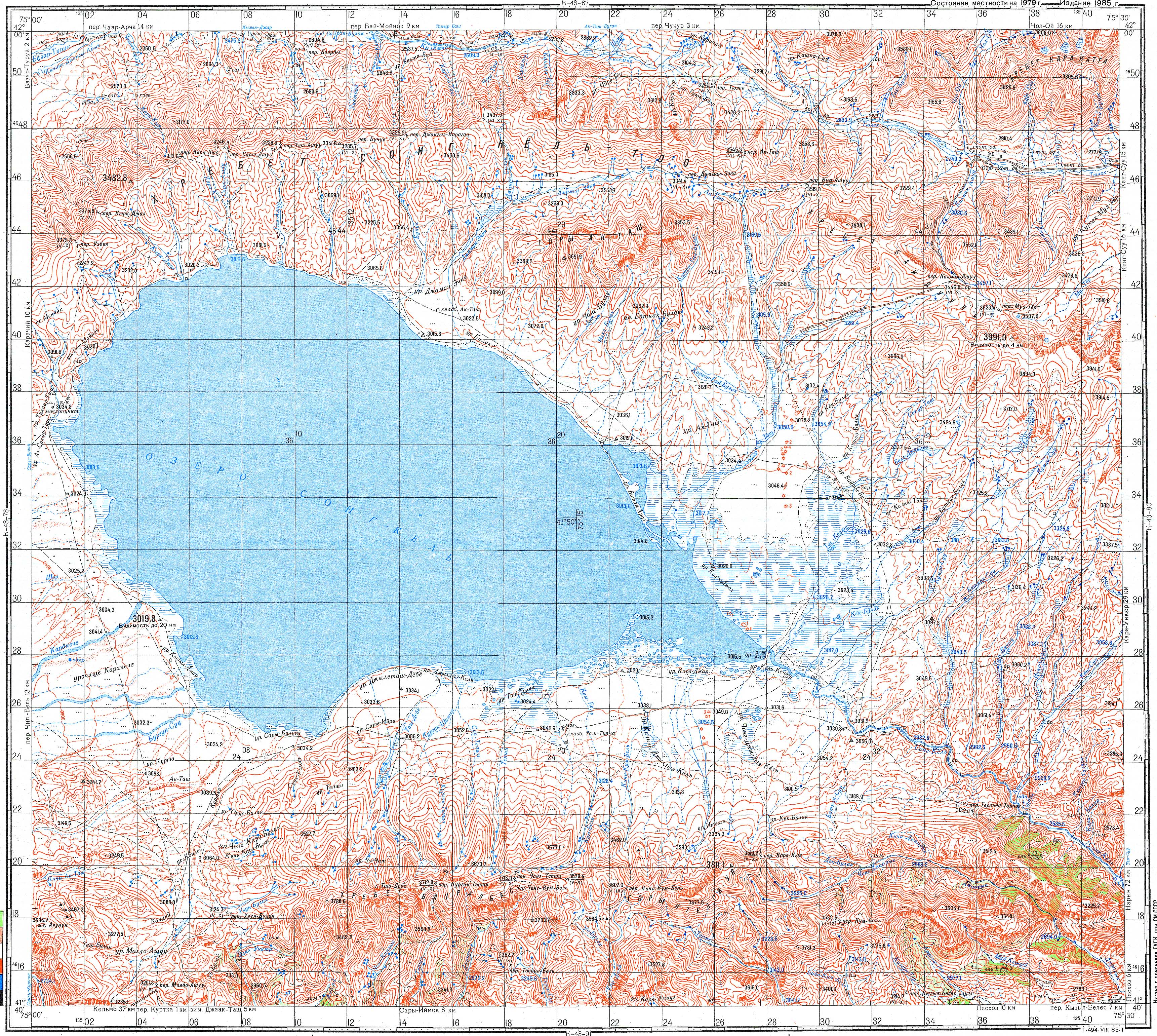
I couldn’t help but be curious and do some searching for some Kyrgyz maps myself. This page from the Kyrgyz Alpine Club is a great review of what’s available. It looks like Soviet Military maps from the 70s/80s are the best resource, topographically speaking.
The whole country is available in 1:100,000 maps with contour intervals of 40m. Sample here
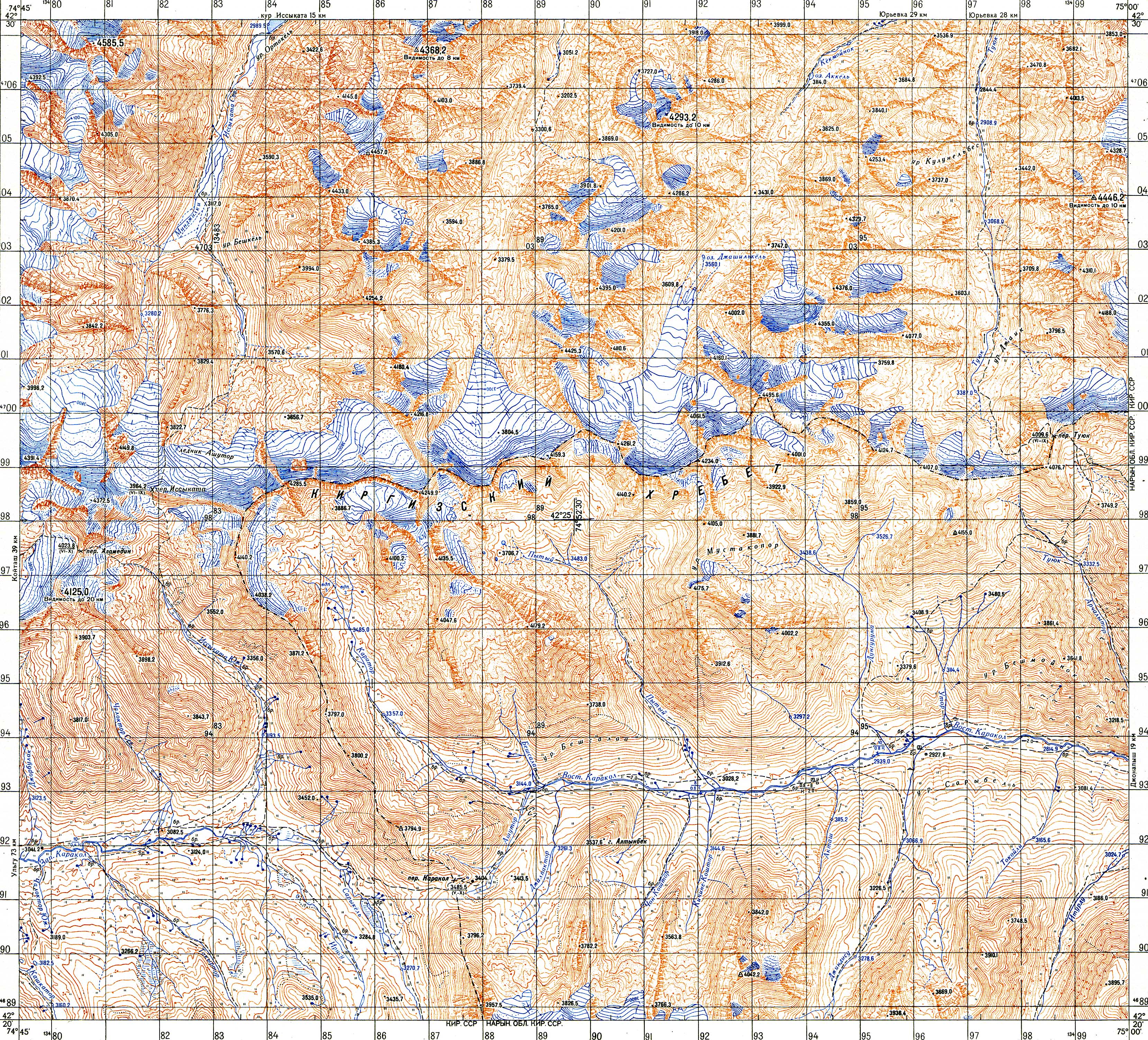
About 20% of the country is available in 1:50,000 maps with contour intervals of 20m. Sample here
The whole country is mapped at 1:25,000, but the maps are not public.
Andy and the rest of the management team, do you have an approximate standard for what quality/resolution level of maps are good enough to identify valid SOTA peaks? I know that in the U.S., before lidar, most of the early peakbagging efforts used the USGS topo quads that are scale 1:24,000 and have contours every 40 vertical feet/~12 vertical meters. But I’m not sure if other countries have been added that e.g. used 1:50,000 or 1:100,000 etc.
Another potential source of data for this is Digital Elevation Models (DEMs), typically captured via lidar/sar/stereo image pairs. Global coverage is readily available in 30-meter rasters from multiple sources. However, as has been pointed out in another thread, 30m (which I believe is the source for OpenStreetMap’s contours layer) isn’t accurate enough for capturing mountainous terrain.
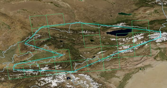
I have found this publicly-available High Mountain Asia dataset from NASA/University of Colorado with 8-meter rasters, and it seems to cover ~40% of Kyrgyz Republic, perhaps enough for a few regions to start the association:
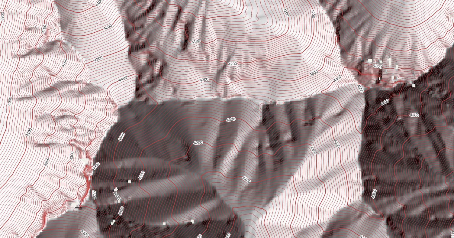
Supposedly a good contour interval is twice the vertical error, which for data from the stereo image pairs is 5.0m. So I downloaded some example tiles, loaded them in QGIS, and extracted a hillshade layer and a contour layer with 10m intervals. It looks decent-ish in some places:
The user guide notes “The investigators elected to preserve only “valid” DEM pixels, and did not perform any additional interpolation or filling to remove voids. Future releases will include void-filled products.” So this DEM is not the end-all be-all, but perhaps it is another tool in the toolbox for now, and will be complete in the future.
The Soviet mapping used to be conveniently available from a couple of WMS map servers but unfortunately these vanished just as we started to look at EX. Most of the sites offering them for download charge. I hadn’t seen that one. I thought there was a lot more coverage than that. Unfortunately those appear not to be georeferenced.
“It depends”
If all you’ve got is, say, 50-m contours it’s really not very useful. But if maps have near-total coverage of summit spot heights that obviously becomes more valuable, even though many of the low-P summits will get filtered out. The big benefit in that case would be the ability to distinguish between neighbours, greatly reducing the chances of picking the wrong summit from similar-height candidates.
So for the Soviet maps we have used both the 1:50k and 1:100k in the past. The latter look to have 40-m contours in this area but with pretty good spot height coverage.
We use DEMs a lot - preferably DTMs. Our go-to is GLO30. We are keeping watch for anything better. RADAR and optical sources are somewhat problematic in producing DSMs rather than DTMs (surface models vs. terrain models). The gold standard is LIDAR. In my experience the optical ones throw up many more wild outliers than you get from SAR, so they are a major pain, having to remove many false summits first.
A DEM that’s full of holes does not lend itself to automated analysis. EX has very many candidates so this presents a problem.
Where we have good DTMs the mapping steps are reduced basically to collecting names (and maybe spot heights).


