Thank you very much for creating this software and sharing it with us. I have too, pinned it to my web browser, and will be testing it out over the next few weeks. I always used mountain forecast, and was gutted when it went behind a paywall. Let’s test yours out, will give feedback in a week or twos time
I didn’t go to G/LD-052 and do the activation [for two reasons I won’t bore you with] but with a westerly moderate breeze all day – it takes only about 30mins for HRC to get the same wx as at my QTH near Arnside (~8km to the west)
I wasn’t consciously thinking about the wx all day yesterday but only certain events
All times (BST) are very approx.
7-9am: dry, breezy, blue sky, with all-white cumulus clouds (cumulus humilis / mediocris)
9-10am: a few grey clouds with light rain shower (cumulus / a few cumulonimbus)
~11am: very heavy hail small-lived shower (cumulonimbus)
Early afternoon: several heavy rain showers otherwise breezy, dry
Late afternoon: dry, cloudy, still windy (stratocumulus / altocumulus)
Early evening: very heavy longer-lived hail shower (cumulonimbus)
I’ll leave you to compare this anecdotal info with your models.
It’s predicting 15C dropping to 10C for the summit of G/SP-006. I’m parked up and it’s 7C. Also reckons virtually no rain today but it’s currently a little damp. So I’m not too sure about the weather models.
I have just noticed something else to fix. Basically if it’s red it’s saying a high probability of rain, I decided to use trace instead of red but showing 0.0, as this is a little confusing. It actually means it will rain but the accumulation is less the 0.05 mm and so the model rounds it down to 0.0mm. However it is still showing 0.0mm in some cases instead of Trace. A fix will be along shortly
Rain - whether it’s light or heavy - is widespread, typically lasting several hours or days (from Nimbostratus clouds)
Shower is localised, falling from one cloud or local cell, and is shorter-lived depending the wind speed (from cumulus if light or from cumulonimbus if heavy)
So, for my events, it was alternating between dry and showers (hail and rain).
Thanks to everyone that is feeding back, some issues with rain levels now fixed.
I found that one model was over writing data from another.
Also now shows todays weather
Here is a summary of how the weather data is derived, for anyone who maybe interested
Unfortunately, I have removed the todays forecast.
It was causing a problem that to get todays weather, it loaded an older model run instead of the latest model run.
When you run the forecast now it always runs 5 days from tomorrow, this way you are always looking at the lates model run.
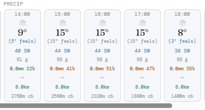
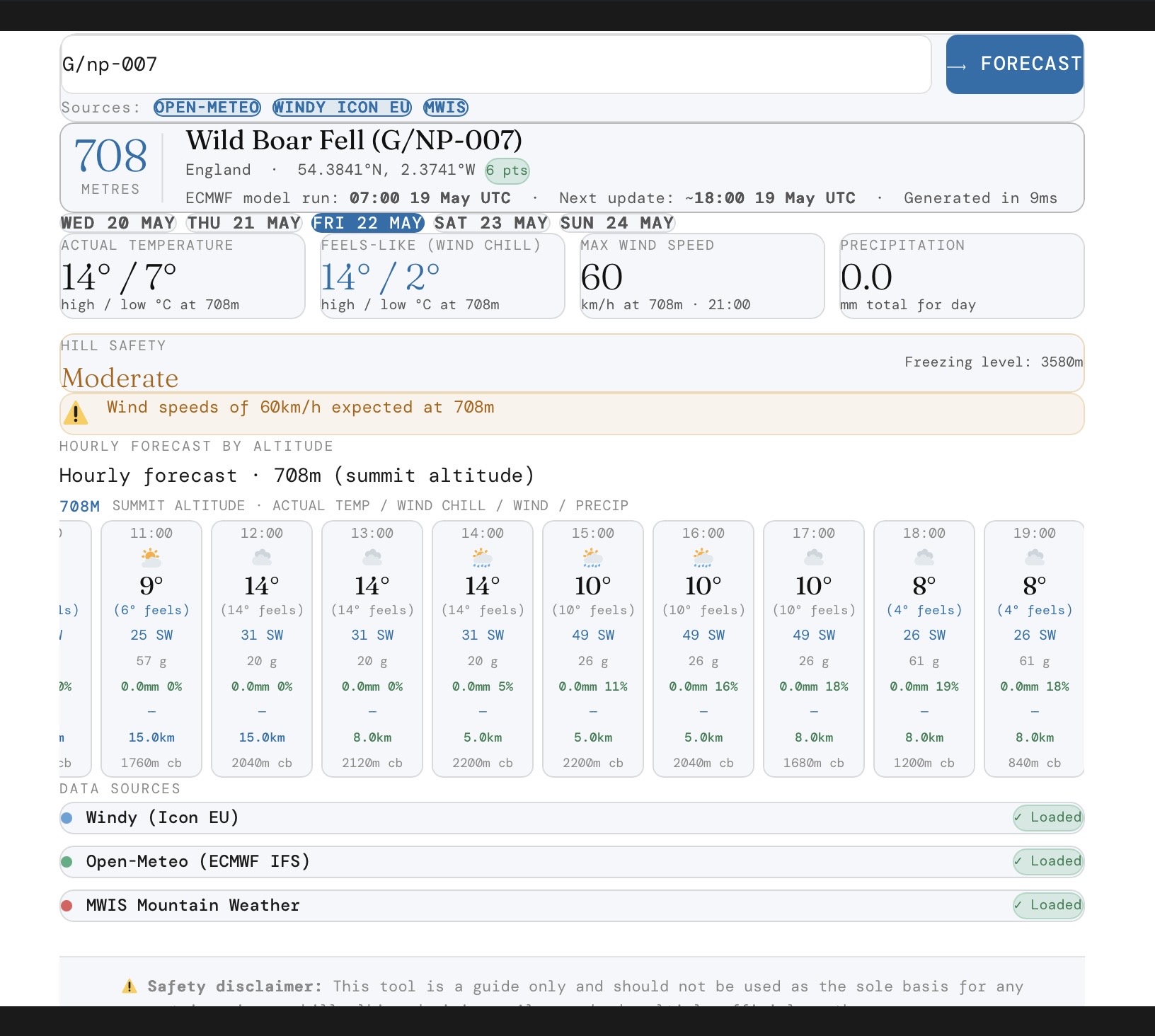
Still getting some weird forecasts. Looking at G/NP-007 for Friday the temperature jumps from 9C to 15C and then back to 8C. That seems unlikely. Plus the feels like temperature is 15C even though the wind is stronger.
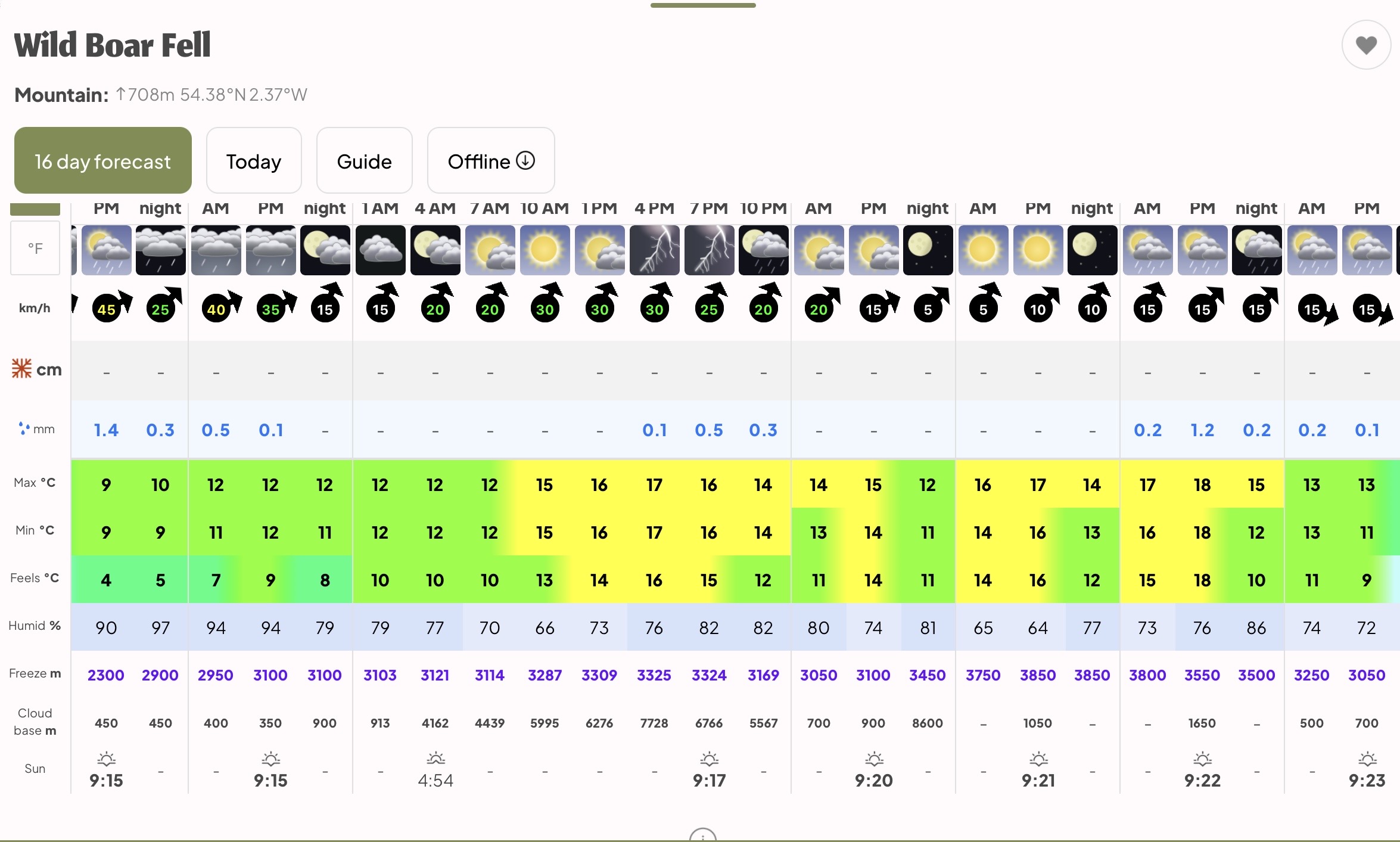
The temperature jump does look odd, although a bit different on the latest model run, the wind chill seems similar to mountain weather.
I will keep a close eye over the next few days.
Ideally I need a summit with a weather station to compare forecast to actual observations.
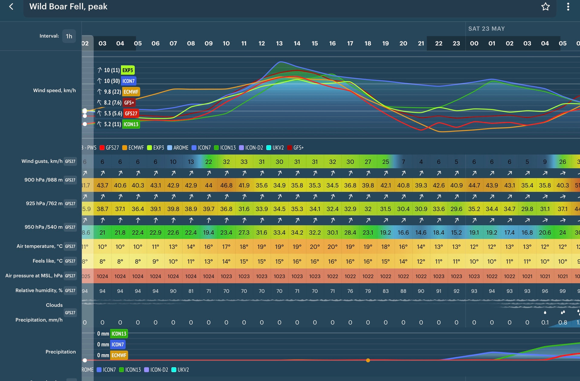
The following are from wind pro app and mountain weather.
Windy temperatures are at surface.
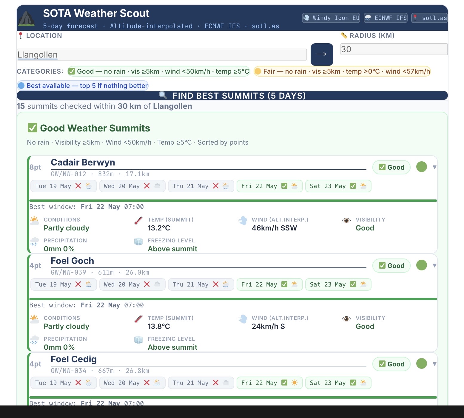
I have created another add on tool to the weather app, for a bit of fun only.
Inspired by this post while back by Paul G4IPB
Again designed really for the UK only. it’s only as good as the weather tool, so will likely have flaws.
It’s on the same page as the weather app, link above, if you scroll down the page.
It attempts to find the summits with the best weather over the next five days. It finds summits within a radius of a given place name, summit name or postcode. It’s sorted from highest to lowest points. It’s a busy screen so takes a big of getting used to.
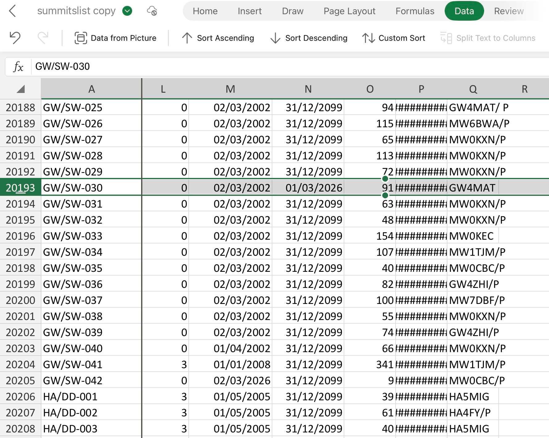
They may have been retired. i.e. end date < today’s date.
I must check (in the office today) I think summits added for new associations/regions etc. may be in the CSV and not yet active. i.e. start date > today’s date.


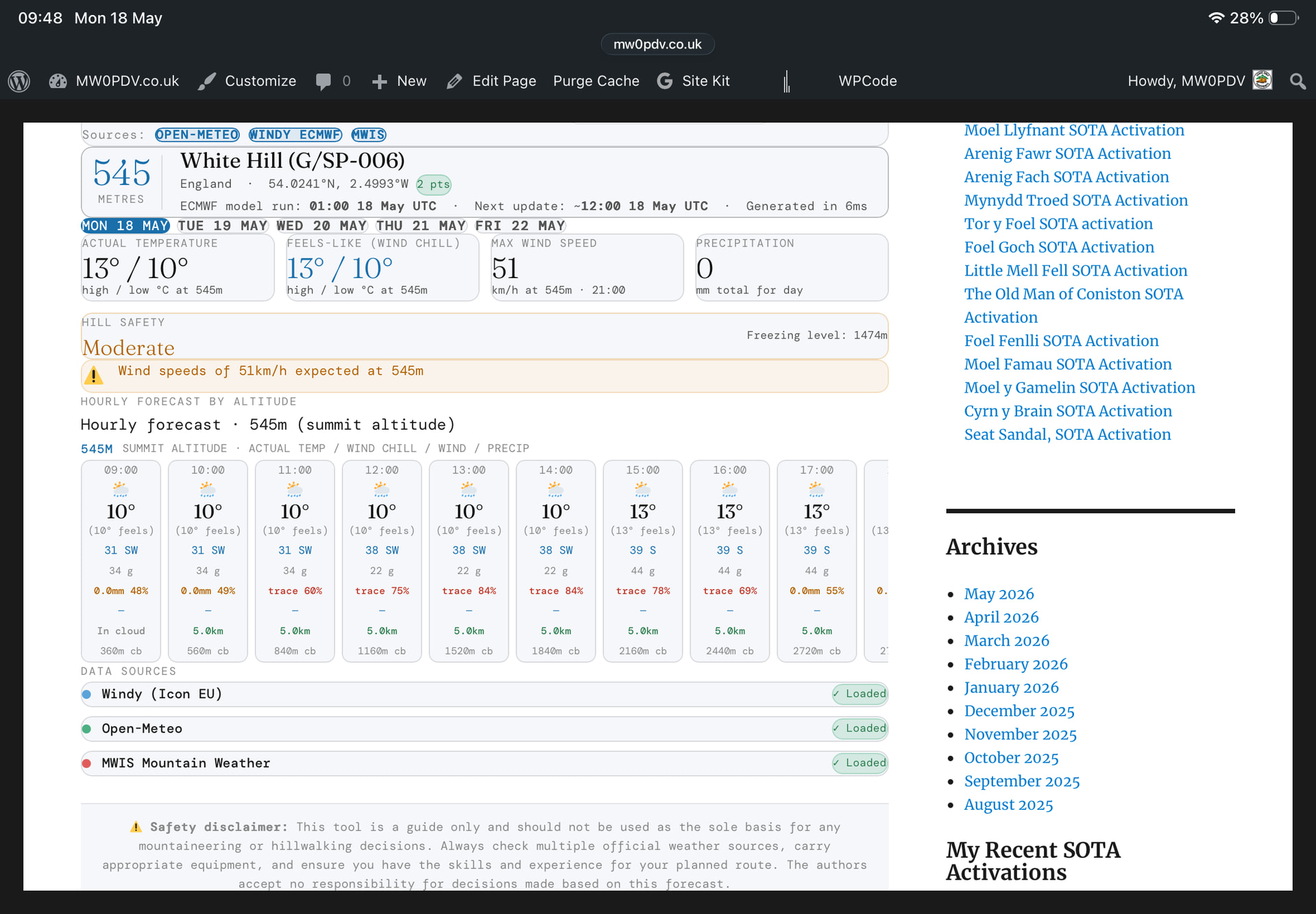
 it would be interesting to know what the visibility is/was like.