CQ 270 CW SSB Gang! - Cool Kids Sip from the Hour Glass? (Part 3)

Saturday 22 August was a busy day for me with things other than radio to do later in the day. I decided I’d keep progressing on the 2026 SOTA challenge and head to a nearby summit, VK3/VT-078 Gentle Annie, about 50km away as the crow flies. By road it’s about 64 km to the trailhead with a 1.2 km steep, muddy track to the summit.
Arriving at the junction at the base of the hill I was greeted with light rain falling.
I have a simple rule for hiking - never start hiking in the rain. If it rains after I have started hiking then I’ll deal with it, but it makes no sense to leave the comfort of a warm, dry vehicle to immediately get wet.
While waiting for the rain to clear I decided to test my Personal Locator Beacon, PLB. This is something I should do every couple of months, but I hadn’t done since I purchased my second PLB in August 2024. I downloaded the PLB manual to my phone and read the test procedure by which time the rain had stopped. Stepping away from the car I ran the full test, that includes RF and GPS testing, and the test failed. I re-read the instructions to be sure I had done it right which I had and, as detailed in the instructions, I repeated the test and it passed.
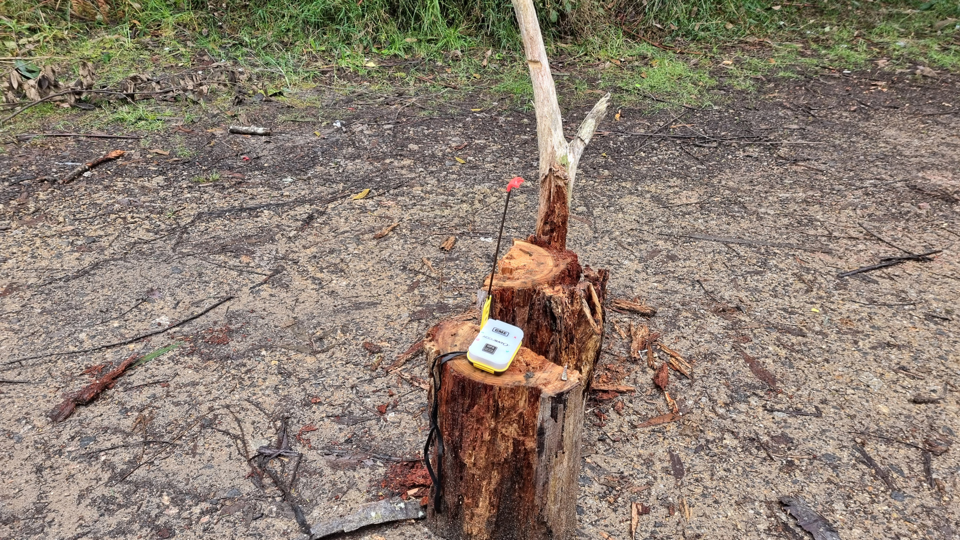

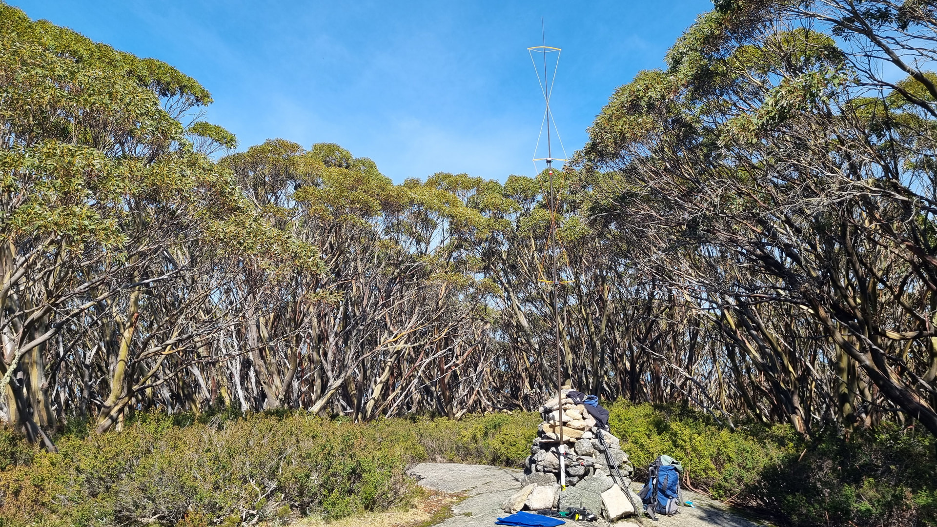
Comforted by the knowledge that if it all goes south, I can summon help, I packed my backpack with FT817, amplifier, batteries, tarpaulin, hourglass antenna and, for its first activation, a dual hourglass antenna.
The summit is named Gentle Annie, but there is nothing gentle about accessing Gentle Annie.
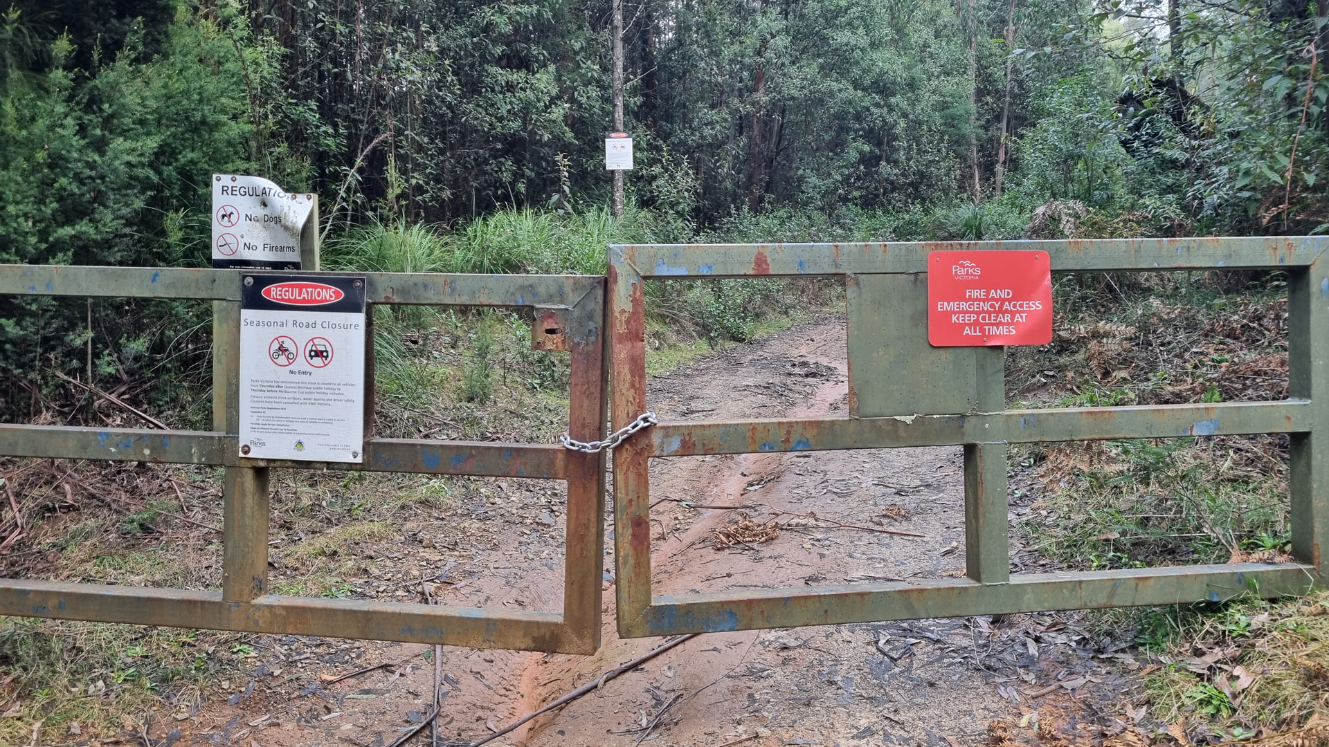
The journey to the summit starts at a seasonally closed gate. These gates are common in forest and park areas in Victoria and are locked from mid-June until early November. The idea of closing tracks through the winter and spring is to stop them being damaged.
I have activated this summit seven times before and only once, in 2014, has the track up not been a rutted or churned-up mess. In 2014 I found the track had been repaired and graded a couple of months earlier, and I was able to drive my 2012 RAV4 AWD to the top. Today it was a challenge just to walk up the muddy track.
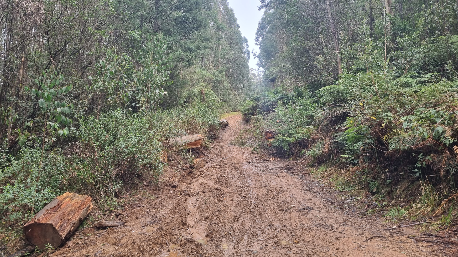
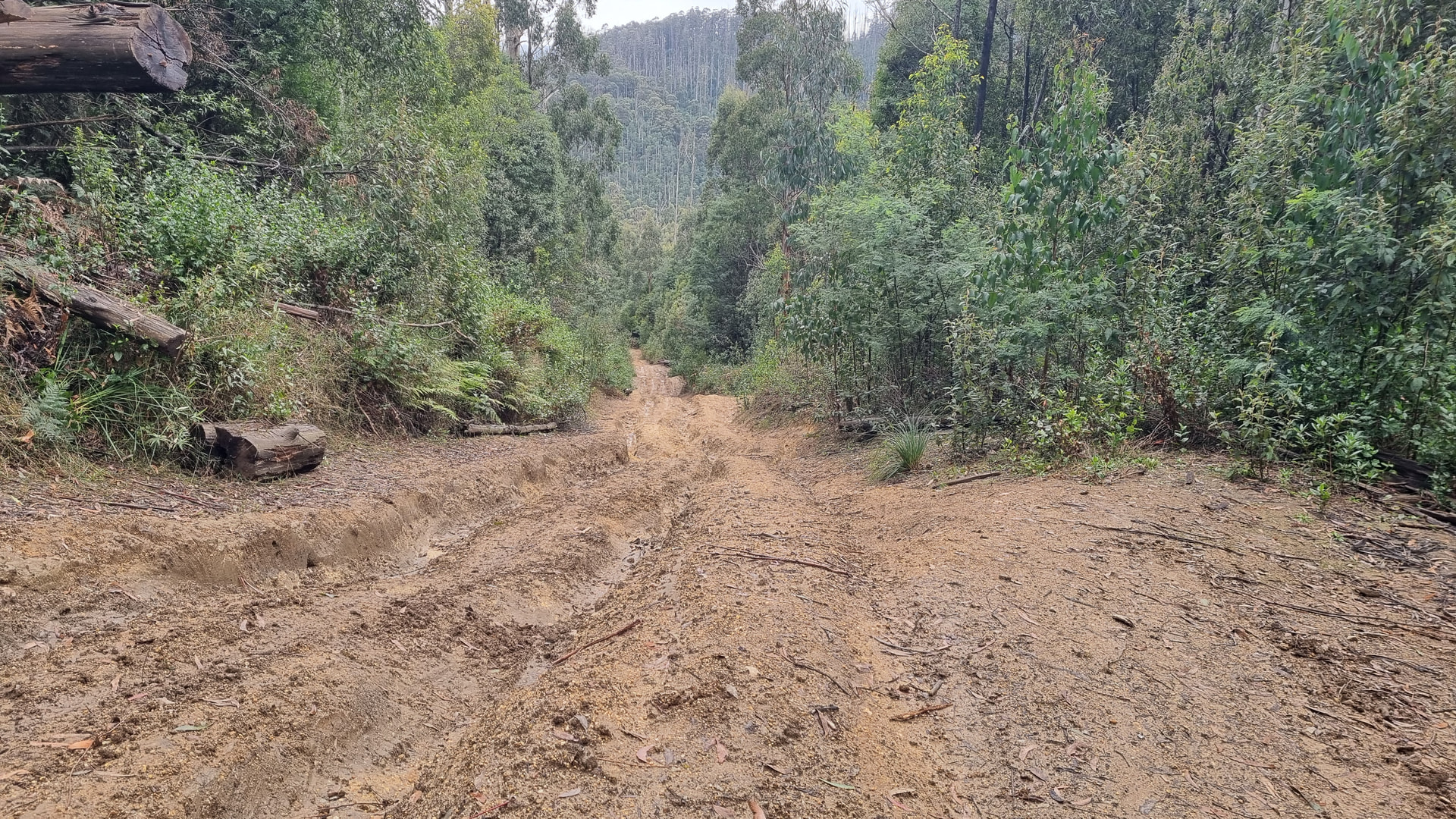
The track starts at about 450m ASL and rises to 687m ASL with some sections being steeper than others. With my hiking poles and new boots, I was able to make the climb, and descent, without slipping over in the mud.
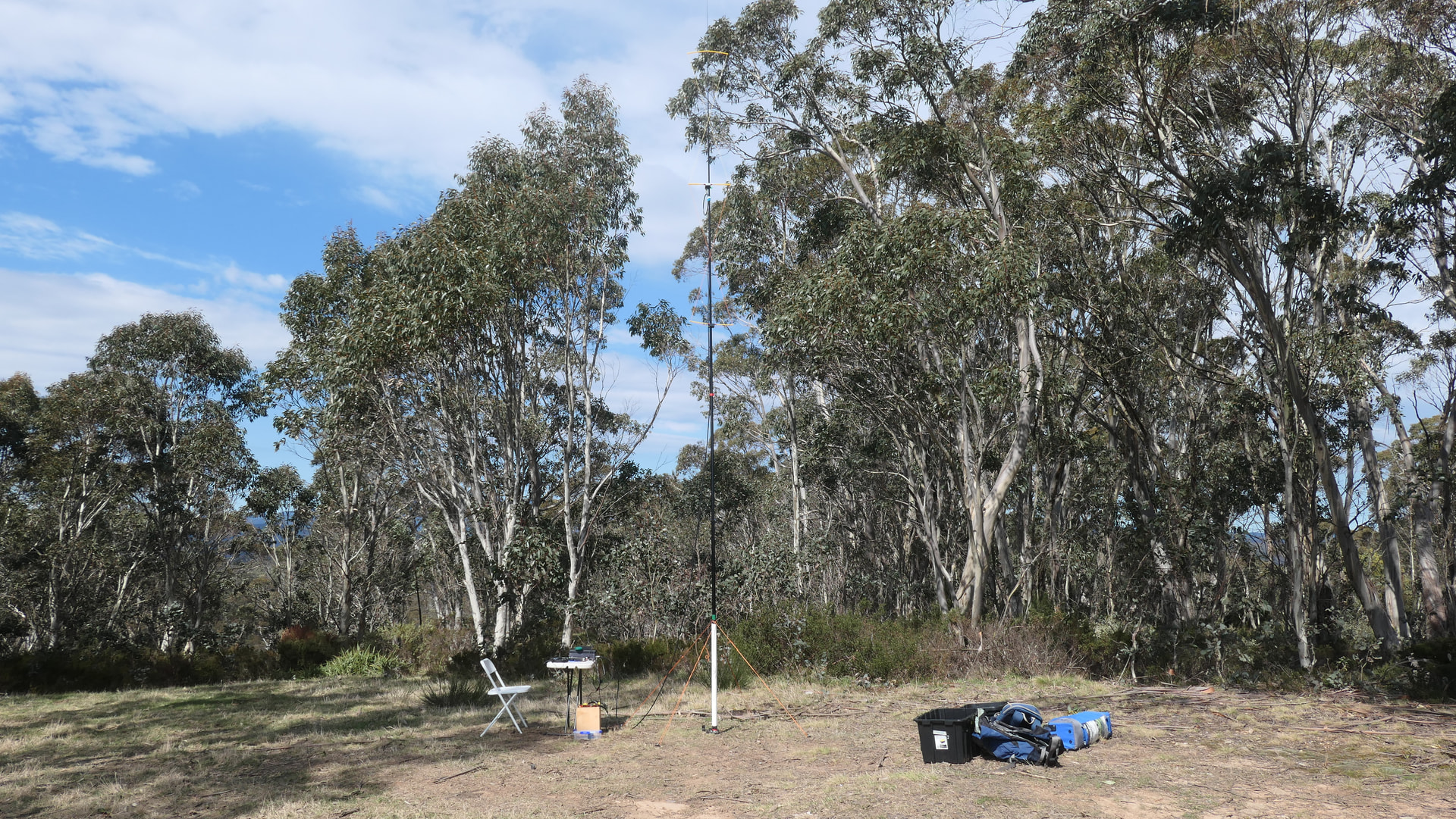
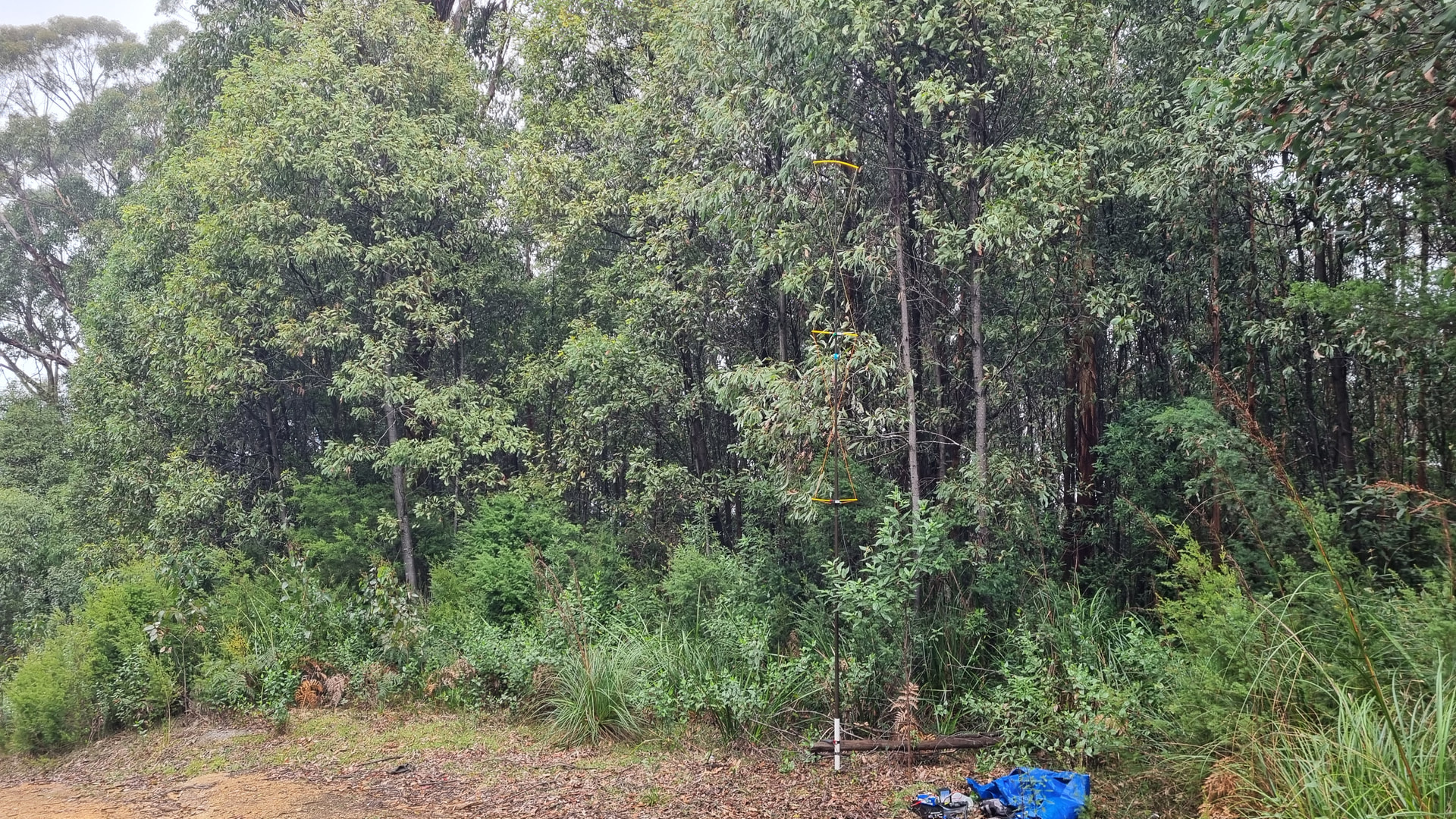
After reaching the activation zone, about 20 minutes before 0000 UTC, I set up my 6m pole with the dual hourglass antenna along with the FT817 and battery. Normally I lay a tarpaulin on the ground and then set my station on top, but today, I just set up on the grass and kept the tarpaulin for sheltering under.
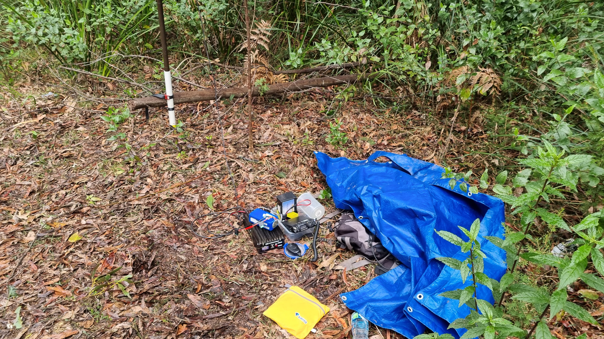
I managed 6 QSOs before UTC rollover and 15 QSOs after rollover. Geoff @VK3SQ was keen to work me, so I added the amplifier and second battery to the setup, but we were unable to make the QSO.
While calling Geoff I noticed the FT817 was showing less than 12-volt input from the 7Ah LiFePO4 battery during heavy modulation. I haven’t seen this before with this battery that I have been using since August 2022. This raises two possibilities, the battery is staring to fail, or I had not charged fully after it was last used. I’ll load test it during the week and see how it performs.
The rain was intermittent and after about 1 hour on the hill I decided it was time to head back down to the car.
Due to the poor weather conditions, I was unable to compare the performance of the two hourglass antennas, however I did confirm that the dual hourglass antenna works.
From the 21 QSOs logged the closest was 41 km and the most distant was 70 km.

In late November, after the access road reopens, I am planning a visit to VK3/VT-028 Mt Horsfall to do some comparisons between a 5-element Yagi, the single hourglass, and the dual hourglass antenna.

7 Likes

Again, another riveting report with new insisghts. I did not know the PLB system but understand that it is a good decision not to rely on APRS or anything else in such an area with slippery tracks (admirable :flexed_biceps: ) and rainy weather.

I am looking forward to your test SHA vs DHA.

Thanks for sharing, 73 Peter

1 Like

For those interested in distress beacons in Australia, info can be found here; Distress beacons - Beacons

2 Likes

Hi Peter,

Thanks for another enjoyable report! It seems there really isn’t much “gentle” about Gentle Annie – mud, rain and a rather slippery climb to the summit! 21 QSOs under those conditions sounds like a pretty successful outing to me. I hope the issue with the battery can be sorted out soon!

Good to see that the Dual Hourglass finally made it into the field and successfully completed its first activation. A proper comparison may have to wait for a better day, but at least we now know it works!

73, Roman

2 Likes

I’m back from France/Switzerland and here is a brief reprot from HB/VS-262, Bettmerhorn (2871 m), on Sunday 16. August.

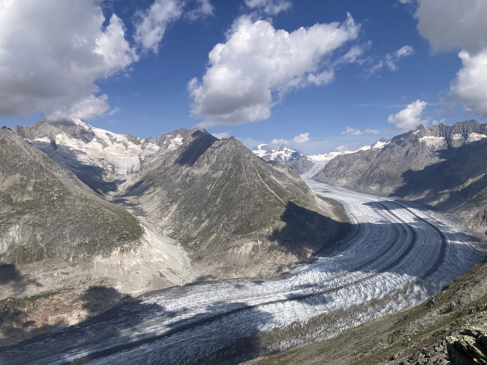
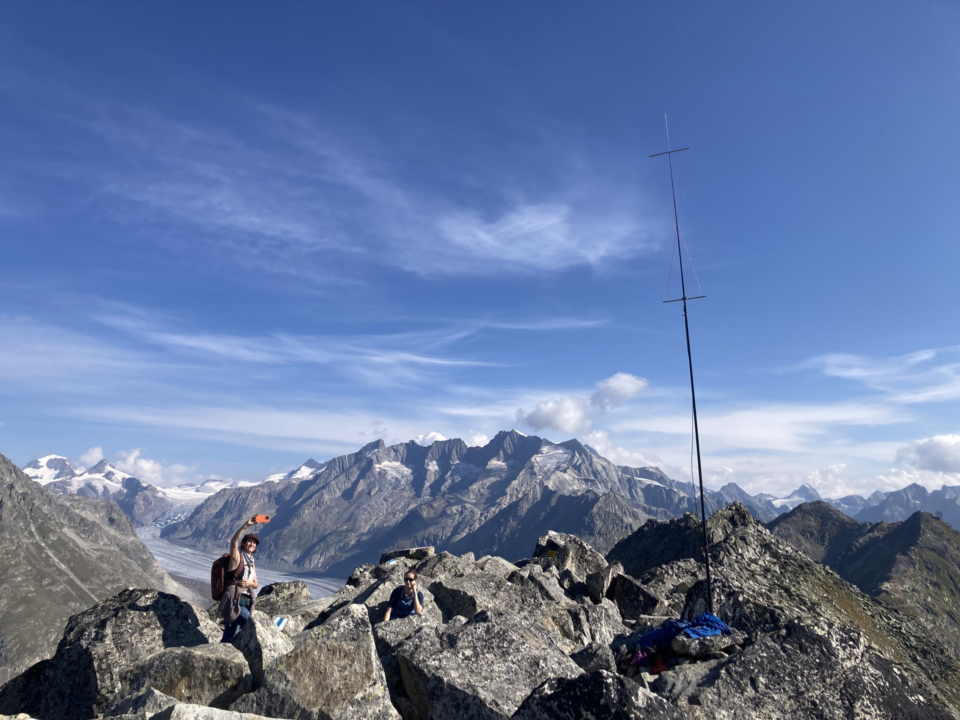
Getting there was unusually easy: cabin lifts did most of the work, leaving us with only a little over 200 vertical metres ascent to the summit. The highlight on the way up was the view of the Aletsch Glacier and the surrounding Mountains.

For 2 m I had brought the Single Hourglass Antenna. I wasn’t sure how much space would be available at the summit or how crowded it would be, so I wanted something that could be set up quickly, occupied little space and was not more conspicuous than necessary. Although, admittedly, even the SHA attracts enough attention on a busy summit.

I started the activation at around 08:00 UTC. The Global Mountain Activity Contest was in progress, so there was certainly no shortage of signals on the band. I could hear several stations, but calling them resulted in zero replies.
At nearly 2900 metres a.s.l. one might expect an excellent VHF location, but Bettmerhorn is surrounded by considerably higher mountains, so the take-off is not nearly as good as the altitude might suggest.

Eventually I found an Italian station and was able to work him - the only QSO on 2m SSB in the log. But hey, one was enough and it was across 318 km :slight_smile:

So not exactly a big log, but I was very happy with it. Carrying the VHF equipment to the summit had definitely been worthwhile.

73,
Roman

8 Likes

I have been busy with things other than ham radio for the past few weeks, but today, Saturday 12 September 2026, I was able to get out into the hills again.
When I say hills, these hills are nothing like Roman @DL3TU recent activation in Switzerland, but I did find a little bit of snow.

My summit today was VK3/VT-006 Mt Saint Phillack. At 1565 m ASL it is worth 10 points plus 3 points for the current winter bonus. Leaving home at 5:45 am I travelled via the M1 freeway, bitumen country roads and well-made dirt roads to the Mt St Gwinear car park.

Mount St Gwinear, located in the Baw Baw National Park, is a family friendly snow attraction with free entry that during winter offers toboggan runs, cross country trails, a snowplay area and a heated shelter room. Mount St Gwinear has no lifts, no accommodation, and today, being the 12th day of Spring, had almost no snow.

There are several ways to access the Mt Saint Phillack summit. On my first activation in 2013, Glenn @VK3YY and I started from this car park and hiked over Mt St Gwinear to get to Mt Saint Phillack. On my second activation, in 2025, again with Glenn, we started at the Baw Baw Village car park and hiked down and up from there. Today I had decided to retrace my first activation, including the hike up and over Mt St Gwinear.

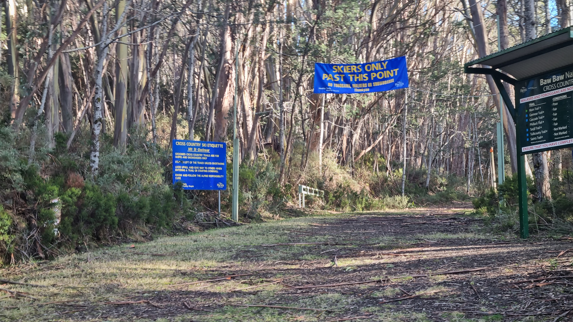
Leaving the car park at about 8:30 am, I headed up Main Trail, past the advisory sign suggesting only skiers should pass.


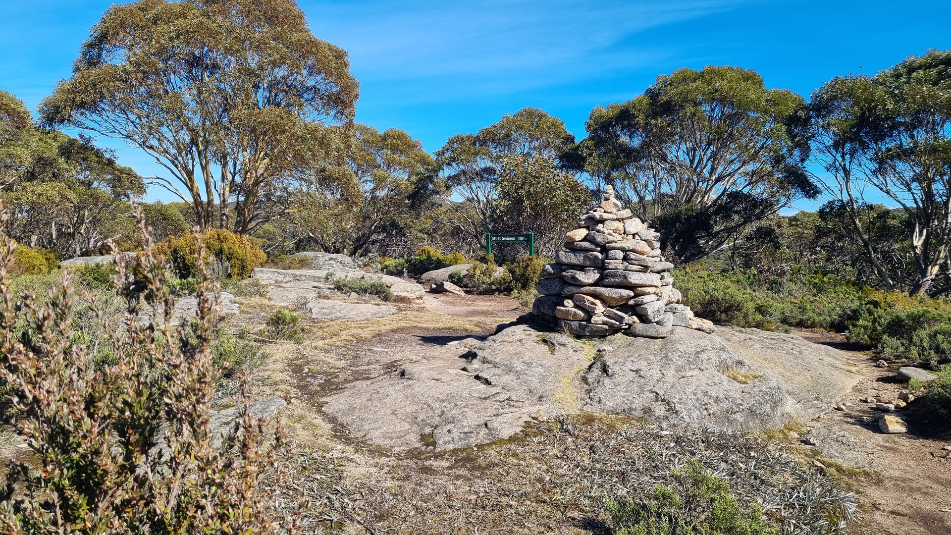
From the car park to the top of Mt St Gwinear is an almost constant climb rising 220m over 2.7 km. The track up to Mt St Gwinear starts out as a normal MVO road later narrowing toward the top. There were patches of snow in the shade of the trees along the track. Like most tracks in this area, there are poles with orange arrows attached to help locate the track under snow. At the summit of Mt St Gwinear is a stone cairn and an information sign stating the elevation as 1509 m. The hike to this peak took 60 minutes. In 2013 Glenn and I did the same hike in 45 minutes. The passing of the years seems to slow me down.

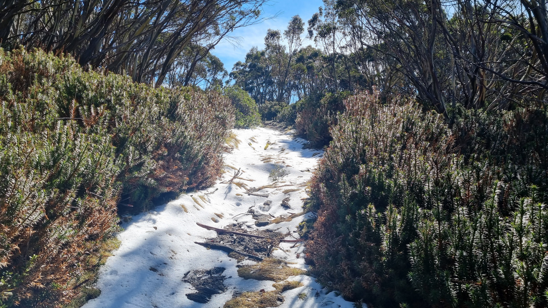
From Mt St Gwinear the track narrows to single file and drops down to a bridge over a creek. As the track descends to the bridge there was a patch of snow, up to 3 cm deep, partly covering the track.

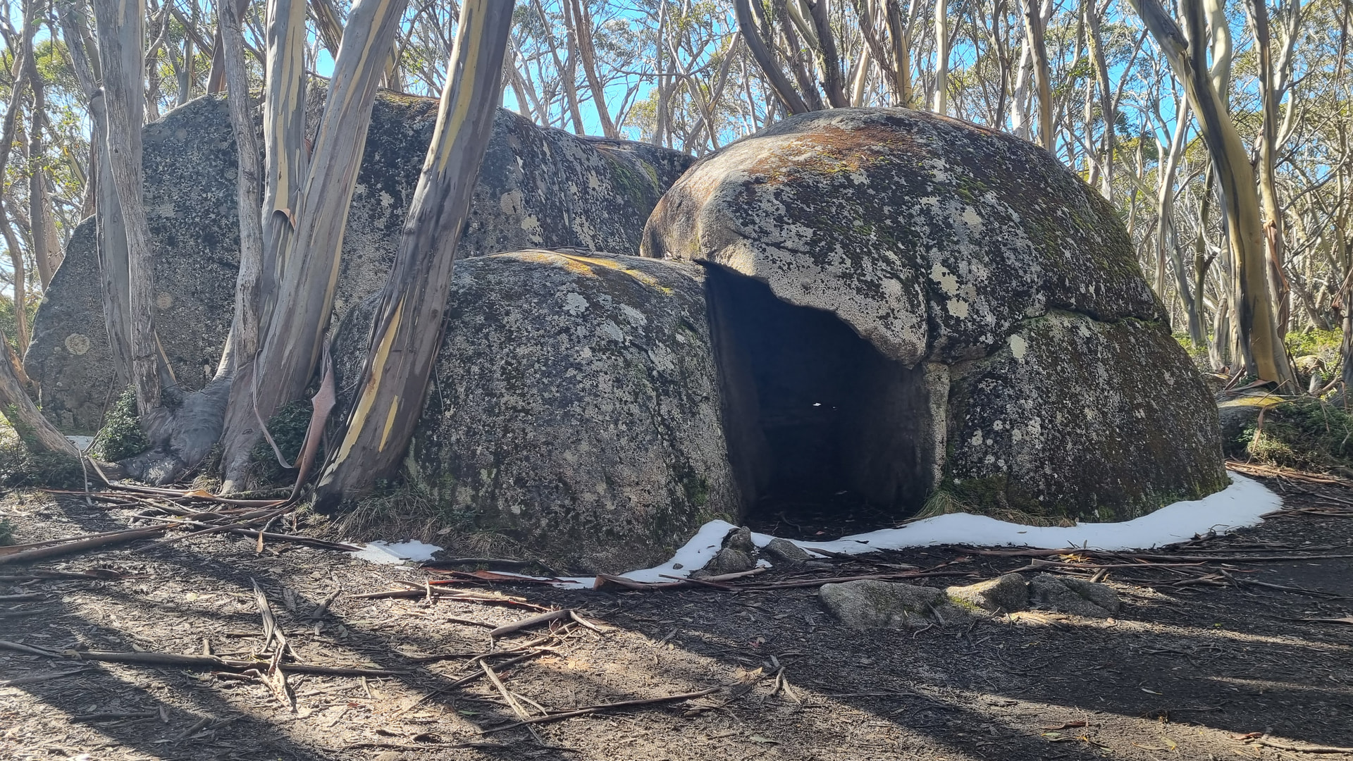
Rising up from the bridge over the creek, the track meets the Australian Alps Walking Track at Camp Saddle, known for its Rock Shelter formation.

From Camp Saddle to the Mt Saint Phillack SOTA summit, I followed the Australian Alps Walking Track for about 1km rising up 80m to the summit.
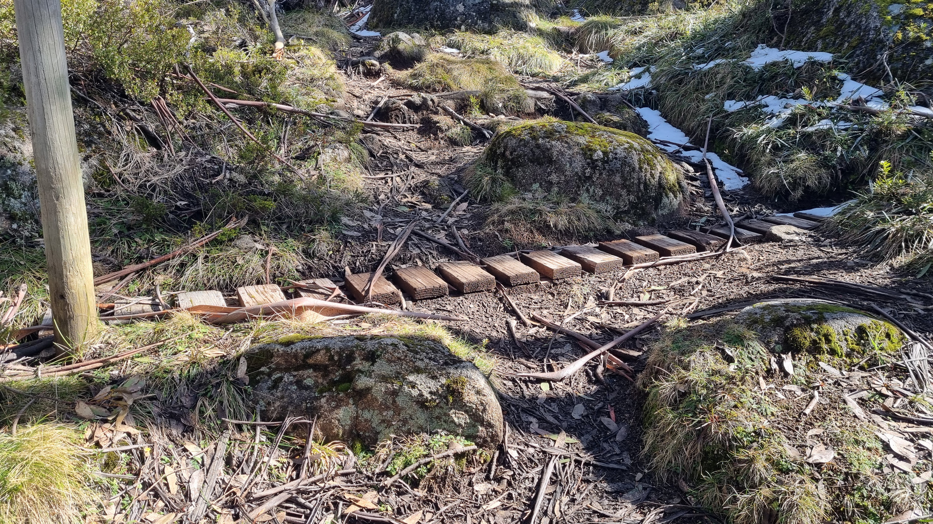
Along the trail are many wooden drains placed across the track to trap water running down the track and divert it to the side to reduce erosion of the track.

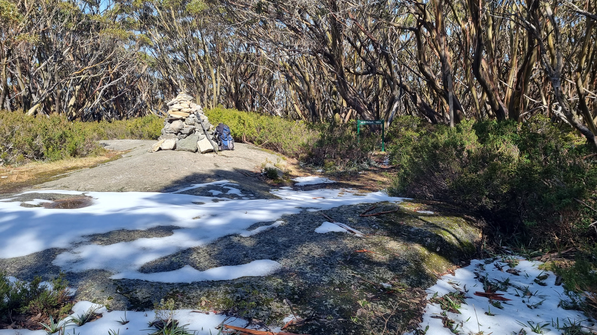
As I hiked up to Mt Saint Phillack there was more snow appearing on and beside the track and my arrival at the summit revealed a large patch of snow.
This was good to see as it fulfilled one of my SOTA goals for 2026 Your SOTA Goals for 2026! to activate one summit with snow in the AZ.
The hike from the car park to the summit took 1 hour 54 minutes. Back in 2013 it was 1 hour 24 minutes. In 2025, starting at Baw Baw Village, Glenn and I made the journey to the summit in 1 hour 35 minutes.

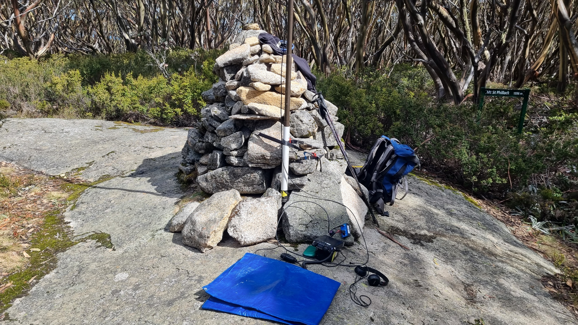
Today I only worked on 2m SSB. The station was FT817ND and the antenna was a double hourglass supported by a 6m pole. I posted my first spot to SOTAwatch at 0046z and logged Geoff @VK3SQ, 162 km away almost immediately. A steady flow of QSOs followed for 20 minutes including David @VK7DC, 364 km away in Tasmania.

After about 1 hour, when my CQ calls were going unanswered, I tuned some of the beacons and changed the antenna to a single hourglass to make an unscientific comparison between the two antennas.
Based only on perceived audio improvement both the VK3RGI Mt Carrajung and VK3RED Donald’s Knob beacons sounded stronger on the double hourglass.
Whilst using the single hourglass I completed three more QSOs.

In total I was on air for about 90 minutes and logged 18 QSOs ranging from 94 to 364 km.

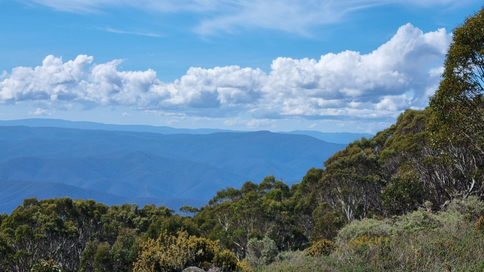
On the hike back to the car park, I took a detour, walking a different track to the side of Mt St Gwinear, rather than rising up and back down 60 metres of elevation over the peak. On this detour there was a clear view to the Northeast with VK3/VT–016 Mt Useful and other summits visible.

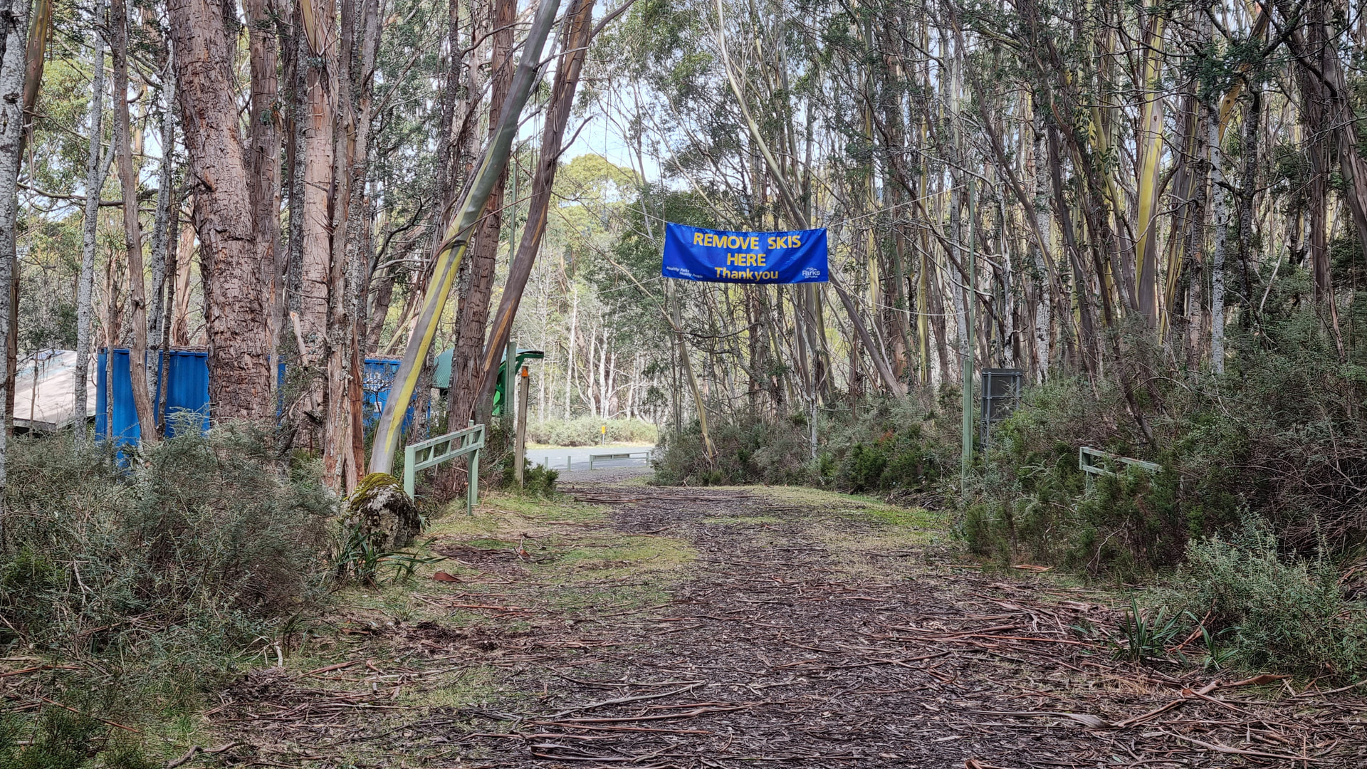
My expedition finished back at the car park where I was cheerfully advised to remove my skis. The trip from Mt St Phillack to the car park took 75 minutes, ten minutes quicker than in 2013.

7 Likes

…great read Peter, was terrific to work you too. Using the 4 element yagi as well as the single Hourglass; switching betwen each as we talked!

cheers :clinking_beer_mugs:

Geoff vk3sq

1 Like

I am pretty sure that the difference results from the delays caused this time by the stops for taking so many photographs :wink:. Thanks for sharing and for writing up another interesting story around them. I am very pleased to see another Double Hourglass Antenna (DHA) in operation. If I am not mistaken, there should be a set of three now (VK3ZPF, @DL3TU, DM7KN). May be, we will see more before this years challenge ends…:thinking:

73 Peter, DM7KN

2 Likes

You are 100% right with this. In 2026 I stopped at 20 different locations and took 114 photos on the ascent to Mt St Phillack. In 2013 we stopped at three locations and I took 15 photos.

3 Likes

Impressive file keeping and scientific statistics!:scientist: !

1 Like

Saturday 19 and Sunday 20 September 2026 were the dates for the VK VHF UHF spring field day, a 24 hour contest focusing on portable operation on bands above 30 MHz.

The VHF UHF Spring Field Day sees a few clubs and individuals make their way to the hills. This also presents an excellent opportunity for SOTA operators to get more contacts on the higher bands than normal. Not only does the field day bring more field stations onto VHF and UHF, but there are also more home stations trying to contact those stations.

I had planned three drive up summits on the Saturday staring with VK3/VC-001, Mt Matlock, a summit I have activated five times before. Leaving home at 6:30am I arrived at Mt Matlock at 9:30am.


I set up a 9-metre squid pole with the double hourglass antenna in a clearing slightly off the top of the hill. I was using RG213 coax today as I needed extra length to achieve the full height of the mast.

First in the log was Peter @VK3PF S2S at VK3/VT-083, 34 km away. Peter has written about his SOTA day here. I then worked a steady flow of regular chasers over the next 45 minutes including S2S with @VK3HRX at VK3/VS-018, 262 km away. The field day activity started at 11:00 am, and I continued, only working on 2m, until 11:30 am. I finished the activation with two contest stations in the log making a total of 21 QSOs with the closest, 34 km, and the furthest, 262 km, both being S2S contacts.

Leaving Mt Matlock at 11:40 am I headed to my next summit VK3/VT-013, Mt Selma.


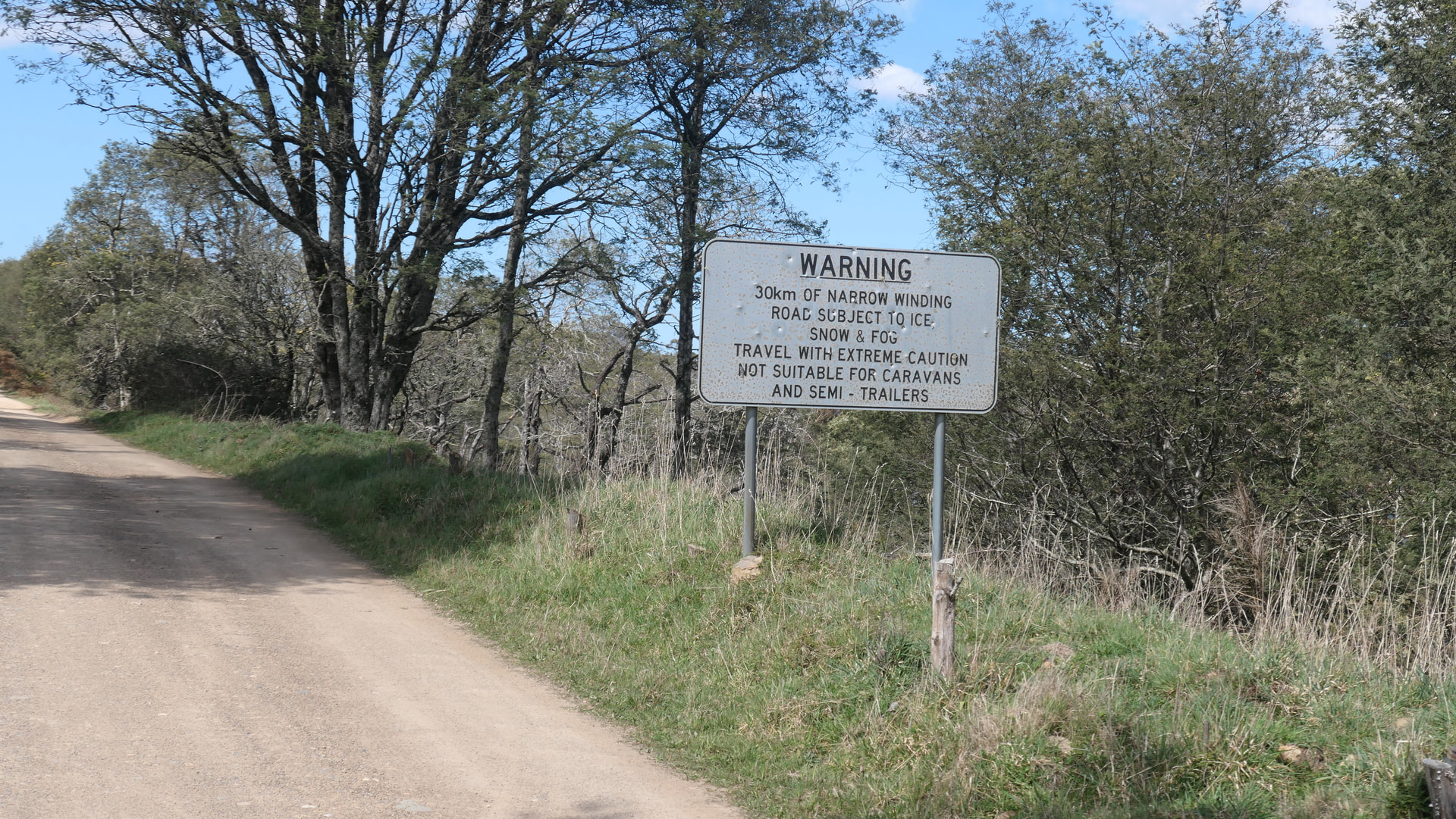
The dirt road between Matlock and Mt Selma is narrow, has many tight corners, and is littered with potholes. Although there was no ice, snow or fog, a slow speed was required to maintain control and avoid vehicle damage. The trip from Mt Matlock to Mt Selma is about 32 km and took about 2 1/2 hours to complete.
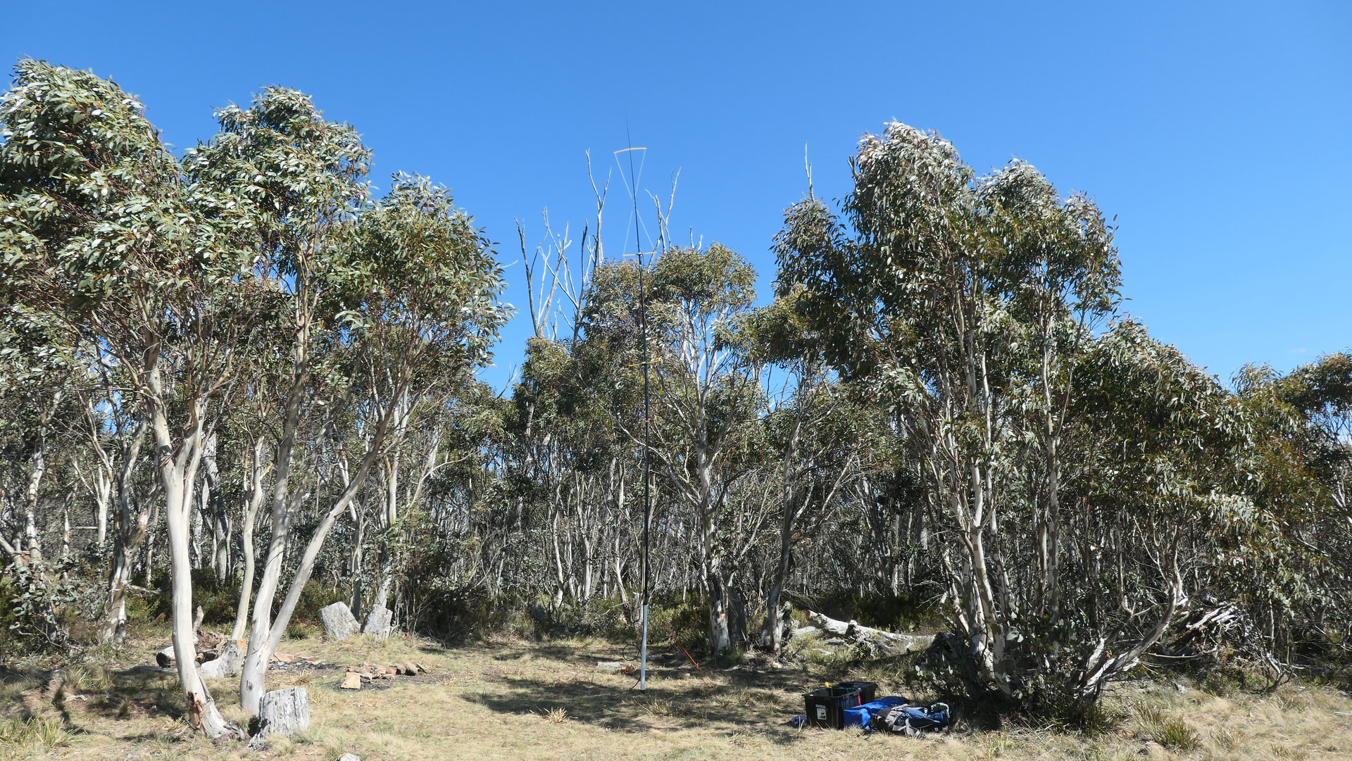
At Mt Selma the wind was strong and, despite sheltering in the trees, conditions were not comfortable and I spent most of the activation wearing headphones.
I kept the second to last section of the pole down to minimise the movement of the antenna, https://youtu.be/s02DFNTykvU, although there was noticeable QSB on most signals as the antenna moved about in the wind.

My first QSO was again S2S with Peter @VK3PF who was activating VK3/VT-016, Mt Useful, about 10 km away. Peter packed up shortly after our QSO and later arrived at my summit as I was about to close down.
I logged 17 QSOs on 2m SSB, including three contest stations, and a second S2S QSO with @VK2HRX, who had moved to VK3/VS-015, about 292 km away. As was the case at Mt Matlock, my closest and furthest QSOs were both S2S contacts.
Peter @VK3PF helped me pack up, showed me some of his antennas including his single hourglass antenna that he set up in exactly the same place I had been operating from. I left Mt Selma at about 3:00 pm heading for my next summit VK3/VT-030, Mt Lookout, about 20 km away.
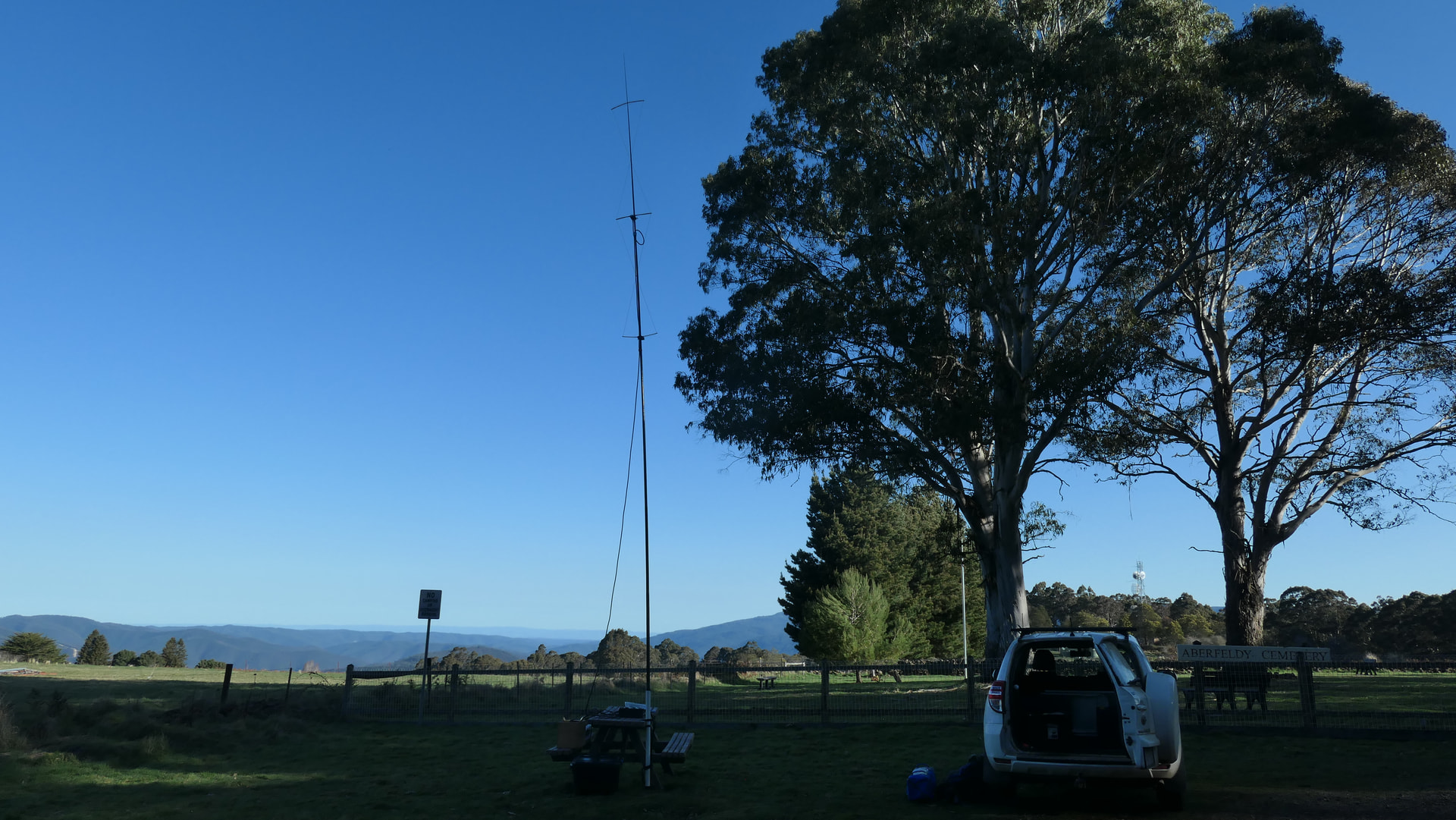
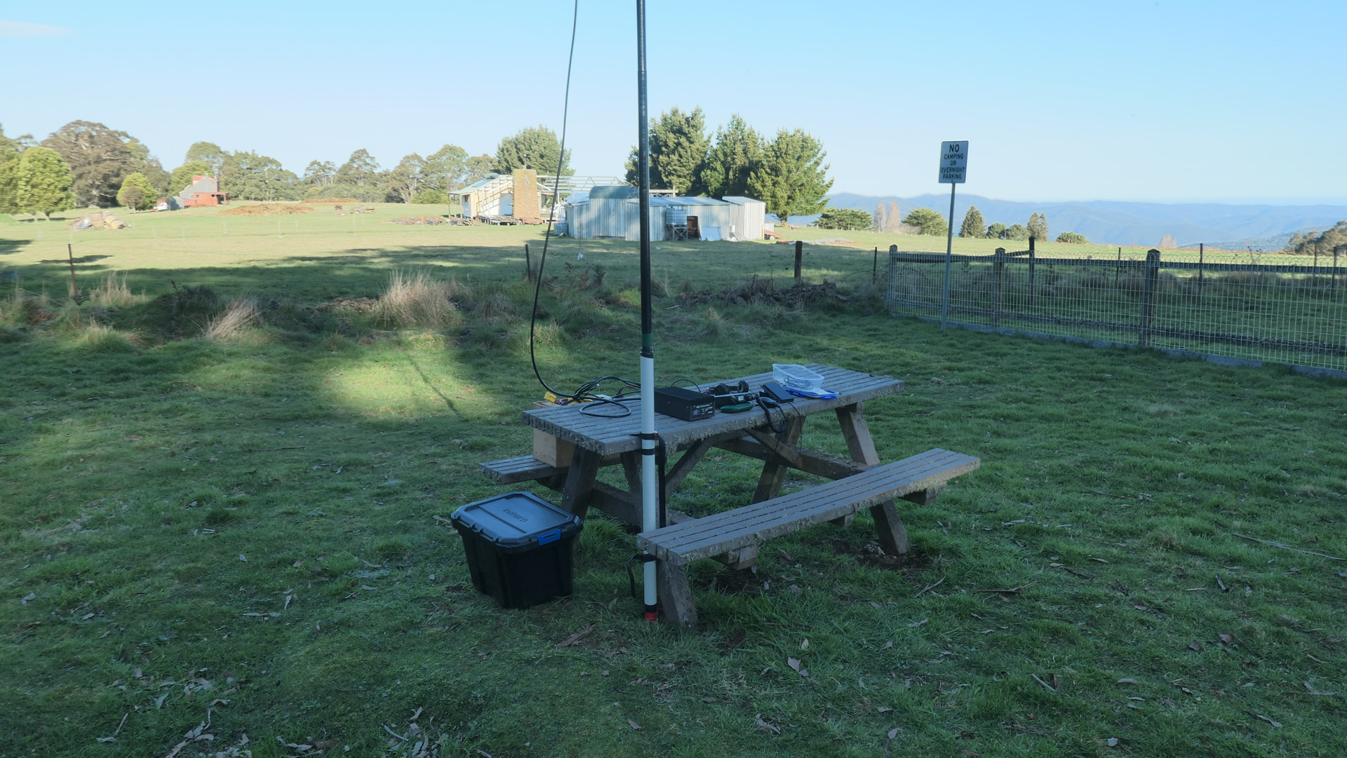
The drive to Mt Lookout was again on bumpy potholed, dirt roads and I arrived at the summit about 3:40 pm. Mt Lookout is on a relatively flat hilltop and can be activated from a picnic area, located in front of the Aberfeldy Cemetery.

This was my second activation of Mt Lookout, with the first one being in 2024 as part of the 10m SOTA challenge. I attached the 9-metre pole to the picnic table and made myself comfortable. The surrounding trees did a good job shielding me and my antenna from the wind. I struggled to get QSOs at this summit as, although it is 1115m ASL, it has much taller mountains around it that block VHF signals to the west and the north. Notably this was the only summit in this trip that I wasn’t able to contact both Geoff @VK3SQ located 140 km north of the summit, and Tony @VK3CAT located 130 km to the west.

The most distant QSO was with @VK7DW 419 km south in Tasmania, and the closest QSO was S2S with @VK3PF who had now moved to VK3/VT-022, Conners Plain, 19 km away. After 45 minutes I had logged nine QSOs, including one contest station.
At about 5:00 pm I packed up and headed home, looking back on the 47 QSOs I had made and considering what to do on Sunday. I arrived home just after 8:00 pm having covered about 370 km for the day.

On Sunday morning I thought an unplanned activation somewhere near home may be a good way to further build up my score for the 2m/70cm challenge. The closest summit to home is an unnamed summit, VK3/VC-037, located about 40 km by road. Although I had already activated this summit twice this year, I was keen to work some of the contest stations who were not normally on 2m on the weekends.


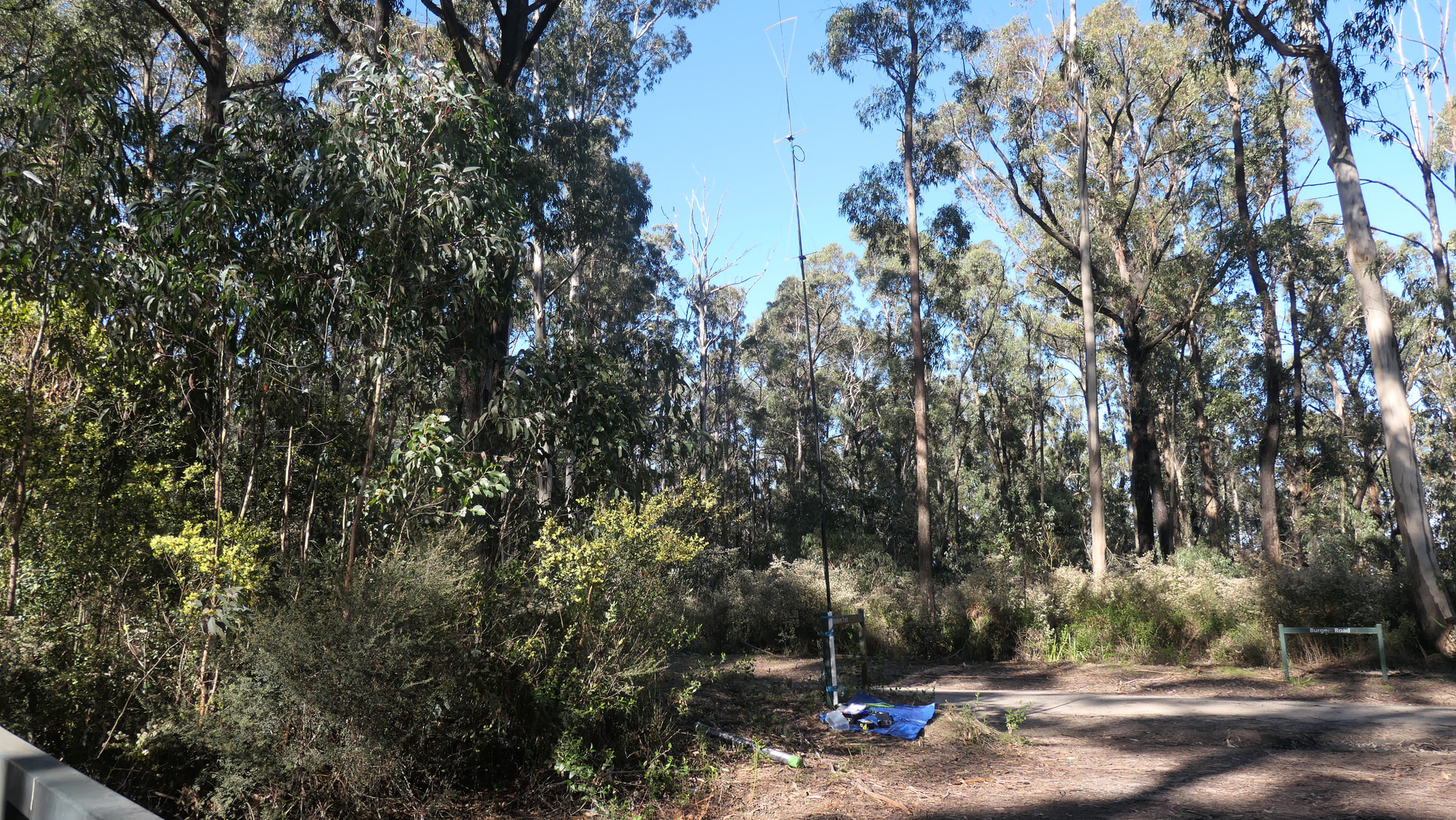
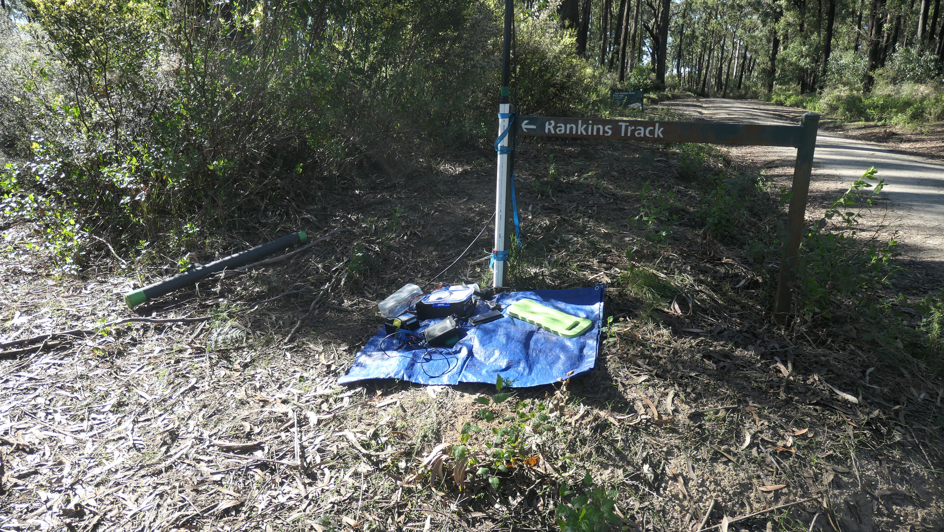
Arriving at VK3/VC-037 at 7:40 am I set up the double hourglass on the 9m pole, anchoring it to a convenient post.
I was on air at 8:00 am, 2200 UTC, and logged 24 QSOs in just over one hour, between 35 and 250 km away. Unfortunately, there was no S2S QSOs from this summit, but I did log @VK3PF who was back home.

The double hourglass performed well at all locations, although the wind loading at the first two summits was a concern.
At each summit I was using FT817ND and a 1980s style linear amplifier giving me about 40 Watts to the coax.
The four-summit weekend yielded 71 2m SSB QSOs.

7 Likes

Peter, again another entertaining report about your contest weekend and the performance of the DHA (double hourglass antenna).

Did you observe any differences in the SWR depending either on the location (summit) or the positioning of the coax feedline in relation to the pole/antenna?

73, Peter

1 Like

Interesting question. I don’t normally use an SWR meter when portable, relying only on the built in one on the FT817ND. The 1980s era linear amplifier I use has a very basic power meter that strangely shows higher deflection when the SWR is higher - which is abnormal behaviour for an output power indicator.
At the third summit on Saturday, VK3/VT-030, Mt Lookout, I was careless when placing the strain relief loop at the top of the coax. Normally I position the loop at right angles to the antenna wire but, at the initial set up, I had it close to the wire in the lower element. The closeness of the loop caused higher deflection of the power meter in the amplifier. I repositioned the strain loop and all was normal again.

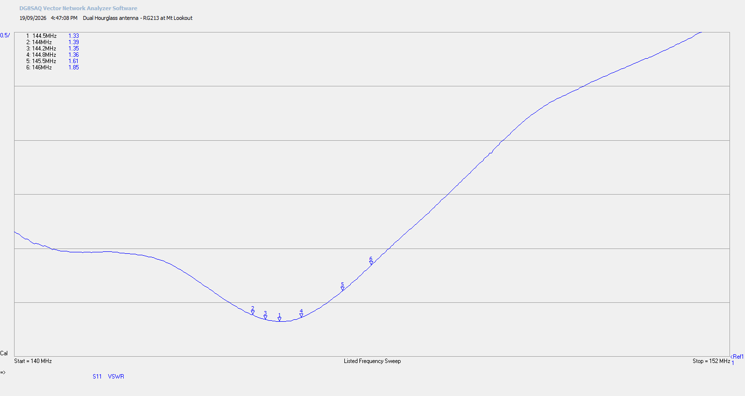
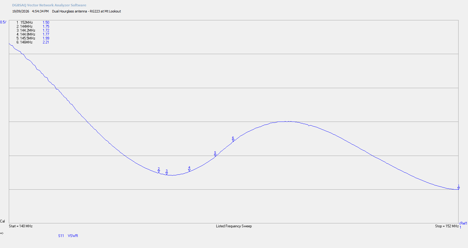
Before packing up at Mt Lookout, I did two SWR sweeps of the antenna. One with the RG213 coax, and one with my normal RG223 coax. The SWR results are not ideal, but still very workable.


2 Likes

Re the impedance mismatch due to coax placement.

Power metering is an indication of the incident voltage as measured at the rig or amplifier. If the impedance at the rig is higher than usual due to a mismatch at the antenna end of the line, the same power can cause a higher voltage reading. Conversely if the impedance is lower than usual, the power metering is lower than usual. The incident impedance is subject to the length of the line in wavelengths so a higher than normal swr at the feedpoint can result in a higher or lower impedance at the radio end of the line. The impedance on the line varies, repeating the same value at every half wavelength.

I just use the power metering setting on the 857 and 817 because I take that factor into account and that saves me from monitoring the swr. If the indicated power is higher or lower than usual, I know something is wrong with the antenna system.

73 Andrew VK1DA/VK2DA

2 Likes

Any power meter (or even circuit inside a rig) than you or I could afford isn’t a power meter at all. It’s an RF “VOLTMETER”, calibrated to pretend that it is a wattmeter. What does that mean? It means that the whole “Ohms Law” equation is factored into what the scale reads. Load ain’t 50 Ohms exactly? Then reading ain’t accurate! The Bird 43 manual goes into a bit of detail about just how “off” you can expect the reading to be. So the behavior of your so-called “power indication” is both expected and explainable.

3 Likes