If you can embrace the peat, you’ll like this, if not then pick an alternative
Tuesday 28th September 1400z
I set off from the side of The Lecht ski area, not at the road summit area, but around 1km to the south, marked 644m spot height on the 1:50,000 OS map. Leaving from the ski car park would have been shorter but steeper, and I fancied using the Land Rover track that headed up the hill from my chosen spot. Temperature was around 13 degrees celcius, with a stiff SW gusty breeze.
The track soon became single track path and this came to a peat hag which led to short grassy slopes over the first top of the day - Meikle Corr Raibhach. I’d planned on following a series of tops around to Carn Mor, around 7km one way. However, looking over to the next top (747m on the map) I could see it was defended by row upon row of peat hags. I chose to take a line along its eastern side. This was pathless, a bit heathery in places, but overall not too bad going on sheep tracks.
Meikle Corr Raibhach
Peat hag barrier
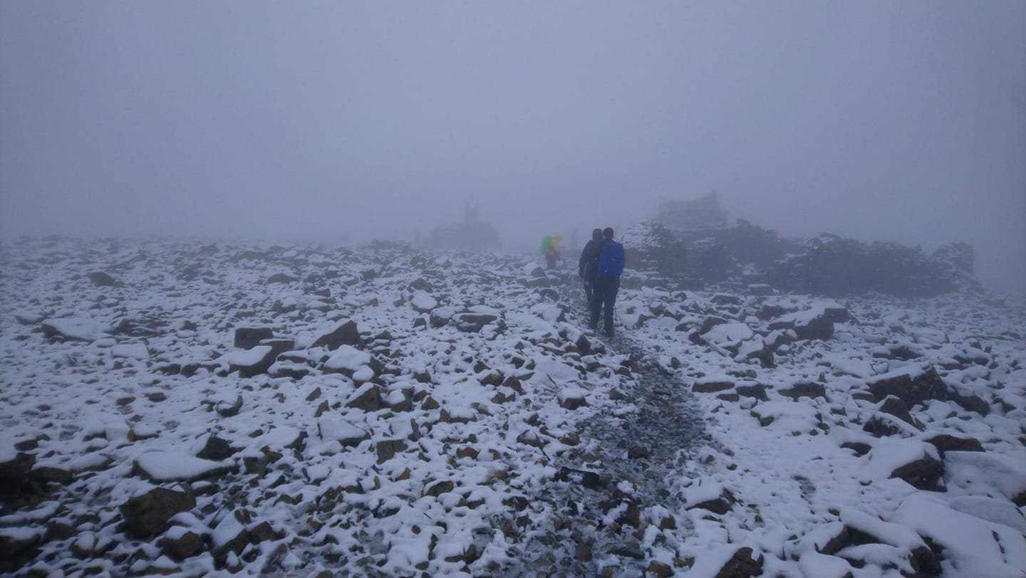
On crossing a mossy burn, I ascended springy mossy slopes, arriving at the top of the next bump, Meikle Corr Riabhach (779m) to find a fenceline and a flat summit area riven with peat hags, unavoidable this time.
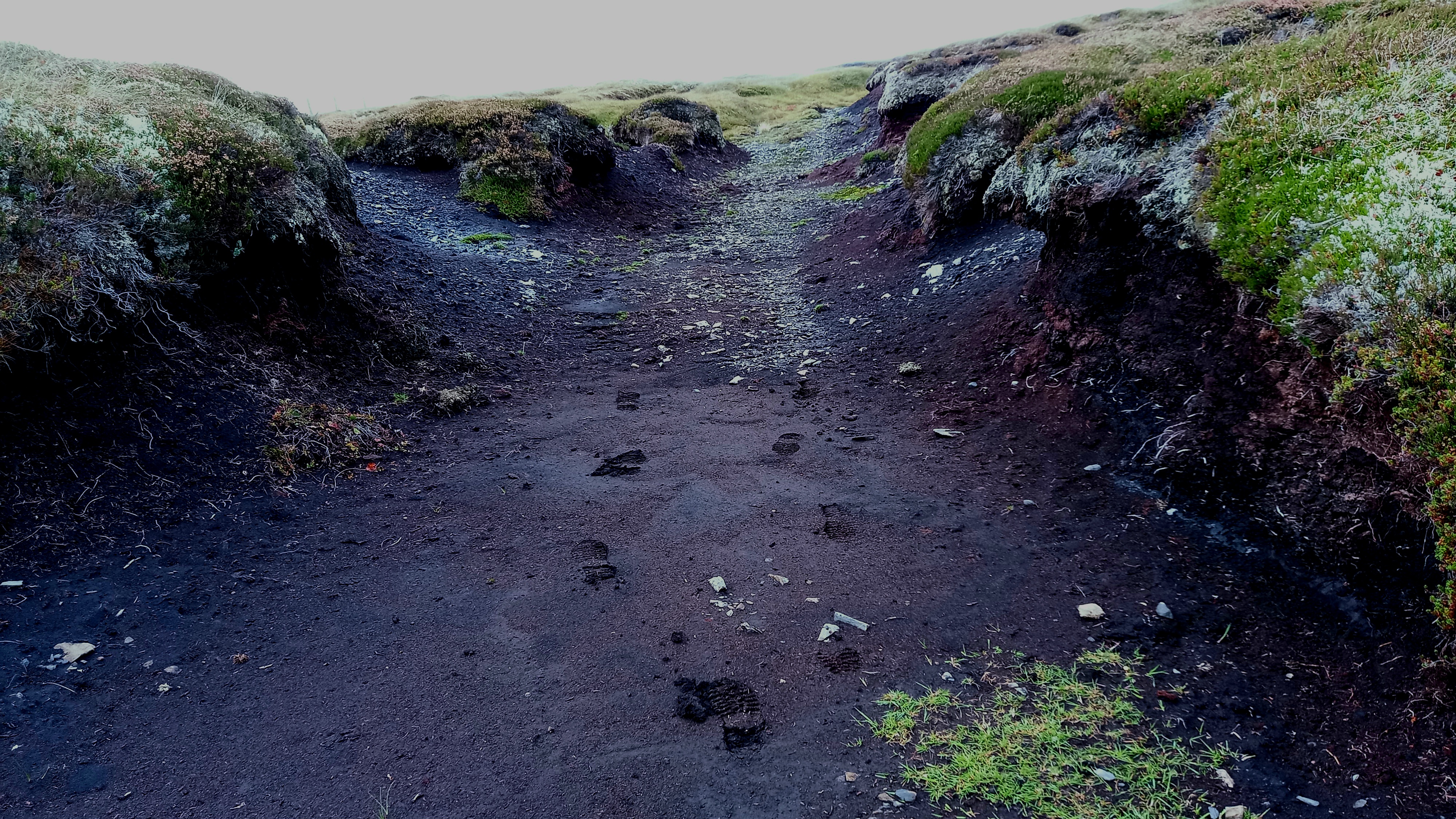
Peat hag motorway
Eventually I reached a gate and on the other side, a better track. At a cairn, the fence kicked out west and I could finally see Carn Mor, although Monadh an t-Sluich Leith (800m) barred the way. Descending easy slopes from the cairn to a bealach (col) led to a wide peat hag followed by another spongy and grassy climb. Thankfully a narrow track skirted around the west side of this top and I soon reached a final wide col. A wider stony path led from here up to Carn Mor.
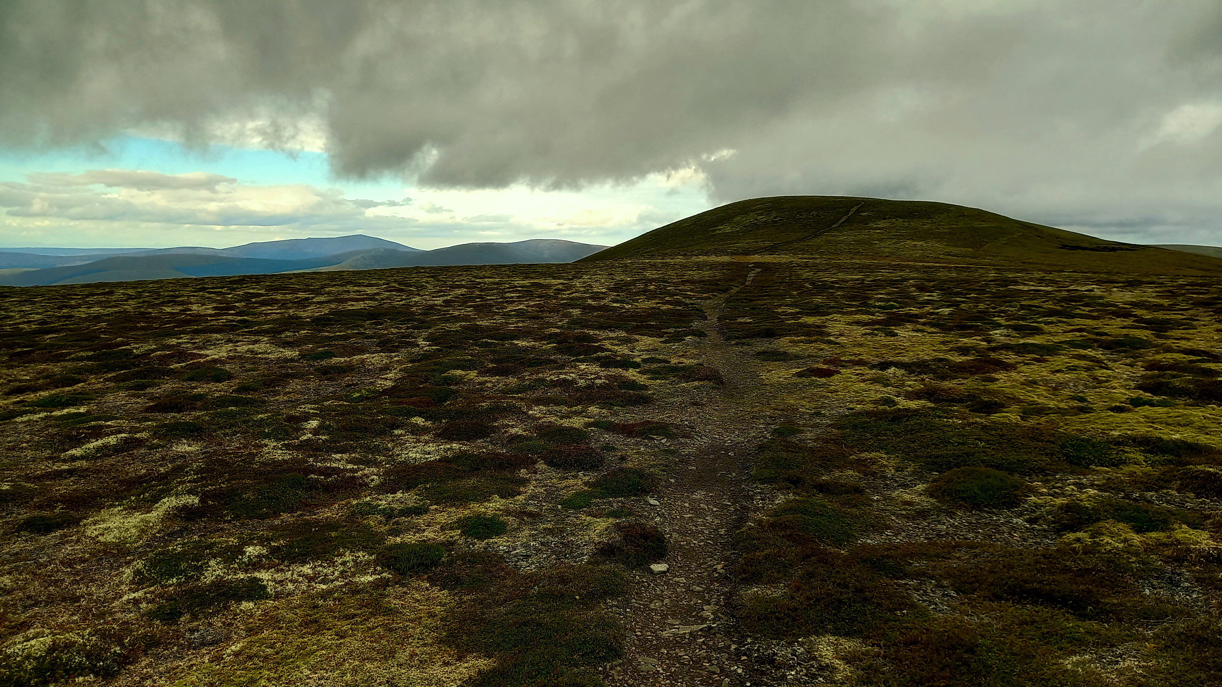
final summit path
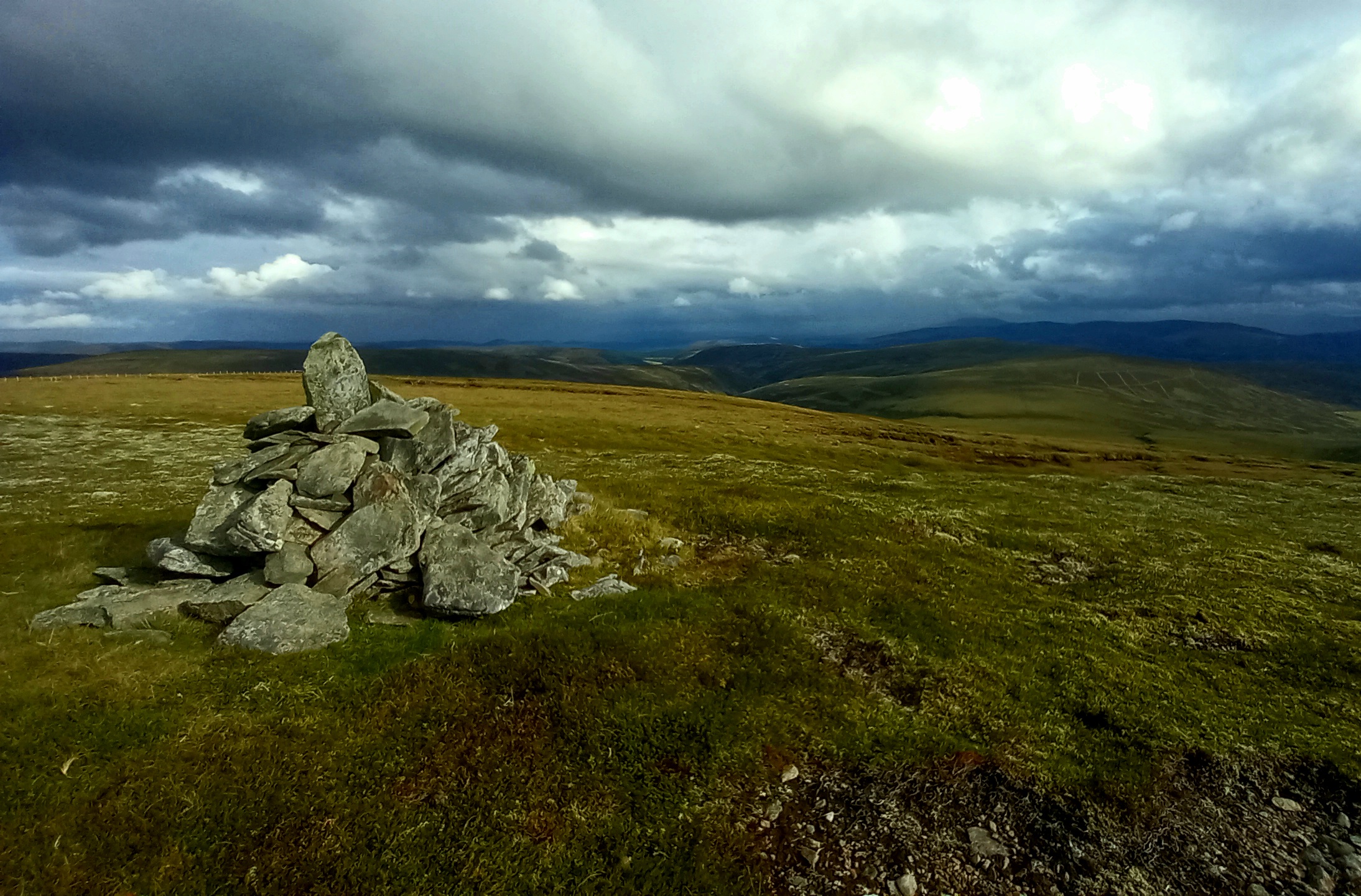
Carn Mor has no shelter. It has a Trig point. It is actually well located (in the centre of no where in particular) and thus has great views all round. 4G was good on the O2 network. The wind was getting up and the forecasted 10% chance of rain showers decided cash in its chips.
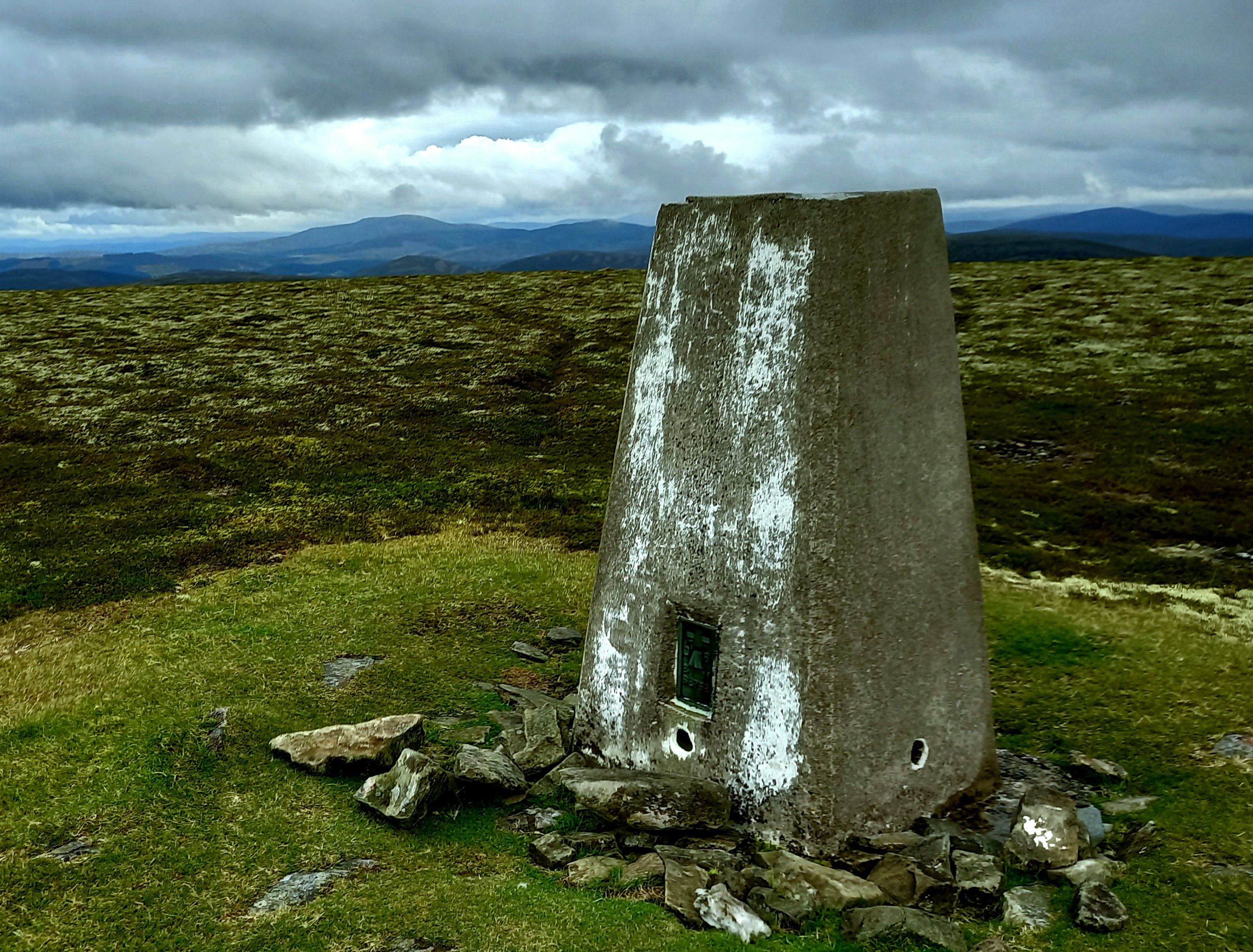
Carn Mor summit, with my local summit Morven GM/ES-018 in the background
Activating GM/ES-029
I’d brought the KX2 radio and two aerials - a W3EDP and a 40m/20m inverted V. despite the well located trig point, I was going to have to guy the mast, having forgotten to pack anything to strap it to the trig point. I went with the W3EDP, strung out along a west-east line. I considered hauling out the bothy bag, but in the end managed to get some shelter from the trig point plus my rucksack, having layered up my clothing beforehand. It was now 9 degrees celcius, probably 4 degrees with windchill.
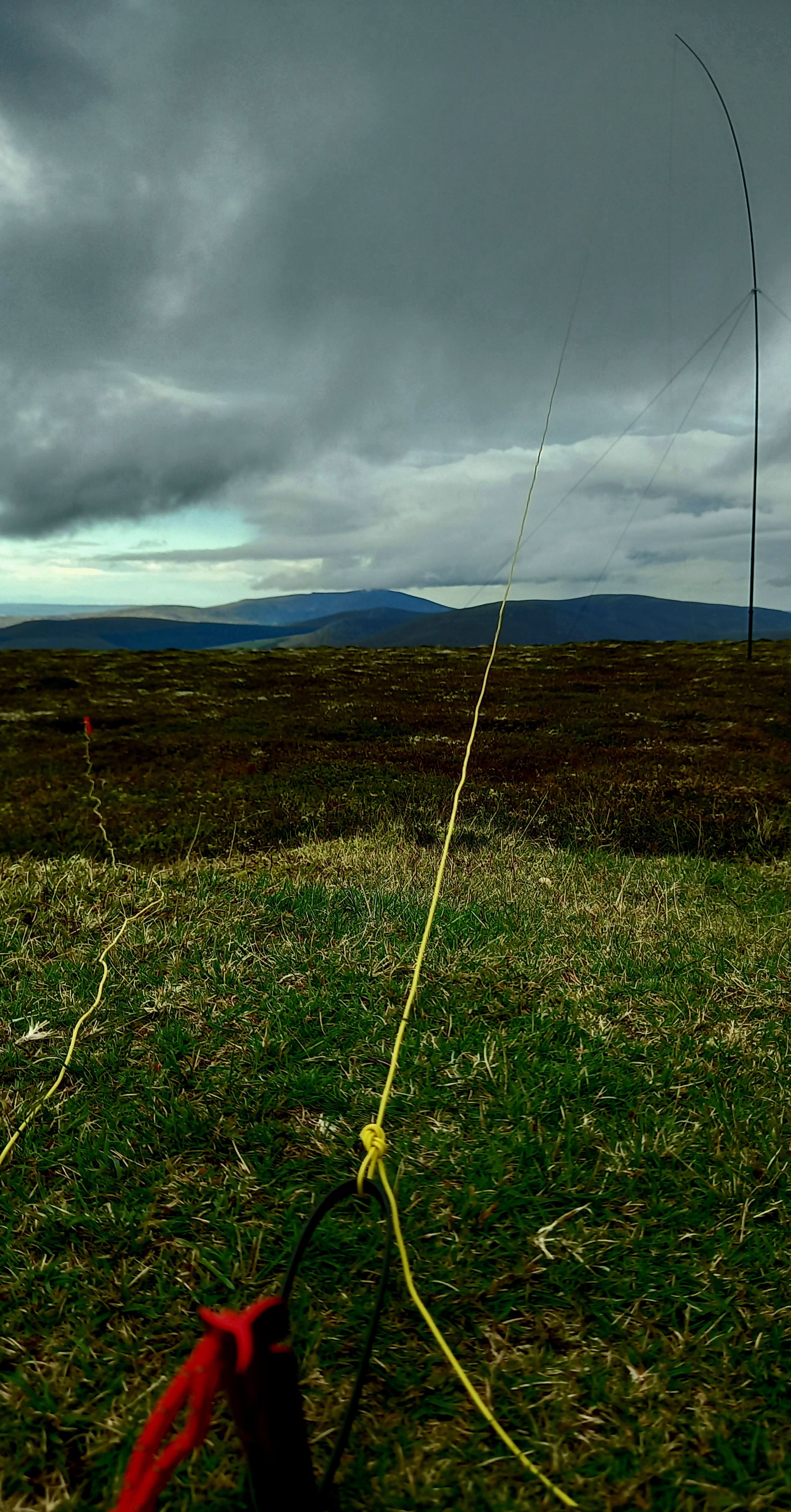
W3EDP
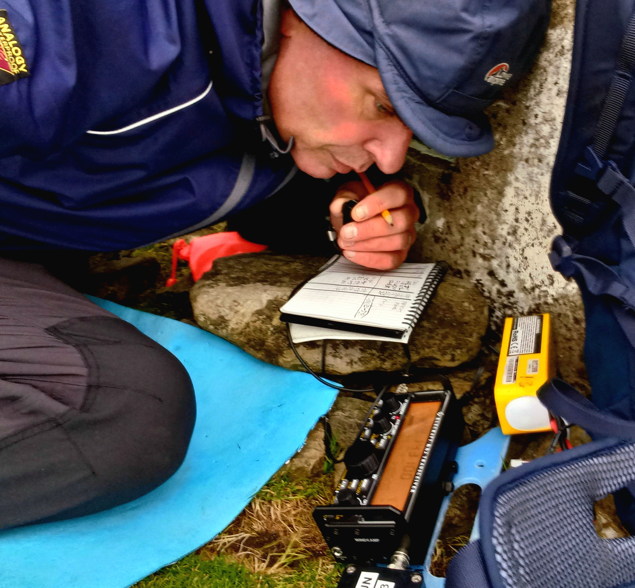
The MM0EFI office
1545-1554 20m SSB bought in F4WBN, OK2PDT, SV1RVJ & OM1AX and then it dried up. Tuning up to 15m I heard several stations, so took a punt and re-spotted myself. The only station to answer my CQ was John MM0WIV, who was up at a campsite at Rosemarkie near Inverness. Probably line-of-sight. John was using a Super Antenna MP-1 antenna. Fun time over, I retuned to 40m. The band was (as expected) very noise, with both S5 background noise and QRM. Spinning up the dial, I found a slot at 7.183MHz and spotted.
1606-1615 40m SSB. there was a shorter hop than of recent times, which was great. I worked some UK chasers I’d not heard for a few weeks. I worked 14 stations - SA4BLM, S57S, G4WTF, ON3UA, GI0AZB, 2E0AGB, M6VWX, GI0AZA, ON4VT, G0HIO, DL6MST, G0FVH and finally Don G0RQL. The usual suspects, but some new ones as well. Great to work GI on 40m, needing a really short skip for that!
I was packed up and away from the summit at 1630z, half-an-hour before my planned “latest time for a safe exit”. The weather system had passed over and it brightened up a little. I followed the same route back to the car, enjoying the late evening skies to the west and east.
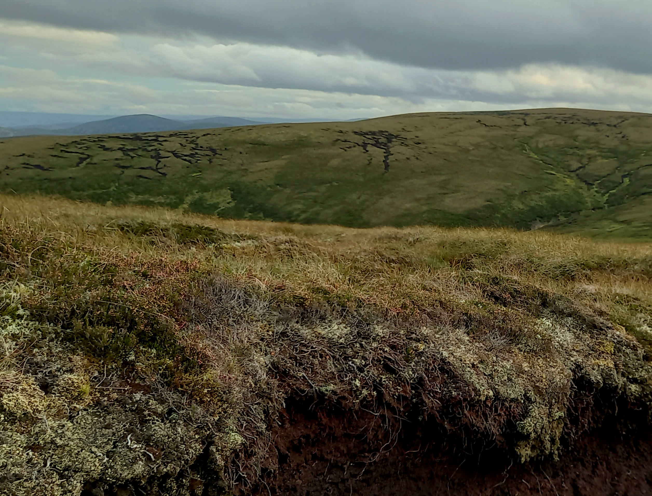
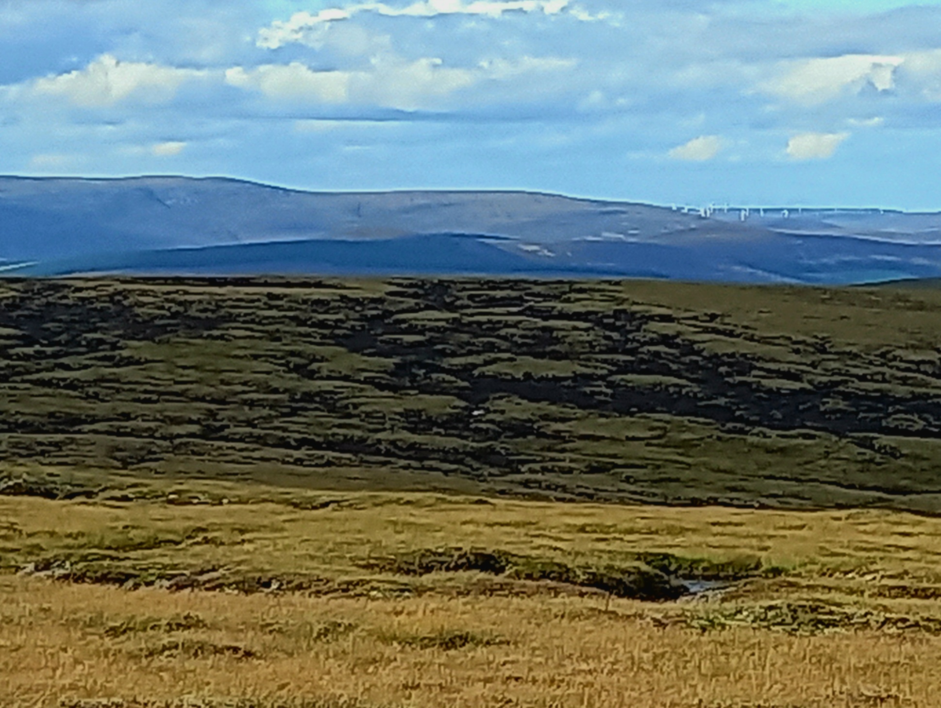
Scarred hillsides
SUMMARY
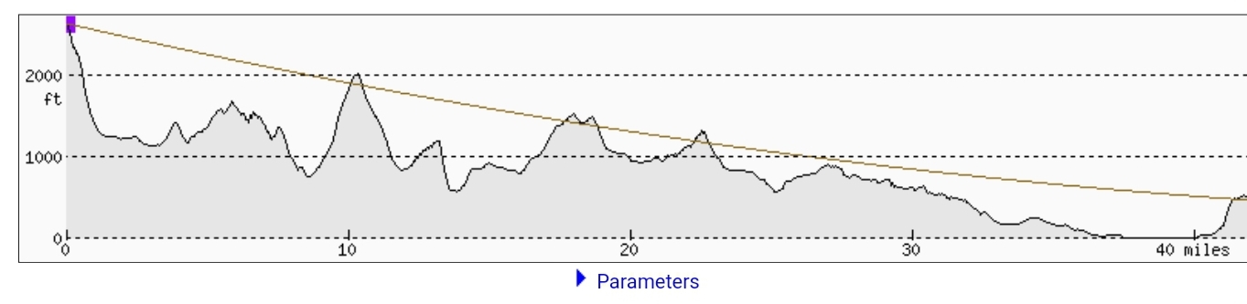
Ascent - 90 minutes
Summit Time - 60 minutes
Descent time - 90 minutes
Total Ascent - 452m, 1483’
Total distance - 14.8km, 9.5 miles
Route - there are easier ways up Carn Mor. I chose this route because I fancied the climb from the Lecht and didn’t want to drive a further 20 minutes to Chapeltown, where the shorter northern route starts. the hags weren’t too wet, despite heavy rain the day before, however I think this way would be wet throughout in winter, so probably best avoided unless under a firm covering of snow.
As for timing, well the nights are drawing in. It was dusk when I made it back to the car, so not much margin for error. I was glad I didn’t use the extra half hour and push it to the limit, given the terrain.
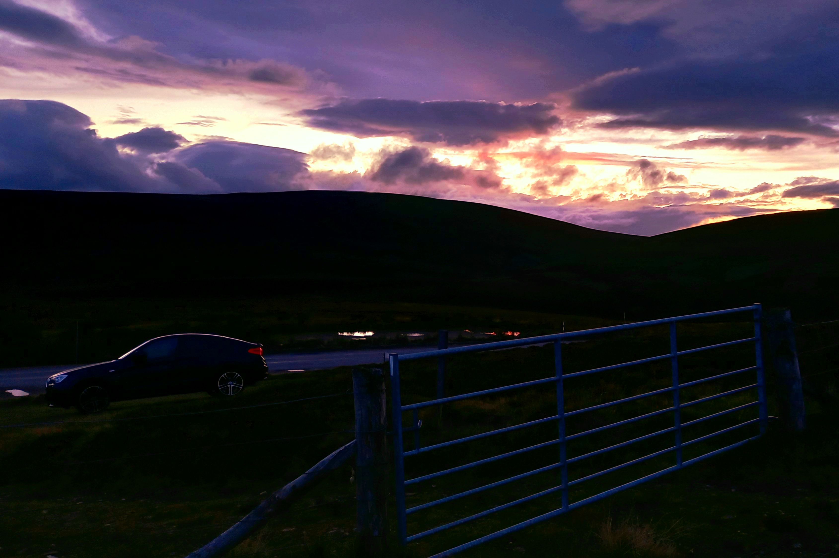
Arriving back at the car
Thanks for reading! 73
Fraser