My old trusty ViewRanger gps app has been sunsetted. I would appreciate recommendations for easy-to-use android GPS app that provides free download of topo maps and tracking as you hike.
Thanks & 73,
Barry N1EU
My old trusty ViewRanger gps app has been sunsetted. I would appreciate recommendations for easy-to-use android GPS app that provides free download of topo maps and tracking as you hike.
Thanks & 73,
Barry N1EU
HI Barry
Viewranger finished over a year ago, what a pity, it was brilliant. Outdoor Active was given to UK Viewranger users as VW sold out to them. In my opinion, it is next to useless and lacks much of what Viewranger provided.
On a Smartphone I now use Locus 4 Premium Lo Mapping with server support for EU travel outside UK (Walking holidays, motoring and SOTA hiking). In UK I use an app called Topo GPS - no server support on that one. Provides UK OS 25K maps. For planning on PC in UK as Topo GPS does not have server support, I use Memory Map with UK OS maps in 25k and 50k scales. I’ve used that program since 2006.
All three programmes are paid for on an annual licence basis, but Locus 4 has a free version available with limited functions.
There are plenty other mapping apps available, I’m sure you will get lots of other suggestions, but there is nothing that compares with Viewranger I believe.
73 Phil G4OBK
Hi Barry
I use Oruxmaps, it fits all my need, its free, but you may donate something if youare happy with the app.
73 de hb9fvk (ruedi)
I use Memory Map exclusively. The new Memory Map for All app works across all platforms, so it is easy to draw a route using your PC and then sync it to your phone via their server.
I use a garmin gps 66i as well. This means downloading garmin connect and garmin explore apps to your phone. Routes can be drawn on the phone and will sync. to the gps, which has detailed UK OS maps on it. The reason I mention this - we’re just back from Tenerife and I found the garmin topo maps on my phone had enough detail to use on the hills we climbed, showing all of the trails we needed. Be aware that the maps do not show enough detail for serious mountain use, eg crags, scree, trees, ground type etc.
mapy.cz
I have used the Locus app for SOTA activations in France. It has contour lines and this was useful for checking I’m inside the AZ. But the mapping is OSM so the accuracy is not always perfect - I’ve found paths marked on the map which did not exist on the ground.
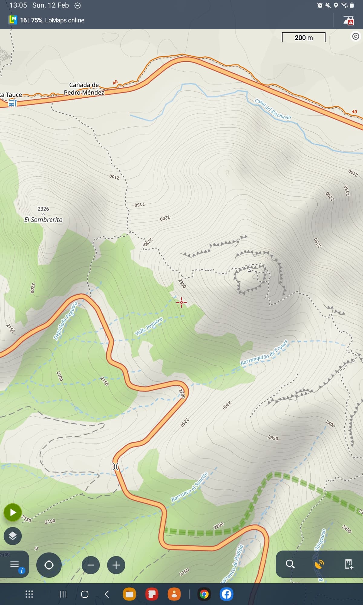
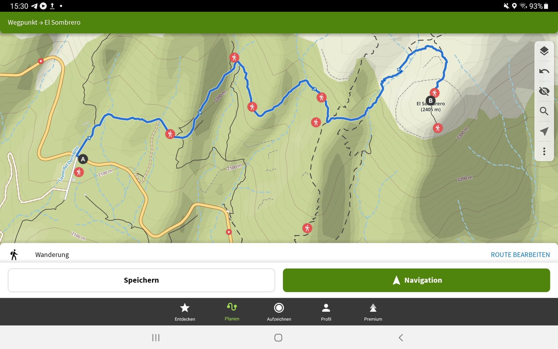
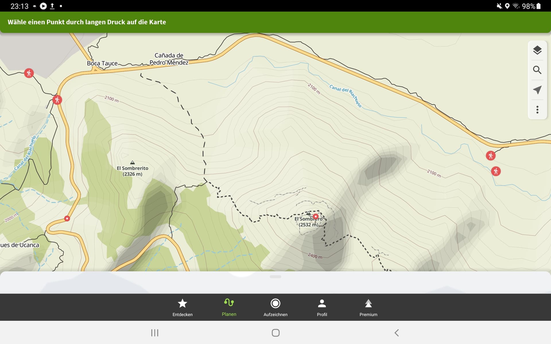
Here is a screenshot of EA8/TF-004 which Fraser activated recently. It shows the paths he used and that the summit is surrounded by cliffs but that is about all.
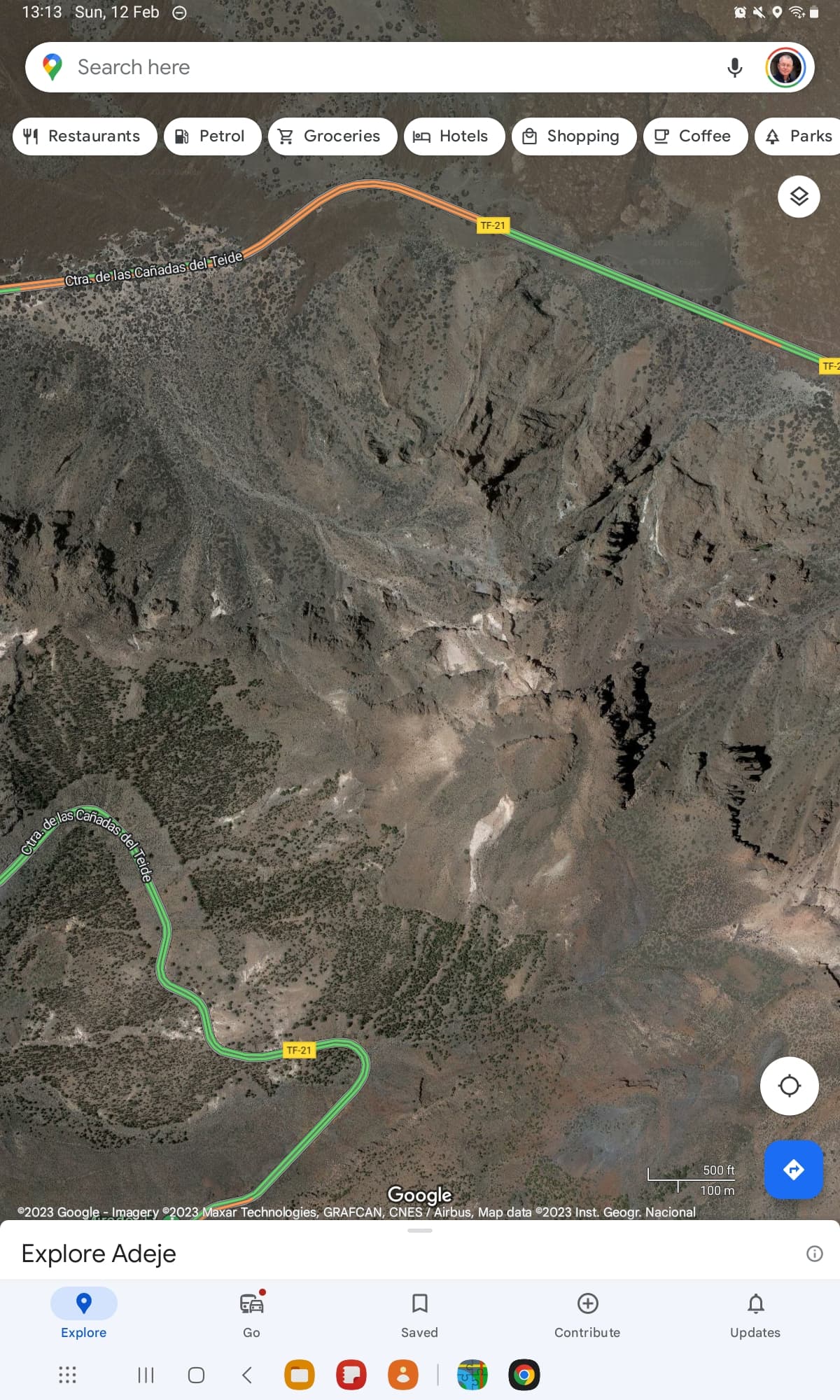
But sometimes a satellite view can be revealing. This is the same place on Google Maps which gives a better idea of the going.
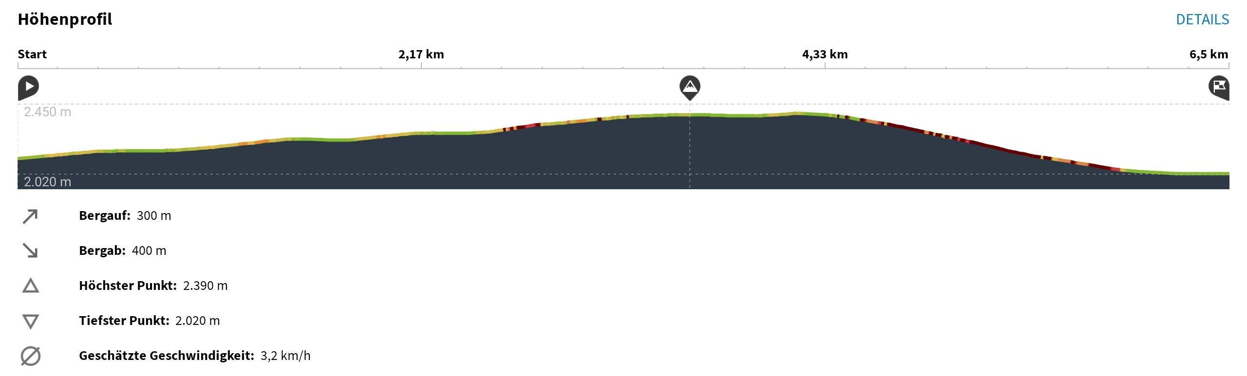
I was caught out in Scotland a couple of years ago when the OS map app when viewed at 1:50K scale suggested the ground would be fairly level but on 1:25K the story was very different - the ground was a maze of hummocks. Of course I only discovered this after having to negotiate a way around them on the way to the summit. ![]()
Let’s give a try to my favorite KOMOOT www.komoot.com ? Not free, but accurate and trustful.
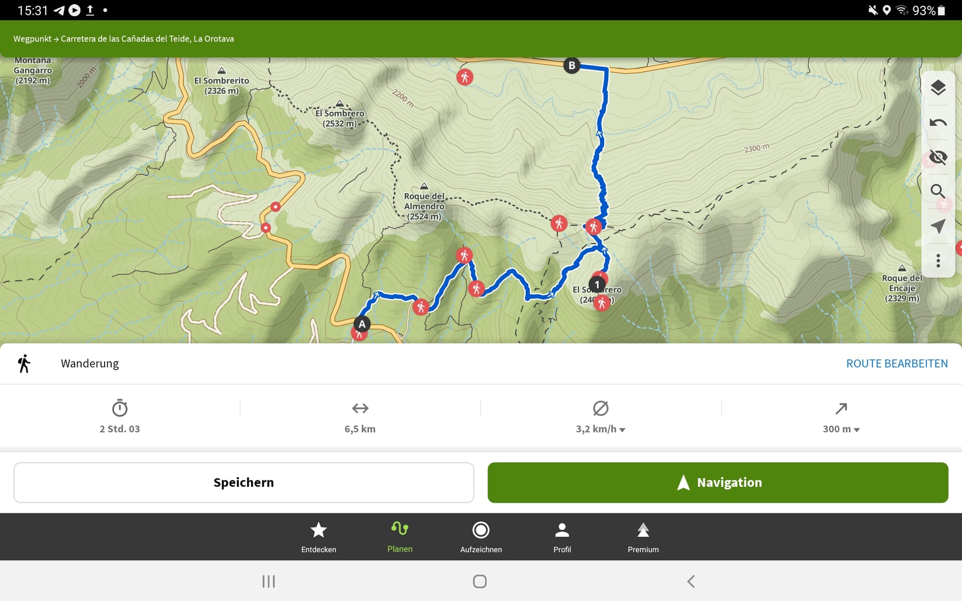
See the tour of Fraser to the Sombrero.
73 Chris
I have used Oruxmaps for the past few years and have been very satisfied but recently I won’t download Open Topo for me so I have just started to experiment with Fatmap. So far, it seems to be a winner and I suspect I will become my app of choice.
Take a look at Gaia, It also has all the back roads, trails and lots of ATV trails in it. You can track your progress with it, download, etc.
I use Maverick. It loads and caches OS maps for the UK, the OSM bike hike maps plus others.
I paid the £5 to get the pro version because there were a couple of features I wanted that were limited in the lite edition.
Unfortunately it seems to have been abandoned and there havent been any updates for years which is good and bad: theres a couple of odd quirks that need improving, but it’s not getting bloated with new features or bugs.
Gaia looks good but they want $40/year for most features, including offline navigating. But it looks really good,
It’s $40 well spent. I’ve had Gaia for a couple of years now. Just off the top of my head, I think there’s something like 250 map layers one could use. Plan your route and then sync up with whatever device you’re using. I run an Android cell and in the Taco I have an Android tablet. And my kids run IPhones (you can have up to 5 devices I believe). Another app I see quite often while out and about is Onyx - mainly used by the hunters I come across. Onyx will also give land owners name and contact info as well. All the hikers and offroaders (new term: Overlanders, ??) I come across are running Gaia. I quite often see up to 50 percent discounts for Gaia so maybe iffen you search around you can snag it for a bit less. I think I paid $39 on my last renewal…
73, Todd KH2TJ
Hi Chris, Wrong El Sombrero. There are many. We climbed the higher one further left. Also, the screenshots in my report were from Strava. ![]()
From what Fraser said I’m giving the Memory Map For All app with UK OS mapping a try at no cost to me. I can access the licenced OS Memory Maps I bought on DVD from 2015 via their web server. I left it downloading overnight and imported all 25K UK OS on my backup phone SD card so it can be used offline without a phone signal being needed. It looks far better than their clunky MM app they gave away before, however on PC for planning, I prefer Memory Map Navigator having used that since I stated doing SOTA in 2005/6 era.
The Topo GPS app I have on subscription for a year runs out on March 3rd, so if I find MM for All does the job it could save me about €30.
Thanks for the tip Fraser @mm0efi MM for All looks like its worth trying out.
73 Phil
I have to put in a plug for CalTopo, which I find is the most useful tool in route planning for SOTA and other backcountry adventures (but it is NA-centric). I view the mobile app as an extension/companion to the web interface where you will do most of your planning. You will need a $20/year subscription for the ability to download layers to your mobile device, but you can give it a test drive with a free account which will give you access to most of it’s great features. You might want to join us on Wednesday evening (Feb 15th) for my final CalTopo class where we will be looking at the use of the mobile app.
73, pat - ww4d
+1 for Komoot. I used Back country navigator for years as it downloaded the OS Maps the the edition I use is no longer available. Komoot is much better for recording routes as well.
Alex
I’ve been using Oruxmaps for years for lightweight navigation on a small old Android phone for navigating. Normally this is in good weather such as the FN rally in June or Winter Sun holidays (Canaries etc.). I have the app and routes on my main phone but that stays in my bag when walking, hence the old phone being pressed into use. It’s expendable. I use it with OSM based maps which have always seemed “good enough” with GPX downloaded from SOTA maps etc. or other internet sources. I simply look at the map and location cursor and wander about. I have never tried any turn-by-turn navigation. There are plenty of different themes available so you can set it up for road/city navigation with street names and shops/hotels or for hiking/biking with more of off-road info. I think it works with Mapforge format maps that also work with Garmin Basecamp on a Windows 10 tablet.
All of these are only as good as the maps and it has always worked for me when out of the UK. In the UK I have a proper GPS and more accurate 1:25k paid-for mapping data. The free maps are remarkably good when I have used them in France, Switzerland, Canaries, Czech Rep, Poland, Germany, Holland, Belgium etc. But again, it’s on relatively simple hikes, the I’ve no info on the OSM accuracy on serious Alpine type terrain.
I don’t like change, so I have been using an old version of Orux rather than updating as I didn’t like the UI changes. I have the APK file so I can install it on any Android device. One thing to be aware of is Android 14 is changing what APKs you can install… effectively it is not going to allow old apps, such as my Orux APK, to install, only recent apps will be allowed. This is stop people installing old apps full of security holes. A fine intention but if you use an old app that has not been updated for years then it may not (propabably will not) install on Android 14 onwards. Bit of a bummer.
In the UK I use a proper drop-proof, water-proof, works with gloves Garmin GPS (Etrex Vista HCx). I bought a second hand one as a back up for pennies that came with an SDcard containing a hookey version of some proper maps ![]()
Seeing as no one has mentioned it, I use GPX viewer pro. The best value for money fiver I’ve spent. With the pro version, you can download topo maps for offline use.
A while ago there was an app on the Android store call MMTracker. This was an offline version of Memory Map app which supported the loading of memory map OS maps in QCT format.
I then use the Sotlas tracks(GPX) and import into Memory Map for offline tracks. While the maps are a little out of date the hills and main roads haven’t moved in the last few years.