A Winter Kakanui Traverse?
The dream
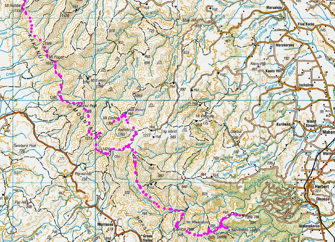
I’ve long dreamed of traversing the Kakanui Tops over winter. A long rolling ridgeline of golden tussock interspersed with brief conical peaks, climbing to 1600m above sea level. Work trips have taken me to their tops in summer. But in winter I sit in my shack and stare at their ice-coated tops that frame the horizon. I dream of striding along that white-clad ridgeline beneath a bluebird winter sky, crampons crunching into deep smooth snow, the kilometers flowing by as the distant features of the plains 1000m below change and ebb slowly past.
The last major snowfall was over 3 weeks ago as I sit and plan this trip, the ridgeline ice-clad and glistening from my window. The snow-line lying at around 1000m – the main peaks covered but the valleys and saddles clear. The exact conditions I’ve been waiting for the several years, and 1 week of leave booked and up my sleeve.
The reality
A narrow front stalls over coastal Otago on Sunday, closing roads and postponing the trip by a day. Rainfall was predicted at just 3-5mm, snow being ten times that. A nice powder coat to make things look pretty, maybe slow progress a little, but not enough to cancel the trip.
Day 1 – Monday
It’s 5pm by the time I turn off the state highway and head up Mt Misery road, sun already set and sky darkening. Radio reports are of up to 80mm of snow, more than forecast, but still manageable. Soon the grey gravel road turns to white snow, well-trodden by ute and tractor tracks. I finally chicken out at the high-point before the descent to Red Hut, 2km from the roadend. I could certainly drive down to the saddle on the compacted snow, but unsure of the substrate beneath the snow, climbing back out later on what’s likely to be freeze-thawed clay could be challenging. So I return 1km to the carpark at the Glencoe Scenic Reserve access and park up.
The walk starts easy, following the tracks of a single ute and tractor along the remainder of the road. Shortly after the private Red Hut, the ute tracks skew and slide off the track into a ditch. A confusion of tractor tracks mark the resulting recovery effort.
Beyond, I walk in pristine white powder snow, past the roadend carpark and up the steep hill towards Mt Miserable. A rough-cut track supposedly descends into the creek, climbing out directly to Kahikatea Lodge, but I take the simpler option and follow the unformed Mt Misery Road along the park boundary to the top of the spur which hosts the hut. Snow is 100mm deep and powder-soft, relatively easy going on the smooth track surface.
Turning off the road-bed to descend to the hut, the easy ride ends. The ridge is knee-deep with rolling tussocks, the 100mm of recently-fallen snow sitting atop them at thigh height. Walking now by torchlight, cold stinging legs above the gaiter-line, I plug through it all, following the ridge as it descends. 200m from the hut the tussock ends at a solid wall of manuka – plastered white with a thick render of snow. Touching any branch results in an avalanche of snow, cascading off all higher branches – mostly down my neck. With just 200m to go, I push on, push in. Each contact with vegetation raises a glistening shower of snow crystals from above, blinding in the torchlight – and I must pause, wait until the cascade clears and visibility returns before making the next move. I’m very conscious of the risk of ‘hut fever’ – just 200m to go, and pushing on only in the knowledge that warmth and shelter lie just ahead. Recall, as always, the couple found dead on the site of the old Waiopehu Hut: pushing on in similar conditions to that known certainty of shelter and safety, only to find the hut gone, the clearing empty. Never depend – always take other shelter.
But thankfully, Kahikatea Lodge soon emerges, present and intact, just 10m away as I exit the bush. It’s so cold that snow-covered clothes are still bone dry, a shake all that is required to rid them of their powder-coat. Soon I’m in warm clothes, the billy boiling and lying cozy in my sleeping bag dreaming over the topomap of the next day’s progress to the Kakanui Conservation Area and over Mt Misery, Conical Peak and Obi.
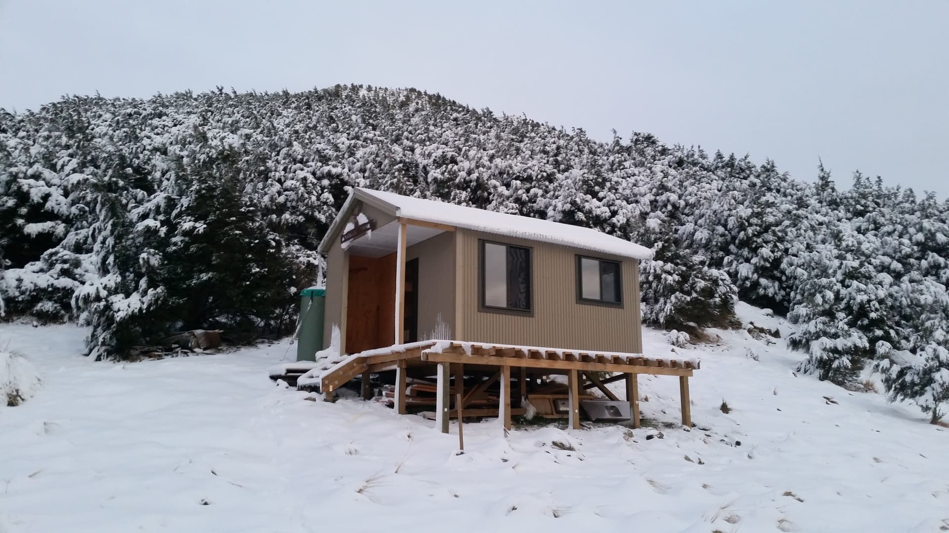
Kahikatea Lodge – ZLH/OT-103
==
Day 2 – Tuesday
I leave the warmth of the hut at 7:30am - soon after first light. I push through the 200m band of bush and ascend back up the steadily climbing ridge of deep snow and tussock. I’d planned on being at Mt Miserable by 9am – 1 hr to climb back to the park boundary, and another 30 minutes to walk the remaining 2km along the bed of Mt Misery Road to the summit.
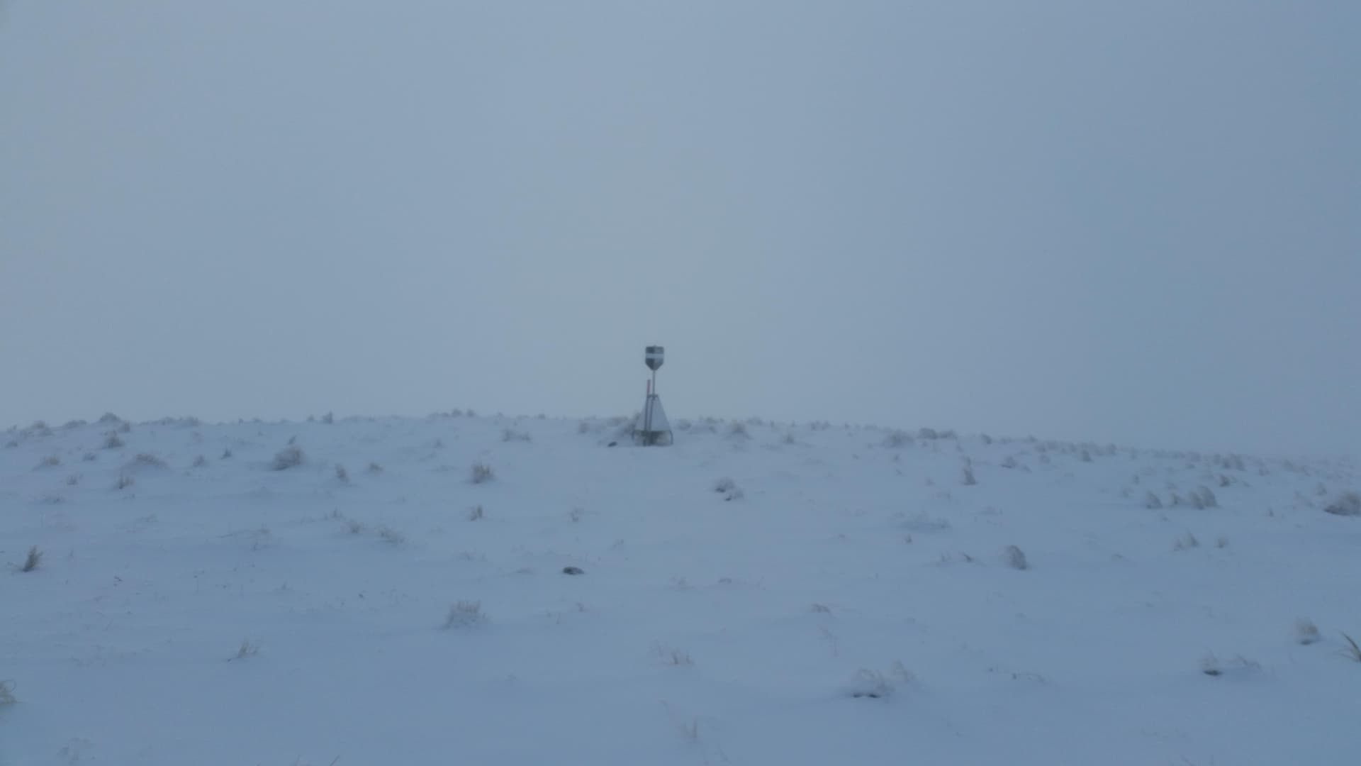
The climb is exhausting and slow through the deep snow and tussock, but once on the farm track the way has been trampled by cattle and progress is easy through the dim grey clag. I’m happy to be on the summit at the end of the marked track at 9:09, taking a quick photo of the trig point before scuttling down into the relative shelter of the south-western flank to activate the peak.
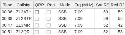
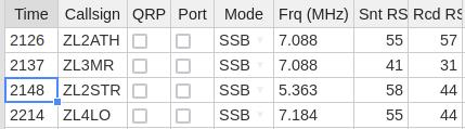
Thankfully, I ‘rug up’ well before deploying the 40m EFHW and radio. After a couple of easy contacts to Auckland, the well dries up completely. I can just hear a Christchurch station, ZL3MR calling me, but have no success in responding the skip distance must be just wrong. 20 minutes later and the tally still stands at two. I can hear the shivers on my CQ calls. A further 15 minutes on 20m yields nothing, after which I give in and do what I should have done from the start - unwind the 9.8m counterpoise that turns the EFHW into a 60m OCFD and give 60m a go. The South Island finally comes into play and, with ZL3MR and ZL2STR in the log, rapidly pack up gear and stomp back off 1km down the track to the Bell Saddle junction - trying to work warmth and circulation back into chilled, numbed limbs. 1hr20 to qualify the peak with 4 contacts.
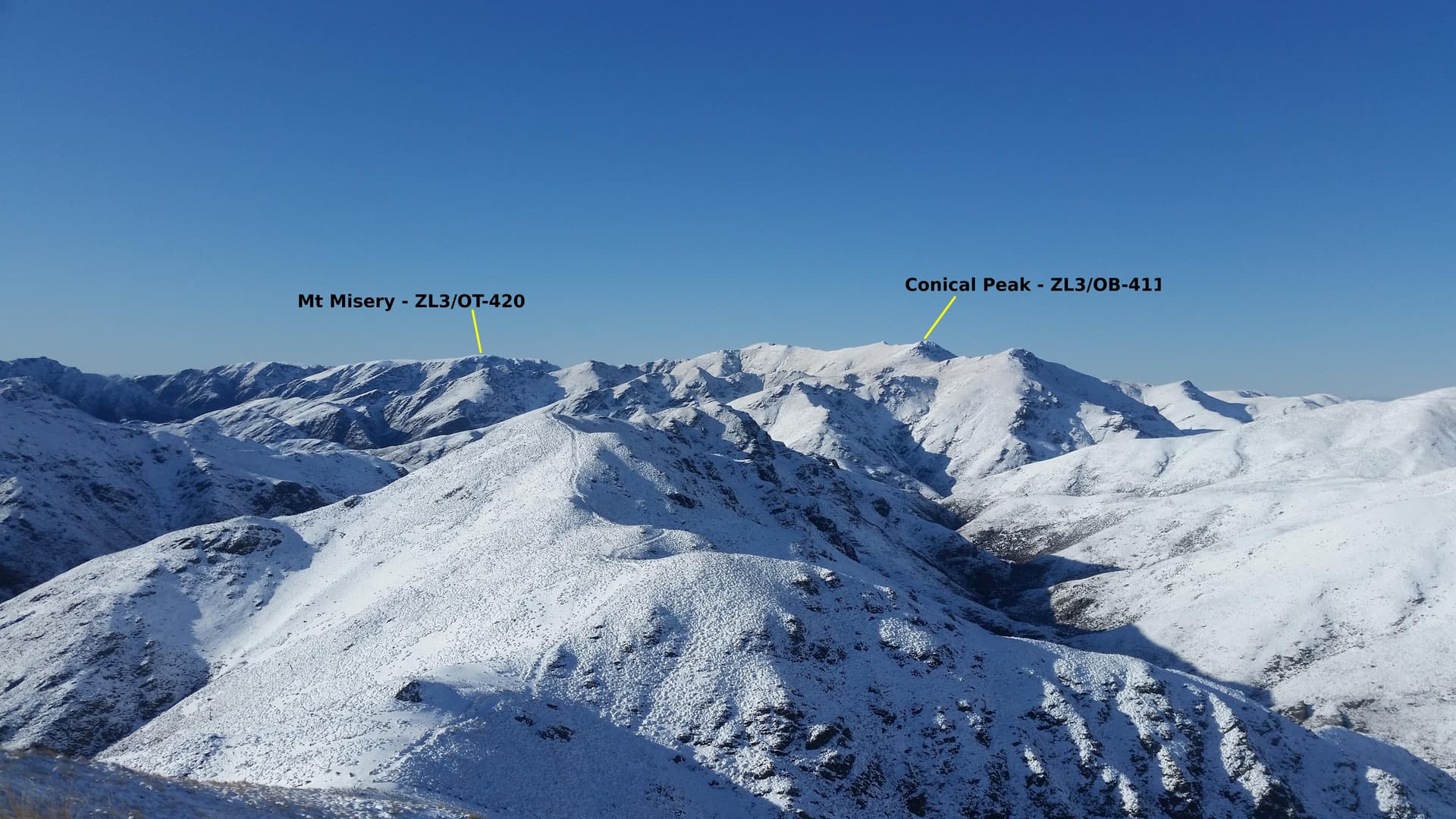
Mt Miserable - ZL3/OT-420
The farm-track ends at the turnoff and I follow a steeply descending fenceline through waist-high tussock to the saddle. It’s 3km to the start of the next network of farm tracks at Conical Peak, and a slow 3km it proves. As predicted, the newly purchased snowshoes are of no use in the soft fine powder, and are quickly abandoned and re-stowed.
The clag has descended and so navigation is by compass and instinct – clambering through deep snow-covered tussock over an unnamed intermediate peak before descending the second saddle and starting the long slow rise to Conical. The plan was to be at Conical by 10:30am, but with the long activation of Mt Misetry and slow progress, we’re miss that target by a country mile. It’s 12:30 by the time I reach the peak – 2.5hrs to travel 3km!
Thankfully, the activation of Conical Peak is easier and faster – 4 ZL contacts on 40m in the first 10 minutes, and nothing on 20m in the next ten.
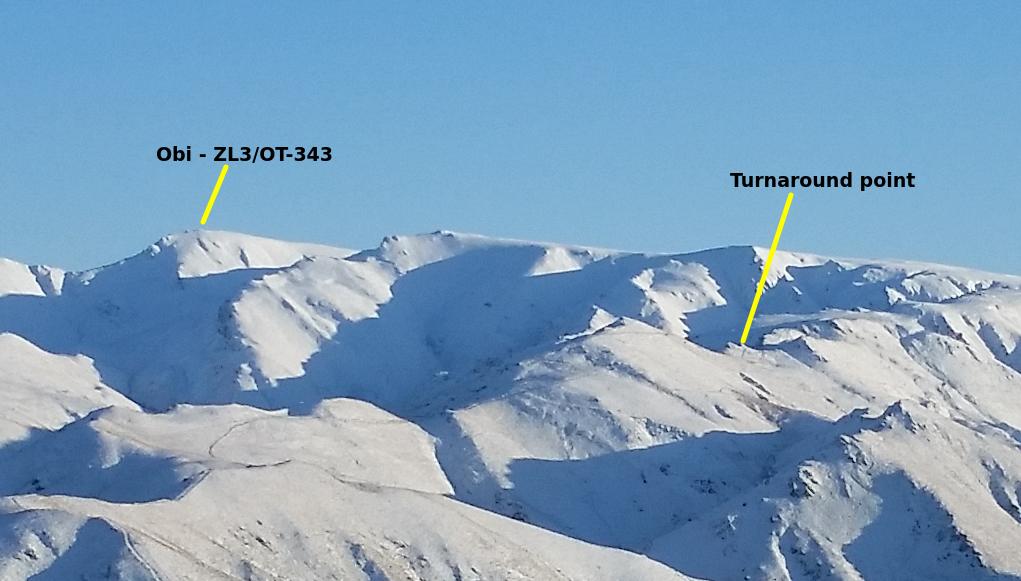
Studying the maps the night before, I’d set myself a 2pm cutoff for the final ascent to the high Obi tops from the Gentle Annie turnoff. But it’s already 1pm, and that decision point is still 8km away, and there’s no way I’m even going to reach that junction today, never mind by 2pm.
So instead I follow the easement down to the Waianakaru River flats for an early camp at the riverside stock-yards. My dream of traversing the length of the Kakanui tops is looking unlikely, but there’s still time to climb to Obi highpoint and Half Moon Hut tomorrow, and then to exit the range over Kakanui Peak and down the Shag River on Friday or Saturday. That will still make it an amazing trip.
Total distance travelled on day 2: 12km. Time taken: 7 hours.
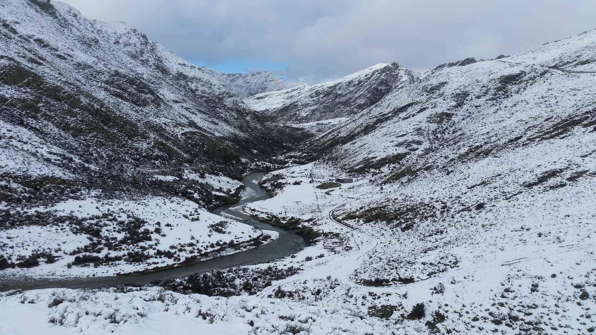
Waianakarua River downriver of access easement
Day 3 – Wednesday
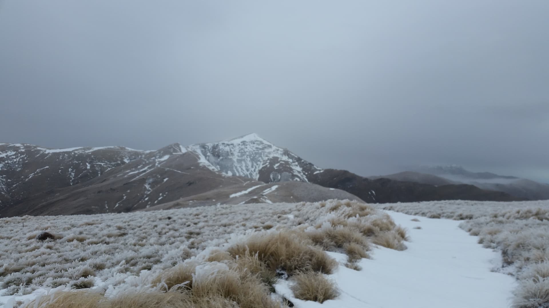
Wednesday dawns crisp cold to bluebird skies. This is what I’ve been dreaming of!
The easement follows the fenceline up steep faces out from the Waianakarua forks to join the farm track above, winding up the ridgeline of Otepopo Spur. The forecast was for 80mm of snow, but by the time I reach the 800m contour, there’s easily twice that, drifting in places to waist deep. The snow has turned from fine powder to ‘farty snow’ – the sort that squeaks and grunts as you step on it. But the change has made no difference to the snowshoes, which still sink right through it until they hit solid earth beneath. As before, we’re soon back to bare boots for faster, easier progress.
I’ve revised my go/don’t go cutoff at the Gentle Annie turnoff back to 11:30am, given the slower than expected travel. It’s close to that time when I reach the track junction, just 6km under the belt so far today and already exhausted from pushing through constant, soft snow. So it is fatigue, rather than time that leads to the call to seek out a spot for a low safe camp and early stop, rather than continue to the exposed tops. This is taking longer than I’d hoped, but I still have plenty of time to climb to Half Moon Hut on the Obi-Dasher tops tomorrow, and cross Obi highpoint on Friday to descend to the Pig Root highway via the Shingley Creek easement.
Total distance travelled on day 3: 8km. Time taken: 4 hours.
Day 4 - Thursday
After a cold night, it takes me an hour to regain the ridgeline track and another hour to zigzag up the last main climb to finally reach to 1000m contour. The point where the snow was supposed to start! I push on another kilometer beyond the 2nd Gentle Annie turnoff – the last escape from the ridge, through deep, soft drifting snow. The track sidles the eastern face of the ridge, and I tell myself things will improve once I get off the drift-prone bench and onto the more windswept ridgeline. But even out on the open ridegline, there is little change. Soft fresh snow is now easily 400mm deep, drifting even deeper. A thin, ice-sharp crust has formed after the previous day’s sun-melt, but again the snowshoes break straight through, just provide more surface area to lift back through the crust with each step.
After the reported snow-fall, I’d been prepared for 80-100mm of fresh snow, and had proceeded on that basis. But it’s clear that the high plateau has attracted far more snowfall than observations reported, and that the conditions and progress I’ve been expecting are not going to eventuate. Whilst I am confident that I can reach the park boundary at 1200m asl, the shelter of Half Moon Hut lies 3km beyond that across untracked tussock tops. I’ve been stuggling enough of the flat reliable surface of farm tracks, and that 3km it what may be waist-deep, snow-covered rolling tussock could easily prove impractical. To add to which, a minor front is forecast for Thursday night, and I’ve no desire to fall short and be tent-camped on the broad exposed 1200m tops in 400mm of powder snow when that arrives.
They are hard decisions to turn round, just 3km from my first goal of summitting the Kakanui range in winter. To walk 2 days back the way I’ve come, when the goal lies so close.
But these are the decisions that keep us alive.
Mt Obi / Kakaunui tops
Back the way we came
ZL3/OT-420 – 2022-08-09 (2022-08-08 UTC)
ZL3/OT-411 – 2022-08-09