Back in March I purchased an MX-P50 amplifier for the FT818. I had not had the opportunity to use it yet as previous activations were either multi-day trips (in which I was trying to save weight) or single day outings in which I had forgotten a vital cable.
With the winds set to be slack over the night of the 8/9 July 2021, I decided to camp atop a summit. My luck has been poor so-far for overnight summit camps. A night atop Grasmoor in May yielded poor HF conditions; a night atop Robinson in June also failed to deliver in terms of HF.
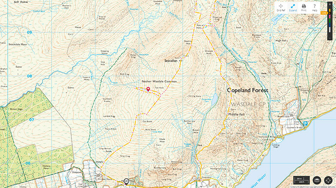
I was not feeling terribly strong, following a second dose of COVID vaccine the week before, and also wanted to ensure I avoided tourist hotspots, so I chose Seatallan (G/LD-025).
©Crown copyright 2021 Ordnance Survey. Media 018/21
After work on Thursday 8/7/2021 I set off on the bicycle, and parked at the bottom of the metalled track leading to Windsor farm (NY 127 055). It was around 1830BST as I set off walking (the bike parked behind the Windsor Farm sign, hidden in bracken).
I walked NW up the track at first, veering north at the sign for the bridleway. The bridleway heads on to the west of Seatallan, to reach the River Bleng - so I soon broke off from the track to follow a sheep trail NE onto Cat Bields.
I was looking to find a different route to the usual trudge through tick-infested bracken and grass onto Glade How. I was also hoping to find a stream on the west of Cat Bields. No stream was found, but the going felt a little easier than the Glade How route.
Atop Cat Bields I followed the main ridge NE, inspecting every spot of boggy ground as an option for water - I was trying to avoid collecting water until close to the summit. The weather was warm and damp with not a breath of wind. The ground underfoot was wet (it always is on this hill) and the cloud base was at a little above 550m.
I was carrying three 4200mAh LiFePo batteries, the FT818, two handhelds (I like multiple redundancy!), a fibreglass pole and various antennas - hence the reason for not wanting to carry water any further than needed.
At the 570m contour I dropped my pack and headed west to a stream marked on OS 1:25000 maps. I had earmarked this stream before setting-off as a potential water source. The stream appears to start at the 520m, contour on OS maps - on the west side of the hill (NY 132 076). No water was found at 520m, and I had to drop down another 100m before finding water.
The water consisted of a small but deep pool covered mostly in sphagnum moss - there was no water running in the stream bed. Filling a bottle showed it to be yellow/brown colour, with lots of fascinating floating material. After quaffing a litre of this rather dubious water I filled a 1litre bottle, and a 2litre bladder, and headed back to my pack.
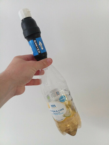
I use a Sawyer Squeeze filter, and also carry chlorine dioxide tablets (and a pack of Immodium in case those options fail).I have come to greatly trust the Sawyer Squeeze, and I’m sure this water was fine - it didn’t look very pleasant but if used to make whiskey would no doubt imbibe it with a lovely peaty flavour.
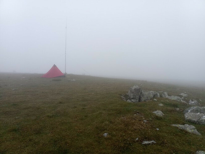
Back at my pack, the extra 3kg felt punishing, and I was glad to have only around 150m of further ascent. The mist closed around me, and by the time I reached the summit was down to 20m visibility.
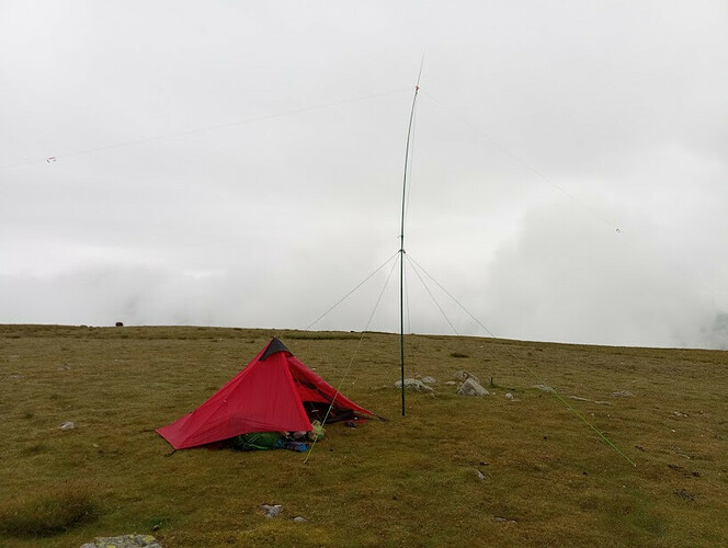
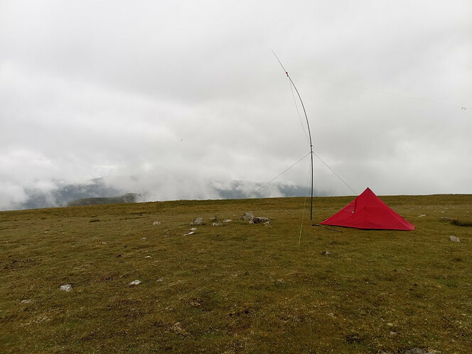
The tent was setup first, a short distance east of the trig point, on lovely velvet grass (covered in sheep droppings).
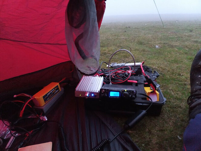
A 2m flowerpot antenna was attached to the fibreglass pole, and I called CQ at 2055 BST. First to respond was 2E0EVD, followed by G1OHH, GM4WHA and G4VFL to give four contacts. There was quite a pileup and I soon had 13 contacts in the log.
Operating 2m on Thursday evening
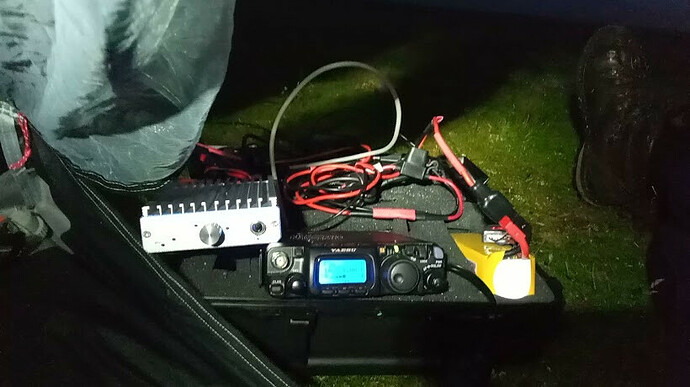
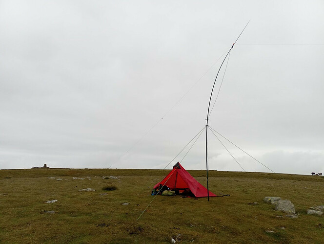
Swapping for the inverted vee linked dipole (60m/40m/20m) I called on 20m first, with no response. After a few minutes a realised the band filter dial on the amplifier was on the wrong band, with it switched round to 20m I soon had a few contacts in the log - S51DX (not a chaser) followed by, on 14.310MHz F4WBN and M7BZK. I spent an hour on 20m from about 2200BST to 2300BST and then switched to 40m.
Conditions on 40m were really rather good, and I had a big pileup of inter-G stations, making around 20 stations in total over a period of almost an hour.
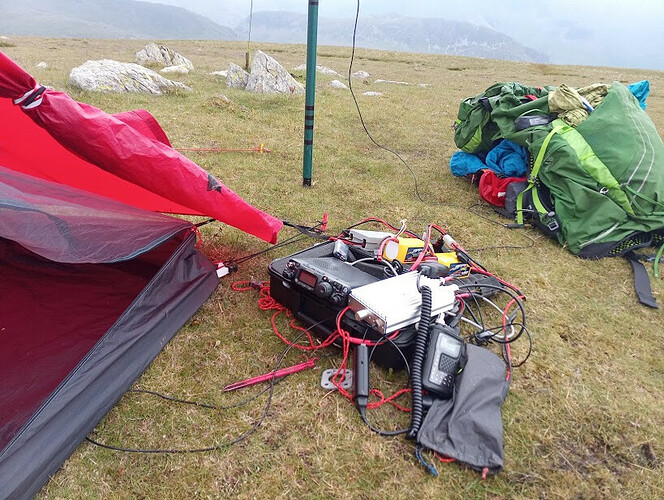
Operating on HF on Thursday evening with new amplifier
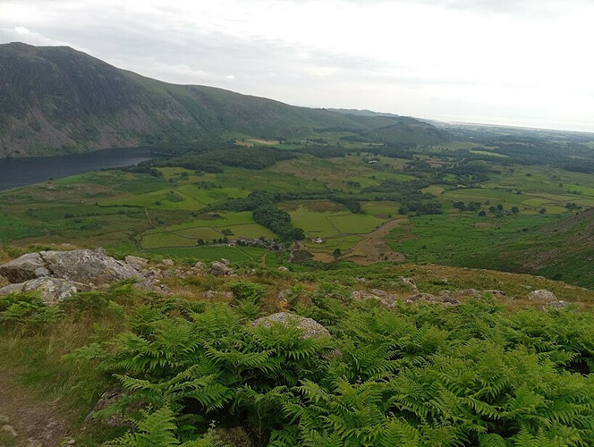
I was hoping to work some DX, and although I could hear a (non SOTA) station in Alaska, I couldn’t seem to reach him. None of the US SOTA stations could be heard. By now the mist had lifted and I was treated to a great views towards Blackpool, across to the Isle of Man and east towards Scafell Pike. I could see around half-a-dozen lights making their way up Scafell Pike at about 2345BST.
Night time operation atop Seatallan
With the clock reaching midnight, and wanting to be up by 0500BST I decided to call it a night. I was soon sleeping soundly.
Waking at 0530 BST, there was steady rain. I was back on the radio, whilst lying in my sleeping bag. I didn’t have much success - none of the SOTA stations in the far east could be heard, so I took a nap until about 0800BST and started again.
The rain had stopped by about 0800BST, visibility was poor at about 20m.
GW4ZPL was the first station of the day (9/7/2021) on 2m, I then chased DL/ON4TA/P on DM/RP-003. There followed around an hour of operation on 20m with a large pileup of continental Europe stations and a good handful of S2S - HB9BIN/P on HB/ZH-010, F5ODQ/P on F/PO-245 and OM1ALT/P on OM/BB-052.
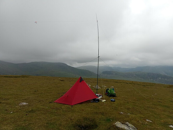
The mist has cleared at last - Friday morning operating HF with an inverted vee linked dipole
I then switched to 40m at 1100BST, and caught M7BIA/P on G/SP-004; a good hour of operation on 40m followed with a big pileup of inter-G and European stations. After the pilup subsided I chased a further few S2S - 9A/S5SVN/P on 9A/PH-012, CT2JLS/P on CT/BL-025 and LB4TH/P on LA/HL-111 - I was really pleased to get my first S2S into Norway.
At midday I switched back to 20m, and another pileup ensued for about 15 mins. I spent the following hour chasing S2S, making a further 11. I was pleased to work M0NOM/P on Skiddaw and had a chat about the amp, which he had originally recommended.
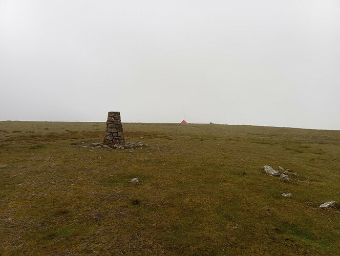
View of tent from trig point
Looking east towards Red Pike
At around 1330 I decided it was time to make a move, it was now quite sunny and I decided to head NE to explore around the Pots of Ashness, before heading onto WOTA/HEMA summit Middle Fell.
Starting to pack up
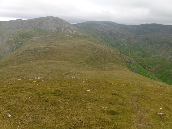
The is lot to explore on the ridge across to Haycock, and I wanted to check out if there is a route down Lad Crag beck - as this is a useful shortcut to Netherbeck. I spent about an hour exploring, and eventually headed south onto Middle Fell (elevation 582).
Pots of Ashness with Haycock behind, Scoat tarn also can be seen to the right of the image
Calling CQ WOTA from middle fell yielded sveeral QSOs, including one operator on his Gold DofE expedition (M7LCJ) - using radio operation as a project.
I dropped back down to the road and headed to my bike.
In total I had made almost 140 contacts with 98 of those on Saturday (had Iknown at the time, I would have stayed to make the 100, but I only counted when I got home). I was pleased with the number of S2S QSOs, and the amplifier had performed really very well.
Many thanks to those who chased me, and thanks also to the S2S stations.
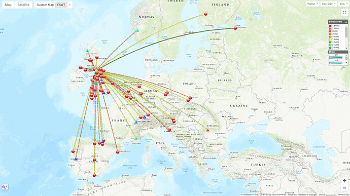
Full map of QSOs on Friday 9/7/2021
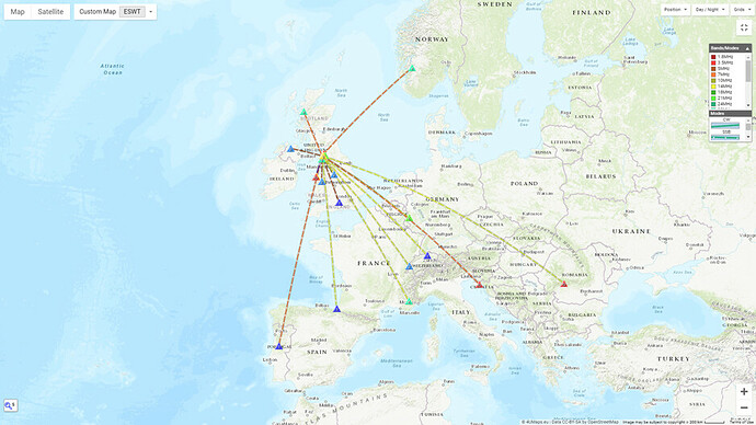
S2S QSOs
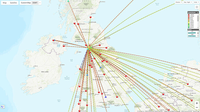
Inter-G on 40m
Descent from Middle Fell
Sawyer squeeze and water from Seatallan.
 ) up every hill we did in Scotland a couple of weeks’ ago, but found we didn’t need it too often. Nic my wife was keen to just use 6w (and prove that I didn’t need to carry my ‘insurance for poor band conditions’) and generally we could qualify most summits on 40m. I’m still not sure I want to leave the amp at the hotel if we’re climbing a 10-pointer, but the extra 1.5kg in my rucksack does drag a bit on a 1000m+ ascent!