It’s been two years since I ventured up Skiddaw. Although the WX forecast wasn’t great I wanted to get the SOTA points, and tick off the related WOTAs for the year.
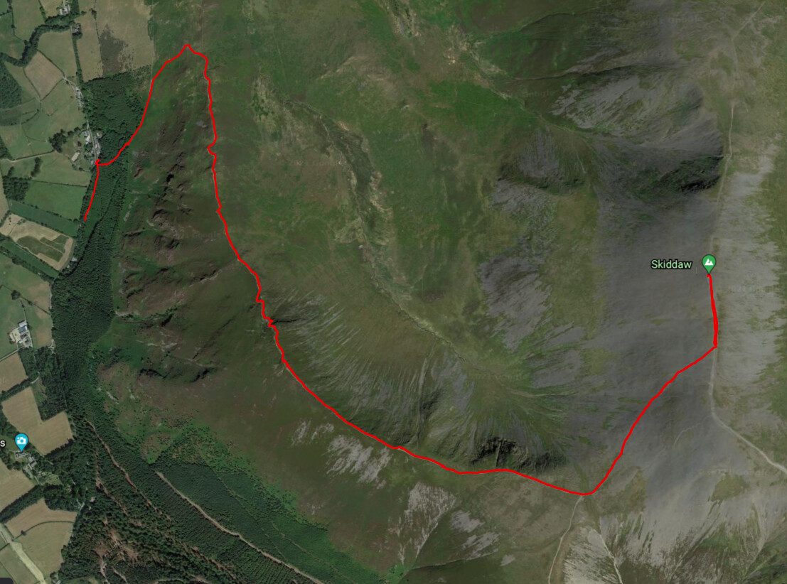
The route covers the Wainwrights Ullock Pike, Long Side, Carl Side and Skiddaw itself. Wainwright himself recommends this route for the ascent of Skiddaw. I would agree, although being a ridgeline walk probably not the best approach with high winds.
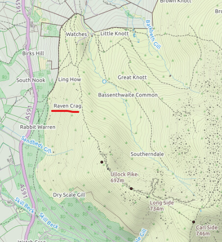
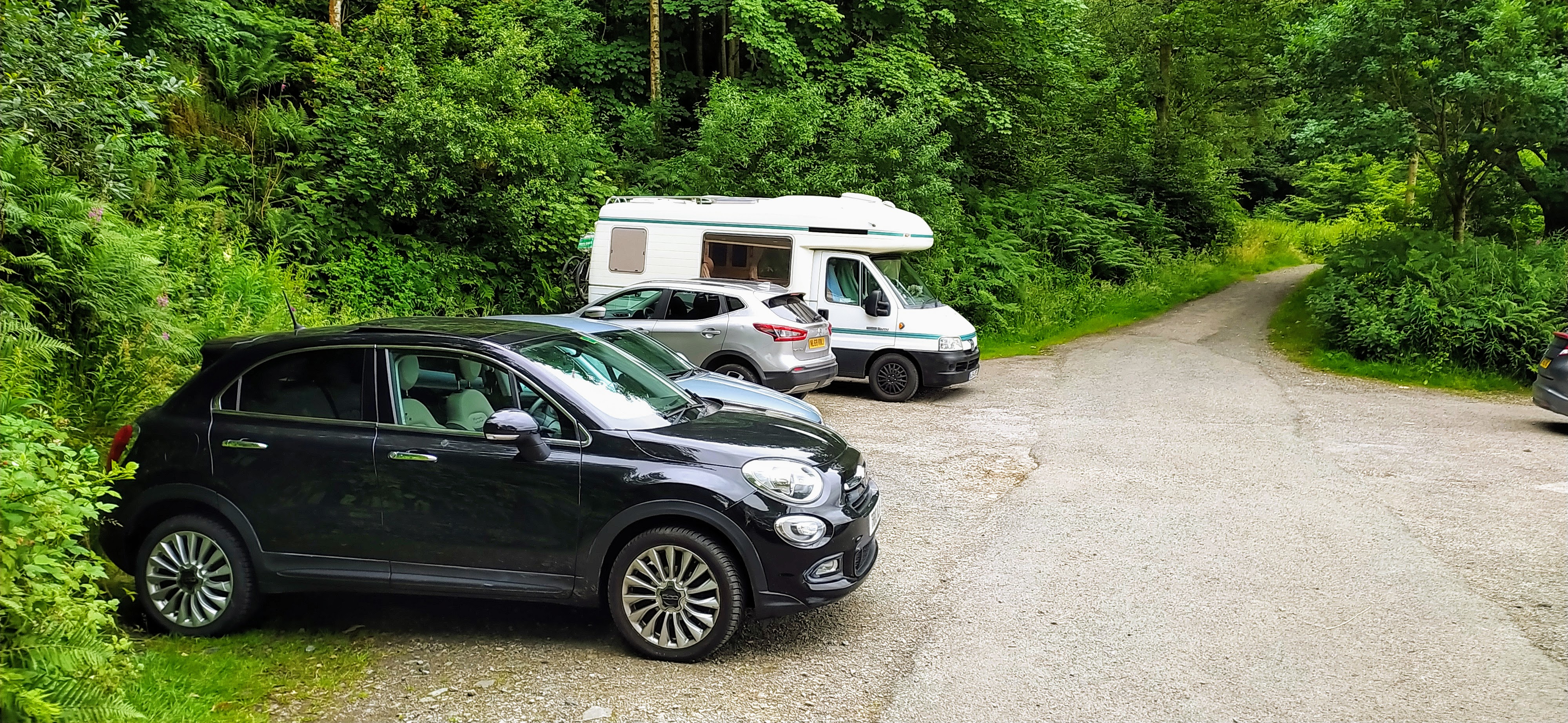
Parking
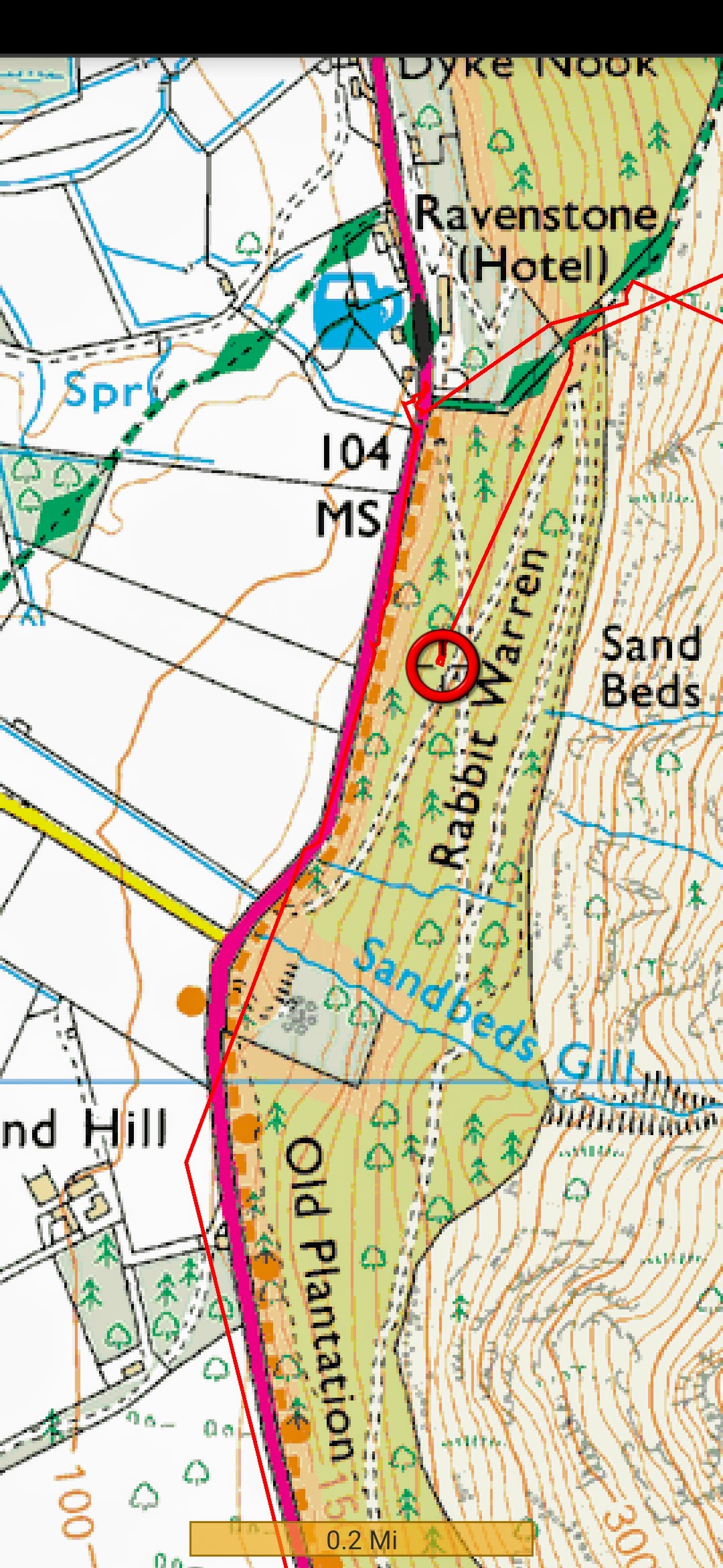
As you traverse the A591 there are a number of potential parking spots. I chose a pull in at Rabbit Warren which can take about 10 cars, and free!
©Crown copyright 2021 Ordnance Survey. Media 018/21
Parking Position
Parking
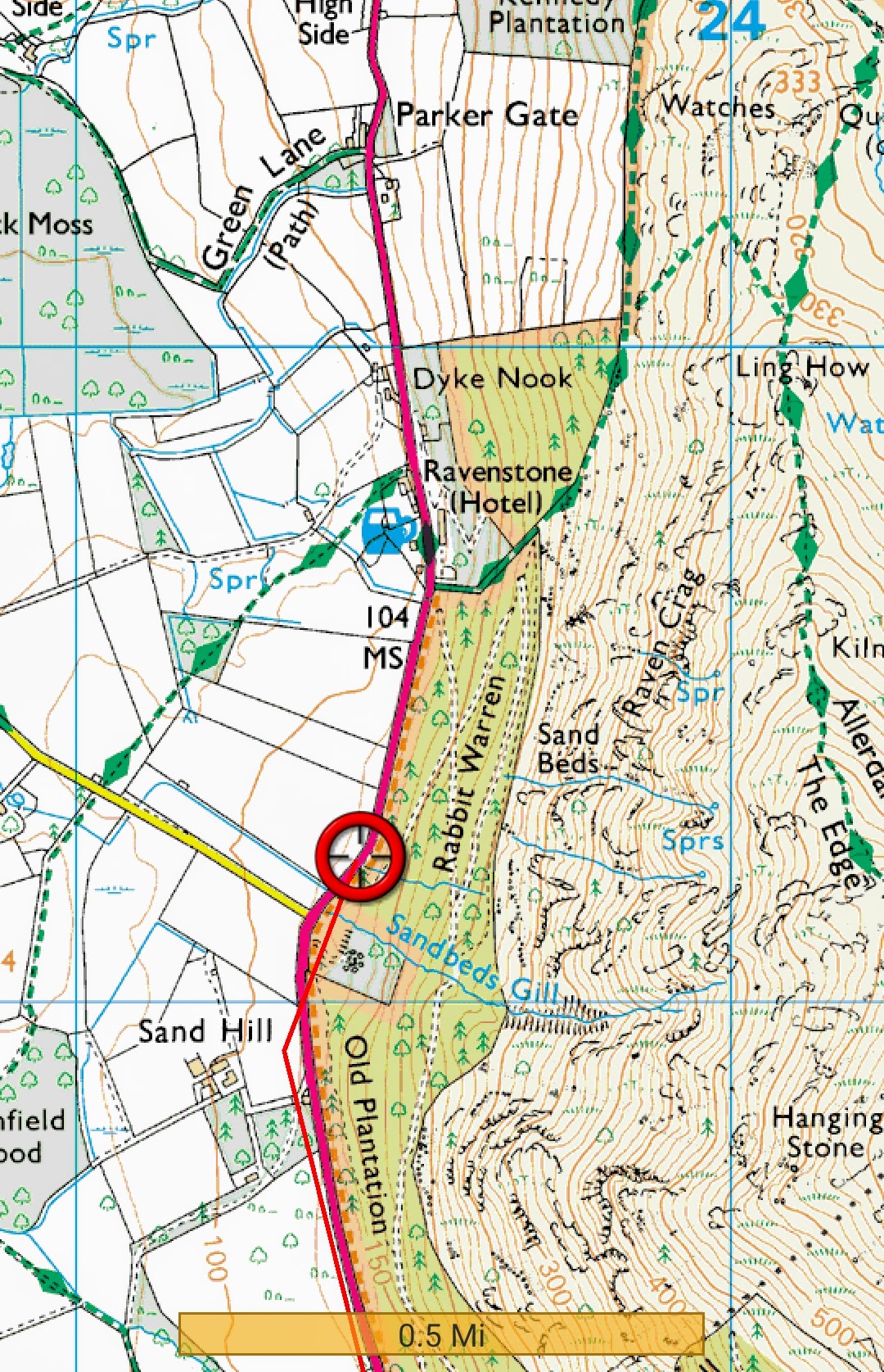
I made the mistake of taking the low footpath to the Ravenstone Manor. The path up from that position (although labelled as a Bridleway) is very steep and muddy with low overhanging branches, not how you want to start such a long ascent. Better to start in the opposite direction (South) from the car park into Rabbit Warren and after about 50m you can turn to the North East for a much more pleasant ascent through the woods to the foothills.
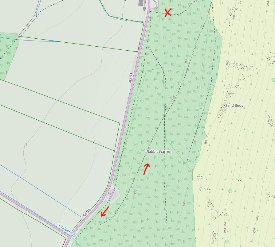
Taking a better route
Initial Ascent from Rabbit Warren
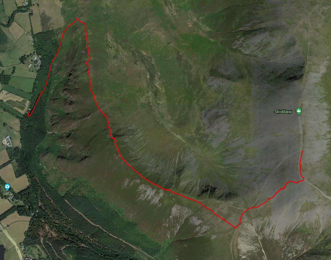
Ascent GPS Track
The ascent takes you through some fantastic woodland - it would be worth a trip to walk through the woods on its’ own.
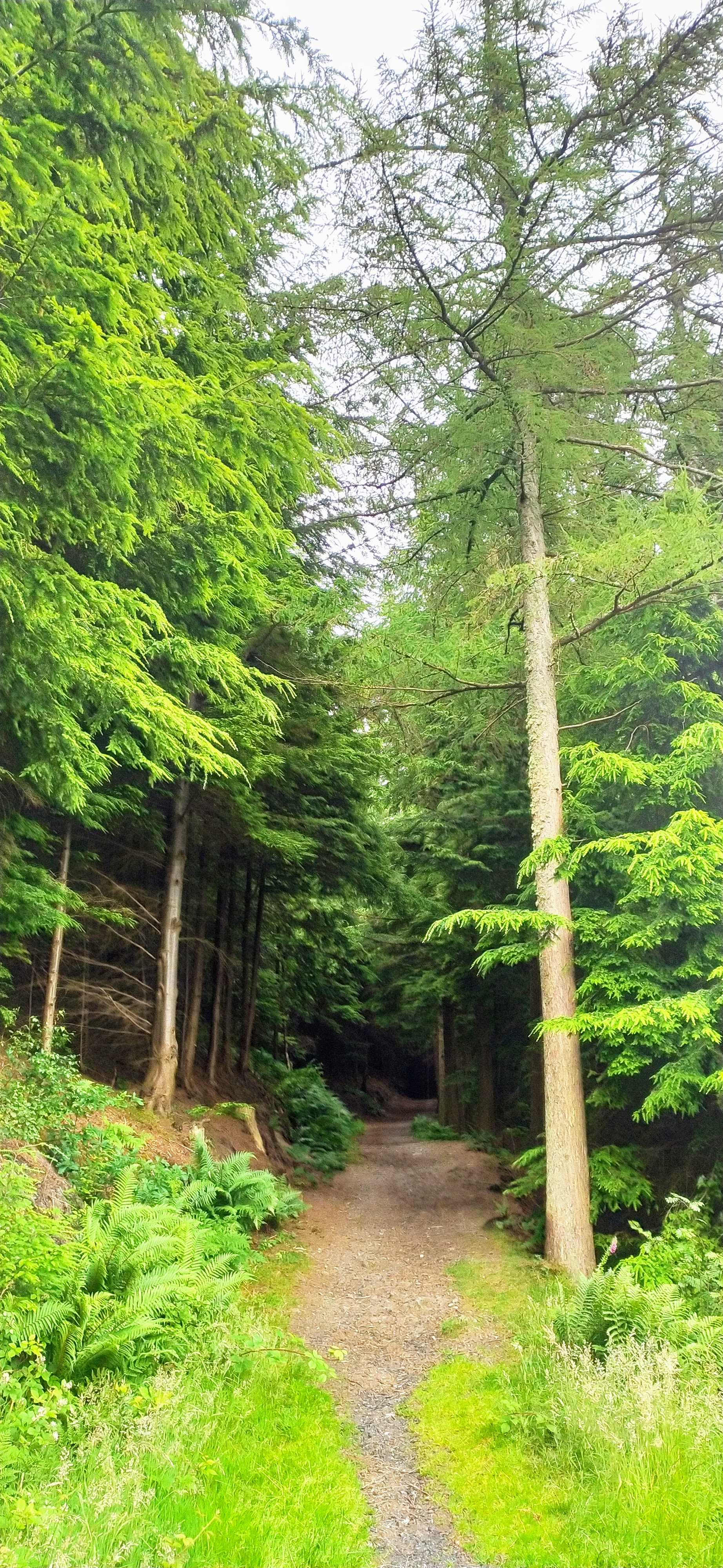
Amazing Woods
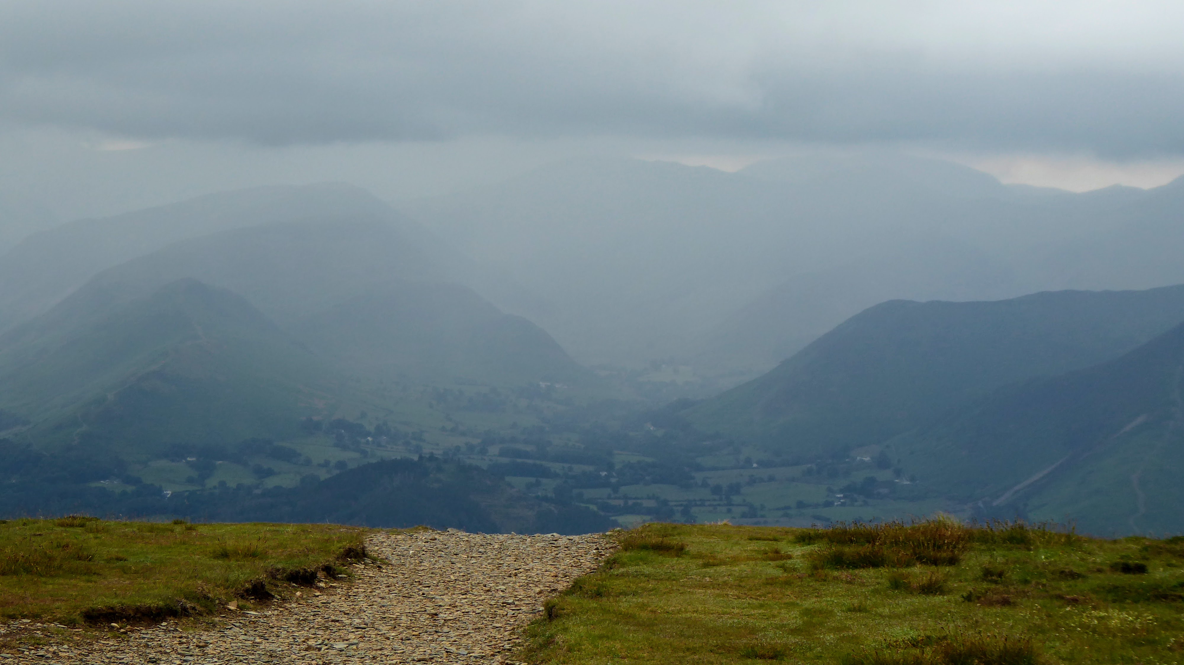
The path to the rideline of Longside Edge is good, and before you know it you are looking back down on Bassenthwaite and across to Skiddaw.
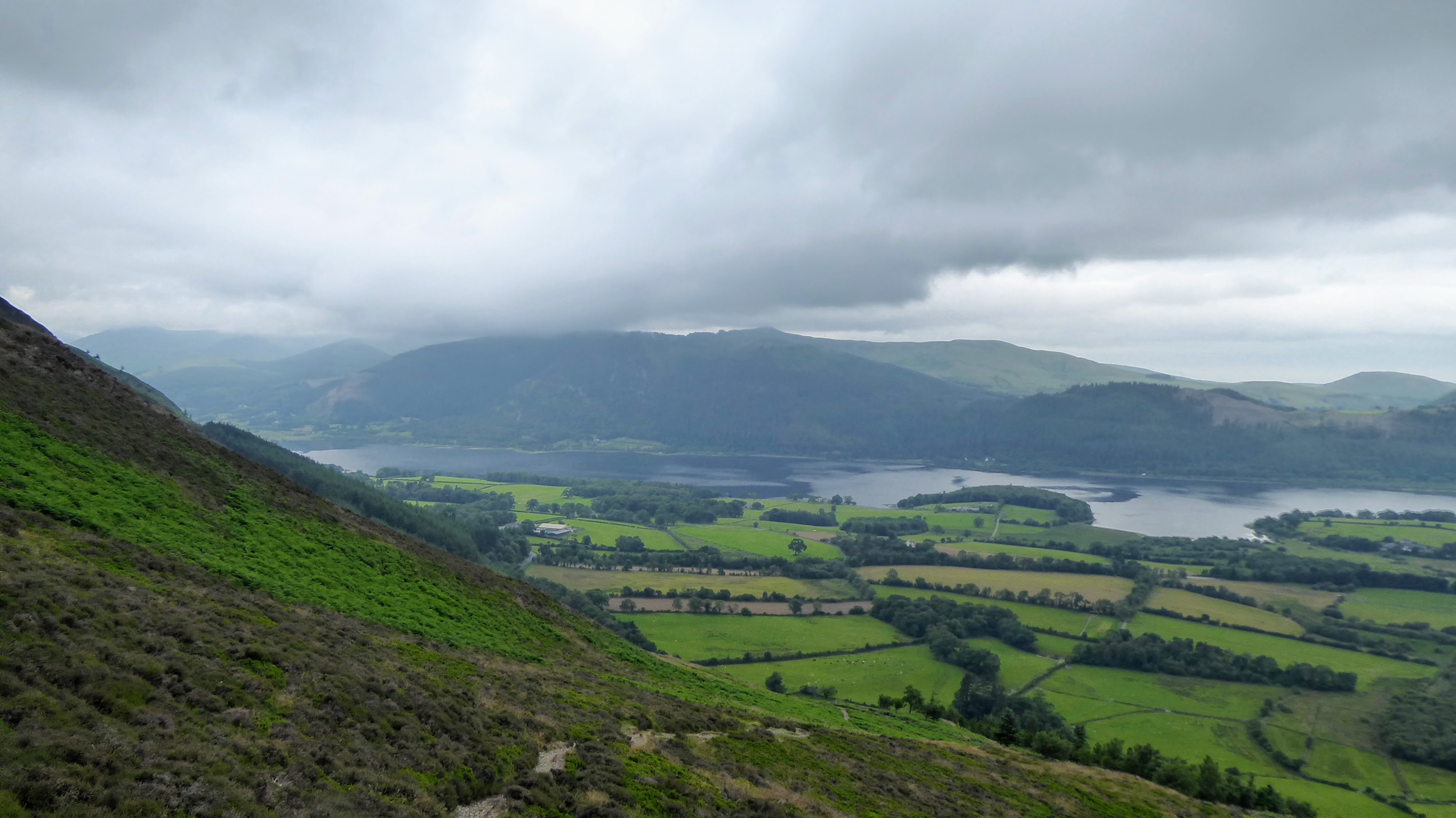
Bassenthwaite
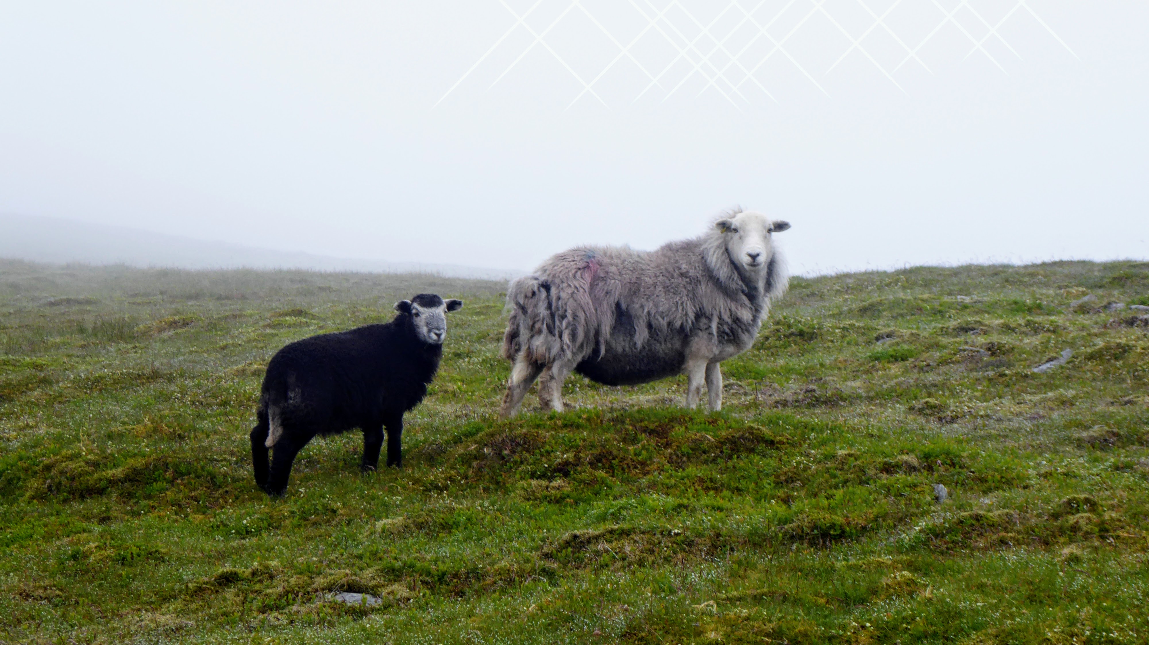
Obligatory Lake District Sheep Photo
Conditions under foot were good although visibility was poor. You have to remind yourself that when you arrive at Ullock Pike you are already at 680m, because it feels like it!
It is then a very easy 10 minute walk to the next Wainwright, Long Side.
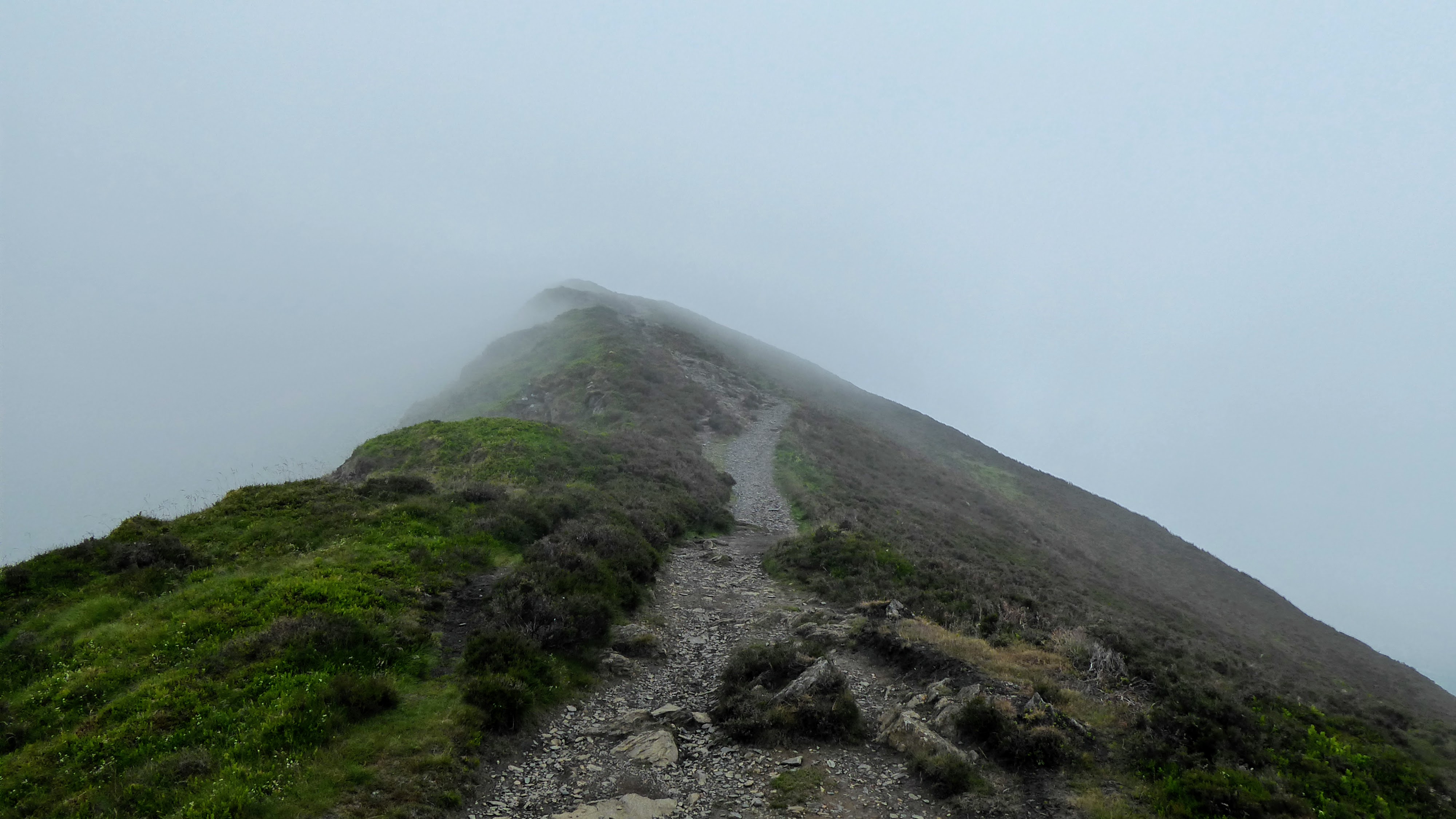
Walking in the Mist
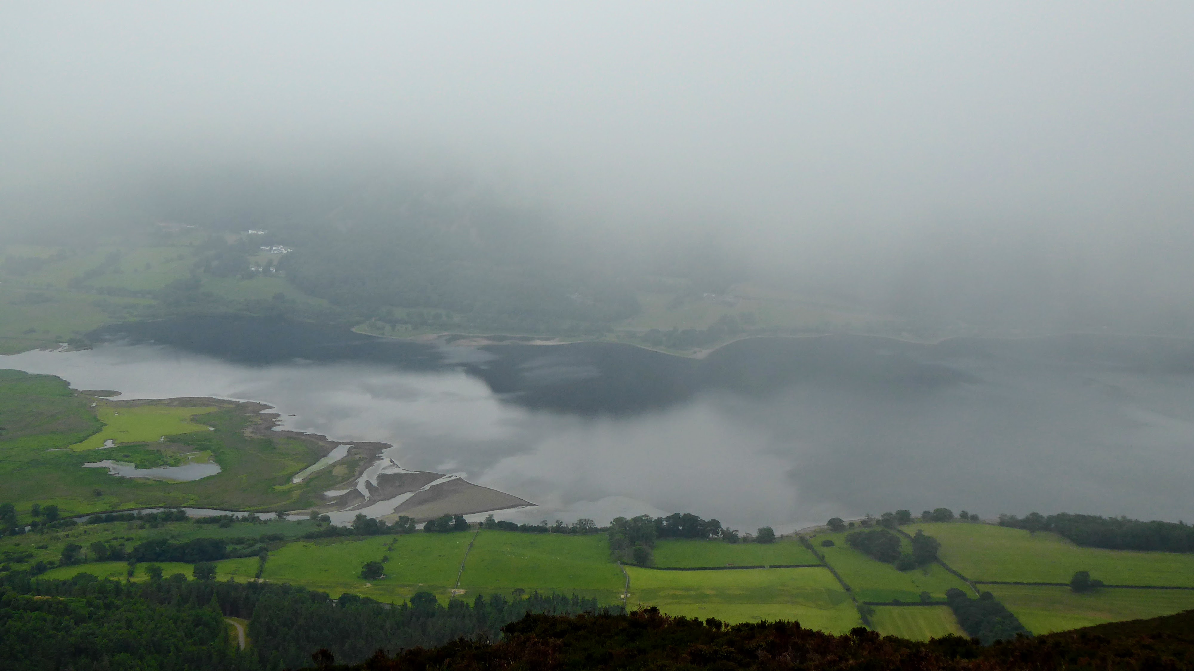
Brief views down the Bassenthwaite
Cain stones on Long Side
The plan was to the ascend via Carl Side but in the mist I took the left hand track and ascended Skiddaw via the northern route, rather than Allerdale Ramble. I preferred this route to the ramble, especially when I realised that it reached the summit, and not half way up Allerdale Ramble which is how I read the map!
Skiddaw
| WOTA ID: LDW-004 | Height: 931 m (3054 ft) |
|---|---|
| SOTA ID: G/LD-004 | Grid ref: NY260290 |
| HuMP ID: n/a | QTH Locator: IO84KP |
| Book: The Northern Fells | Lat: 54.650551 Long: -3.147009 |
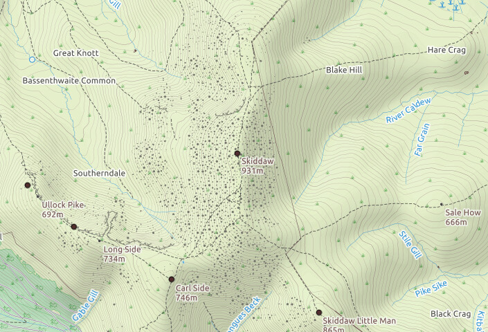
Skiddaw Map
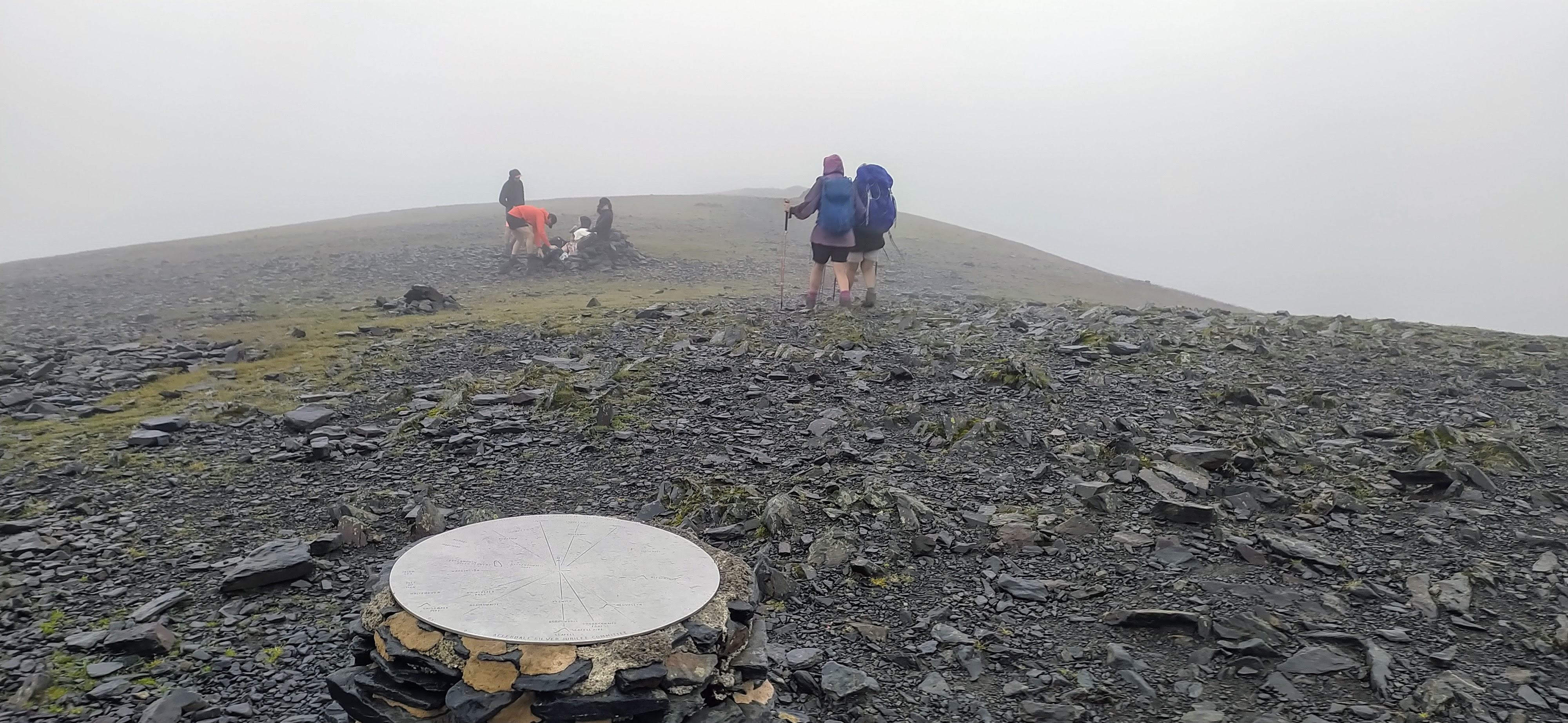
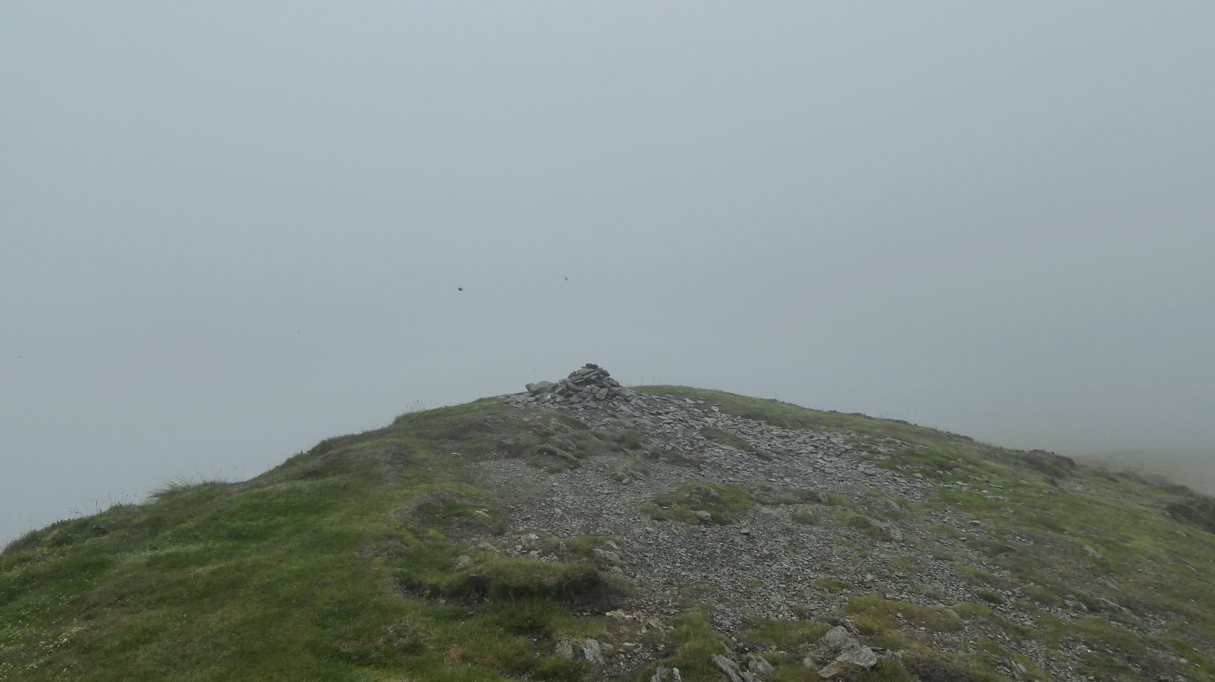
Skiddaw Summit
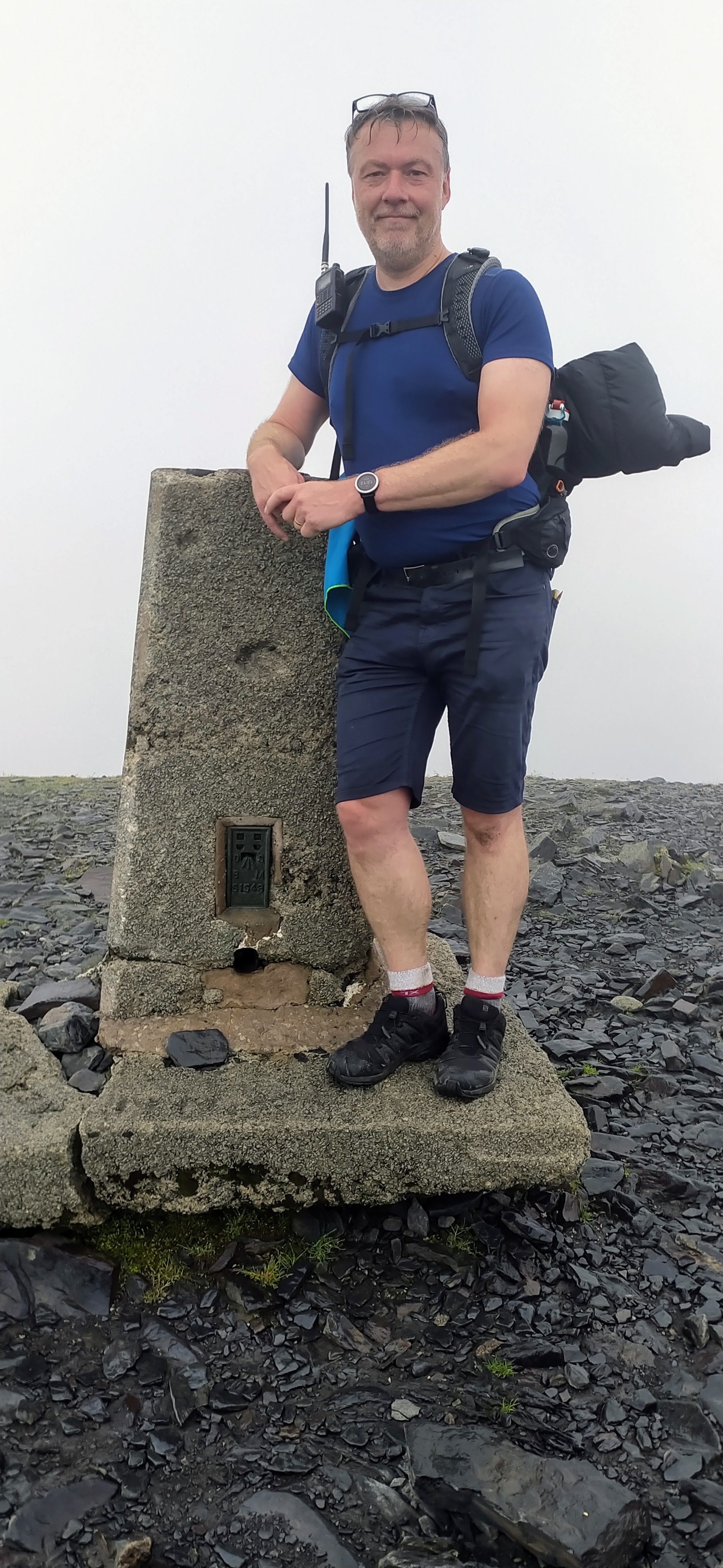
Summit Selfie, not the best expression!
Thankfully although misty it didn’t affect the activation.
VHF Contacts
I used the FT1XD with the Spectrum Communications 49cm Whip to do the VHF activation, as I had once again misplaced my Slim J. A nice set of contacts on VHF!
| TIME | CALLSIGN | FREQ | MODE | RSR | RST | SOTA-RX | OPERATOR | QTH |
|---|---|---|---|---|---|---|---|---|
| 11:22 | G1OHH | 145.575 | FM | 59 | 59 | |||
| 11:24 | G4WHA/M | 145.575 | FM | 59 | 59 | Centre of Carlisle | ||
| 11:25 | G1FVA | 145.575 | FM | 59 | 59 | |||
| 11:26 | G7CDA | 145.575 | FM | 53 | 56 | |||
| 11:27 | 2E0XUP | 145.575 | FM | 59 | 59 | |||
| 11:27 | M1DYU | 145.575 | FM | 53 | 53 | |||
| 11:28 | G1OAE | 145.575 | FM | 59 | 59 | |||
| 11:30 | 2E0LDF | 145.575 | FM | 59 | 59 | |||
| 11:32 | M7KOM | 145.575 | FM | 59 | 59 | Dearham | ||
| 11:33 | G0TDM | 145.575 | FM | 59 | 59 | |||
| 11:34 | G8CPZ | 145.575 | FM | 52 | 54 | |||
| 11:34 | M7BUY | 145.575 | FM | 59 | 59 | Kevin | Workington |
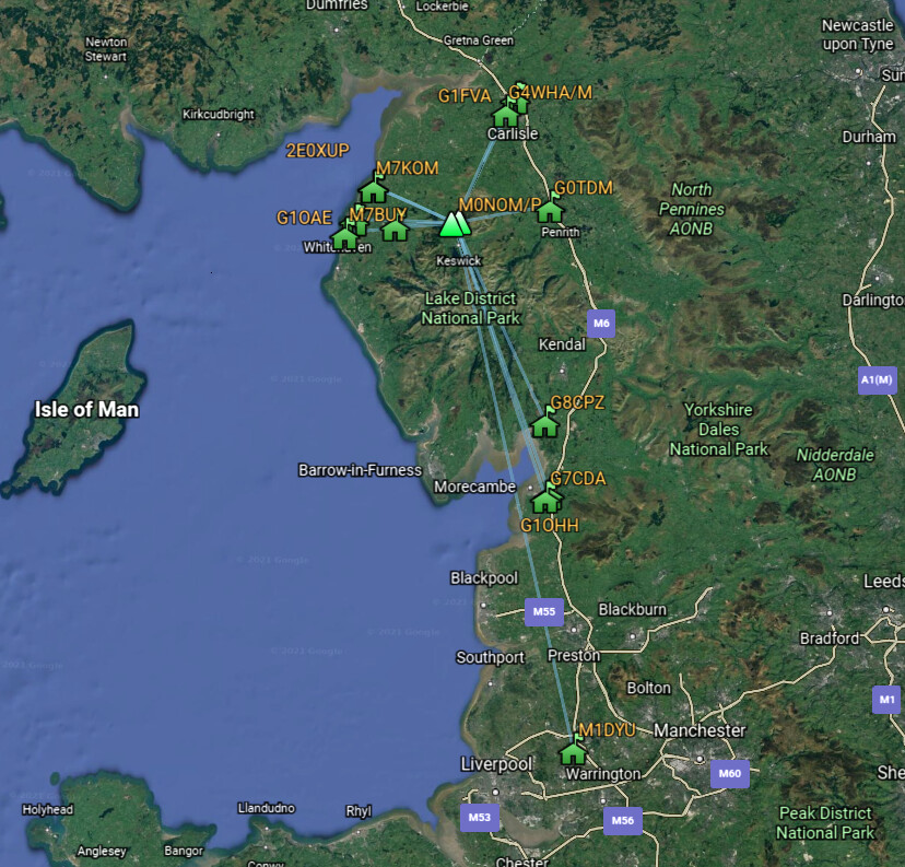
VHF Contacts
For HF I had the FT-817, with Palm Pico Paddles, SOTABeams Band Hopper IV and 6m travel mast, to support the antenna Inverted V at about 5m. I setup on the easterly edge of the summit ridgeline, and as I was operating from time to time had views over to Mungrisdale Common.
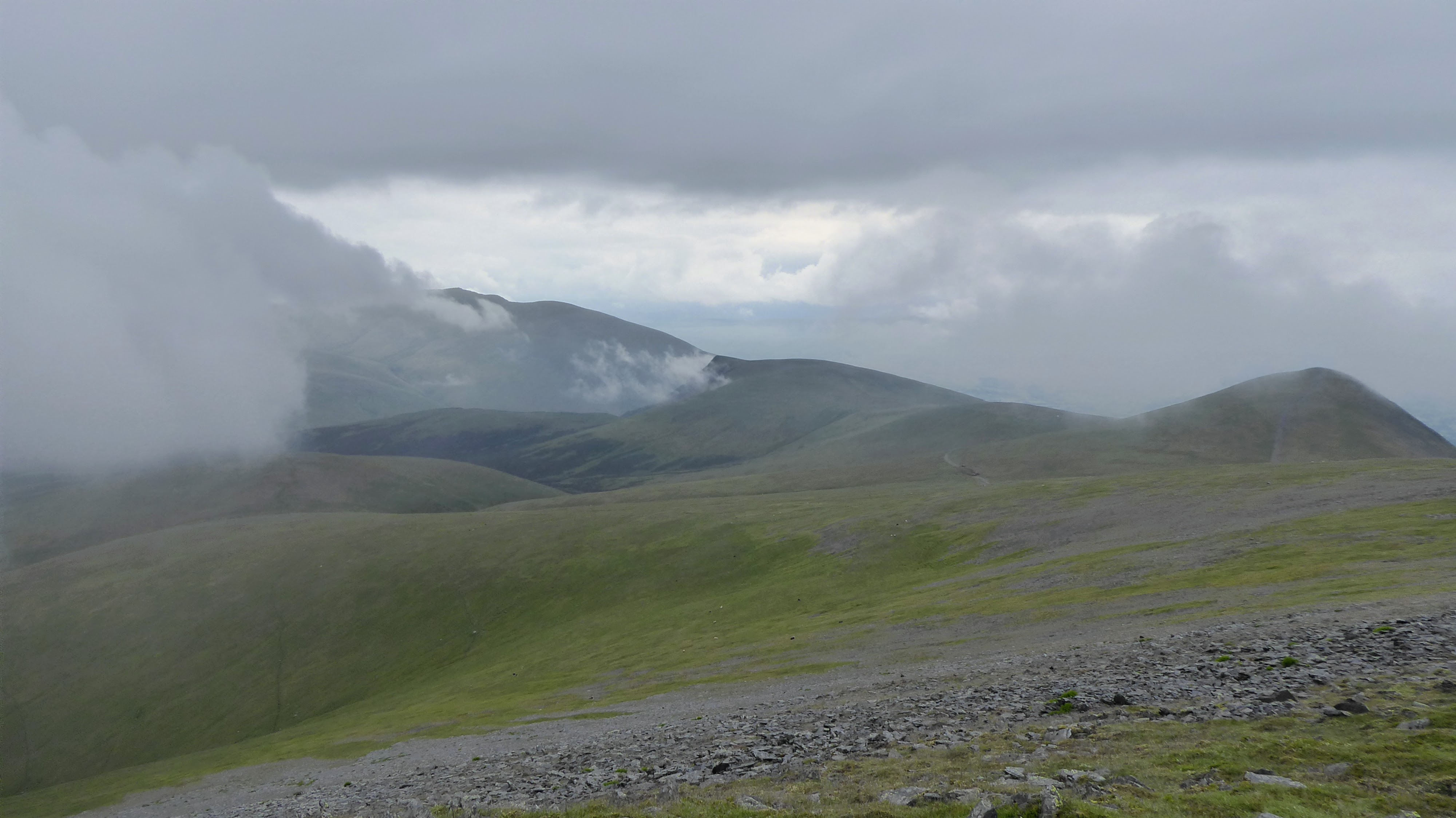
Views to the East
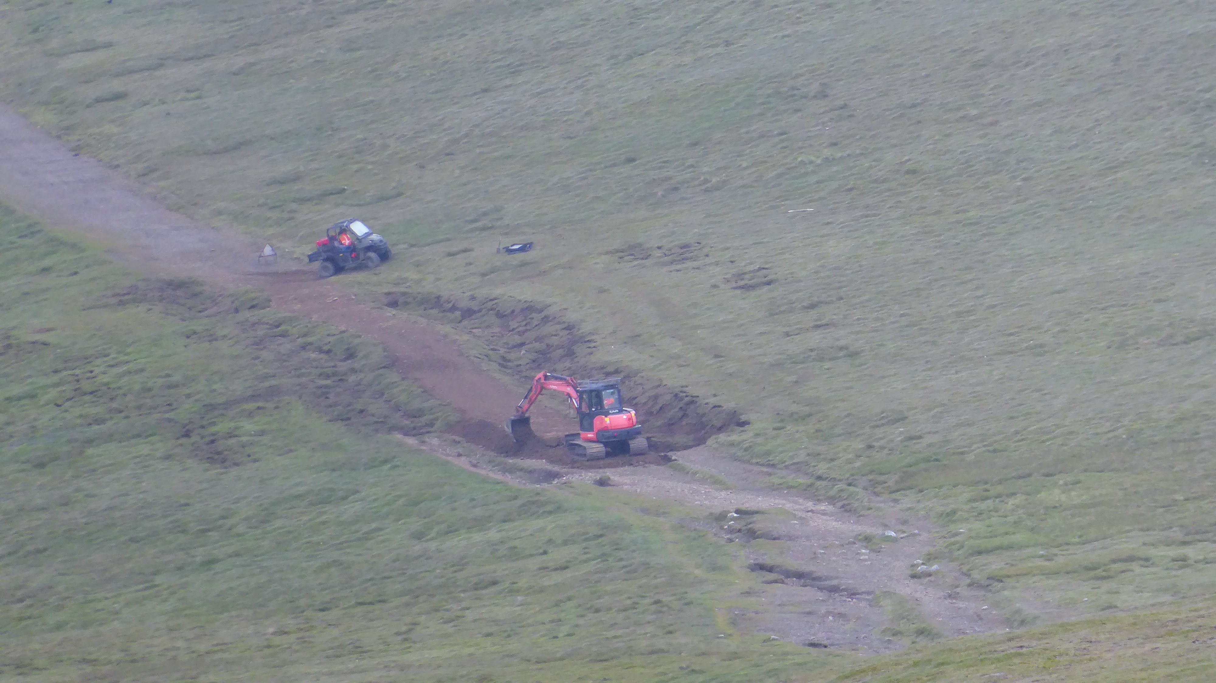
Repairing a path
HF SSB Contacts
It was nice to get some SOTA summit to summit contacts. Band conditions have not been anywhere near as good as we had for the past two weeks, and especially on 20m the QSB was deep at times.
| TIME | CALLSIGN | FREQ | MODE | RSR | RST | SOTA-RX | OPERATOR | QTH |
|---|---|---|---|---|---|---|---|---|
| 11:52 | S59WT/P | 14.275 | SSB | 55 | 55 | S5/KS-061 | ||
| 11:54 | F4WBN | 14.305 | SSB | 59 | 59 | |||
| 11:55 | G4IPB | 14.305 | SSB | 55 | 56 | |||
| 11:55 | HB9DDZ | 14.305 | SSB | 55 | 59 | |||
| 11:56 | SQ9MDF | 14.305 | SSB | 56 | 59 | |||
| 11:57 | G8CPZ | 14.305 | SSB | 44 | 44 | |||
| 11:57 | OE6GND | 14.305 | SSB | 59 | 59 | |||
| 11:58 | OK2PDT | 14.305 | SSB | 57 | 58 | |||
| 11:58 | SM5LNE | 14.305 | SSB | 57 | 58 | |||
| 11:59 | EA4BQG | 14.305 | SSB | 57 | 56 | |||
| 12:00 | M0MZB/P | 14.305 | SSB | 59 | 59 | G/LD-025 | ||
| 12:01 | SP9AMH | 14.305 | SSB | 56 | 44 | |||
| 12:02 | OK2JIQ | 14.305 | SSB | 55 | 51 | |||
| 12:07 | F4HZR | 7.158 | SSB | 56 | 58 | |||
| 12:08 | EA2CKX | 7.158 | SSB | 53 | 58 | |||
| 12:08 | EA2DT | 7.158 | SSB | 51 | 51 | |||
| 12:09 | GI4OSF/P | 7.158 | SSB | 55 | 55 | GI/SM-009 | ||
| 12:09 | M0BKV | 7.158 | SSB | 55 | 57 | |||
| 12:10 | DL3HXX | 7.158 | SSB | 44 | 55 | |||
| 12:10 | G4WSB | 7.158 | SSB | 55 | 55 | |||
| 12:11 | 2E0WGA | 7.158 | SSB | 51 | 57 | Anthony | ||
| 12:15 | GB250CC | 3.716 | SSB | 55 | 55 | |||
| 12:16 | M0BKV | 3.716 | SSB | 55 | 55 | |||
| 12:17 | EI3GYB | 3.716 | SSB | 52 | 58 | |||
| 12:17 | G8CPZ | 3.716 | SSB | 58 | 55 | |||
| 12:18 | M6BLV | 3.716 | SSB | 53 | 53 |
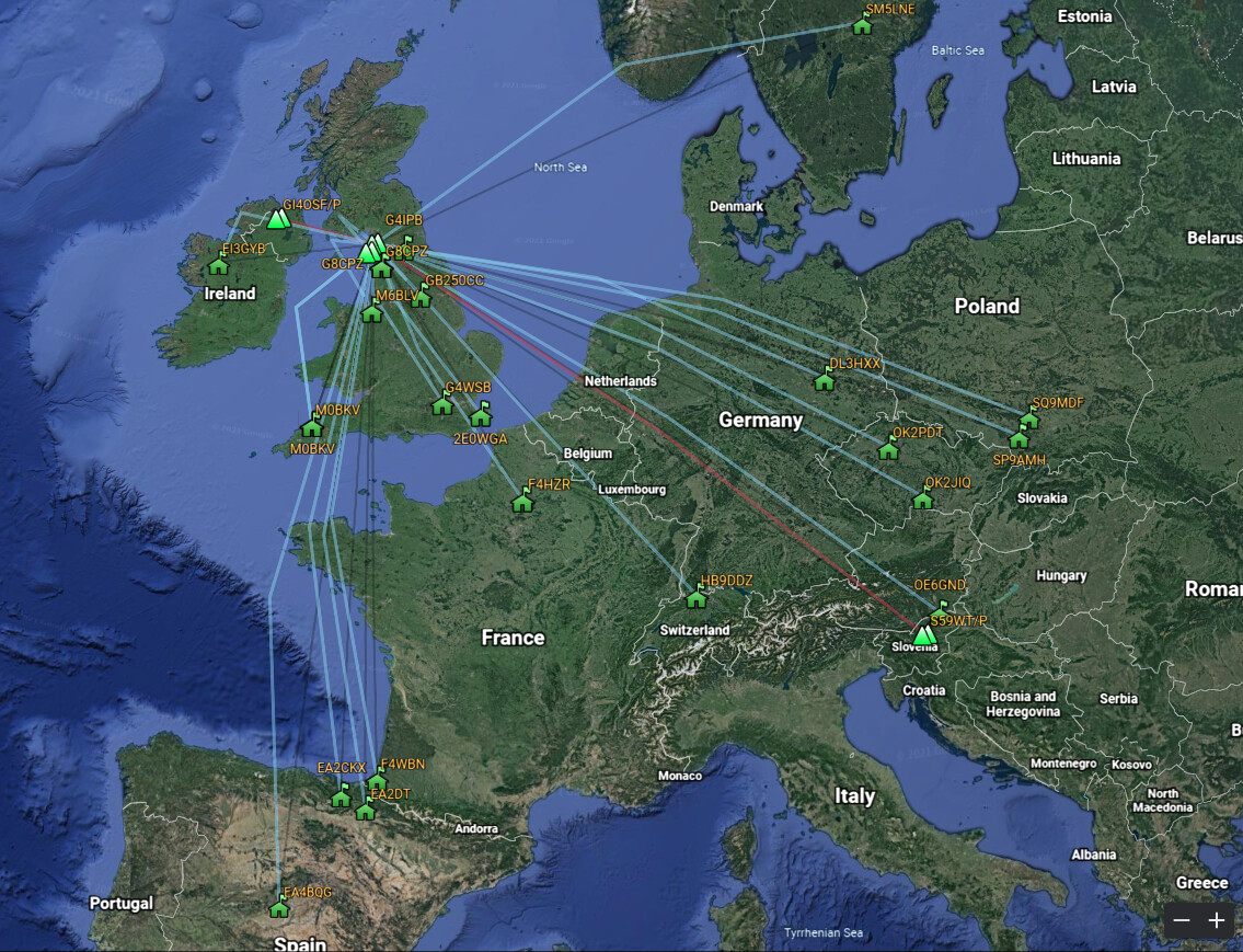
HF SSB Contacts
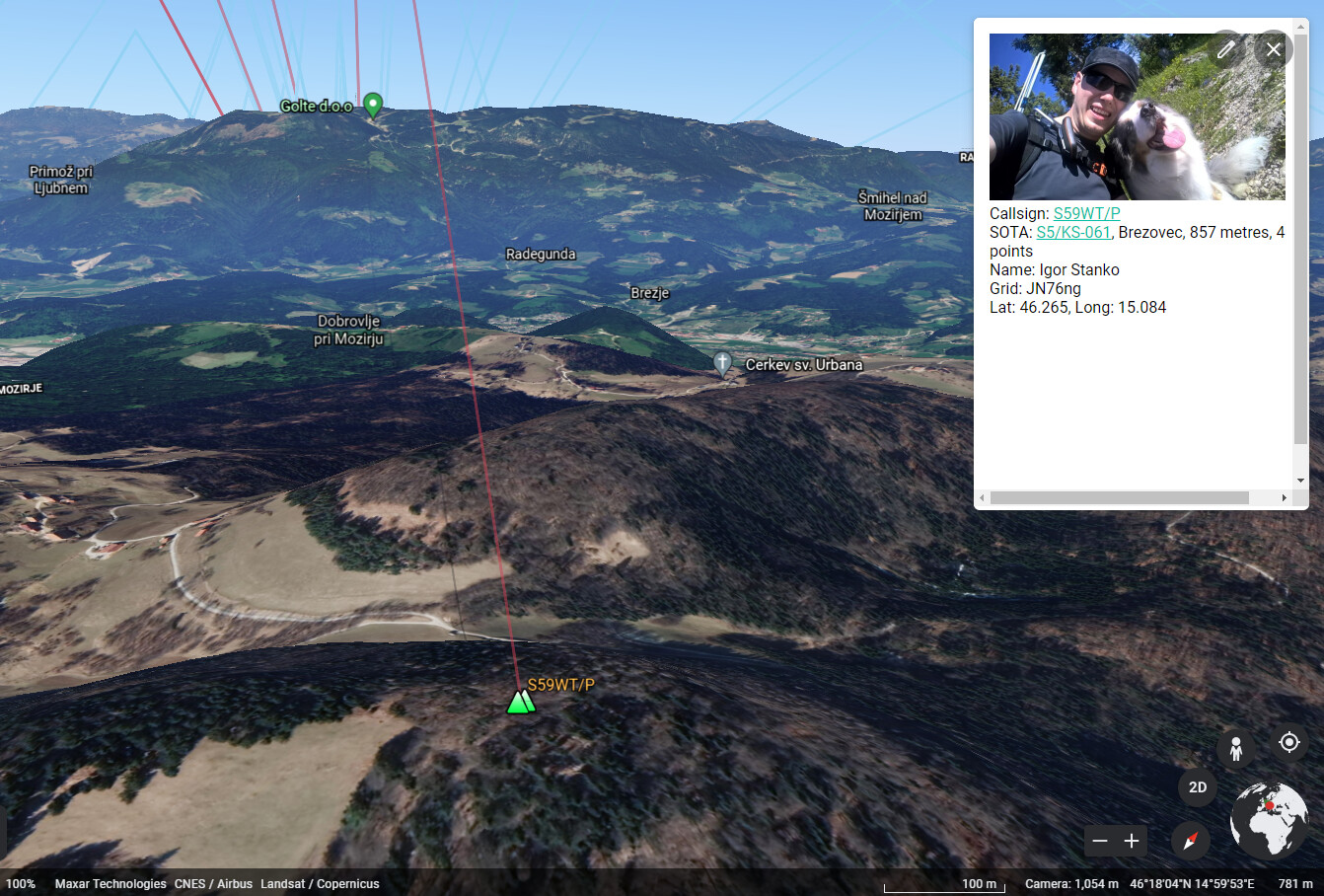
SSB S2S with Igor S59WT/P on S5/KS-061
Great to get Matthew M0MZB/P in the log S2S from Seatallan G/LD-025. He’d been out camping. I’d recommended the combination of FT-817/8 and a Chinese 50w amplifier and he sounded great on that combination with nice punchy audio via our 20m groundwave contact.
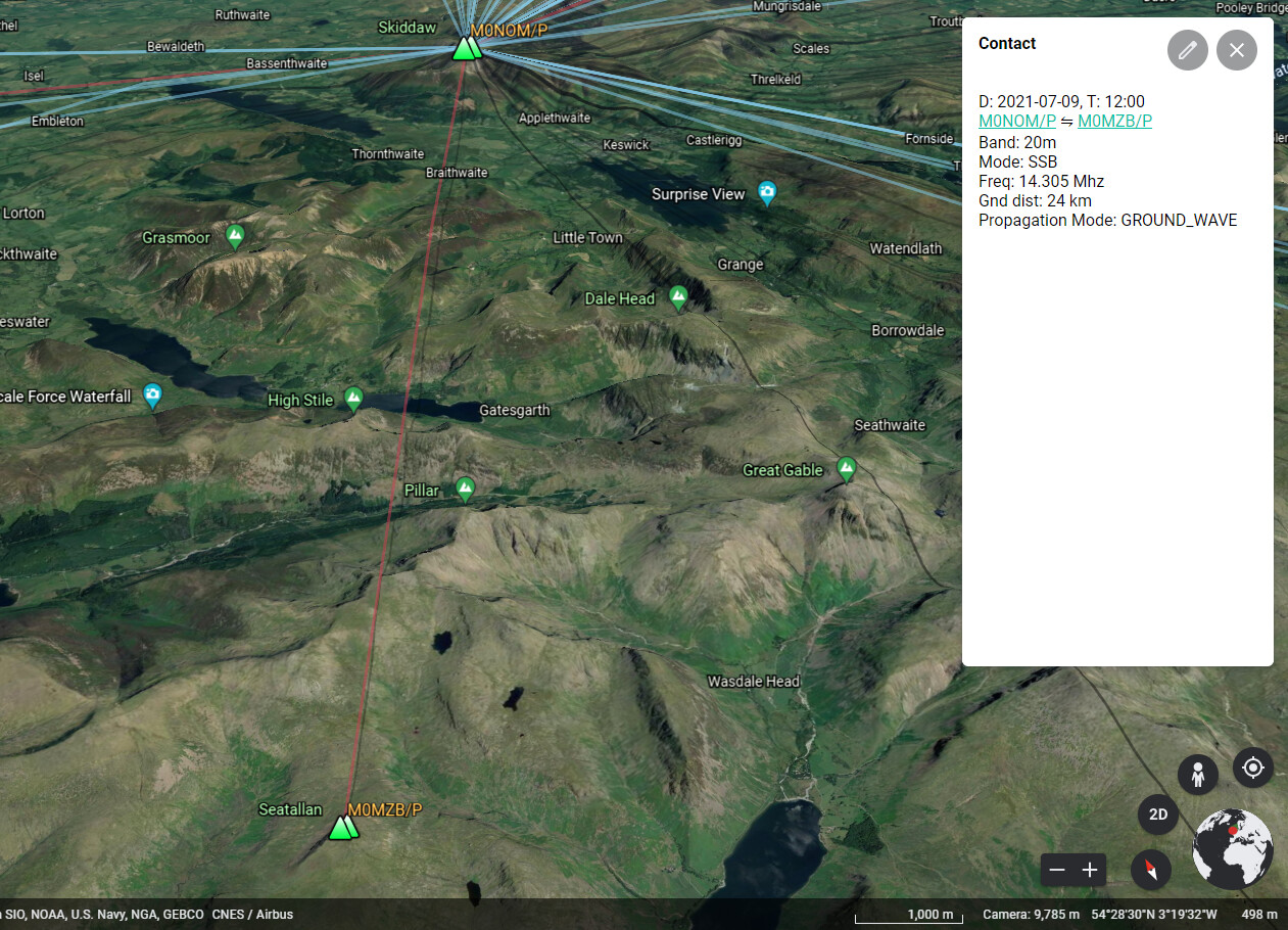
S2S with Matthew M0MZB/P on Seatallan G/LD-025
HF CW Contacts
I braved a Morse activation, and after 25 minutes was thoroughly exhausted! The summit to summit contacts were especially tricky, because there is more information in there and the signals tend to be weaker. I was pleasantly surprised however when checking my log that all but one of the callsigns had been copied correctly. Still struggling to differentiate between U and V, and S and H. Lots of dits, but how many!
| TIME | CALLSIGN | FREQ | MODE | RSR | RST | SOTA-RX | OPERATOR | QTH |
|---|---|---|---|---|---|---|---|---|
| 12:26 | HB9AGH | 14.058 | CW | 549 | 559 | |||
| 12:28 | DL1FU | 14.058 | CW | 569 | 559 | |||
| 12:31 | EA7GV | 14.058 | CW | 529 | 599 | |||
| 12:32 | DL2HWI | 14.058 | CW | 579 | 599 | |||
| 12:33 | UT8UU | 14.058 | CW | 559 | 559 | |||
| 12:35 | HB9AFI/P | 14.058 | CW | 559 | 519 | HB/VS-118 | ||
| 12:38 | DL6WT | 14.058 | CW | 599 | 599 | |||
| 12:40 | OH3GZ | 14.058 | CW | 559 | 519 | |||
| 12:42 | HB9CLT/P | 14.058 | CW | 569 | 559 | HB/AR-004 | ||
| 12:44 | HB9AFI/P | 14.058 | CW | 569 | 559 | HB/VS-118 | ||
| 12:47 | G8CPZ | 14.058 | CW | 539 | 559 | |||
| 12:50 | DJ5AV | 14.058 | CW | 549 | 599 | |||
| 12:51 | HB9CBR/P | 14.058 | CW | 449 | 519 | HB/BE-172 |
Good to get Andy @G8CPZ in the log - another nice 20m groundwave contact.
HF CW Contacts
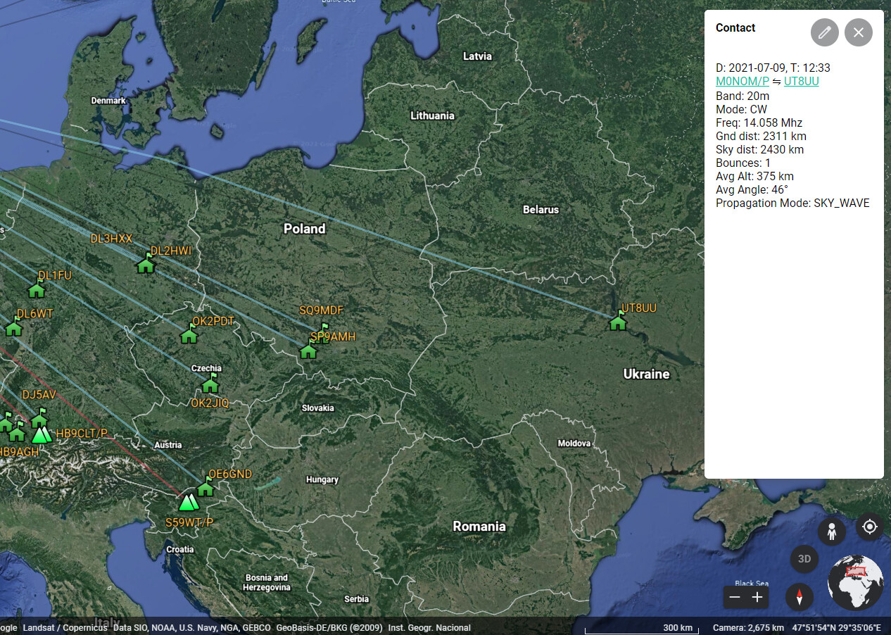
Furthest contact of the day at 2,311km with Sergey UT8UU
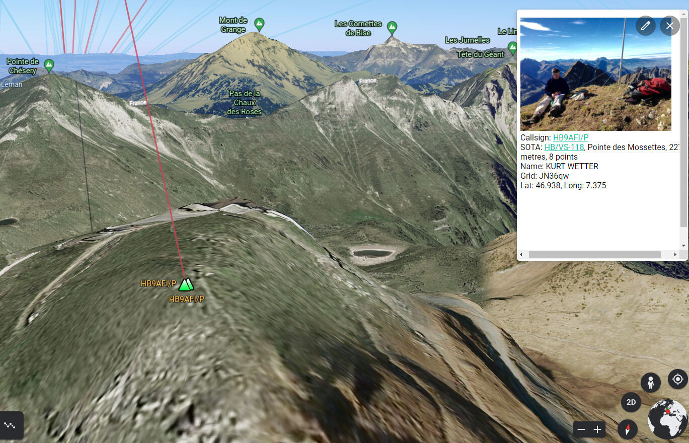
S2S with Kurt HB9AFI/P on HB/VS-118, Pointe des Mossettes at 2,277m, must have been a nice view!
Descent of Skiddaw
I somehow missed the start of Allerdale Ramble which I though would be more direct to Carl Side than the route I ascended by, but at the bottom it was clear they both converged. The Ramble never gets any easier, thankfully it was dry but the loose scree always provokes some Laurel and Hardy comedy.
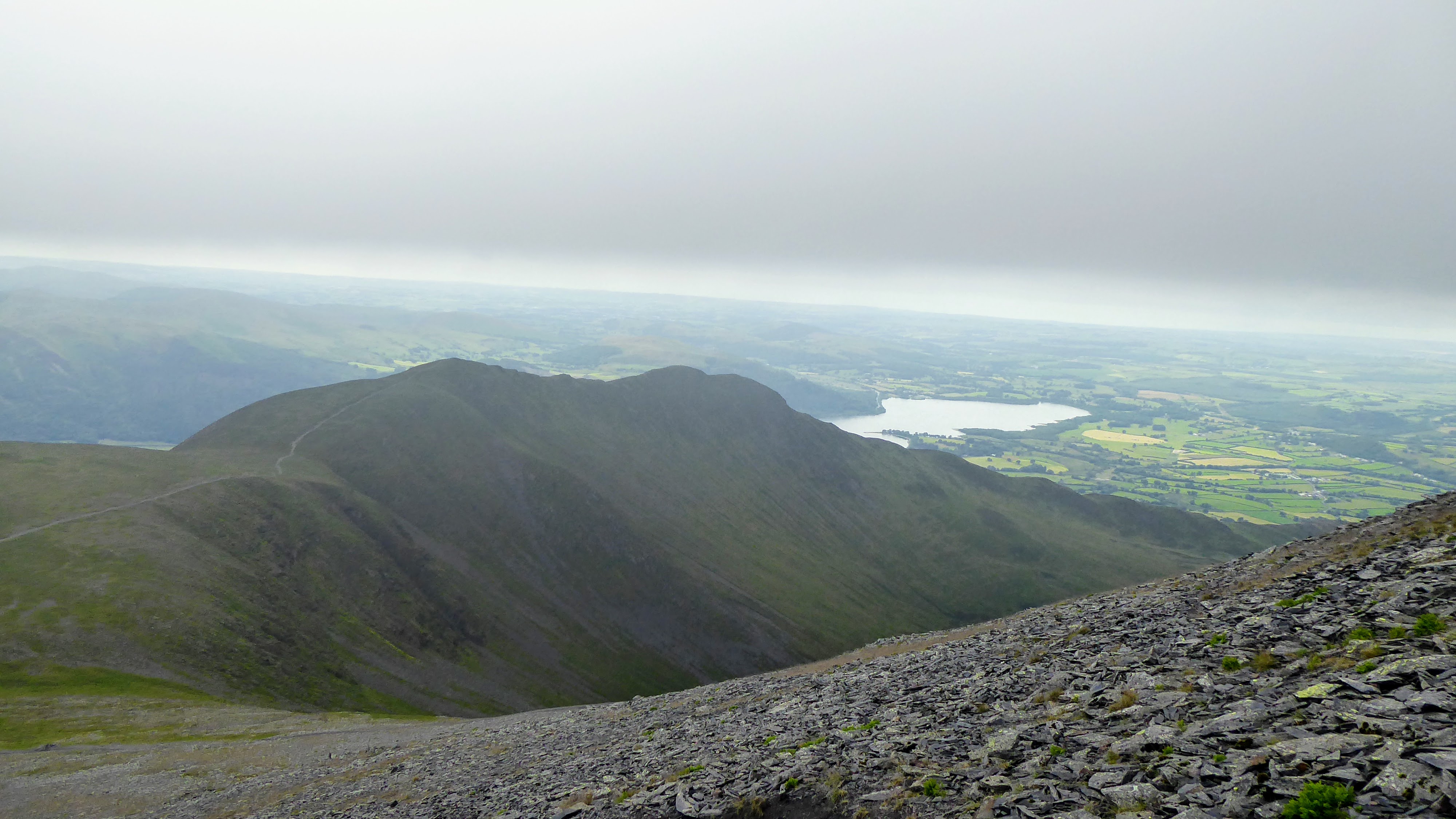
Views of Long Side on the descent via Allerdale Ramble
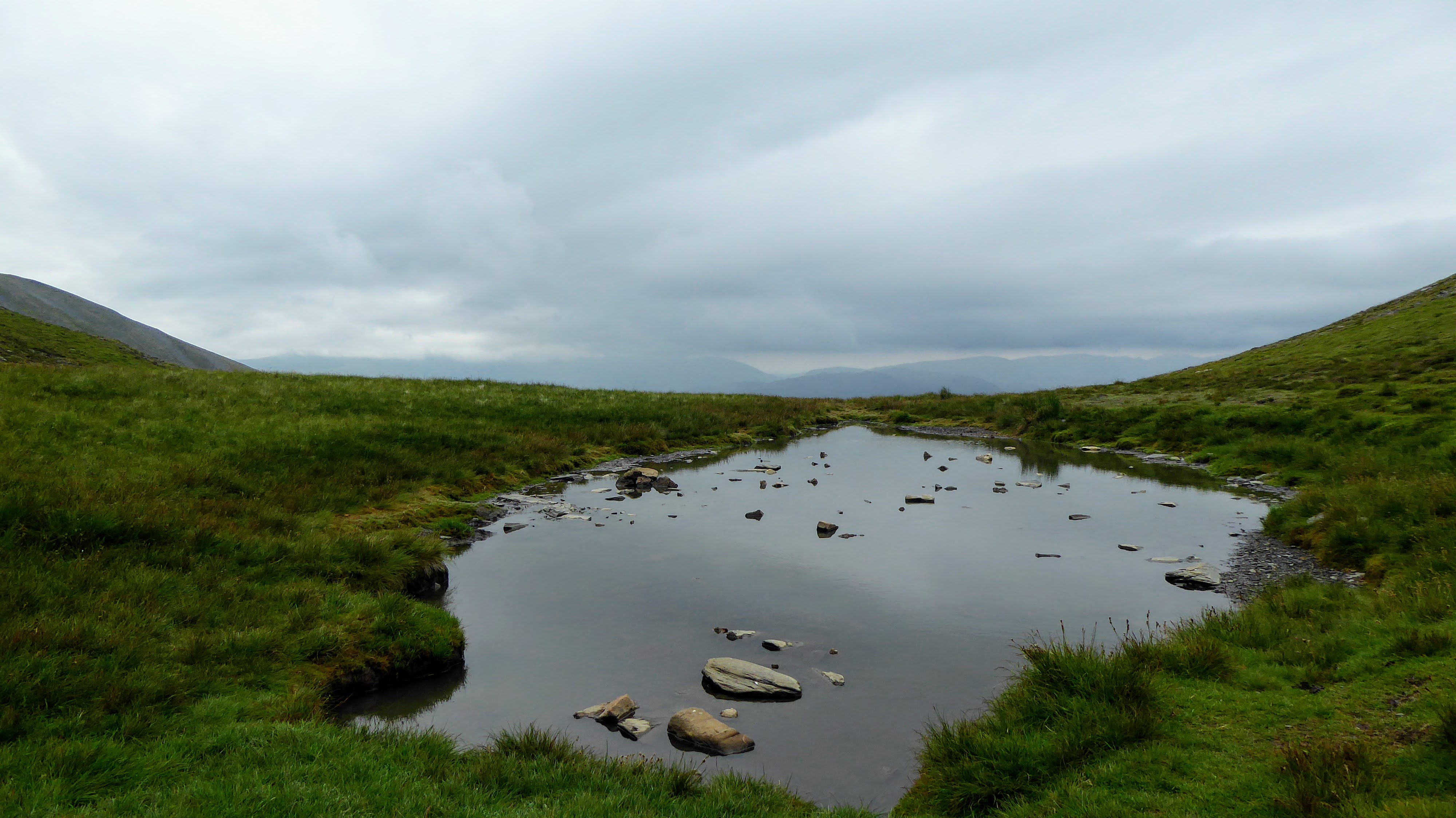
Carl Side Tarn

Arty Cairn Stone pile on Carl Side
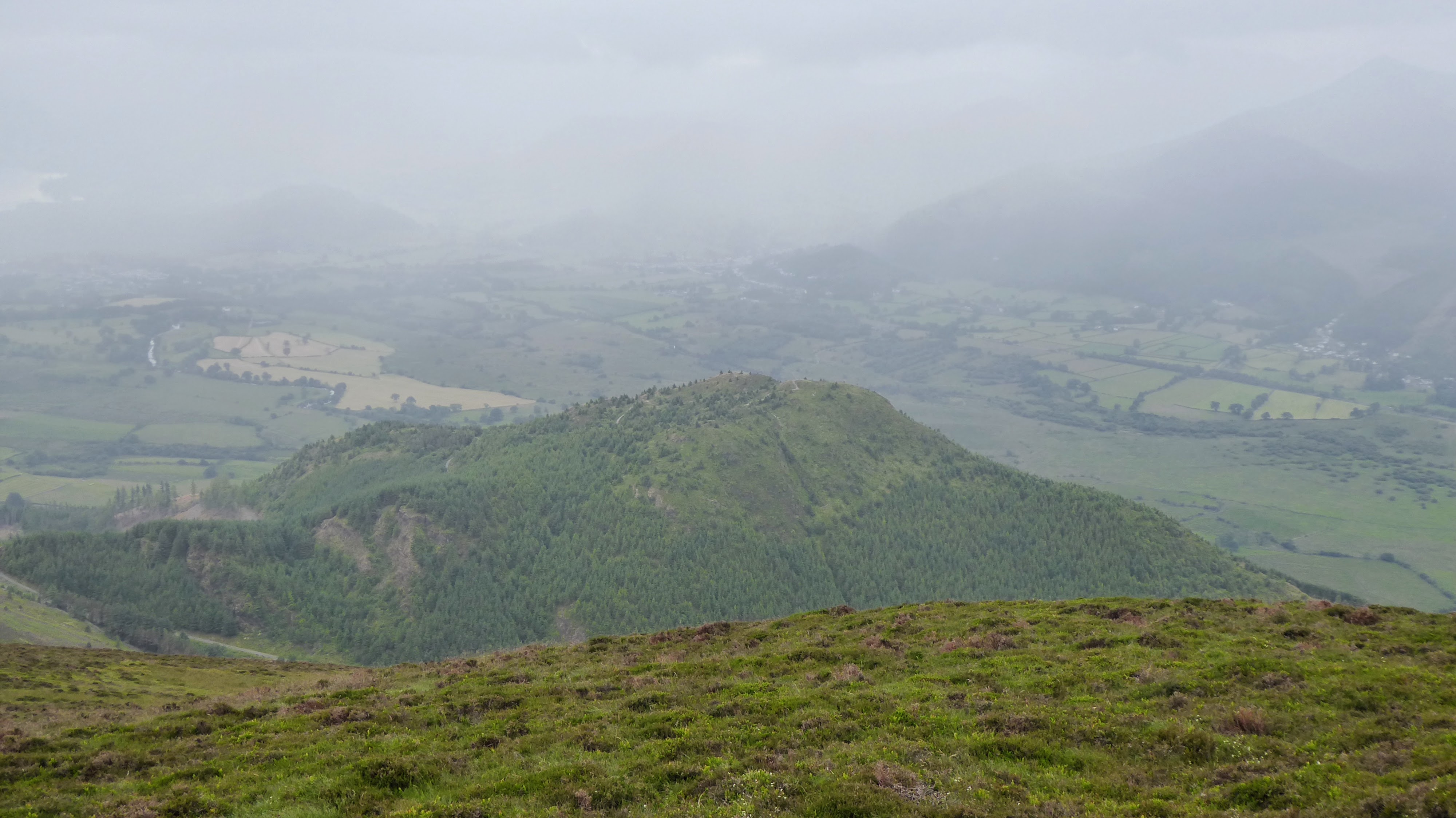
Main path to Millbeck
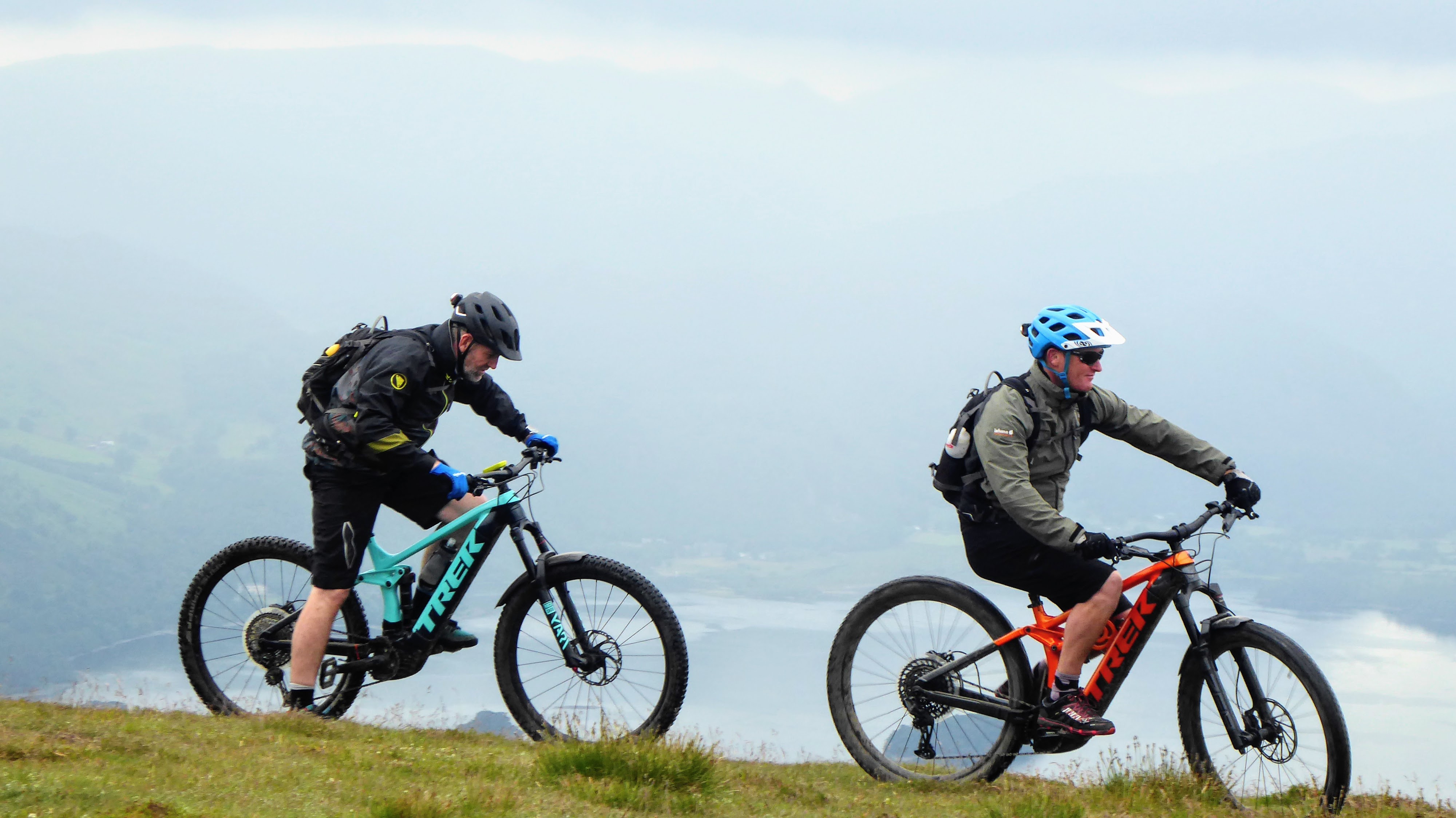
Mountain Bikers on Carl Side
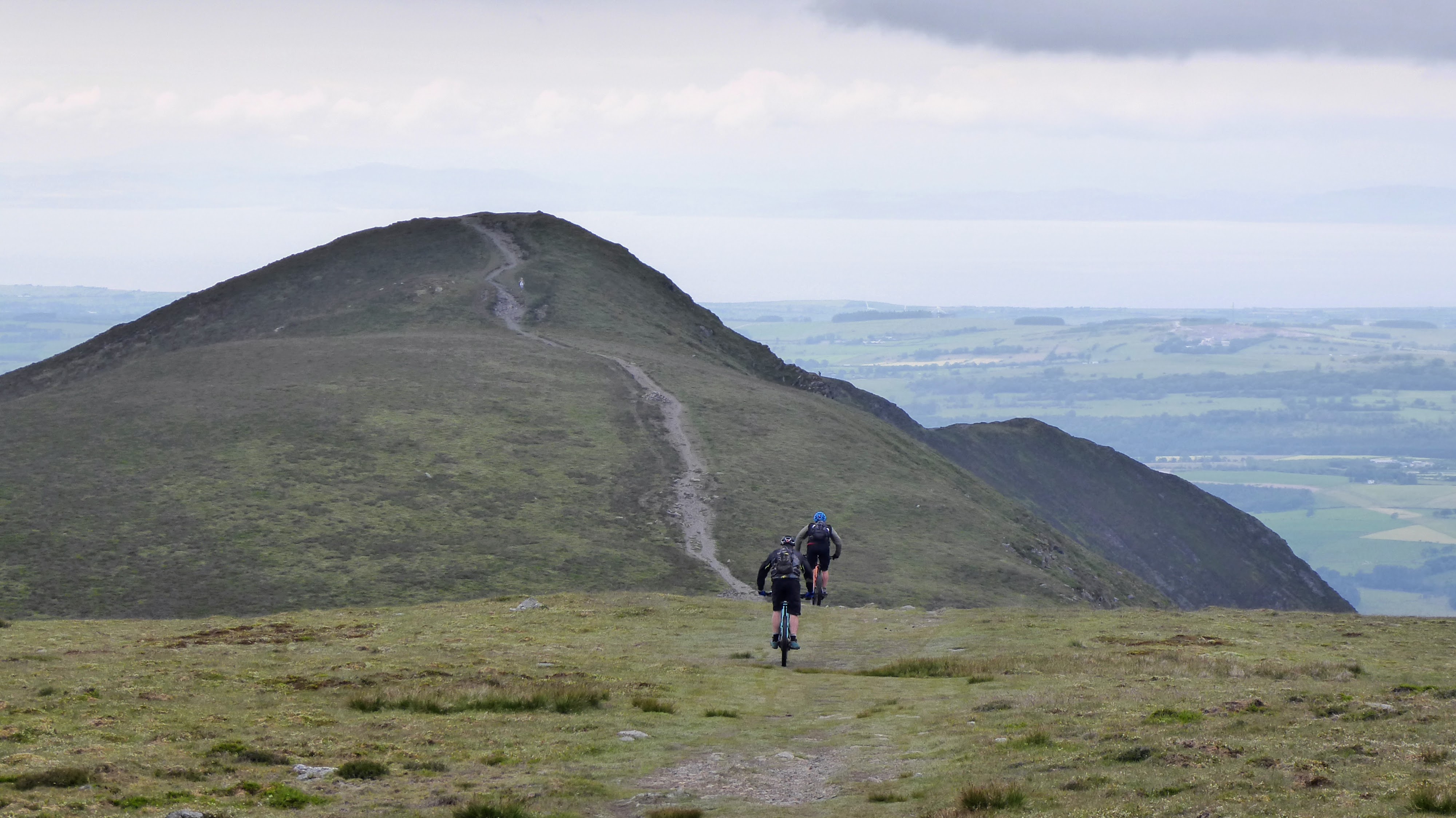
Heading back to Long Side
The return journey was uneventful apart from the rain starting and making stones underfoot slippery. There was sporadic cursing but I managed to stay mostly upright. My trousers were a bit of a state at the bottom however!
Dodd from Carl Side
Dodd summit from Carl Side
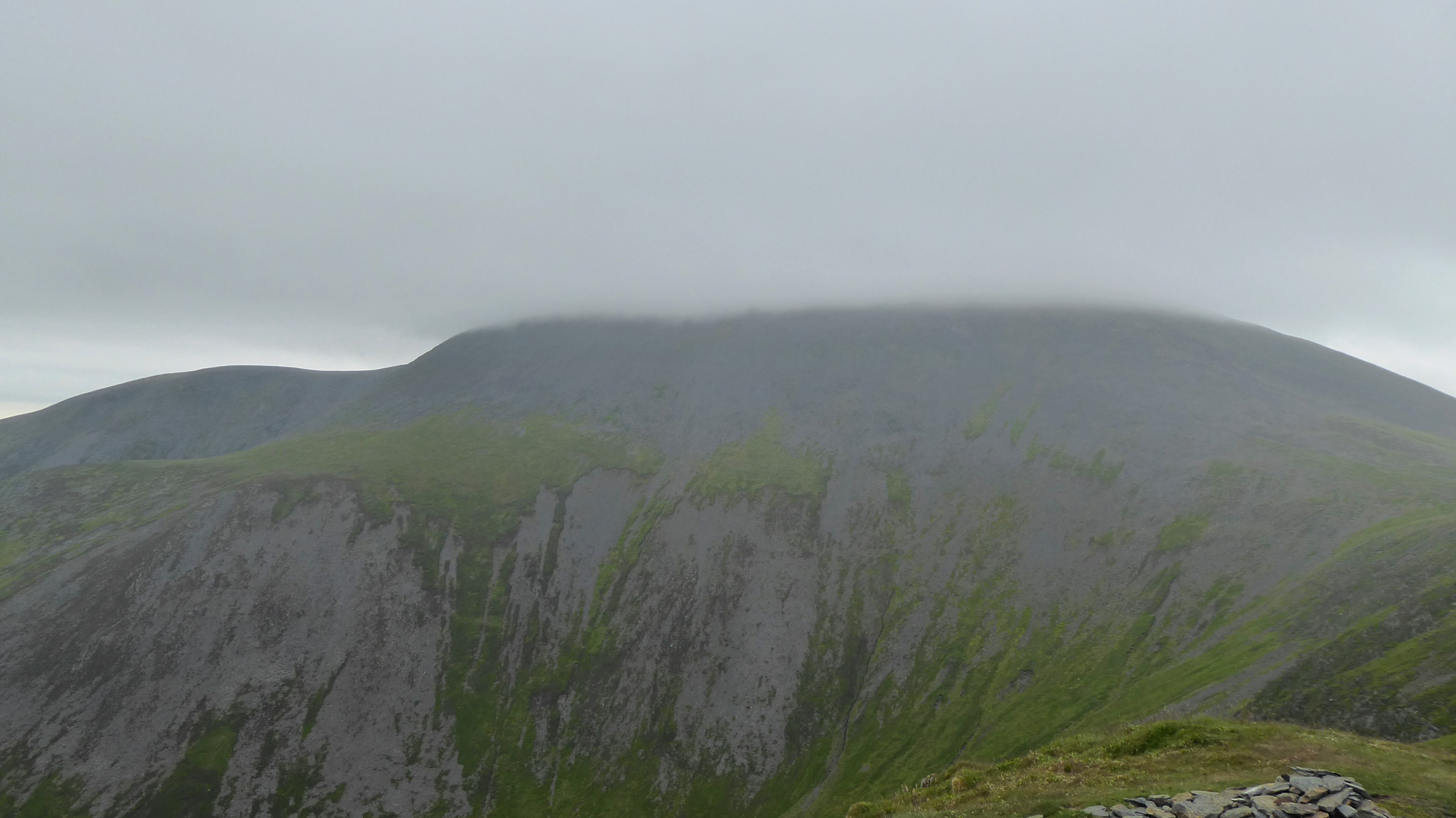
Skiddaw now back in the clouds

One of two obvious TV Masts to the North East
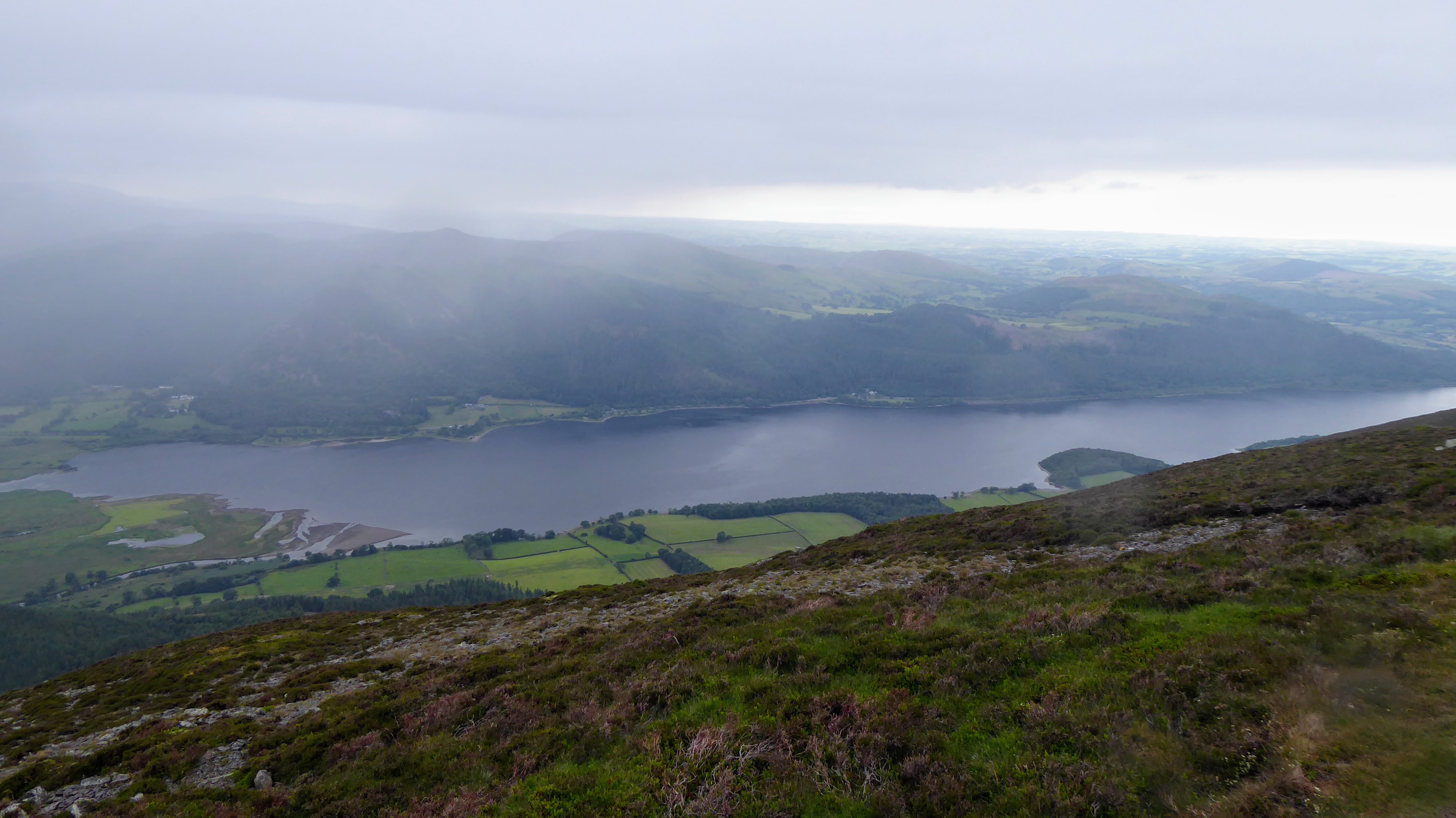
Bassenthwaite
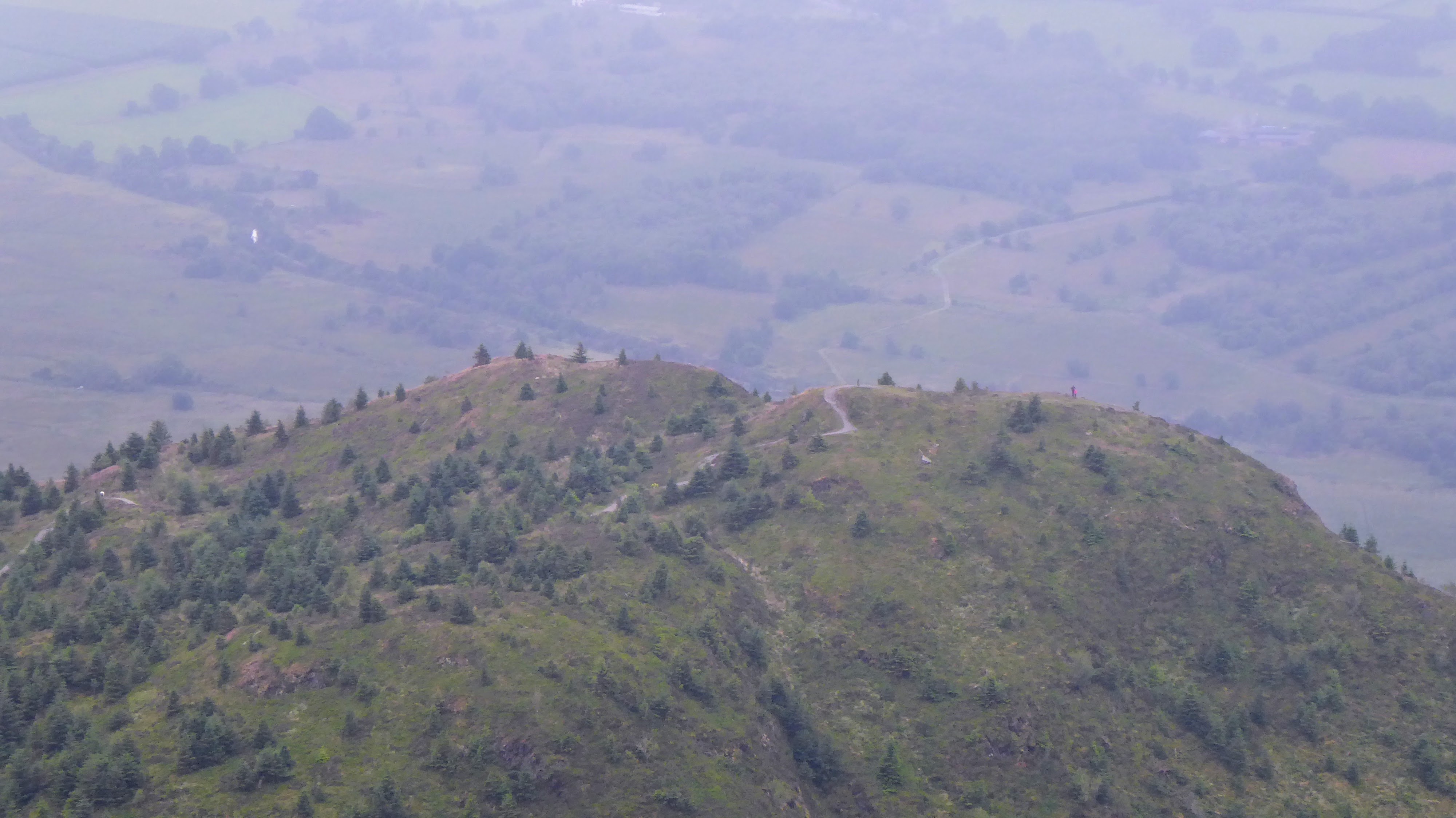
Noisy Raven!

Dropping off Ullock Pike
Descent GPS Track
©Crown copyright 2021 Ordnance Survey. Media 018/21
Descent via a path through the Rabbit Warren
Thanks to all the chasers, the legs were suitably stiff this morning - taking a day off now!