On Friday 9th February I set out cycling from home to head up into Wasdale. I didn’t have a clear plan, other than to spend a couple of nights out camping, with one of those nights being atop Kirk Fell. This was to continue my plan to camp on top of as many of the higher LD summits as possible.
The weather was unsettled and cool, with a fine, still night forecast for Saturday. My intention was therefore to spent Saturday night atop Kirk Fell, but I was undecided what my route should be for the rest of the time.
As I cycled past Wastwater I eyed-up Scafell Pike, and eventually paused the cycle at the turn off for the national trust carpark. I was considering heading up the Hollow Stones route, with the possibility of camping in the derelict stone shack on the summit. However, the forecast was for a wet and windy night, so it didn’t seem a good idea. As I was watching, a dark cloud rolled over the summit and made-up my mind. Instead, I decided to park the cycle at Wasdale Head, and head to towards Esk Hause via Styhead.
I locked the cycle to a notice board at the parking area at Wasdale Head green, and changed into walking boots. With winter conditions evident from about 500m and above, I was carrying ice-axe and crampons, along with two VHF radios, a CW only radio and several antennas plus a 5m pole. I had 3 to 4 days worth of food in case my plans changed.

Heading up to Styhead
Heading past St Olaf’s Church, I looked up at the route to Kirk Fell, along Kirk Fell nose. This route is notorious for being a laborious slog; it the only route up to Kirk Fell that I have never yet tried. From this angle it didn’t look too bad, and was ear-marked as a possible descent route.
Part way up the walk to Styhead a steady rain/sleet started to fall. I took the opportunity to stand behind a large boulder and change out of my cycling shorts, and into leggings/waterproof trousers. Now feeling much more comfortable, I started walking again, and soon starting crossing patches of snow. By the time I reached Styhead Tarn there was a good covering of snow on the ground.

Styhead Tarn with Great Gable Behind
The tarn looked wild and lonely in the dull light of the wintery day. Mist covered the summit of Great Gable, and the stone steps heading towards Sprinkling Tarn vanished into a snowy mist. The dark chasm of PIers Gill, the bane of several walkers, frowned at me from across the hill side.
A whiff of tobacco smoke caught my nose as I approached the tarn, and I found a gent lying inside the stretcher box, smoking. I walked past giving a quick wave, and crossed towards the route up to Sprinkl ing Tarn.
The snow was now thick and powdery, knee deep across much of the path. Unfortunately nobody had broken the ground ahead of me, so the going was slow as I ploughed through the snow.
Spinkling Tarn looked magical in the mid -afternoon light, with snow lying all around. This is a busy spot during summer, but today it was quiet and peaceful. After a short beak at the tarn I set-off again, and was caught by two young lads, out for a walk from the Keswick side. We chatted about our plans; they were navigating using a route plotted on google maps (essentially just following a red line on a 'phone screen , without much else shown on the map). Which took turns to break the ground, until just short of Esk Hause when we had a another chat about onwards routes. Their plan, it seemed was to head over Allen Crags and back down to Keswick.
The conditions at this point were very wintery - thigh deep snow in many places, a brisk wind, and a threat of heavy snow/rain fall in an hour or two. Fortunately, the two lads realized that returning back along their tracks would be the best option, and we parted ways.
Emerging onto Esk Hause, the wind was at about 30mph and carrying a light snow fall. It was now about 1530 and I decided to try camping in the shelter on the south side of Great End - marked as “Bield” on OS maps, The shelter was buried in snow, so I used my axe to carve out a platform for my tent. I then sat in my bothy bag for 5 minutes rest, and checked the met office forecast.
Despite being sheltered by Great End, and the bield, the wind was whipping about me. The elevation here is about 850m, just short of the summit of Great End. The weather forecast suggested things would deteriorate for the next few hours, before brightening up mid-morning on Saturday. In the interests of getting a quiet night sleep, I dropped back down to Sprinkling Tarn to pitch my tent. It would have been fun to camp at the bield, but I wanted a good sleep without the wind rattling my tent all night.
Having broken through the snow on the way up, the descent to Sprinkling tarn (elevation just over 600m) took about 15 minutes or less. By t he time I reached the tarn it was raining heavily. I carefully pitched my tent on a small prominence, and then filled my water bottles before diving into my tent. It felt like such a relief to get under the canvas. The rain started to become rather heavy and I was glad I had descended – the snow platform I had made at the bield would risk turning to slush if this was also falling as rain higher up.
I cooked my meal, Pasta a la Funghi, did a little morse practice and then watched a film for a little before dropping off to sleep.

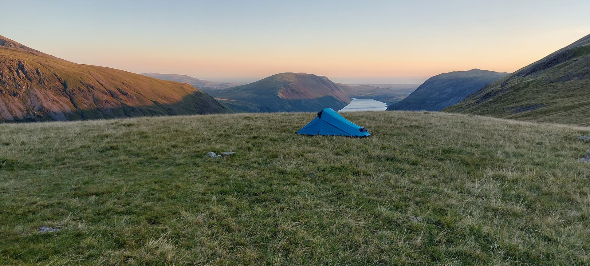
Camping at Sprinkling Tarn
I slept soundly for most of the night, only waking to hear the rain a wind a couple of times. I was using a Hilleberg Akto tent, which can stand up to quite ferocious conditions, and using a PHD sleeping bag with waterproof outer - so I had no worries about staying warm and dry.

Saturday morning at Sprinkling Tarn
The following morning revealed a thaw had taken place over night, there was still plenty of snow around, but going would be much easier. I took down my tent, and was heading off just after 8am. The walk up to Esk Hause was easier than the previous afternoon. As I headed around the back of Great End, I could see that my snow platform was still in good condition.

Heading up to Esk Hause , patchy snow after overnight thaw
A heavy snow shower set n as I climbed over Ill Crag and descended to Brad Crag Col. The ascent to Scafell Pike form this col can bank-out in thick snow, and become quite hazardous with loose drifts. The thaw had removed most of the snow, however the mix of rock, ice and slush made the going tricky in places.
Cresting the summit, I was pleased to have Scafell Pike briefly to myself. I stood at the main summit shelter and called CQ on my HT. 2E0LDF was first to respond, followed by GW4ZPL, G4VFL and G1FVA. I made a total of 17 QSOs before closing down.

Obligatory photo of summit of Scafell Pike
Heading of the summit, I was aiming for the corridor route. Just as I lifted my pack onto my back I heard MW6BWA/P calling from GW/NW-013 and was delighted to claim the S2S points. Heading down to Lingmell Col, there was now a steady stream of walkers, and the cloud was starting to lift. I turned right at the col, to join the corridor route, with Styhead Tarn visible ahead and below me.

Heading back to Styhead

Piers Gill
The corridor route is a pleasant jaunt along the hillside, and allowed my to complete a full circle of the summit by the time I got back to Styhead. After a quick spot of lunch I headed up Aeron slack - my favorite route to approach Great Gable. The going was fairly easy, with a blue sky above me, and the stream trickling along the slack as an excellent water source.

Summit of Aeron Slack, looking west across Ennerdale (Pillar at left, High Stile centre, Grasmoor at right)
The last bit of the ascent is a scramble over rocks, which was much more pleasant than when I last took this route (in descent) back in March 2023. Atop the summit, it was now 2pm, and starting to get a bit chilly.
I called out on 2m using my HT and M0LLC was first to respond followed by, G4WHA/M, G6AEK and M0YMK. I was pleased to finish the pileup by catching GW4TJC/P on GW/NW-026.

View from Great Gable, looking Over Kirk Fell towards Pillar, Buttermere is visible to the right
After packing away I started the descent to Beck Head. this is an unpleasant route at the best of times, as I always seem to lose the path and end up scrambling over boulders. Today, the patch was covered in ice, and I was glad to have my crampons to secure my descent. Sure-enough I deviated from the path at one point, and was again glad of my crampons as I traversed across a patch of ice and snow to regain the route.

looking back at Great Gable
I hurried across Beck head and up the eastern side of Kirk Fell, pleased to reach the grassy top of the fell. I walked along the southern edge of the plateau and filled by water bottles with about 3 liters of water from a small stream before heading up to the summit proper.
I scouted around for a few minutes before setting on a pitch a stones throw from the summit shelter. Once the tent was pitched I set about getting my EFHW lofted, and then connected up the radio.
I only managed a couple of contacts on 40m, it seemed that most of the chasers had gone to bed, so I put a call out o 2m and spoke to GM4WHA, GW4ZPl and M0LLC. Combined with he contacts on 40m I just about qualified the summit.
I made my dinner Curry Fruit Rice – and listened around on the bands for a while, before taking a wander around the hill side in the dark. A light atop Pillar suggested that someone else was also out camping on a summit tonight. I eventually got into my sleeping bag, and headed off to sleep, leaving my HT tuned to the 2m calling channel.
At shortly past midnight I awoke to have another wander around, and watch the stars. I like have a midnight wander during summit camps. The Milky Way was clearly visible, as were the twinkling lights of West Cumbria. At a few minutes past midnight, I heard GM4WHA calling on 145.500MHZ, and we had a quick chat before heading off to bed.
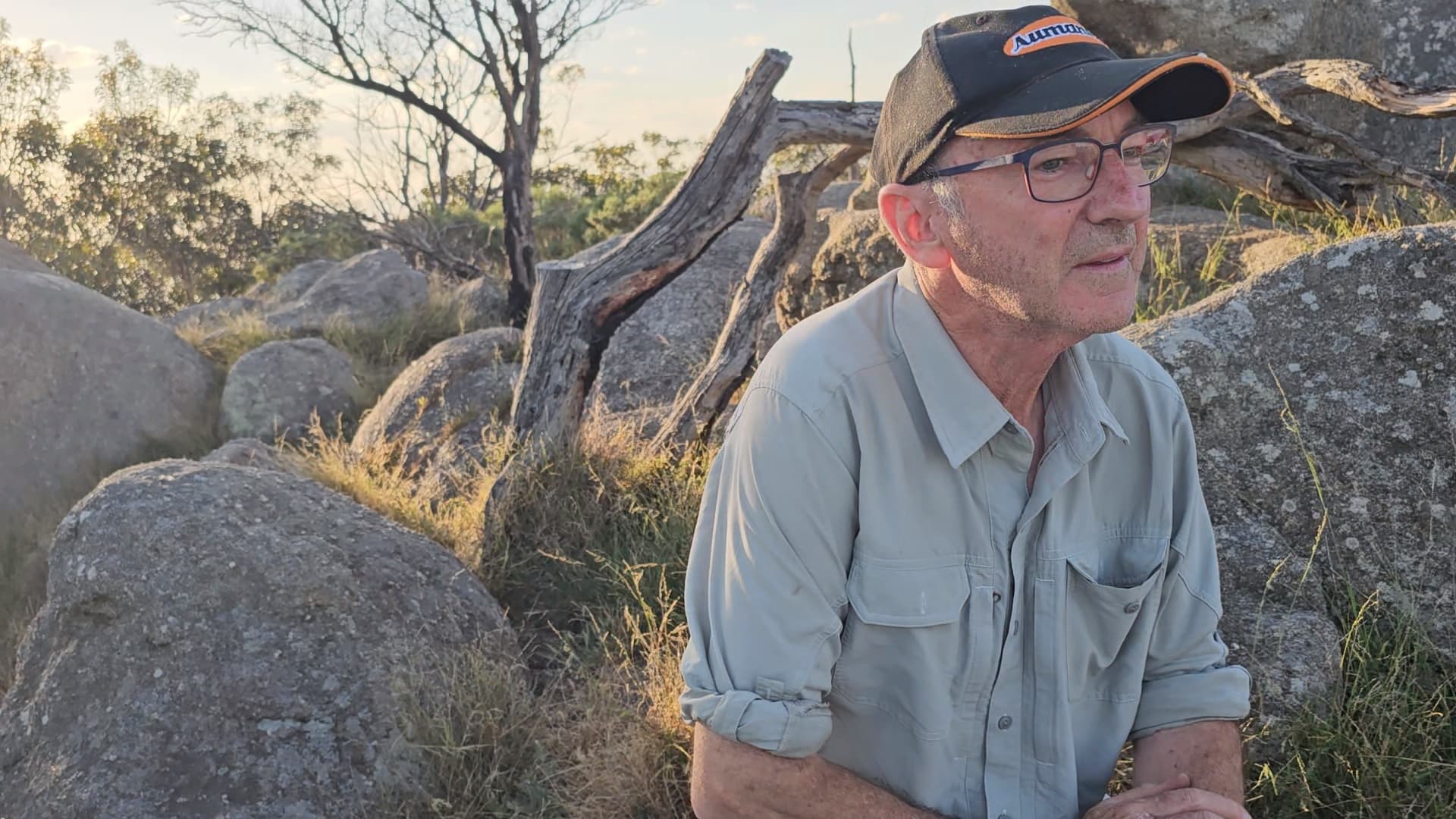
Next morning I started on 40m CW at about 0730, and made a good mixture of contacts, including a good chat with DL1HBT, with whom I hatted about the book I have recently published, followed by a 2m FM QSO with M0TKF/P on G/LD-008. I then starting scanning around for S2S on HF, and noted VK3HN/P calling on 20m from VK3/VC-030 . I was amazed that I could clearly hear his signal, and when his pileup had subsided I started calling. I was delighted to hear him respond with “M0M?”, and after several repeats he managed to construct my callsign and receive my signal report. As I write this a week later, I am still delighted at getting a S2S to VK.
The QSOs continued on 20m and 40m, and I made a total of 46 contacts over the morning. By about 10am I decided to pack away and head down the slope to Wasdale Head.
I will not be taking this route again, the scree slope was most unpleasant with a heavy pack. My favorite route up Kirk Fell goes via Baysoar Slack - a much longer route, but greatly more enjoyable.

Evening on HF (click to view without crop)

View of EFHW (5m pole at right) with Scafell Pike in cloud in background (click to view without crop)

HF Setup

Morning atop Kirk Fell