I’m not sure if it’s best to do individual threads for my reports on our SOTA trips or gather them into as as I have been doing in Scotland tour September 2026, but thought this one would benefit from its own title.
14 September 2026: Monday: GM/ES-084 Bin of Cullen and GM/ES-073 Knock Hill
The forecast wasn’t ideal, with showers forecast ahead of a main rain band arriving from the southwest around 17:00. The forecast looked slightly better east and north, so we decided to do a couple of little hills without too much ascent, starting with GM/ES-084 Bin of Cullen. It was cloudy with a few spots of rain as we drove on the A95 past Keith and then north to a parking area at a track start at NJ492633. There is limited parking and it was busy with dog walkers, but we eventually managed to manoeuvre into a space without blocking the gate.
It was dry as we set off, and warm so we just had jackets over shirts as we took the path through the trees. At a junction where we turned left to follow the main path, we passed a group of geography students being taught surveying in the forest. The gradient was gentle until we turned a corner where a set of zigzags took the track uphill and eventually out of the forest. We continued to the summit which provided excellent coastal views and luxury accommodation. It was our first encounter with a square sided “Lossiemouth” trig point, and there was also a toposcope, two seats and a picnic table. There was gorse near the trig but a heathery area on the western side. Other people visited the top while we were there, but there was plenty of space.
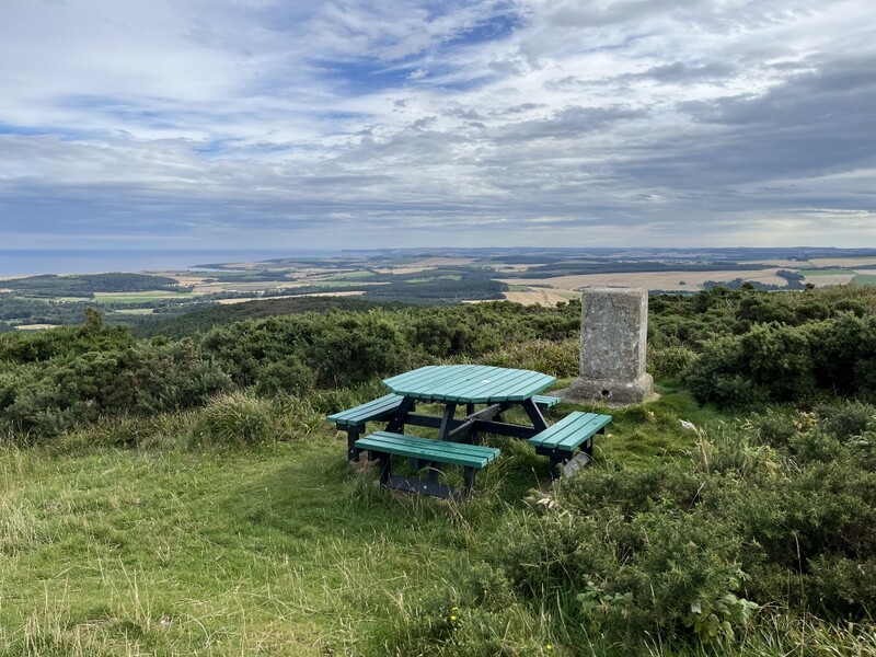
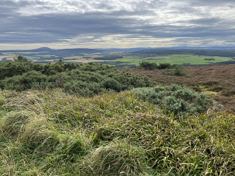
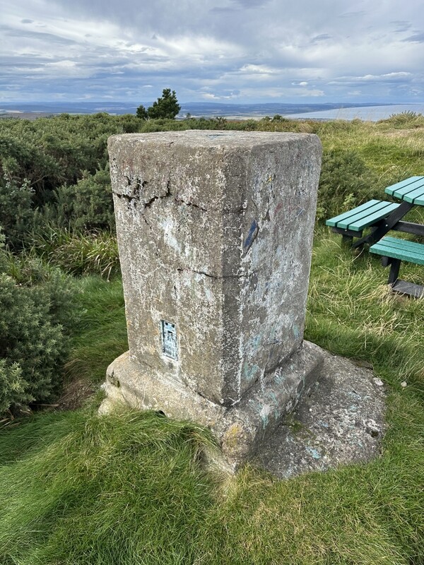
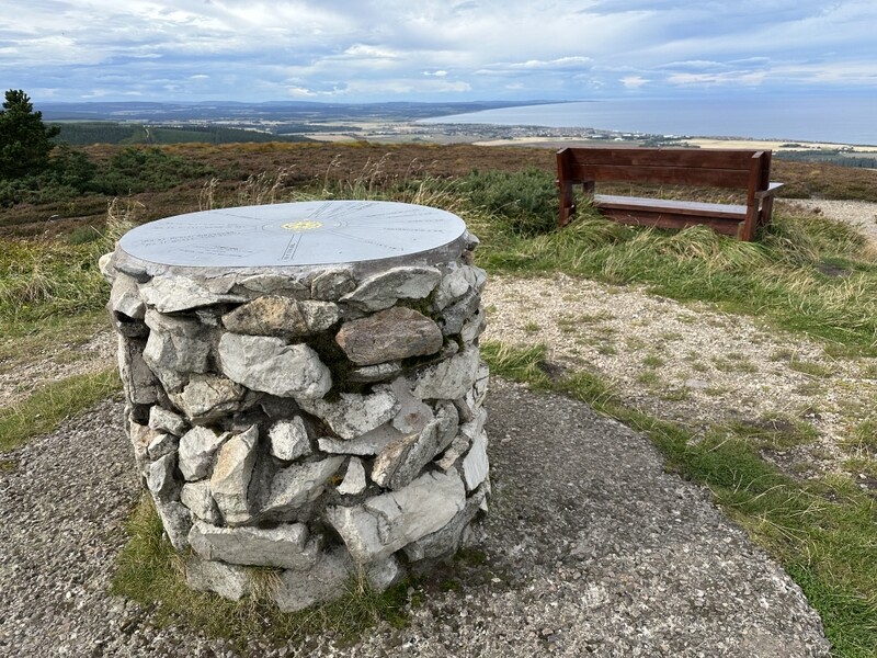
It was windy so we needed to add extra layers, the waterproof being useful when it later rained. Radio was less good than the views. Caroline used one of the seats to support the MFD but initial calls yielded just one 2m and 70cms FM caller. 60m SSB was no better for Martyn, so after over 20minutes we decided to try 40m, with both of us working stations until qualified. Having got 4 40m SSB contacts Caroline left Martyn with HF and returned to 2m getting one more 2m & 70cms contact. As we were about to pack up, we managed a final 40m S2S with M0KPW on G/LD-056. Only 5 contacts each on 40m SSB. With lunch eaten, there was some light rain as we packed up, but it stopped before we left.
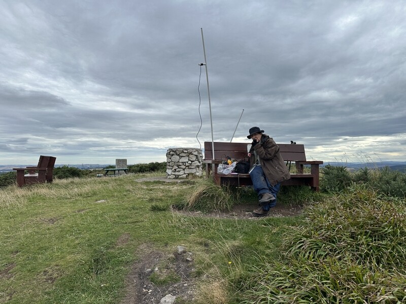
Bin of Cullen GM/ES-084 VHF
On the way down we passed the geography students now surveying higher up the hill whose teacher asked what we had been doing at the summit, so we explained. Where the paths split, we took the more direct path avoiding the zigzags, which was mostly good, but involved some close encounters with gorse. Emerging back onto the main track we then had the curious incident of the dog. As we emerged a man was walking up with his dog a little behind him. On seeing us the dog suddenly turned tail and ran down the hill. We stood still as the owner called the dog back but it wouldn’t come and instead ran further down the hill round the corner. We cautiously carried on down, to see the dog standing some way away further down the track, only for it to turn tail and run even further away. The owner started to descend and kept calling the dog, but it run away every time it saw us round another corner. We eventually stopped and waited for the owner to pass us, and he eventually caught up with the dog, which started behaving more normally once the owner was between us and him. The owner shrugged “looks like we’re not going to the top today” as he passed us! We let the man and dog stay ahead of us all the way back to the car park.
There was rain as we drove to our next target of Knock Hill GM/ES-073. The parking area at NJ547552 is up a very bumpy single track road with few passing places, but there is plenty of room to park where the main track turns right. We were lucky not to meet anything on the way up, as several vehicles passed in both directions while we sat in the car contemplating whether to venture out into the rain. The rain became lighter so we togged up with Paramos and rucksack covers. A narrow path heads upwards through the trees about 20m further along the track from the parking, with some gorse to negotiate. The rain stopped and we were soon overheating as the trees gave way to heather. It was a steep slog upwards – no zigzags or wasted steps here.
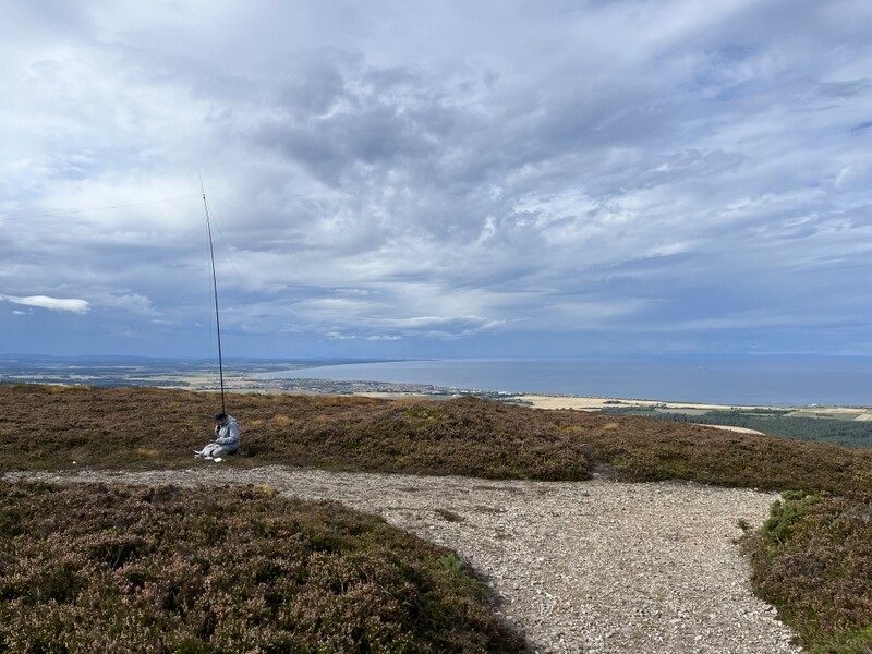
Through a gate at the top to another square sided “Lossiemouth” trig point on a small grassy mound with heather beyond. There were also a cairn and a small drystone memorial. There was no suitable hole in the trig point so Caroline lashed the MFD to the outside, the chunky trig point stretching the limit of her bungees. The heather was low enough to make HF reasonably easy to set up. Radio conditions were a bit better – Caroline managed three 2m FM and 70cms FM contacts, but a fourth wasn’t to be had. So after Martyn had qualified with 6 on 60m SSB, we moved to 40m SSB for an S2S with Tim GM5OLD on GM/SS-272 with Caroline getting a further 12 contacts.
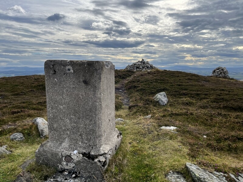
Knock Hill GM/ES-073
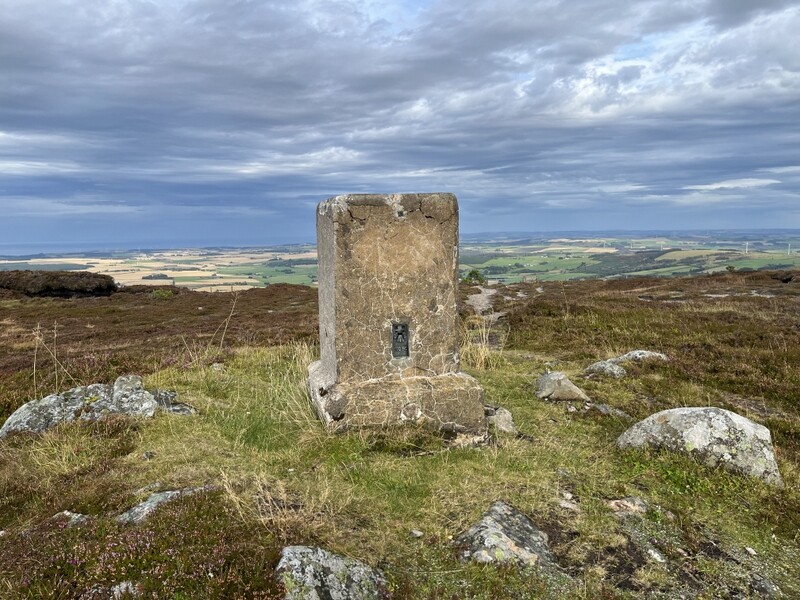
Knock Hill GM/ES-073 “Lossiemouth” trig point
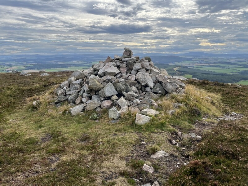
Knock Hill GM/ES-073 cairn
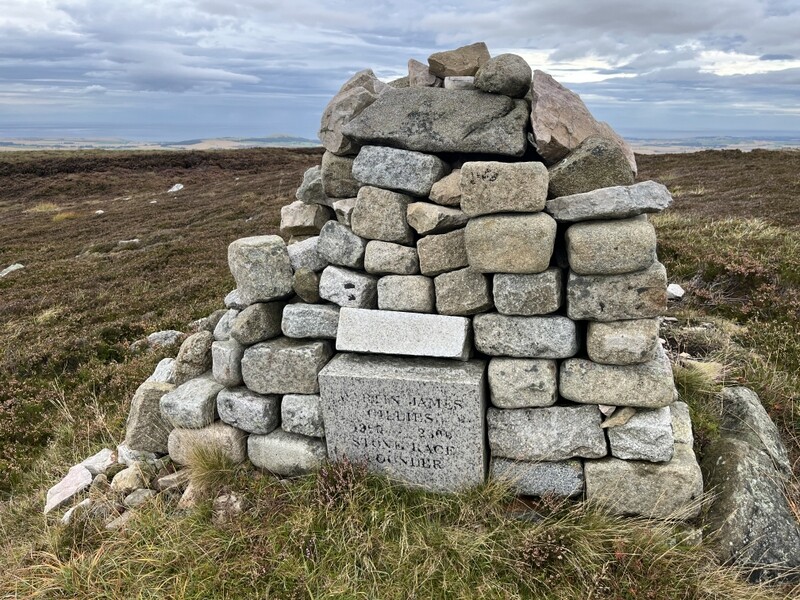
Knock Hill GM/ES-073 memorial
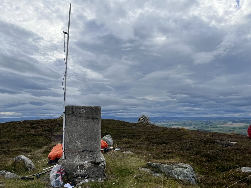
Knock Hill GM/ES-073 VHF
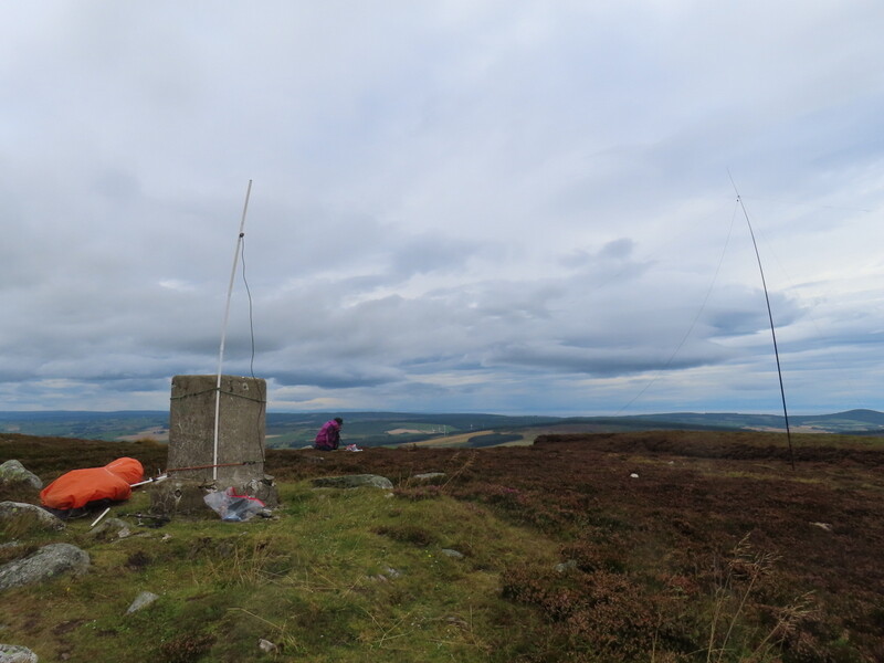
Knock Hill GM/ES-073 - both stations
We managed to pack up in the dry, but had more rain on the way down. The rain had stopped back at the car, but we drove back to the cottage through more heavy rain, which had stopped by the time we got to Grantown. A very striped day.