Trip to GM/SS, GM/ES and G/SB

Next week Martyn M1MAJ and I will be heading north and hoping for some decent weather to do some SOTAing, first 4 nights in Lanarkshire, then a week in Aboyne, Aberdeenshire and finally 3 nights in Northumberland on the way back. As usual I will be concentrating on 2m FM and 70cms FM, so would be grateful for any locals to make contacts, and Martyn will normally be on HF, but we’ll both use the other rig for any S2S opportunities, or when radio, weather or other conditions require.

Which hills and when will depending on weather and our level of fitness. From Lanarkshire I’m hoping to do at least Kirkland GM/SS-164 and Cairn Table GM/SS-120 which Martyn activated before I was licensed. We’re mostly aiming at uniques, but may do some repeats, depending on conditions.

We haven’t visited Aberdeenshire previously, so there are lots of uniques for us to go for. We like to get completes so GM/ES-078 and GM/ES-059 are high on the list. The only other completes for both of us in the area are Lochnagar GM/ES-008 and Creag an Dail Bheag GM/ES-088. Much as we would like to do Lochnagar I fear that given our normal slow rate of progress up hills it isn’t going to be feasible now the days are shortening, and ES-088 also looks like a long walk in. We’ll mostly be looking at 1 and 2 pointers and some of the lower 4 point hills. Local tips on hill accessibility would be useful. In particular I note suggestions that some of the car parks and routes through the forests around GM/ES-077 Bennachie are closed/blocked. Is it sensible to try to combine Bennachie and Millstone GM/ES-077 in one walk or are they best done as two separate walks from different starting points. I also note that the bridge over the Dee at Aboyne is closed.

In Northumberland we would like to do Cheviot if the weather is good (we last did it pre-SOTA). Also walked pre-SOTA is Long Crag G/SB-008 which we did from the Forestry parking for Thrunton Wood, but 30 years later that doesn’t look ideal. Any local tips?

Thanks,
Caroline

3 Likes

When you are in Northumberland consider a short detour to Ros Castle, it is a very short walk but is a rather nice hill. I’ve only done Long Crag from the car park just past Lordenshaw and although probably longer than going through the woods it is a really nice walk with good views. There is one steep descent through the rocks at Simonside other than that a very easy path for the whole walk.

Yes!

To be honest, Bennachie is a lovely walk from the Back of Bennachie car park, on a great path and Millstone Hill is a nice short hike up a good path from the Don View car park. Doing them both together would involve some back-tracking. You could easily do both in the same day, as separate hikes.

Look forward to hearing you both!

4 Likes

This is a long one!

Some GM/ES summits that you might consider are:

It’s easy to get carried away with this list as they’re all good hills! But these are ones that I enjoyed and think you would too, given the types of hills you’re looking for. Not checked if you’ve done them before though.

3 Likes

Kirkland hill might be a bit soggy after this weeks rain but it’s a nice wee hill.

Blackcraig hill GM/SS-070 was a nice walk a couple of weeks ago, about 90 minutes each way.

Andy

MM7MOX

A fun day today on 2m!

I wanted to do Ben Macdui (GM/ES-001) and Carn a’Mhaim (GM/ES-013) via Derry Cairngorm (tick off that hill), and Caroline had told Fraser they were doing Geallaig Hill (GM/ES-036) and Craigendarroch (GM/ES-078) today. I was hopeful we’d manage a S2S on one at least, but timings don’t always work out. The weather forecast was a bit mixed, maybe sun, maybe cloud, maybe rain, but in the end it was mostly wind!

Up and over Derry Cairngorm, barely able to stand up at the top, and onward to Ben Macdui. The cloud was about 1300m, so would come in and out - in being grey and out being lovely views all round. Thankfully there are multiple shelters at the top and I picked one and call CQ on 2m. Caroline and Martyn were in the car and so chased as /M. A few familiar voices on 2m and then I moved to HF. The wind and band conditions were annoying so I was pleased to give up when I saw Jeff, MM/WJ7V (@WJ7V), and Amy’s, MM/KC7JNU, spots on Morrone GM/CS-060. They were working Caroline and Martyn when I tuned in, who had just got into the AZ, and afterwards we continued the trend of 59 2m QSOs. (Jeff and Amy are on their MM Holiday as well, GM/ES being a popular destination - you will recall Morrone is technically part of the Democratic People’s Republic of GM/ES).


I packed up and headed off, whilst Caroline and Martyn got setup on Geallaig. Just being a little bit lower meant the views were lovely all round. The wind was still relentless, but now was mostly behind me, so helped me along!


I just managed to catch you both again as you were packing up! Making 6 2m S2Ss today.

After a long walk back, I was wondering if you were still doing Craigendarroch, or the tea rooms of Ballater had trapped you for the afternoon! I had the HT on the passenger seat and when I saw the spot on my phone I pulled over and we managed 2m and 70cm QSOs. I was actually outside Dinnet (not Aboyne as I thought) so only 9km away. Everyone here has 2m hamalerts set for GM/ES, but I pinged the whatsapp group anyway, and saw you managed to get some more: VHF+ from Craigendarroch isn’t easy!

I was home in time for dinner, chicken curry and then finished off the chocolate sponge from a previous night (alas no custard, which I was meant to buy for myself yesterday but forgot🤦)

15 Likes

Great photos Alex

4 Likes

Actually we were on the walk up, but not yet reached activation area.

Martyn

We’re now back from our trip, having managed 18 uniques for me over 14 days, 3 of which Martyn had done 20 years ago before I was licensed. More statistics once we’ve checked and submitted the logs, but here’s the first of what I hope will be a batch of activation reports.

Despite lovely weather on the drive up to our first base near Crawfordjohn in Southern Scotland, we didn’t have time to do a hill on the way, and the weather forecast for the next few days was dismal, but we managed to salvage an activation on each of the full days we had there.

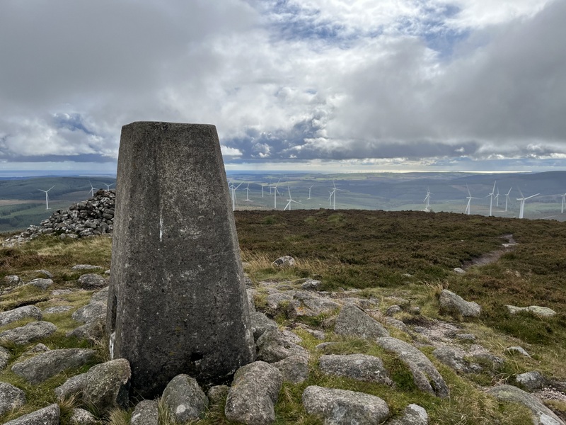
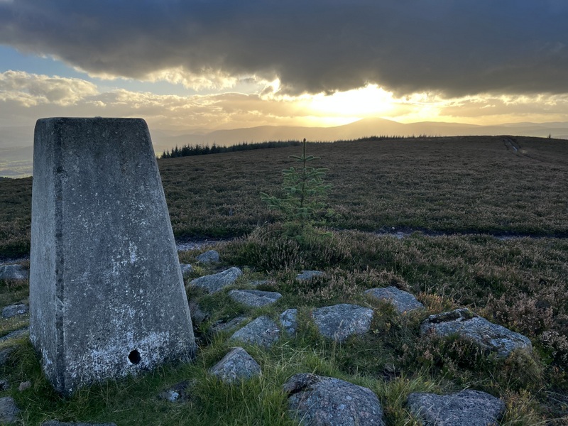
10 September 2025: Wednesday - GM/SS-164 Kirkland Hill
The forecast wasn’t good, with showers in the morning turning to a more concentrated rain band later in the day. Caroline wanted Kirkland GM/SS-164 as a unique because Martyn had activated 20 years minus 3 days ago which was a few months before she got her licence.

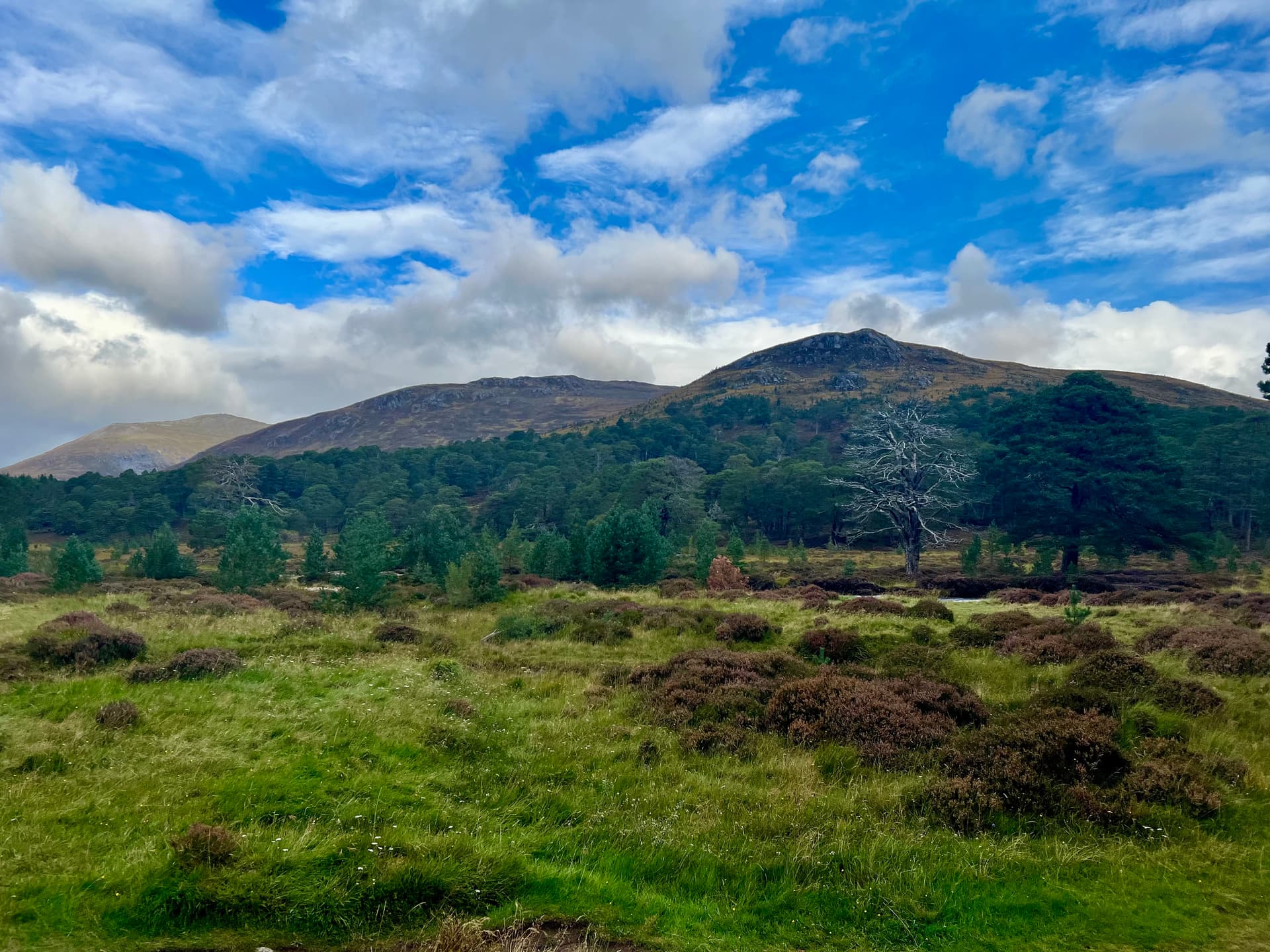
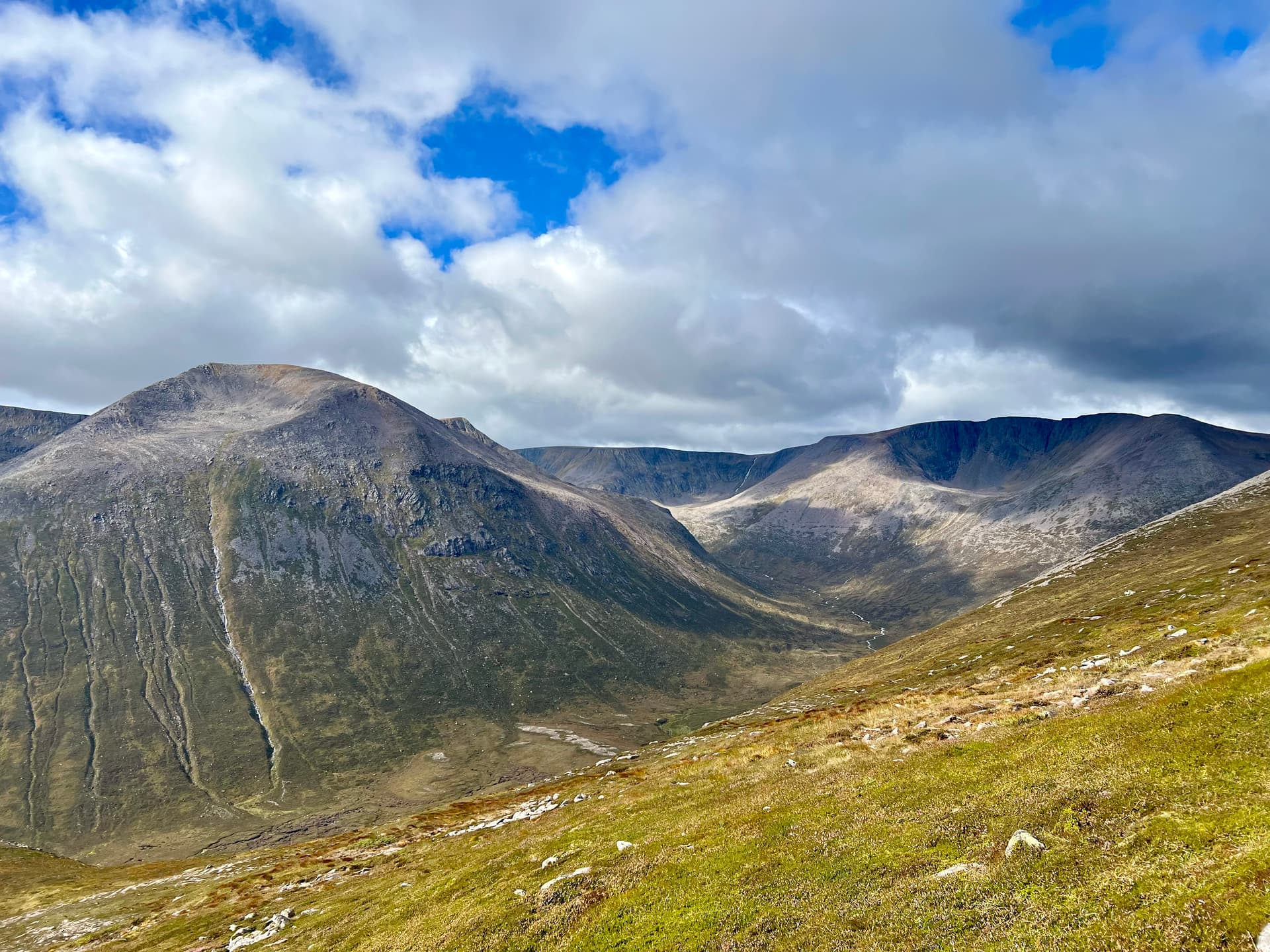
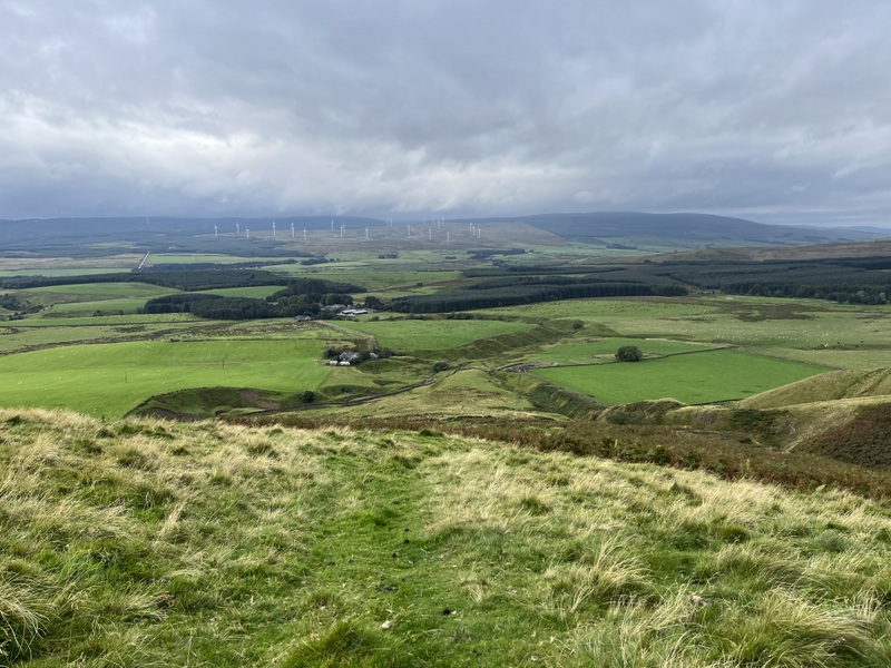
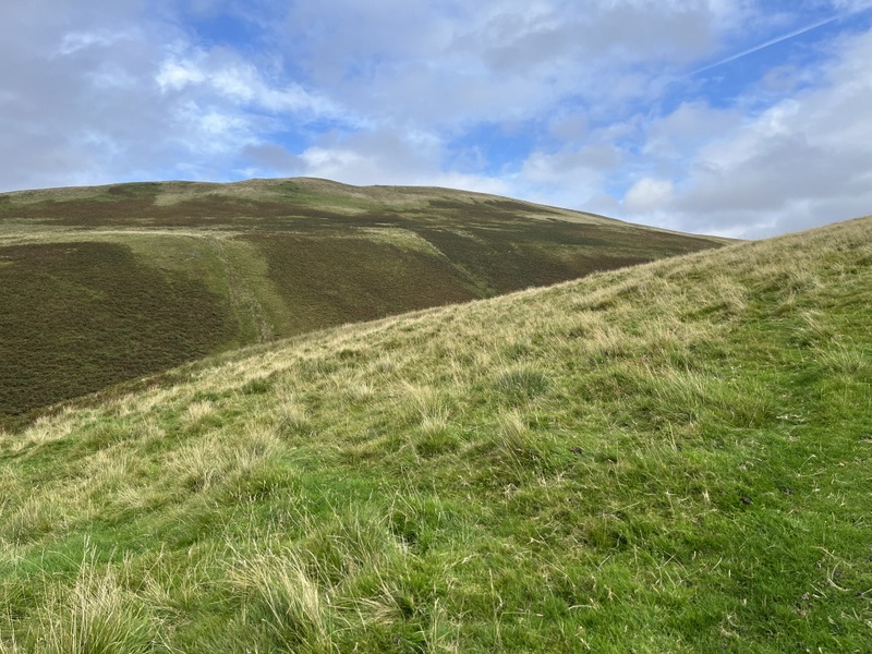
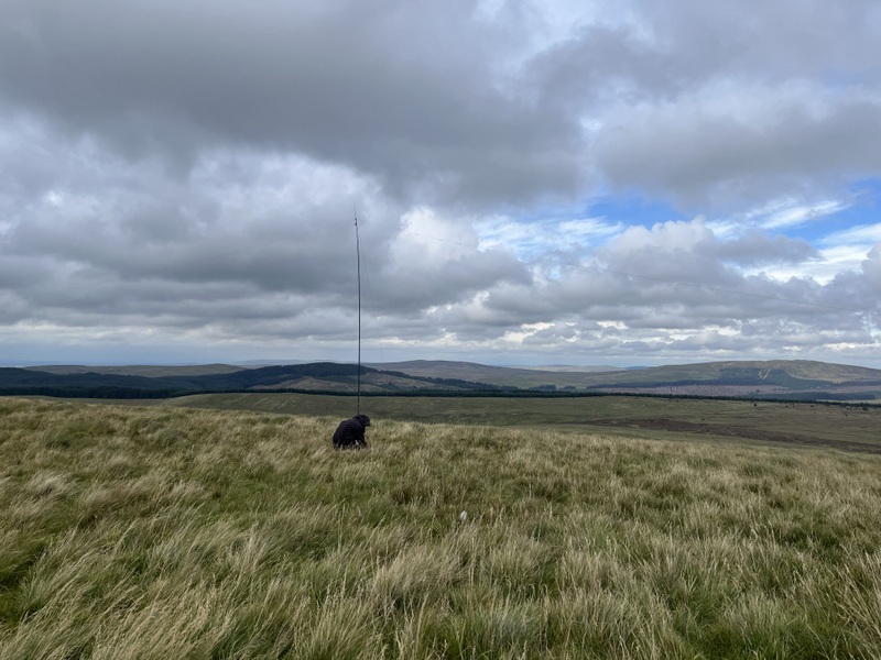
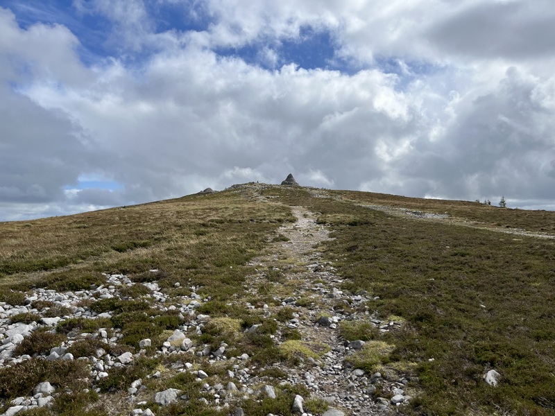
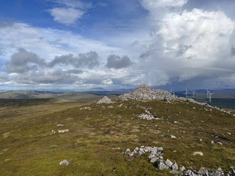
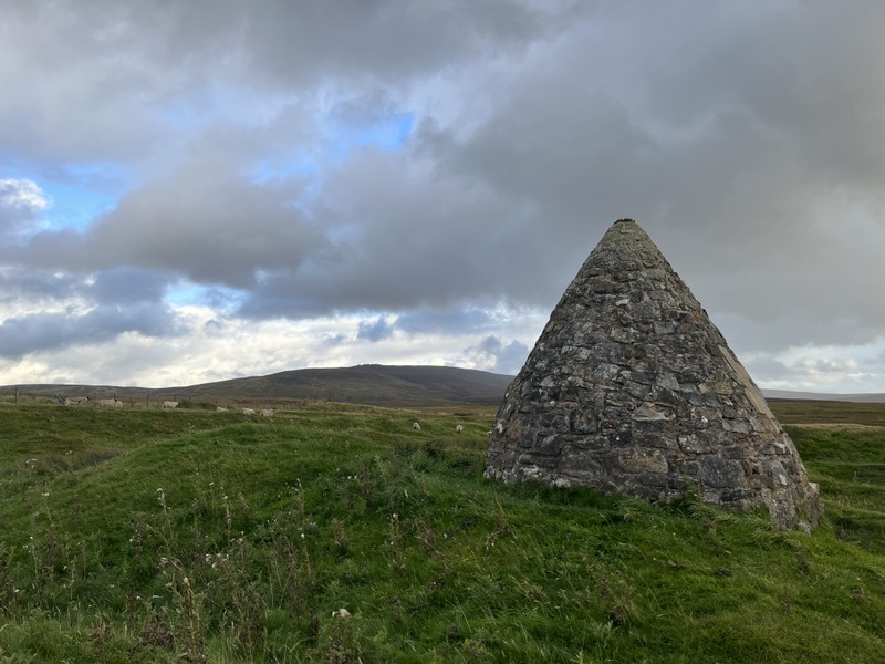
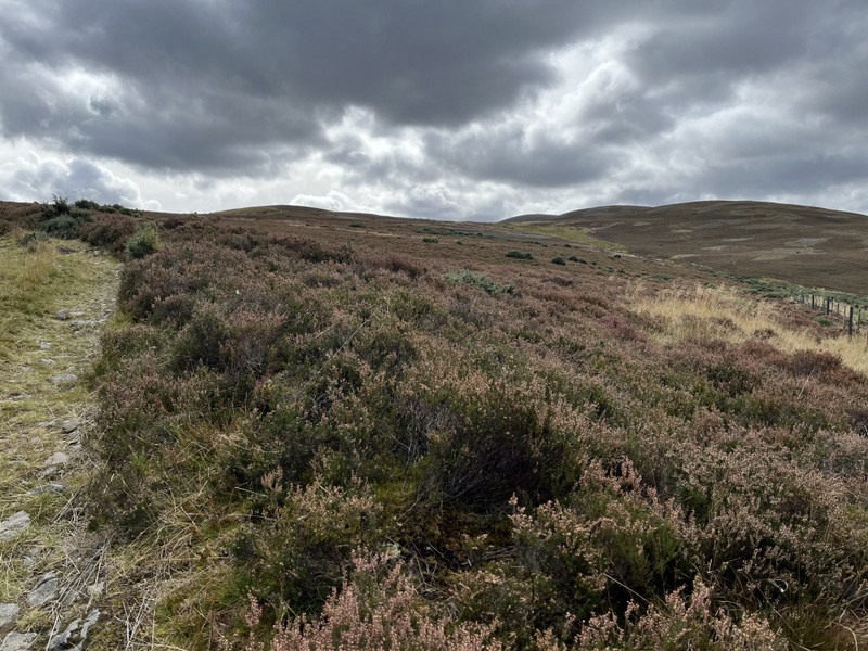
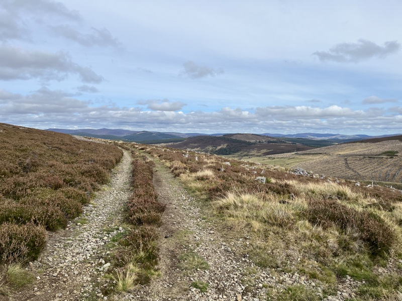
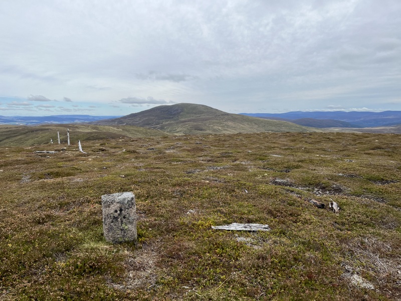
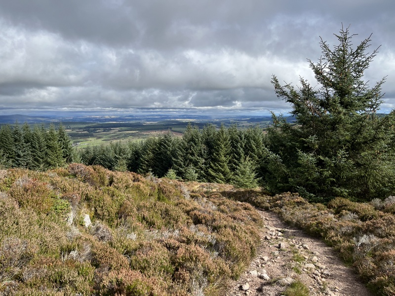
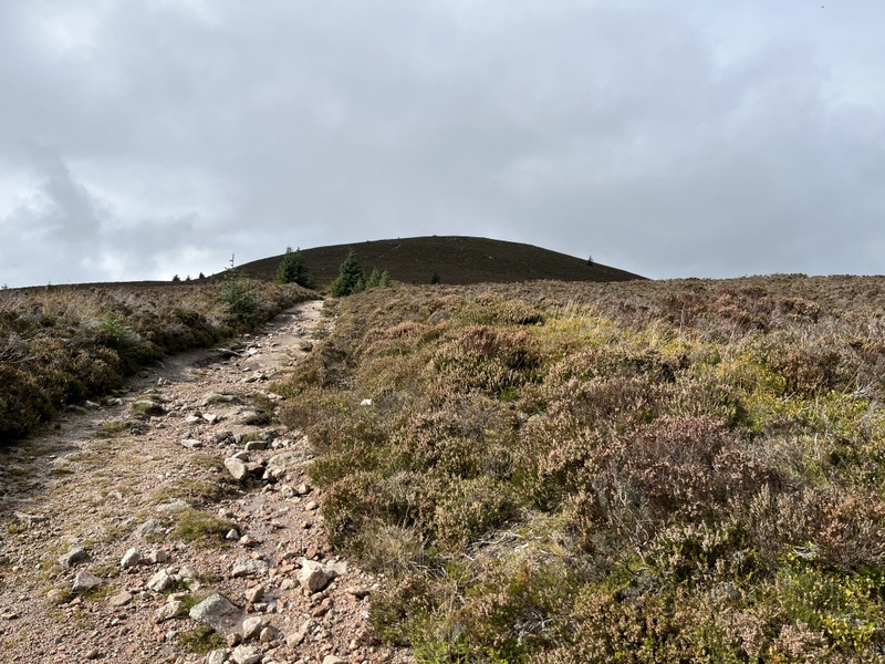
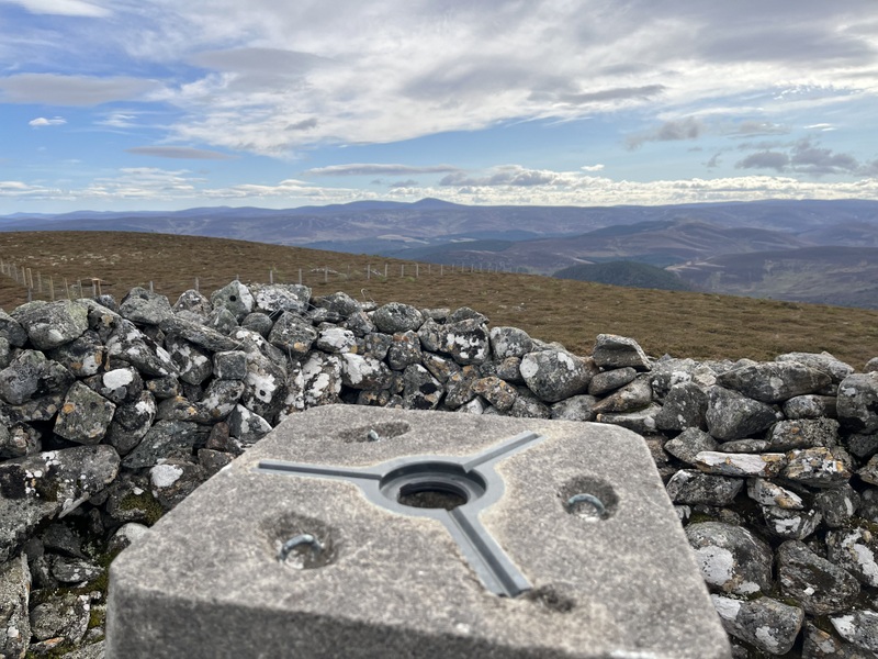
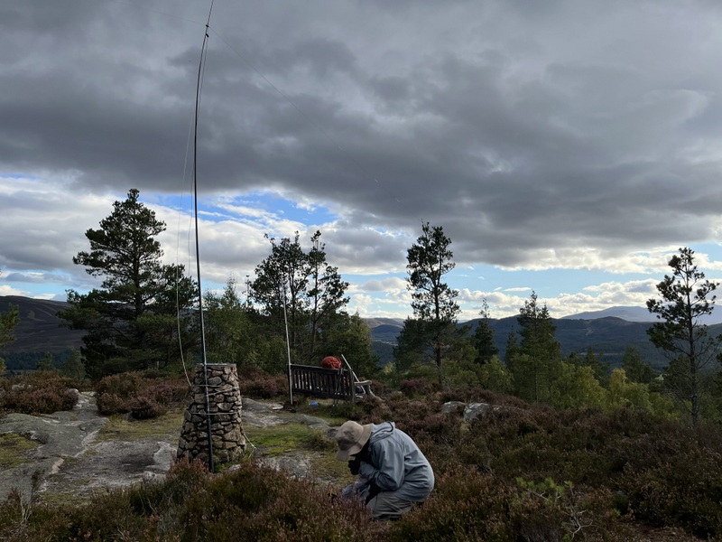
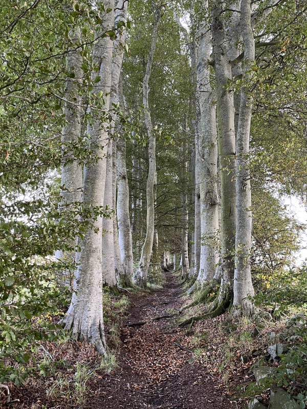
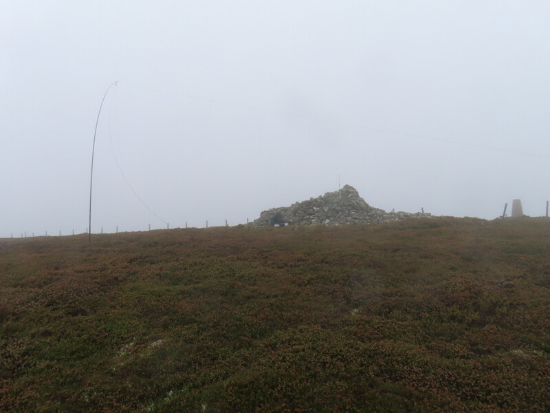
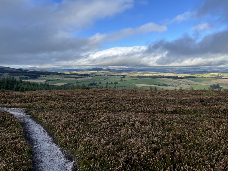
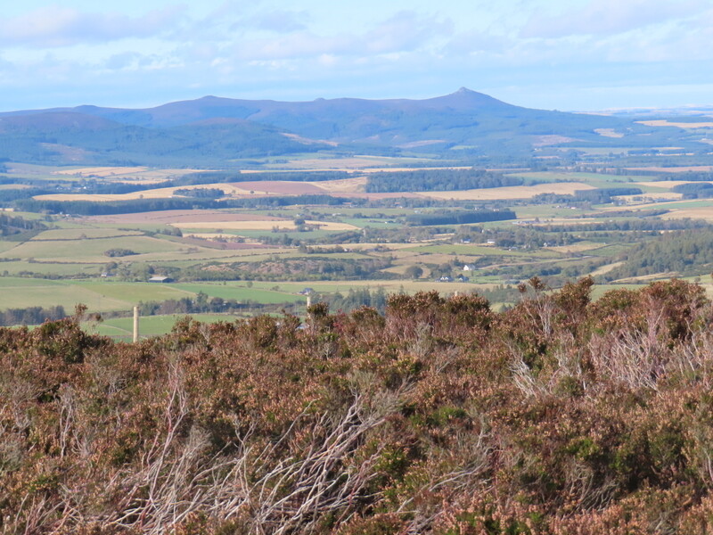
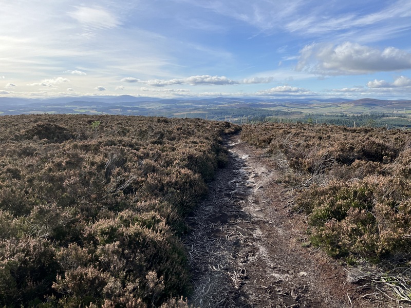
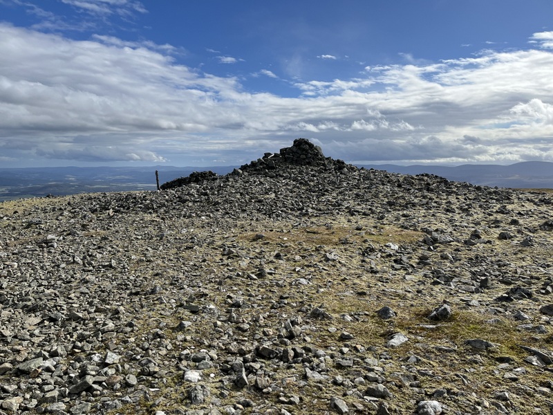
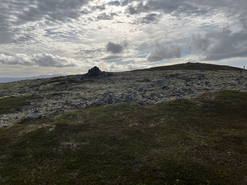
It was dull with some light showers as we drove down the scenic but winding B740 to the A75 and Kirkconnel and round to the little car park with an interpretation board at Old Kirkland. There was intermittent rain as we walked to the end of the road and then on a good track leading through a farm and up to a remote cottage. The rain had stopped by the time we went round the cottage on a rough track which leads towards the ruins of St Connel’s church - given we knew rain was forecast we didn’t visit the church and continued up a rough ATV track up the ridge of Little Kirkland Hill. The track faded as we ascended and effectively disappeared as we got up the steepest bit, and it was then pathless rough grassy along the ridge terrain. Approaching the col between Little Kirkland and Kirkland an unmapped fence appeared in front of us - since we didn’t know where the fence went but was heading in the right direction, we decided to follow a faint vehicle track running along it. Arriving at a high point (within the activation area) we needed to cross the fence to make our way to the trig point.


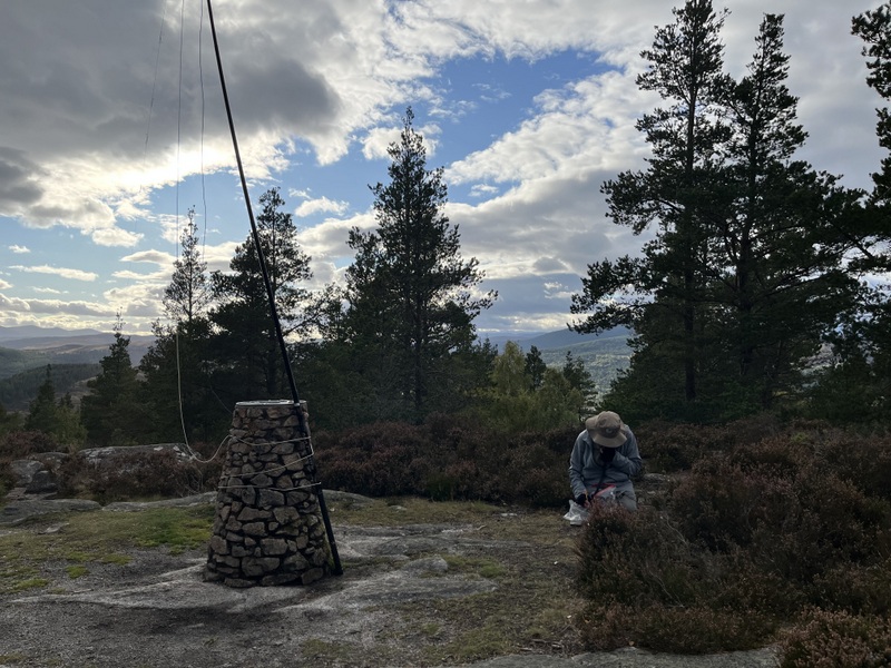
Looking back when ascending Kirkland Hill


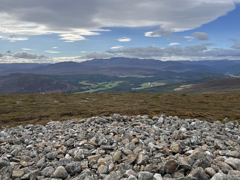
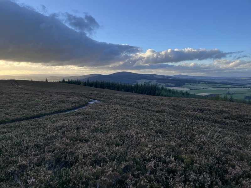
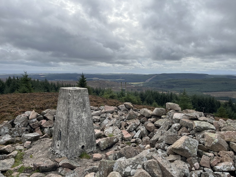
Kirkland Hill from ascent route
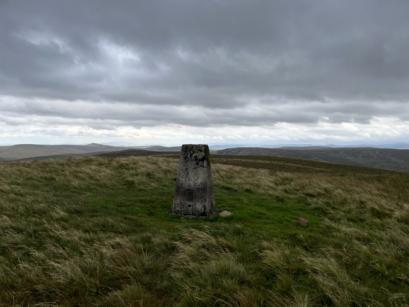
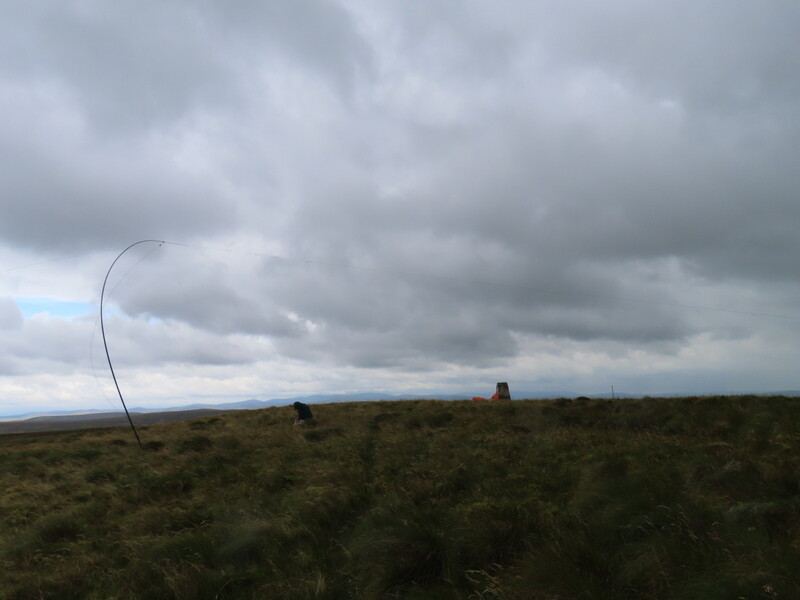
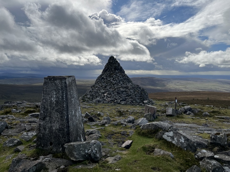
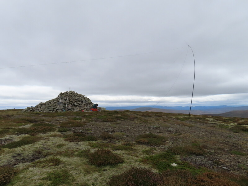
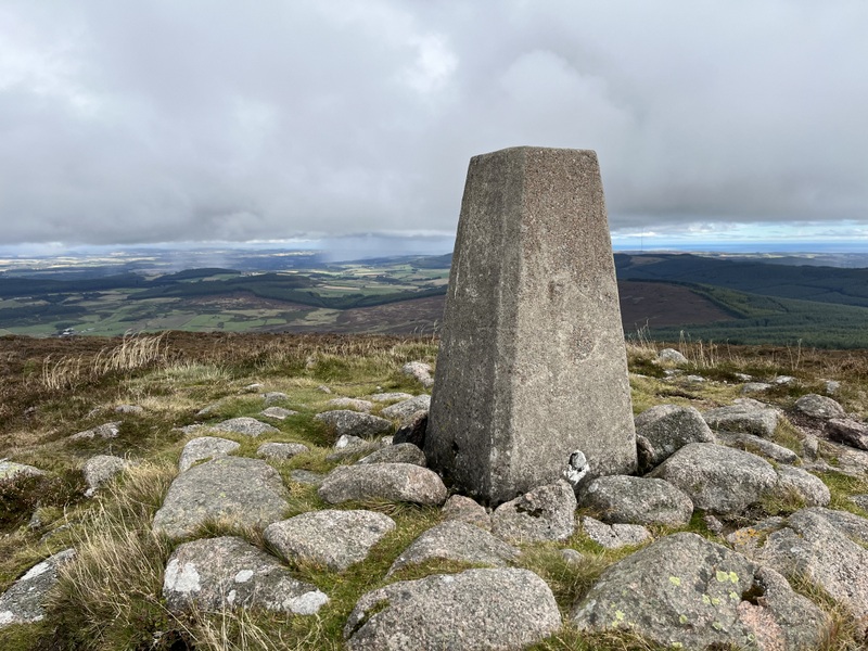
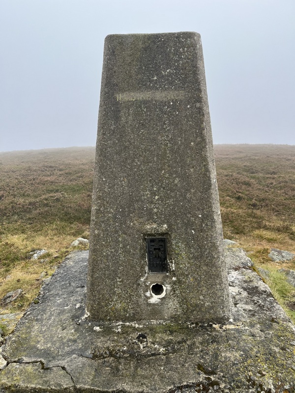
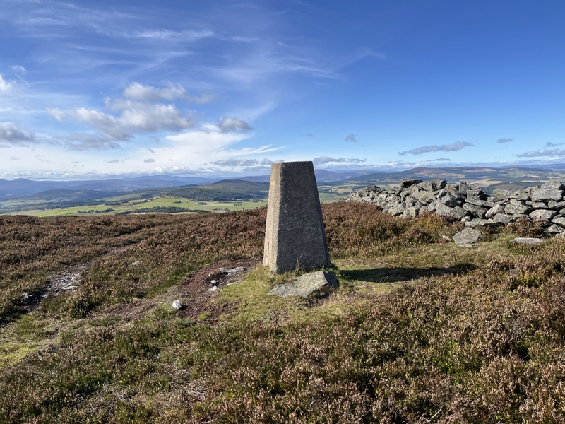
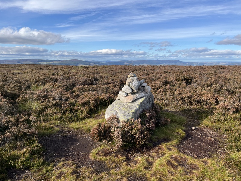
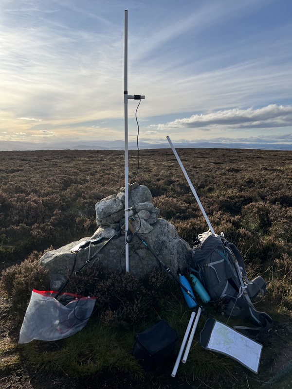
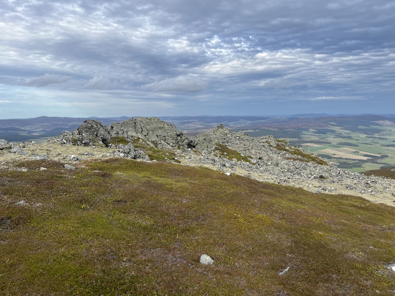
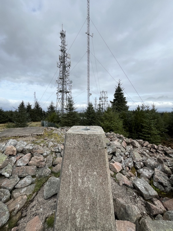
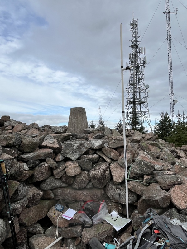

Kirkland Hill

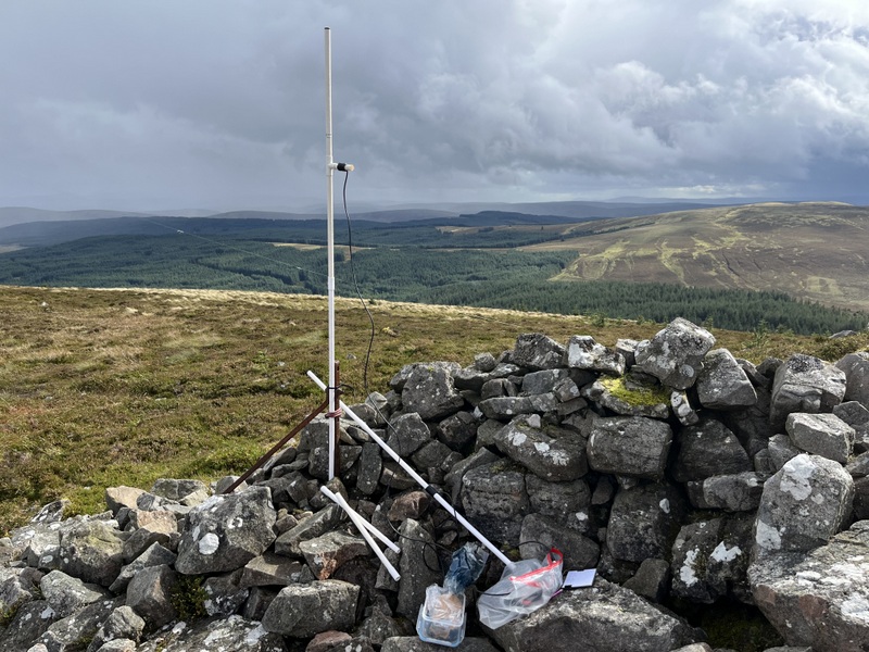
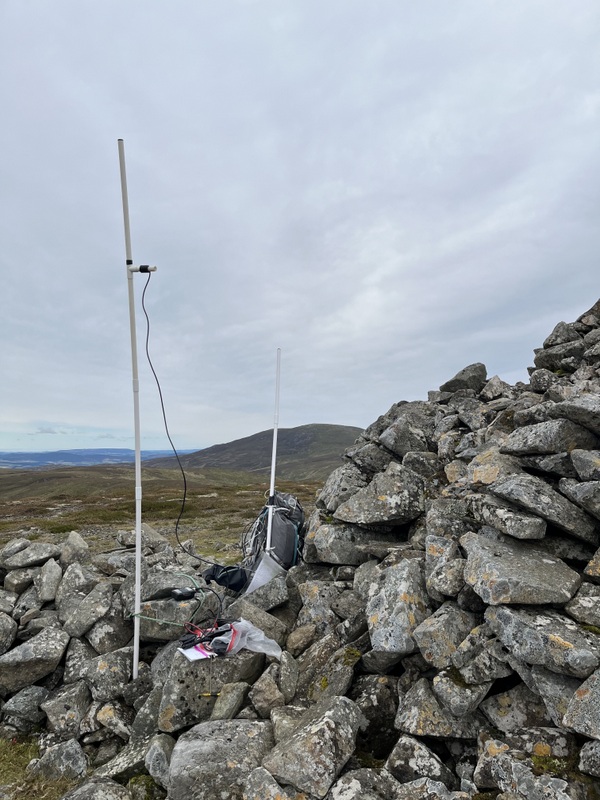
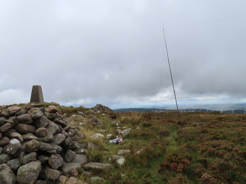
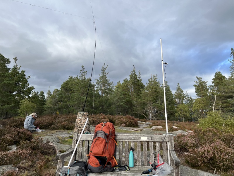
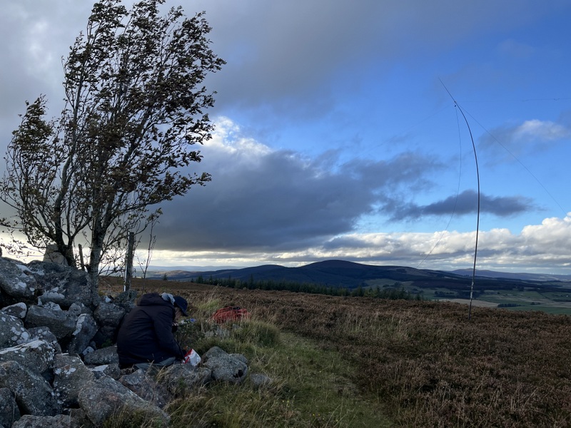
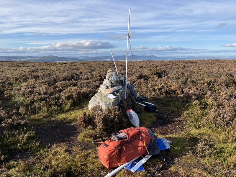
It was initially dry at the summit but very windy, with the rounded top offering little shelter. Caroline hunkered down on the least windy side of the trig and Martyn went a little way downwind. Caroline was just working her 4th 2m FM contact as Martyn came over to see how she was doing, having himself qualified on 60m. Once she had 2 more on 2m and a single 70cms contact, Caroline took down the precarious 2m antenna and tried 40m - poor conditions with lots of QSB. Caroline’s final 2m calls got 1 more contact for a total of 8 on 2m FM, 1 on 70cms FM and just 6 on 40m SSB after Martyn had qualified with 5 on 60m SSB. Unfortunately we couldn’t hear Helen Melhuish on her summit - Caroline had listened for Simon on 2m FM, but wasn’t surprised she couldn’t hear him given the intervening high hills, but had hoped we could make it on 40m.
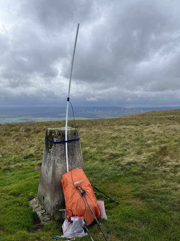
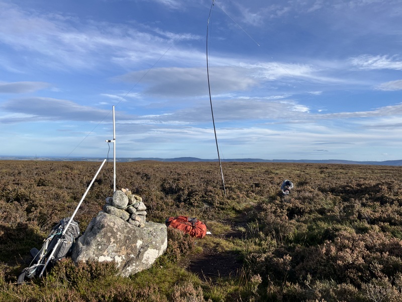

Kirkland Hill VHF


Kirkland Hill HF


Kirkland Hill HF

The incoming rain caused us to give up trying to chase a different S2S and abandon thoughts of eating lunch at the summit. We packed up in 45 degree rain. The rain did ease as we retraced our route, but came down again by the time we got back to the church ruins and continued all the way back to the car. Surprisingly a little seat in the car park was sheltered by trees, and we used it to sit and eat our belated lunch instead of steaming up the car. The rain continued and the roads were a little flooded in places as we drove back to the cottage, where a welcome brief break in the rain allowed us to unpack without getting everything too wet.

Thankfully the spacious and warm holiday cottage had space and a good airing/coats cupboard to allowed us to get things dried out. Given our normal slow hill walking rate we’ve been noting ascent times as a guid to how long it will take to descend when using the same route. This one was 1:25 up and 1:15 down.

11 September 2025: Thursday - GM/SS-120 Cairn Table

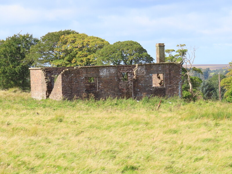
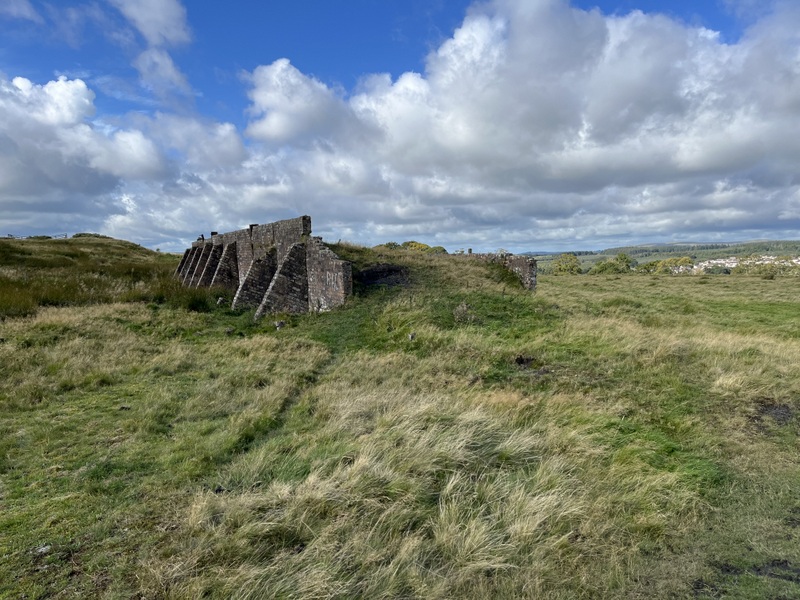
This was the day Caroline reached the same number of unique GM summits activated as Martyn, and happened to be exactly 20 years since Martyn’s activation. The forecast was for a windy and showery day, but without longer rain bands. It was dry as we parked up in the walkers’ car park in Kames south of Muirkirk (on the River Ayr Way) and set off on the main path to GM/SS-120 Cairn Table. We spent a little while looking at the various industrial archaeological remains, but failed to work out what the various constructions were for.


Industrial remains

Once past the main industrial ruins the path became quite boggy: it has a reputation for wetness and we were doing it after heavy rain, but became drier underfoot as we got higher. Unfortunately we didn’t quite make it to the summit before having to stop to apply waterproofs.
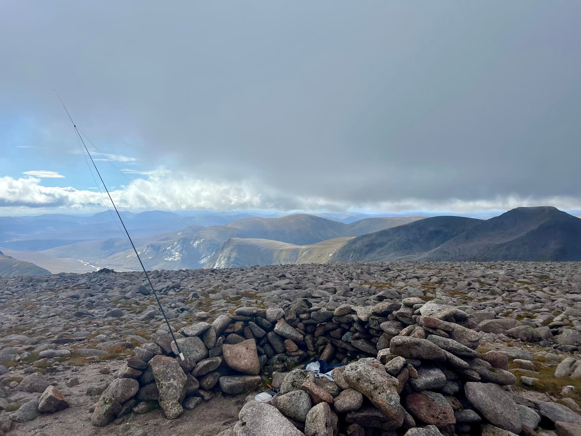
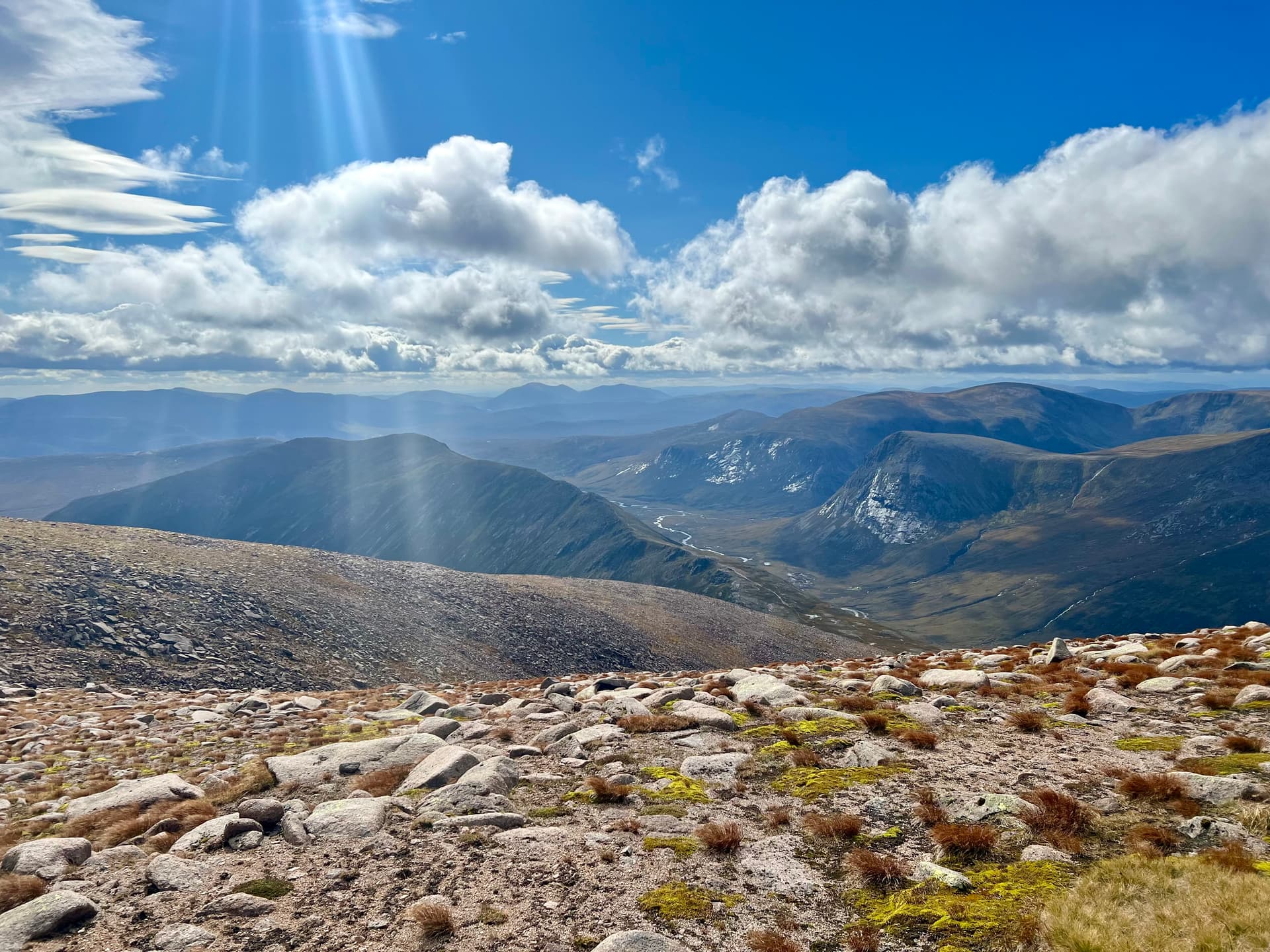
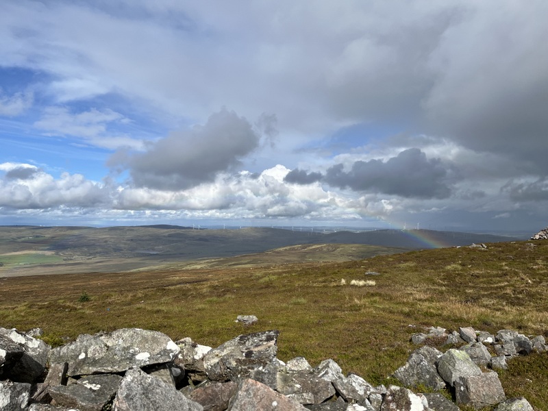
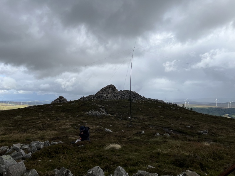
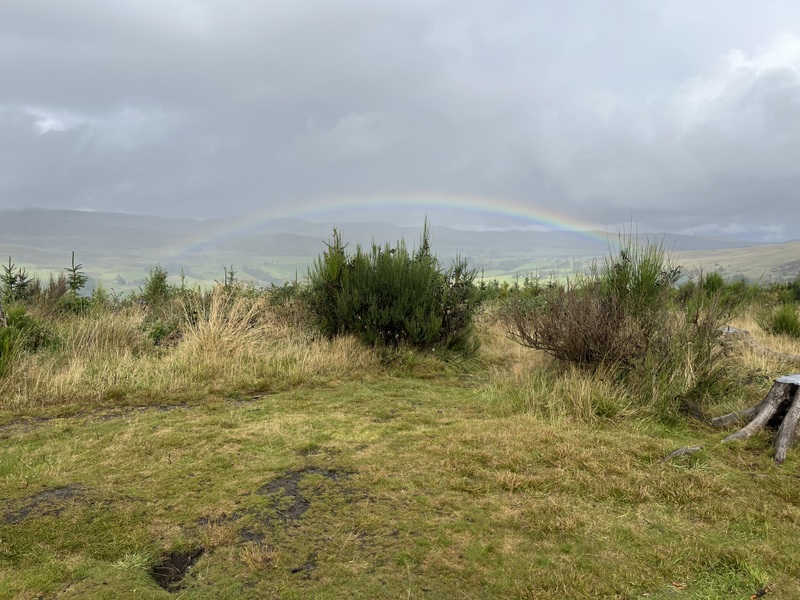
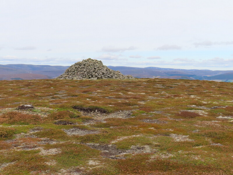
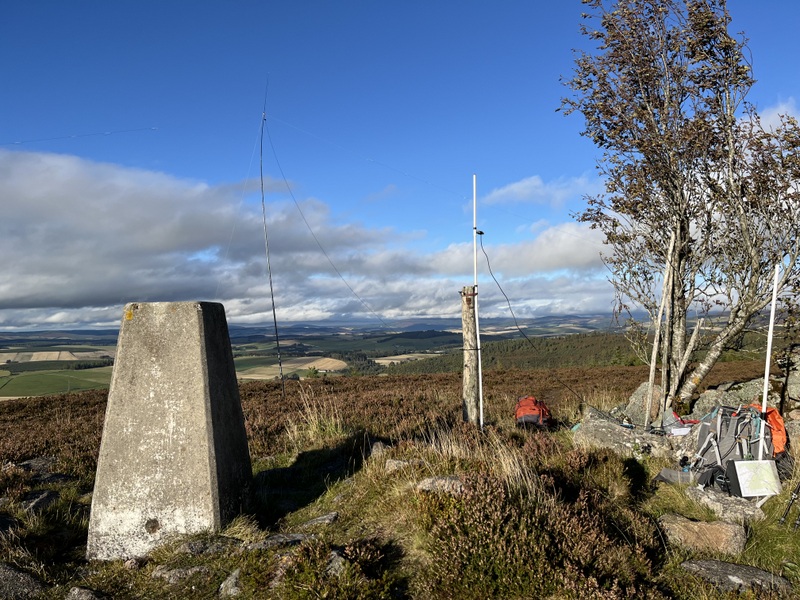
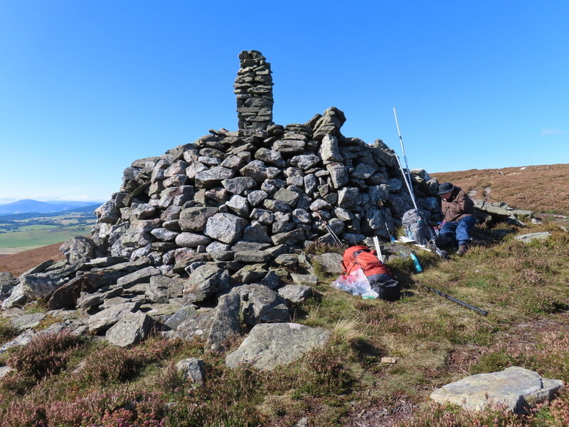
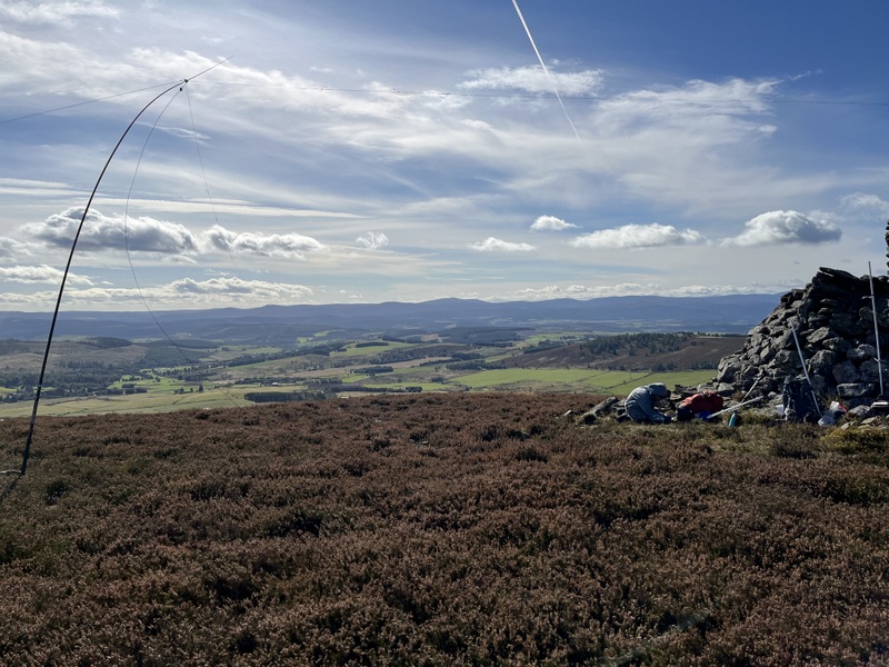
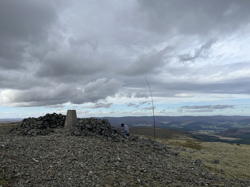
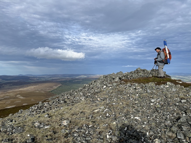
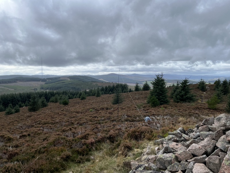
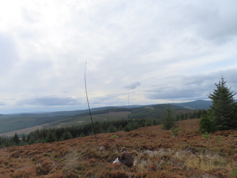
It was extremely windy at the summit. It was almost impossible to stand by the exposed trig point, and wind was whipping round the massive main summit cairn, but we managed to find a bit of shelter on the east side of the summit below the trig point. Caroline erected VHF/UHF in a bit of a shelter where there was a convenient post for antenna support, and Martyn got HF up in the dip between the main summit cairn and the subsidiary ones to the east. We got showered on at various points during our 2 hours at the summit, and saw a bit of rainbow when we weren’t actively being showered on. We got a reasonable number of contacts, Caroline getting 16 contacts on 2m FM, 4 on 70cms FM and 4 on 20m SSB, 3 of which were S2S. HF was better than the previous day with Martyn getting 4 contacts on 60m SSB, 16 on 40m SSB and 8 on 20m SSB including the S2Ses.
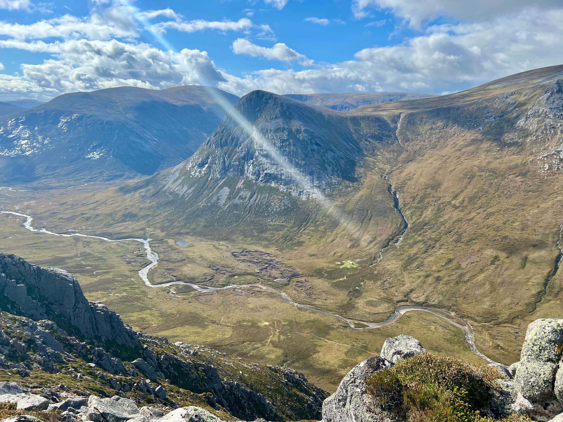
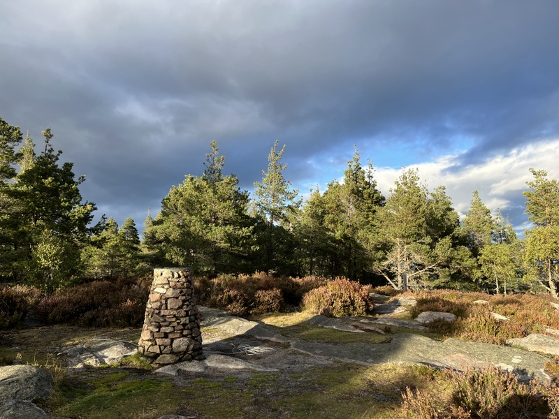
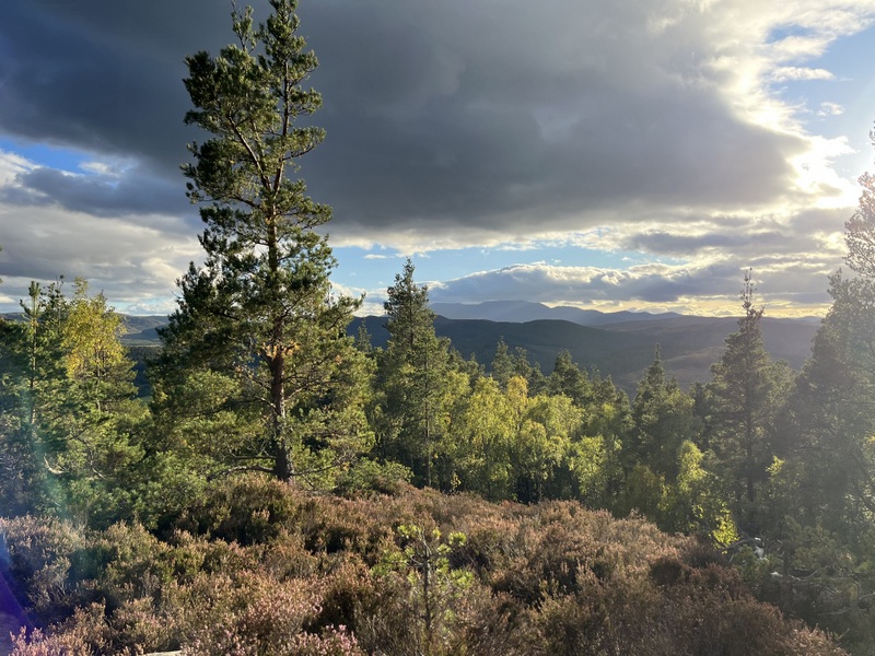
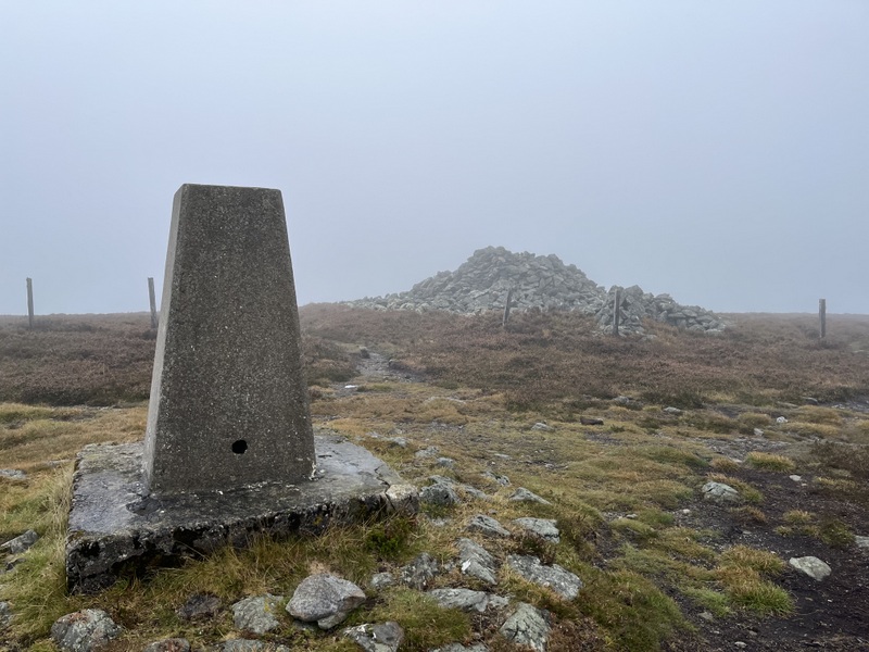
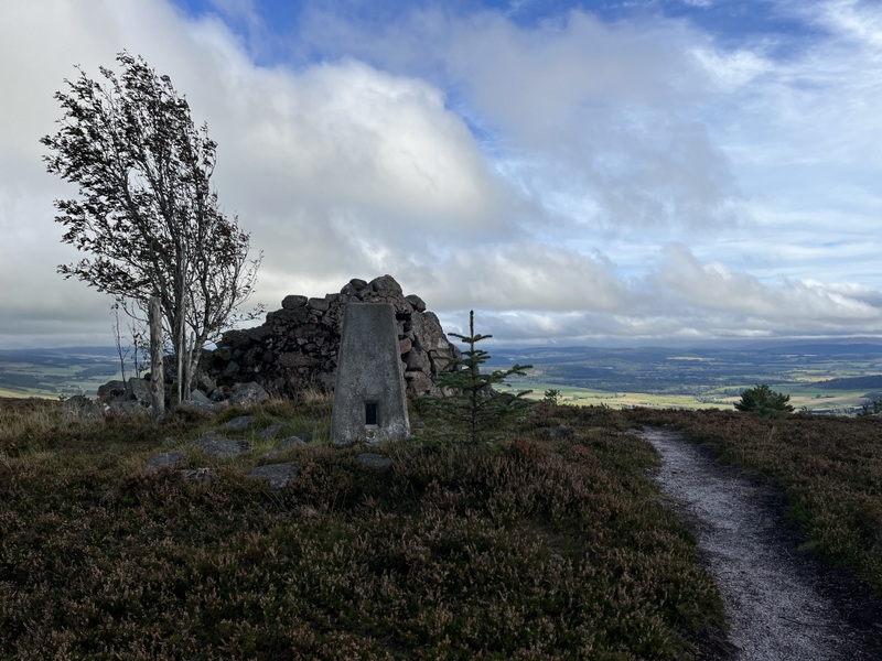
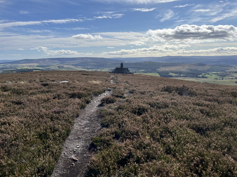

Cairn Table


Cairn Table


Cairn Table with slight rainbow
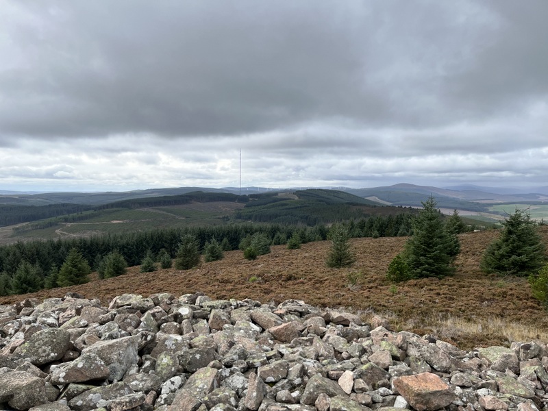

Cairn Table


Cairn Table


Cairn Table


Cairn Table VHF


Cairn Table HF

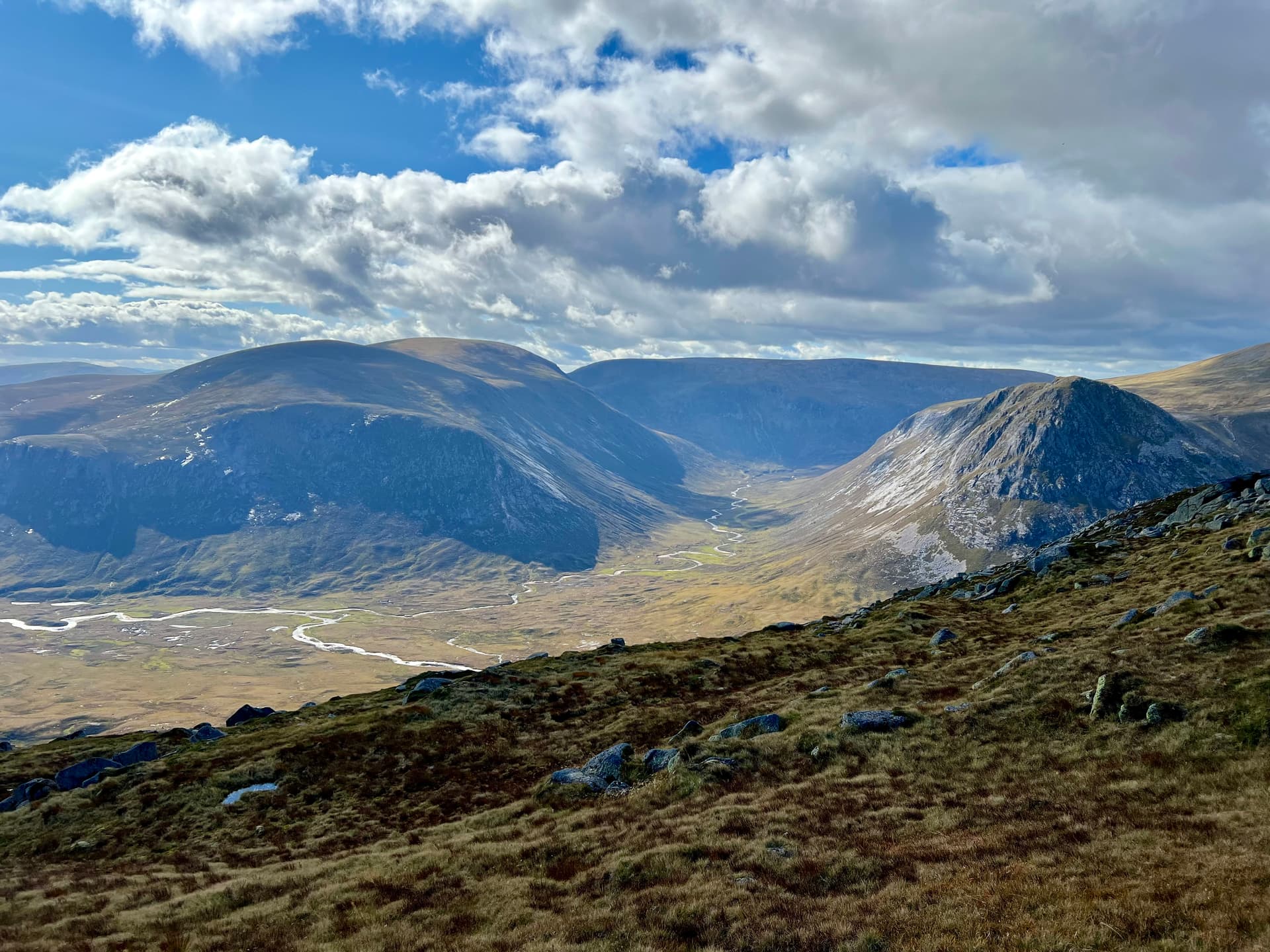
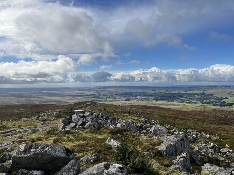
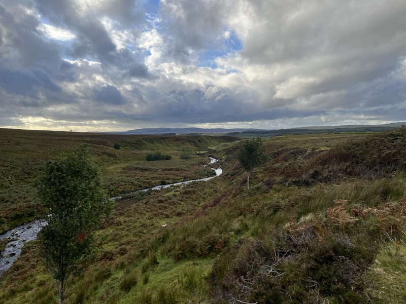
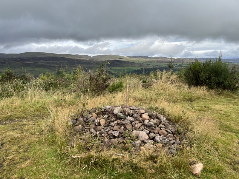
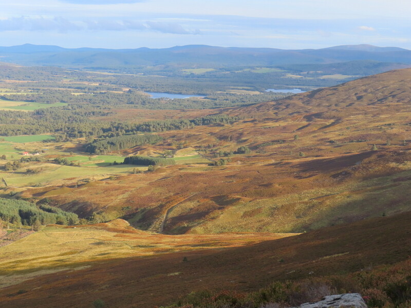
Apart from some brief light drizzle the showers had mostly gone as we descended, taking the path dropping down towards Garpel Water for a pleasant circular walk, though again with some wet areas. The lower levels were back in the industrial archaeology area and we passed a memorial cairn to John Loudon Macadam of early 19th century road building fame. This walk was 1:45 up and 2:15 down, but that included a 20 minute apple eating stop and time looking at the memorial cairn.


Descending Cairn Table


Macadam Cairn

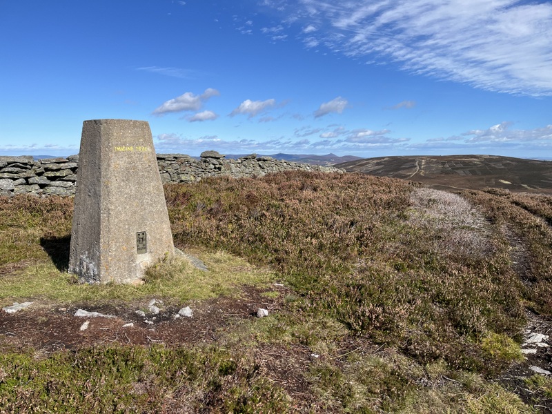
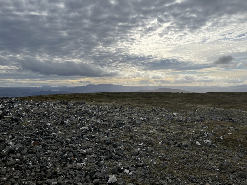
12 September 2025: Friday - GM/SS-174 Common Hill

Friday was forecast to be windy and showery, similar to Thursday but in daylight hours it turned out to be better with only a little rain while we were out. We contemplated doing Tinto for the third time but thought it might be too windy so went for Common Hill GM/SS-174, a unique for us and lower than Tinto. We drove through Douglas up Station Road where there is a small car park next to a community woodland near the end of the public road.

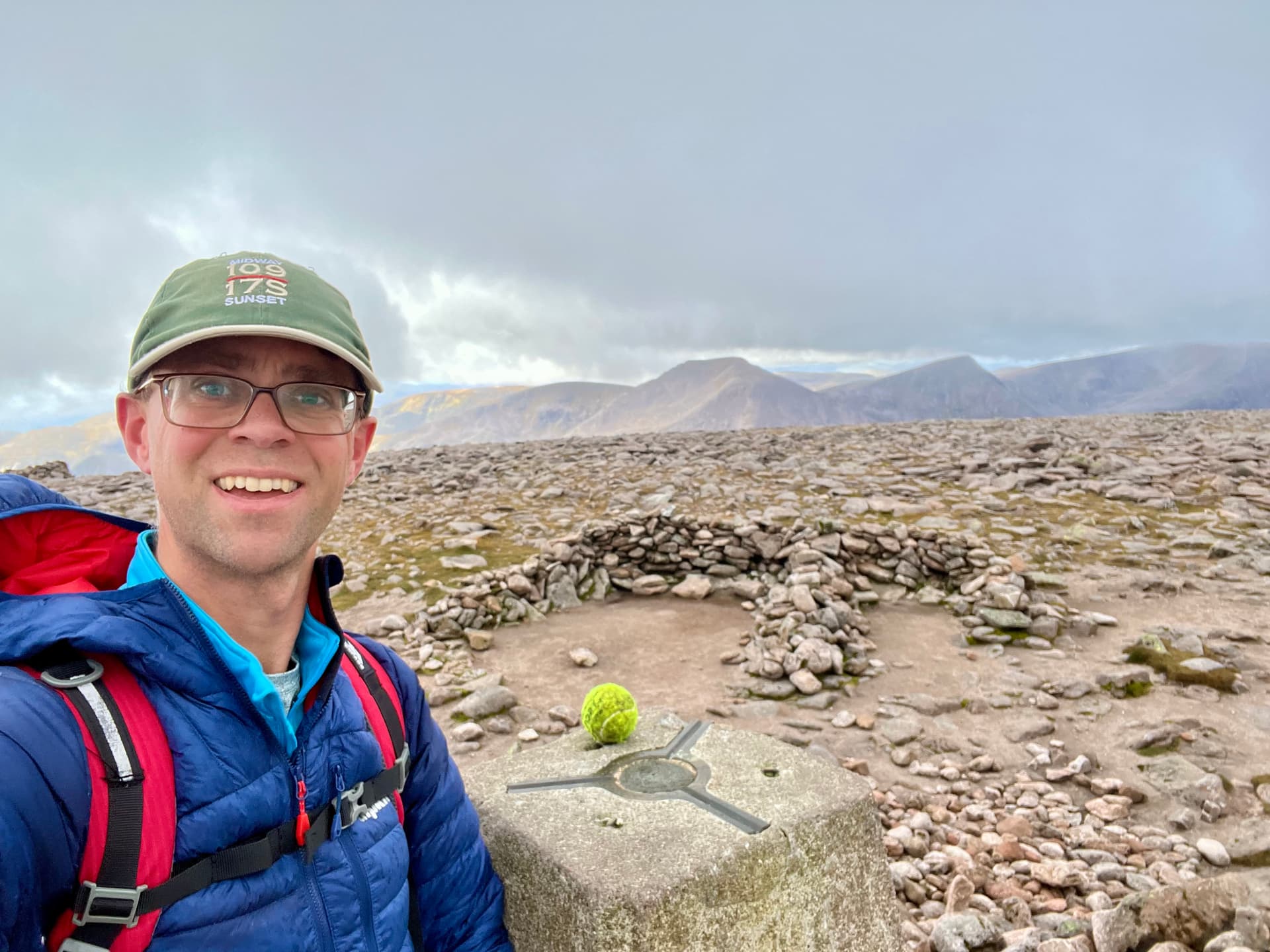
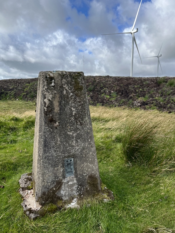
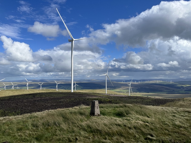
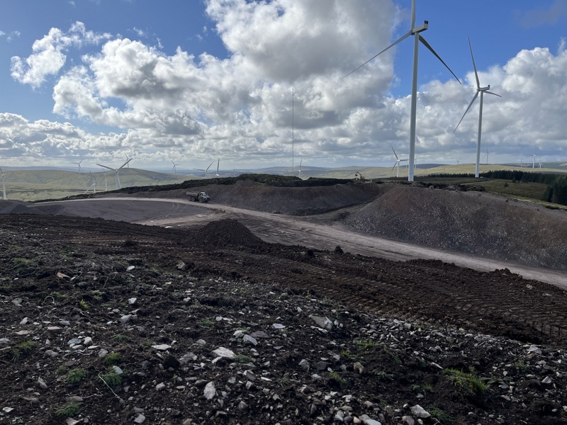
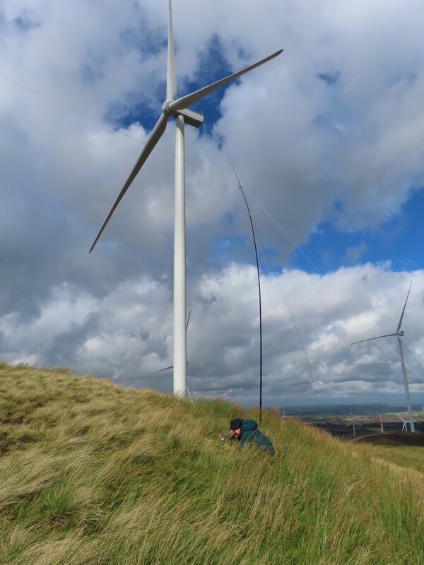
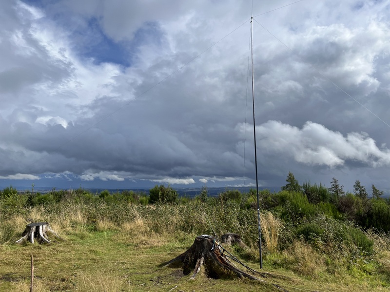
It was a different sort of walk being in the middle of a wind farm which is being extensively developed, so most of the walk was on construction tracks with lots of vehicle movements, including an artic with very large cable reels on the back and some big earth movers! The site seemed walker friendly and we were warned to take care. A brief shower caused us to apply our rucksack covers and we were told their bright orange was good for making us seen. Part way up there was another gate before most of the earth moving was concentrated, and the gatekeeper gave us a map showing the new tracks and turbines which aren’t yet on the OS map. A large chunk near the top of the hill has been removed as a borrow pit but the trig and surrounding grass are still there. The ascent took us about 1:30.

The trig isn’t to highest point anymore as a bank has been added between the borrow pit and the trig which helpfully blocked much of the earth moving noise on the other side. The bank also gave shelter from the wind as we dropped down slightly from the trig point allowing a pleasant activation.


Common Hill Trig point with new bank behind


Common Hill Trig point from the new bank


The borrow pit behind the bank

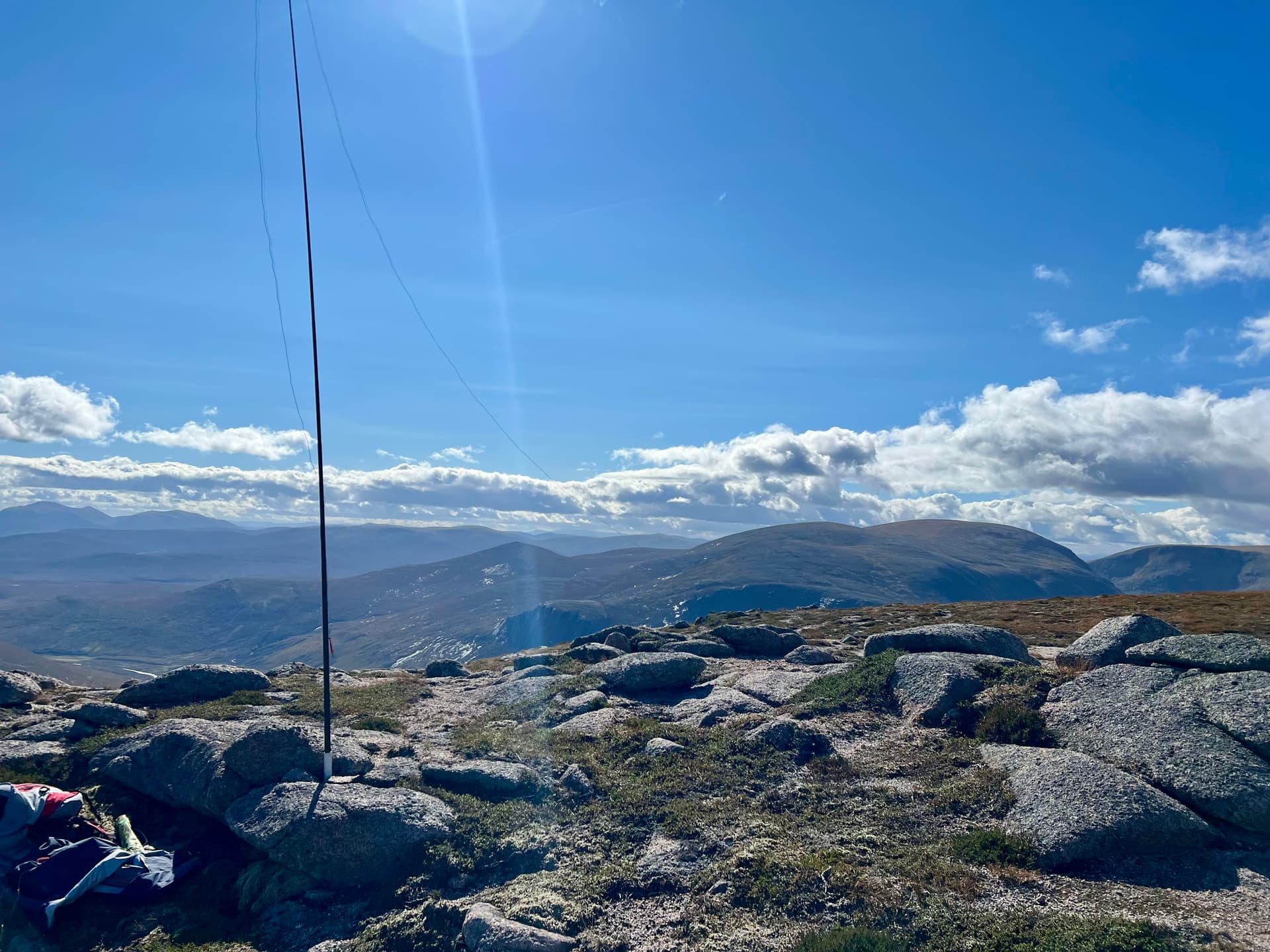
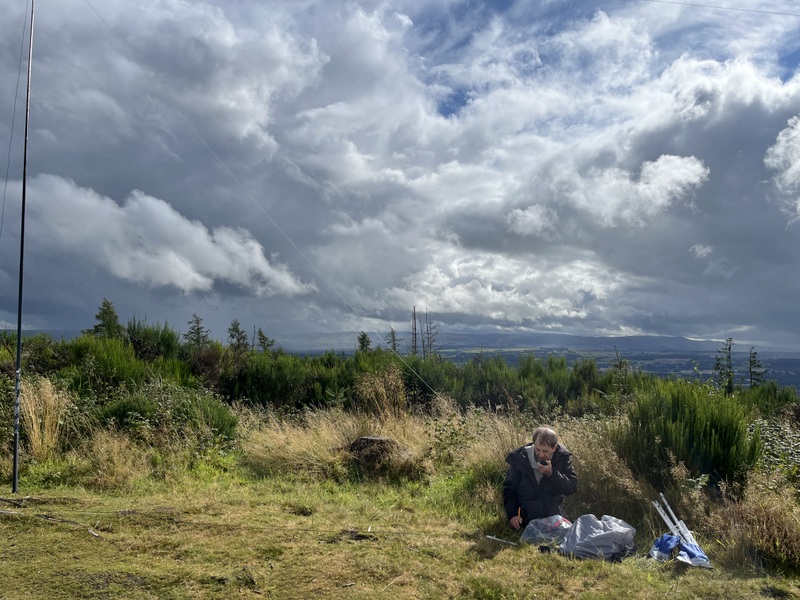
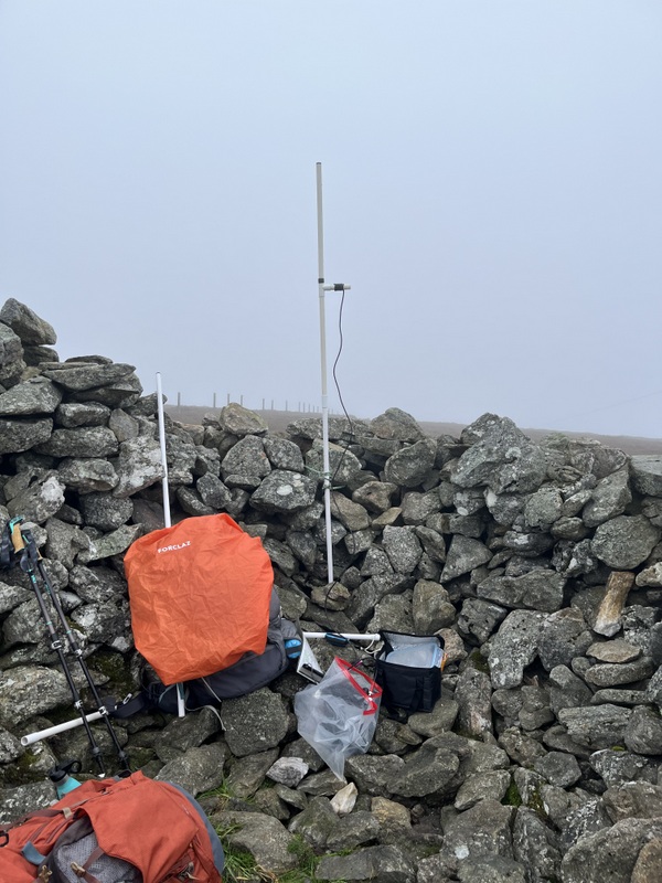
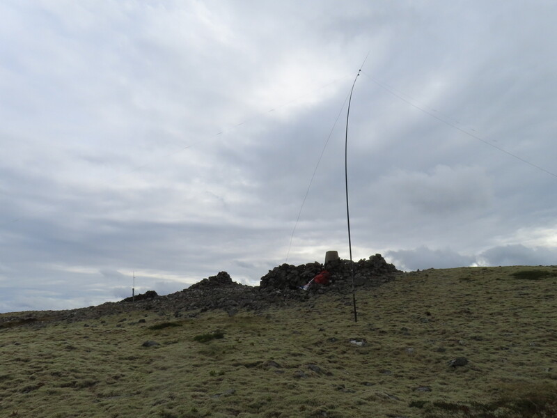
It took Caroline 45 minutes to qualify the hill on both 2m FM (6 contacts) and 70cms (4 contacts). While making the 4th 70cms contacts Martyn came over to say there was a 20m S2S available with Gerald ON/M0WML/p on ON/ON-001, which Caroline managed to make. Having already qualified with 9 contacts on 60m, Martyn then had a good run of 12 on 20m. Having eaten her lunch Caroline took over HF for a run of 21 on 40m while Martyn ate his lunch. Final calls on 2m FM picked up 2 more for a total of 8. Despite the proximity of the wind turbines we had no interference, though some of the new ones were static as not yet commissioned.


Operating VHF


Operating HF

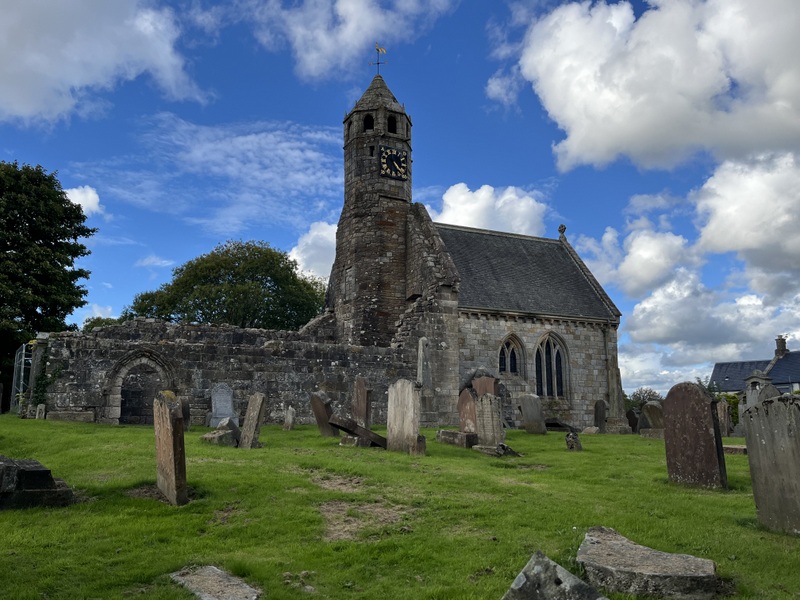
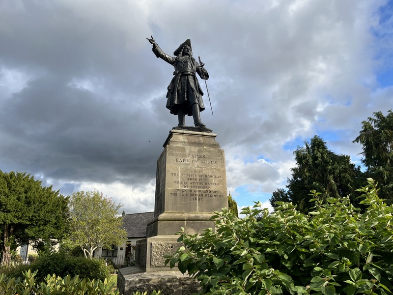
After descending the same way (about 1 hour) we had a time to visit a few of the historic bits of Douglas. This included the part ruined St Bride’s Church (a mausoleum of the Black Douglases) and the now disbanded Cameronian’s Regimental Memorial.


St Bride’s Church


Cameronian’s Regimental Memorial

10 Likes

13 September 2025: Saturday GM/SS-264 Knock of Crieff
We were moving from Crawfordjohn to Aboyne in Aberdeenshire, and the forecast of bands of extensive heavy showers didn’t bode well for getting to do a summit on the way, but we contrived one somehow.

We packed up the car in the dry and had some light showers as we drove north. Plan A had been to do Lendrick Hill, but we abandoned that looked to be a wetter area. Plan B was to do either Torlum or Knock of Crieff; plan C was to not do a hill. We continued on the A9. At the decision point it wasn’t raining, but the main rain band wasn’t due for another hour. We chose to divert off the direct route and investigate the Visitor Centre in Crieff, and then decide if we could manage to activate Knock of Crieff GM/SS-264.

We had a look around the Visitor Centre (mostly café and gift shop with a display about drove roads about the back). As we came out the first of the next band of predicted showers arrived, so we decided to go for the Knock of Crieff parking, eat lunch in the car and see what it looked like then. The views from the viewpoint car park were rather limited, with visibility varying.

As we finished lunch the rain eased, but with more forecast we didn’t fancy getting our SOTA rucksacks soaking wet and then loading them into in a fully loaded car. Instead we decided to try a minimal activation with a couple of handhelds in pockets, but then Martyn decided to throw an FT-817, battery and antenna wire in his small (non-SOTA) rucksack and carry the poles in his hands. Caroline went with just her Kenwood TH-F7E handheld in a pocket with the RH-770 now in Martyn’s rucksack.

We got to the top with only a little light rain, though on the narrow summit path the wet vegetation encroached. Once at the top we put out calls on 2m FM with the handheld and RH-770 as rain resumed and after about 15 minutes had 2 contacts each. The rain eased and Martyn put up the HF dipole while Caroline continued calling ending up with 4 2m FM and 1 70cms contacts. Meanwhile Martyn got 4 contacts on 60m and chased a CHOTA station on 40m. The rain having stopped Caroline then had a brief run of 5 40m contacts before we decided to pack up before the next shower arrived. We got the timing right as we got nice views on the way down and were back to the car and packed up in the dry. An activation contrived from unlikely conditions! Just 15 minutes up and 20 down – longer because of photo stops.


Knock of Crieff GM/SS-264 cairn


Knock of Crieff GM/SS-264 with faint rainbow


Knock of Crieff GM/SS-264 HF antenna with handheld resting against tree stump


Knock of Crieff GM/SS-264 operating HF after the rain


Descending Knock of Crieff GM/SS-264

Light rain had resumed by the time we got to Perth to stock up on food supplies in Tesco. We then had some torrential rain as we continued on the A90, but it eased as we went over the hills on the B974 and Old Military Road. We got to our holiday apartment in the dry!

10 Likes

Nicely framed rainbow picture, I think I’ve leant my gear against that same stump !

Andy

MM7MOX

2 Likes

14 September 2025: Sunday: Mona Gowan, GM/ES-034

The forecast was for a day of moderate winds starting bright but with a rain band due from 17:00 onwards becoming heavy later. We chose to do a single 4 point summit, Mona Gowan, GM/ES-034, which we had considered doing following with a smaller one – but with rain due late afternoon it would be a single summit day.

We took the route from the north parking in a small parking area opposite the drive to Culfork. The walk went on a road down Glen Conrie and then on tracks passing the cottage at Fleuchates and joining a wider track coming out of the forest to ascend past felled forest by Meikle Charsk hill. The track continued all the way to the top of the hill, where there is a large Jubilee Cairn.


Ascending Mona Gowan, GM/ES-034 - summit is just right of centre


Ascending Mona Gowan, GM/ES-034


Mona Gowan, GM/ES-034 Summit Marker


Mona Gowan, GM/ES-034 Jubilee Cairn

It was too windy to operate comfortably by the fence junction at the summit so we retreated back behind the cairn for a bit of shelter. Caroline heard a possible but weak summit station on the handheld as we arrived, but wasn’t able to get the FT-817 and better dipole up to work it before it was gone. Martyn managed to set up HF a little way away - not quite as sheltered, and reasonably quickly had the hill qualified on 60m.

Caroline quickly got 2 2m FM contacts (Fraser and Alex) plus Alex on 70cms, who told her that the Aberdeen net on 145.550 were interruptible to work SOTAs, so she soon had 3 more 2m FM contacts, but none of them could hear her on 70cms. Despite getting some shelter from the cairn a wind gust blew Caroline’s MFD antenna apart, cracking the T piece in the middle, but some tape soon had it back in operation, and it survived the rest of the week. Martyn had a run on 12 contacts on 40m before we moved to 20m for Caroline to get 13 contacts, including 3 S2S which Martyn also grabbed.


Mona Gowan, GM/ES-034 VHF with repaired antenna


Mona Gowan, GM/ES-034

We were starting to get cold and wanted to try to get down before the rain so packed up. On the way down we took the path over Meikle Charsk hill for some different views. It took us 1:50 for the ascent and 1:30 for the descent route (which had a small amount of re-ascent). The clouds were threatening but we got back to the car and loaded up in the dry. There was some intermittent rain as we drove back, and that evening heavy rain hammered down on the skylights in the upstairs lounge of the apartment.

15 September 2025: Monday - Kerloch GM/ES-059

The forecast was again for a reasonably dry morning, but with rain due by late lunchtime, so an even shorter dry activating window than the previous day. The rain was coming from the west, so we decided to go east and head for Kerloch GM/ES-059, which we both needed for a complete. We parked in the small car park at the start of the track to the Sand and Gravel Workings, opposite West Knockhill Cottage. We set off south along the track somewhat slower than the joggers from an adjacent car. This is a summit where you can see your destination at the start, though sight is lost later on, and we made the most of the views on the way up. The joggers were soon passing us as they headed back to the car park.


Ascending Kerloch GM/ES-059


Ascending Kerloch GM/ES-059


Ascending Kerloch GM/ES-059 - nearly there

Past the gravel extraction site the track continues as a forestry track, first entering some fairly open young woodland, before through another gate into the main plantation, some of which has been felled giving views. Eventually the wide forestry track comes to an end at a junction. We knew we wanted to bear right, but the path in that direction looked more like a stream bed. We persisted as it climbed through the trees, widening in places, and with some fallen trees to negotiate. After a while we encountered the first of 4 zig zags, and at the second one the rain started to come down, so a quick stop to apply rucksack covers and waterproofs. At the fourth zig zag there was an alternative path straight on so we cut that corner. The rain had mostly stopped by the time we reached the edge of the woodland where a path led through the heather to the summit with trig point cairn and shelter – though still with cloud swirling around the summit.


Kerloch GM/ES-059 trig


Kerloch GM/ES-059 trig and wind farm

The square shelter was just beyond the trig point, and provided suitable stones to prop up the MFD in a corner. Meanwhile Martyn set up just outside the shelter on the side protected from the wind. It took Caroline 20 minutes to qualify the hill on 2m FM and a further 10 to get it qualified on 70cms as well, ending up with 7 2m and 6 70cms contacts. Meanwhile Martyn also qualified the hill on 2 bands – 5 contacts on 60m SSB and 7 on 40m SSB. There had been intermittent dampness, and with lunch eaten we didn’t have time for more bands, so packed up. We got more rain as we descended, this time taking the longer top zig zag as some of the stones on the cut off looked slippery in the rain. The rain eased as we got back to the main forestry track, so we dried off a bit. Rain was just restarting as we got back to the car, so quickly got things packed away. Ascent took 1:50, descent 1:35.


Kerloch GM/ES-059 VHF


Kerloch GM/ES-059 HF

Our original schedule had GM/ES-080 Cairn-mon-earn as a follow on to Kerloch, but rain stopped that. Instead we took advantage of an early finish to top up food supplies in Banchory on the way back.

6 Likes

16 September 2025: Tuesday - GM/ES-036 Gellaig Hill and Craigendarroch GM/ES-078

Finally a day when the weather forecast didn’t include significant rain, but it was due to be very windy. We wanted summits where there might be some shelter.

Our first target was GM/ES-036 Gellaig Hill, and we encountered our first single track A and B roads of this Scottish trip as we drove to the starting point at NJ280000. There were already several vehicles parked in the layby but we fitted in on the end, some of them with mountain bike carriers. Despite that we saw no sign of bikes on the hill, and only a couple of walkers. A gate a little north of the parking gave access to a track which passed grouse butts as it meandered up the hill. As the track bent to follow a fence, we heard Alex GM5ALX calling from GM/ES-001 Ben Macdui, so stopped to work him for the chase, before pressing on to try to get the S2S.


GM/ES-036 Gellaig Hill from near parking


ascending GM/ES-036 Gellaig Hill

Given the wind we headed towards the shelter at the far end of the lozenge shaped activated area, thinking the wind must be even worse on Ben Macdui. The summit is topped by a mound of stones with the trig point on top surrounded by a shelter. As we tried to contact Alex, we heard a different and unexpected CQ SOTA – from the American couple MM/WJ7V and MM/KC7JNU on GM/CS-060 Morrone, so we both worked both of them, and then managed to find Alex for an S2S. Caroline missed out on getting 70cms contacts because those contacts were using the rucksack antenna, which used to give a reasonable match on 70cms, but now gives high SWR – to be investigated. There were suitable fence posts near the summit for antenna support, but too exposed to the wind, so given the hill seemed quiet, Caroline used the hole in the trig point to support the MFD, while Martyn set up HF on the more sheltered side of the summit mound.


GM/ES-036 Gellaig Hill trig


GM/ES-036 Gellaig Hill


GM/ES-036 Gellaig Hill VHF/UHF


GM/ES-036 Gellaig Hill HF

Caroline managed just one more 2m FM and 70cms contact before all went quiet: time for lunch. Meanwhile Martyn had got 4 contacts on 60m before coming over to see if Caroline wanted 40m – yes please. 40m wasn’t in good shape, with lots of QSB, but Caroline got 5 contacts before returning to VHF/UHF while finishing her lunch. Martyn returned to HF getting one more 40m contact search and pounce while eating his lunch. Caroline’s return to VHF/UHF was well timed, as the Aberdeen lunchtime net appeared on 145.550, and she ended up with 8 2m and 4 70cms contacts. As we were packing up to head off to our next summit Alex GM5ALX arrived at his next summit GM/ES-013 for a final S2S for both of us. The descent took just 50 minutes compared to 1:20 on the way up.

Our next target was Ballater’s little hill: Craigendarroch GM/ES-078, and we found a space in the Station Square Car Park. Ballater’s car parks are curious in that they are advertised as free, but attached to various posts are notices asking you to use an app to pay for parking: we only noticed them when we got back from our walk and attempted to pay, but that was near the end of the “charged” period, so it only took a one hour payment. We made our way to the start of the walk in the woods, choosing to do the summit circular walk clockwise. Most of the walk was in trees, but as we got higher gaps opened up giving some views. Passing one viewpoint we made our way to the summit with a toposcope and a convenient seat. We had no problem with the wind here – overall it seemed to have dropped a bit, and Craigendarroch’s trees provide some shelter, leaving enough breeze to deter any midges. It was by now a lovely afternoon with some clouds and interesting light.


Craigendarroch GM/ES-078


view from Craigendarroch GM/ES-078

The summit area seemed quiet, so Caroline set up using the seat as antenna support. The surrounding trees proved more of a challenge to Martyn as it was difficult for him to find a suitable place for the back guy, so he ended up leaning the pole against the toposcope, wrapping the guy rope round it! A call out on 2m brought Alex GM5ALX/M on his way back home, who we both worked, Caroline also working him on 70cms. Fraser MM0MFI and Simon GM4JXP were also worked on 2m. Martyn had as good a run on 60m as is typical these days – 6 contacts. 40m also seemed a bit better when Caroline took over, getting 10 contacts. Finally Martyn tried 20m – 4 contacts. During our time at the summit one other person visited, a local man and his dog. He said that now in his 70s, he climbed the hill most days with his dog as training for going up the bigger hills, having already been up Lochnager this year and intending to do it again this year.


Craigendarroch GM/ES-078 VHF/UHF and HF


Craigendarroch GM/ES-078 HF & VHF


Craigendarroch GM/ES-078 HF

We descended by carrying on along the circular summit walk – some steep and narrow bits, but also views of the Dee valley with some interesting light, and of the crags of Craigendarroch. The ascent and the slightly longer descent were both around 45 minutes, with more photo stops on the way down. It was a lovely evening, and once down in Ballater we did a bit of a tourist walk as sunset approached.


Dee valley views descending Craigendarroch GM/ES-078


Craigendarroch GM/ES-078 from Ballater

8 Likes

17 September 2025: Wednesday - GM/ES-047 Pressendye and GM/ES-068 Craiglich

The forecast was for another windy day with light rain due late morning and lunchtime. Not a day for doing big hills so we went for a 2 point and a one point hill, and prepared to get wet, but hopefully not too wet.

Our first target was GM/ES-047 Pressendye. We parked in the car park north of Tarland at NJ481059 and headed north along the road to NJ483104 where a gate led into a lovely narrow tree lined path uphill. At this point we had views of the summit, but failed to take photos, which was a mistake as the clouds later descended and covered the summit. The tree lined path led to a path which ran roughly along the edge of woodland, before going through woodland where it was crossed by bike trails. Out through a deer gate and onto a track over heather moorland, and then into forest. We were now on a track shared with mountain bikers, and some who were toiling uphill stopped for a chat, so we explained the poles and SOTA. They took a track right up Pittenderich and we continued straight through the forest. As we left the forest for open moorland, we entered clouds and the rain started, mostly light but with a noticeable horizontal component. An hour and 40 minutes after we set off the trig point and cairn/shelter appeared out of the clouds.


Tree lined path ascending GM/ES-047 Pressendye


GM/ES-047 Pressendye Trig


GM/ES-047 Pressendye Trig and cairn

After a quick trig photo we moved to the shelter, Caroline setting up inside and Martyn outside on the side most sheltered from the wind. VHF/UHF started off with regulars MM0EFI, GM4JXF and GM5ALX, the latter only on VHF, so after Martyn had qualified with 4 contacts on 60m (including an S2S), Caroline moved to 40m which seemed in reasonably good shape, getting 16 contacts in 15 minutes before it went quiet. Having eaten lunch Martyn took over HF on 20m with 7 contacts, while Caroline returned to VHF, eating lunch while waiting for the Aberdeen net to appear; they brought her total to 5 contacts on each of 2m and 70cms.


GM/ES-047 Pressendye VHF - too windy to have antenna higher


GM/ES-047 Pressendye HF in the clouds

We descended through the clouds, finally getting some views below the clouds as we emerged from the forest – some places were getting sun, but not where we were.


Descending GM/ES-047 Pressendye

Back at the car after an hour and 15 minutes we rapidly packed up to move to our second hill GM/ES-068 Craiglich. We parked in a large layby near mobile phone masts at NJ527064, crossing the road to go through slightly dilapidated overlapping gates into a field with cows, following a faint track by the fence and then bending round to enter woodland. The main gate into the woodland had clearly not been opened for some time with trees growing through it, but there was a pedestrian way through. By now the day had brightened and we got warm as we ascended. However despite there being a reasonably wide gap between the planted trees, lower level vegetation and small trees had taken over much of the former track leaving a narrow path through vegetation that was still wet from the earlier rain. The path became clearer as it turned SE and then forked with the left path heading up the ridge line, eventually leaving the trees for the heathery top.

Views opened up as we walked along the ridge to the trig point. The OS map shows a monument at the summit, but what we found was substantial partially collapsing cairn. One side of it looked to have been built with neatly ordered stones, but we saw no inscription. Some later googling suggests that there was a broken plaque visible in the 1980s, saying it was erected by the tenantry of the estates of Farquharson of Finzean. The wind had eased but we still chose to get some shelter from the cairn. There is a very convenient post between cairn and trig point which Caroline used for the MFD, with Martyn setting up HF in the heather a little further round the cairn.


GM/ES-068 Craiglich views


GM/ES-068 Craiglich trig and cairn


GM/ES-068 Craiglich VHF with HF beyond


GM/ES-068 Craiglich HF

Caroline got just two VHF and UHF contacts – regulars MM0MFI and GM4JXP, so after Martyn had qualified with 4 contacts on 60m, she moved onto 40m for a fairly slow 6 contacts. Another swap and Martyn tried 20m, to try to make his log respectable, getting 6 contacts, including an S2S which Caroline also grabbed. It had turned into a lovely evening, and the clouds finally cleared off the top of Pressendye to give us some distant views. The ascent had taken 45 minutes and we were back down in 40.


GM/ES-068 Craiglich sunset


GM/ES-068 Craiglich with views towards GM/ES-047 Pressendye

13 Likes

You had every kind of weather on that trip. Great photos. :blush:

2 Likes

A very comprehensive set of reports and a useful guide to these hills.

I was hoping to do some of these this Summer myself but unexpected events got in the way.

Andy

MM7MOX

3 Likes

Well we didn’t get snow (thankfully!). We did quite a lot of careful reading of weather forecasts, and that combined with a bit of luck (more of that in later reports) means I think we made the best of the conditions.

I’m thankful to those who have done reports that I’ve used, and special thanks to @GM5ALX for several of the routes. When done I’ll try to remember to link the reports from the summit pages.

There are more reports to come, but life (mostly in the form of work on the house requiring lots of stuff to be moved) has been getting in the way. Anyway here’s the next day’s pair of hills.

18 September 2025: Thursday - GM/ES-065 Benaquhallie and GM/ES-070 Hill of Fare

The winds were forecast to be even stronger today, at least in the morning, so we were again looking for relatively low hills with some shelter. It was forecast to be sunny and dry which was good.

Our first target was GM/ES-065 Benaquhallie, which has a large cairn a little way down from the summit, but well within the activation area. We parked at the start of a track opposite a quarry at NJ591073, pulling in tight to a pile of tree trunks to avoid blocking the track. We set off along the descending track, going left off of it for an ascending grassy track ascending the flanks of Tulloch Hill, which soon faded and we made our way to another faint track by a fence line which descended to reach the main track just past Clasholm, which we followed as it gently ascended with good views of our target ahead. It bent left to meet a fence which we then followed to the summit, passing a small plantation along the way. The wind really hit as we made our way to the summit, and it was hard to stand by the trig point, so after a few photos we headed down to the large and distinctive cairn upon a cairn.


GM/ES-065 Benaquhallie Trig


GM/ES-065 Benaquhallie Trig


GM/ES-065 Benaquhallie path down to cairn

Even at the lower level we still needed wind protection, wandering around the cairn to work out the least windy spot. Caroline set up VHF/UHF by the cairn with a minimal amount of antenna poking up above it, with Martyn a little further around the cairn so as not to provide audio interference to each other. Despite the suboptimal position Caroline had the summit qualified on both 2m (5 contacts) and 70cms (4 contacts) in half an hour. 60m wasn’t playing for Martyn and he managed just 1 contact, so since Caroline had just got her 4th contact, he went on 40m for a reasonable run of 12 contacts. When 40m went quiet, he went into search and pounce on 20m while we consumed lunch, getting him 3 S2S and Caroline 2. Wanting to do a second summit we didn’t have time for a run on 20m, but while Martyn was packing up HF, the Aberdeen lunchtime net appeared giving Caroline 4 more 70cms and 2 more 2m contacts – so she ended up with more 70cms than 2m contacts.


GM/ES-065 BenaquhallieVHF/UHF


GM/ES-065 Benaquhallie HF

The wind didn’t seem quite so bad on the way down, perhaps as it was more behind us. Enjoying the views and blue skies we missed the main path left down Tulloch Hill, continuing along the ridge a bit further before finding another path dropping back down towards Clasholm – although accidental it gave good views back on the descent. We then followed the main track back to the car. Descent took 55 minutes compared to 1 hour on the way up.


Looking back at GM/ES-065 Benaquhallie on descent - I’m not sure if the bump that is the cairn will show on this resolution - a bit to the right of the summit.

A relatively short drive took us to the parking for GM/ES-070 Hill of Fare in the disused quarry at NJ649047, where there were several other cars. We set off along the forest road, initially undulating, and possibly drivable in a car with better clearance than ours as far as a gate into the next section of forest. We continued gently uphill through pleasant woodland to a gate leading out onto the heathery top, where a path ascended a bit more steeply. The wind had dropped a bit and it was pleasant walking with views to either side. The hill has a massive activation area, but we decided to try to find the true summit, eventually locating a large stone with a small cairn on top a little way off the main path.


Ascending GM/ES-070 Hill of Fare with Mither Tap and Bennachie in distance


Ascending GM/ES-070 Hill of Fare


GM/ES-070 Hill of Fare summit cairn

There was no shelter on this one, but thankfully the wind had dropped to a breeze, and in the afternoon sun it was a pleasant place to set up our stations. The large stone had a flat side that Caroline could lean her antenna against with a bungee around the cairn. Martyn based himself a little way away down one of the small paths to the cairn and had no problems setting HF up on the relatively short heather. We had one visitor while we were at the top – a runner with his dog. It took Caroline 20 minutes to qualify the hill with 4 70cms and 5 2m contacts, but then it all went quiet. Martyn qualified the hill with 4 quick contacts on 60m and then moved to 40m for 7 more contacts. Caroline having eaten her afternoon apple, she took over HF for a run of 6 contacts on 20m. It was a lovely afternoon and it would have been nice to stay longer, but we wanted to be down well before sunset – taking about 55 minutes to descend compared to around an hour on the way up.


GM/ES-070 Hill of Fare VHF/UHF


GM/ES-070 Hill of Fare VHF/UHF


GM/ES-070 Hill of Fare both stations


Time to descend GM/ES-070 Hill of Fare

6 Likes

It was windy in Aberdeen that day, so goodness knows how you didn’t blow away!

Every time I do I summit, and it doesn’t have a route on sotamaps (and by extension sotlas), then I upload mine. Soon ES will have a route for every summit (those that don’t is because you should do the summit with another and that other has the route).

Some places have multiple routes, but it’s at least one that works, and not too many of them are straight lines from the car park to the summit!

3 Likes

19 September 2025: Friday - Morven GM/ES-018

At last a day forecast to be both dry and less windy, so we tackled what was to be the highest of our summits on this trip: Morven GM/ES-018. We drove down the single track road to the track junction at NJ410044 where we fitted ourselves in between two other cars. There was a mixture of cloud and sun as we set off, following a route from sotamaps which took us back along the road to a gate opposite woodland which was slightly overgrown, and then through fields where there were some temporary looking fences to negotiate – we then realised that there was now a better path from the other end of the parking area to the ruin at Balbennie, which we used on the way back.


Ascending Morven GM/ES-018 looking down on Balbennie

Up and through another gate and we were onto the open hillside where a path weaved up steeply, initially grassy and then through heather. It was a bit of a slog and we were glad when the gradient eased onto the first of at least three false summits. It was then easier going through lower vegetation with some rocky outcrops, most noticeable on the false summits at Little Cairn and Middle Cairn – we skirted round them on the way up, but did go over their tops on the way down. Finally the rocky outcrop and cairns on Morven came into view.


Morven GM/ES-018 trig


Morven GM/ES-018 Cairn and shelter

Although less windy than previously, there was still enough of a chill wind at the summit for us to need some shelter. Along the way we had been overtaken by a pair of walkers who had bagged the shelter with a rough wooden seat by the main cairn. The trig point has a low shelter round it, but it wasn’t offering much protection. Martyn decided it would have to do as a base for HF as the best ground for setting up his antenna was nearby. Caroline eyed up a post near the occupied shelter as after wandering around the summit, decided that there weren’t a lot of VHF options other than the post, so set up outside the shelter as far away from occupants as possible to prevent disturbance. Once the shelter became free, she investigated it, but decided that the wind direction meant being outside was more sheltered than in!


Morven GM/ES-018 VHF/UHF - shelter is to the left.


Morven GM/ES-018 HF


Morven GM/ES-018 both stations

Caroline had her station set up just as the Aberdeen lunchtime net was getting going, so soon had the hill qualified with 4 contacts on both 2m and 70cms. Meanwhile Martyn had got 3 contacts on 60m, and then noticed a 40m spot for Allan G4VPX on G/SE-003, so he changed the links, worked Allan and called Caroline over for the S2S. Martyn then ran on 40m getting 16 contacts, while Caroline went back to 2m for two more contacts before starting her belated lunch while monitoring 145.500. She then heard a CQ SOTA from GM/WS-001, so called Martyn over. It took a little while to get the S2S with Alister MM0BKQ/P as he worked stations we couldn’t hear, but finally a nice 51/52 exchange. Martyn had been doing some S2S search and pounce on 20m while eating his lunch getting one S2S which Caroline didn’t get plus one we both got. With her lunch eaten Caroline then ran on 20m getting 11 contacts. Despite feeling a little chilly in the more exposed HF position she decided to give 15m a quick go – only 4 contacts but one of them was transatlantic – woo hoo! At the other extreme the 4th 15m contact was GM4JXP who she had already worked on 2m and 70cms!

It was now time to pack up and descend. The ascent had taken 2:15 and we had spent three hours at the top, and the steep bits of the descent would need care. In the end we were down in around 1:55, but that did include a 20 minute stop halfway down the steep section to sit on a rock, eat an apple and take in the views in the late afternoon light.


Leaving Morven GM/ES-018


Descending Morven GM/ES-018 - looking back at summit from Mid Cairn


Descending Morven GM/ES-018 - Mid Cairn


Descending Morven GM/ES-018 - Little Cairn


Descending Morven GM/ES-018 - view from apple eating rock

8 Likes

20 September 2025: Saturday - Cairn-mon-earn GM/ES-080

When planning this SOTA trip, Caroline had plans A, B and C for which hill to do as we moved base from Aboyne to Northumberland, depending on the weather. Plan A was to do Largo Law, which is the only Fife summit we still have to activate, Plan B was do to one of the GM/SS Scottish Borders summits we haven’t done and plan C was to redo Ros Castle, which wasn’t far from our destination. The weather forecast had a wide band of heavy rain over northern England, moving north during the day. Our schedule meant that it looked like the rain would arrive in Largo around the same time as we would and plans B and C were also ruled out as the rain band was expected still to be covering Southern Scotland and Northumberland well into the evening.

Time for plan D, a summit further north closer to our starting point. Our original plans had paired Cairn-mon-earn GM/ES-080 with Kerloch GM/ES-059, but rain had limited us to just Kerloch, and Cairn-mon-earn wasn’t far out of our way south. We parked in the small parking area up the forestry track into Cairn-mon-earn Wood at NO780909. Despite starting south of the summit, the route on good forest tracks starts off heading SE before turning sharp left and curving around the hill to approach from the north. Some areas of forest have been cleared giving views to the north and east. As we came round to the north of the hill, we left the wide stony track for a narrower grassier one, and heard Fraser MM0EFI/P calling from The Buck GM/ES-039, so gave him a quick call on the handheld to let him know we were on the way.

The track emerges from the trees onto the heathery summit with scattered trees and at least five comms towers. We made our way past the comms towers and round to the trig point which sits atop a stony pile with shelters build into the side. We climbed up to the trig point for some views and then looked for somewhere to set up.


Cairn-mon-earn GM/ES-080 trig and comms towers


Cairn-mon-earn GM/ES-080 trig


view from Cairn-mon-earn GM/ES-080

Caroline chose to set up in one of the shelters where she could support the MFD and get it just above the shelter. Martyn looked at setting up HF near the end of the track past the comms towers, but decided there wasn’t room for the 80m dipole there (though he was only going to go down to 60m), so ended up fighting the heather south of the trig point.

Fraser was quickly worked 2m S2S for both of us, with Caroline adding 70cms as well. Contacts with Simon GM4JXP and Alex GM5ALX soon followed, but VHF/UHF then went quiet. Meanwhile Martyn had qualified with 3 60m contacts, and then moved to 40m for some search and pounce working a special event station and John 2E0RTB S2S on G/SC-008 – who despite being strong when working Martyn had disappeared by the time Caroline got to the HF station. At this point we decided Caroline should run on 40m to properly qualify the hill, getting 13 contacts. She returned to VHF/UHF to start packing up just as the Aberdeen lunchtime net was getting going and 10 minutes later had a total of 7 contacts on each of 2m and 70cms, with many thanks being passed to the Aberdeen net for their help during the week.


Cairn-mon-earn GM/ES-080 HF


Cairn-mon-earn GM/ES-080 VHF/UHF


Cairn-mon-earn GM/ES-080 HF

The gentle gradient meant it took 40 minutes to descend, only slightly faster than 45 minutes up. It was almost 15:00 as we set off south, still in the dry. There was damp in the air as we stopped for shopping in Dundee, but we were soon into rain which got heavier as we headed south. South of Edinburgh it became torrential as we headed over the Lammermuirs and then crossing the Tweed into England – very unpleasant driving conditions with a lot of water on the roads. It was dark by the time we got to the next holiday cottage near Whittingham – the rain was now eased to just heavy but still enough to get quite wet in the few yards between car park and cottage door!

Reports on 4 G/SB summits still to come.

8 Likes