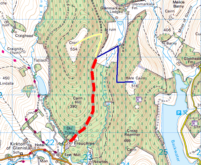
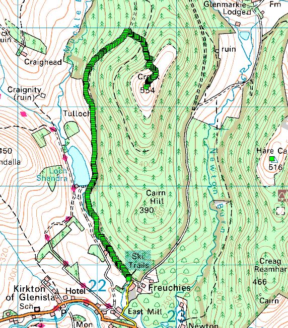
Crock 554 m GM/ES-056
Hare Cairn 516 m GM/ES-063
Creigh Hill 498 m GM/ES-064
Thursday 29th December 2022
After nearly two years of SOTA’ing, I’ve found myself close enough to completing the 87 GM/ES summits that I thought I ought to make a serious attempt to mop up the stragglers. Unfortunately the last eight or so are south of the line of hills - The Mounth - that divides Deeside, where I live, from Strathmore in the south. This time of year the three passes which cross the Mounth can be closed and even when open, they can be for the adventurous! None the less, I’ve made a few forays south and did so again on Thursday, travelling over Glenshee at 0800, once the plough had been over.
Crock Hill
I was able to drive the Land Rover up the estate road thanks to bumping into the residents of the big house as they were picking their way gingerly down the hard iced track in their audi Q5. “You should be alright in that”, they told me, looking at the 110. That worked out really well as I doubt I’d have made much progress by foot on the icy track and would have been going slowly around the verges.
I parked up where the track forks and headed up the left fork to Crock Hill, leaving the track just past some new plantings, heading up hill into well spaced out pines.
the drive in shown as a dashed line
Progress was soon halted by wind blown trees, many uprooted. Unfortunately as I ascended, their number increased, as did their density. It was pretty grim, zigging and zagging my way up and deciding under or over at each new obstacle I came across. Every now and again I’d check my digital map. I was still 200 m from the tree line. Even as I approached to end of the plantation, I was still in the thick of wind fall, with the smaller trees at this height being as much of an obstacle. I had to crawl out into daylight.
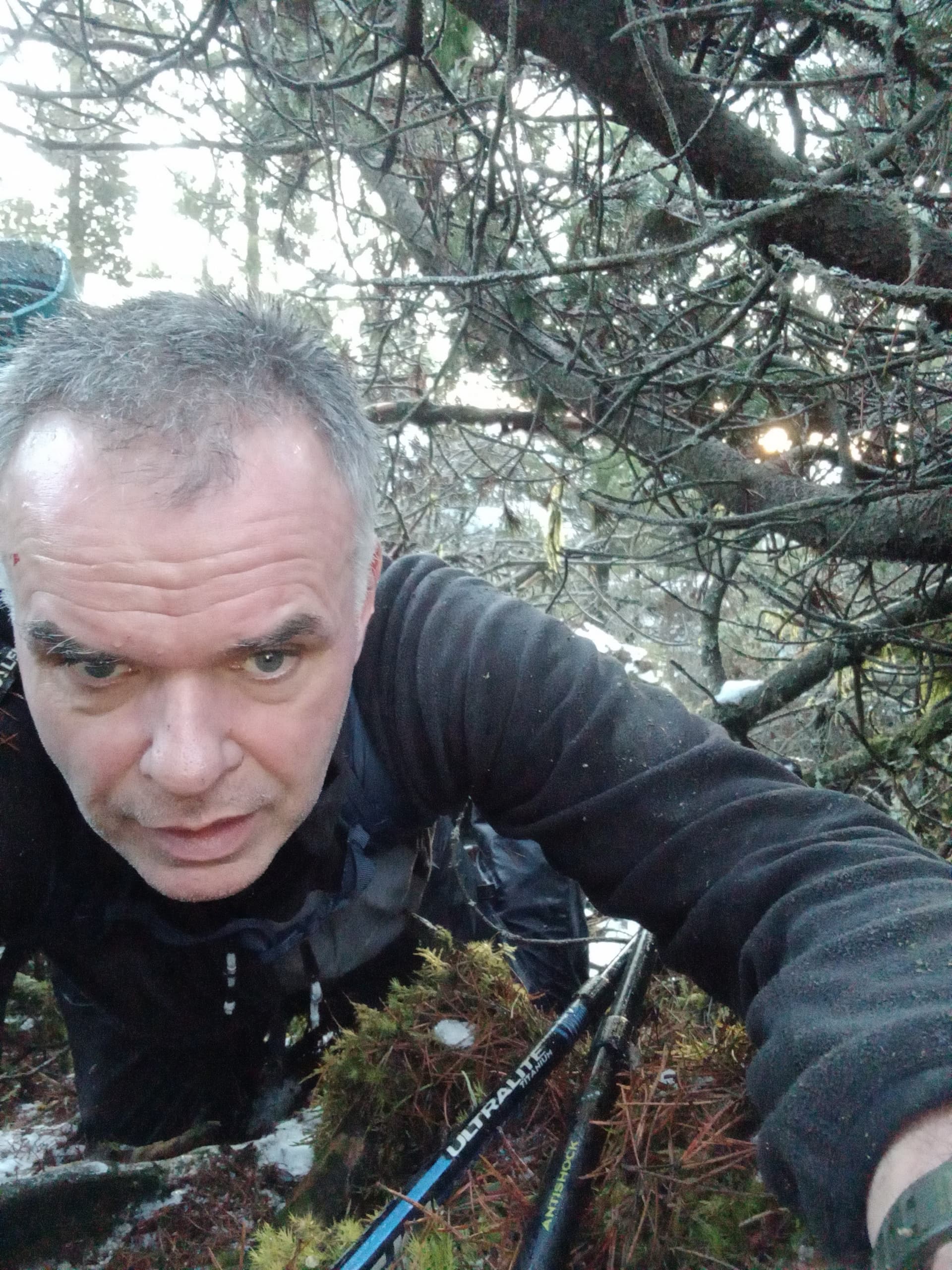
crawling up Crock Hill
I was filthy, my waterproofs and rucksack covered in slime, bark, twigs and pine cones. At least I was on the ridge now and I could see a faint path line through the heather.
The top was reasonably flat, with a few small pines and more importantly, a solitary post for me to attach my mast to!
I was QRV as GM5WS on 40 m SSB at 0920 but I suspect a little too early for the 40 m band (or the Chasers) to wake up. However, I logged 24 contacts in 15 minutes. First in the log was Ben who was activating the GW5WS callsign from a Welsh summit. When it went quiet, I switched off the set, fully aware that it was going to take me longer than planned to get back down.
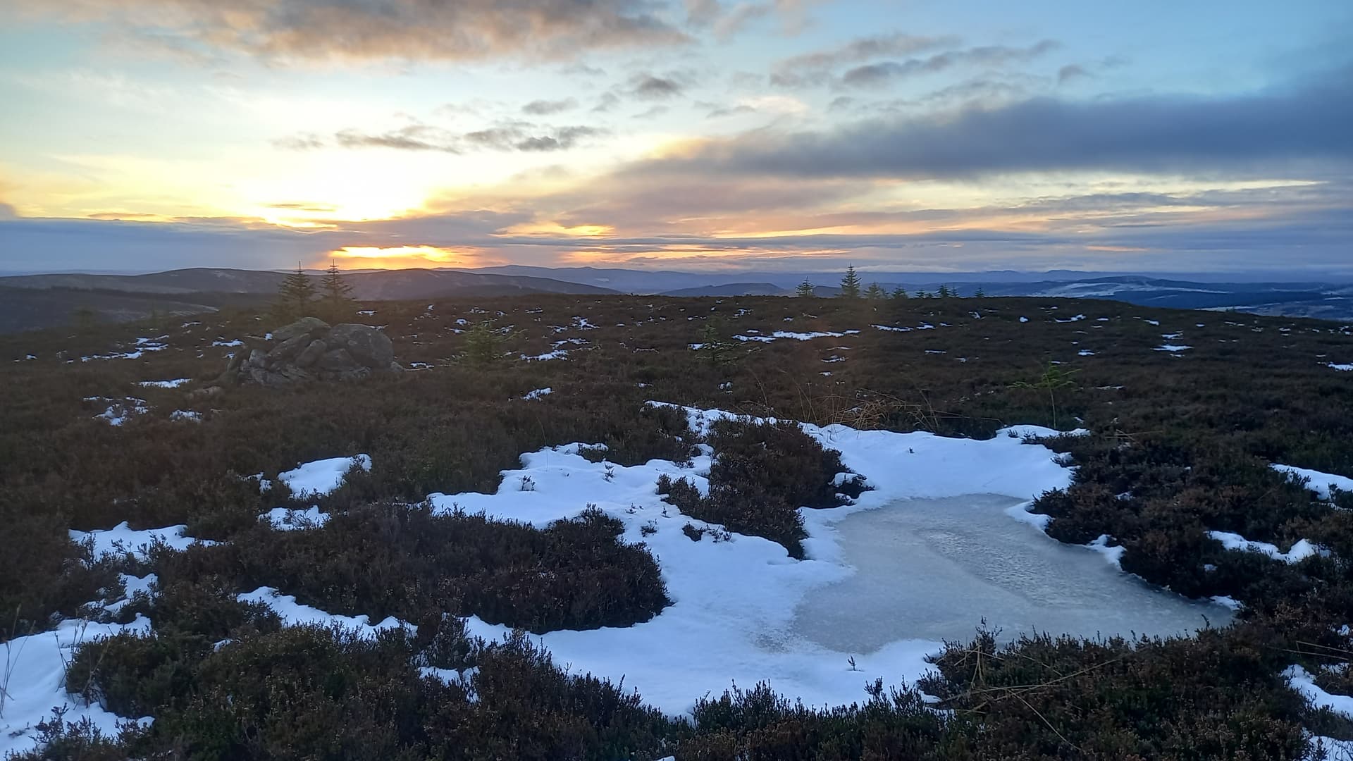
Crock summit
I descended directly, hoping to pick up the edge of the new plantation and miss the windfall. Of course, I was guessing due to the fact it was all out of sight from the convex summit.
Well, it was worse. This area I hit was mature Scots pines and they were thick with foliage. Every 3 m patch of clear snowy slope felt like a victory but it was always followed by metres and metres of awful (and dangerous) ground. A slip here could have easily resulted in a broken leg or wrist. Eventually it passed and I was able to pick my way down between the main plantation and the newer, smaller trees, many of which were dead standing.
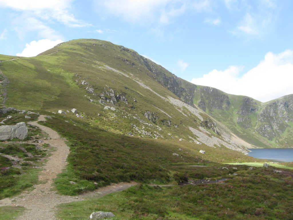
When I got back to the Land Rover, I had a drink, a quick snack and surveyed the route ahead up to Hare Cairn. I had the advantage of working out a strategy when the hill was laid before me as I descended Crock.
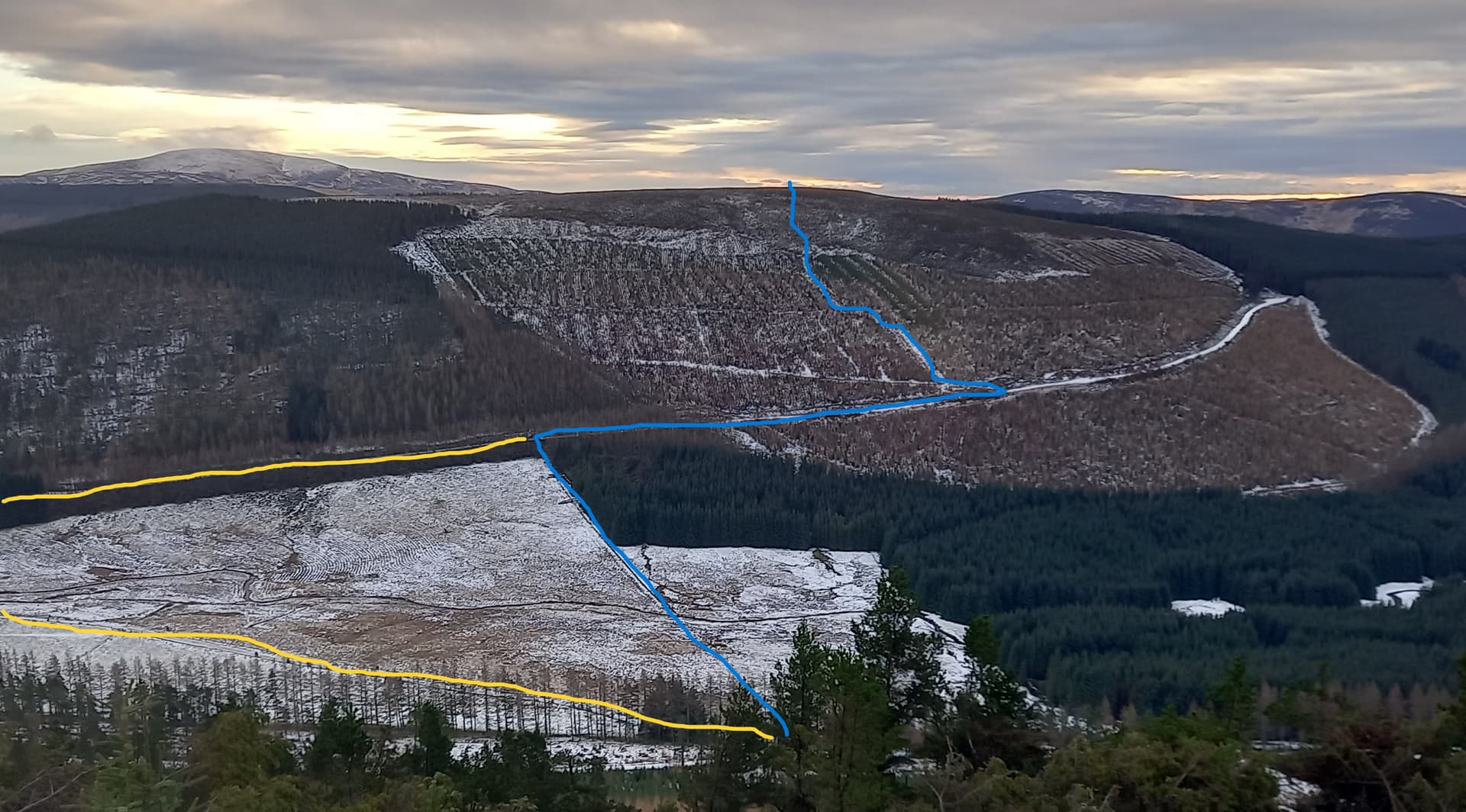
Hare Cairn ascent route in blue and descent variation in yellow
The icy forest track did a big dog leg to the left and then ascended the hill, so I decided a short cut was in order. I went down and across a marshy flat, which was semi-frozen, so not too bad to walk on. This led to the Newton Burn, which didn’t look much from Crock, however on closer inspection was a fast flowing and deep channel. Another setback. A wander upstream revealed a slabby block just proud of the waterline. I plunged my poles in the stream, the current tugging them hard. Once firmly planted, I pogo’d across landing squarely on the slab.
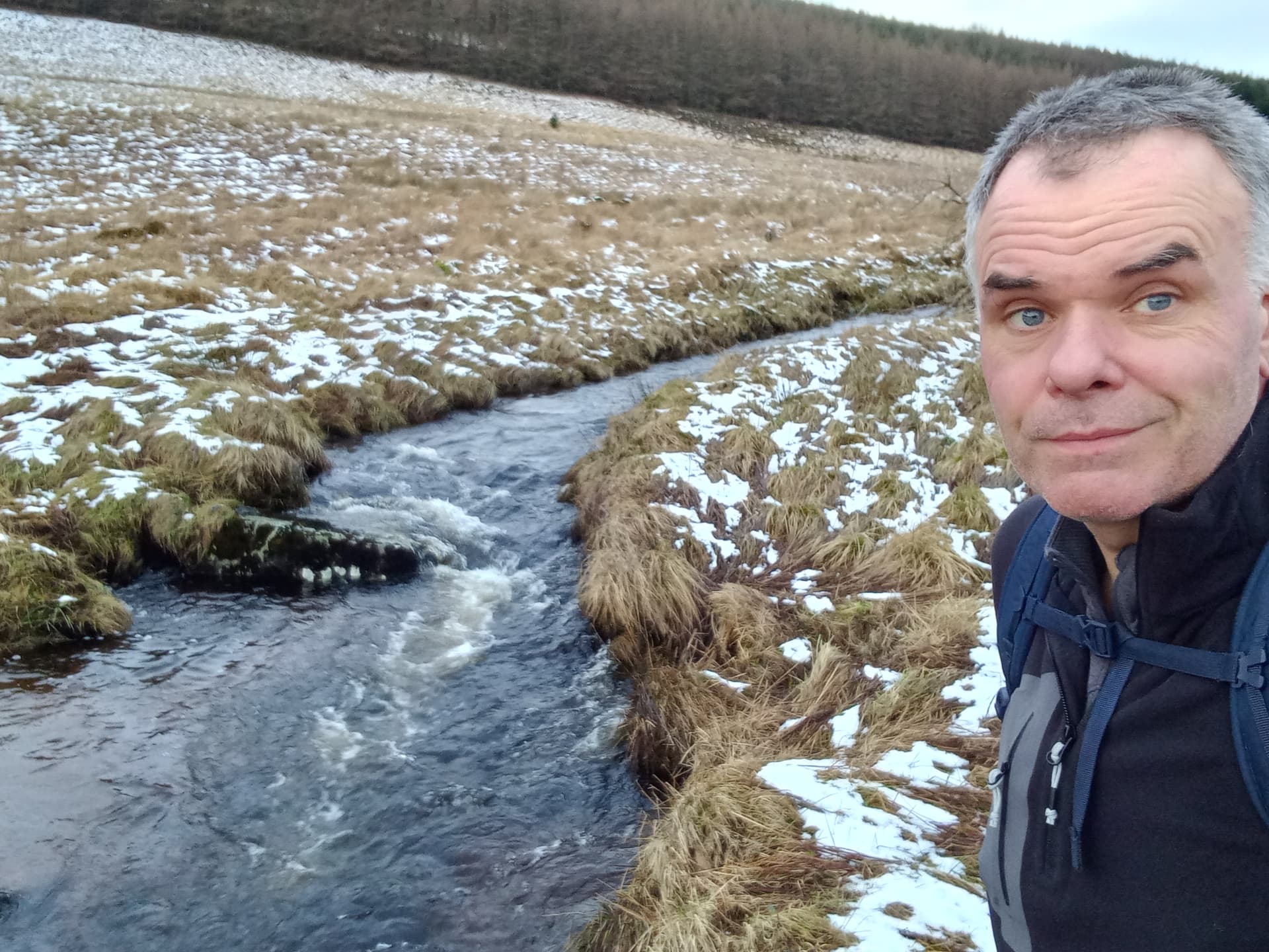
about to cross the Newton burn
Soon I was on the forest track. After a few hundred metres, a much more overgrown track hair-pinned back and just 20 m up this a clear break in the trees led to the upper slopes. It was rough in places and steep in parts, but didn’t present any real problems. I followed fox tracks in the snow all the way.
The summit featured a trig point and a nice row of old fence posts, which were put to good use.
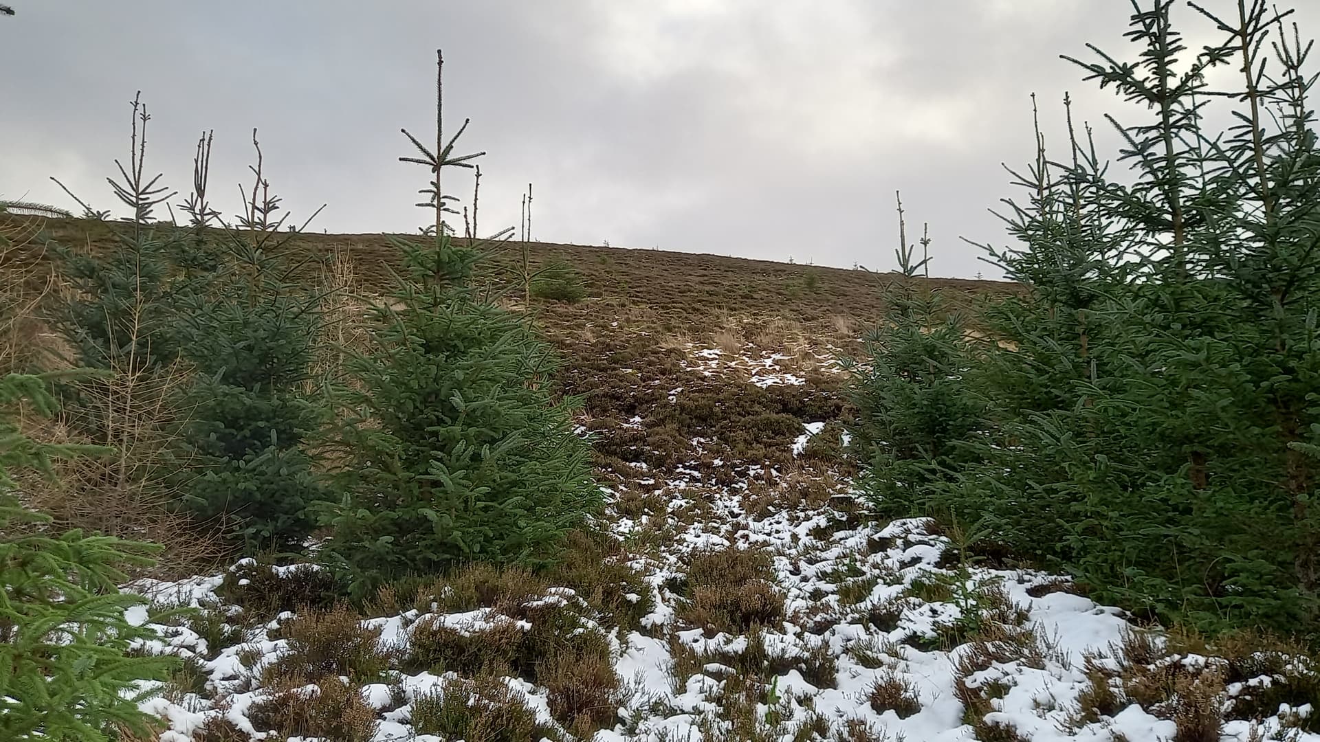
near the top of the firebreak

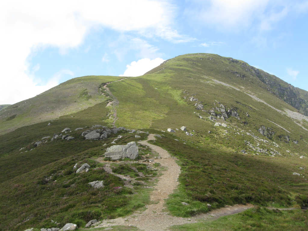
Hare Cairn summit, looking over the Backwater Reservoir and my potential third summit of the day, Creigh Hill, just above the trig point
I’d optimistically planned a third summit today, Creigh Hill and now that I could see it, I could see it didn’t look too bad. It was lower and I could see that it didn’t really have any snow on it, or any trees! However, I was tired and hacked off after Crock and therefore still in two minds…
I’d posted 20 m SSB for this one and immediately wished I hadn’t. The band was awful. I’m not sure why, with a SFI of 155 and k=2. After 15 minutes I’d logged just six contacts. I only had use of GM5WS until 1200, so I didn’t see much point in hanging around. It was now snowing. I decided to cut my losses and head down, my sights now firmly set on activating Creigh Hill.
My descent took a small variation to avoid re-crossing the burn. I was able to pick my way around the edges of the icy track, with the only dodgy bit being when the lodge owners slithered past me in their audi. I took to the steep bank! They waved gratefully.
Crock post-mortem
I had a good view of Crock when descending Hare Cairn. Even if I’d climbed Hare Cairn first I probably would still have run into trouble on Crock, as it was impossible to tell the state of the forest from this distance. In the below image I’ve marked my routes as well as the windfall area.
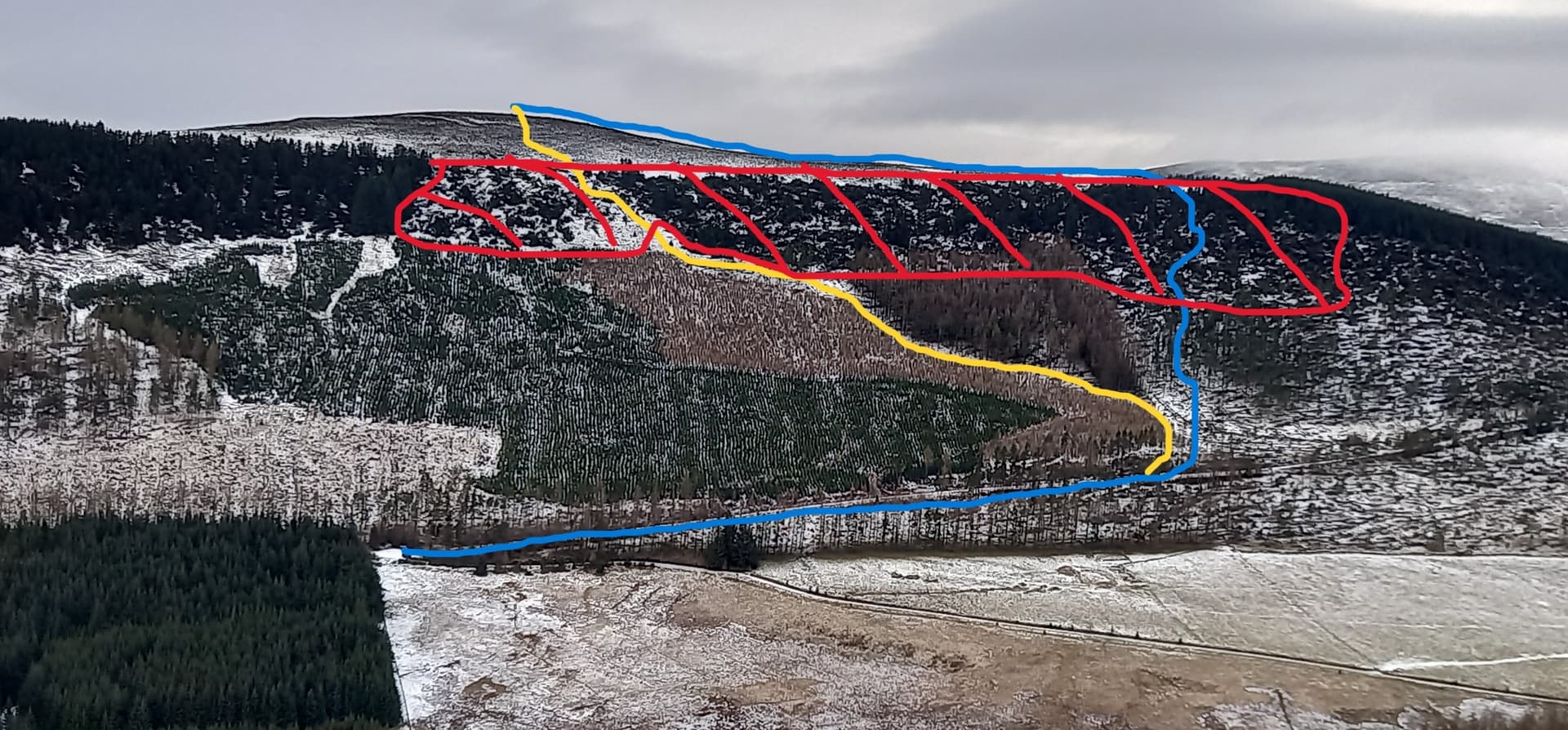
blue = ascent, yellow = descent, red = windfall
It may be possible to ascent directly from the fork area and head around the left of the new plantation and around the left hand edge of the windfall. Good luck to anyone who tries it!
Onwards to Creigh Hill
Even on icy roads, it was only a 15 minute drive round to the east shore of the Backwater reservoir, which is the source of fresh water for the city of Dundee. The large lay by only had one visitor today - Me. From the south end, a short track led to a gate. Through the gate a grassy ATV track ascended not Creigh Hill, but the bump to the north of it, the idea being to climb this and then follow the ridge line south to the summit. Although longer, I followed the track, not tempted by the heather bashing short cut for once.
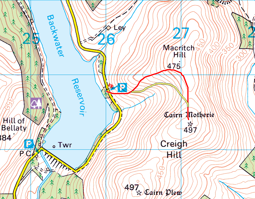
red route up Creigh hill - on the 1:25000 map, Creigh hill is shown as 498 m
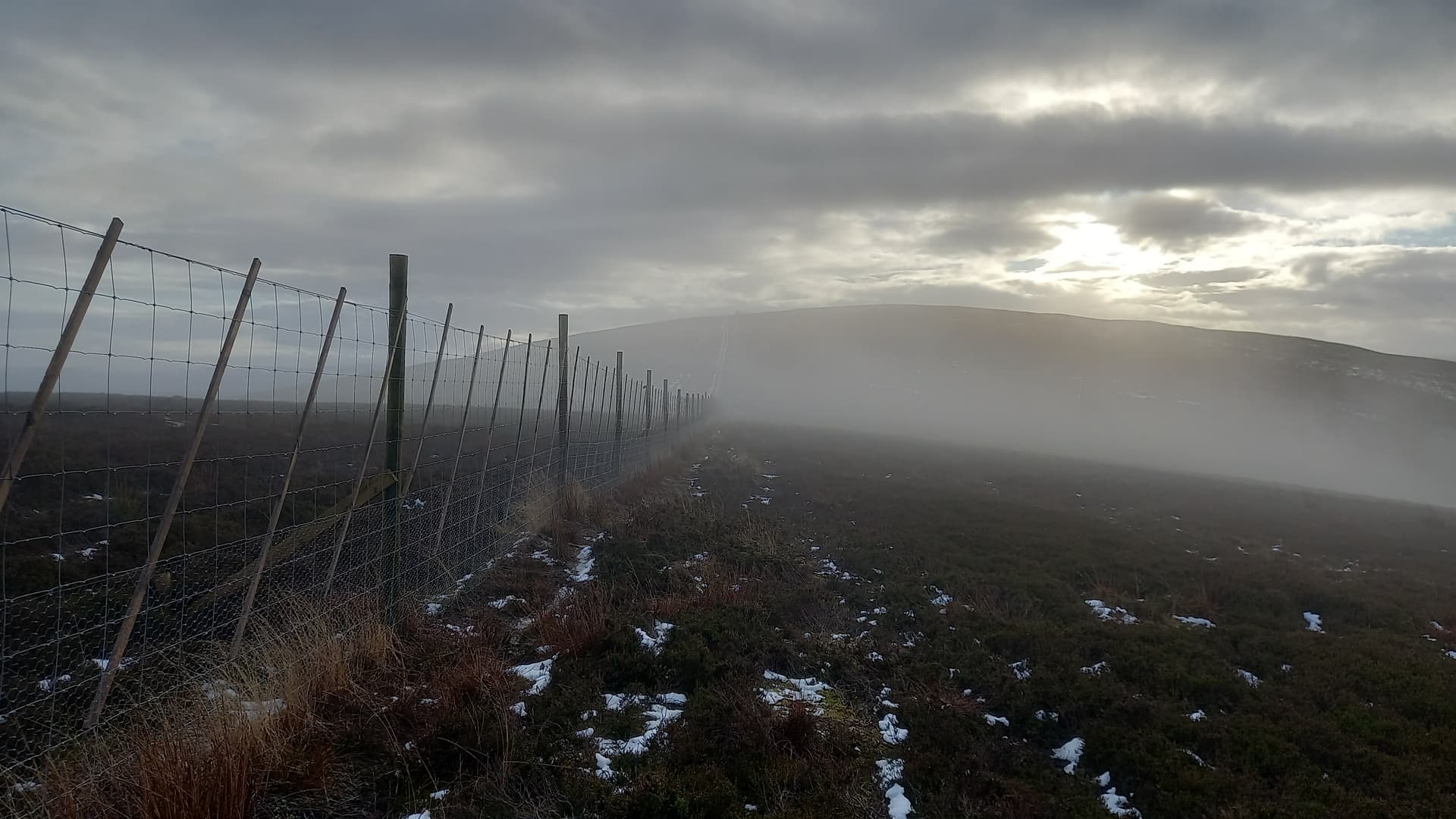
Creigh Hill appearing out of the clouds
When I reached the ridge and deer fence, the last of the show showers of the day passed over and the summit was revealed. It looked terribly far away, just an illusion. Easy slopes led up to a summit adorned with a fence, a stone shelter and a random post which had obviously been placed with SOTA in mind!
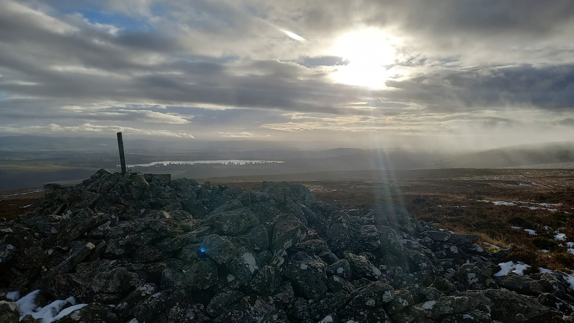
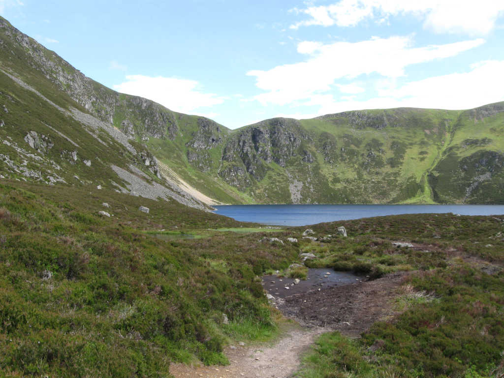
from Creigh Hill south to The Loch of Lintrathen
40 m SSB was the order of the day. It was working in the same fashion as in the morning and I quickly logged 13 contacts before there was a long enough silence for me to call QRT. None were further than Norway or Belgium - with the exception of Manuel @EA2DT.
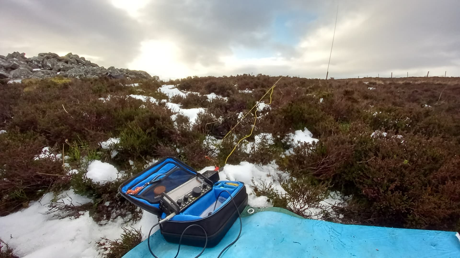
KX2, W3EDP and Carbon 6 pole used throughout the day
On the return, I spotted a faint but clear track heading off through the heather and it took me on a much shorter route back. It is shown in yellow on the map. It could be found on the ascent if one were to walk directly towards the summit of Creigh hill from a steel gate next to the ATV track at NO26583 59998.

crossing the Backwater dam on my return
Summary
I don’t see the situation on Crock hill improving any time soon. The fallen trees have been there too long to be of any commercial value. The hill can be climbed directly from the car park to the south. I’ve read it is rough in places but would be a better option. Hare Cairn was a breeze in comparison and Creigh hill is pretty simple too.
Band conditions weren’t the greatest yesterday and I was disappointed I couldn’t give more chasers a contact as GM5WS in my final outing using the callsign. However, it’s been great fun using the call on half a dozen summits this month.
There’s talk of the RSGB issuing special callsigns for the King’s Coronation in May and using hilltop fire beacon locations to facilitate this. That sounds right up our street…
73 and a Happy New Year!
Fraser MM0EFI
 but you smashed it once again
  was great to make a S2S with both of us using the TA call-signs again!
