Continuing the discussion from The Ultimate RSGB LoRa Balloon Project - IT'S A MUST :) (Part 1) - #100 by M7SDO.
Previous discussions:
Continuing the discussion from The Ultimate RSGB LoRa Balloon Project - IT'S A MUST :) (Part 1) - #100 by M7SDO.
Previous discussions:
Not really surprising, but I didn’t get to open the repeater. With the antenna I received, I guess it wasn’t that likely!
Anyway, I am going to order some IPEX 1.0 to SMA cables so I can make a better antenna for lora use going forward. I also found out that the battery connection is reversed in polarity to another device I have, and the two 1S LIPOs with the same JST plugs. If you plug them in and then plug the USB cable in, the reverse polarity protection reports “Low battery”. If you plug the battery in while the USB is powering the device, you will let some smoke out. You can guess how I found out… Anyway, seemingly no harm done - it still functions on USB or battery power, but I wouldn’t be surprised if the battery charging circuit is no longer working.
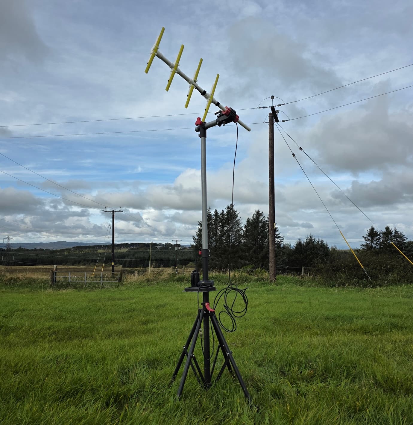
Thank you to all involved for making this happen, we took the opportunity to build a yagi at our weekly club night and five of us met this afternoon to give it a go from Paisley.
Just one packet from mine got through.
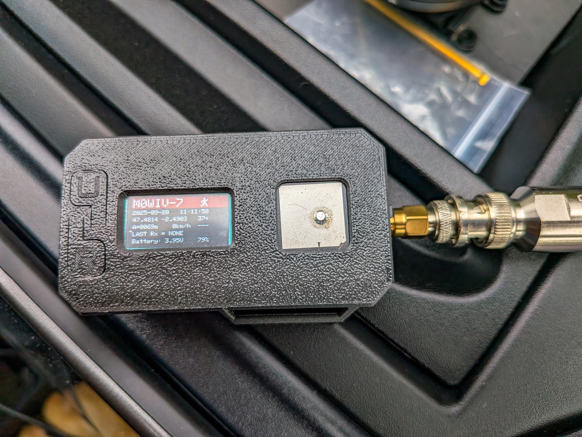
M0LEP-12 2025-09-20 11:47:47 IO81TQ > IO82NW 88.9 miles 166°
At that point the balloon was a bit over 25,000 ft. just NNW of Ellesmere, and moving away from me at over 80 mph.
It would be interesting to see a balloon track labelled with the positions it was at as it relayed each valid position. ![]() Even more interesting would be to add all the packets it got errors on, but I expect there’s no data on that unless it was actively logged in the software and extracted post flight…
Even more interesting would be to add all the packets it got errors on, but I expect there’s no data on that unless it was actively logged in the software and extracted post flight…
Any news on whether the payload’s been recovered yet?
Well, I had fun with this.
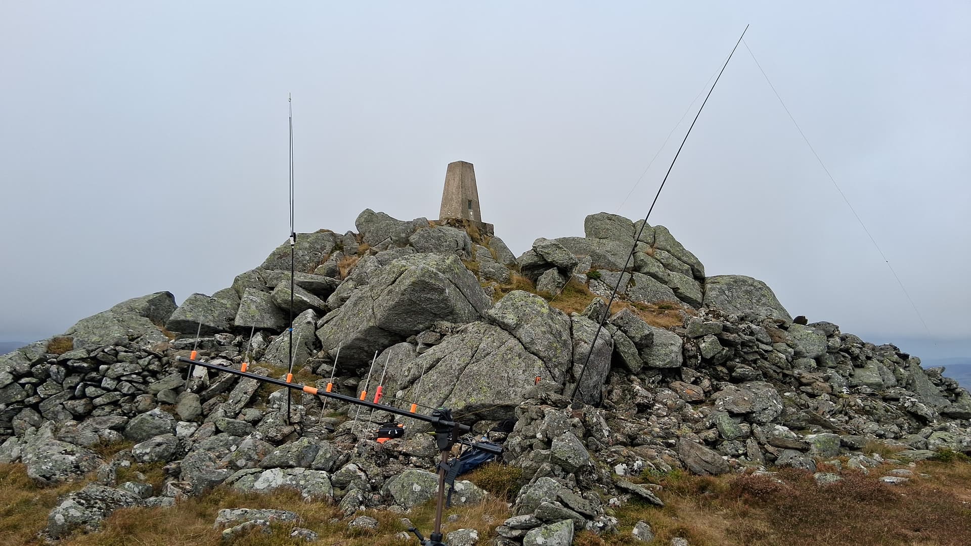
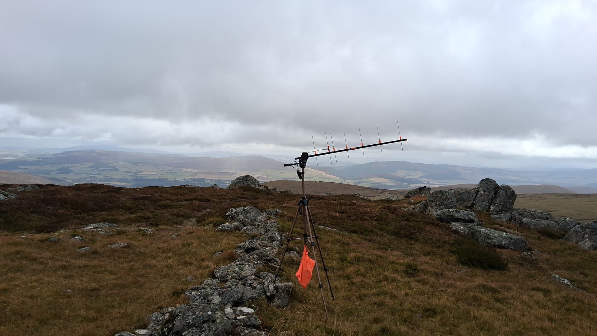
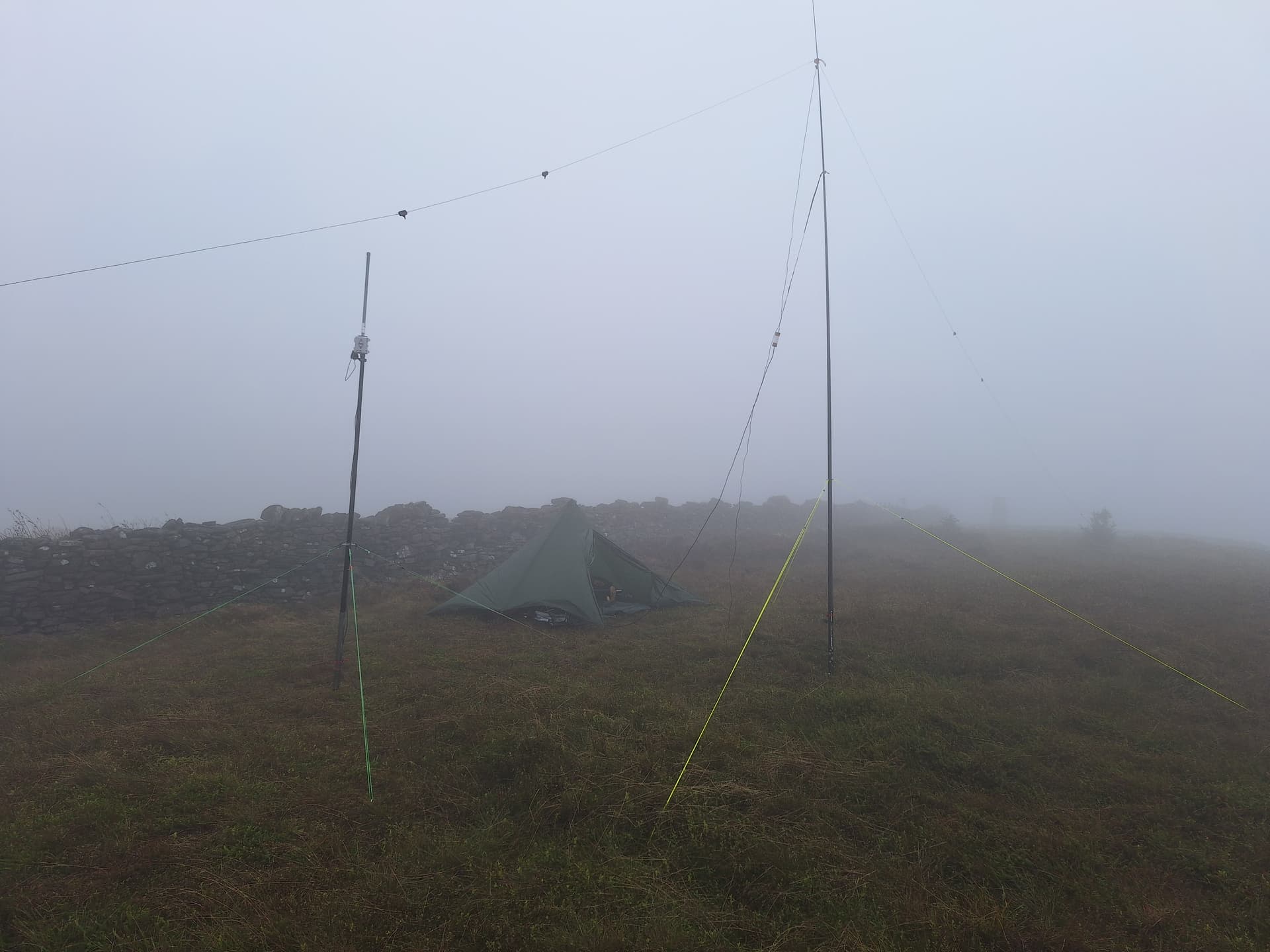
As for today, well I decided on The Buck of Cabrach GM/ES-039, figuring I’d have some downtime to play on 2m and HF, once the tracker was set up.
L-R VHF, 70cm LoRa and HF
Heltec tracker and 10dBd 7 element beam. Orange bag full of rocks
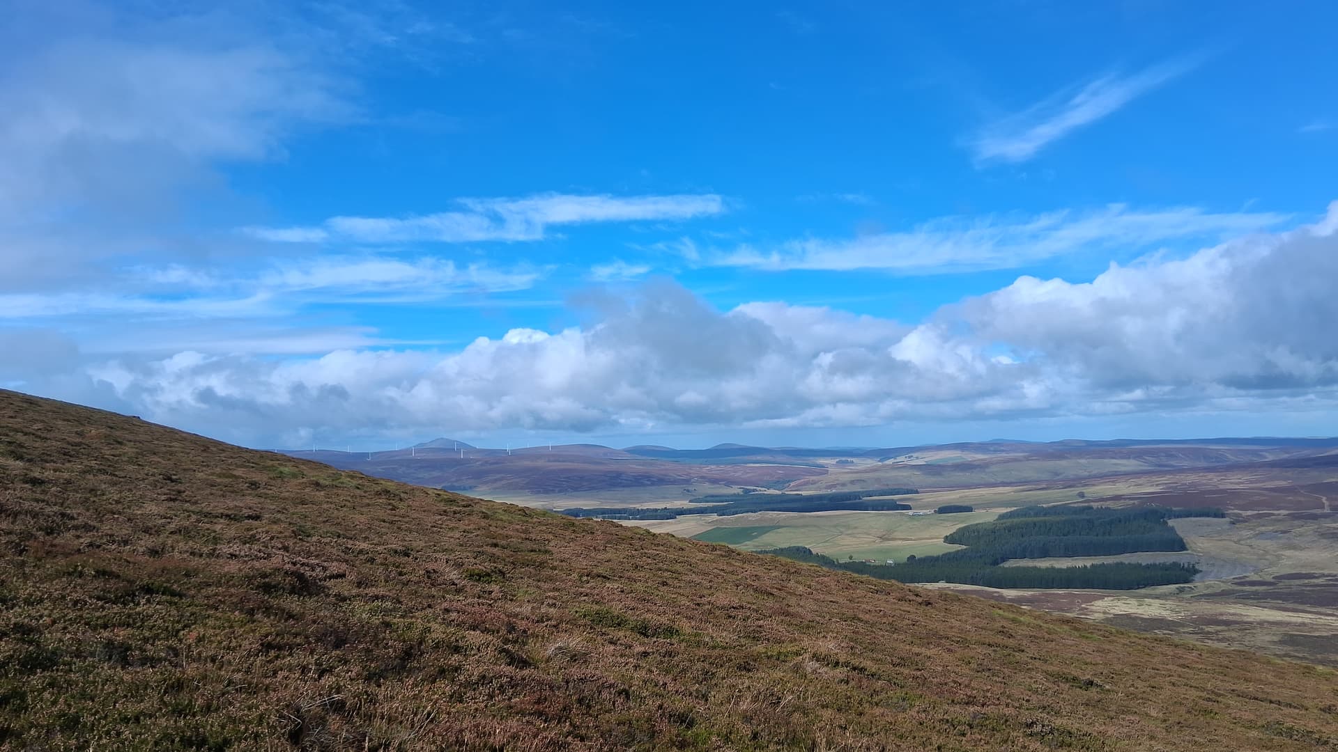
blue skies on the descent
I didn’t manage to open the balloon repeater from my position, but still had fun trying, as well as fun working @EA8DKV on 10m SSB, 40m S2S with Martin @M8BIA on Shining Tor, and then Caroline & Martyn @M3ZCB @M1MAJ who have been up here all week. I’ve been chasing them all week, so great to finally manage a summit to summit.
Now, what to do with my new 70cm yagi?
It looks like people had fun and it seems to have been of some considerable interest. Which is a good thing ![]() Shame about the rains at the launch. They arrived here around 1500BST.
Shame about the rains at the launch. They arrived here around 1500BST.
I’ve seen a few pictures of people’s 70cms antennas and the one’s I’ve seen of Scottish stations looks like they were trying to work a geostationary satellite from the massive elevations. I did a quick calc for your QTH Fraser. I think the satellite was at its max height of 45000ft around Ramsbottom /Bury area. Your hill to Ramsbottom is 408km. and 45000ft is 12800m
So from that figure, the angle is atan(y/x) = atan(12800/408000) - 1.8degs.
Even at only 50miles (80km) at 12800m elevation it’s still only 9degs elevation from the horizon.
I think many people will have been aiming far too high in the sky. When you actually work it out it feels to be far too low down but that’s what the number say. Now a 1.3wavelength Yagi is hardly a pinpoint sharp beam but more accurate elevation will no doubt help. Good to know for the next time one of these events takes place.
I still think that people up our end of the country will have a the devil’s own job trying to get above all the QRM from stations closer in. If there was some way of having few stations txing at any one time it would work fine with QRP and the wee antennas. But realistically, up here you probably need a bit more oomph.
Maybe the next balloon can have 2 radios and there’s a published frequency for everyone to play with and a covert one that only a few people are told of to see just what can be achieved when there’s no other station QRM.
Still, good fun for a damp Saturday. ![]()
I really enjoyed this activity, thank you for organizing the event.
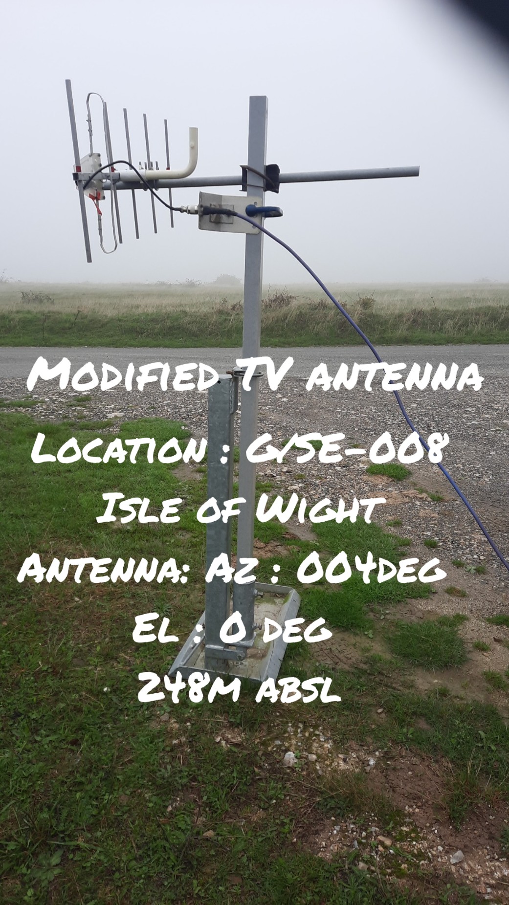
My setup consisted of the following …..
Conditions : wet and windy at times with limited visibility.
Location : G/SE 008 St Boniface Down , Isle of Wight
73
Rob G0PEB
I did the same calculation while I was waiting for the launch. The beam was horizontal and facing due south by the time the balloon went up! The antenna has a 45 degree beam spread too, but it was a little like fishing in the dark. If the balloon had reached the anticipated altitude, then I may have had a chance.
Well done Rob, looks like you managed to hit the HAB at over 200 miles!
I need to think more about how much earth curvature there is because it may have been 12800m ASL but enough earth curvature at that range may mean it never rose about your horizon even allowing for a bit of tropo refraction. I think at best it would be a marginal path.
Maybe the RSGB should consider launches from other locations? i.e. one from up here when the winds are blowing South-ish .
Absolutely. Additional locations or maybe from the centre of the country. I know there was a guy up in Wick trying it. He had no chance with 42,000’ maximum altitude.
We will have to arrange something similar next year, me and Dave are already planning something up our sleeve! ![]()
Andy, have we had confirmation that the RSGB balloon achieved a maximum altitude of 12.8km?
If true, then at that particular time, using the d = √(2hR) formula, it would suggest a LoS distance (measured on the ground) of many 1000’s of km.
So - baring intervening obstacles like hills and building - the balloon then would have been LoS from Fraser’s location and everywhere else in the UK.
Did I miss something?
[EDIT UPDATE: I got the square root calculation wrong. See later]
I knew it!
Well done both of you. This event generated a bit of excitement, which is great.
Also, rumour has it that the next generation coming into amateur radio are much more interested in this kind of thing than having a “voice QSO”. APRS, packet, data modes and the like are the future.
Well that was fun! I was running one of the iGates GB1HAB-11 on Shining Tor G/SP-004. As we approached the top the heavens opened and stayed that way for the next four hours! Being prepared I put the iGate and my own antennas up and disappeared into my tent. After contacting Ben on 40m to confirm everything was working, I switched to 20m for some SOTA fun. It was great to work everyone including Fraser @MM0EFI and James @M7SDO who also had iGates. With 65 QSOs in the log and 24 S2Ss I emerged from the tent to make the 40 minute dash to the car. It was fun to work everybody and be involved in the project. It seems to have generated a lot of interest. Well done Ben! Special mention must go to Dave @G1JKS who built and designed all of the kit. Not only did it survive the balloon flight but also 4 hours of Derbyshire deluge!
I think the calculations are wrong, at around 13Km the horizon is somewhere around 300 km or 200 miles from memory. My figures are almost certainly wrong but the decimal point is in the right place.
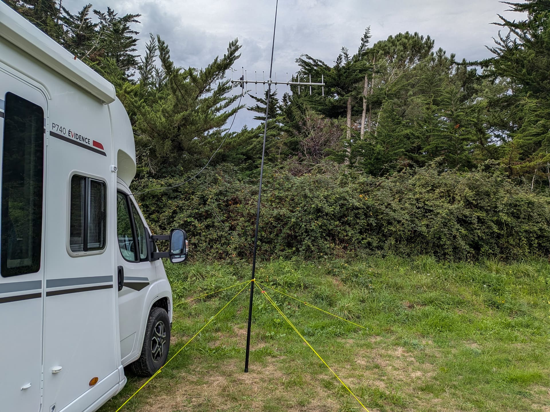
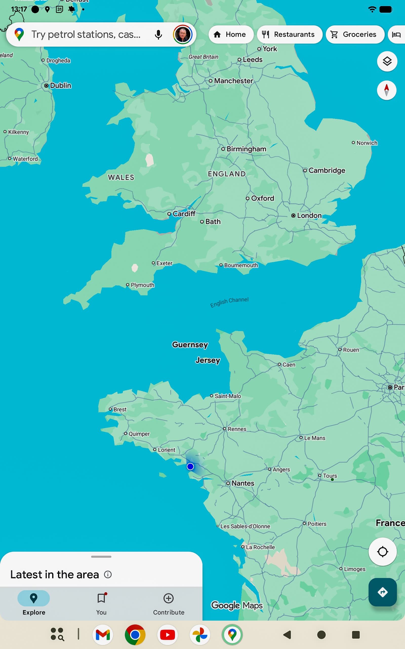
However, I’m putting a claim in for the most optimistic attempt from a little north west of Nantes in France, blue blob on the map below. Although somewhat irritatingly two weeks ago we were on the tip of the Cherbourg peninsula with a clear view over the sea north. I might have had a chance from there. ![]()
G7ATJ-7 6 2025-09-20 11:30:58 2025-09-20 12:25:10 IO90JO > IO83VR 219.0 miles 168° 2025-09-20 12:25:10
This is the longest distance shown in aprs.fi info for GB1HAB. I don’t know if that is definitive.
Using my phone whilst eating at the table… Mustn’t let Mrs FMF know!
At 12.8km and 6378km isn’t the horizon distance 405km? Need to use big computer and keyboard to confirm this so you may be right.
Perhaps I’m using the wrong formula but using d = √(2hR) where: