I wasn’t able to take part in the Trans-Atlantic party this year. I just have so much on this November that I tbought if only fair that I turn up at work on the odd occasion. However, with a fine forecast for Sunday I made plans to get out up a local peak.
Carn Ealisaid GM/ES-030 has been good to me. My first trip up there was on a warm afternoon in September 2021. The next time, a claggy early morning in April 2022 where I was rewarded with three VK summits on 20m SSB. The standard route allows speedy access. A quick hike up a ski road from a high (600m) starting point, then a drop to some peat hags before climbing the final slopes. It is ok when dry and takes less than an hour.
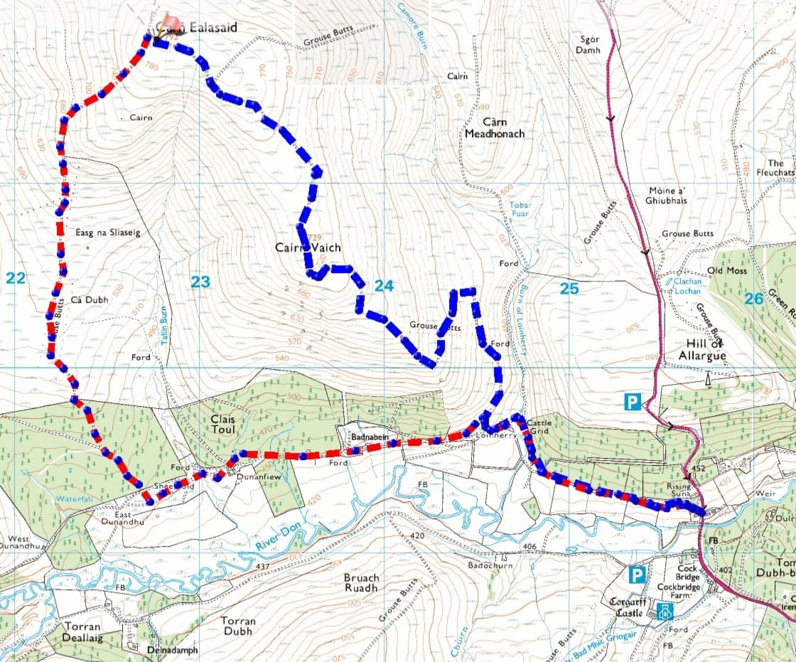
Well the time came to try SOTA from Carn Ealasaid once more. With weeks of rain, I really didn’t want to be traversing a minefield of soft peat, so went on the search for another route. The hill can be climbed from the south, east and north – all via the A939 road. I settled on the route below, mainly because of the good track. The only detraction was the 400m starting point, so an extra 200m to climb. I need the exercise though.
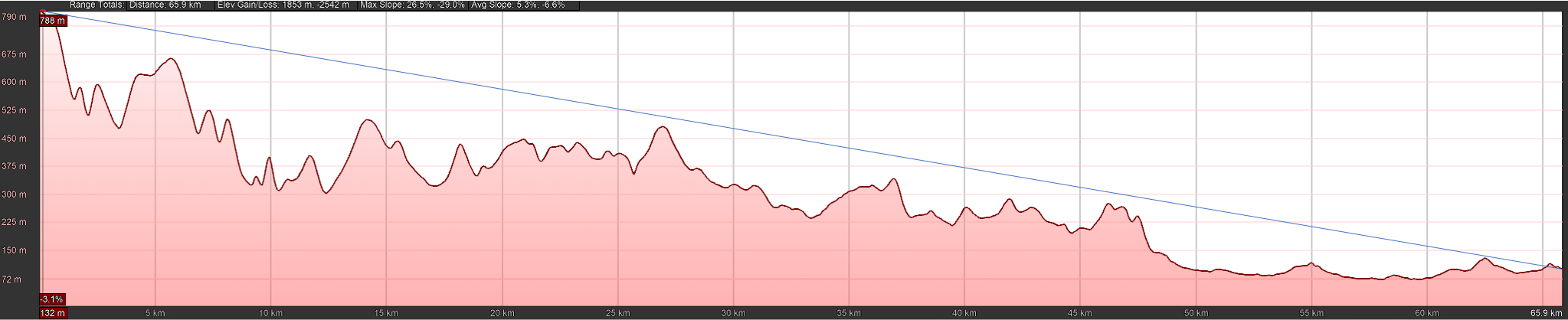
ascent in blue, descent red
Sunday 5th November
0630 saw me demolish some pre-prepared overnight oats (a glass holding 40g porridge, some raisins, spoon of maple syrup, spoon of peanut butter and topped up with milk), a cup of tea and then grab my pre-packed bag. I was away from home at 0700, straight into some drizzle. 0730 saw me parked at the start of the very steep climb out of the hamlet of Cock Bridge. I thought I may have to park at the Corgarff Castle car park, however the outdoor centre was un-occupied so I parked there.
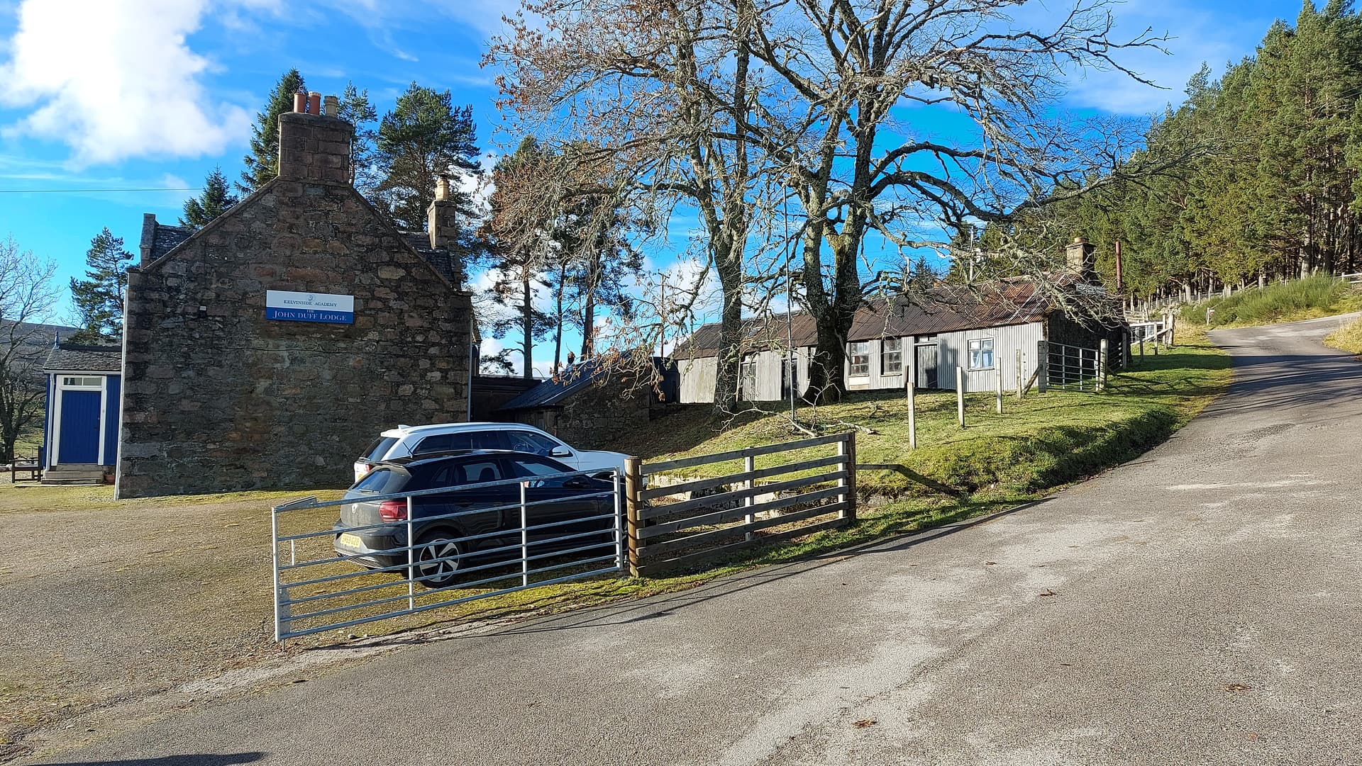
parking photo taken later in the day when there was more light
Walking up the back of Briggies bothy took me through a gate and then on to a well-made vehicle track for about 1500m. I then crossed a bridge and passed between the unoccupied Loinherry cottage and a locked bothy. Almost straight away a grassy slope climbed up to the right and then eased eased off to slowly climb the contours of Cairn Vaich. Nice pleasant walking, although the zig-zags were long and could probably be short-cutted. On passing Cairn Vaich the track dropped slightly and here I made the mistake of following a lesser path through the moss. It was very wet and a bit boggy. I should have stuck to the main vehicle track that swung to the east at this point. Never mind, my path soon re-joined the main track.
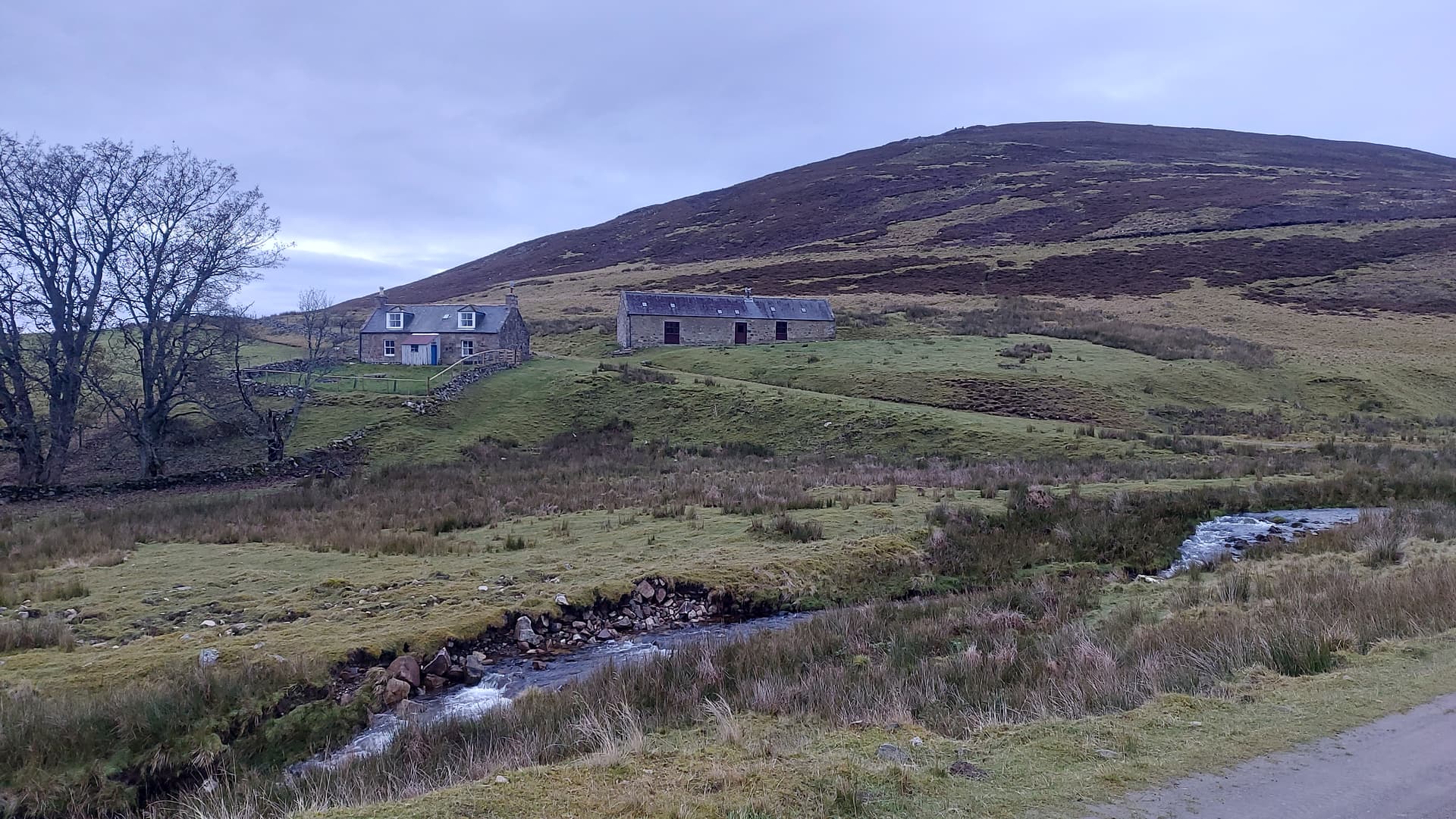
the cottage at Loinherry

that’s a blanket of fog if ever I saw one
There was a bit of drizzle and the hills were still undecided about coming out of the clouds. The forecast was for blue skies, however we all know what that can mean in the mountains. Looking east I could clearly see the distinctive shape of Ben Rinnes GM/ES-021. That gave me some hope.
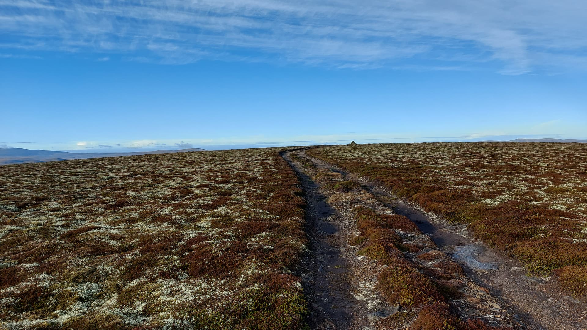
approaching the summit of GM/ES-030
Before long I could see the summit cairn in the distance and the sky turned blue. Perfect. I arrived at the top at 0850, it having taken around 1 hour 20 mins to hike the 3.4 miles / 5.5km. I’d posted on twitter and told the locals I’d try 2m FM first of all, but I was a bit early so set about putting up my HF station. I managed to guy the EFHW with a single guy, with the antenna wire arranged in a shallow V to help. Not a breath of wind. Temperature around 2C. My work done, I stopped and looked around. The clouds had cleared all around me and I could see they had dropped into the glen over towards Speyside. The views were extensive with glimpses into the NW highlands beyond Inverness, as well as the distant Sutherland hills in the north and the Cairngorms to the south, west and east.
2m was immediate then slow. @2M0WNA Mike was first out of the gates and we had a brief catch up. I then had to wait almost 20 minutes for my next contact, and that was it. @GM4OAS Gordon had been trying from over in Mallaig. I heard him briefly but it was a stretch for my handheld and RH-770. Later @GM4JXP Simon would call in but couldn’t hear my reply.
With that out the way, I went over to the KX2. I was not really sure what I would get on HF today. We were either in the middle of a solar storm or in between solar storms. I wasn’t really sure. 40m provided an instant answer to that. I logged 20 QSO’s in little time at all. When my CQ was met with silence I moved up to 20m. Another 20 QSO’s. A little harder this time due to fading. I also managed a summit to summit with @EA3GNU who sounded like he was running a kW. A perfect 5/9. @EA2DT was weak on 20m and asked if I was doing 15m. “Yes I was”, was the answer. On 15m I logged 10 QSO’s and Manuel had a better signal on this band. Just because it was there and easy to do, I moved up to 10m, adding a few SV stations, with 3 QSO’s on this band.
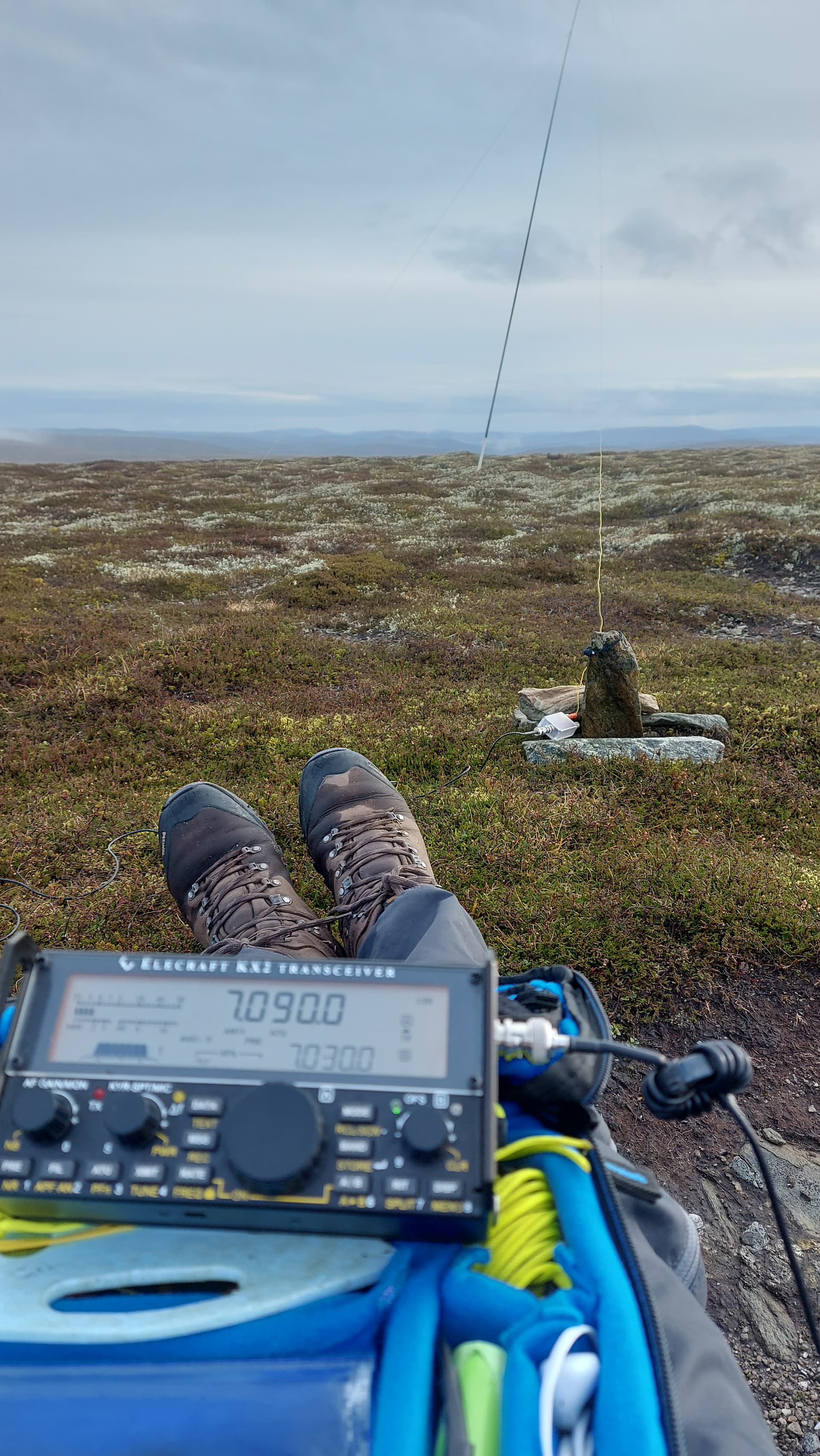
about to look for a frequency on HF
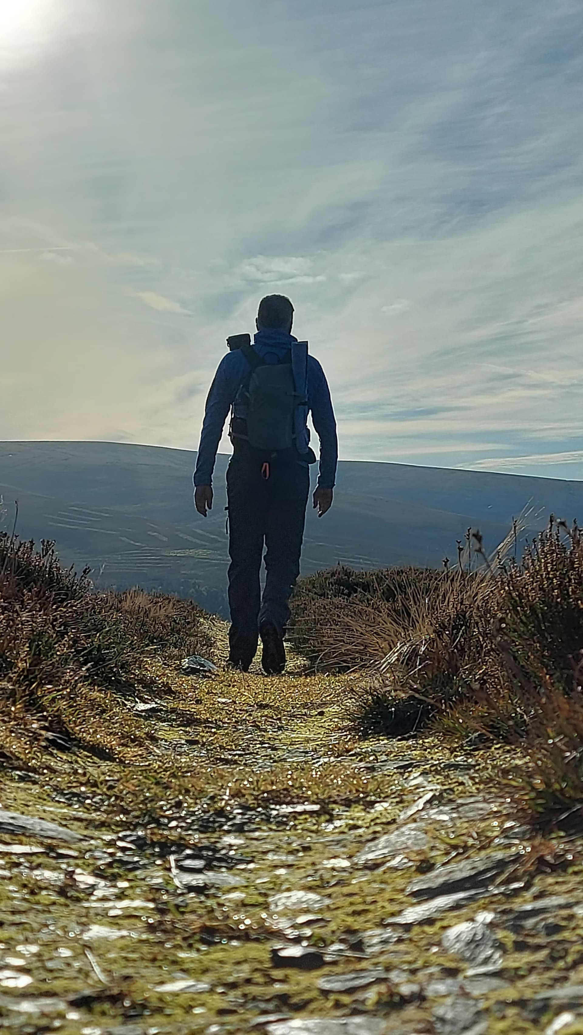
By now I’d been operating for over an hour and the temperature was starting to affect my extremities. I called it a day and packed up the kit. The route down was a continuation of the track that took me to the summit. It headed down the broad south west shoulder of the hill and dropped me much further west along the glen. At 4 miles / 6.5km it was a little longer, but worth it for the excellent views over to Ben A’an (GM/ES-006) and Beinn a’Bhuird (GM/ES-004), scene of many a grand day out. Oh and not to forget the bleak Brown Cow Hill (GM/ES-023), scene of many a forgettable walk.

Distant Cairngorm giants
heading down to the glen
I was back at the car for 1200 and home by 1220. Within 5 minutes I was sitting down to some freshly made Broth and warm fruit scones. The perfect belly filler after a morning in the hills!
Summary
This route has lots going for it. A great track on an easy grade throughout. Completing the loop is hardly any further and opens up some great views. Yes, the route from the ski centre starts 200m higher, but involves pathless sections as well as some descent and re-ascent, not to forget the dreaded peat hags.
Carn Ealisaid is a fairly bland mossy lump, however the extensive 360 views are superb in clear weather. They don’t really photograph all that well as the rounded dome puts them so far away. Worth waiting for a nice day for a first activation there I think.
As for the activation, well 2m was slow, with just two contacts, however that’s two more than I’ve ever made from here before. I should have taken the yagi. GM4OAS and GM4JXP both called in but couldn’t hear my response, so I could have qualified it on 2m - Maybe. HF was a blur. I thought I’d probably logged around 25 contacts in all. It was only when I got home and uploaded my log that I saw I had 55 HF QSO’s in it, from 18 different countries.
73, Fraser MM0EFI