The Lost Tooth
Ok, slightly tenuous title, but there’s a good reason for it. My nephew Struan and I have been trying to get away for a few days to the hills since he was sixteen. He’s now twenty four and soon to depart for Oz (VK) for a gap year, so we thought we’d better do something about it.
April’s planned bike/camp/hike and a round of the Ben Alder Munros (5 SOTA) was shelved due to late season snow. We re-planned that for Wednesday and Thursday of this week, however with Wednesday’s wall-to-wall rain, we cancelled again. Thursday afternoon and Friday looked OK, so I’d plan something less ambitious nearer to home.
Thursday 11th July 2024
Struan was driving up from Dundee and would arrive at 1030. We’d have lunch at 1pm and then Mo would drop us off at Corgarff Castle around 2pm. We’d then walk 10 miles / 16km west over to and through Glen Avon and hopefully find a campsite at the bottom of the dramatic Slochd Mor, a deep glacial valley.
At 10am a porcelain crown on one of my rear molars became detached and I neatly coughed it out onto the coffee table. Oh!
After a quick call to the dentist, I drove the eight miles to Aboyne, got the remains of the cement ground off and the crown re-attached. I made it home in time for soup and we still left roughly on time.
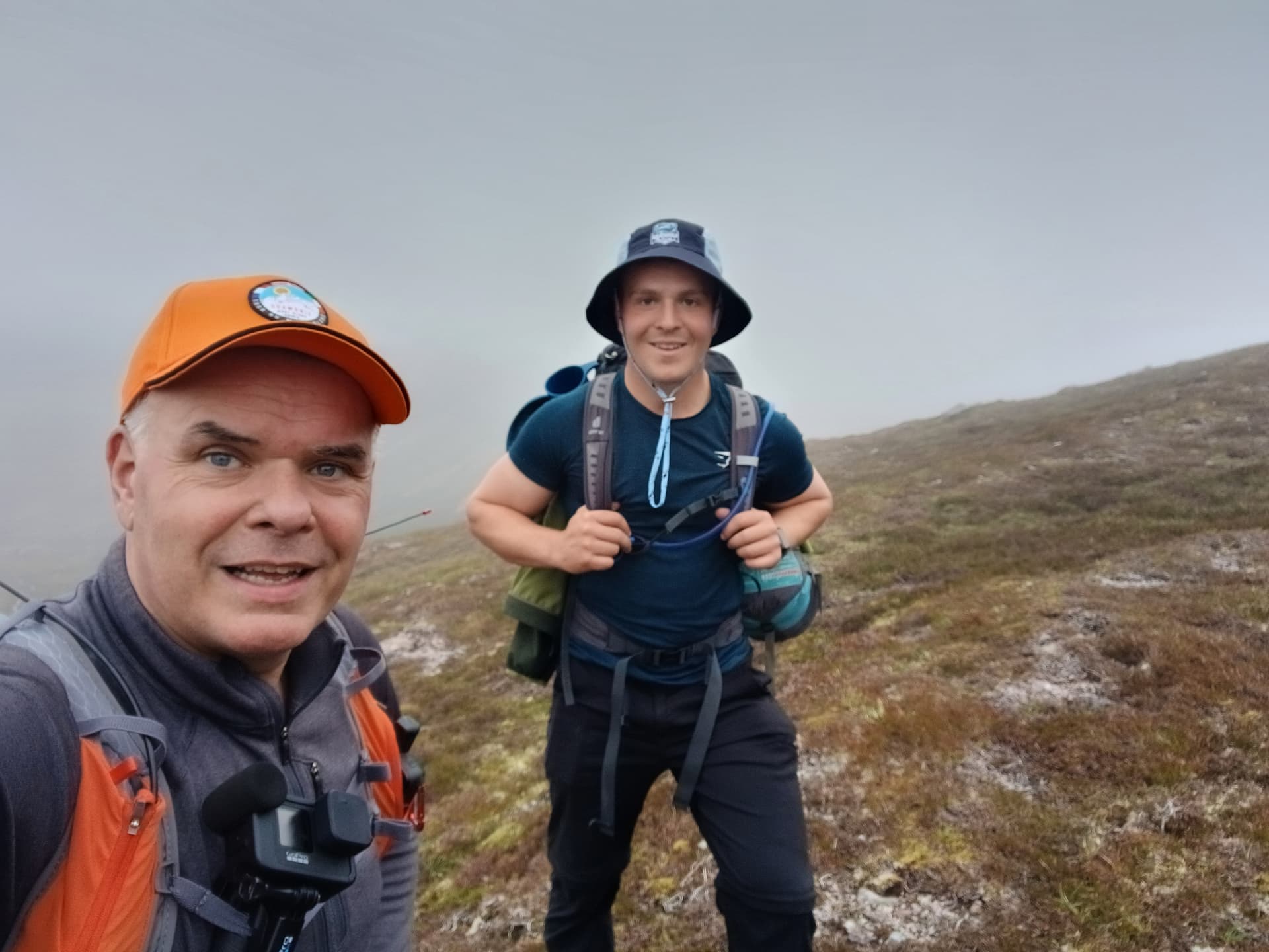
We set off from the castle around 2.15pm along the good vehicle track that heads west into the broad valley that contains the infant River Don. We both carried 11kg loads. Mine was a 29l pack, containing my KX2, short vertical wire, carbon 6 pole, Quansheng UV-K5 and slim-G. I had half of the tent, some dehydrated food and a litre of water. Struan’s 30l bag had the cooking stuff, the other bit of tent, 3l of water in a pouch and so much food that he had to tie his sleeping bag and mat to the outside.
After an uneventful 8km, we dropped down some moraines beside the huge estate house at Inchrory and into Glen Avon at the point where the River Avon takes a 90° left turn. Rumour has it that before the moraines were deposited, the River Avon flowed straight and joined the Don in the valley we’d just traversed.
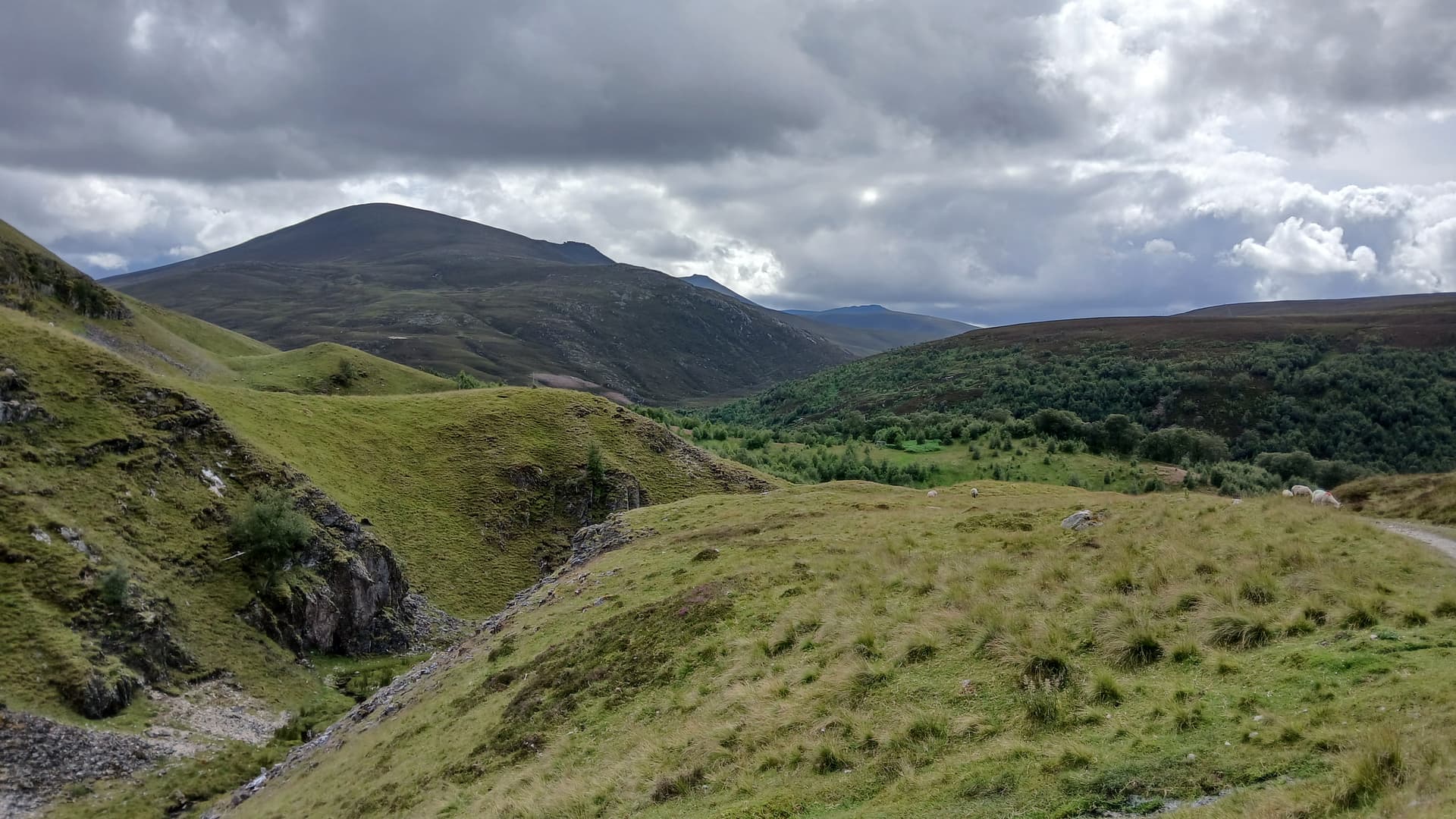
moraines blocking the River Avon course
above the River Avon
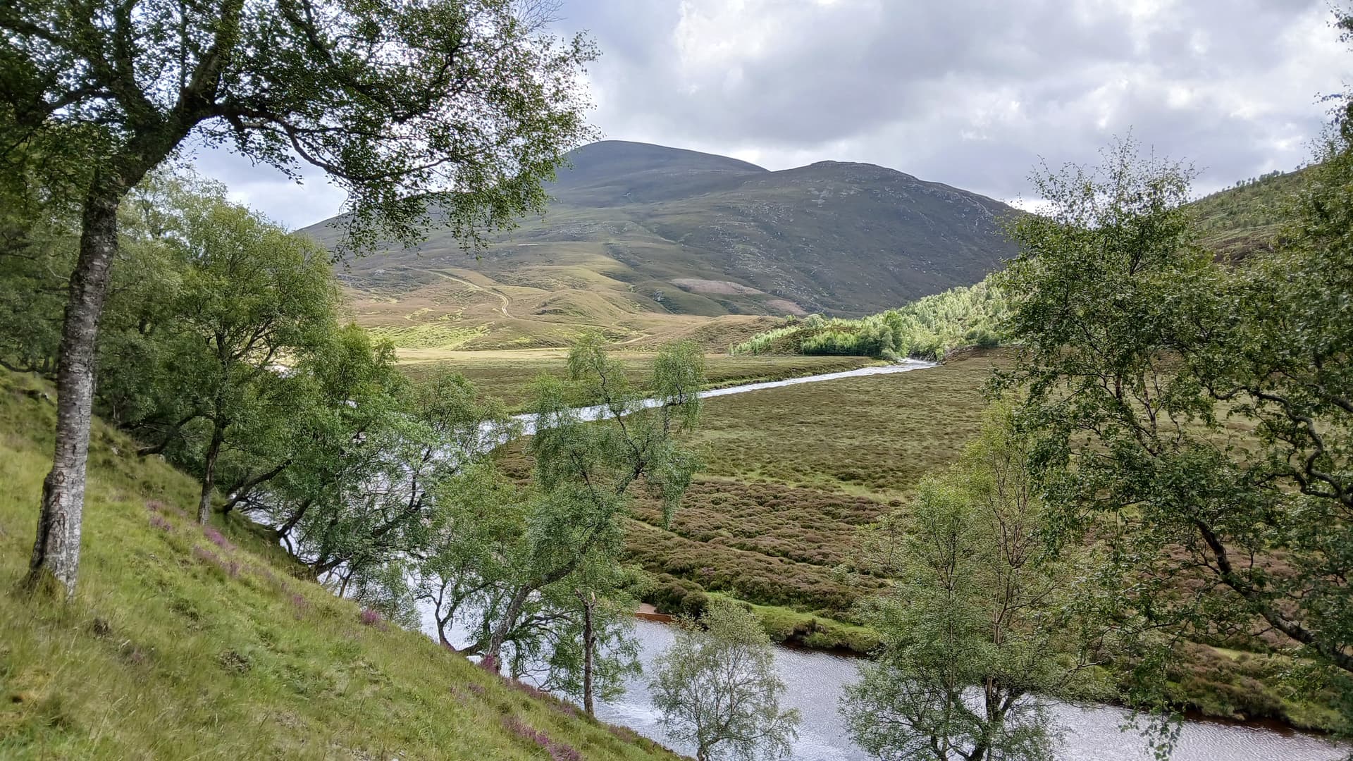
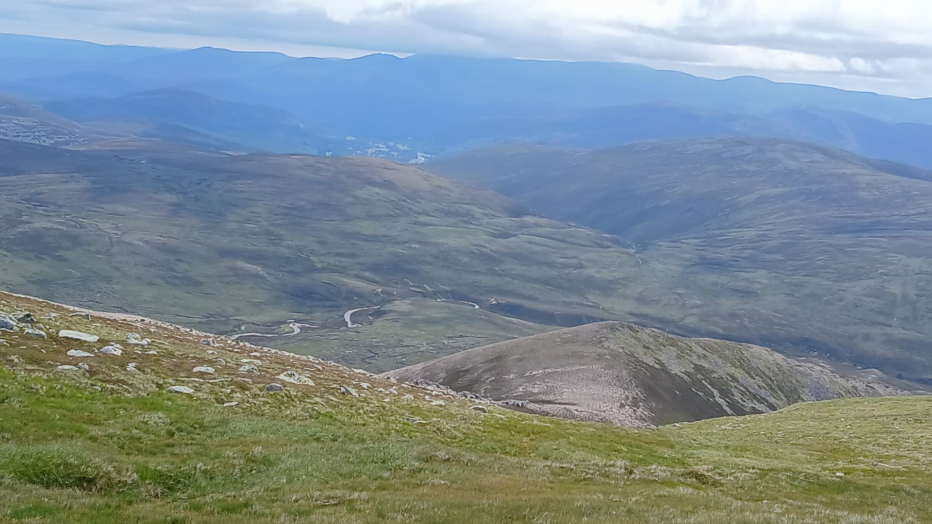
A good vehicle track took us west through the new glen. I was surprised to see the river gush through a narrow channel at one point, the water still high after recent rains. Some time later we crossed to the north side and climbed zig-zags to continue along a higher track. Here we had superb views of the bulk of Ben Avon to the south. Multiple tops and countless tors, with complex valleys, corries and ridges cutting into its’ massive flat plateau.
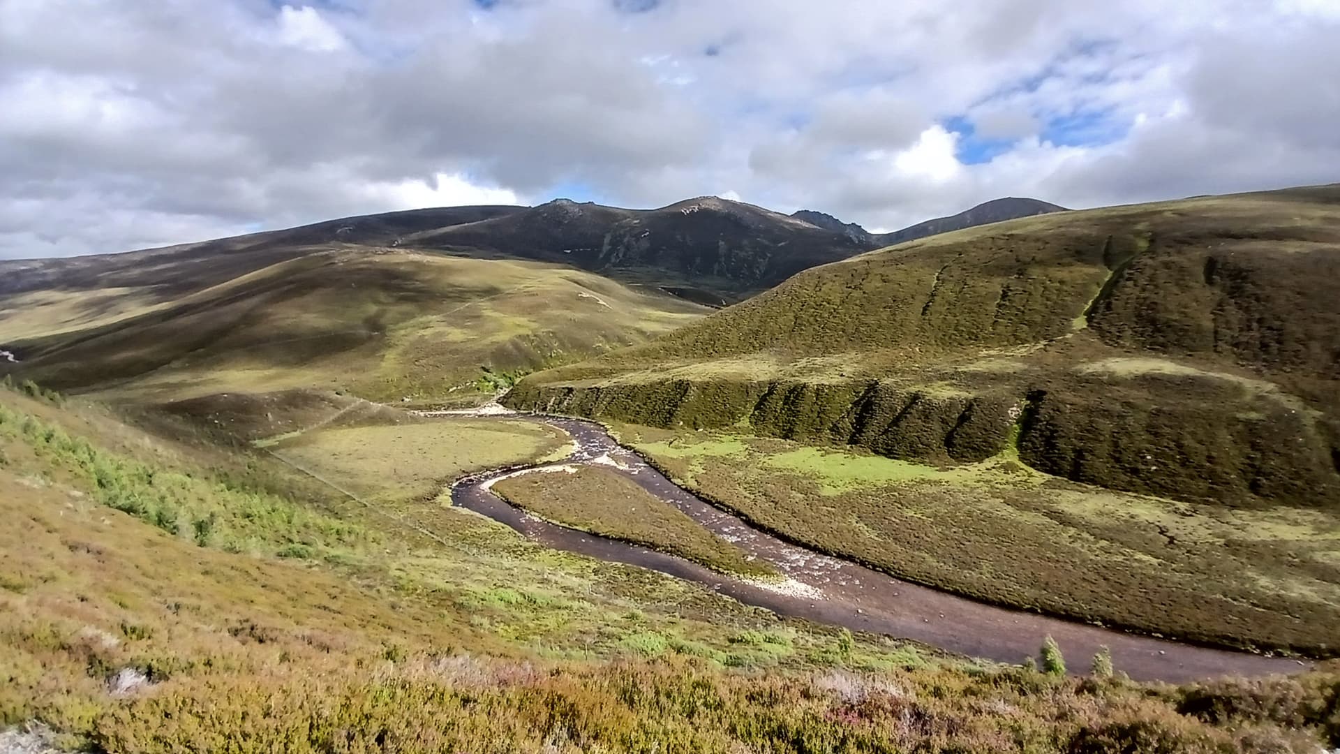
Glen and River Avon
We were aiming to camp near a footbridge which would allow us to achieve our Friday mission – an ascent of Ben Avon and Beinn a’Bhuird from the north. We eventually arrived at the bridge at 6pm, bang on schedule, however there was little to offer comfort to a camper, just tussocky grass, long heather and bog. We decided to go over the footbridge and explore the south side.
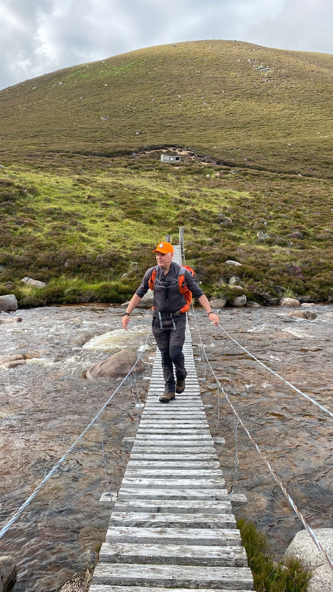
on the shoogly bridge
It was a glacial moraine maze, with all lower ground wet and rough. A rough stalkers path took us over one moraine and then up another. This looked more promising, with some level shelves and nice granite gravel patches. We soon found a good spot and had the tent up by 6.30pm. The only nearby water seeped out of the ground below the moraine. It was a bit brown and had an earthy taste, but would do the job. It would be boiled for drinks and our de-hydrated meals.
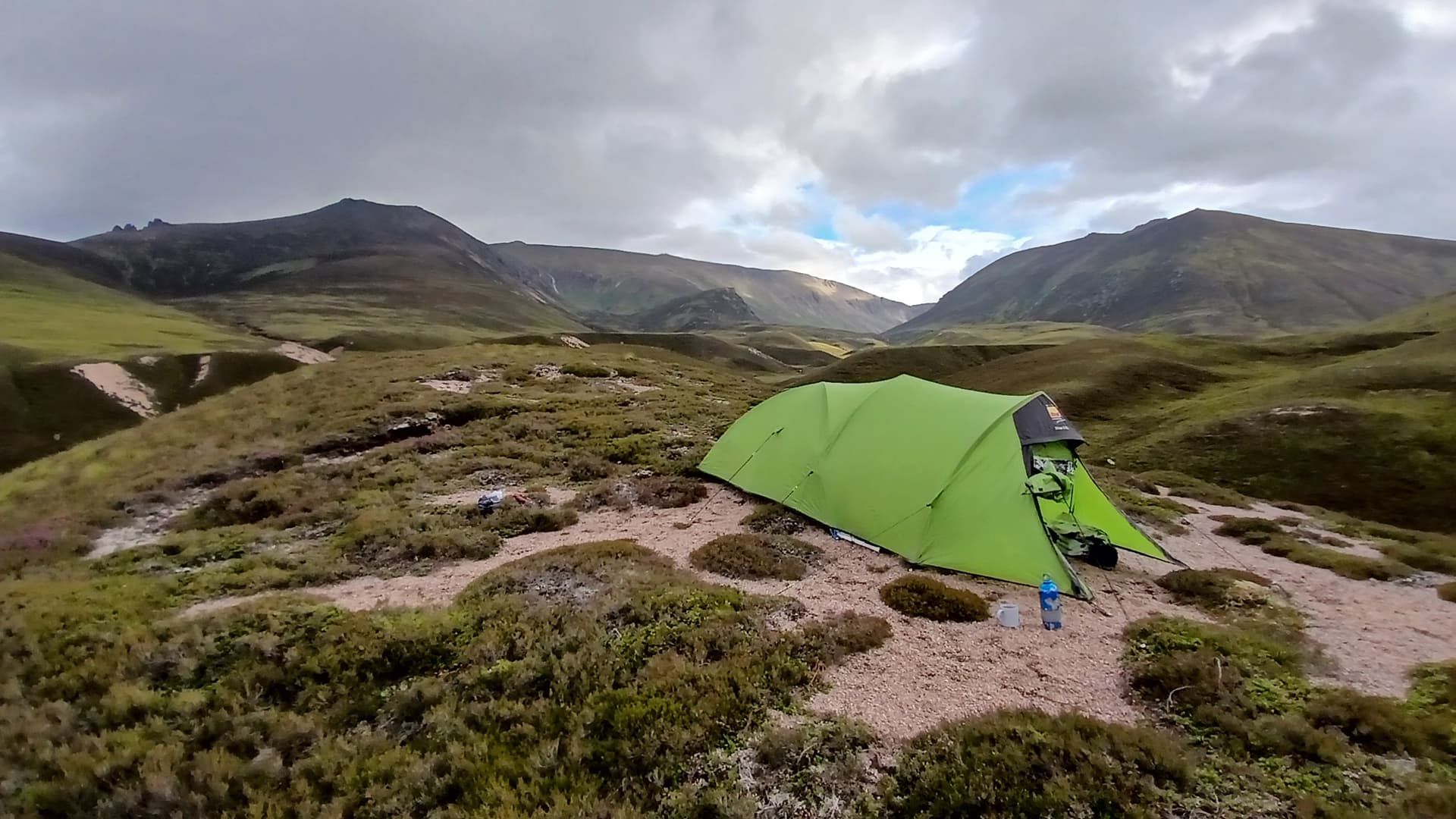
moraine camp
When we finally finished eating, drinking (Highland Park 12 year old) and ran out of conversation, we turned in around 9pm, with a 5.45am alarm set for the following morning.
Friday 12th July 2024
Up at 5.45am, having both slept soundly and comfortably, we had some porridge, bananas and coffee and then ventured outside. The outer tent was wet. Some unheard rain showers overnight. Looking south, the high tops were shrouded in cloud. No worry though, the mountain forecast was for sunshine and light winds from 9am.
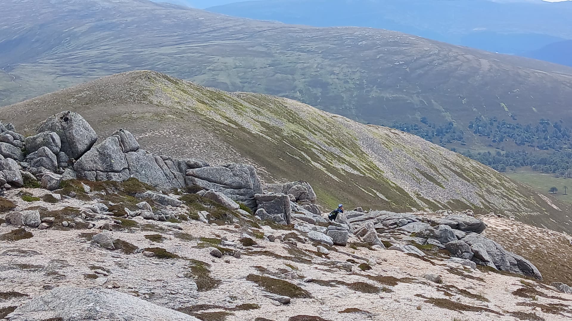
We were packed, loaded and away for 7.15am, initially following the stalkers path over and around moraines until it crossed a stream. Here we disposed of our brown water and filled up with lovely clear fresh stuff. Continuing over a flat section and climbing a further moraine allowed us to finally decide on our route up to Leabaidh an Daimh Bhuidhe, the highest of Ben Avon’s many tops. We had a choice of two ridges, but plumped for the one that bordered the east side of the Schlochd Mor. It is named as the Sron na h-lolaire on the 1:25000 OS map.
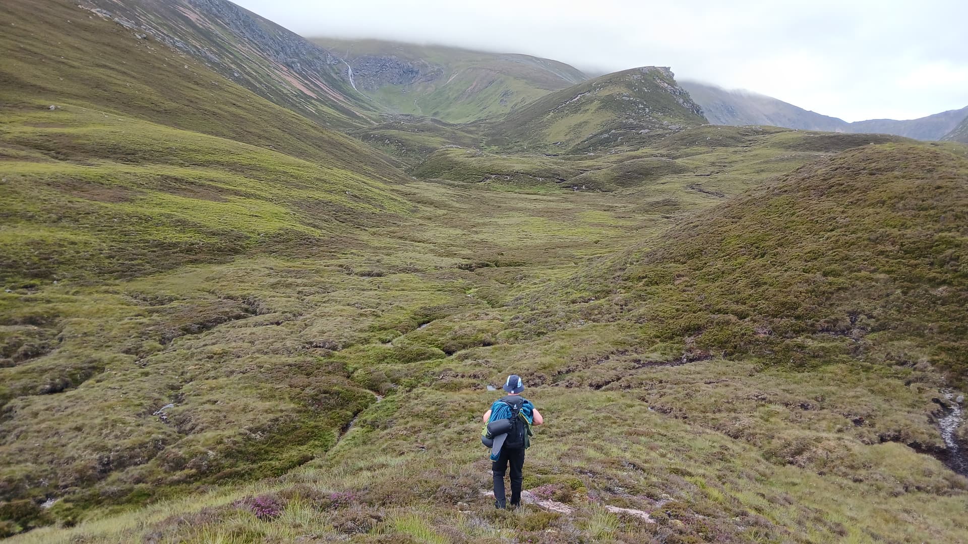
ups, downs and ups
Getting to the ridge involved traversing some pretty rough ground which was teeming with amphibian life, with numerous frogs and newts hopping and scurrying around. Sometimes deer tracks took us easily up for a few metres, then other times a steep grassy ramp was found. Eventually we made the main ridge and plodded up easier angled slopes and into the cloud. I challenged Struan to walk up the slope for 300m and then turn 45° right for a further 200m. This would land us at the summit tor and help him learn some hill craft.
into the gloom
I reckoned on 150 paces for 100m, given the steepness of the slope. Remarkably we both stopped within 5m on one another after the 300m leg. We turned 45° to the south west and plodded on up through the mist and a lessening grade. “There it is!” claimed Struan. “No, that’s just a wee tooth. We’re looking for a bigger one.” “What about that one?” “Nope, keep going”. On the third occasion and without any avoidance of doubt, he made a correct call. The summit tor loomed out of the gloom in front of us.
We took an easy scramble from the north end and were soon established on the highest granite block. It wasn’t the best place to be. Visibility was down to 20m. A strong damp breeze washed us with moist and cold air. The rocks were soaking. However, we were established on the highest point of Ben Avon GM/ES-006, at 1172m and a ten point SOTA summit. All I had to do now was activate it.
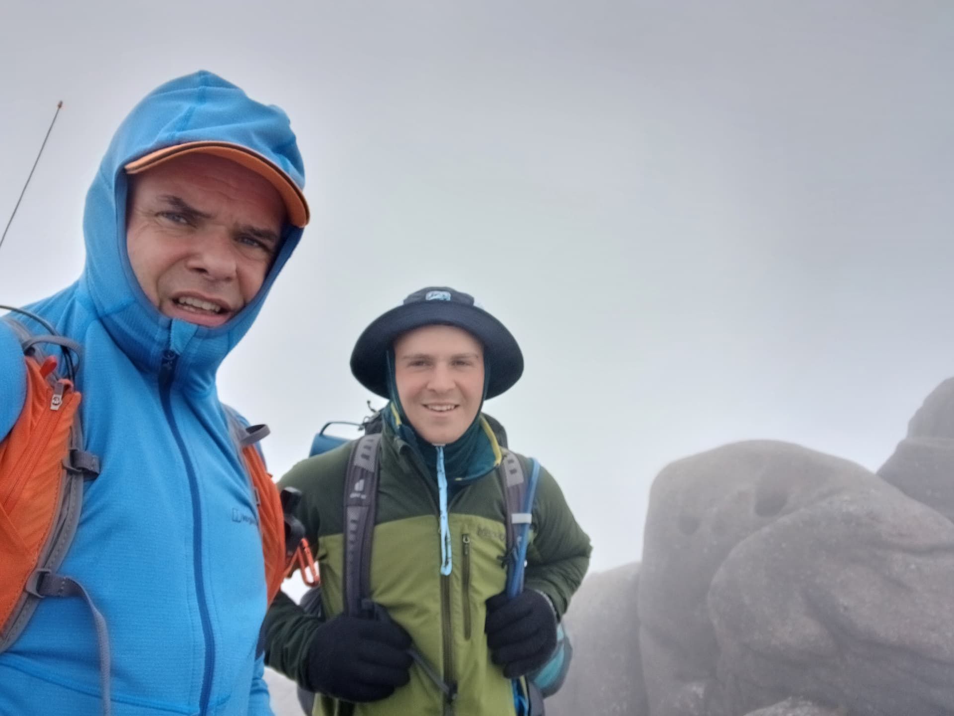
summit selfie
Activating GM/ES-006
I was hoping to pull this off on 2m, having had success before and also due to alerting the locals. I fed the slim-G out, already attached to the pole. The pole stayed in the pack and I fed out enough sections to get it up in the air. My rucksack held everything in place and my knees held the rucksack tight.
I really struggled. I received a message via Iridium that stations in Aberdeen some 80km east were hearing me 59. I had no or little copy. Was the Quansheng deaf? I was confused, having made 140km QSO’s using the same set up from Wales a couple of weeks previously. Incoming signals were so weak that I had to press the radio speaker to my ear to hear them over the constant noise of the wind whistling over the exposed tooth. It took 10 minutes to qualify the summit, and that was only with the patience of the callers. Struan having been given the job of camera man, was getting a tad cold, so we decided the best plan was to get down and get moving.
Safely off the tor, we headed west along the plateau edge, bracing against the uplifted wind whipping over the corrie edge. Soon things calmed and the view opened up as we dropped in height towards The Sneck, a bealach that sits above Munro height at 986m. From there we zig-zagged steeply up a gravelly granite path towards the tor that marks the South Summit of Beinn a’Bhuird.

the way ahead
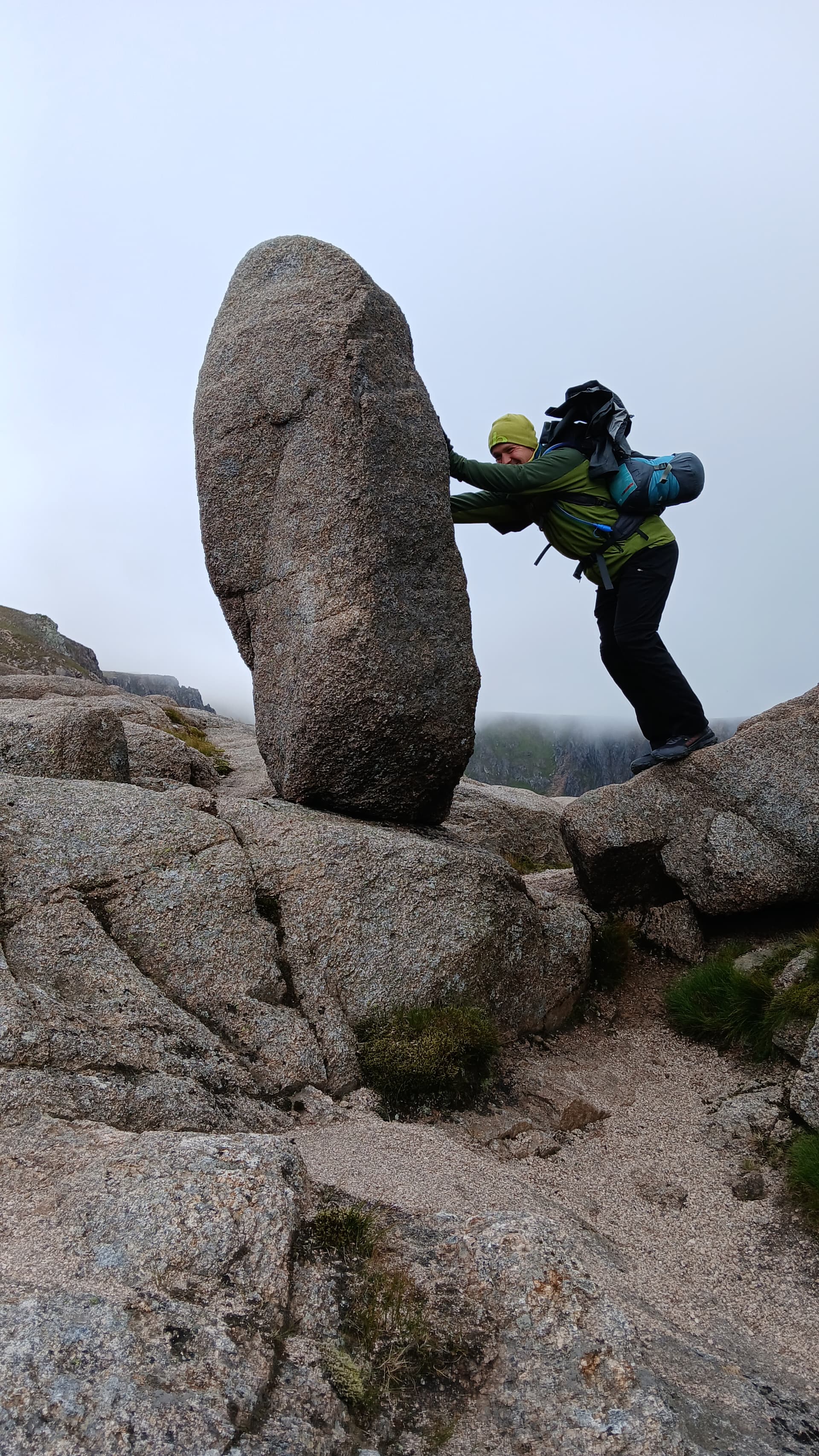
not the first, not the last to try this
Around 1800m after this and after crossing a gently rising tundra landscape, we arrived at the lonely summit cairn of Beinn a’Bhuird GM/ES-004 and a loftier 1197m. Still no visibility, but thankfully much less wind. We were bang on schedule – 11am.
Activating GM/ES-004
2m again. No one else around, so I sat at the foot of the cairn and repeated my previous set up. This time it was confusingly easier. Chris @2M0RVZ couldn’t be heard from my previous summit. Now I was farther away, with Ben Avon in the path, but he was workable. GM0CQV had to repeat his callsign letter by letter three of four times over on Ben Avon. Now he was 5/7. This time, however, I made four contacts in little over four minutes. Then it dried up. Honest! Nice to have a welcome summit-to-summit with Peter @G4AIB (GM4AIB) who was on nearby GM/ES-030 Carn Ealisaid, which we had walked by at the start of our expedition.
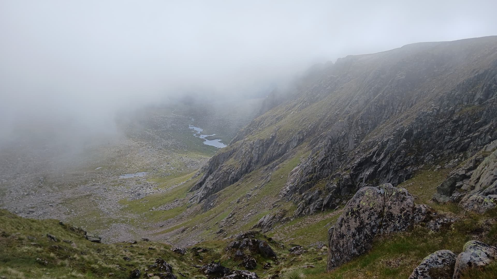
vast Cairngorm corries
HF was a possibility but I had good reason to be back at our pick up point on time, and it was 10 miles away! Navigating off the featureless plateau would take time in the cloud-out, so I packed up, had a quick drink and off we went. I did take slight detours from the path so that Struan could see into the vast corries of the mountain. We eventually reached the South Top, having tramped across 2.5km of almost level ground. Clouds began to lift. Warmth touched our skin. The descent down a shallow corrie to the stalkers path around Carn Fiaclach appeared in front of us.
a long way to go
Part way down the slope, we stopped in the improving conditions for a spot of food. Malt loaf for me and cereal bars for Struan, he having already munched his way through just about everything else he carried. As a 24 year old rugby player, I reckon he must consume about twice the calories a day that I do!
Unfortunately our still lofty position on the hill revealed the entire route to our finish point, and it was still almost 13km away. I wanted to be there by 3pm, with 3.15pm being the utmost latest time, leaving no reserve. It looked impossible.
descending

clear tops by afternoon

final look at Beinn a’Bhuird
The next couple of hours were a blur. Down the rough slopes. Pick up the path. Go round the hill. Go round a moor. No time for finesse, so wade the knee deep Water of Quoich. Squelch up to the main track. Stumble rapidly down Glean an t-Slugain, it looking lush with no time to admire. Onto the main track again. Brief chat with an elderly gent who enquired as to our activities. Jog the next 2km to make up the time lost chatting. Speed walk the final 3km along Deeside. Finally, arrive at Keiloch car park at 3.20pm, five minutes past the bogey time. Mo, waiting with cups of chilled orange juice for us, bundling us into the car at the same time. Fresh trousers and a T-shirt, clean trainers and socks awaited me. Off we went, not screeching of tyres, but with some urgency, the VW Polo GTi set to sport mode. An entertaining drive down Deeside, taking no prisoners on the 36 mile drive to Banchory. Google said 60 minutes. Mo did it in 55. I got changed on the way. I somehow managed to clean my teeth. At 4.15pm on the dot, I stepped out of the car and into the Banchory practice of my dentist, right on time for my next appointment.
The dentist, however, was running 10 minutes late.