Two days, five summits and a happy coincidence
Monday 30th June 2025
I had a motorsport meeting to attend in Kinross at 7pm. I decided to make a day (or two) of it. I left home at 0815 and arrived at the lovely Fife village of Falkland around 2 hours later. I set off on a round of the Lomond Hills. Until the day before, I thought there were two - West Lomond GM/SS-154 and East Lomond GM/SS-198, otherwise known as the Paps of Fife. It was only while leafing through my new favourite book, Scottish Hill Tracks, that I discovered that Bishop Hill GM/SS-187 is also a Lomond hill. There are still thankfully only two Paps though.
West Lomond
My route took me up through the delightful Maspie Den, then onto the moor leading to W. Lomond. From there, I headed south over moor and rough grazing to Bishop Hill. Finally, the long hike back east to East Lomond and the steep descent back to Falkland. It was an interesting, if long, amble among some nice landscapes. Very different from the usual for me. I activated all three summits on 2m FM, and had a bit of spare time on the last one for a spot of HF. Around 6.5 hours, 15 miles in total. Has anyone else done these three in a day, I wonder?
the long trek from Bishop hill to East Lomond
Alex @GM5ALX messaged me. He was planning on climbing the remote and rarely activated Munros of Carn an Fhidhleir (Carn Ealar) GM/CS-027 and An Sgarsoch GM/CS-024, and would I like to come. No was the answer, and not because I’d already done them twice, but because I was mulling over a possible Tuesday expedition of my own. You see; I had the Land Rover down in Fife with me, and that was for a reason. I had my bike in the back, and I had recently added “1 person camper” to its list of abilities.
All good, and on to the meeting. It was a post hill rally wash-up meeting and took for ever. It was 2215 when we all left the hotel. I jumped in the Landie and headed north. An hour and a bit later, I parked up at the last possible place it is possible to get off the A9 Perth to Inverness road before it ascends the Drumochter pass. I chucked my bike out of the back, rearranged a few things and settled down for the night. It rained heavily.
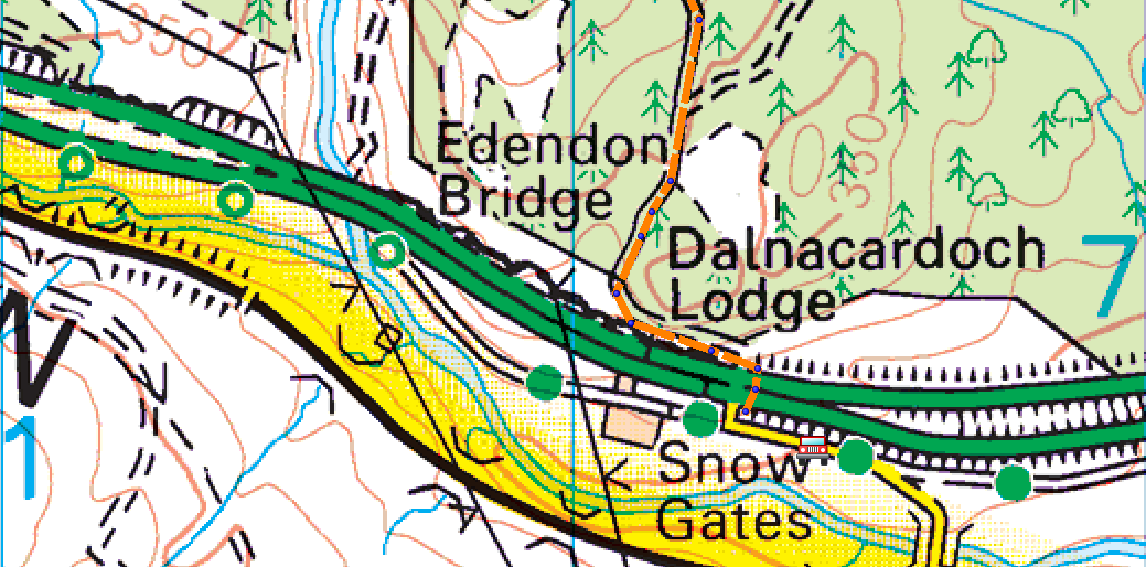
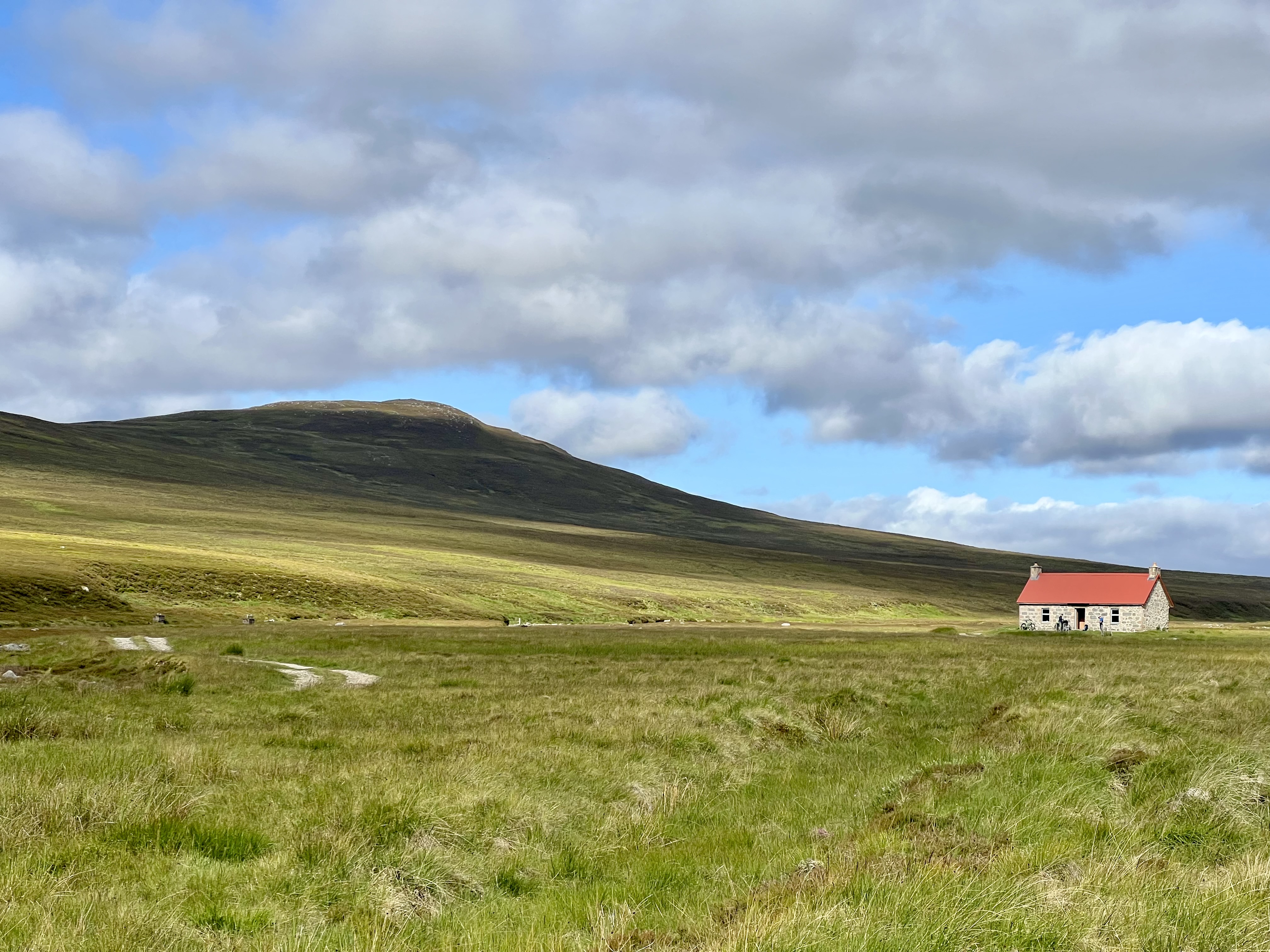
camp, above the letter ‘w’ of Snow
Tuesday 1st July
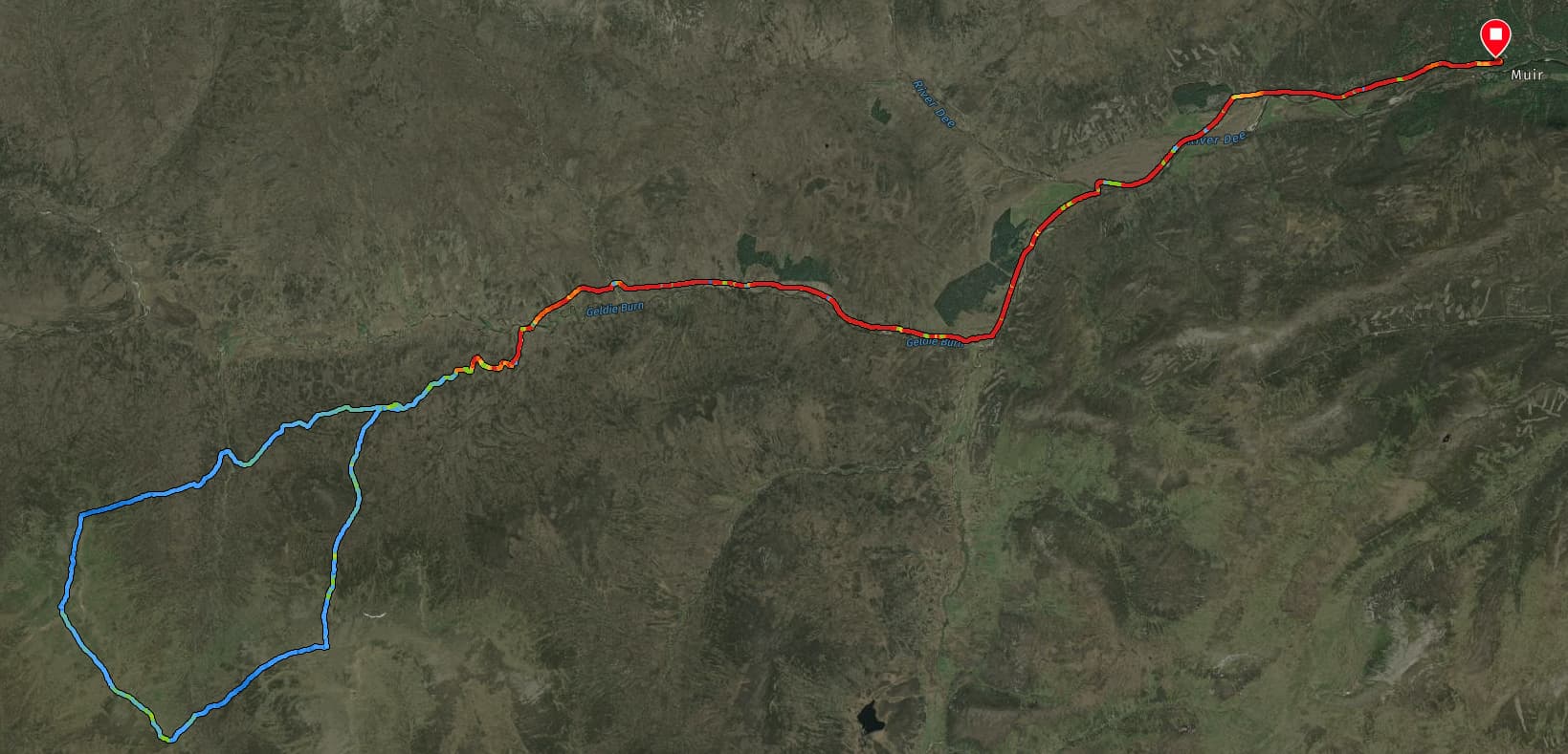
Up at 0715. Porridge, cereal bar, coffee + tea, packed and away by 0835. I’d camped at NN 72408 70183, so just had 200m to cycle to reach and then cross the A9 road. I was then on my way on the 5 mile/8km cycle up the ancient Gaick right of way and to the Corbetts of An Dun GM/CS-069 (827m) and A’Chaoirnich GM/CS-057 (875m). These hills had only seen three activations and the last one was 10 years ago.
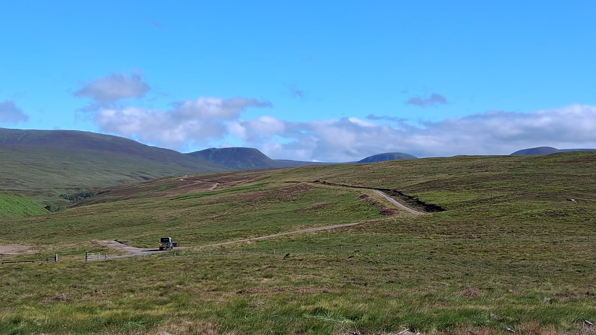
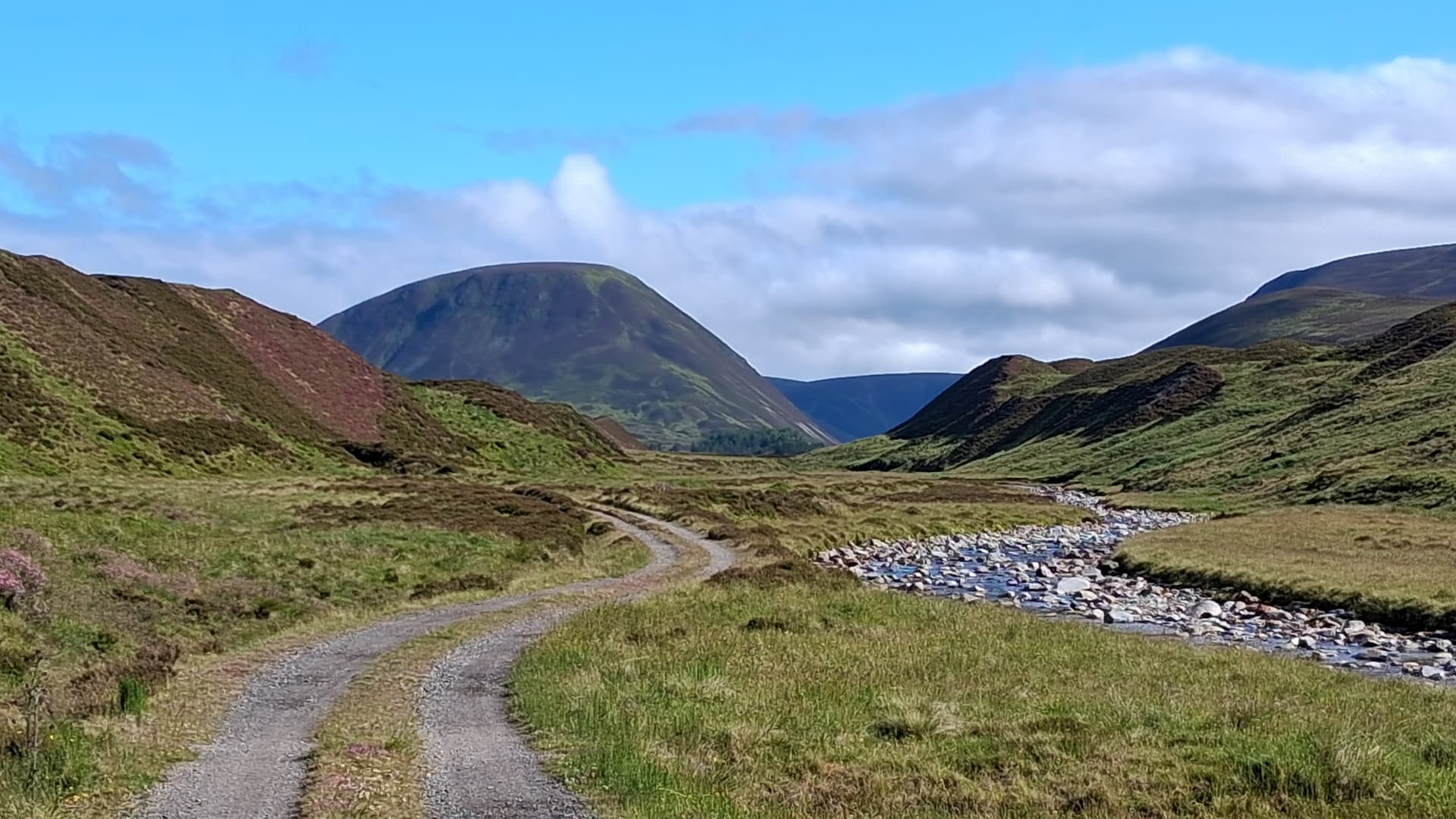
the initial track. Gamekeeper viewing deer from his 110
The track was rideable all the way, undulating in places but never too steep. It followed the Edondon Water, crossing it a couple of times. After about an hour, I reached a deer fence and parked the bike. I was using a Walkhighlands route which did a big loop of the two hills, and this is where the return leg joined the outward one.
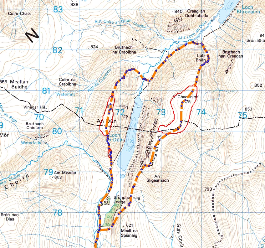
the Walkhighlands route goes clockwise from the south
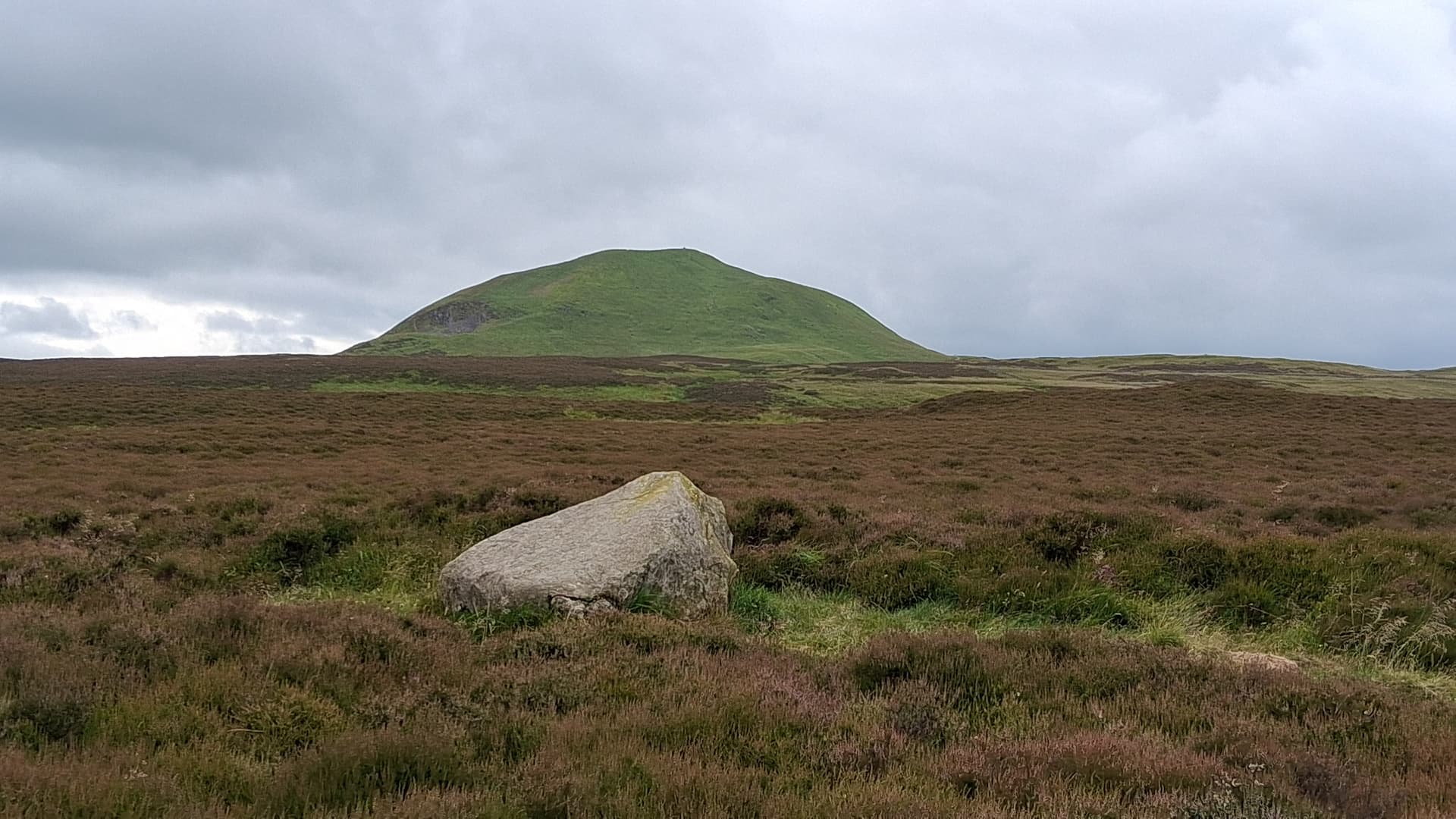
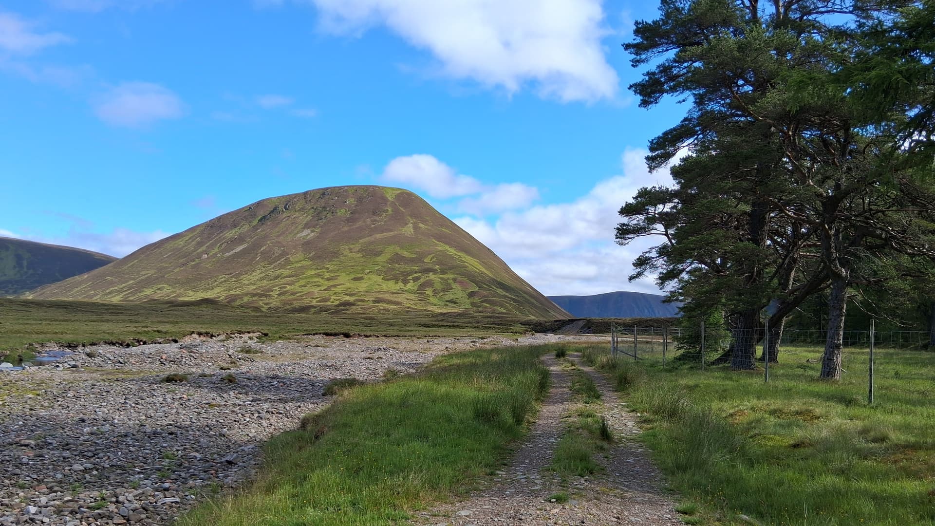
closing in on my summits
From there it was a further km on the track and then continuation by path, with a bit of bog hopping. An Dun reared in front of me, a grassy castle, showing little weakness in its fortifications. I plodded up and aimed for grass, trying to avoid heather. I glanced up to see a hiker above me. Didn’t expect that. He’d found a path. Introductions done and we climbed together. It turns out he graduated in electronics a few years before me. We swapped stories about RF, solar flares and SOTA, and his work on the first Phillips CD players, silicon wafers and getting their IC rejection rate down from 78% to 35%.
An Dun GM/CS-069
All of this helped us both with the lung bursting climb. Suddenly it eased off and even more suddenly, we were at the cairn. He went back the way we’d ascended and I asked if he was going on to do the other one. Yes, was the answer but he was going to return to the valley and climb it from the south, rather than do the much longer loop to the north. That got me thinking. I’d tried to synch, my times with Alex, but I had a much longer (7km) hike to the next one, versus his 3.5km. A quick look at my map revealed that heading back the way I came would give me a 5km hike, albeit with a 340m drop, versus Alex’ 280m descent. Anyway, the numbers stacked up a lot better than my original plan.
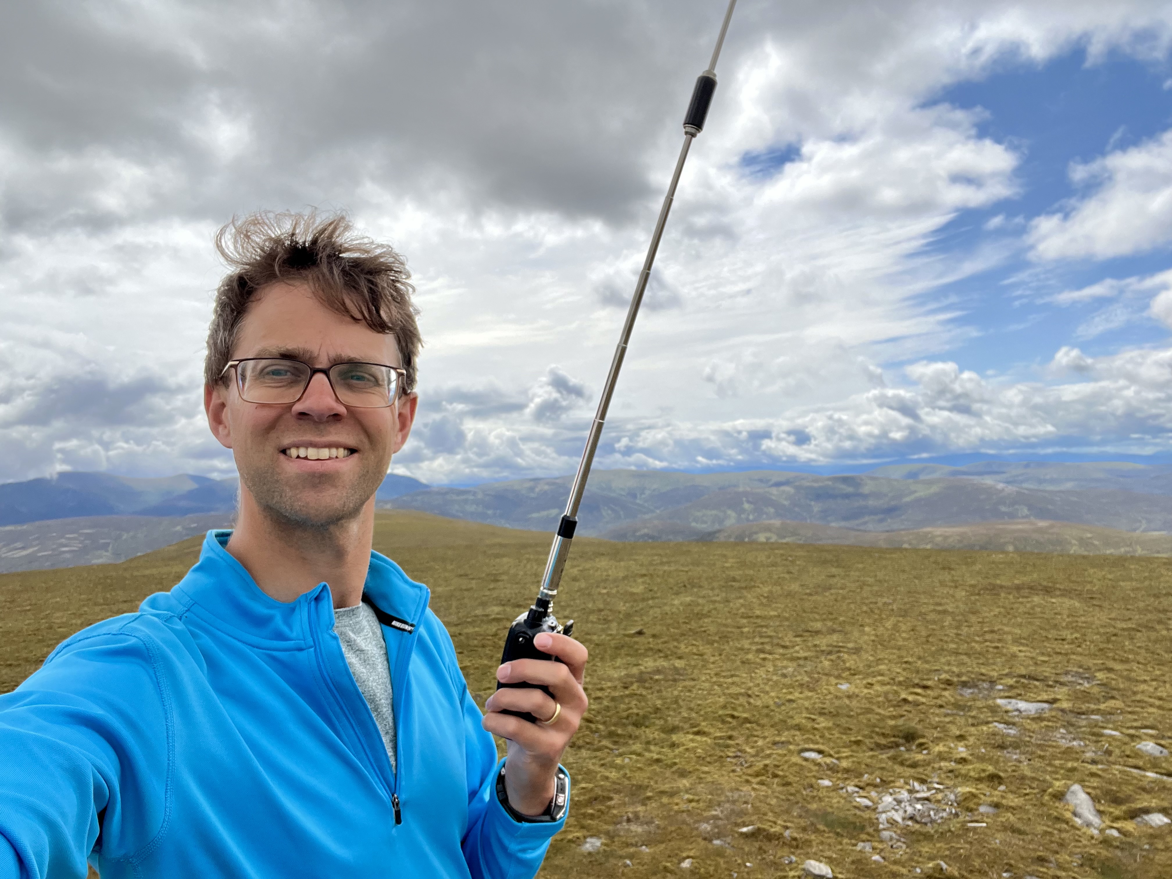
I was QRV at 1050, so about 2 hours and 15 minutes after setting off, 40m was in decent shape (phew!) and I added 11 contacts to the log, before having a summit to summit with Alex on 2m FM. I was finishing my activation as he arrived to start his, aiming to give me more time to get across to A’Chaoirnich.
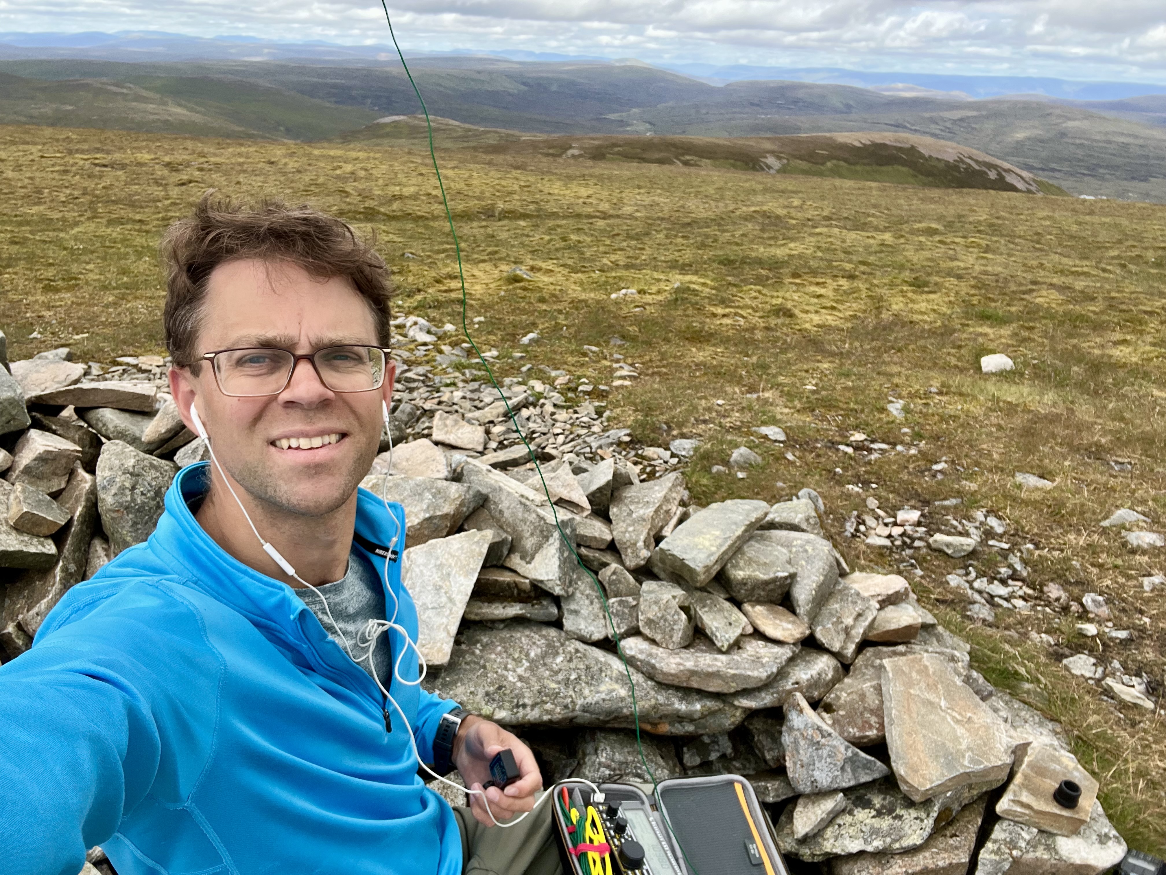
summit selfie
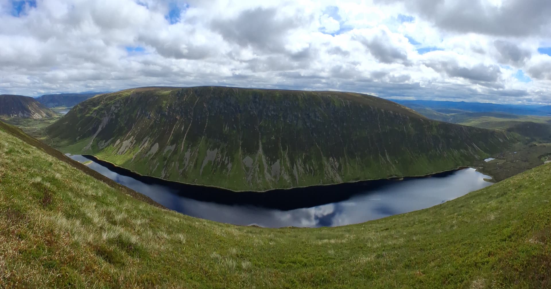
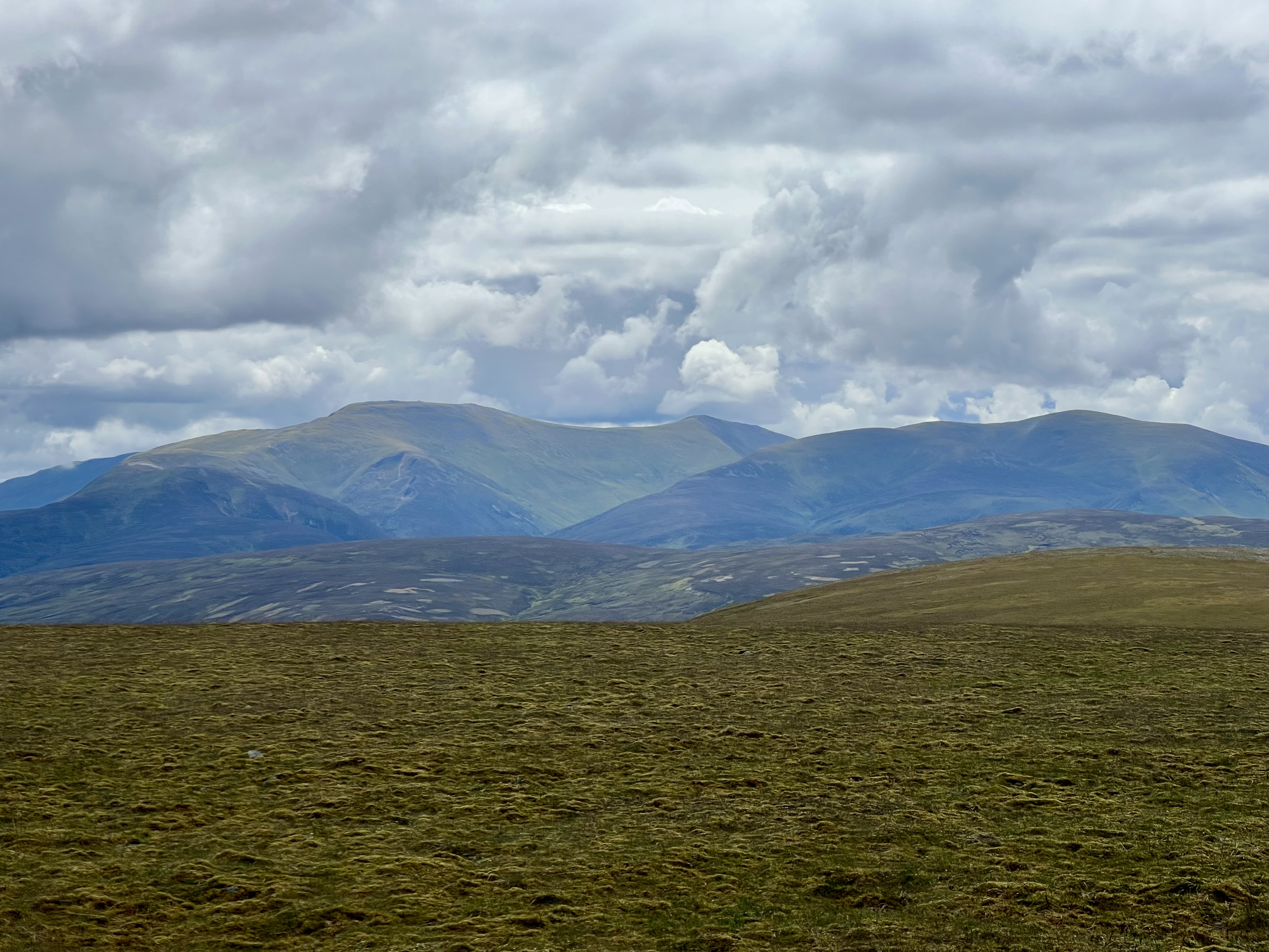
slightly distorted panorama. Loch an Duin and A’Chaoirnich GM/CS-057
I set off down the ascent route, the narrow and faint path much easier to follow this time. For anyone planning this hike, aim for NN 71739 79430 on the way up. Below that is grassy and there is little evidence of a path.
The ground between me and the ascent of A’Chaoirnich was pretty boggy and broken, however the loch shore looked flat and more appealing, so that’s where I headed. I was only when I was half way around the loch shore that I made a discovery. There wasn’t any water flowing out of the loch to the south. The land to the right of me was the watershed and it drained into the loch. Loch an Duin actually drains north, and after a series of rivers and lochs, ends up in the River Spey.
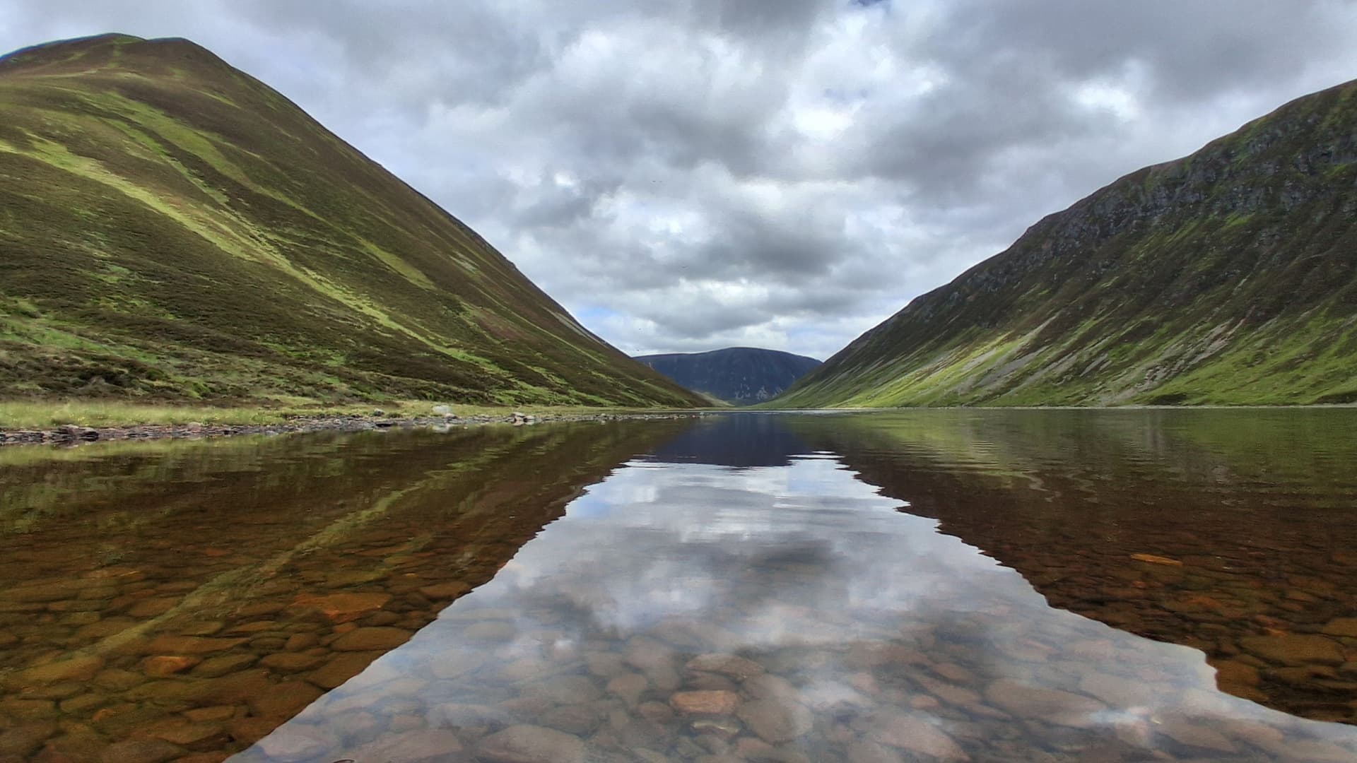
lochside view
Anyway, I was aiming for a stalkers path that took a rising traverse south along the west face of A’Chaoirnich. A direct ascent looked ill-advised due to the steepness as well as a band of broken crags higher up. I gained the path and followed it south for around 500m. It wasn’t ascending as much as I wanted, and it was taking me away from the summit, so when I saw a gap in the crags above, I just went for it. A proper bit of technical heather climbing, with a few metres on the scree to see what that was like. It wasn’t good, so back to the heather. After 15 minutes I was out the top and onto the broad ridge. I headed back north, found a path and plodded up it.

up this. On reflection, not the best plan
at the top of the steep bit
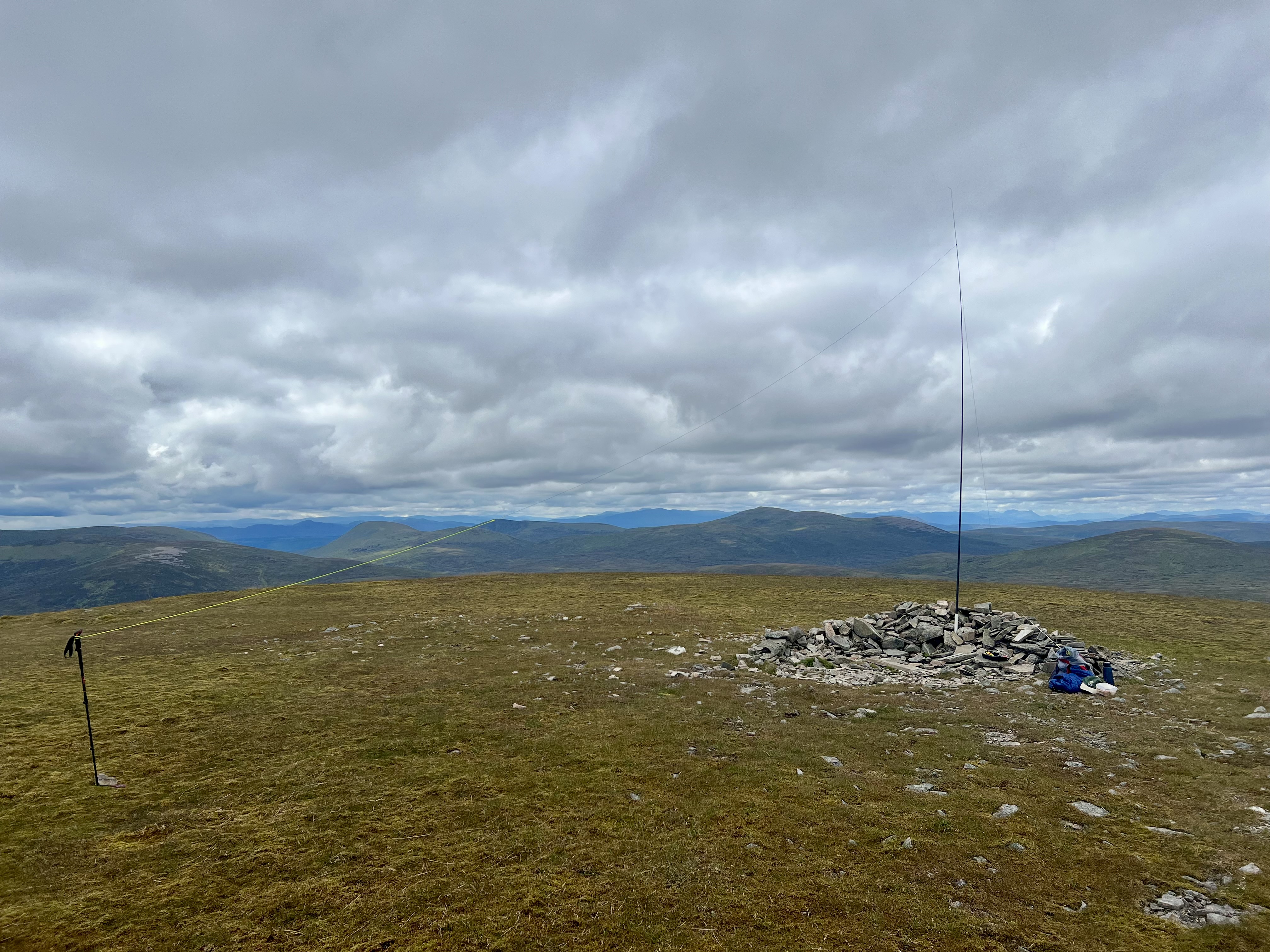
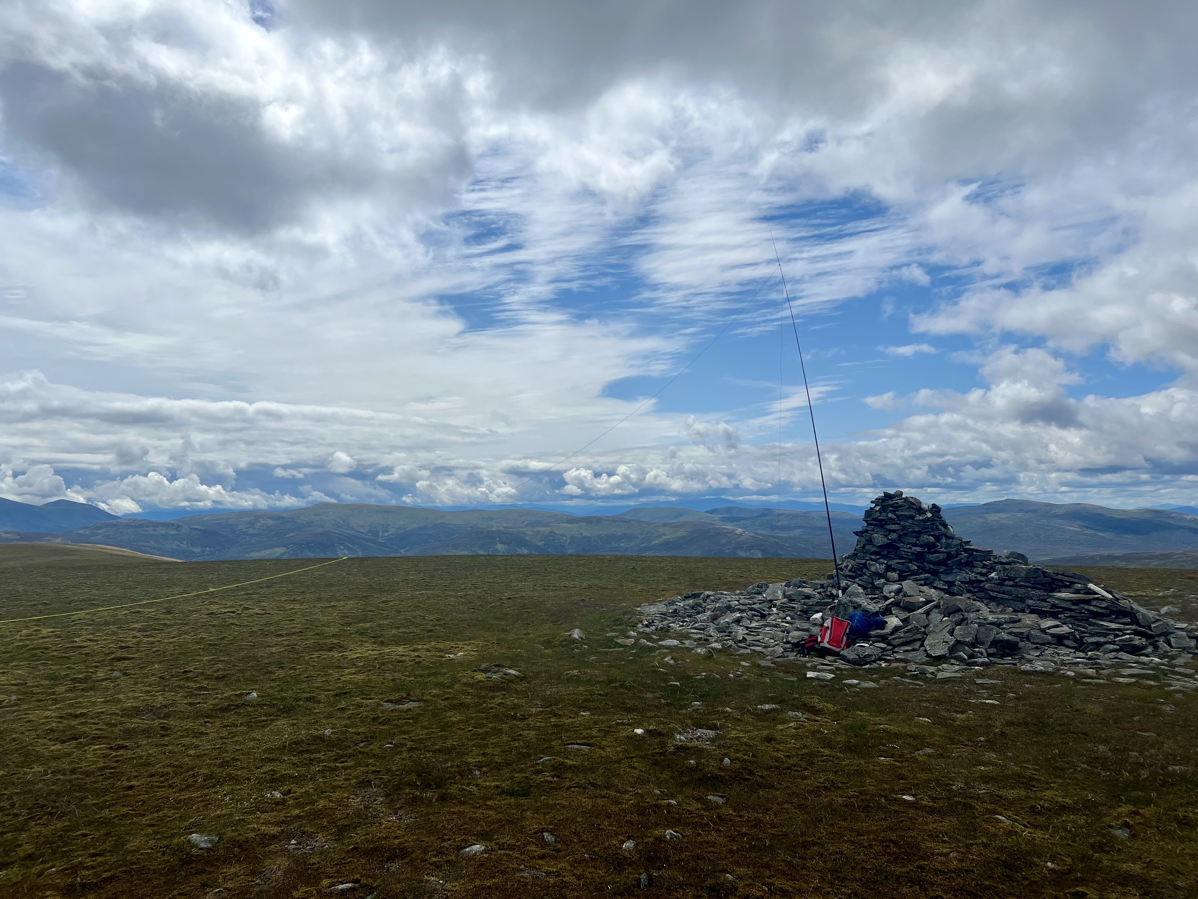
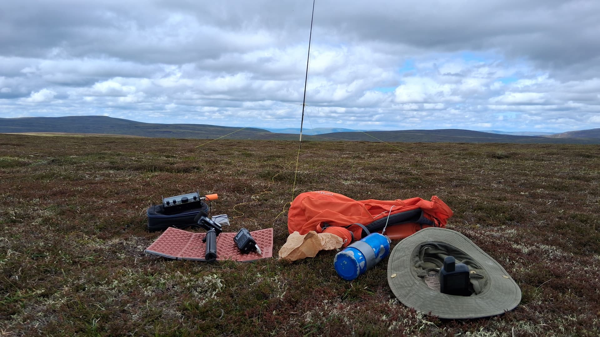
After initial steepness, it eased off onto a massive plateau area, with the summit to the north end of this. When I arrived, Alex was already activating his second summit on HF. I set up my HF station and then posted a spot on 2m FM, with the only expectation being that I would work Alex. Well, it didn’t turn out as planned.
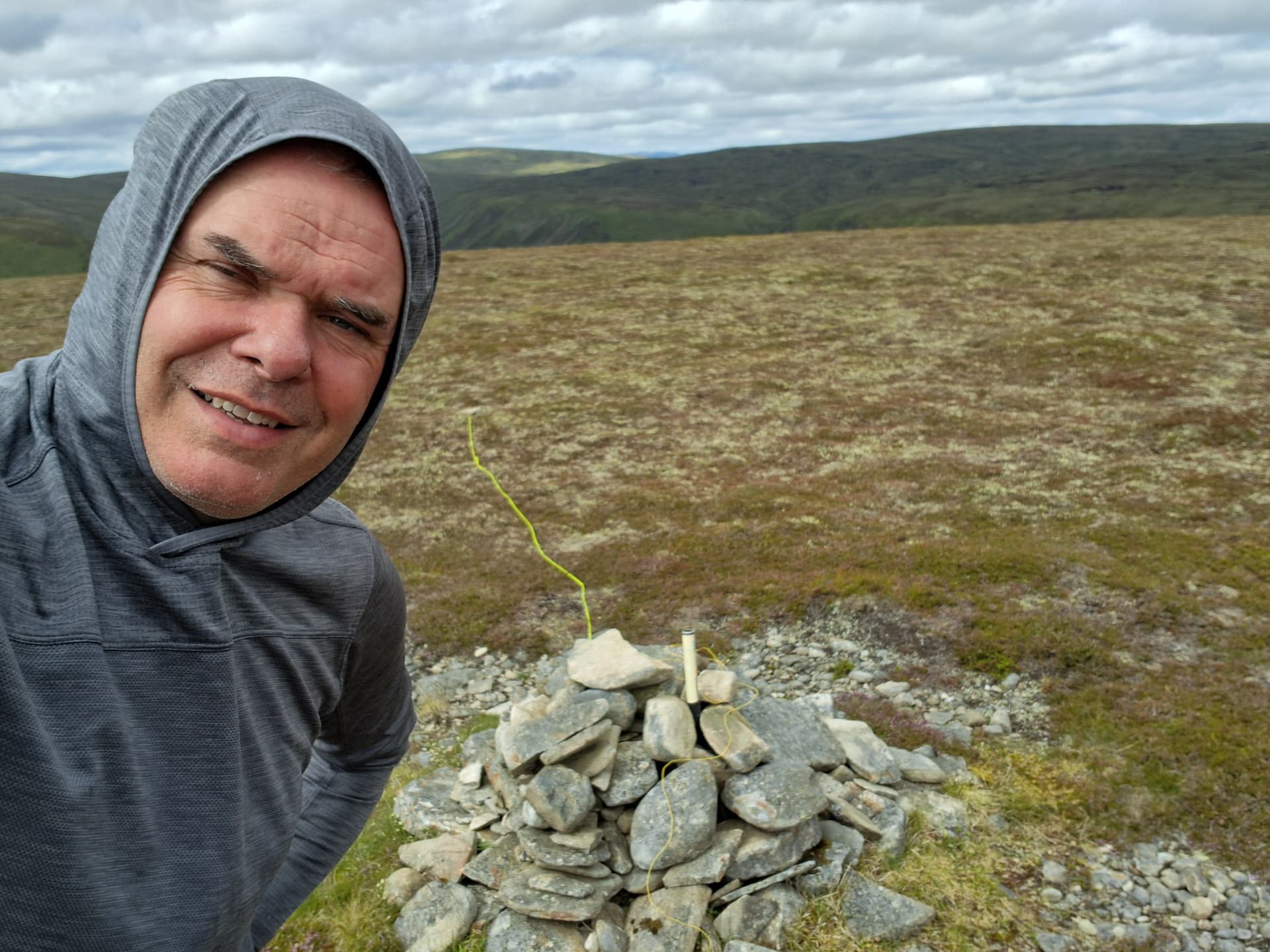
A’Chaoirnich GM/CS-057
The World’s smallest pile-up, with Gavin @GM3GAV and Jack @GM4COX calling at the same time! Then Alex from his summit, and finally Brian GM8PKL. Not bad, qualified the summit on 2m with just the Tidradio H8 and a telescopic whip. No further calls, so on to 40m. Again, the band was in good shape, with S2S to GW and DL. 20m had QSB but I still added a few more.
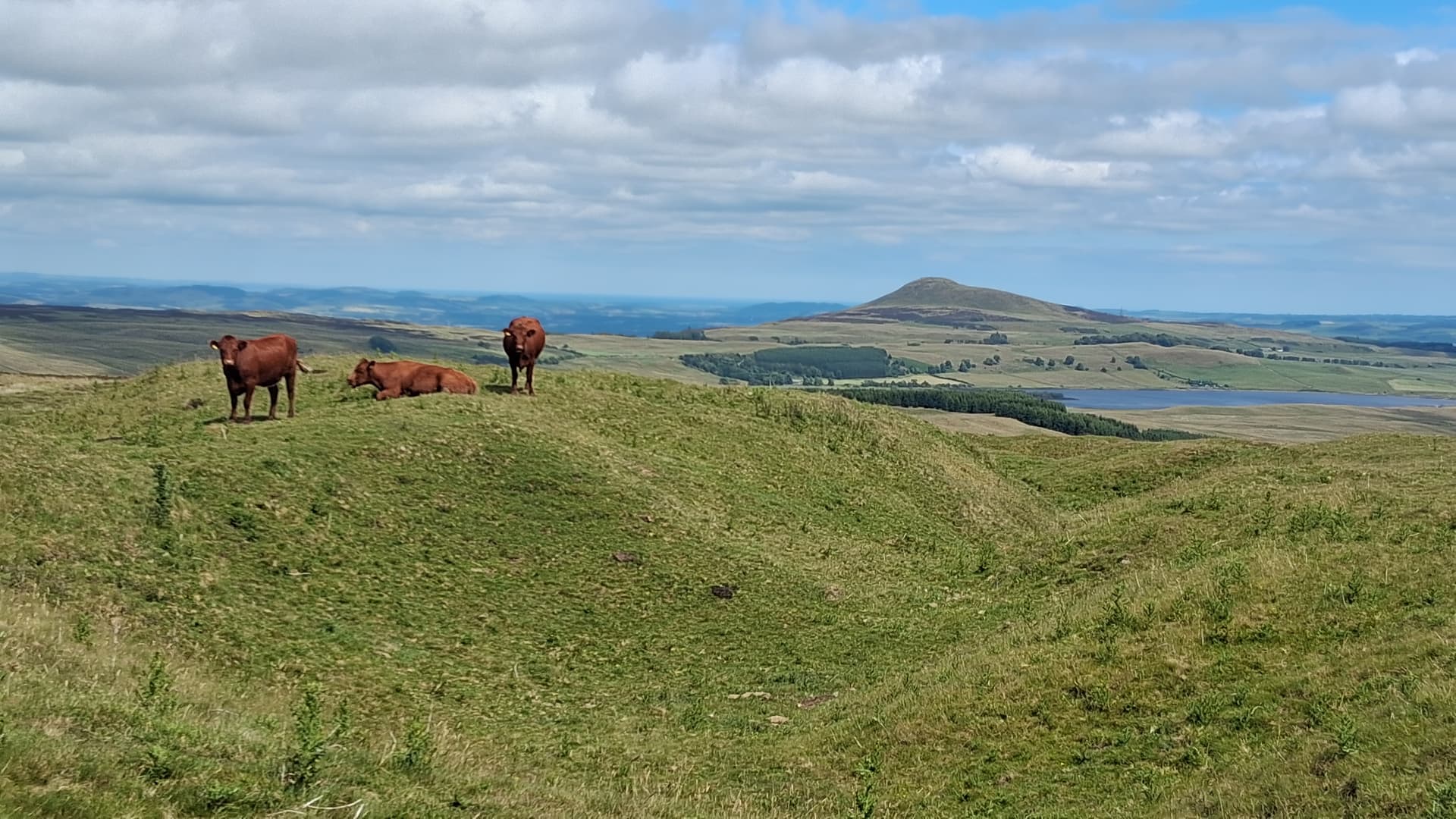
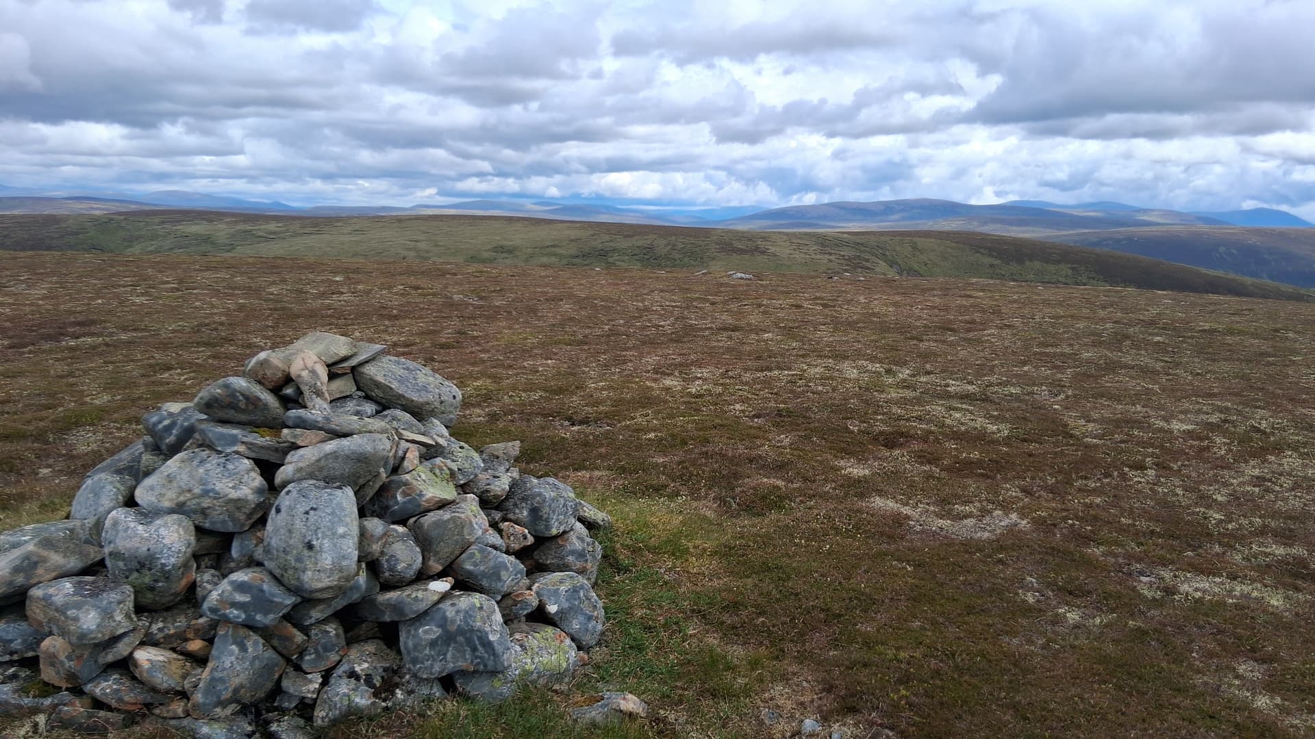
plenty of room up here!
Denis @MW0CBC whatsapped to say he was 20 minutes from his summit. I posted QRT but left the station set up and went off for a wander. A’Chaoirnich is one of those hills that has outstanding views, and I mean really outstanding. A 360° panorama of mountains. Not the best for photography, however, as the wide plateau takes up much of any shot. Still, a place to linger and soak up the scenery. Denis eventually sent me his frequency and we had an easy summit to summit to his peak Moel Llyfnant GW/NW-018.
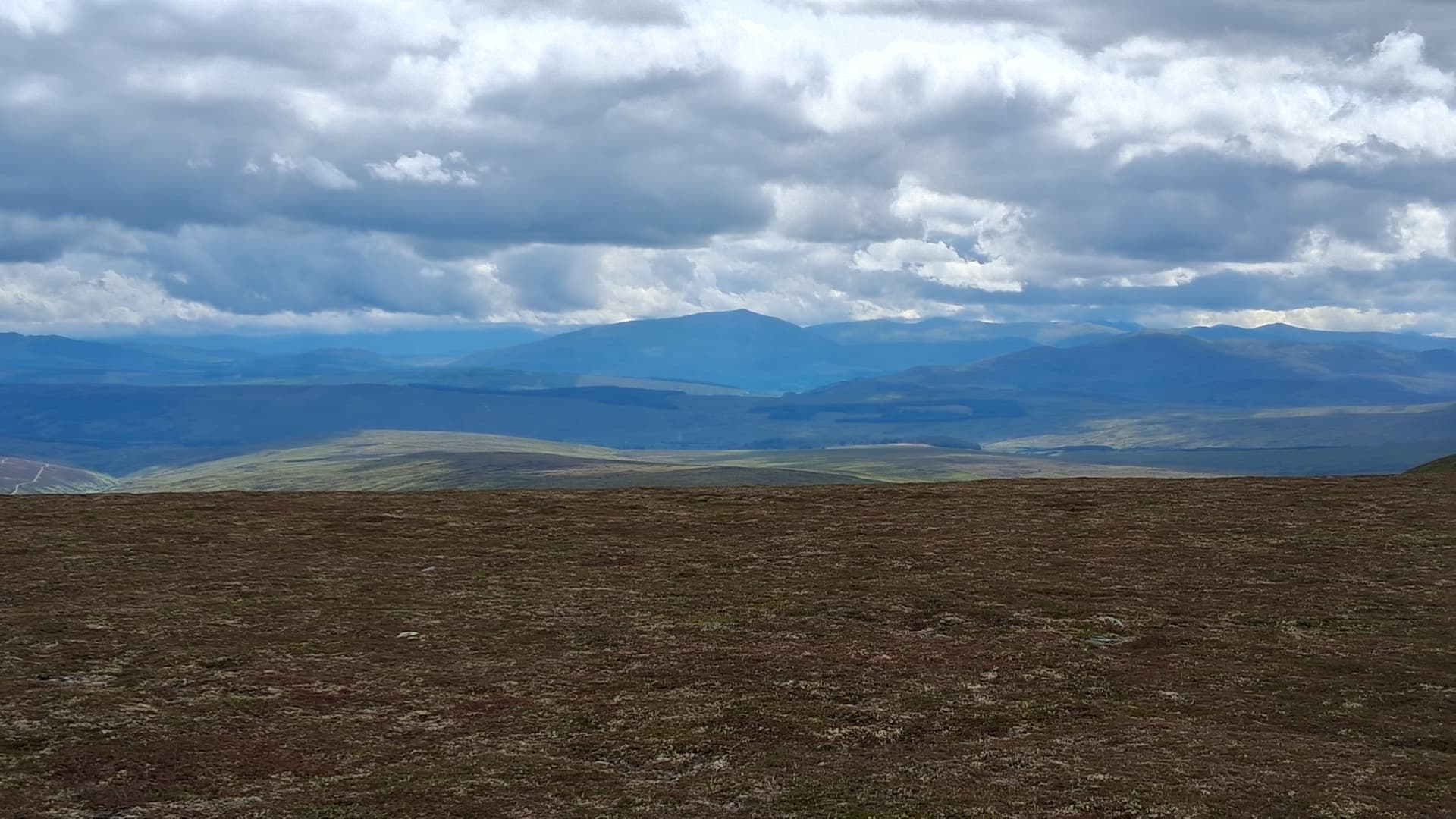
broadside of Schiehallion GM/CS-005, the summit soon to cloud over
I ate, lingered some more and then decided I’d really better head back. I’d been on top for about an hour. My descent followed the path until it ran out above a steepening, with bumps ahead of me and a ravine. Looking around, I found the top of the rising traverse path I’d used earlier, so I descended this, heading north again for a couple of hundred metres, before heading directly downhill towards the NE corner of a deer fence. This I followed west over some boggy bits and it took me back to the track. Knowing what I know now, this would be the best place to dump a bike, and it would have saved me the 1km of walking I did to get back to mine. NN 71731 78566 for reference.
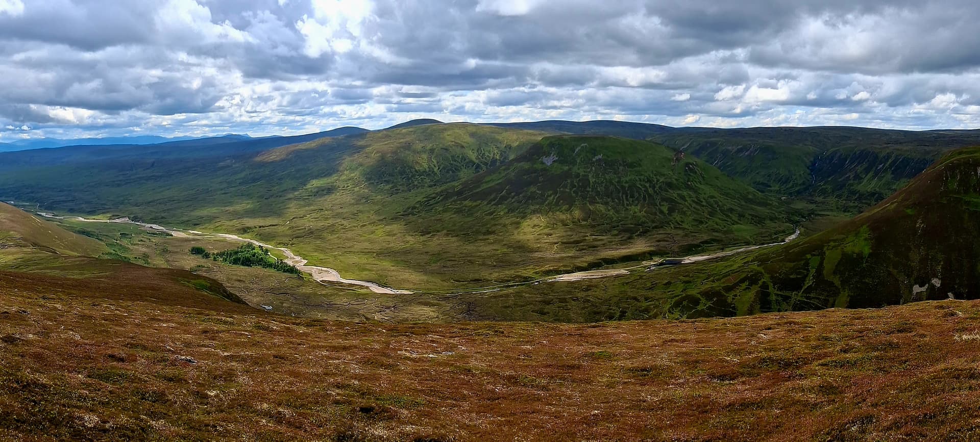
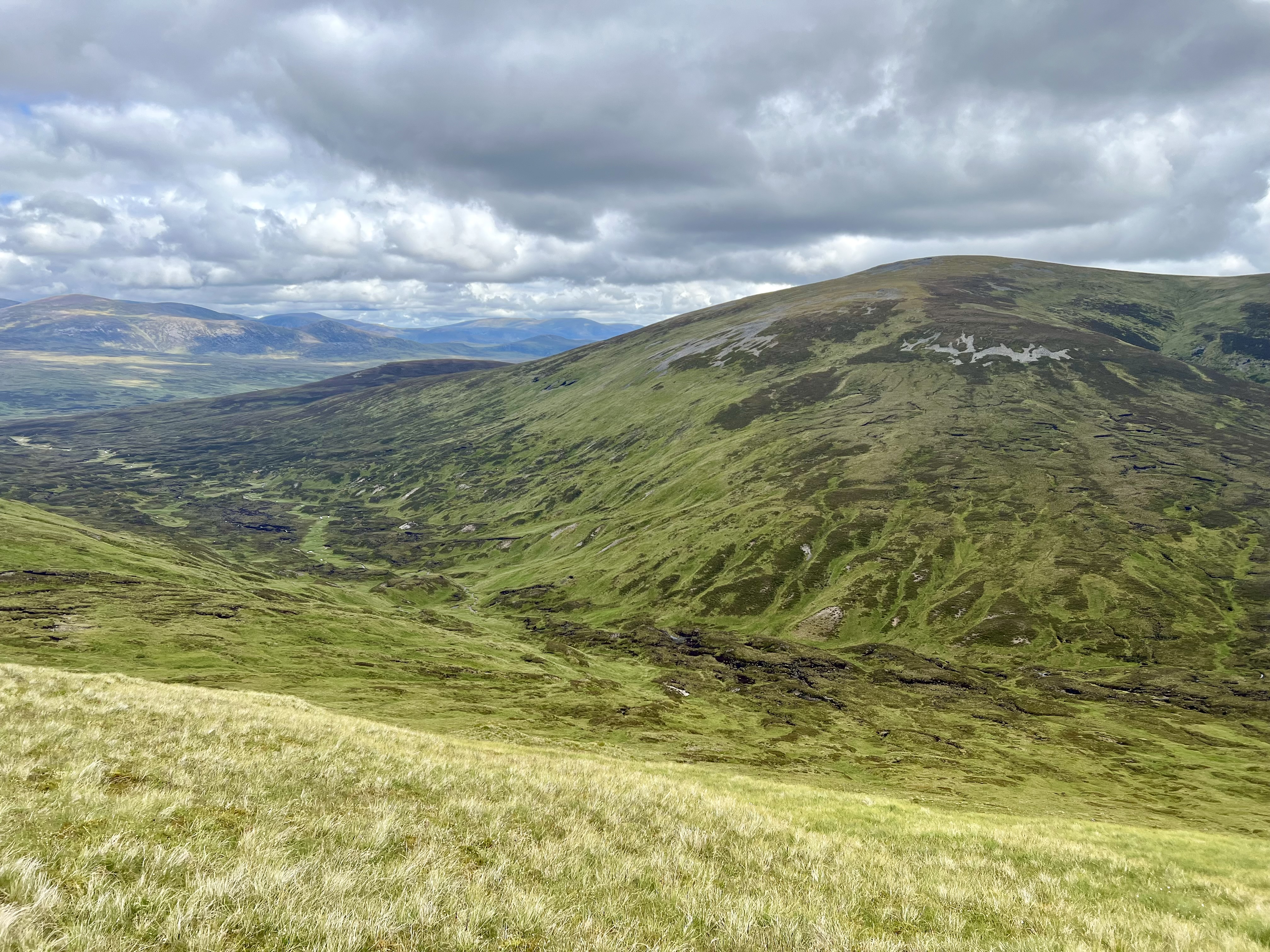
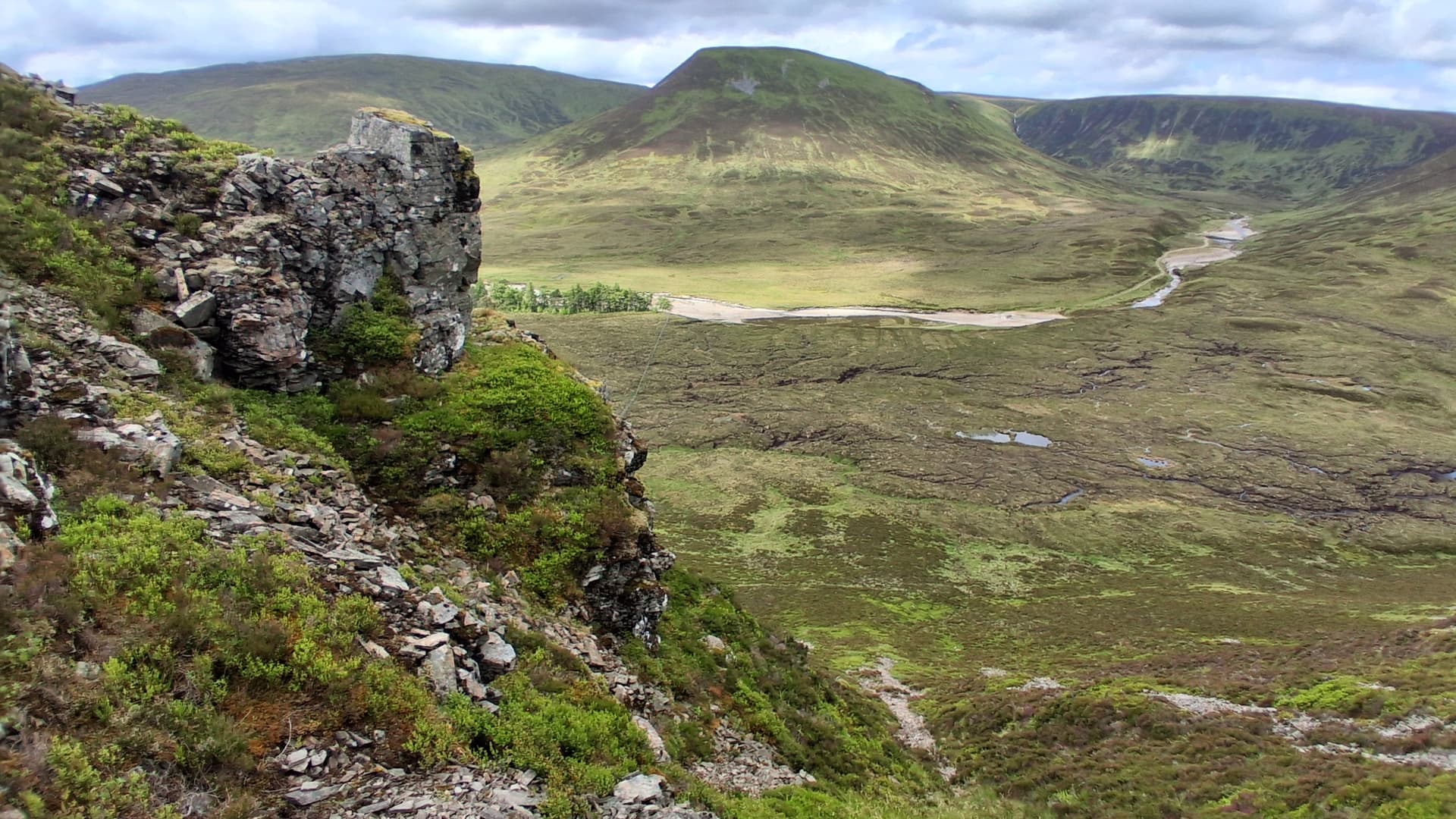
panorama of my descent route through the glen
Bike and me reunited, I pedalled and free-wheeled back to the start in 30 minutes, arriving back at the Landie at 1545, so 7 hours in total. An hour or maybe 45 minutes could be shaved off of this due to time spent yapping to my new pal when I bumped into him a second time, and my extended stay on A’Chaoirnich.
Notes
Route - I think I got this mainly right. However, on my return to the glen for a final time, I could see that my scree and heather scramble probably didn’t save much time. The photo below shows the scree slope to the left, as well as the rising path, which ends up on the right at the bumpy ridge. It then doubles back up hill to pass near the top of the scree slope.
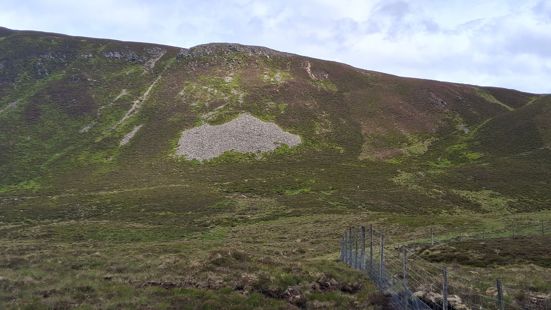
my route up the scree ribbon. Stalkers path below the scree patch
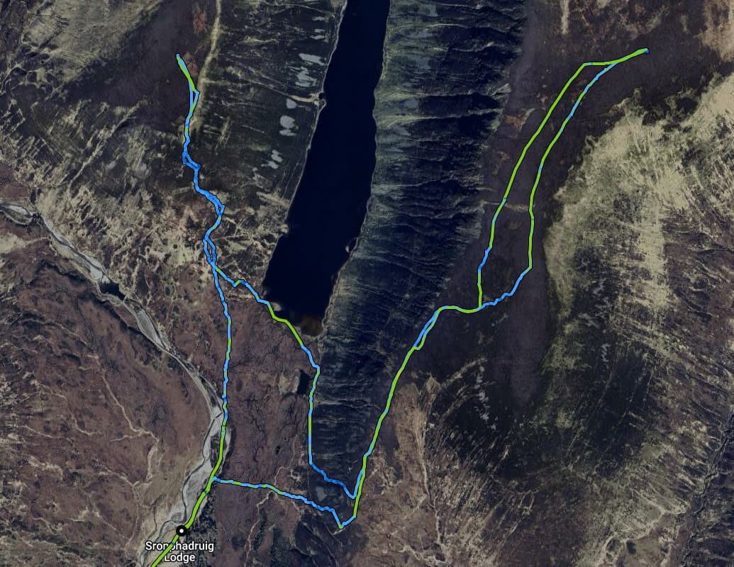
my weaving route, from gps. 26km / 17 miles
No 4G signal in the glen, but surprisingly good on top. However, I activated A’Chaoirnich from the southern end of the activation zone due to a faltering signal further north. I was prepared to spot via Iridium, but there was no need to.
Wildlife - newts, beetles, mountaineering frogs, grouse fledglings, Ptarmigan, Curlew and Dotterel were all evident. No deer, although there must have been some higher up in the glen.
Terrain - good Land Rover track, rough grass and heather, with short cropped vegetation on the tops. Not much wet bog. Much steepness though.
Midges - evident on the tops but only when I was near to the ground, operating my radio. I was wearing a thin hooded top I’d bought in the USA, from REI. The idea of the top is to offer full sun protection. Great for midges too. A quick spray of Smidge on my face and hands kept them away for about half an hour, which is as good as can be expected.
Summary
A contrasting couple of days in the hills. The Lomond hills left me feeling more tired than the Gaick Corbetts. Not sure why? Also not sure why these two fine hills don’t get more activations. They are only 5 miles from the A9 road. I guess the road is lined with lower hanging fruit!