Motivation
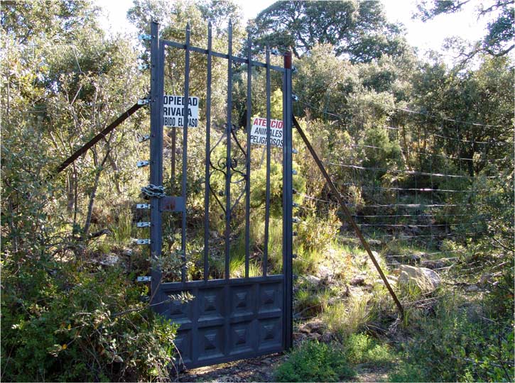
I have been looking for activating this summit since long time ago, but there is a big difficulty to accomplish this hike: the very summit lies inside a big private hunting field whose owners don’t facilitate the visit from mountaineers… The park, a wide area in this mountain, is surrounded with a high barbed wire fence, and surveillance is monitored by private rangers.
For that reason many people found the doors closed for this summit and there were quite a few SOTA activation here in the past.
Is there a way I could do this activation?
And… what does it have to do with a WW2 RAF officer grave?
Read on and I’ll explain.
Climb
The traditional route starts at the abandoned village of Peña (yes, the same name than the mountain); more detail of this village down the article. The route follows the west ridge towards the summit, but nowadays there is a strong iron gate that cuts any chance to proceed.
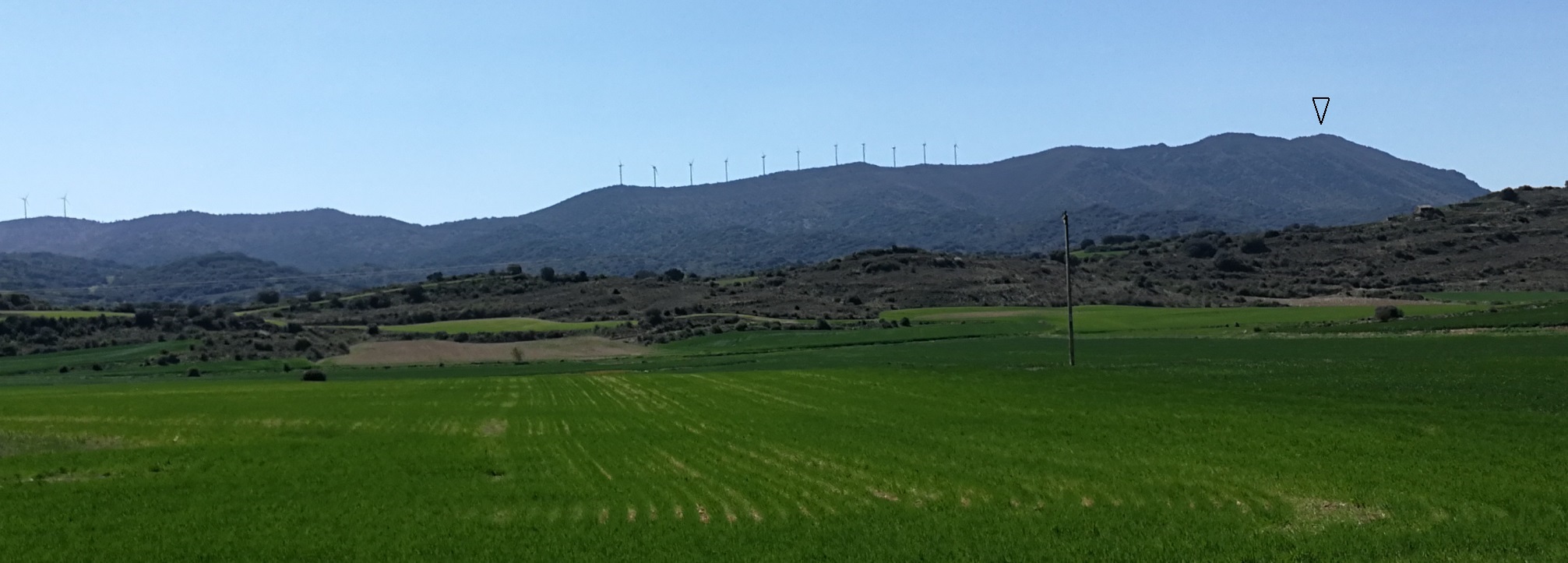
After a thorough map analysis, I saw that past the summit, in the opposite ridge, there are wind power mills along the eastern side of the mountain.
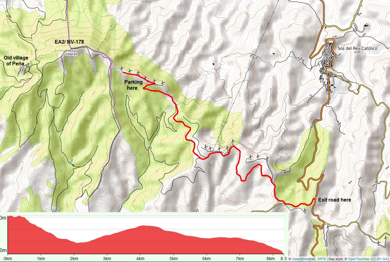
I had some bad experience in the past while trying to drive on a severe degradated service track , and I wasn’t sure about the one I could just see in the satellite picture in google maps, but it looked like the only feasible way to give it a go.
As you can see on the map, that track is 8,3 km long to the highest mills at about 980 meters elevation. Could I drive it up with my car, that is not a 4x4?
Perhaps being a bit worried with this uncertain plan, I slept bad. I woke up and drove to the access of this service road, after the beautiful village of Sos del Rey Catolico. I was glad to find there a wide dirt road in good condition. It seems it has been constructed not long time ago, and it is not deteriorated. Therefore I could drive with care and parked my car near the highest wind mills area, at 970 m. This parking point is in the border between the neighbor region of Aragon and Navarra.
Afterwards I started the true hike to the summit.
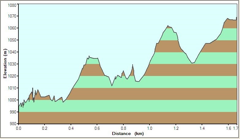
- Track length: 1,7 km
- Summit elevation: 1068 m
- Height gain: about 120 m accumulated (the track is going up and down several times).
See the wavy profile around the fence:
To do the climb you leave the wind mills and walk west and soon find the fence that surrounds the private land. There you just have to follow it and walk carefully towards the summit.
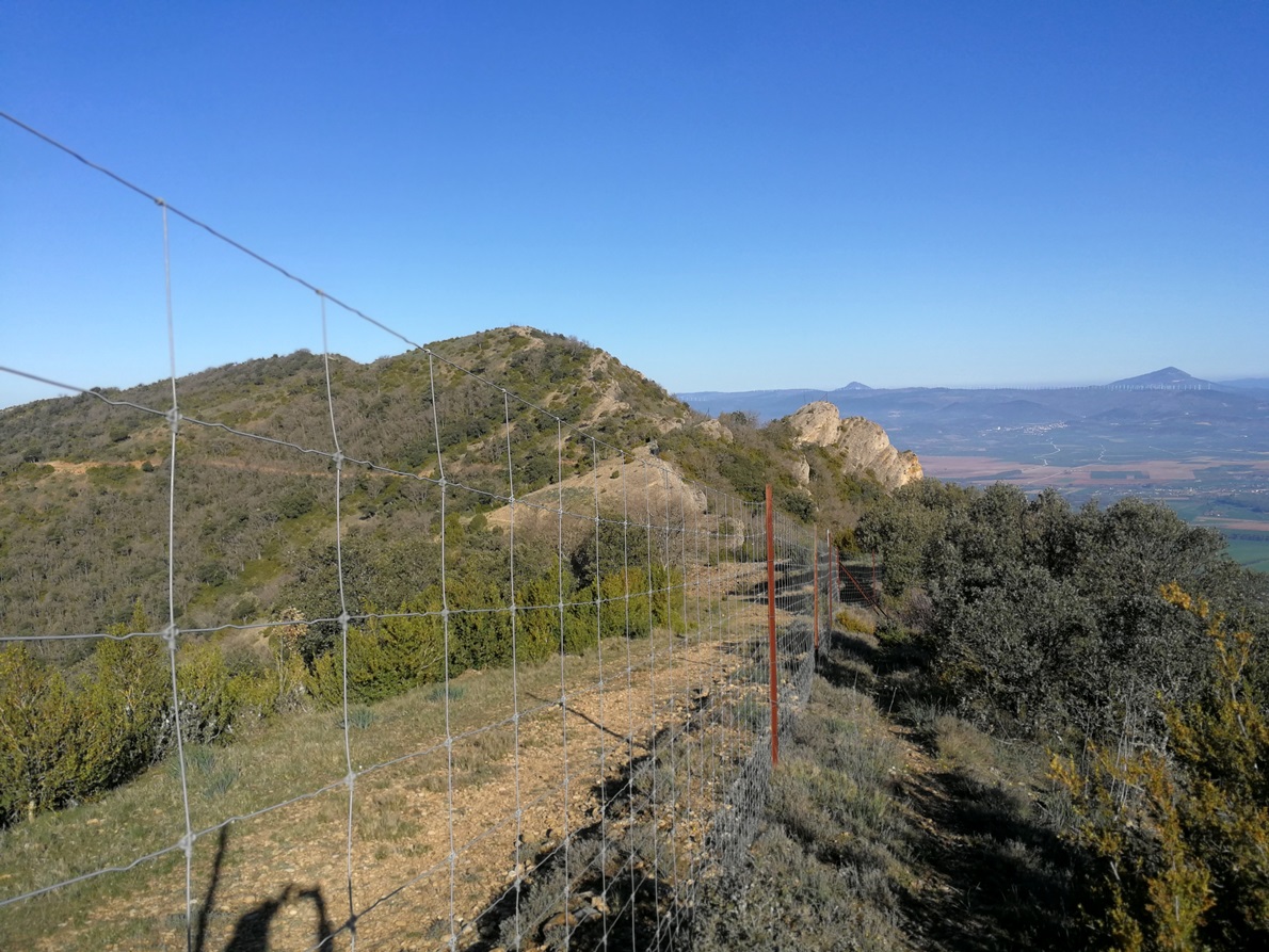
It is not complicated, there are only some points where you need to use the fence as a chain to progress,in order to pass around some impressive rocks.
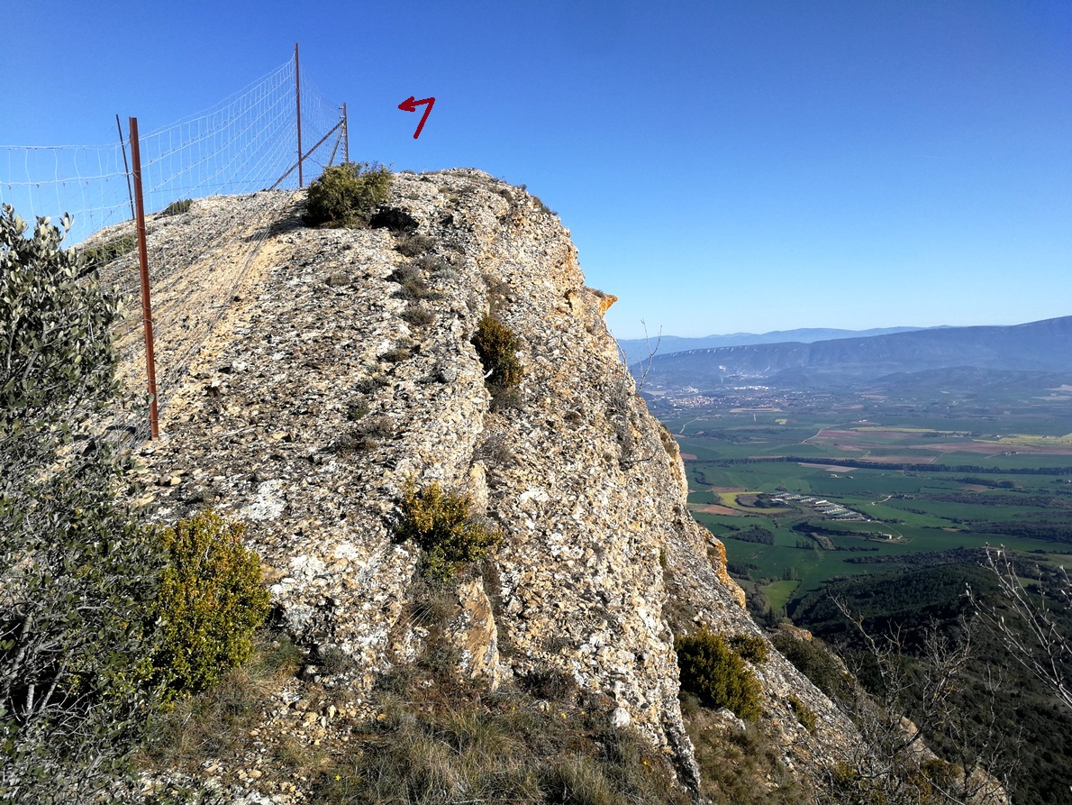
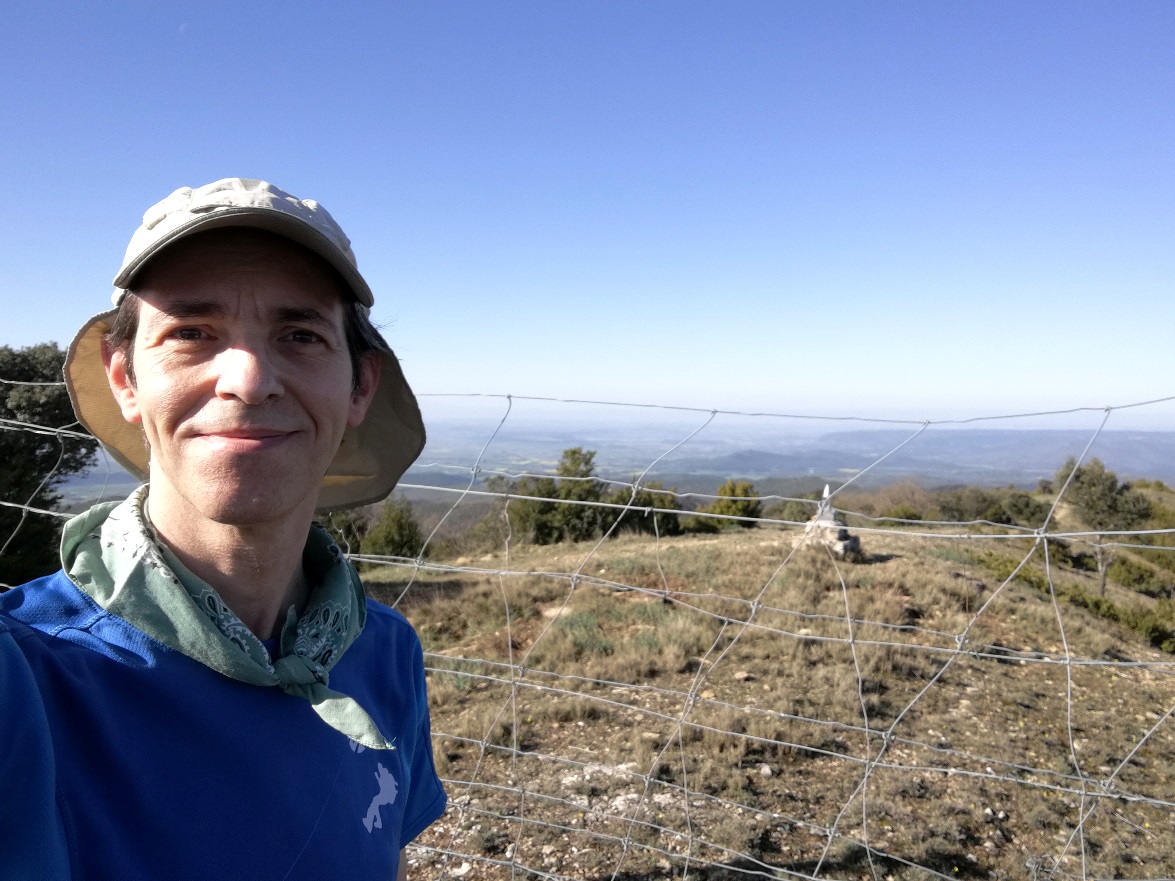
After a nice walk for 40 minutes, I reached the summit, where there is a geodetic vertex.

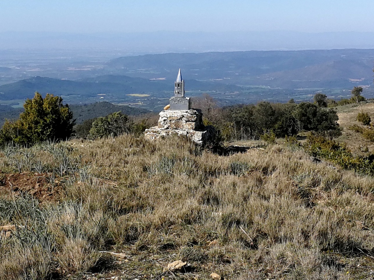
What a pity I couldn’t visit the mountain mailbox, a model of a church, that rests trapped inside the fence.
Activation
Activation date: Aprli 5th 2021.
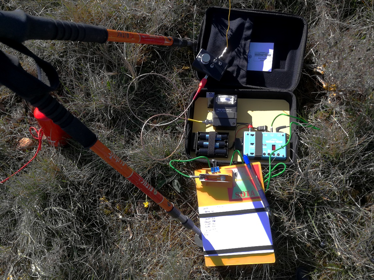
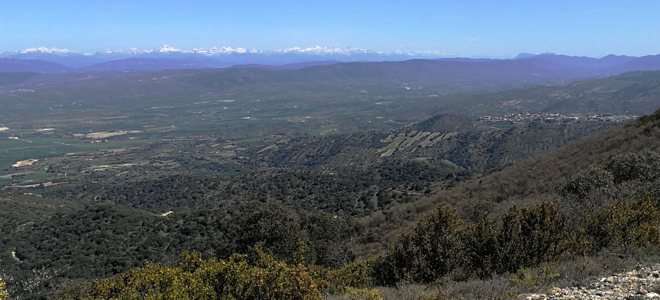
This time I brought my light LNR MTR-3B CW tribander, in a new soft case, preconnected to 3 x 18650 LiIon batteries, and I setup the EFHW antenna next the summit. I could see the Pyrenees range there, lovely high mountains with some snow nowadays.
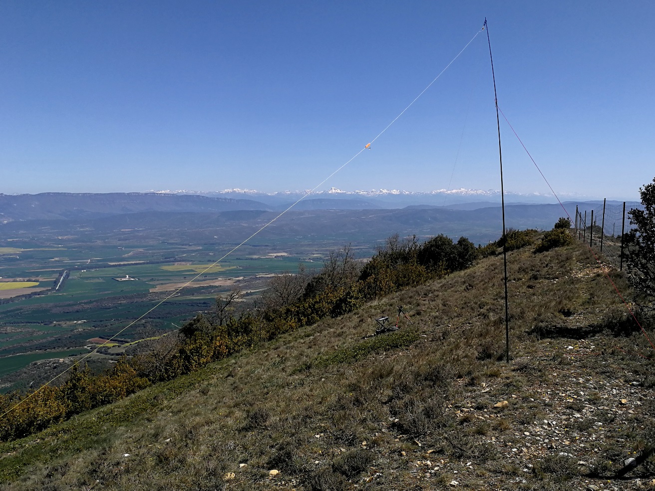
I used my mountain sticks to hold the feed point a bit high over ground:
I started on 145 MHz FM for a while and then was active for 1h 35 minutes running on 7 – 10 and 14 MHz CW. I closed my log with 76 qso, including S2S with EA2CSC Gotzon, EA2DXY Roberto, HB9DST Paul, SP9MA Jarek, EB2FDT Javi, 9A8RA Ante and SQ8JMZ Robert
I enjoyed the activation very much, logging some of the S2S with my VHF handheld, at about 120 km far away; it is always worth having the handheld for such short range qso with some friends.
Here a last picture of the scenery, with the Pyrenees and at right hand the old village of Sos del Rey Catolico (yes, curious CW name too, perhaps I will show this picturesque place in the future).
Historical tip of the day
We are almost done, but, what about the RAF officer grave?
Remember that the standard route starts in the ancient village of Peña, that I didn’t followed today. It does worth to tell something about this misterious place.
This very small village is located in a curious bent plateau at 830 m elevation, as you can see:
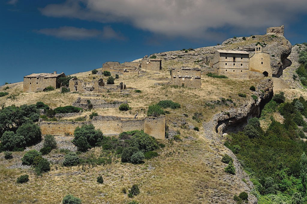
Their few habitants abandoned the village back in 1952, and only a Belgian priest remained there alone until 1962.
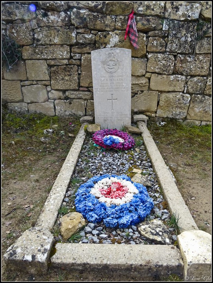
If you exit the village and head towards the summit, before the fence you find the cemetery, at 890 m elevation, where there is a curious grave.
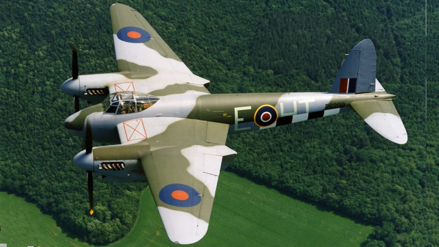
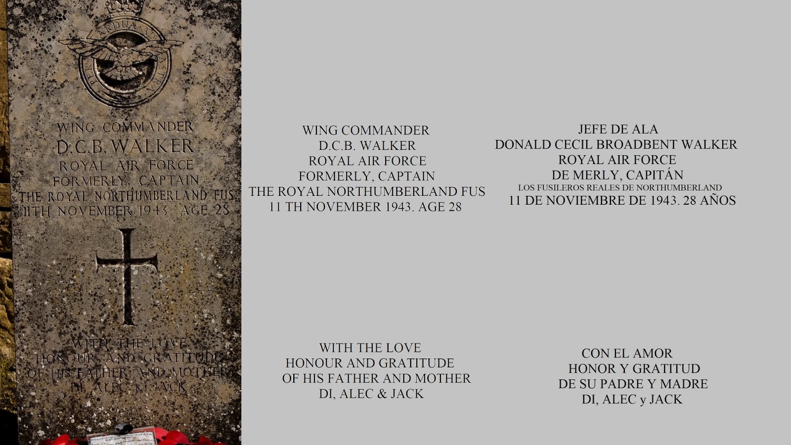
On November the 11th 1943, a british de Havilland DH.98 Mosquito was flying to Southern France to make aerial reconnaisance. When flying over Toulouse, the plane was hit by anti-aircraft and the pilot tried gliding towards South arriving in Spain.
The plane was severely damaged and A.M. Crow, the co-pilot, jumped out the plane and thanks the parachute he saved his life. Nevertheless, D.C.B Walker, the pilot, died while they were trying to find a safe place to land.
The inhabitants in Peña, saw the dark trail of the plain just before hearing it crashing. And also watched the co-pilot parachute in the distance. They assisted him and tried to rescue the pilot, but found the remainder of the plane widespread in the mountain. Crow explained later that he saw Walker jumping out but his parachute was trapped by the tail of the plane…
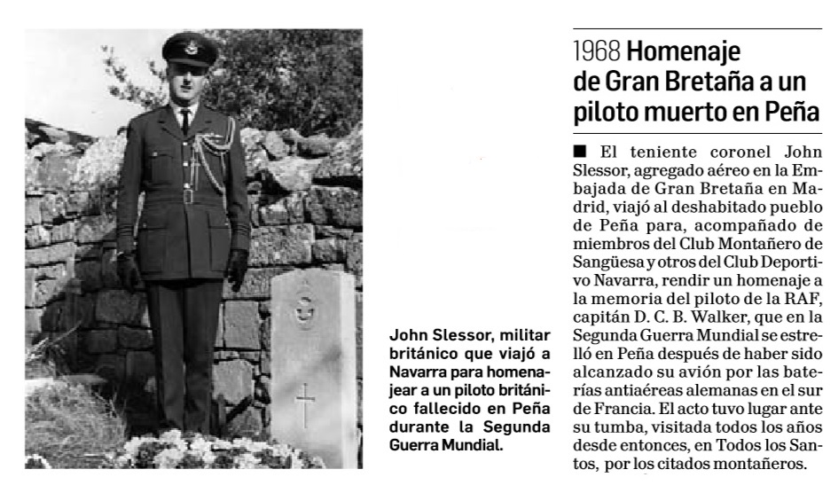
That is why it was decided to bury the pilot in the cemetery of Peña, and there, you can still find this grave.
A headstone was later donated by the UK government and put there in 1952:
Here a last view of Peña range while driving back home:
It is great to enjoy the nature, play the radio and learn stories by visiting new places due to Sota scheme.
73 de Ignacio