Stuck between a rock and a hard place

welcome to another edition of the course “English language for novices” (like me) :wink:
In this edition I’ll try to illustrate the saying “to be stuck between a rock and a hard place”. In German language the same meaning is expressed by “die Wahl haben zwischen Pest und Cholera”, i.e. the choice between pestilence and cholera. Don’t be scared, I’ll definitely not talk about such kind of ugly diseases :cold_sweat:

Before I forget it, first of all Brian @G8ADD is to blame for the existence of this activation report, because his comment in another thread inspired me to take a day off the job and waste my time at such a awful day with hiking in the mountains:

Brian, I hope you accept all the guilt :smiley:

The first destination of todays tour was the soon to be deleted SOTA reference OE/TI-425, the summit called “Scharfreiter”, with a height of 2100m ASL, located on the border between Tyrolia and Bavaria.

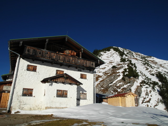
After abt. 800 height meters elevation gain I passed the “Tölzer Hütte”, a nice and frequently visited hut that offers refreshment during the summer month but is closed during the winter.

After passing the hut there remained still about 300 height meters until reaching the summit.

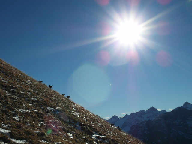
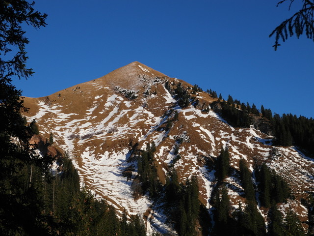
As you can see winter also arrived here in the Alps:

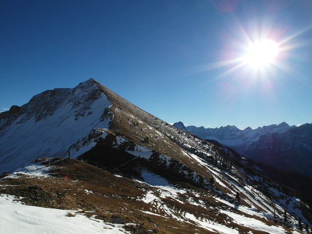
Knowing this summit, I was also aware that the challenges to ascend this mountain significantly change between summer time, when it is a frequently visited summit, and winter time, when almost nobody is ascending this summit, at least from this side.

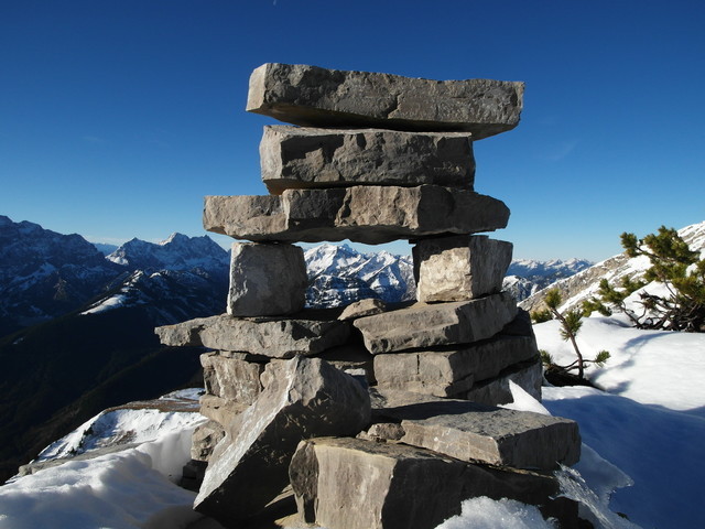
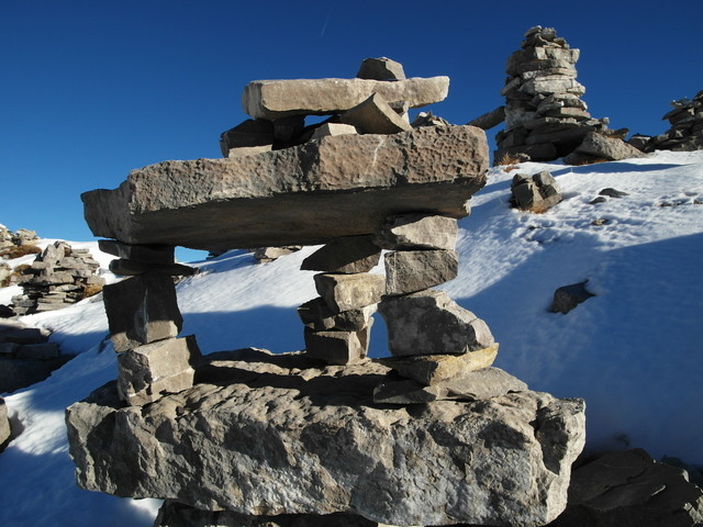
Near half of the route between the hut and the summit a lot of “Steinmanndl”, i.e. small cairns, could be found:

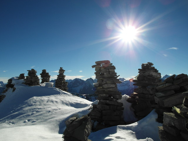
Some of these small piles of stones were quite strikingly designed:

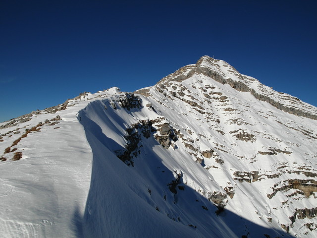
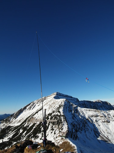
After this intermediate little enjoyment the real life began :scream: :

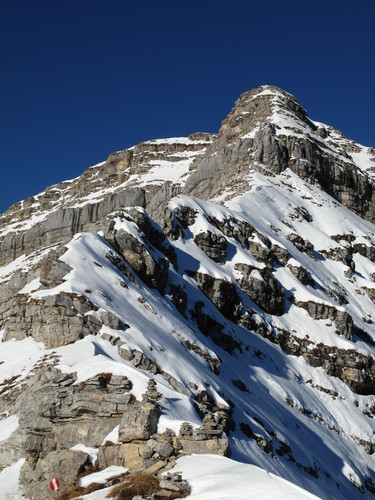
Without snow, e.g. during summer, the normal path up to the summit completely avoids the ridge shown in the photo above. Unfortunately lots of snow covered this easy way up and additionally the snow was hard frozen and therefore was prone and slippery.

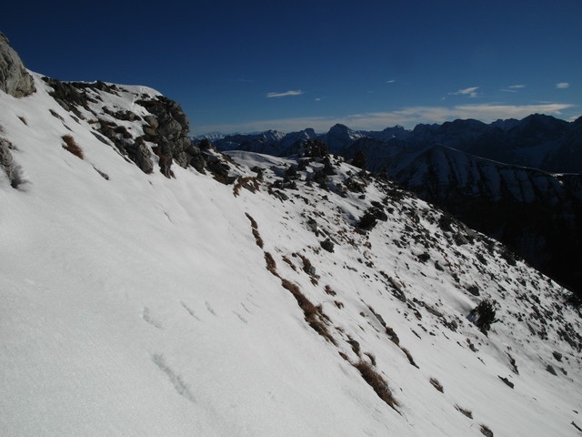
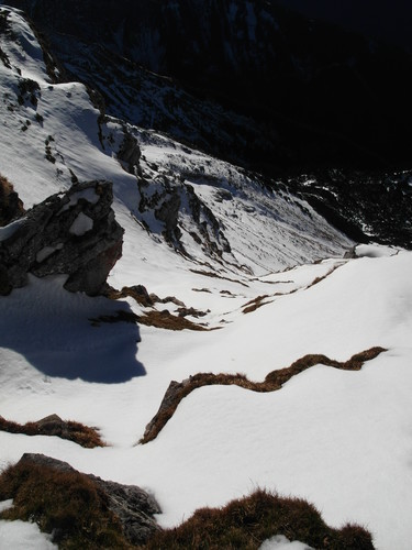
Here you see the gully, where the summer route leads up to the summit, photographed from the top, now filled with frozen snow:

Since abandoning the SOTA activation was out of question :wink: you can simple realize that I had the choice between pestilence and cholera
And in his case, at least in my humble opinion, the English saying “choice between a rock and a hard place” hits the nail on the head, because now I had to decide to either scramble up the rocky ridge or to risk slipping down the gully on the hard frozen snow :worried:

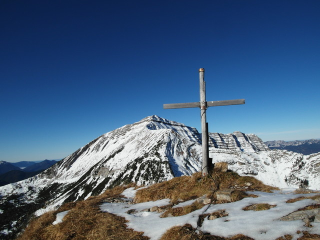
In the end I decided to take the rock, or better to say the rocky ridge, and finally was welcomed with bright sunshine at the top of the mountain :relaxed:

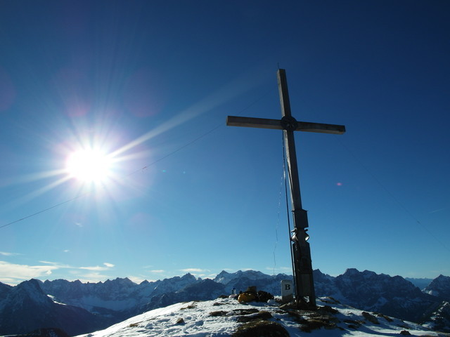
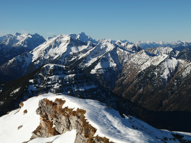
After enjoying the brilliant view to the surrounding mountains…

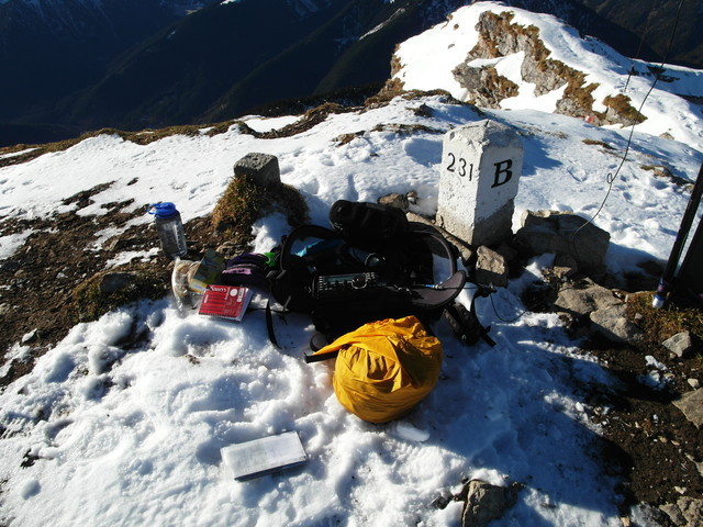
the SOTA activation of OE/TI-425 on the 30m and 20m band in CW and SSB brought 40 contacts into my log, including 2 summit to summits with Switzerland and Greece.

Nearby the Scharfreiter is also the soon to be deleted summit OE/TI-645 “Delpsjoch” located.

Because it was still not to late for another SOTA activation, I decided to hike up the summit Delpsjoch. This time on a pathless but nevertheless far easier route.

During my ascend I could watch a pride of chamois that also enjoyed the sunshine and the mild temperatures:

Soon I arrived on this lower summit …

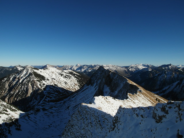
nevertheless exhibiting great views to the Scharfreiter…

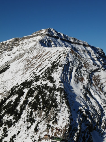
and other mountains:

During my SOTA activation of this reference OE/TI-645 I could log more than 30 contacts including a summit to summit with another OE/TI reference and also 3 contacts from Canada and North America

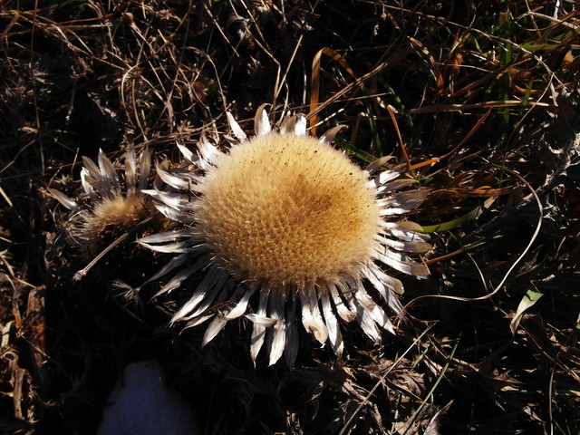
During the descent from this second summit I stumbled across this nice flower, a Carline thistle (Carlina Acaulis) …

that reminds me of the nice activation report of Ignacio, @EA2BD,

This flower is also called “Jägerbrot”, i.e. chasers bread, because it can be eaten. Since I’m no chaser, just an activator, and because this flower is protected by law on nature conservation, of course I did not rip out this beautiful flower.

During my descent I had a last view to the Delpsjoch, before I reached, late in the afternoon, the car park.

Once again many thanks to all chasers for calling me.

Special thanks to chasers that spotted me on SOTAwatch and to the two chasers, Bill and Manuel, who informed the other activators that a S2S from my side is desired and therefore helped me in establishing the summit-to-summit contacts.

And of course thanks to Brian for inspiring me to not spend this day in the dull office.

73 Stephan, DM1LE

15 Likes

I accept it with pride, Stephan, and only mourn that age and distance prevent me from accompanying you - although those splendid pictures enable all our mountain lovers to accompany you in spirit. Thank you so much, Stephan, for brightening a rainy night far away from the mountains.

Brian

Brian

Thanks for the groundwave 20 metre contact to Schafreiter yesterday Stephan, unfortunately I could not hear you at all on the second summit. It’s a shame that both of these summits are to go. Well done on activating them before that happens.

73 Ed DD5LP

Well done, Stephan!

73, Sylvia OE5YYN

Oh my

Such cracking photos of the area well caught and well enjoyed your report as well. Especially about a flower that should not be there.

Thanks for DM/NS-166 very loud here yet could not hear you on the 2nd one and what happened explains why. oh well just one of those things.

Karl

Yes, very good path in the morning from NS-166 to the UK. A 58 signal from your station is rather rare, but this time I could read your complete callsign (not only “3FE”) at once though there were other chasers calling!
Too bad, the connector broke on DM/NS-165 just when things got interesting, with an opening to VE and N.

Topics confused? :wink:

Ahoi
Pom

Carlina acaulis flowers in September and then the head dries like the “everlasting flowers” and sheds seed in the spring. I gather it is a popular house decoration in its dry state. (Aren’t I full of useless information! :wink:)

Brian

1 Like

Yes seemed a very good 1000km ship on 20m yesterday

just one of those things with the connector as least its been found and can be sorted

karl

Marvellous report Stephan. That mountain looks like it has more prominence than the 154m ASL of Arnside Knott which will be around in SOTA for years to come. Was kann man tun? Regeln sind regeln.

73
David

Great report Stephan, plenty of rocks and hard places there but much beautiful scenery to compensate.

I see many crosses at the top of your peaks. Are they in memory of those who fell into a hard place or is it a thanksgiving offering for having made it to the top?

73
Ron
VK3AFW

You could organise a re-survey!

Brian

Hi Ron,
You are more likely to find a cross on a summit in Germany and Austria that you are a trig point. I believe they form parts of religious pilgrimage routes.

73 Ed.

Many things to learn in this topic ;-)): Summit cross - Wikipedia

73, Sylvia

Thank you Sylvia,

I have a much better understanding of this now.

In VK we have cairns and survey markers of various kinds but only one peak that I know of which has a memorial cross.

73
Ron
VK3AFW

Well done Stephan, splendid pics as usual.
Although I would probably had abandoned the hike (between pestilence and cholera) your effort gave us all beautiful views and I felt almost like being there on top with you.

Please keep calm and dont be too risky because I’m willing to see many more new summits, unavailable for me!

Nice to share flowers as well !!
VY 73 de Ignacio

First of all thank you for your interest and for your kind words.

Brian, @G8ADD
I also get inspired so often by other reports so it’s just reasonable to give something back. But, as you know, photos can act only as a poor copy of the real scenery.

Ed, @DD5LP, & David, @M0YDH,
I included the info about the soon deletion of the SOTA references, in case someone, who is reading this report next year, wonders why I’ve activated invalid references.
Fortunately not all is lost: The summit “Scharfreuter” has a prominence of more than 560hm (see “Schartenhöhe” in Wikipedia Schafreuter) and it is also, as I’ve mentioned in my report, a border summit with two SOTA references and therefore will loose one of it’s refs, in this case the OE/TI-reference. The second SOTA reference DL/KW-035 will still exist in the future.
The Delpsjoch will definitely lose its one and only SOTA reference, because its prominence does not fulfill the p150 rule. Even it would be debatable whether the conflict to the p150 rule can be proven within the accuracy of the SRTM-1 data: The height of the summit is 1945m ASL (Wikipedia Delpsjoch) the nearest known reference point is the “Tölzer Hütte” (Wikipedia Tölzer Hütte) at a height of 1825m ASL. And you still have to descend at least abt. 20 to 30 hm down in order to reach the saddle point between the “Tölzer Hütte” and the “Delpsjoch”.
But it is out of discussion for me, because I’ve confidence in the good work of Sylvia and her helpers and their efforts to not carelessly dismiss any summit.

Ron, @VK3AFW
The best answer has been already given by Sylvia. I just can add my point of view. Nowadays the summit crosses are mainly maintained (I guess claimed would be not the correct word) by organizations of very different interests. That could be veterans who want to keep up the remembrance to the fallen; or mountain rescue organizations that dedicate it as symbol for the hard work that is done by their comrades; or simply tourist organizations that want to provide some kind of “decoration” in order to increase the attractiveness; or many others.
Nevertheless those summit crosses are very helpful for SOTA activators, as they most often indicate the highest point of a summit and they are often visible from far distance and therefore facilitate orientation.
Christian @OE5HCE maintains an impressive list of summit crosses. It’s really worth to take a look: Panoramio OE5HCE Gipfelkreuz

Ignacio, @EA2BD
Of course, especially at this summit “Scharfreiter” I experienced in the past already several times that “nature is setting the rules”, as the winterly conditions forced me to abandon my ascent. So I’m used to return without summit success; which isn’t too drastic as the mountains will still be available for a next try under better conditions.
Recently I’ve heard a meaningful saying: “If someone leaves for a mountaineering tour, the summit is not the destination, the real destination is your home

73 Stephan, DM1LE

“Danke für die Blumen” as we say in German!
We’ve had the most accurate computer evaluation possible by OE8FNK (much, much better than Landserf which is pretty inaccurate when it comes to our peaks and mountain ranges) and have “rescued” whatever there was to rescue and added whatever there was to be added but, unfortunately, Delpsjoch only has a prominence of 128 m (saddle is at a height of 1817 m) and needed to be deleted :-(.

73, Sylvia

Landserf is as good as the data you feed it (until you get to a very large survey area, bigger than ZL1, say, in which case it can choke, even with large amounts of available RAM). Our main “go-to” data set is SRTM. We know not to swear by its accuracy;so we log to below p150 and check by other means in case any non-compliant summits turn out to be Ok. Our aim always is the most accurate list of p150 (or p100 where the rules permit) summits, and are of course open to any well-informed suggestions for correction supported by reliable sources…

73, Simon

I am sure Landserf is an excellent tool and provides invaluable help in evaluating summits.
I am not an expert on Landserf, in fact I have never been able to come to grips with it, but I know that it has its weaknesses. The evaluation of our summits was based on SRTM data but Landserf seems to have misinterpreted the data for quite a number of our summits and reported prominences <150 for summits that actually fulfill P150 (it doesn’t seem to be very good with very pointed peaks…). We had to prepare about 200 screenshots of the corresponding Austrian maps to prove their validity.

73, Sylvia OE5YYN
SOTA AM OE

Hi Sylvia.

I’m “splitting hairs”, defending the software Landserf as distinct from the input data. SRTM (Space Shuttle Radar Topography Mission) covers most of the planet and is generally “good enough” to give us a near complete set of candidate summits when treated appropriately. Sometimes better data are available, when the custodians of such data allow (for example ,Spain has very good LIDAR data freely available, whereas UK LIDAR data, to really high resolution, are not on public release). We do watch out for other data sets, especially at high latitudes not covered by SRTM. The process is far from automatic and we are very appreciative of local input, especially when large-scale topographic mapping is not available to us on-line (this varies a lot between national mapping agencies and makes a huge difference). Also some topo maps look decidedly “mid-century” (or older) whereas the good ones are derived from clever stuff like stereoscopic satellite imagery.

I acknowledge that the smoothing effect of 1-arcsec resolution data such as we have from SRTM affects elevation data more than on higher-resolution terrain models. But even 5-m LIDAR gave a false positive on Tenerife, dropping the elevation of a knife-edge col. Yes, it can work both ways, over-reporting p as well. I wasn’t involved with OE but I’m sure we very much appreciate the local input received, as you can never have too many eyes on the maps!

I’m sure you know this all very well Sylvia, but I thought others might be interested to hear a little more about problems and pitfalls (and successes) of building up the summits lists.

I could go on and on about it, but I have probably over-stepped the boredom threshold for some by now!

Have fun!

73, Simon