SOTA trip to G/DC and G/SC

Next week Martyn M1MAJ and I will be off to the south west with the main aim of activating our remaining uniques in the area, though we may also redo some previously activated summits if time and weather allow. We’ll have a few days based on the Devon/Cornwall border for the G/DCs, and then move to Somerset for some G/SCs. Will try to put up alerts when specific plans are firmer.

As usual I’ll be looking for VHF and especially UHF contacts, though I get the impression that it may not be a good area for them. Martyn will normally concentrate on HF - 60m, 40m, 20m, whatever seems to be working!

I have routes for all the summits having been looking at previous activation reports, but am not impressed with either DC-006 Carnmenellis or DC-008 Hensbarrow, so would welcome any useful recent experiences of them.

5 Likes

Weather not looking good, but we will probably try to do Brown Willy G/DC-002 today, but may abandon if too wet.

3 Likes

It looks like I was last to publish an activation on G/DC-006.

It was after a lot of rain so beside the gorse the ground was quite wet. I should have used boots or wellies not trainers.

I followed G4OBK’s route this time, the tracks were churned up with cattle so there was a lot of mud. I found it better to stay away from the wall where I could the ground was a bit dryer. There is a notice on the gate saying private but it is marked as Access Land on the map. The footpath to the Access Land goes through the farm and had you would have to get past the dogs, better to stick to the G4OBK route. There was cattle on the Access Land but they were bored and wet so ignored me.

I was there for a 4m QSO but had to work hard for VHF contacts this time. I didn’t Alert so I was not too surprised at there not being many people on at random near tea time.

My suggestion would be to send a direct e-mail to those who have chased the summit recently on 2m.

The Tx mast gave me trouble on 2m and I had taken a bandpass filter for 4m. On the previous trip I had failed on 4m due to the Tx mast overloading the Rx. People could hear me but I couldn’t hear them. If you have a bandpass filter for 2m don’t leave it in the car !

Some 1 point summits count for more than others, this is one that counts for a lot !

This time 0 points but I did get the one 4m QSOs so objective achieved.

73 de

Andrew (G4VFL)

2 Likes

We did activate Brown Willy G/DC-002 today, though it was a struggle in a number of ways. We took the route from the north over the edge of Rough Tor. Given the forecast and the rain we had driven through to get to the parking we set off in waterproofs and with rucksack covers on. It was windy throughout, but on the outbound route it was mostly dry with only some light rain. As we approached Brown Willy the wind became much stronger, making it difficult to safely pick through the rocks. We did make it to the trig point but it was hard to stand or move safely: trying to keep 3 of feet and walking poles on the ground for stability!


Brown Willy in distance


Brown Willy


Brown Willy towards Rough Tor: I was struggling to stand to take this one, so it’s surprising the trig looks anything like vertical!

We carefully made our way down onto the more sheltered eastern side, and managed to find a sheltered spot behind some rocks near the summit where I could try to get a 2m antenna over the rocks and Martyn could spread out an HF antenna.
I decided that the 2m dipole was too fragile for the wind and used the EFHW rucksack antenna raised on an extension pole. I expected to struggle on 2m, but started well with a husband and wife pair, but then nothing. When Martyn came over to see how I was doing I expected him to ask if I needed HF, but instead he asked if he could have VHF contacts as the HF antenna wasn’t matching. I persisted and over 90 minutes managed to get 10 VHF contacts. Martyn grabbed 5 of them in between trying to sort out the HF dipole, but was unsuccessful.


VHF setup hiding from wind behind rocks.


Useless HF antenna!

Light rain had started soon after we arrived at the summit and continued on and off, but by the time we were packing up was becoming more serious. Once out of the shelter of the rocks, it was a less pleasant walk back with driving 45degree rain in our faces: sometimes heavy, sometimes lighter. It was the sort of rain that proved that none of our waterproof gear is actually waterproof, though we would have been a lot wetter without it.

Back at the holiday cottage Martyn discovered a broken connection, which meant he was using half a dipole :frowning:. Not clear if he can fix it at the holiday cottage, so it might be the spare dipole with less bands tomorrow.

Many thanks Andrew G4VFL for the information about Carnmenellis: timely as we are hoping to do it tomorrow. We will be wearing boots (provided that they and everything else have dried out from today’s soaking). We were hoping to get Carnmenellis and Watch Croft done in the same day, given the limited time we have at our current base near the Devon/Cornwall border, but the forecast for tomorrow is also looking rather damp, so not sure we will manage it.
I do have a bandpass filter for 2m: just need to make sure it gets back in the rucksack which is drying out.

10 Likes

Well done for overcoming the struggles and successfully activating G/DC-002. I listened out for Martyn when I saw his spots on 40m but didn’t hear anything. Bad luck on the antenna.

Hope things go more smoothly on the next one! :point_up::point_up::point_up:

73, Matthew M0JSB

2 Likes

Aiming for Carnmenellis G/DC-006 and Watch Croft G/DC-007 today. Long drive so not sure of times or it we’ll manage both of them.

1 Like

We got back from the trip at the weekend. We were too busy driving to, walking up and activating summits to do reports on the fly. Some reports may appear here when I have time to write them.

A quick summary of the 11 days activity:

  • 18 summits activated, 14 of them uniques for both of us.
  • That means that we have both now activated all of G/DC and G/SC, and as a bonus we also managed to activate our last remaining G/CE on the way home.
  • I got at least one 2m FM contact on all 18 summits, but only got 4 qualifying 2m contacts on 15 of them.
  • I got at least one 70cms FM contact on all 14 of the summits I tried 70cms (weather conditions or time constraints meant I didn’t manage to deploy a 70cms suitable antenna on the other 4), getting 4 or more 70cms contacts on 9 summits. I needed to venture onto HF to qualify 4 summits, but also did some HF just for fun.
  • Apart from the antenna disaster on Brown Willy mentioned above Martyn activated all the hills on HF. He always started on 60m and got at least one contact on all remaining 17 summits, but only qualified on 60m on 8 summits. One or other of us activated the 17 summits on 40m. On some summits where we had time 20m and 10m were also used. The backup HF dipole we were using only had 60, 40, 20 and 10 available.

A special thanks to those who worked me on 2m, and especially those able and willing to QSY to 70cms.

8 Likes

Some photos now added to that report.

It was a long drive, but we managed both of them on 11th September 2024. The forecast was still suboptimal: some sunshine but also showers, some heavy. We managed to get out to the holiday cottage on the Devon/Cornwall border reasonably early. It took 1:15 to drive to the parking for Carnmenellis.

We parked in the rough layby at SW688364, donned boots and rucksacks and set off along the road, straight on onto a footpath where the road bends right, follow the footpath round a right bend, and take track left to access area. The gate to the access area has a faded notice saying it is private, but beyond it is now access area. The gate is also broken and only on half a hinge: It wouldn’t easily open, so we climbed over onto the muddy cow churned area beyond. Over rough ground beyond the cows to a more bracken and heathery area ascending towards the summit, finding a bit of a path not far from the fence. We had driven through some showers and there were still some about, and one arrived as we neared the summit. Given the weather we decided not to cross the barbed wire fence to the trig point as the vegetation beyond looked worse than where we were which was well inside the activation area.

Martyn found space for the HF dipole in the less dense vegetation below the fence. Caroline used a fence post to support the end fed half wave VHF antenna on an extension pole, deeming it too windy for the dipole. She also needed to use the 2m bandpass filter to block out interference from the many antennas on the summit: this meant that 70cms wasn’t possible. It took Caroline 15 minutes to get 6 2m FM contacts on the log, but then it went quiet. Meanwhile Martyn had moved to 40m after only getting 3 on 60m. He had 17 40m contacts in the log by the time Caroline wandered over after finishing her lunch to see how he was doing. The terrain made it awkward to change the links to 20m, so Caroline continued on 40m while Martyn ate lunch, getting another 4 contacts.


HF setup


HF setup with Redruth antenna mast in distance.


VHF antenna and source of interference!

We retraced our steps back to the car. When we picked up a traffic report, we were glad that we decided to take the more southerly B3280 towards Penzance as the A30 was blocked by an accident on the Hayle bypass. The B3280 wasn’t a fast road with many sections not really two cars wide, and it took about 50 minutes to get to our parking for Watch Croft. It seems most people approach from the south, but we decided to approach from the north, parking in a parking area opposite the remains of the Engine house of Garn Gilver Mine at SW420363.


remains of the Engine house of Garn Gilver Mine

We headed back down the road and took what looked like a path heading in the right direction, but it disappeared into deep vegetation, so we re-examined the map, retreated to the road and continued down it, until a clear path headed off left near the low point of the road. Once on the proper path it was easy walking up to a path crossing where we turned right towards the summit. This path narrowed as it ascended but was in general wide enough to avoid tangling in gorse and heather. The trig point sits atop a pile of stones, with excellent 360 degree views.


Ascending Watch Croft

Ascending Watch Croft

Ascending Watch Croft

Having seen nobody else since we left the road, Caroline took advantage of the hole in the trig point to erect the 2m dipole, but after 3 contacts in 10 minutes it all went quiet on 2m FM. Meanwhile Martyn was struggling to find somewhere to get the HF dipole up, the summit being covered in gorse and heather with few narrow paths. He eventually got it up, but at the expense of multiply blood stained trousers where the gorse had attacked him. Martyn also got stuck after 3 contacts on 60m, so we partially shared 40m (wanting to minimise link changes given hostile vegetation). Caroline ran on 40m getting 16 contacts, with Martyn grabbing one of the stronger regular chaser as well to get his 4th. He took over 40m for two more contacts while Caroline went back to 2m for final calls which picked up a mobile station to qualify the summit on 2m FM for her.


VHF


HF and VHF


Taking down HF


Late afternoon sun on Watch Croft


Descending Watch Croft.

Caroline had planned a more interesting longer return walk, but time was against us, so we retraced our steps. From the point of view of walking and views, a nice summit; for HF operation not at all nice! At least we avoided any further showers on the afternoon walk and activation, driving through some rain on the 1:15 journey back to the holiday cottage (the A30 running well as the Hayle bypass accident had cleared).

7 Likes

12 September 2024: G/DC-008 Hensbarrow Down and G/DC-003 Kit Hill.

Another day of sunshine, showers and moderate winds was forecast. Our plan was to activate our last two G/DC summits, G/DC-008 Hensbarrow Down and G/DC-003 Kit Hill. We had a good run down the A30 but needed to come off at the A391 as the B3274 which would have given a more direct route to the start point for Hensbarrow Down is closed for major roadworks.

We parked in the small muddy parking area at the start of the footpath at SW992575. It was empty so we could choose the only spot where we weren’t getting out of the car into mud or puddles. We had driven through some rain, but it had stopped by the time we were setting off on the walk. We started off on the footpath which was narrow and increasingly encroached by wet vegetation. Shortly beyond where the footpath passed a short crossing track, we deemed it to have become impassable and retreated to the crossing track which took us a short distance to the main quarry track. We followed the gradually climbing quarry track around a long left bend, eventually getting views back to the white painted 312m trig point which was on the summit of the original natural hill. We decided against a trig point visit through the damp dense vegetation.


312m trig point now about 50m below summit!

We continued on the quarry track round a right hairpin, leaving it back on ourselves along an older more vegetated track. We headed right off that track to head towards the summit of the former tip, crossing another older grassy track. Clouds were heading our way, and the wind got up as we approached the fairly rounded top, and then a shower arrived. It wasn’t clear where the true summit was, and we dropped down slightly on the eastern side where some isolated broom bushes provided a little shelter from the wind. We had views over the China Clay workings towards St Austell and along the coast.

Caroline had noticed interference on the handheld as she climbed, so this was another summit where the 2m bandpass filter was deployed, with the FT817 running into the EFHW rucksack antenna (it being too windy for the 2m dipole). This meant that 70cms wouldn’t be possible, but as it turned out there was just a single 2m FM contact, into nearby St Austell: unsurprisingly very strong signals. There was plenty of space for the HF dipole with large areas of light vegetation. For the first time on the trip Martyn qualified with exactly 4 contacts on 60m. He passed HF to Caroline for a run of 10 on 40m to qualify the hill for her too. With his lunch eaten he took over HF for 20m getting 15 contacts including an S2S for both of us. Once Caroline had finished her lunch we packed up.


VHF sheltering behind broom bush.


HF overlooking China Clay workings


HF overlooking China Clay workings


Hensbarrow Down towards St Austell.

The weather had varied over the time we were there, sometimes sun, sometimes rain, through thankfully most showers were light and/or short-lived: it looked like some places were getting more rain than we did! The return roughly followed our outbound track, except that we stayed on the quarry road all the way back to the public road. We had an hour’s cross country drive to our next destination of Kit Hill.

By the time we got to Kit Hill the showers were decreasing. We only had a few spots of rain, but while Caroline was operating HF, Martyn managed to snap a rainbow, so there was rain nearby! We parked at the car park halfway up the hill and took a track around the south of the hill before ascending to the summit. This was the nicest of the Cornish summits activated so far with good views and plenty of space for activating, it could get rather crowded on a nice summer weekend. There were people about but on a showery September weekday afternoon we could set up without too much impact, though Martyn kept an eye out for dogs around the HF antenna.

Caroline set up the VHF dipole by one of the toposcopes surrounding the ornate former mining chimney on the summit, while Martyn set up on the grassy area inside the polygonal folly enclosure. We had visited the trig point but deemed it too awkward for HF (and there are notices discouraging walking over some of the earthworks near the trig point). Once setup it took Caroline 10 minutes to get 4 2m FM contacts. Best DX was a contact into Swansea, crossing most of the Cornish peninsula. For the first time on the trip Caroline was able to try 70cms, but only one of the 2m stations was strong enough on 70cms for a contact. 60m was still playing reasonably well, so Martyn qualified the hill with 4 contacts there before moving onto 40m where he got 10 contacts including 1 S2S for both of us. We finished off the activation with a run of 5 contacts on 20m for Caroline. We roughly retraced our steps on the return, with a brief diversion to look at the remains of the South Kit Hill Mine (mostly chimney stack).


Ascending Kit Hill


Kit Hill


Kit Hill


Kit Hill


Kit Hill


Kit Hill rainbow


Kit Hill VHF setup


Kit Hill HF setup


Kit Hill HF setup


South Kit Hill Mine

3 Likes

Thank you for the reports and photos… they reminded me of my vacation 5 years ago.
We spent a week in Newquay and a week in Weymouth.

Beautiful

I (only) activated 6 summits back then.

73 Armin

3 Likes

13 September 2024: High Willhays G/DC-001

This was the day when we moved from a holiday cottage on the Devon/Cornwall border to one in Somerset east of Bridgwater. The forecast was much better than previous days, with little chance of rain, and given the relatively short distance to the next holiday cottage, we calculated we had time for a proper hill on the way. This was to be a repeat of High Willhays G/DC-001. We had checked before leaving on holiday that there was no firing on the northern Oakhampton ranges. It took only half an hour to get from doing our shopping in Launceston to the Meldon Reservoir parking, despite congestion on the A30.

It was ideal weather for hill walking, blue skies with fluffy clouds and a pleasant breeze, though it clouded over later. We ascended over Yes Tor, with a prominent trig point and only 2m short of High Willhays. There were a few people and some Dartmoor ponies by Yes Tor.


Meldon Reservoir


Cattle above Meldon Reservoir


Yes Tor


Yes Tor towards High Willhays


Dartmoor ponies


Dartmoor ponies

Fewer people continued along the ridge to High Willhays. We couldn’t work out if the large cairn or the tiny cairn marked the highest spot. Caroline propped the VHF antenna up against the rocks, while Martyn operated HF from a slab of rock a little lower: comparing photographs, a very similar spot to that he used on our first activation in November 2012.


Does the big cairn mark the summit?


Or does the little one mark the summit?


HF station


VHF station


Both stations

This was the first summit of the holiday where Caroline managed to qualify the hill on both 2m FM (7 contacts) and 70cms (4 contacts). The added height helped, that and that there were a pair of Marks operating from Kit Hill Car Park (unfortunately from a vehicle, so no S2S). Martyn struggled to two contacts on 60m, but did better with 14 on 40m. Caroline moved to 20m for another 18 contacts including 2 S2S which Martyn grabbed too.

We took a slightly longer return heading south past Fordsland Ledge and over Black Tor getting more good views. Back at the car park We used the toilets, but Caroline was startled as birds flew out as she entered. She then realised the reason for some mess by the side of the washbasin: a nest perched on top of two electrical boxes in the corner, with 3 little faces poking out.


Black Tor


What are you doing up there?

8 Likes

Excellent reports, many thanks. Lots of memories evoked from what seems like ages ago… indeed in terms of my SOTA history these summits were ages ago, apart from the more recently revised Hensbarrow Downs G/DC-008 of course. I really enjoyed reading of your exploits and look forward to more from you. Pity I was only able to get into the shack to work you from a few.

73, Gerald

3 Likes

@M3ZCB @M1MAJ - lovely to QSO with you in the G/SC area.

Be sure to message if you’re in this neck of the woods again. :+1:

:mountain:

2 Likes

14 September 2024: Saturday - Dunkery Beacon G/SC-001.

In order to activate all the summits within a reasonable driving range of the holiday cottage near Bridgewater (8 uniques and 3 repeats) we needed to do 2 each day for 5 days and have one single summit day. The weather forecast was good and doing a single summit would also mean that we could have a bit more of a walk, so we make our target Dunkery Beacon G/SC-001.

Getting to Dunkery involved using the A39 from Bridgwater towards Minehead. Caroline has memories of her father complaining about the A39 when going on childhood holidays to North Devon around 60 years ago. It must have had some improvements in the meantime, but it wasn’t a pleasant drive. Traffic was heavy, usually nose to tail, often behind a lorry which would sometimes struggle to cross with another similar in the narrower twisty sections. It was a relief to turn off onto the A396 so we could approach Dunkery from the south: the road wasn’t any better, but there was less traffic! By the time we got to Wheddon Cross we needed the toilets in the village: in a mosaic decorated block with donation box.


Decorated conveniences.

Continuing over the moors and wanting to have a proper walk we drove past the first two car parks closest to the summit and parked in the more northerly Webber’s Cross car park. As we were loaded up the rucksacks by the car a man wandered over and asked about our kit. He turned out to be another radio amateur, but he wasn’t there to play radio: he had an easel set up and was painting. We had a chat, but he didn’t have a radio with him, so no chance of a contact later.

We took a path through Hollow Combe, a pleasant wooded area and then up onto the more heathery and bracken of the higher ground. We turned left onto another path which narrowed as it ascended the hill before joining a wider path which led us to the large cairn on the summit. As we approached the summit cairn, we were surprised to see a grey squirrel running up the cairn and down the other side: a long way from tree cover. It was busier around the cairn where several paths converged, including those from the closer car parks, though one of the walkers we spoke to had come up from Exford.


Ascending Dunkery Beacon


Dunkery Beacon


Dunkery Beacon

Martyn moved into the heathery area below the cairn to set up HF away from major paths (especially necessary as mountain bikes come over the summit). Caroline set up VHF and UHF on one of the grassy mounds below the cairn. It took less than 15 minutes for Caroline to qualify the hill on both 2m and 70cms, with contacts into both South Wales and SW England, ending up with 13 2m contacts and 7 70cms contacts. The best 2m DX was a GB2SCC, a CHOTA station in Ceredigion. Interestingly some of the contacts worked on both 2m and 70cms were stronger on 70cms, despite her antenna being suboptimal for 70cms. Meanwhile Martyn was struggling to 2 contacts on 60m, but a move to 40m brought 15 contacts including one S2S for both or us. Doing just one summit meant we had time for Caroline to try 20m, getting 10 contacts.


We also had time for a longer walk off, northwest and through Bagley Combe to a minor road, along to Cloutsham and then a bridleway which dropped down into the East Water Valley. There was then a steep path to climb back up to the Webber’s Post Car Park: a pleasant 9km round trip, though the final climb had us puffing more than the ascent to the summit!


Crossing East Water in Bagley Combe

The A39 traffic was lighter and moving better on the return journey, but still not a pleasant road!

6 Likes

It was good to work you too, with especial thanks for the S2S from Staple Hill. We may not be down in that area for a while (we have a preference for uniques and have now done all the G/SC, but it’s a lovely area with lots to do besides radio so may be back).

Report on the activations that day below.

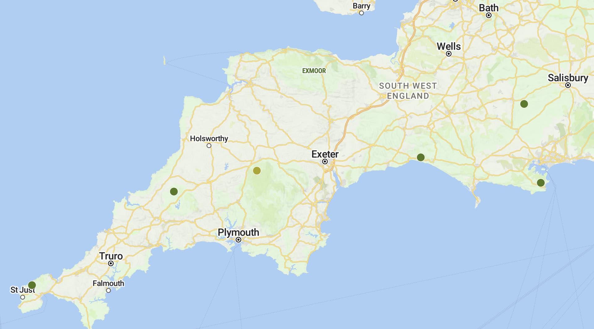
15 September 2024: Sunday - G/SC-004 Staple Hill and G/SC-002 Will’s Neck
We woke to a misty morning, getting some atmospheric sunrise views through the east facing patio doors of the holiday cottage. The forecast was for a generally dry day once the mist cleared but with a moderate amount of cloud, and possible light rain later. We couldn’t face the thought of driving the A39 again to do the two other summits near Minehead, so decided to do the two summits closest to the holiday cottage, where the main driving challenge was getting through Taunton.

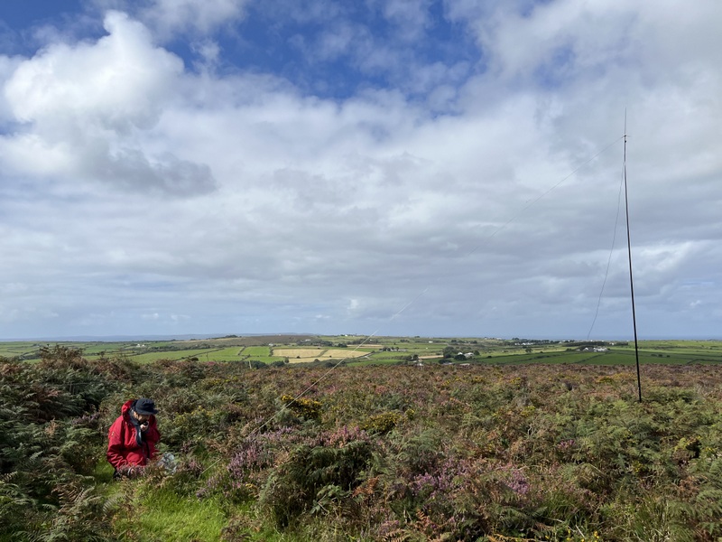
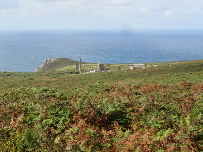
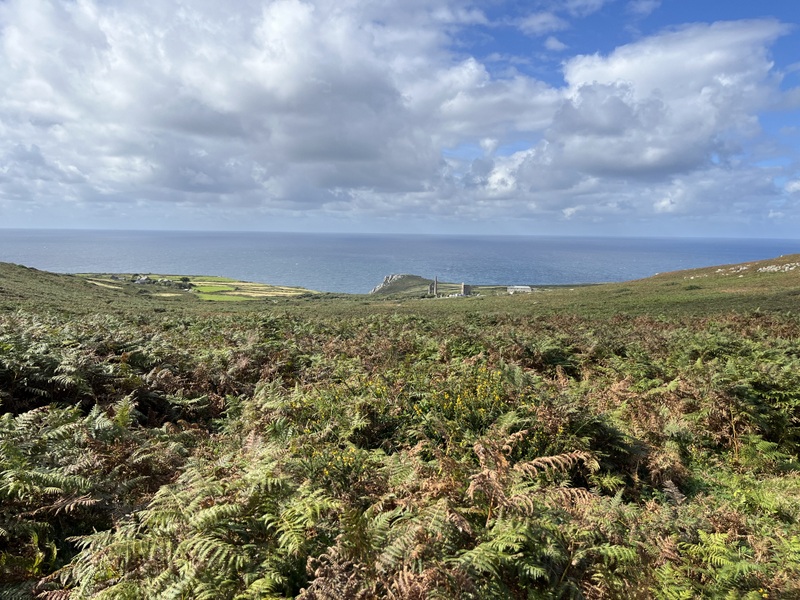
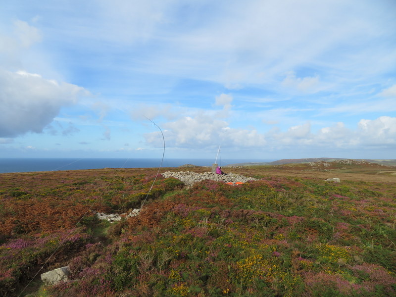
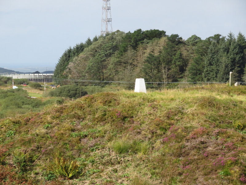
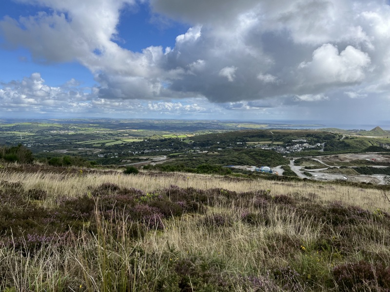
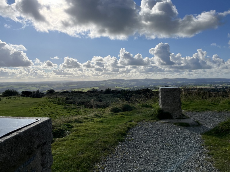
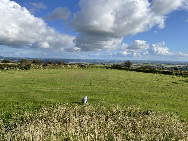
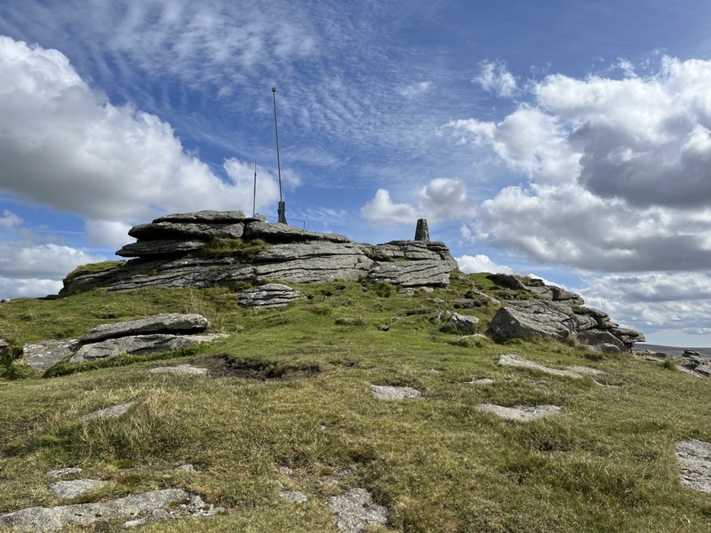
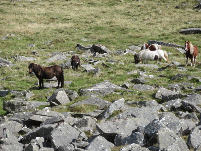
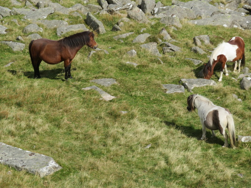
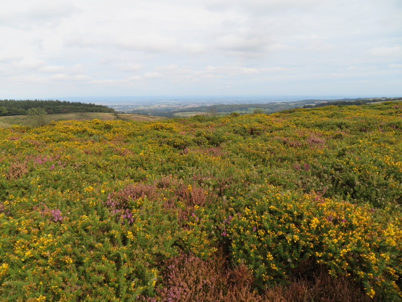
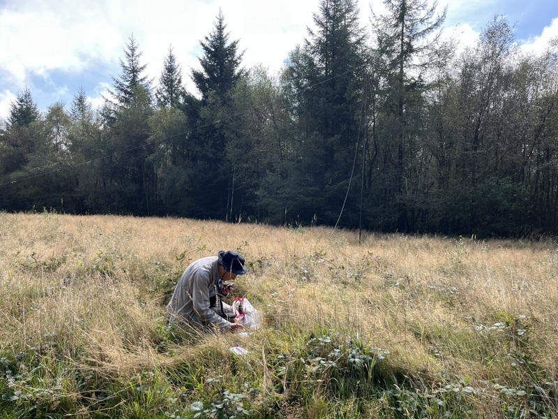
Our first target was Staple Hill G/SC-004 in the Blackdown Hills. We needed to drop the car antenna to get into the forestry parking, which was quite busy on a Sunday. The car park is in the activation area, but we wanted a walk and to be out of the way of people, so went in search of the trig point. It took us some time to find it well hidden in the trees. That done we retreated to the field we had spotted where the bridleway leaves the forested area. There were convenient fence posts to support the VHF antenna and plenty of space to spread out HF.


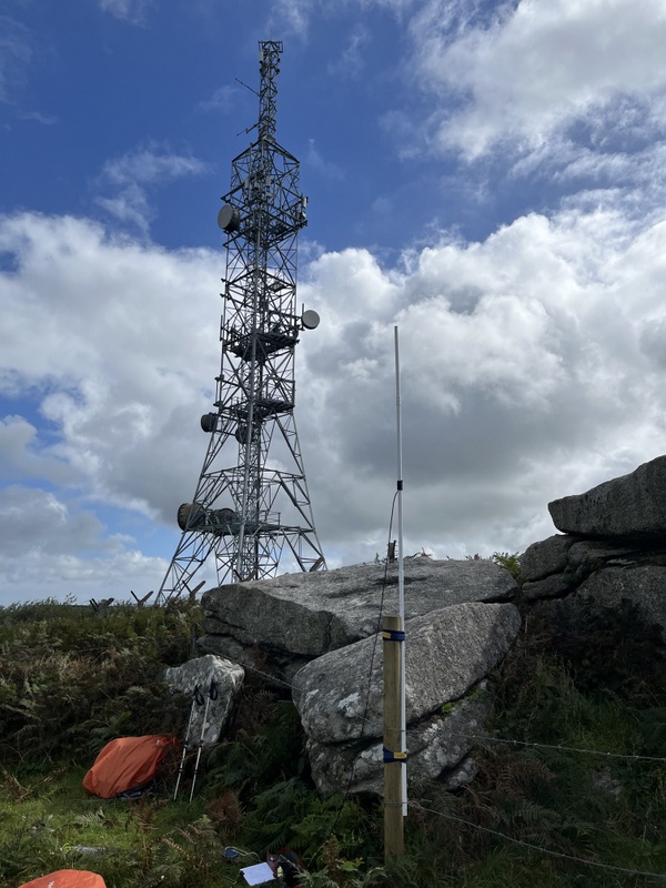
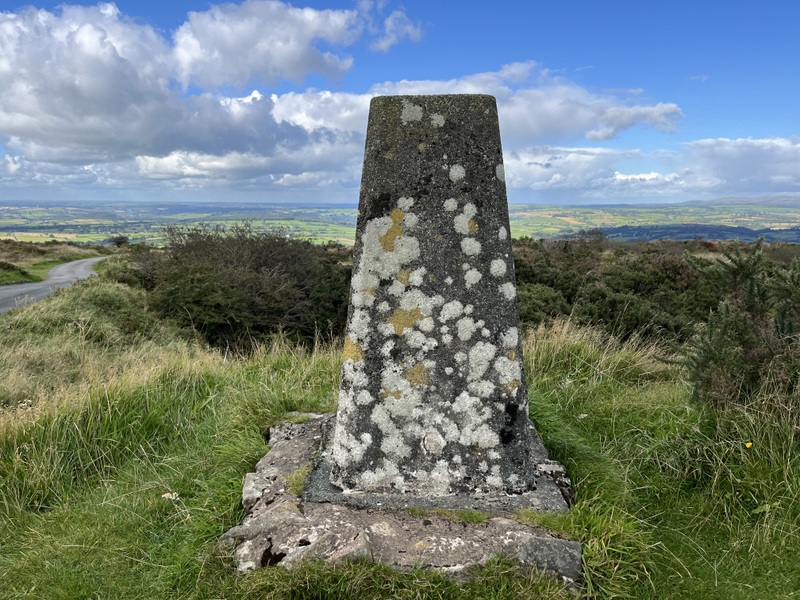
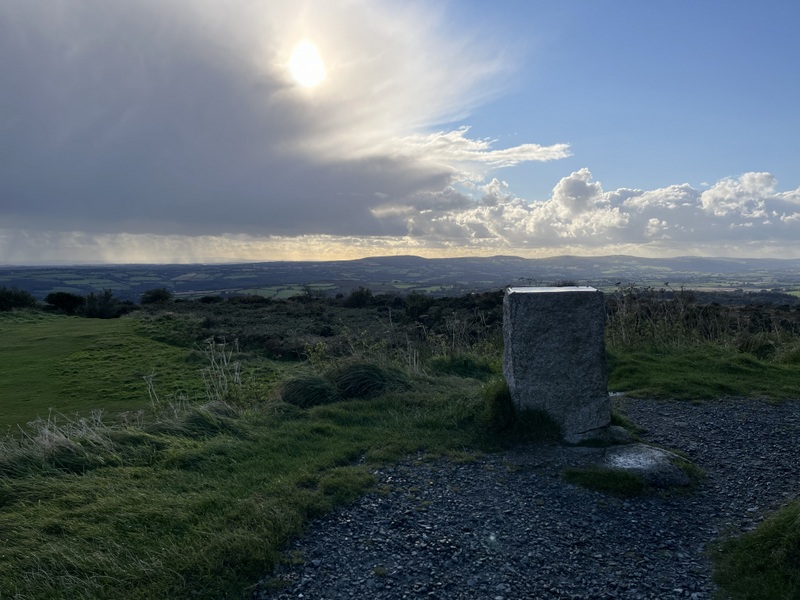
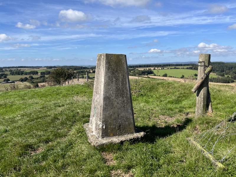
Staple Hill Trig point


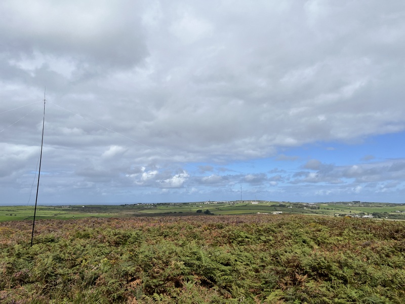
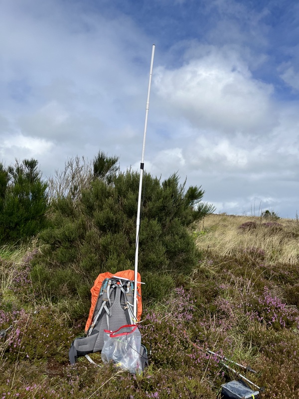
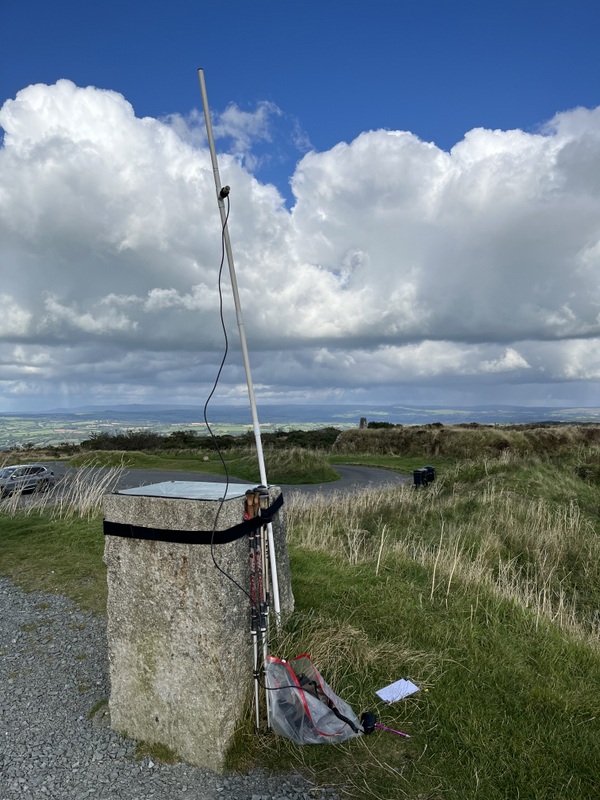
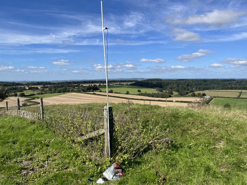
Staple Hill VHF setup


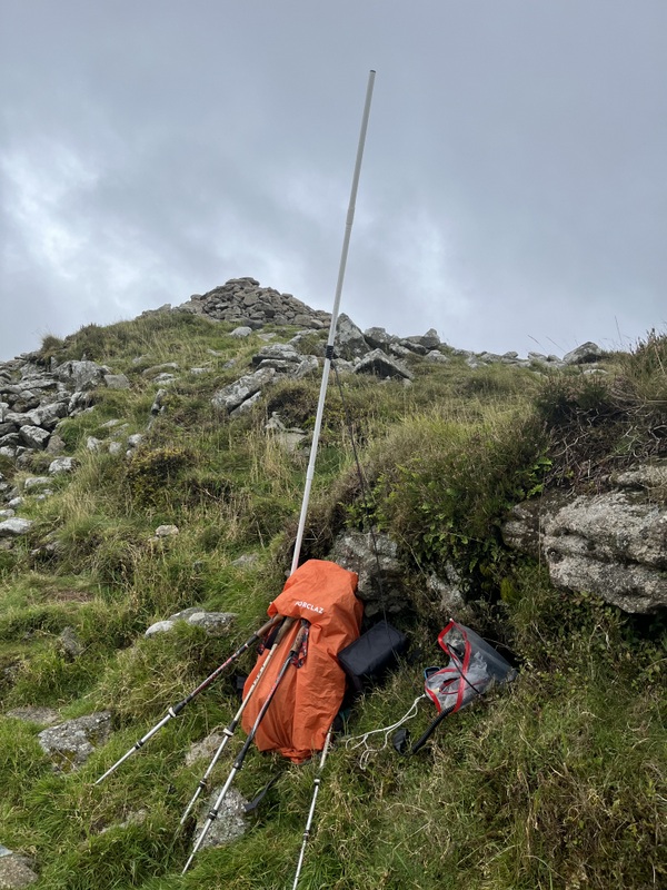
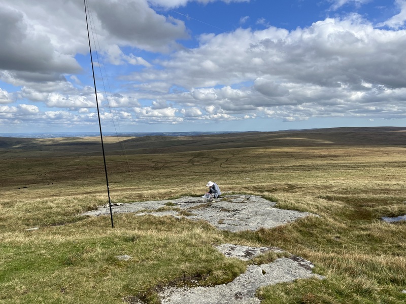
Staple Hill HF setup

Caroline struggled on VHF getting just one contact in 20 minutes calling. During that time Martyn qualified the hill with a quick run of 4 60m contacts, but that was all on 60m. A move to 40m brought a S2S for both of us. Finally Caroline managed a difficult 2nd 2m contact. In order to qualify the hill, Caroline moved to 40m for a run of 15 contacts. Martyn had eaten his lunch by the time 40m ran dry, so he took over HF on 20m while Caroline ate lunch with intermittent calls on 2m which finally got Caroline 2 more contacts, so the hill was qualified on 2m FM. 20m yielded 5 calls, 2 of them S2S for Martyn, only one of which also manged to work Caroline. Despite attempts, no 70cms contacts were made.

Having packed up, we were just about to leave the field when Caroline’s handheld sprang into life, enabling us both to work Matt M7MFS who was just setting up for his Sunday afternoon net. This was to prove a boon on our next summit. Caroline had planned a longer walk back to the car which would have taken us out of the activation area, but the forecast hinted at late afternoon rain, so we decided to go straight back to get to the next summit, Will’s Neck G/SC-002.

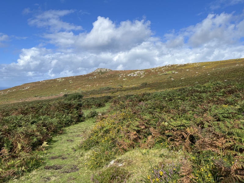
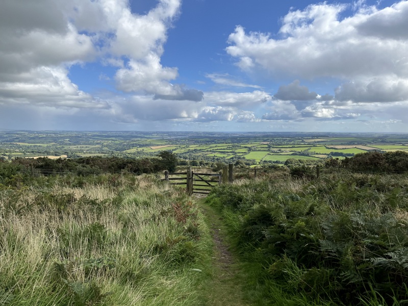
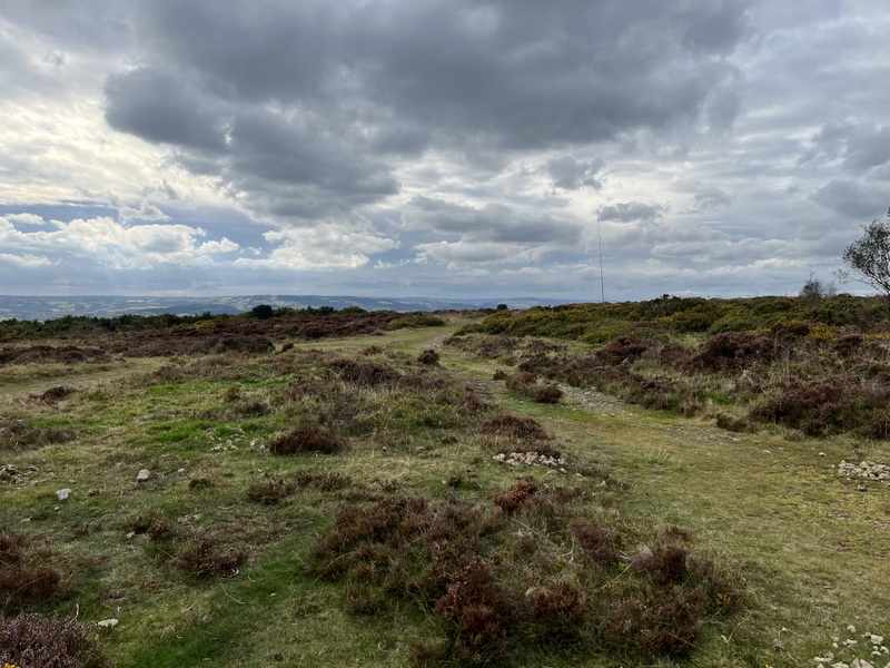
Back through Taunton we made our way to the Lydeard Hill Car Park, which was fairly full. We took the path going over the top of Lydeard Hill, getting nice views. We heard Richard @M1HAX calling from G/WB-013 Garway Hill, and managed to work him for the chaser points. We were still some way off the activation area of Will’s Neck for the S2S, but pushed on in the hope we could get the S2S before Richard had to leave. Catching our breath where we had crossed the 365 contour and were well into the activation area, we heard Richard working someone and saying his battery was dying, and then silence and no response to our calls :frowning:. A shame because Caroline also wanted to thank him for the route details he publishes, which we had used for some of our activations.


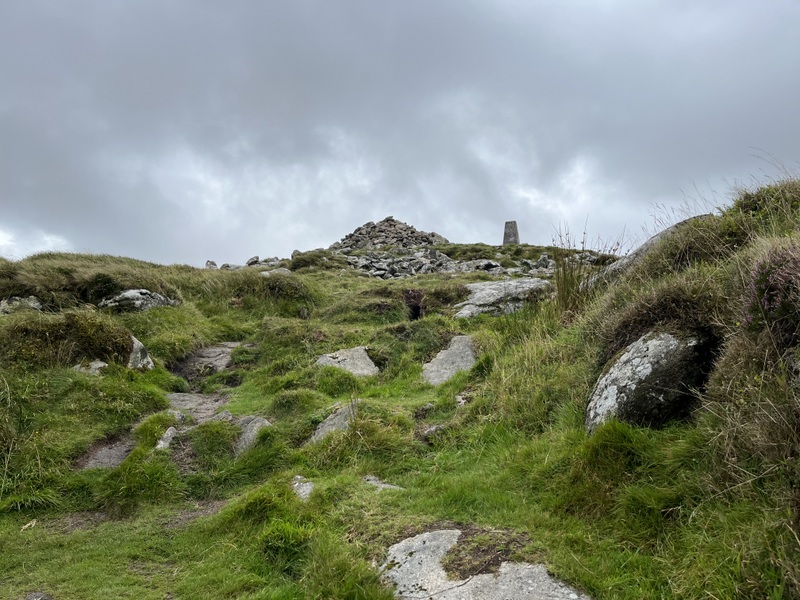
Lydeard Hill Ascending Wills Neck (trig visible in distance)


Ascending Wills Neck

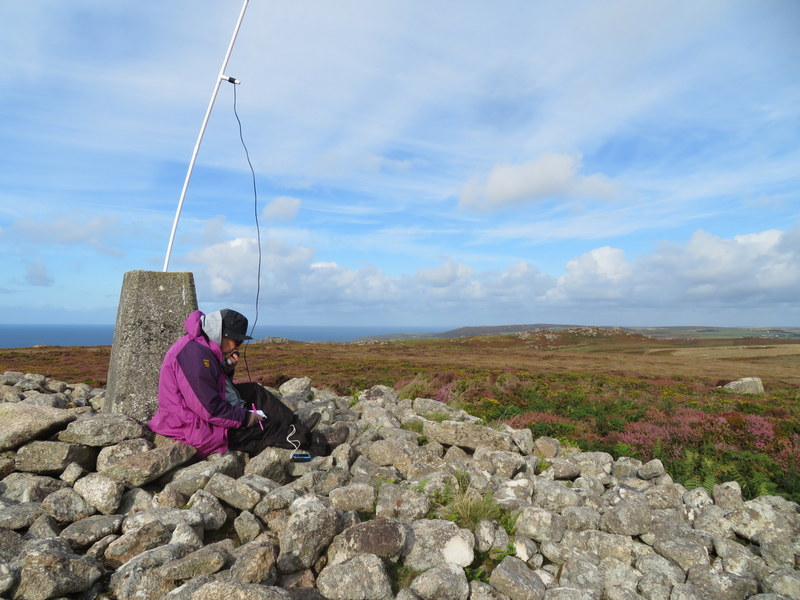
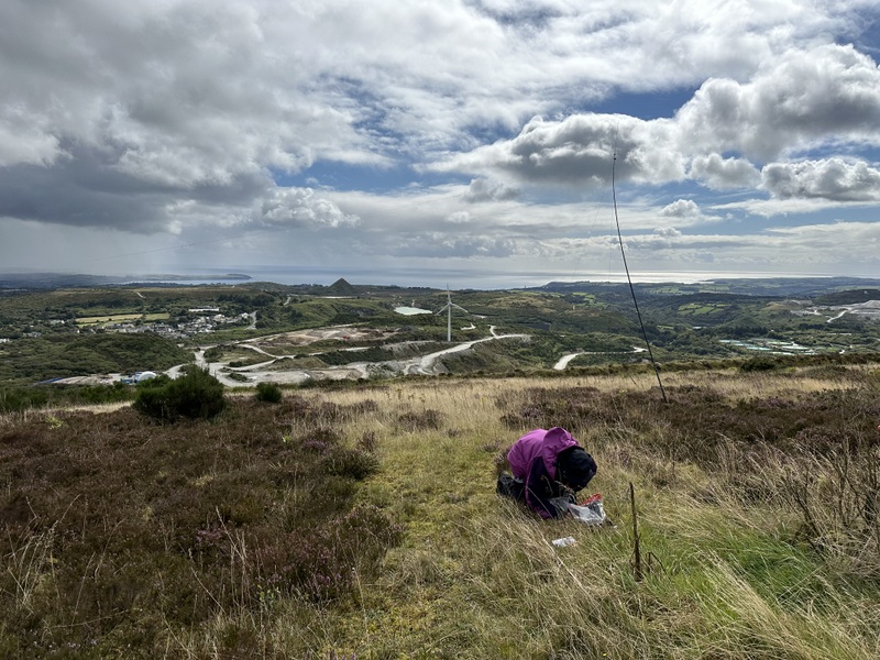
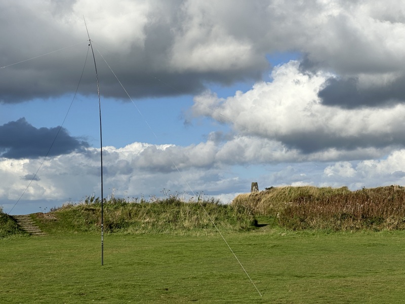
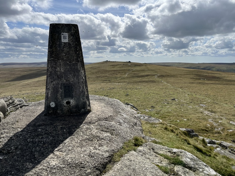
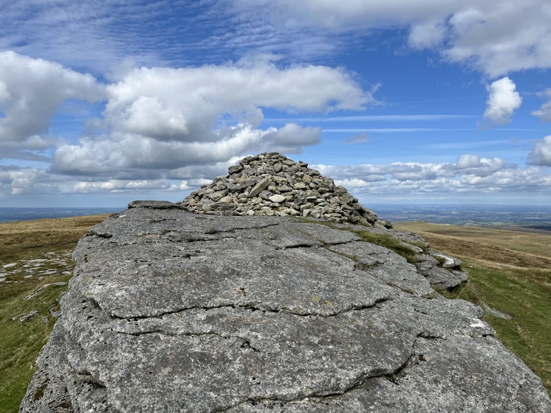
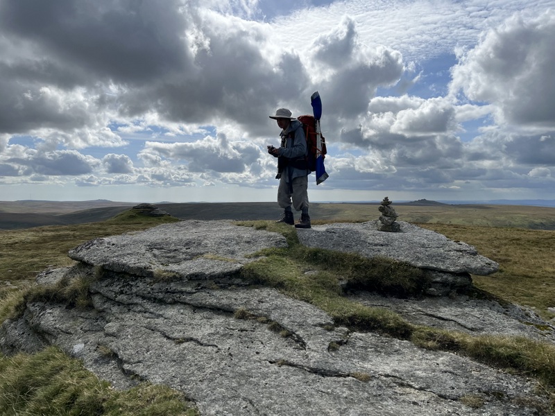
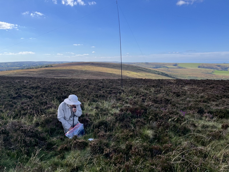
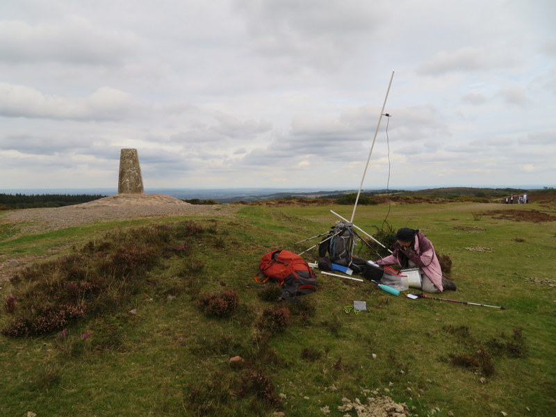
We continued to the summit at a more relaxed pace. It was busy, but not as busy as Dunkery. Caroline set up a short distance from the trig point, while Martyn was some way away on the edge of the heather to avoid the HF antenna crossing paths.


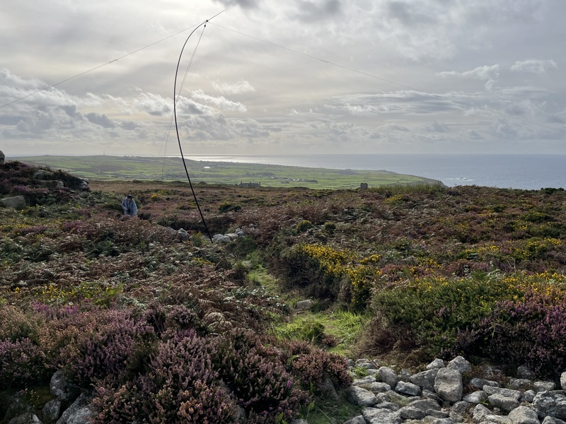
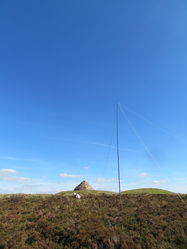
Will’s Neck: HF antenna in distance away from trig


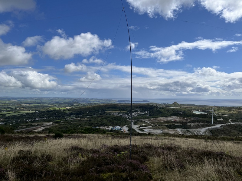
Will’s Neck: HF Setup


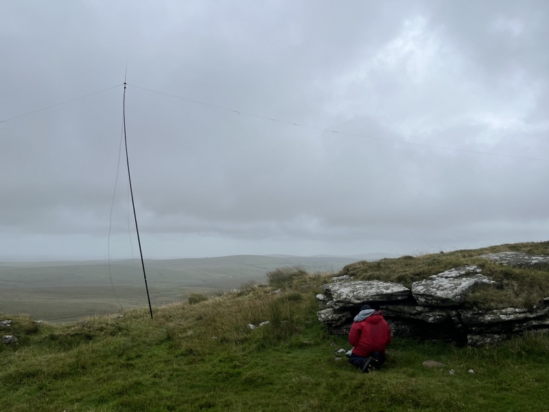
Will’s Neck: VHF /UHF Setup
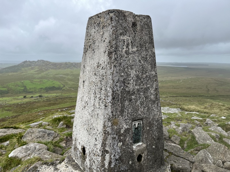
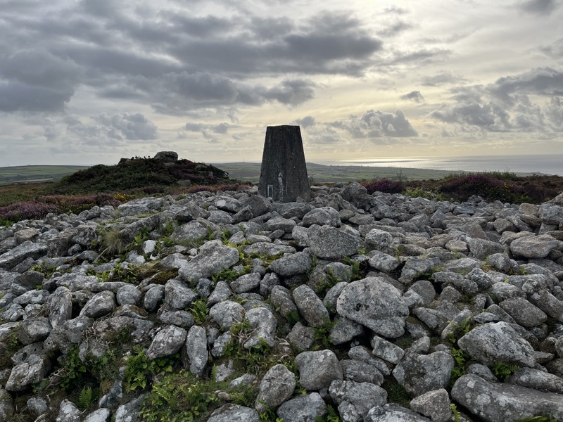
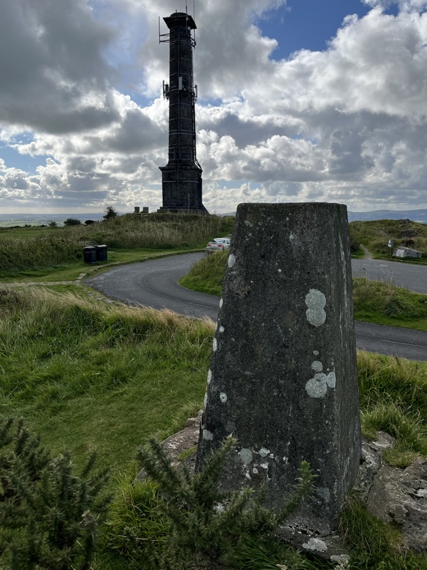
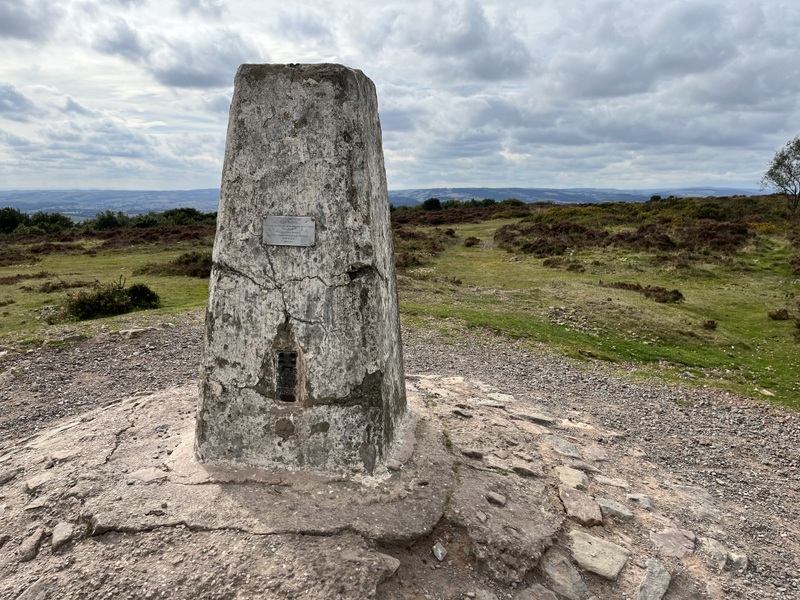
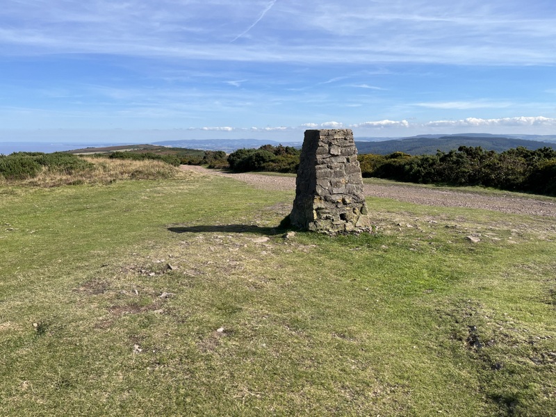
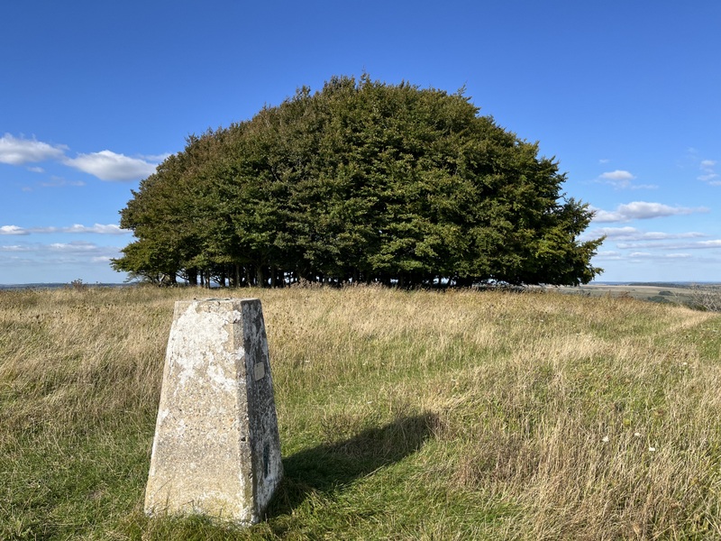

Will’s Neck: trig

VHF/UHF was much more fun here, with special thanks to the net organised by Matt M7MFS. Caroline first worked 4 of the net on 2m FM, and then Viki M6MBA popped up on G/SC-008 Win Green for an S2S. Of course both Viki and Caroline wanted a 70cms S2S, so we moved there out of the way of the 2m net. Some of the 2m net people followed us there and Caroline ended up with 7 70cms contacts. Further special thanks to Omar 2E0OMX who having worked Caroline on 2m from home, then popped up to Staple Hill G/SC-004 to give us both a 70cms S2S. It’s probably the first time Caroline has had two 70cms S2S from a summit, and probably Martyn’s first 70cms S2S (he only worked Viki on 2m). A return to 2m FM left Caroline with 15 2m contacts in total.

Meanwhile Martyn had qualified with 5 contacts on 60m, before moving to 40m for 9 contacts including an S2S with Rod M0JLA on Win Green. We finished with a difficult 40m S2S chase of a Swiss summit.

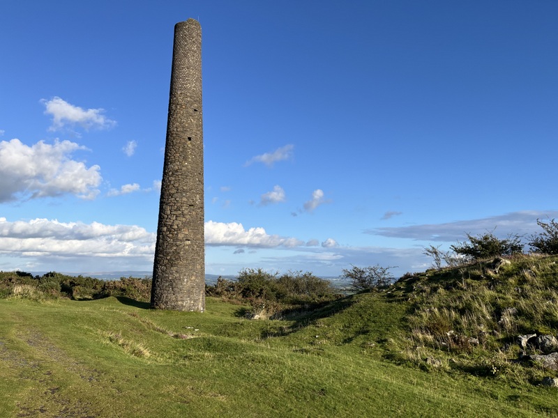
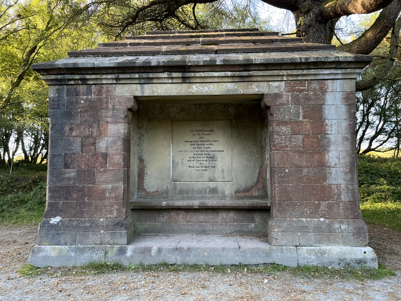
There was a still a hint of rain, but we decided to take a longer return route to look at the Triscombe Stone: a knobbly lump of stone believed to be a Bronze Age meeting point marker on the ancient tracks over the Quantock Hills. There were a few spots of rain but not enough to be troublesome, and it stopped by the time we got back to the car.


Triscombe Stone

6 Likes

Monday 16 September 2024: Periton Hill G/SC-006 and Selworthy Beacon G/SC-005

We woke to another misty morning, though not as fine a sunrise as the previous day. We would have to endure the drive along the A39 towards Minehead to do the two remaining G/SC summits west of our base for the week. Martyn volunteered to drive to reduce Caroline’s stress levels, and surprisingly the A39 traffic didn’t seem quite as bad on Monday as it had been on Saturday. It still took an hour and a quarter to get to the parking for Periton Hill G/SC-006 at SS963447.

We took the public footpath heading roughly SSW: pleasant walking through the forest to emerge into the access area on the ridge. We chose this approach to the summit, so that we could look out for possible activation spots along the ridge. The path ran along the edge of the forested area for much of the ridge, with younger trees and vegetation on the other side of the track. We spotted a couple of possible places to set up, but none were ideal, so we continued to the summit. This was a walk where we felt we were missing something - a dog - most other people we saw had one! Having been cloudy on the ascent the sun finally emerged.

Our brief initial exploration failed to find the trig point (which we expected to be hidden in trees), so we went a little further towards the true summit (nominally 2m higher than the trig, and also in trees). On the way we observed a grassier area where we could set up HF near the track. It was rather wet from overnight dew, but was the best we could find. The tree cover meant there was nowhere good for VHF operation, so Caroline set up near the track as far from trees as practical. Her efforts resulted in one 2m and one 70cms contact with the same station, but then silence.


Periton Hill stations.

Having just qualified the hill with 4 60m contacts, Martyn then handed HF over to Caroline for 40m. Before finding our own frequency, we chased a German summit for an S2S, after which Caroline had a run of 7 more contacts. Thin pickings, but with lunch eaten we decided against further HF bands as we hoped our second summit Selworthy Beacon G/SC-005 would offer better conditions. While Martyn was packing away the HF antenna Caroline went and found the trig point in the trees: closer to the track running north of the true summit than the one we were on to the south. We took a slightly shorter bridleway back to the car, which seemed to have better views than the ridge path.


Periton Hill trig point


Descending Periton Hill

It was now turning into a nice sunny day, and we decided to walk up from Selworthy village rather than one of the car parks along the ridge. It was disconcerting to note multiple cars parked inconsiderately in passing places on the twisty single track road into Selworthy, but when we got to the relatively small church car park there were some free spaces. Putting a pound in the honesty box, we headed through the pleasantly wooded Selworthy Combe to emerge onto the heathland. We were now getting warm under almost clear blue skies: a lovely day, and we got views over the Bristol channel to South Wales and back to Dunkery Beacon and Periton Hill. Crossing the road that goes to the top car park we made our way to the Selworthy Beacon trig point.


Selworthy Beacon


Selworthy Beacon


Selworthy Beacon looking towards Dunkery Beacon

Despite the nice weather there weren’t a lot of people around, but Caroline set up VHF a little way away from the trig point, while Martyn found a grassy spot among the gorse and heather a little way down the hill. As expected, this was a much better position for VHF/UHF and Caroline quickly got 4 2m FM and 3 70cms FM contacts from both South Wales and SW England. 60m was also working reasonably well for Martyn with 6 contacts. Caroline then had a run of 8 contacts on 40m. When they dried up, Martyn took over HF for 5 20m contacts while Caroline returned to 2m/70cms to look for the elusive 4th 70cms contact: success – another 4 2m FM contacts and 3 on 70cms. So between us we had qualified the hill on 5 bands.


Selworthy Beacon HF looking over Bristol Channel towards South Wales


Selworthy Beacon VHF/UHF


Selworthy Beacon, both stations


Selworthy Beacon, both stations

It was lovely at the summit, and it would have been nice to have stayed longer and/or explored more, but we still had the drive back along the A39 after descending the hill. So we descended via the Memorial Hut and Holincote Combe and back to Selworthy through the woods. As we approached Selworthy, Martyn noticed the waist bag he uses to carry compass etc didn’t feel right: the strap had suddenly and unexpectedly parted from the body: he had had it for years, but it hadn’t shown any sign of imminent failure. One of several things to break this holiday!


Memorial Hut

6 Likes

Tuesday 17 September 2024: G/SC-007 Long Knoll and G/SC-008 Win Green

Having done the summits close to our base and west of it, it was now time to head east for our next two uniques: G/SC-007 Long Knoll and G/SC-008 Win Green. Having read various reports of the potentially hazardous parking/walking on the B3092 for Long Knoll, we looked for alternatives. As National Trust members we considered using the parking at Stourhead, but that would require a longer walk, which would probably not leave time for Win Green. Scanning Streetview suggested it might be possible to park on the road leading to Kilmington church. An hour’s drive and we were by the church, turning round to park tight against the wall to leave space for agricultural vehicles to get through to the farm beyond.

Back to the crossroads we headed north along Butts Lane. Spotting a public footpath sign hidden in a hedge we took it to cut off a corner of road walking. If repeating the walk, we would stick to the road! The first field was grazed and a bit muddy, but no serious problems once we were over a rickety stile. The problems came at the next field boundary, where the path entered an area of overhanging bushes, with an even more decomposing and high stile. We eventually struggled our way through. The next field had been relatively recently harvested which was a good thing, as there was no sign that there had ever been a discernible path through the crop. At the Coker’s Lane track we turned left past Homestalls looking for a footpath on the right. At this point we realised there was a discrepancy between Caroline’s printed map (recently printed from OSmaps) and Martyn’s Memory-Map for All on a phone, with the path on different sides of a boundary. A note on the finger post said the path had been diverted, and it looked like the printed map was right, with the path to the right of the boundary.

Our next problem was as we approached the edge of the access area. The map implied the path entered the access area in the corner, but although there were signs there had once been a path it was too overgrown. We retreated and continued on the path skirting the access area, and soon spotted a stile. It was then just up: 55m of ascent in 200m! The trig point appeared with fine views all round.


Long Knoll views

There were convenient fence posts to support the VHF antenna, though Caroline avoided the two closest to the trig as wasps seemed rather interested in them. Caroline got three 2m FM contacts reasonably quickly, but QSYing to 70cms failed, and it went quiet for a bit. Then a few more came in, some of whom could also work 70cms. In over an hour and a half operating she got 13 2m FM contacts and 5 70cms. Best 2m DX was Aberdare in South Wales.

Meanwhile Martyn had set up HF running along the ridge on the opposite side of the fence to the path. A surprising number of people walked by while we were up there. 60m on produced 3 contacts, but a move to 40m got 8 more, including a S2S for both of us with Paul on G/SB-007 Tosson Hill.


VHF/UHF setup


VHF/UHF setup


HF setup

We took a longer but less awkward return, retracing our steps towards Homestalls and then taking the Coker’s Lane byway south to the Harepit Lane track which took us back west towards the car. A pleasant walk with just a few rutted muddy sections on Harepit Lane. We recommend the parking and basic route: just avoid the footpath and don’t try to enter the access area in the corner!

Back at the car and then a 40 minute drive to the activation area parking for Win Green. There were a moderate number of cars in the car park, and most of the people we saw on the hill had dogs. We took the slightly ascending path towards the rounded summit thicket and nearby trig point. Most people seemed more interested in the toposcope than the trig point, so Caroline propped her VHF antenna against the trig point, while Martyn used a grassy area away from the main paths for HF.


Win Green Toposcope


Win Green trig point and rounded thicket


VHF/UHF station


HF station

Caroline’s 2m FM CQs were answered within a couple of minutes, and a QSY to 70cms brought a run of 4 contacts, so the hill was first qualified for her on 70cms – a rare occurrence. A return to 2m FM brought 4 more contacts but that was it for FM. Meanwhile Martyn had qualified the hill with 4 60m contacts, followed by 5 on 20m. We then swapped stations for Caroline to have a run of 13 on 40m. Meanwhile Martyn had reconfigured the VHF dipole horizontally, and was pleased to make a single 2m SSB contact.

It was a lovely late afternoon, but with the hill qualified on 5 bands, it was time to pack up as we still had a 1 hour 15 minute drive back to base. We had a little walk beyond the summit after packing up, but not enough to drop out of the activation area!


Low sun over Win Green.

8 Likes

I’ve thoroughly enjoyed reading your reports, especially those for G/SC which I visited last year. It was fun looking at some of the photos such as the Long Knoll trig point and remembering I activated in exactly the same spot. It is of course a Bond summit so I hope you dressed appropriately! :slight_smile:
Many thanks!

2 Likes

Hi M1MAJ & @M3ZCB, some great writeups here, well done :slight_smile: Thanks for the QSOs.

Sorry I missed you for the S2S with G/WB-013 Garway Hill, I was having some issues with my power supply so had to call it quits, as you suspected. My main LiFePo4 battery is about 5 years old now having been used for some 4000+ QSOs - clearly the time has come for it to be replaced…!

Glad you enjoy my blog, always a pleasure to hear people find it useful. I still have a good 100+ hills to write up, but it’s always a bit of a challenge as I’m not much of a writer. I’ll get there eventually.

73!

3 Likes

I remember parking at the bottom of the track at the dangerous location. Before leaving the parking spot I wound my window down and listened intently, letting a couple of vehicles pass so I could assess how close they would be when I first heard them. When I could hear no vehicles, it was foot on accelerator and a rapid sprint up the road… and a sigh of relief! It’s a pity that that parking spot requires such measures as the route up the hill is simple from there.

It has been interesting to read of the different approaches that you took to the hills in the DC and SC areas. Nevertheless, your reports have evoked strong memories of hills that I really enjoyed. Many thanks for that. Most enjoyable reading. :smiley:

73, Gerald

4 Likes