SOTA trip to G/DC and G/SC

Don’t sell yourself short! I really like the style of your blog, with lots of clear and consicse information. I’ve found it really helps give a sense of what to expect when planning to activate a summit that is new to me. Thanks for all the work you put into it.

The recommended technique for that parking spot! Definitely a hold your breath moment!

5 Likes

Just the normal walking gear! We wondered if we would get an extra badge for working a Bond summit (G/SB-007) S2S, but we haven’t got round to submitting the logs yet to find out!

The blog together with the routes on sotamaps have been very useful. I hope my reports are useful for those who follow, though that’s more likely when we’re doing rarer summits than these.

3 Likes

Wednesday 18 September 2024: G/SC-011 Hardown Hill and G/SC-009 Lewesdon Hill

Having been west and east from our base, this was the day to head south. We had previously activated both G/SC-011 Hardown Hill and G/SC-009 Lewesdon Hill, but for different reasons ended up using different routes from previously which wasn’t entirely successful, and there were radio problems too.

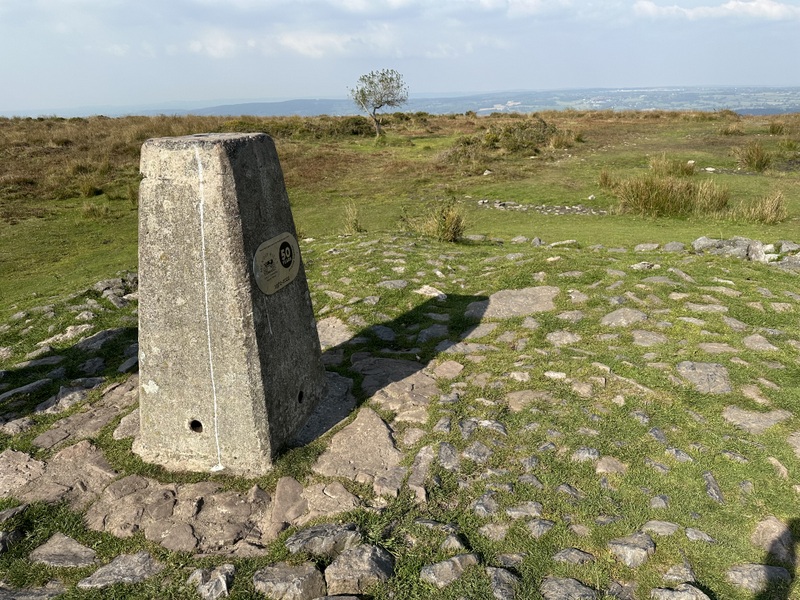
It took 1 hour 20 minutes to get to Morecombelake, not helped by roadworks on the A35. Previously we had parked in a layby on the A35 in Morecombelake and ascended from the southwest, but the layby was fully occupied so we needed an alternative. There is parking just after the minor road to Ryall leaves the A35, but it’s residents only, so we carried onto towards Ryall, finding a muddy pull at SY408943. There was already one car there but just room for us to squeeze in too. A short distance up the road and we found a footpath leading up through woods, before eventually emerging onto a narrow path on the heathland that covers the summit. The path led to the main footpath track that runs north south over the summit, and turned south. The summit is fairly flat, and the true summit is in the vegetation, so we continued to a junction where there was a seat.

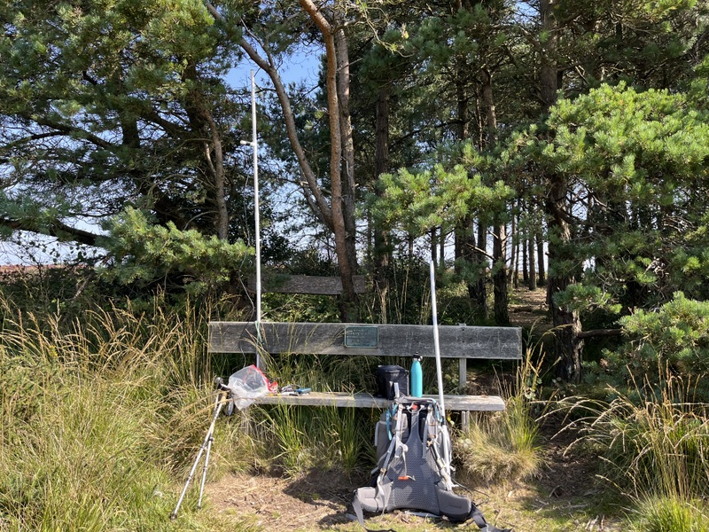
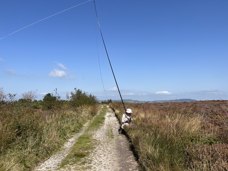
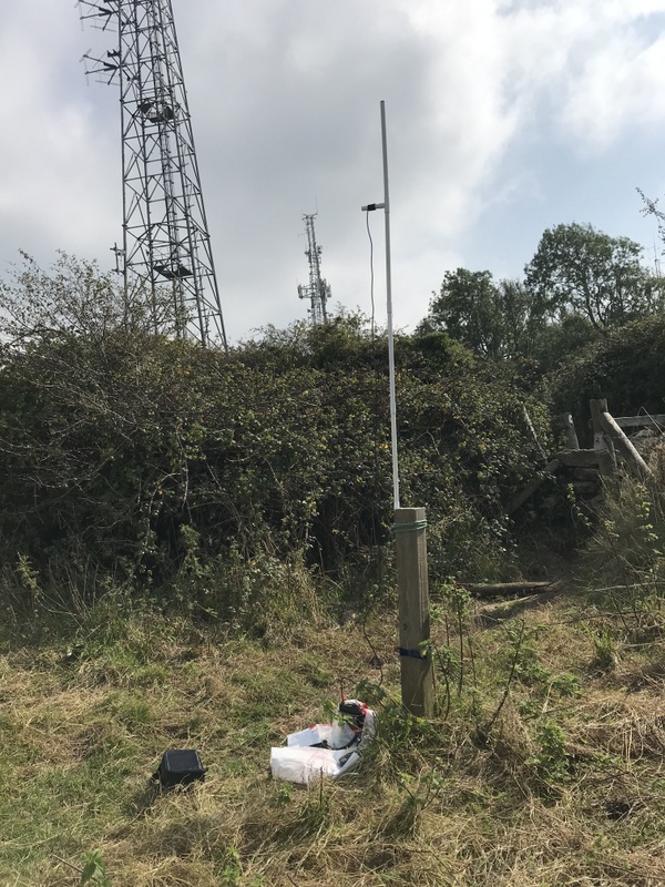
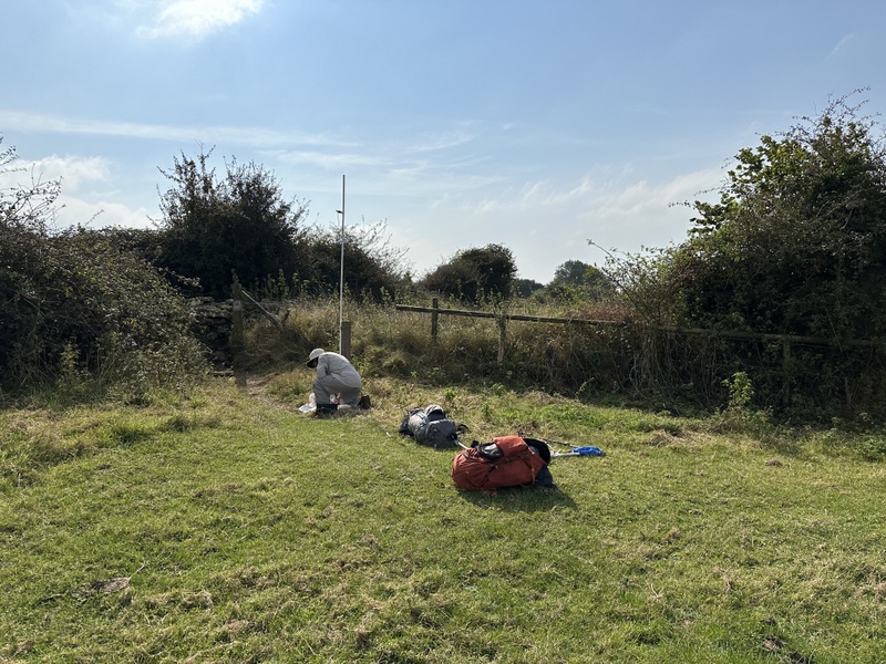
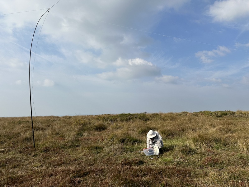
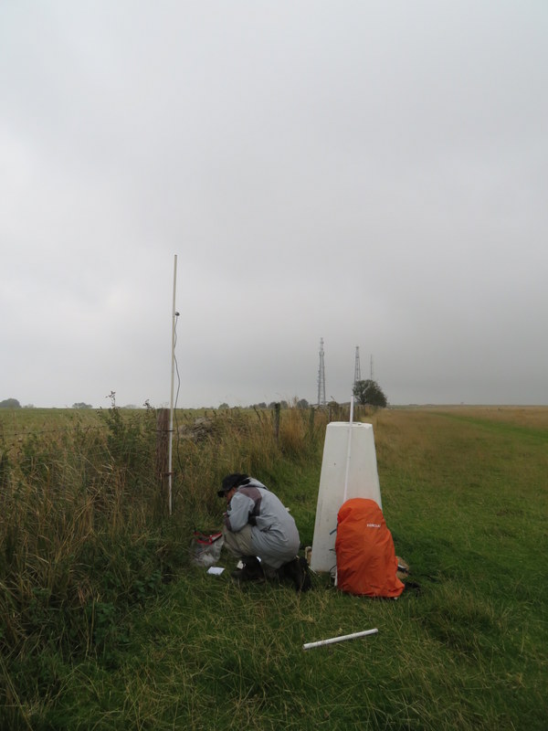
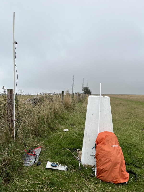
Caroline set up VHF by the seat, being close to the trees probably wasn’t ideal, but off the path the heath was a mixture of heather and gorse: pretty but not good for spreading out an antenna. Initial 2m FM calls got one contact, another 10 minutes and a second 2m FM contact who was also worked on 70cms, but then nothing. Meanwhile Martyn was struggling to get the HF antenna up. The gorse and heather made it difficult to peg out the dipole, so he ended up with a fairly linear setup along the track, but the wind wasn’t right, and the pole kept falling over. He ended up working 4 stations on 60m while holding the pole between his legs. With the summit qualified for him, we contrived a slightly better support for the pole to enable Caroline to have a run on 40m to qualify the hill. The 18 contacts included a difficult S2S which Martyn also managed: made slightly easier in that the person chasing could hear us better than we could hear him, so it took several goes to get his details, but he easily heard the request to work a second operator!


Hardown Hill VHF/UHF


Hardown Hill: awkward HF


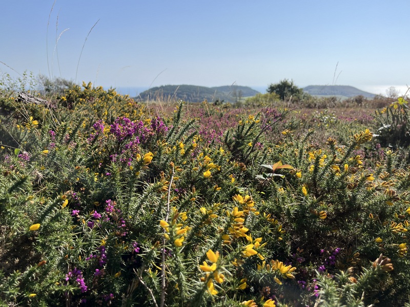
Hardown Hill: some of the lower prettier gorse and heather


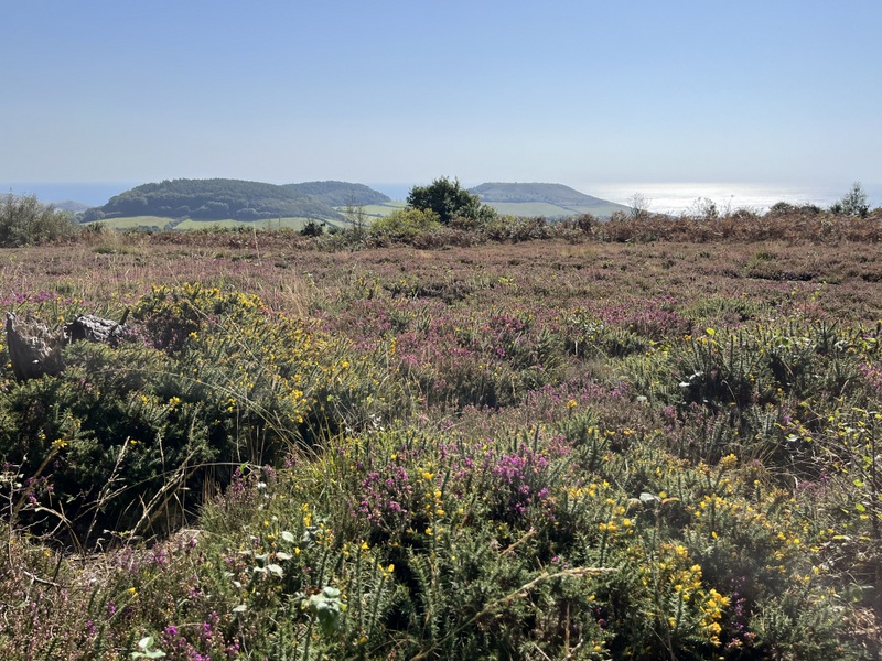
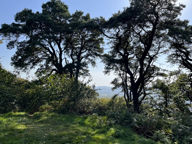
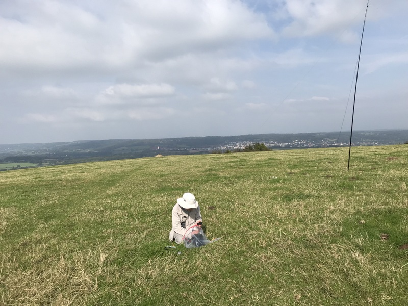
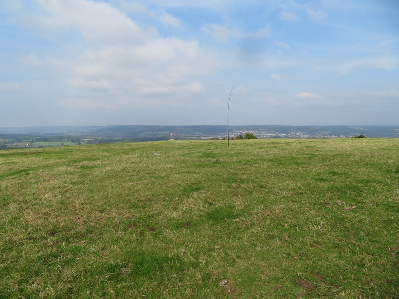
Hardown Hill towards the coast

With lunch eaten it was time to descend. The map showed paths through the access area which would give a circular return, and it all started well with a path over the heathland with good views towards the coast. However as soon as the path started to descend it narrowed with high gorse either side. We abandoned a couple of paths heading in the wrong direction, but after passing through an area where it looked like some had been through with a machete the mapped path got narrower and narrower. Having been getting hot in the sun at the summit, Caroline had taken off her jacket and was walking in shirtsleeves. This proved to be a mistake as the gorse closed in to the point where Caroline deemed the path to have disappeared. Somehow Martyn got in front and said there was a path, and there was some sign of one at ground level, but we were now pushing through head high gorse on both sides: painful, with spots of blood now appearing on Caroline’s shirt. Reading the GPS Martyn claimed it wasn’t far to the mapped public footpath track, so we persisted, but a couple of hundred metres feels a long way in that terrain. Eventually the public footpath appeared: a perceptible path, though with some low hanging tree branches to catch poles. It was with relief we met the road to walk back up to the car. Definitely a dis-recommended route! In retrospect, we should have either retraced our outbound route, which wasn’t as bad, or taken the track south to the A35 (used on the previous ascent) and walked back along the A35 and Ryall road!

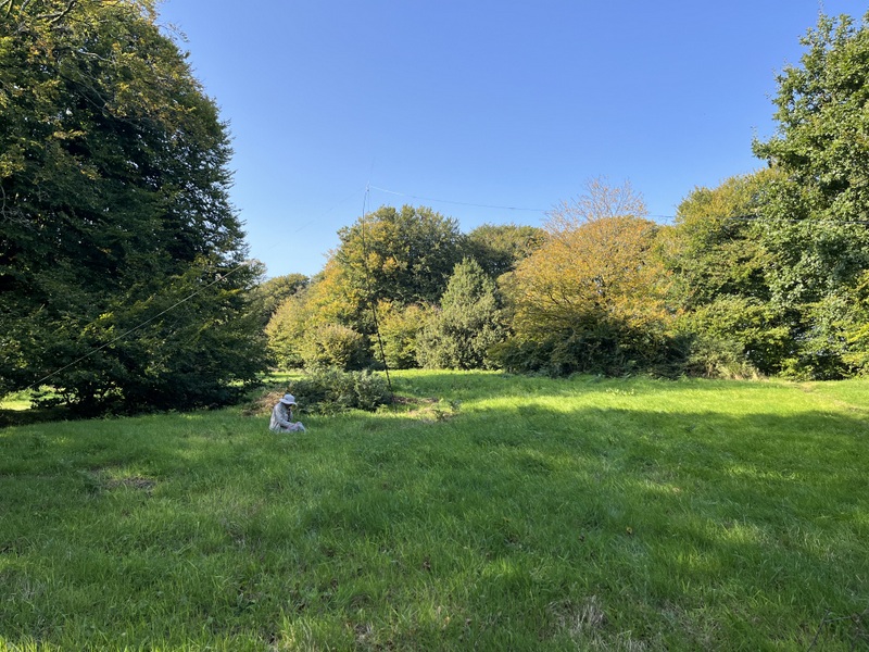
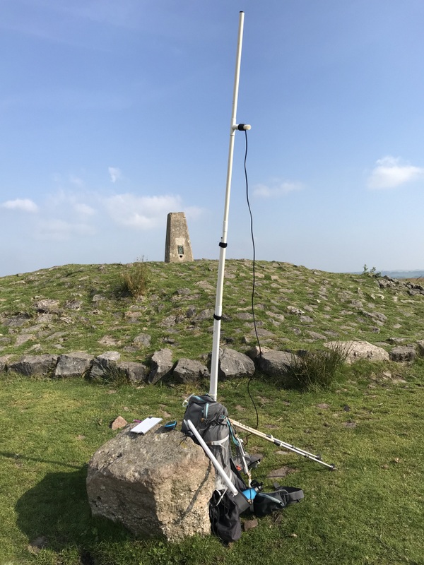
We now had a 20 minute drive to the parking for Lewesdon Hill. On the previous occasion we had approached from the west, from some sub-optimal parking on the B3164, which had been a nice walk, but we weren’t keen to risk the parking again. This time we parked on the rough area off the B3162 at Bucks Head to approach from the south. This time the alternative parking and the there and back walk were all good. The bridleway heads west along a track before branching to take a bridleway heading north through a pleasant wooded area, becoming increasingly steep once in the access area. Leaving the trees the ground suddenly flattens out revealing the grassy summit with scattered trees, with plenty of room for HF.


Lewesdon Hill view through the trees
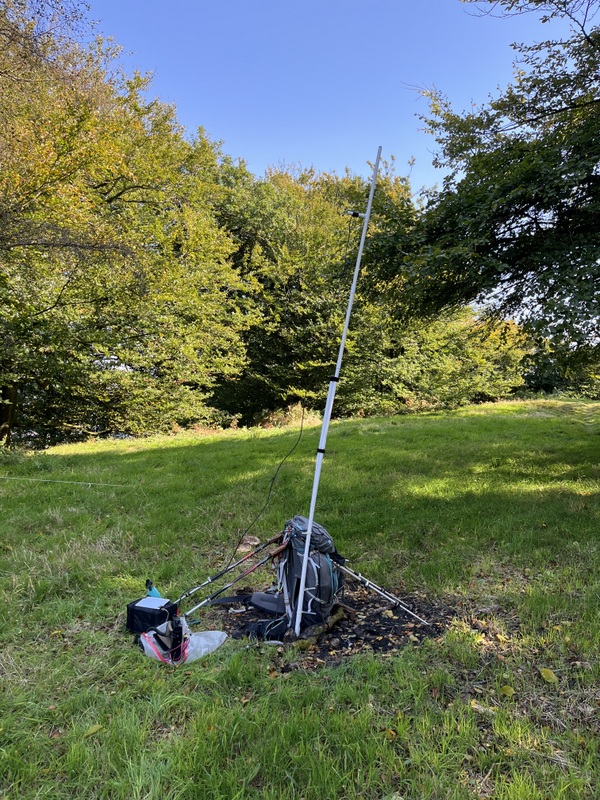

Lewesdon Hill HF


Lewesdon Hill VHF


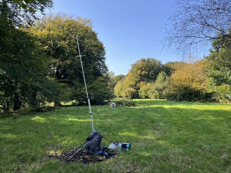
Lewesdon Hill both stations

It was less obvious where to setup VHF, so Caroline tried to find a spot with paths/views through the trees edging the summit, propping the VHF dipole up against the rucksack with walking poles. 20 minutes of calling on 2m FM and nothing. Caroline was getting desperate, so she tried 70cm FM calling channel, not really expecting anything as few people seem to listen there. 2 calls and M0UAC/M came back 59 both ways from Babbacombe seafront. We had a chat about the lack of 70cms activity, and he remarked he listened on both 2m and 70cms when using a dual receive handheld (as Caroline does when walking to and from hills). So why hadn’t he heard Caroline’s 2m calls? Let’s QSY to 2m. Caroline calls on 2m, but he’s clearly not hearing her. Suspecting the FT-817 has a fault Caroline turns it off and swaps the antenna to the Kenwood TH-F7E handheld, and we have contact! Sticking with the handheld Caroline makes two more 2m FM contacts both of whom were able to QSY to 70cms. So now Caroline has 3 contacts on 2m FM and 70cms but still needs one more to qualify.

Meanwhile Martyn has found 60m hard going, getting only 2 contacts. He comes over while Caroline is still talking to M0UAC to ask if she’ll need HF, yes, but she wants to work out what’s going on with her radio first. Martyn goes back to HF to scan 40m answering other stations CQs to get 4 more contacts and the hill qualified for him. With VHF/UHF having dried up Caroline moves to 40m for a run of 19 contacts. We decide we have time for Martyn to try 20m, getting 8 contacts.

Caroline returns to VHF and gets two more contacts on 2m FM on the handheld but sadly no 4th 70cms contact. She powers the FT-187 back up and reattaches the dipole. We have suspected an intermittent fault on transmit for some time, but it’s probably over a year since last seen. One of the symptoms, other than nobody coming back to her, is that when in this state the FT-817 shows nothing on the SWR meter, but with the 2m dipole it often gets a low SWR normally. The SWR meter does flicker, but there is no response to calls, but that’s probably just nobody else listening in range. The incident has taught us something: previously we hadn’t tried other bands, but it looks like the fault is just on 2m transmit, since 70cms was working fine (and 70cms into the 2m dipole always has a noticeable SWR).

It had been a glorious sunny day, so enjoyable apart from the descent of Hardown Hill!

6 Likes

Thursday 19 September 2024: G/SC-010 Dundry Down and G/SC-003 Beacon Batch

Having been west, east and south, it was now time to head north to activate our last remaining G/SC unique G/SC-010 Dundry Down, and re-activate G/SC-003 Beacon Batch. The day had started misty, but this was forecast to clear to leave a dry bright day, which it eventually did.

Traffic on the A38 was heavy and it was almost 11:00 before we arrived at the Dundry Down car park, which was about half full. We’re not keen on summits where parking is within the activation area, but there’s not a lot of other options nearby. We didn’t bother trying to find the 233m trig point near the scrap yard as there didn’t look to be anywhere suitable to setup there. Instead we took the footpath leading to the access area to the northwest of the summit. A large area at the top of the sloping field is above the 215m contour so well within the activation area. There were misty views, and it was a pleasant spot to setup.

There was a convenient post near the stile which Caroline used to support the VHF antenna, while Martyn moved further from the entrance to avoid the paths used by occasional dog walkers. Caroline’s FT-817 was working on 2m FM today, and she worked 7 stations on 2m FM and 7 on 70cms over an hour and a quarter. Most were in the Bristol area or North Somerset, with 6 being worked on both bands. On asking Grant G4ILI in Cheltenham if he could do 70 cms, he replied yes, but only horizontal - no problem - Caroline flipped the dipole horizontal, and once we had his beam and the dipole lined up 70cm FM reports were as good as on 2m. The next station followed on 70cms FM before Caroline had reverted the antenna, being 59+ even with cross polarisation, but he was in South Bristol!

As usual Martyn started on 60m, but only got 3 before changing to 40m to chase Darious M0KCB on G/LD-048, calling Caroline over for the S2S. At that point Caroline had qualified with 4 each on 2m and 70cms, so Martyn found his own frequency on 40m and had a good run of 21 more contacts, including S2S with Andy MM0FMF on GM/SS-001 and Mal GW6OVD and Ian 2W0IWN on GW/SW-017. Caroline grabbed all 4 S2S, realising she had qualified the hill on 40m solely with S2S.


Dundry Down VHF station with 2 or three fixed antenna towers in background. Surprisingly no need to use VHF bandpass filter, so UHF also possible.


Dundry Down VHF station


Dundry Down HF station


Dundry Down HF station

A short walk back to the car and a 20 minute drive and we were at the parking for Beacon Batch on the bend of the B3134. We used a similar route to our previous activation, south on road and bridleway to the point where the access area widens out. There are multiple paths here which will lead to the summit, we took a more easterly one on the ascent and returned further west.

Despite the car park being fairly full there weren’t many people in the summit area. The trig point sits in the middle of a stony and grassy mound. Caroline setup VHF on the grassy area surrounding the mound, while Martyn ventured into the rough heathery and longer grass surrounds for HF.

The FT-817 seemed to be working well, despite sometimes not indicating any SWR on 2m FM. Over 45 minutes Caroline got 5 2m FM and 5 70cms FM contacts: 3 stations being worked on both bands, 2 of which had also been worked on Dundry. Best 2m FM DX was Bridgend.

Meanwhile Martyn had moved to 40m after a single 60m contact. 40m was still working well, so he had a run of 21 contacts. When that dried up Caroline moved to HF to try 20m getting 8 contacts. Having lost her 20m frequency, she had a go at 10m, getting just 2 contacts. As we ere about to pack up HF, a French station was spotted on 20m, so a quick change of the links and Caroline worked him S2S. Unfortunately her request for him to work Martyn was drowned out by other chasers and Martyn wasn’t able to make the S2S. Final calls on 2m added one more contact for Caroline.


Lone tree on ascent Beacon Batch


Beacon Batch


Beacon Batch


Beacon Batch HF station


Beacon Batch VHF/UHF station

8 Likes

Oh you did well to avoid it. I wanted the Marilyn “bag” so scrambled over the dumped rubble etc. to locate it. I would never go back!

2 Likes

Having read bad things about Dundry Down we were pleasantly surprised to find a nice area in the access land to set up. One we might even repeat if in the area.

And now the final activation report.

20 September 2024: G/CE-001 Cleeve Hill

The forecast was for a misty but dry morning with thunderstorms spreading from the east by lunchtime or early afternoon. We wanted to fit in an activation of G/CE-001 Cleeve Hill – the only G/CE we hadn’t activated – on our journey back from Somerset to the flatlands of East Anglia. But could we fit it in before the thunderstorms? We had hoped to ascend from parking at a lower level but given time constraints we would have to forgo our principles and aim for the summit car park.

Progress wasn’t helped by heavy traffic on the M5, and we managed to distract ourselves looking round the upmarket Gloucester Services, so it was just after noon when we pulled into the Cleeve Hill parking. It was dull and misty, but not raining, so we loaded up, prepared for wet weather and headed along the fence to the trig point, ascending all of 5m!

Caroline eyed up a fence post near the trig point, and then realised that someone had left a cable tie attached to it. So she used that post and cable tie, adding a bungee to support the 2m dipole. Caroline’s second CQ on 2m calling brought a response, QSYing to 70cms produced a run of three, a return to 2m another 2 contacts, one of which could also do 70cms, and the hill was qualified on both 2m and 70cms in under 10 minutes, with 3 stations worked on both 2m and 70cms. Another 10 minutes and a couple more 2m stations were worked, but then VHF/UHF went quiet.

There was plenty of space on the rough grassy area away from the fence for HF, the main hazard being the density of sheep droppings. 60m was, as often, poor, so after 2 contacts
Martyn moved to 40m which was in better shape. Over 25 minutes he got 21 contacts, including 3 S2S, the final 2 of which Caroline also got. By now we were hearing distant rumblings of thunder (but no sign of lightening or rain), and Martyn had heard some static crashes on the radio, so time to pack up.


Once packed up the clouds lifted a bit, so we extended our walk to the east, contriving to drop out of the activation area before returning to the car. Despite the continuing rumbles of thunder we still saw no lightening or rain while we ate a late lunch in the car.

10 Likes

Twinned with Tebay and Cairn Lodge so I can imagine they are better than most.

1 Like

That’s the only summit in the G/SC area that I haven’t activated… but looking at the map, I haven’t been enticed to attempt it yet. :joy:

2 Likes

…and Rheged which is just off the A66 / M6 junction….

Thanks for the report, I’m hoping it will be useful if I get the chance to do some southern summits.

3 Likes

Yes, it did seem to have a lot in common with Tebay. It’s some time since we were at Cairn Lodge, and I don’t remember it as being anything special, so it may be worth a revisit when we’re next up that way.

Links to the reports now added to some of the summit information pages, so people can find them.

Finally got round to checking and submitting my logs. There was one summit where I was sure that someone thought they had worked me when they hadn’t, so I used the “See who chased me” facility for the first time. It was very useful.

  • I didn’t find anyone claiming a non-existent chase.
  • I did find two people who recorded me as being on a different summit from the one I was on. I’ve let both know. In one case it looked like someone had picked on a summit from an adjacent spot, and the other looked like a plain typo.
  • It enabled me to find a transcription error in my log - paper was right, but CSV was wrong.
2 Likes