I’m planning to activate in the Acores and have been doing some pre trip research, even though the trip is many months away.
How good is the cell svc generally?
Do the majority of islands have APRS coverage?
I see 4 activations for Serra Gorda CU/SM-008 but it appears to be farmland, there looks to be a few roads all with gates, not sure if this one requires permission or if there is some unknown to me public path to the summit? There is an open gate on the south site on street view but that isn’t much to go by.
On Sao Jorge, Pico dos Frades CU/SJ-002 there appears to be a trail running across the ridge, with a parking spot at a scenic overlook at 38.59742,-27.92663, is there a connecting trail to the summit or a reasonable bushwack?
On Gracoisa Dormida CU/GR-002 Are there trails to the top? I can see a road that runs near the summit, perhaps there is a good parking spot to bushwack from?
It appears Pico Furna Enxofre CU/GR-001 is a bushwack also? The circular road may have a good spot to park?
On Ilha das Flores Marcela CU/FL-002 appears to be a bushwack, not sure if there is an official trail or parking area there?
Anyone know of a private boater who could drop a lunatic SOTA activator off on Ilheu da Mina CU/FL-005 LOL - half joking, one can dream!
Any info would be appreciated - Obrigado,
David K2CZH
I activated some summits on the Azores in 2017. At that time the mobile coverage on all visited islands was excellent.
Pico dos Frades CU/SJ-002: Yes, I remember a trail close to the summit but it is outside of the activation zone. For my activation I parked at 38.5817, -27.8960 and took more or less the “directissima” to the summit. The last meters to the summit are a bushwack so I returned to the trigpoint which is only few meters below the highest point.
Marcela CU/FL-002: At that time there was neither a trail nor an official parking area. I parked at 39.4157, -31.2222 and approached the summit from the south-west. Up to ~700 m a.s.l. the access was rather easy but after having passed a stone wall the vegetation became extremely dense and more than knee-deep. Please see my comment here: CU/CV-001 - CT3/MI-001 activations. I am not sure whether there is an easier access to the trigpoint. At a first glance the vegetation looks harmless from all sides of Marcela …
Thank you! I saw the email and accidentally replied direct, I dont use the reflector often and didnt notice it was an email alert of your post here lol.
Your information is great, I’ll update my notes. Thank you!
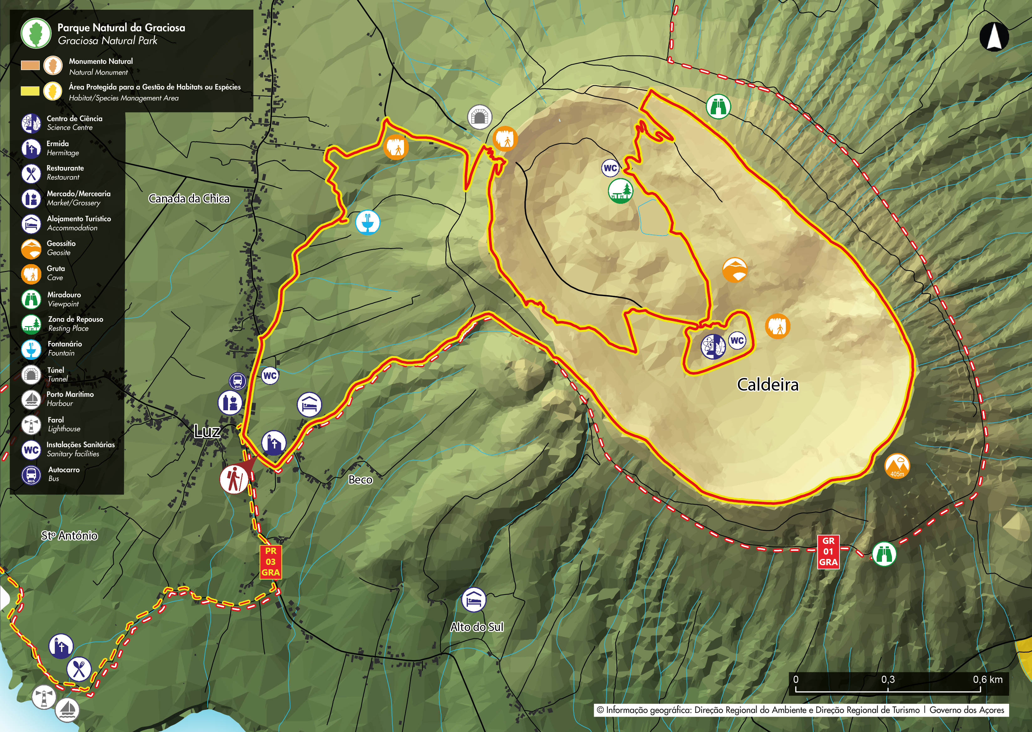
Since my origional post I found an Azorian travel site which shows a legit trail to the summit of Pico Furna Enxofre [CU/GR-001] by hiking around the Caldeira rim, a SOTA dream of mine, so Gracioso is now on the must do list along with Sao Miguel.
If anyone is looking for this map, I’ve linked it here for posterity, the paved road is lower than the AZ and is shown on this map as a dotted red line, but the Caldeira rim trail on this map is bright red with yellow border:
I’ll do a thurough write up after I activate it!
Thanks again Andy! I’ll post an email when the dates are set in stone in case you’re looking for those completes.