I’ve just got back from some winter sun in Marrakech with Mrs MHF & I note Morocco isn’t set up for SOTA.
This is a pity as there are some juicy mountains in the various Atlas ranges. We could see the snowy High Atlas in the distance from Marrakech.
There was a topic about Turkey & it’s mountains fairly recently & the mapping problems there-perhaps the same applies in Morocco.
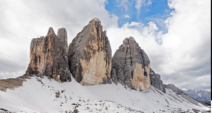
If I can post it, here’s a couple pics I took of some peaks when we visited a Berber village.
Oh well, back to activating & chasing the usual suspects! 73 John


6 Likes
Well there normally has to be someone asking for an association in country X for it to happen. This can come from anyone. We have a Madeira CT3 association because I was going on holiday there and I thought it would be a cool place to do SOTA. It is and many people have gone there since for holidays and SOTA.
The problems are normally getting suitable maps. They have to be accurate and detailed enough. Then it helps to have someone local to act as the AM who can who can help with names for summits. Again someone local can help if reciprocal licences are needed. And then there is the safety aspect of being a foreigner operating radio in countries that don’t have the same views as Western Europe for example. Operating a radio transmitter and sending coded messages “HI OM UR 599 WID VY QSB” will get you locked up quickly. Just ask DJ6SI about his arrest in Kos (an EU member state!!!)
Morocco does do reciprocal licences which is always a good indicator. From the Association Royale des Radio-Amateurs du Maroc
"Obtaining a temporary license (CN2xxx):
We make ourselves available to Radio Amateurs duly licensed in their country, and wishing to obtain a temporary license to practice in Morocco, in order to ensure the coordination of administrative procedures. Simply send us a request to the Director General of the A.N.R.T (National Agency for Telecommunications Regulations) specifying the dates of your arrival and departure from Morocco, the nature of your profession, the reason for your visit to Morocco and the route planned during your stay as well as the address of the drop-off point(s) in Morocco (hotel, residence, campsite or other).
Attach to this request:
a photocopy of your amateur license
a photocopy of your valid passport
complete and sign the form to download here: Formaire_ANRT
a photocopy of the car's registration document if you plan to operate from your vehicle (mobile station).
All these documents must be sent to ARRAM headquarters by mail, fax (fax) or e-mail in PDF or JPG format. Allow a minimum of 30 days (excluding the summer period) for the issuance of the license."
Morocco looks rather good from those photos doesn’t it? ![]()
We have someone asking (G0MHF) and reciprocal licences are available. All we need are maps and a local volunteer.
The good news is there is another African association under preparation that is easy for Europeans to get to. More info when it’s ready to be launched.
6 Likes
Thanks for the background, Andy. I await with interest to see the forthcoming Association!
73 John.
The problems are normally getting suitable maps. They have to be accurate and detailed enough.
I always carry a GPS, track my paths and add them to Openstreet Maps to help others. Many summits have been visited already so their paths are mapped, but when in EA4 I walked all kind of paths which werent on the map yet to head-up to the summits, and when back home I added them to OSM. Actually, this should be mandatory for all SOTA-activators, hi.
73, Martin - PE1EEC.
2 Likes
OSM is not suitable.
OSM is not suitable.
“It depends” as they say. OSM is an additional mapping tool in planning. For Japan I would love to use the GSI-maps on my GPS, but I don’t think there’s a way to download them (there’s an app) so I have to use the OSM-maps. The Garmin has TOPO-maps, but they lack paths & tracks too. Google Maps the same, but you can use the satellite view to see if there might be a path (if the area isn’t overgrown).
So to make OSM better as a community (I notice that Google Maps uses local edits I made on OSM on their maps), we should help improving the maps as many manufacturers use these as source.
73, Martin - PE1EEC
Again, OSM is not suitable.
It is true when one plans the route to the summit, but for making a P150 list of summits in a new association, much better maps are needed.
1 Like
Again, for me in planning it is, even if you don’t like it. Can we agree on this being a matter of personal taste?
73, Martin - PE1EEC
but for making a P150 list of summits in a new association, much better maps are needed.
Indeed. But I guess a lot of countries will have restrictions on detailed topographic maps being available to foreigners for summit approval, out of worries for espionage.
73, Martin - PE1EEC
1 Like
Martin, there is a confusion here. you are talking as an activator, where your personal choice of map support to plan your route is only … A personal choice.
Andy is talking about the required map quality to create a suitable list of p150 summits for sota, as an admin / region manager.
5 Likes
The primary question here was whether the mapping is sufficiently authoritative in matters of height to be used to determine whether a high point qualifies for SOTA. OSM is not sufficiently authoritative for that.
Whether or not OSM is usable for planning a route to an already-determined SOTA summit is a different question potential activators must answer for themselves, but it’s irrelevant when the potential creation of a new association is the subject.
1 Like
I recommend that anyone who needs more information on the requirements for determining the prominance of summits goes to “Sota Home” and read the relevant items on the MT blog.
3 Likes
I’ve been to Morocco and Western Sahara on numerous occasions and have driven across the Altas and Sahara in my Land Rover twice.
Having been arrested in Western Sahara and spent the night being interrogated at an army base, then escorted to the coast the following day, to then be subject to a 6 hour Police interview…
…I would be very careful where I operated portable amateur radio from in Morocco!
6 Likes
Thanks for the comments by Rick, Fraser and Remy.
I have Garmin’s mapping for the UK on my walking GPS and I use OSM myself as a backup on my phone in the UK and the primary GPS mapping when out of the UK (EU, Canaries etc.) But it lacks contour resolution and inherent accuracy for producing association summit lists. Oh, if we could use and rely entirely on OSM we could have associations for lots more countries. But we can’t.
Here’s an example.
This is the OSM view for I/AA-052:
And this is what it looks like really:
You can see how the map doesn’t have the detail needed to get the summits list accurate for the association.
There are occasions when it can work, typically an island with only 1 or 2 summits.
And this is the other problem with some parts of the world. It’s so easy for me to take an exceptionally privileged view of the world that I get living in Western Europe and say what do you expect if you go to Western Sahara. That is the kind of problem I’d expect because of the political situation there and in many North African countries. People who live there would know there safe places and activities and unsafe places and activities likely to result in police/military interactions.
That’s why we like to have locals involved as AM etc. They can advise on what is and isn’t locally acceptable. And most people may discuss the bad points of their country but given the chance would love to show you the beautiful parts and act as unofficial guides and help out.
6 Likes
Hello,
To obtain an amateur licence in Morocco, you need to fill a form…of course.
The form mentions the conditions to use your amateur station.
Here is what is mentionned.
*La station autorisée est une station fixe qui ne doit être utilisée qu’a l’emplacement désigné par le permissionnaire dans sa demande. I translated below.
The authorized station is a fixed station, which should only be used at the designated place mentionned in the request of the licence.
This makes me think that mobile or portable operation is not authorized in Morocco., which can make sota impossible.
You can download the form on the ANRT site which is the official Morocco telecom agency.
Autorisation stations d'amateur | ANRT | Agence Nationale de Réglementation des Télécommunications.
73 de Pierre F5MOG
6 Likes
That could be true.
I know that portable operation was not allowed in Lebanon for a long time for obvious reasons. It was allowed in 2014 for a while as there were some OD summits activated but probably the situation out there in neighbouring countries and the region in general has stopped portable operation again. ![]()
2 Likes
Not advisable to undertake any portable amateur radio operation in North Africa as the likelihood of being accused of spying is great. Back in 2002, I did spend a day hiking (no radio). in the Eastern Atlas mountains in Tunisia but it is not recommended for tourists to go there now as there have been several attacks by Islamist terrorists crossing along the border in the mountains from Algeria, Algeria is a relatively quiet country now compared to how it was but terrorist groups still operate in the mountains. Also be careful what you wear, back in the 90s I can remember hearing about a group of French travellers who were shot as mercenaries for wearing military-type clothing, I can’t remember what country that occurred in now
2 Likes
Yes, I just remembered this terrible event from a couple of years ago:
1 Like
I had forgotten about that one, it was this that I was thinking about