Two Ocean Mountain, W7Y/TT-046. When I first saw it on the map, I liked the name. It’s called Two Ocean Mountain because the Continental Divide runs right over the peak. The runoff on the east side eventually drains into the Gulf of Mexico. The runoff on the west side, drains into the Pacific Ocean.
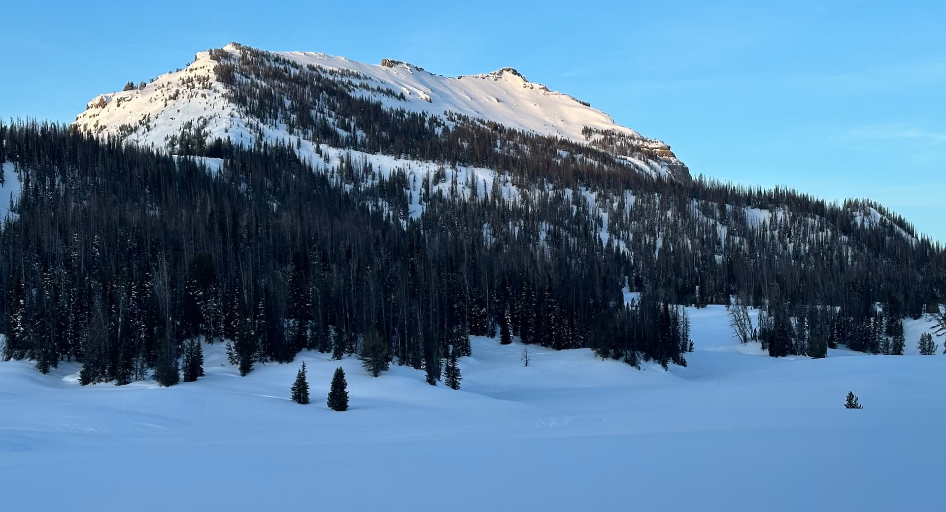
I was nervous about this peak. I didn’t have any information about skiing it, but I could see from the topo that is wasn’t an easy-listening, low angle ski run. It had some mandatory steep terrain to get to summit. From looking at the map and Google Earth, I planned a route that took the lowest angle. But there was no way to avoid some 35-40 degree slopes near the top. Because there were a few trees and krummholz in the steepest section of the route, I was a little less nervous about the climb. Also, once I got on the snow, I could tell that it was a stable spring snowpack.
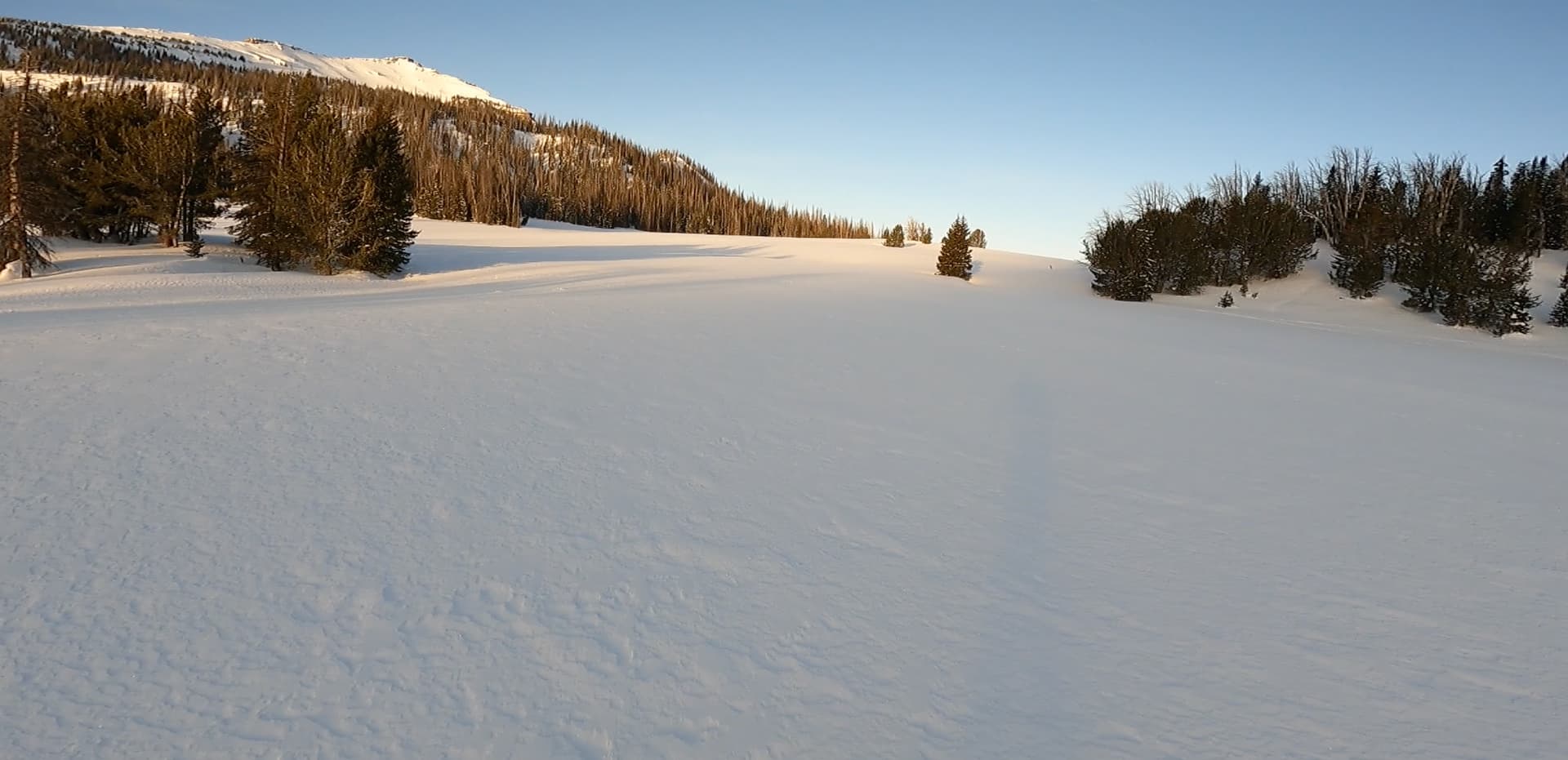
It turned out that my route was pretty good. It was steep, but the snow was not solid frozen solid. I was able to make a track in it. Also, some skiers had climbed up there in the previous storm, and I was able to follow their uptrack for some of the climb. It was somewhat comforting that someone else had used this route to climb the peak.
About 300 feet below the summit, the snow turned to thick, breakable crust. Since it was about 35 to 40 degrees there, I put on my ski crampons to keep from slipping down. I thought of taking off my skis and kicking steps, but I think I would have been post holing and breaking through. With careful route finding, and a LOT of short switchbacks, always looking for the lowest angle and the softest snow, I was able to get to the summit ridge.

It was very spectacular and sunny up there, especially after being on the shaded north slope. The summit ridge is pretty narrow and has great views in all directions. And it was pretty calm. The ridge is very exposed and has no trees; it would have been miserable up there in high wind.
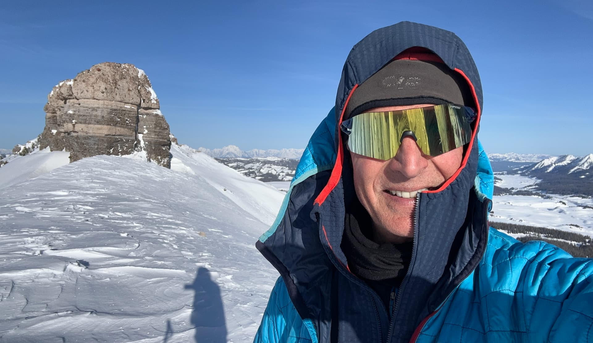
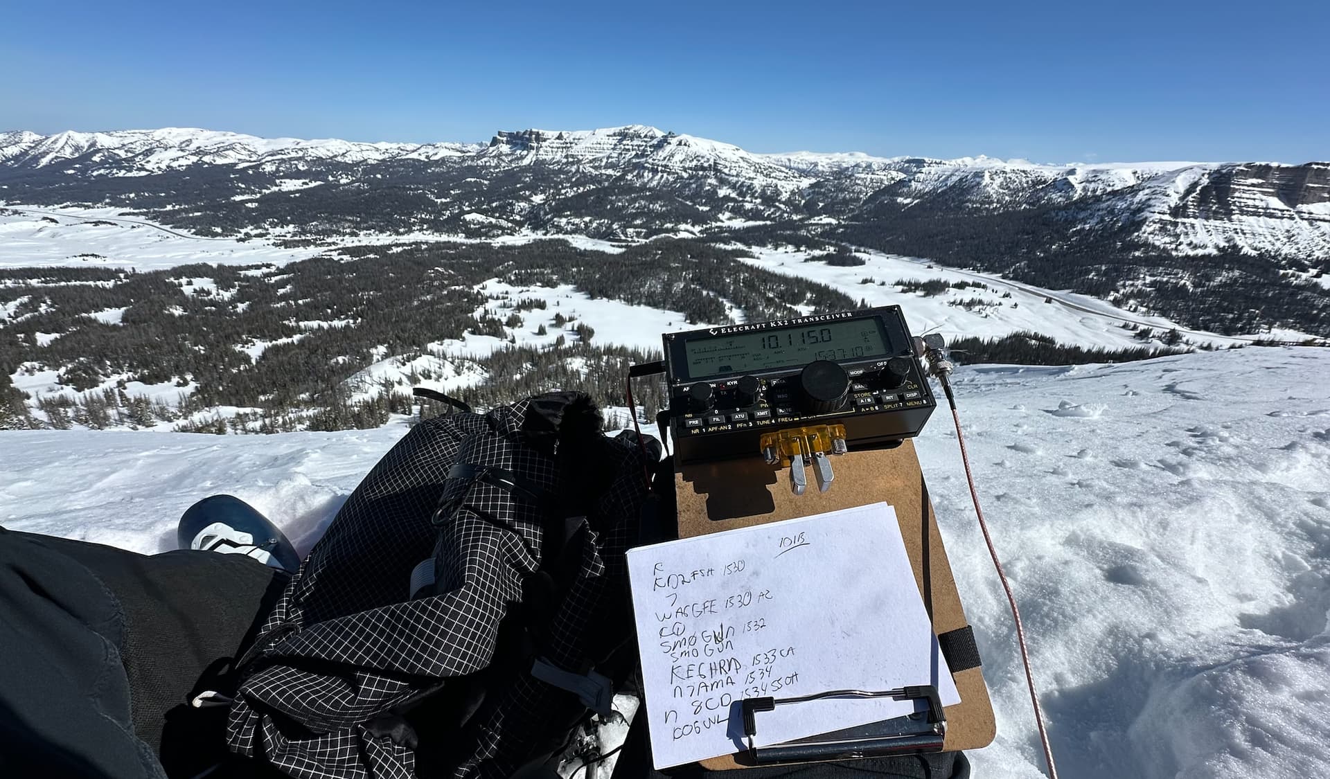
It was a perfect bluebird day about 30 degree F. I could see the Teton range to the west and I could see mountains for 360 degrees. I set up my random wire antenna along the ridge in an east west orientation. Not ideal for getting into the EU, but because the ridge was so narrow, I didn’t have much choice.
I guess it didn’t matter because I had 93 QSOs, 23 of which were DX. 10 and 12 meters only caught a few, but 15 and 20 meters were hot. I got a few on 30 meters. With the sun blazing down, it eventually got too warm in the Bothy bag and I took it off for the last part of the activation. It was a pretty amazing spot for an activation. After 93 QSOs I was worn out and anxious to start my ski down.
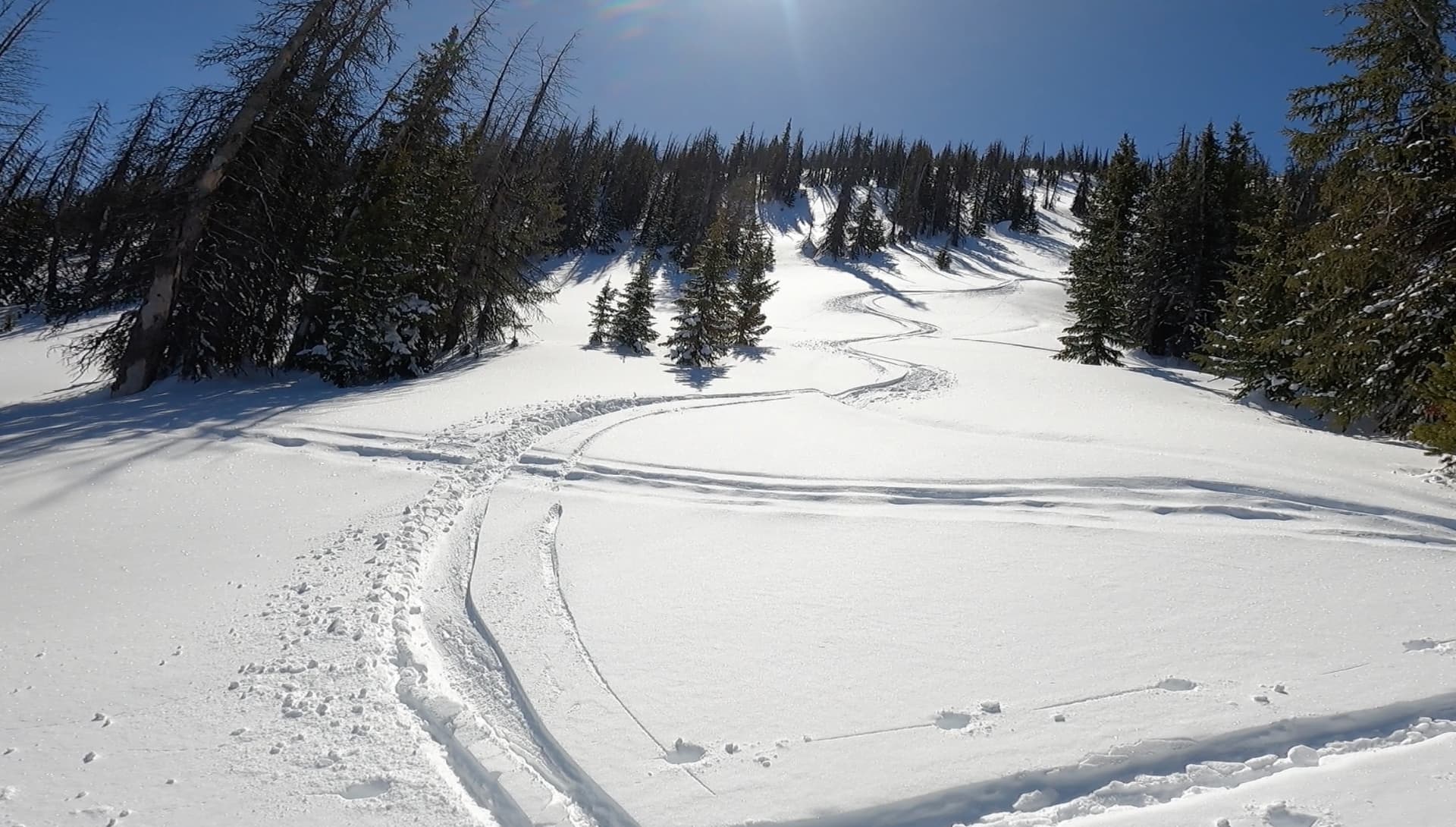
I was nervous about the ski down due to the snow conditions. I was very cautious at first. I didn’t want to get hurt up because I was alone. Once I got off the wind scoured snow of the top 300 feet, the snow softened up a bit and I was able to get some good turns in.
It was a perfect day in the mountains: great, exciting skiing and route finding, and a great SOTA activation. Now it’s time to plan for my next objective on Togwotee Pass: W7Y/FT-129, Lava Mountain.
I made a 6 minute video of the activation. Basically a ski movie with some radio in the middle.
