I’ve been looking at the maps of Angle Mountain, W7Y/TT-052, for about a month. Angle Mountain is considered to be in the Wind River Mountain range, but some consider it part of the Absaroka mountain range. It’s near the summit of Togwotee Pass, Wyoming, and is haven for skiers and snowmobilers in the winter and grizzly bears in the summer. I don’t like hiking in grizzly country, especially because I’m usually hiking alone. Also, I’ve seen grizzlies near the Togwotee pass summit 3 of the six times I’ve been there in the summer. Luckily, I saw them from my car. My wife told me I should take bear spray, and I did. But I left it in the car when I saw how much snow there was. Plus, I didn’t want to carry any extra weight ![]()
Also, I prefer to ski peaks if I can. It’s much easier on my old knees. And even if the skiing is bad, which it often is in the spring, it still much easier than hiking.
This trip made me a little nervous. I’d never skied in the Togwotee Pass area before. Besides it’s reputation for grizzly bears in the summer, Togwotee Pass also has a reputation for high avalanche danger in the winter. But because it was early April, I figured I would find a spring snowpack that was isothermal and pretty much glued to the mountain.
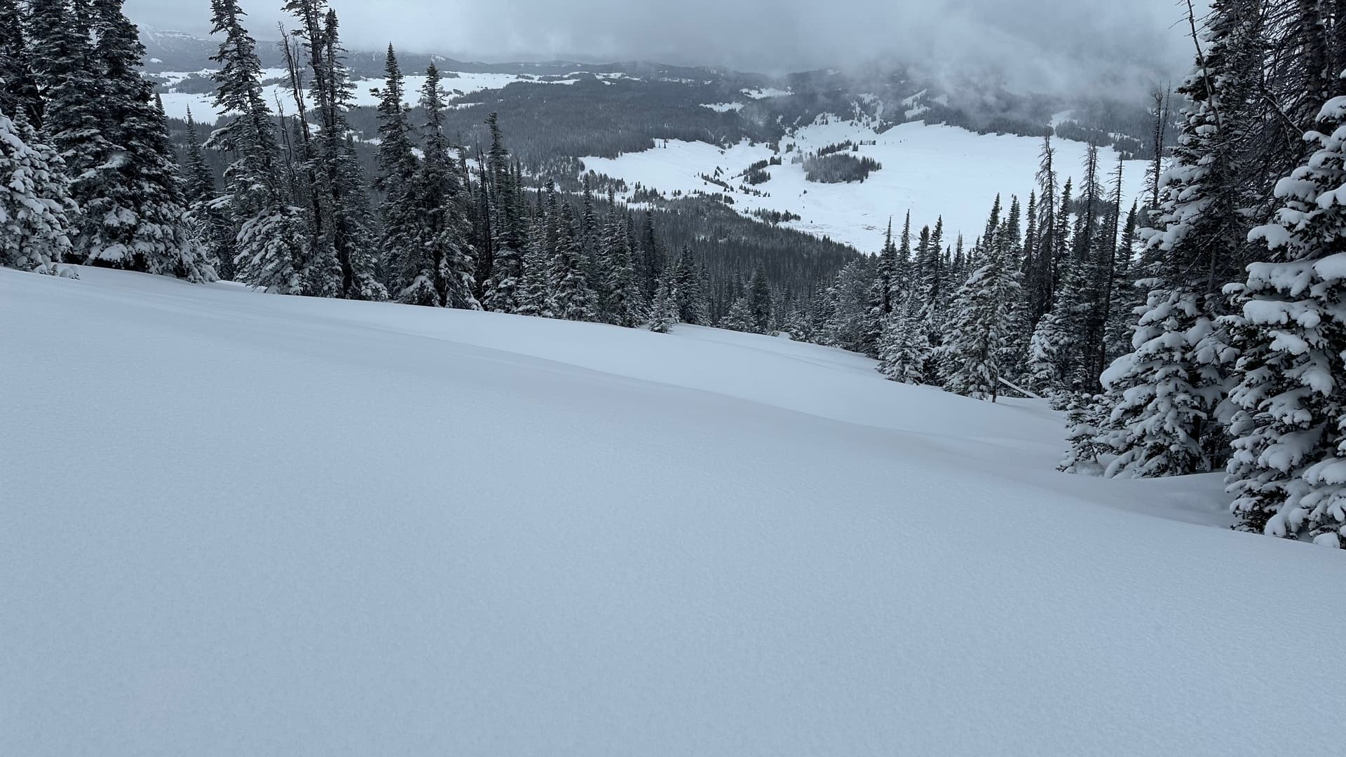
There is no summer trail up Angle Mountain, so I planned a route that took the most gentle terrain to the summit. I didn’t want to get myself into avalanche terrain, especially since I’m not familiar with the area. Also, it had been snowing lightly for three days and the mountain had 6 to 8 inches of powder. Because of the firm spring base, the trail breaking was pretty easy. And my route of 2.5 miles and 1700’ of gain worked out well. Of course, I had to adjust it as I went. Sometimes you can’t see short steep pitches on a topo when the contour lines are 40 feet apart.
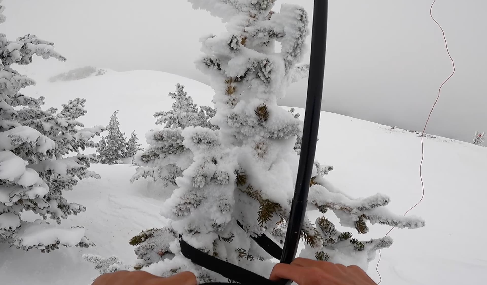
When I got to the top, it was snowing and breezy. I strapped my antenna mast to a small tree and held up the other end with a ski pole.
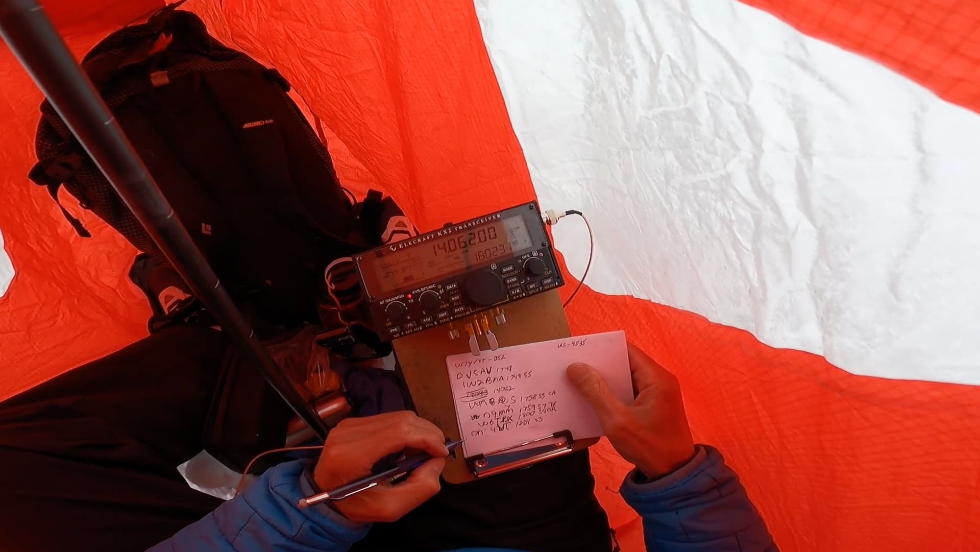
Then I climbed into my Bothy Bag, a warm, cozy environment on such a cold desolate peak. It’s amazing how Bothy bags, with their red light, make me feel comfortable. Good thing. I was up there for an hour and 45 minutes and had 80 QSOs, 23 of which were DX, and I was warm the whole time. I felt VERY lucky to have great band conditions and great snow conditions. It doesn’t get any better than that for Skiing On The Air.
Now for the bonus: a 2.25 mile, 1700 foot downhill run in fresh, light, untracked powder. I can see why this area is so popular with snowmobiles. The mountains here consist of coniferous forests and massive open, low-angle glades. That makes it easy and pretty safe to go wherever you want. And it makes the downhill skiing fun because it’s wide open.
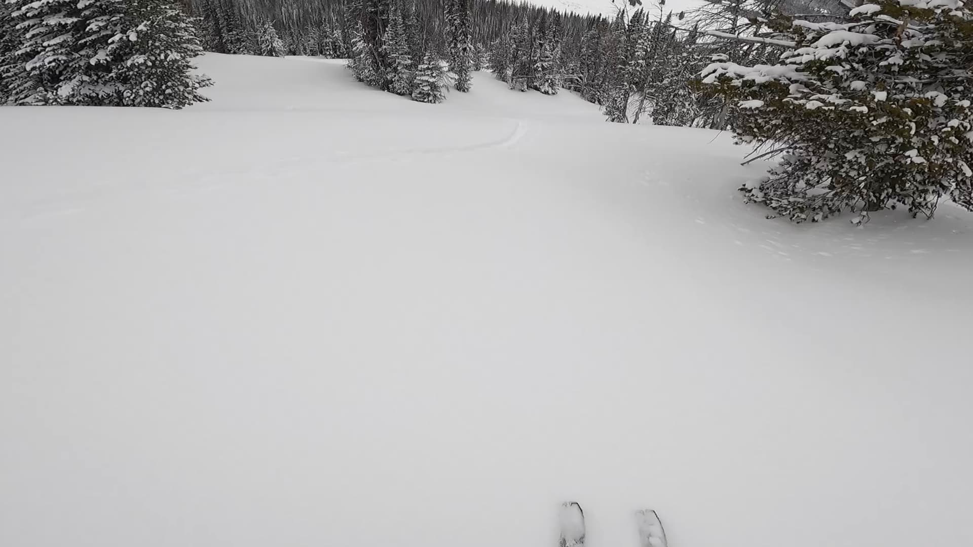
The only problem with these massive, wide-open glades is that if it’s not sunny, you can’t see anything except white. It’s like skiing inside a ping pong ball.
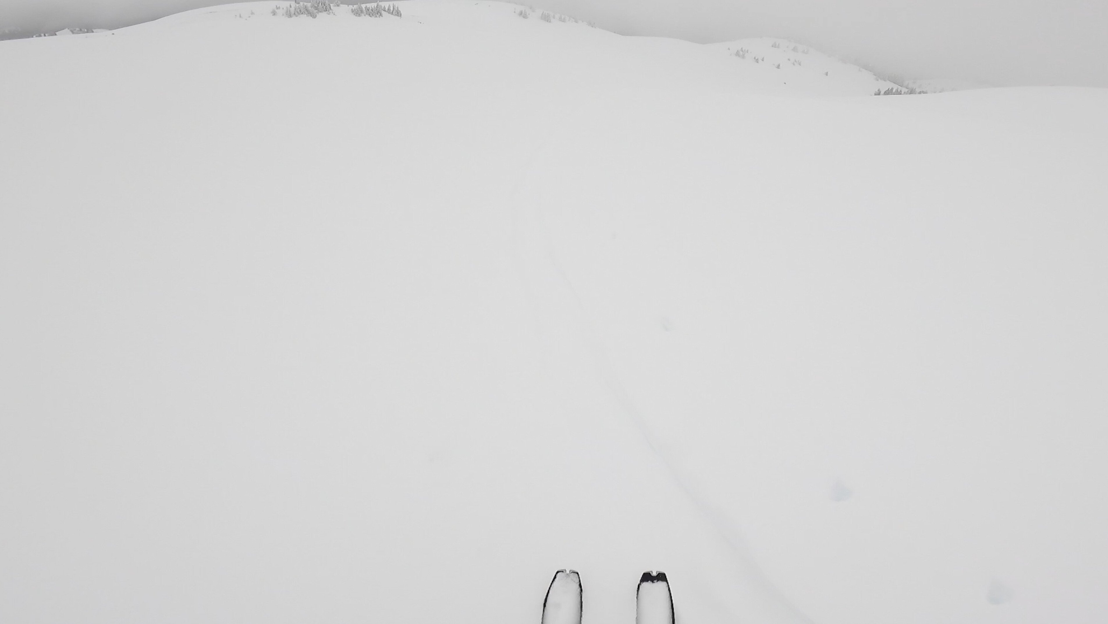
There were times when I was going down and almost fell over because I lost my equilibrium due to the flat light. Because of these conditions, I decided to ski down my uptrack, and that track was the only thing I could see. It was like following the proverbial bread crumbs, but it got me back to the highway and I had some great powder skiing.
Here’s a 7 minute video I made of the ski tour and activation. Mostly it’s a ski video, but there’s a QSO section in the middle.
