Another of the Southern Scotland summits I’ve been avoiding can now be crossed of the list. This summit is a pig to get to no matter where you live in GM. The crow-fly distance is 56miles but it’s 92miles by road. And they’re not good roads so it took me 2hr10mins to do the trip. Made worse by some significant windfarm projects on the roads there with the guys working on Sunday and a major new HV grid cable being run. Unlike normal grid pylons, these are quite low in height and use wooden poles. Probably only 132kV unlike the massive 400kV line upgraded down the centre of the Highlands.
So I finally got to my parking place at Stinchar Bridge. Shalloch on Minnoch has a reputation for being a major bogfest the traditional route and the footbridge has rotted away so you have to cross the Shalloch Burn via stepping stones. Hmmm! Looking on Google Earth shows much better routes through the firebreaks and my work colleague said he went that way because he couldn’t find the kosher route. “It’s 1km further and much, much less hassle.” So that sounded like that but I noticed from Martyn & Caroline’s review they took the other route which is the one I decided on. Reportedly “a bit damp” I thought I’d chance it because we have had so much dry weather recently.
The path starts in the second passing place after leaving the forest going South from the Stinchar Bridge car park. I could see the path on the hillside about 250m away but could not find the start so I just went in a straight line and once hooking up it was fine. For the record, stand in the passing place looking towards Shalloch with your left hand on the pole supporting the passing place sign. Look down and right and there is a huge boulder at the edge of the moor, the path starts 50cm left of here. You wont see it till you stand there and take a step forward in the grass when lo, like a miracle, a motorway of a path appears!  I only found the start on the way back.
From here follow you nose. The 1:25k map shows a path going approx 50% of the route, that’s tosh, it goes nearly to the trig. It is trivial to follow. A bit damp in places and I can imagine it would be horrible after a wet spell. But today or if it was frozen then it’s easy. However, getting here in icy weather would be “challenging”. The roads are cleared marked as not being treated 24/7 in Winter. But ice wasn’t a problem today. It was sunny with a high altitude haze and hardly any wind. And hot for GM, over 20C nearing 25C later. So it was a sweaty tramp over moorland. Exceptionally hard work in the heat. Sadly the WX was turning, from an original prediction of “Scorchio!” it was clouding up with rain/thunder predicted for later.
25mins of walking gets you here. You can see a big clearing in the forest and may make out the track. The car was parked near the left hand end of the forest. Easy so far.
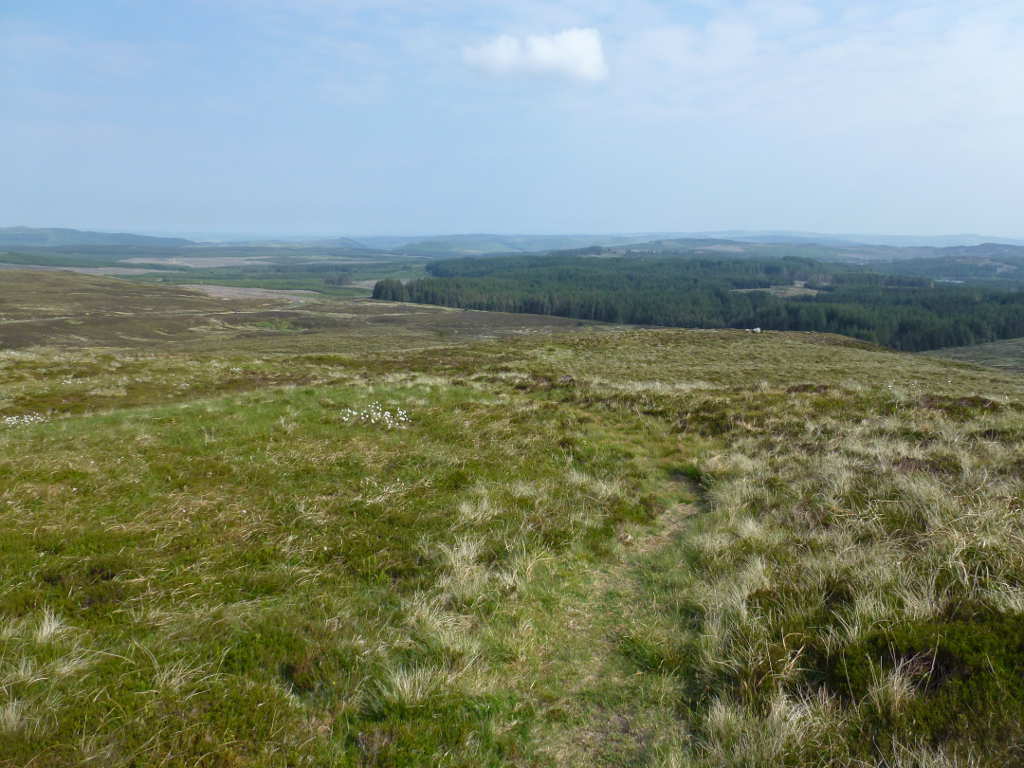
I could see someone else in the distance and this person became the pacemaker. My aim was to catch him up but he was too fast for a lardball like me. But the track was obvious and so no thinking was needed, just put one fooot in front of the other. There is one section were you drop about 60m before the final assault. I hate this because you know you need to climb up again on the way back 
Looking back from where I’d come from (North), the sky is quite blue still. Note the substancial glacial erratic on the skyline. There are plenty of these along the path.
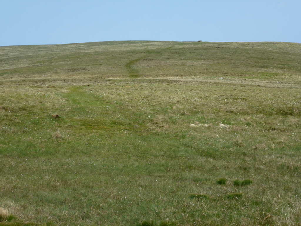
And looking up the final slopes on Shalloch on Minnoch. You can the cloudy sky and the path. It disappears near the top. Not my pacesetter to the topright of the ground. The real summit is about 25m higher than here, another couple of minutes.

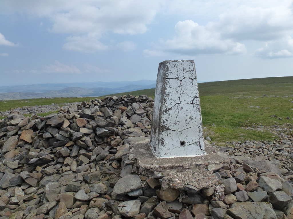
Happy Birthday to you, Happy Birthday to you! The trig point was built on 1-Jun-1937 and so was 79years old a few days back. Amazing condition. They used proper cement before WWII. The later 40’s and early 50’s trigs were made when cement cost much more and so they used a rubbisher mix, many 50’s trigs are in bad condition now. Looking East the clouds are OK.
The trigpoint is in the AZ but not at the summit. 1hr 50m to reach it from Stinchar Bridge. The summit was another 7mins and I was not phased in stopping at the trig. It’s nice to get to the real summit, I could see it across the flat plateau approx 13m higher than me. But blow that on a hot day when I may have to bale out because of thunder. I set up and was just about to call when a lone lady walker appeared and we had a chat about radio and thunder and her route. She was planning to a real walk. The classic approach to Shalloch (and she got lost in the firebreaks), then along the ridge to Tarfessock, Kirriereoch (soon to be a new GM summit) and then Merrick. I wasn’t sure how she would get back to her car but it was probably at least 6km along the road once she got there from Merrick. Too much like hard work. I started on 40m and called into the WAB net which made qualifying easy. By the time I had exhausted the WAB net my phone had got a connection and I could send an SMS but it took minutes to get through, Anyway a spot brought in callers on 40m SSB, 15 in total. I was particularly pleased to give Caroline M3ZCB a complete as I would not have known of this easier route if she hadn’t mentioned it. Then another spot and 4 on 40 CW. Then it went quiet.
By now the sky was dark grey and the bottom of the dark clouds were busy and swirling. Time to get the hell out of Dodge!. So no more bands and a speedy pack up was made. You can see how dark the sky is now.

However, if I had to get down early I was planning on scooping up Craigenreoch SS-135. Return was the reverse done with a bit of gusto to get back to make more time for Craigenreoch. Completely uneventful walk back until I was about 5mins from the car when it started raining. Big spots well spread out and nothing to bother me. In the few minutes it took to get to the car the rain got heavier and just as I got to the car the heavens opened. Well timed I think. It’s about 15mins drive to Craigenreoch and the AZ is about 25mins walk. The AZ is large on there, from the edge of the AZ to the trig is another 20mins walk. Unlikely to be a trig on the air from me from that summit if it’s the second summit on a sweltering day! But the rain didn’t stop. I was driving in the direction of the bad weather and after 20mins it was still teaming down. So no Craigenreoch. Annoying because it’s a hell of drive back and it’s not worth doing on its own. It needs to be done however, or I’ll never clear off all the GM/SS summits South of Glasgow and Edinburgh. Some planning needed…
The Carrick Forest Drive is a permitted route through this very pretty area over Forestry Commission Scotland land. It’s a very good hardcore unsealed track. It comes out by Loch Doon and it’s the alternative route to Dalmellington. On my way down I went East from Dalmellington to Straiton then South to Stichar Bridge. Now I was going East then North… almost a square. The funny thing is the unsealed road is better than the tarmac access section with is breaking badly and not level. No problem for the Hilux. On the unsealed section I engaged 4wd and had fun. There is a speed limit but it was quiet and raining hard so I checked the traction. Good! I soon outran the rain and came upon hordes of people out subathing, camping, BBQing by the various lochs… it was like Tokyo Station there were so many. I did note that 30mph on the surface in 4wd threw up a huge dust cloud behind me. I was like a destroyer laying smoke!
If you think the way I did in that you could nip off the Forest Drive down some other roads to get near to Shalloch so it was a quick 1hr climb then you can’t. All the non-Forest Drive tracks have locked gates with serious shrouded locks. The other Craiglee (there are 2) is accessed off the allowed route so now advantage either for this one.
Another one ticked off and a bit disappointed not to collect Craigenreoch after the drive but life is a bitch and then you die. There are some blighters left. Awkward drives and then a bit of a trek. Lamachan and the other Craiglee are like that. Then there’s all the ones between Newton Stewart and Dumfries. Craigenreoch and the handful down the West coast to Stranraer. And Mullwarcher. I think I need to get the bike sorted for that. Or maybe invent rocket-shorts…
 Joking, the is a dryish route to it.

