Hello everyone,
Warning: This article might contain beautiful mountain pictures and a decent bit of text. And it is not sponsored by the OE/ST Styria region of OE - but it could be hi
With the summer in OE being a bit unpredictable I was delaying my vacation always but finally comitted to book several huts for a multi day hike in September and was hoping for stable weather and mild temperatures.
Since a while I wanted to do a multiday hike from mountainhut to mountainhut. And I wanted to inlude SOTA in that plan. The joy of walking in one direction over multiple days - and looking than back and being surprised how far one can walk - is just too good.
In addition the challenge was to only use solar power for radio and charging phone and GPS watch. That worked out pretty good.
A lucky coincident allowed me to split my trip into two sections. But let’s start with part one:
Day 1
Start: Hochwurzen cable car
End: Ignaz Mattis Hütte, Mountainhut run by Austrian Alpine Association ÖAV
11 km, Ascent: 1180m, Descent: 1035m, Time (incl. activation): 7h 15 min
After a 2 hour drive from my hometown Linz I reached the parking place at the cablecar station Hochwurzen. Ordering a summit-only ticket and leaving the car behind marked the official start of my vacation. Easy elevation gain then was followed up by a beautiful walk over a grass covered range of summits. After 2h 45 min a small path lead up my first SOTA summit the Schiedeck OE/ST-340.
An incredible view distance that day allowed me to spot summits like the Großglocker mountainrange (that I just visited some weeks before) and further on to carinthia (OE/KT) with it’s Ankogel and Hochalmspitze.
Fixing the telecope pole to one of the steel cables the SOTA station was deployed and a successful activation on 2m FM and 20m SSB was good fun. On a Saturday with good weather of course a nice number of S2S was possible.
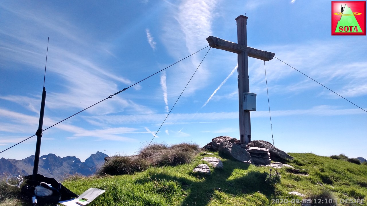
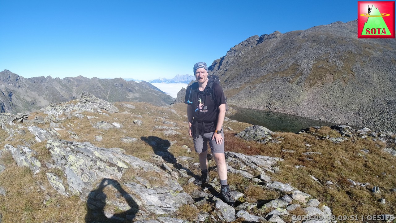
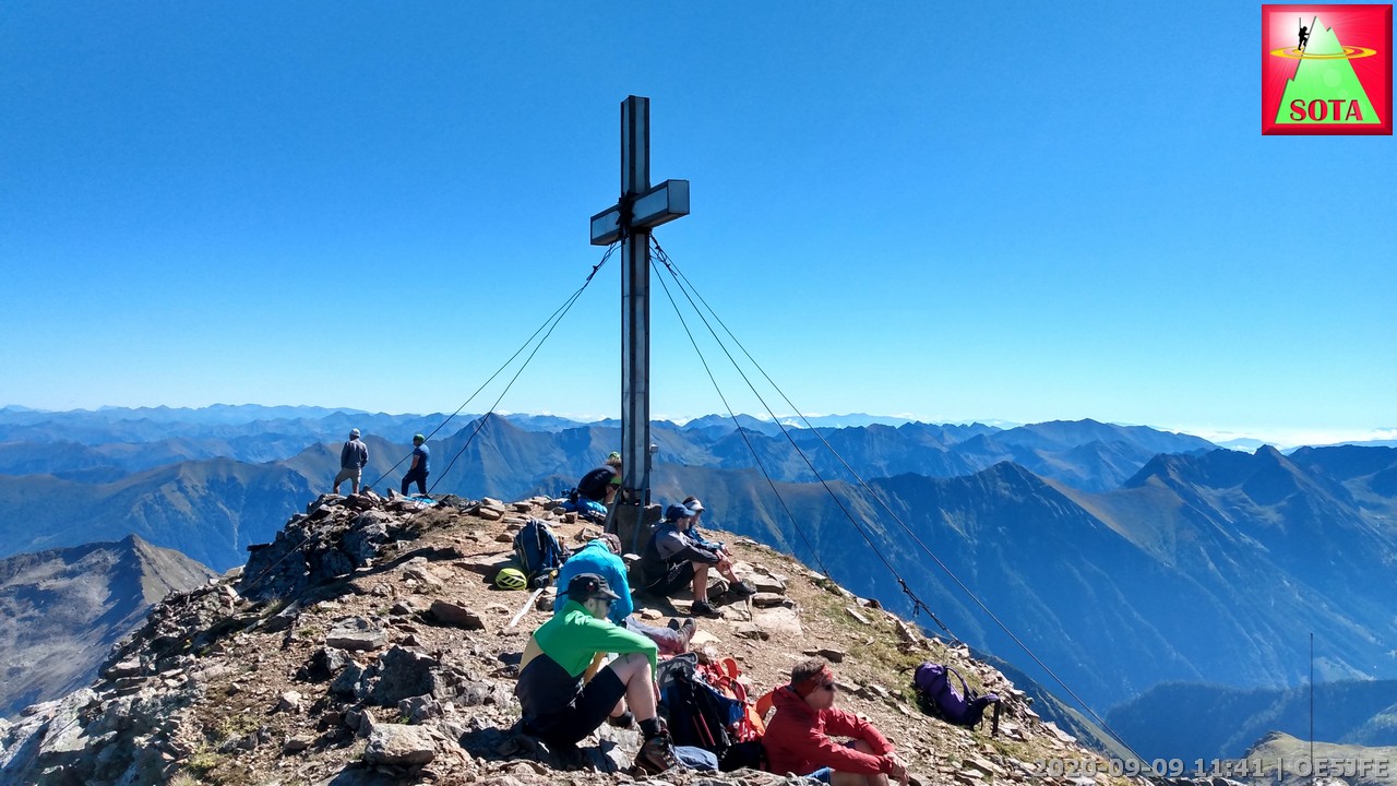
But I had in mind that a thunderstorm in the late afternoon was likely so I ate my sandwich, packed the radio and went back to the main path to continue on to the Kampspitze. Another 1 hour and I was at the base of Kampspitze and depositing behind a rock all gear that I did not need to activation to lighten my pack. I was almost rushing up the summit leaving curious sheep at the grass covered ramp behind. Following some stone cairns the path was easy to find. Just on reaching the activation zone I could hear Christian OE5HCE calling from Hohes Kreuz for a quick S2S. At the summit the usual setup this time using a steel pipe that maybe used to be a part of summit cross in the past. As one of the first QSO I could reach Gerhard OE5PGM who first activated this summit some years back.
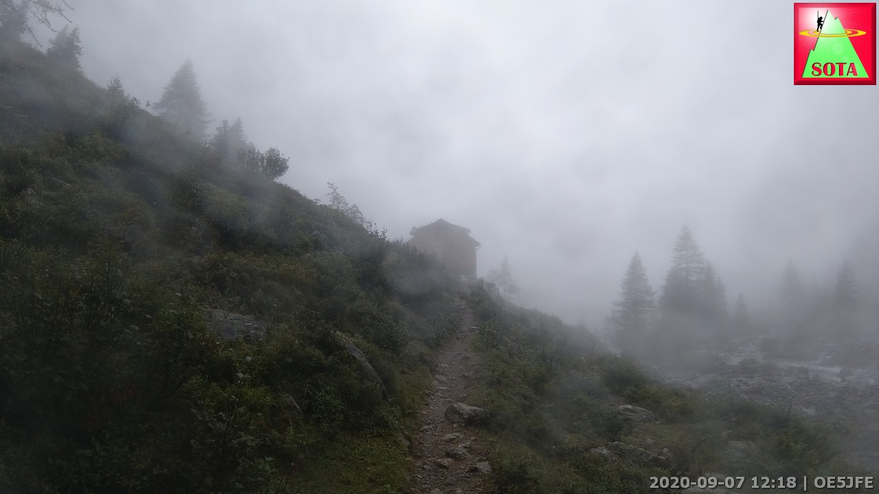
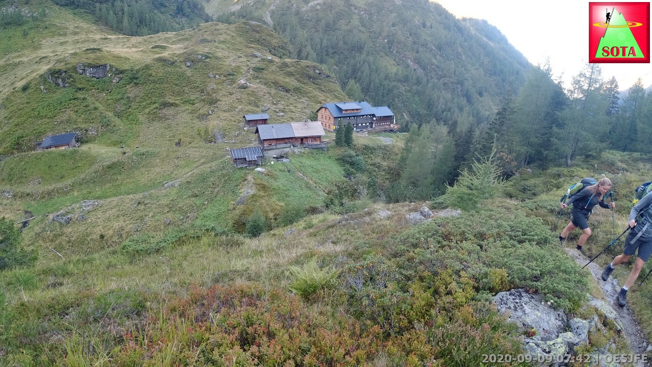
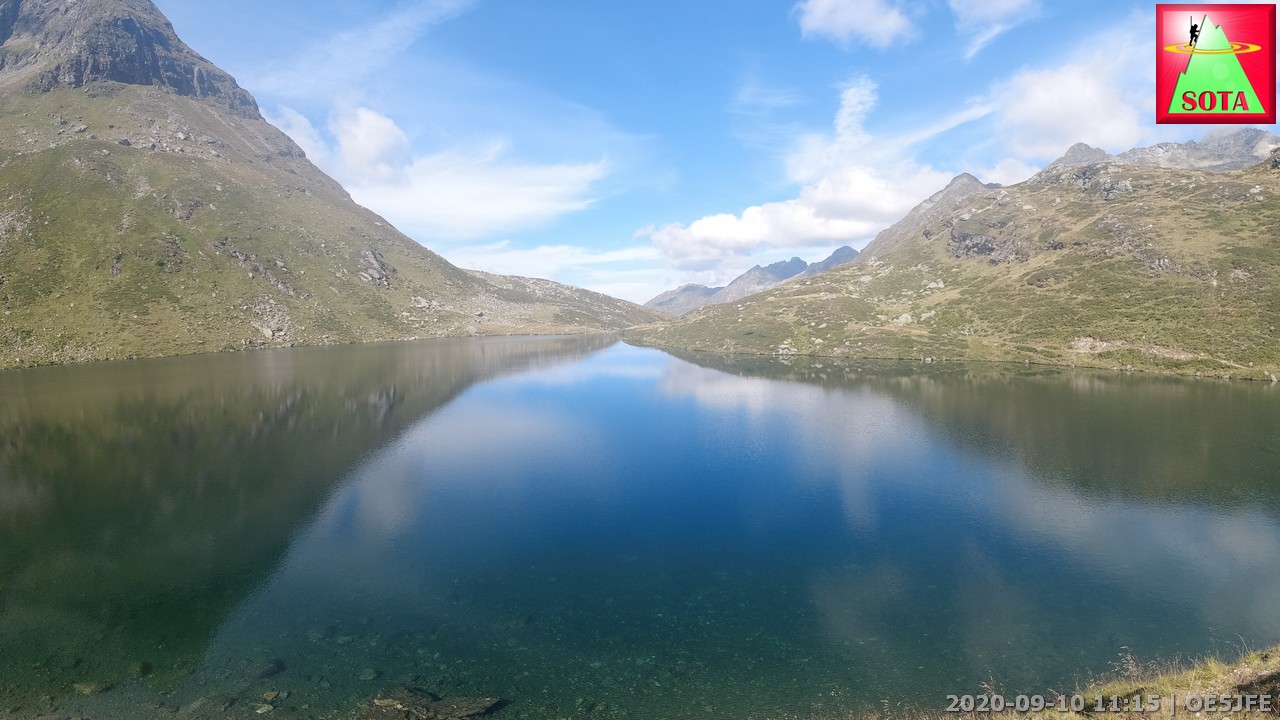
Biggest worry was that the sheep have found my deposited gear and chew up my snacks and cloth. Fortunatly everything as fine and I walked down to the Brennsee and further on to the Giglachsee lake. The Ignaz Mattis hut watching over the lake gave me food and shelter for the night. The thunderstorm did not happen but a bit of rain overnight.
View from cable car station to Dachstein OE/OO-001

First summit for the day in view (left of center)
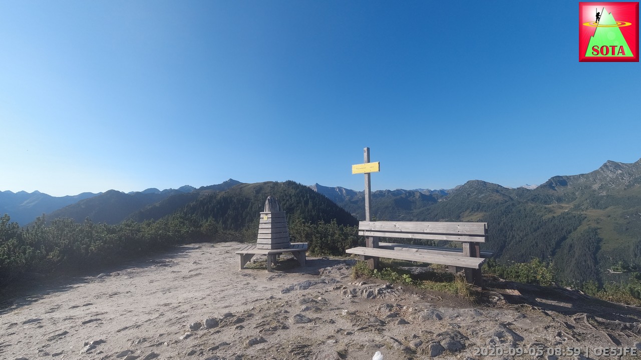
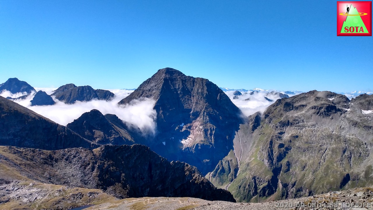
Schiedeck OE/ST-340, 2339 m
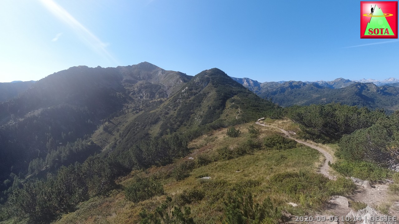
and the next on in the center
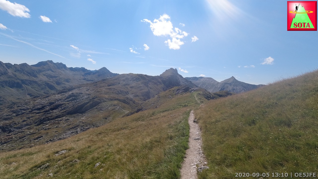
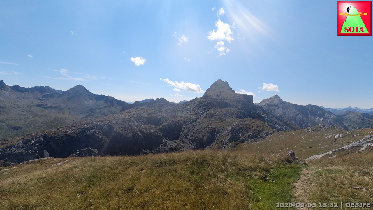
OE/ST-428 Kampspitze, 2390 m summit
Brettersee lake with summit in the Kampspitze above
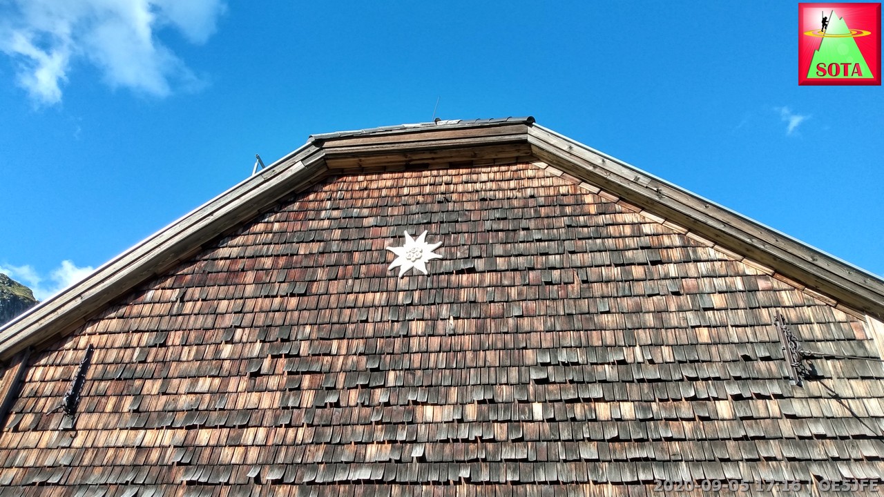
Shingle wall at Ignaz-Mattis Hütte
Day 2
Start: Ignaz Mattis Hütte, Mountainhut run by Austrian Alpine Association ÖAV
End: Landawirrseehütte, Mountainhut
10,7 km, Ascent: 1000m, Descent: 994m, Time: 5h 23 min
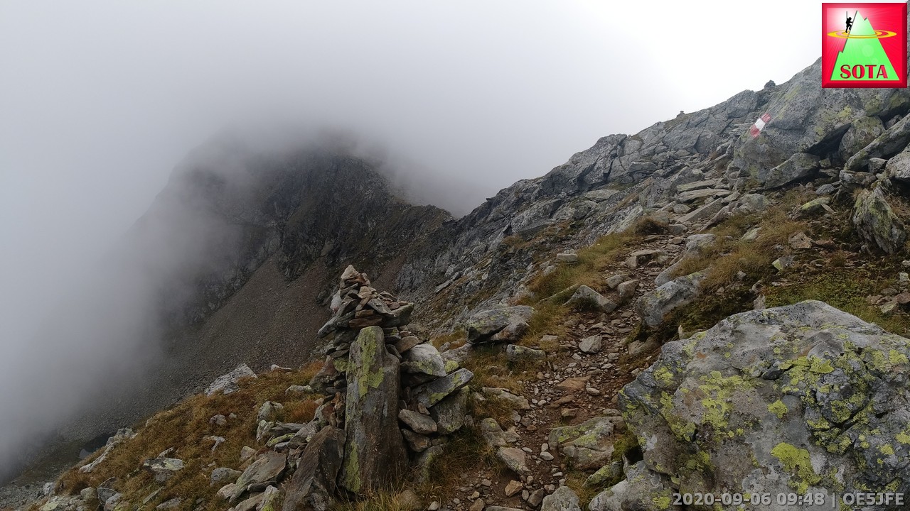
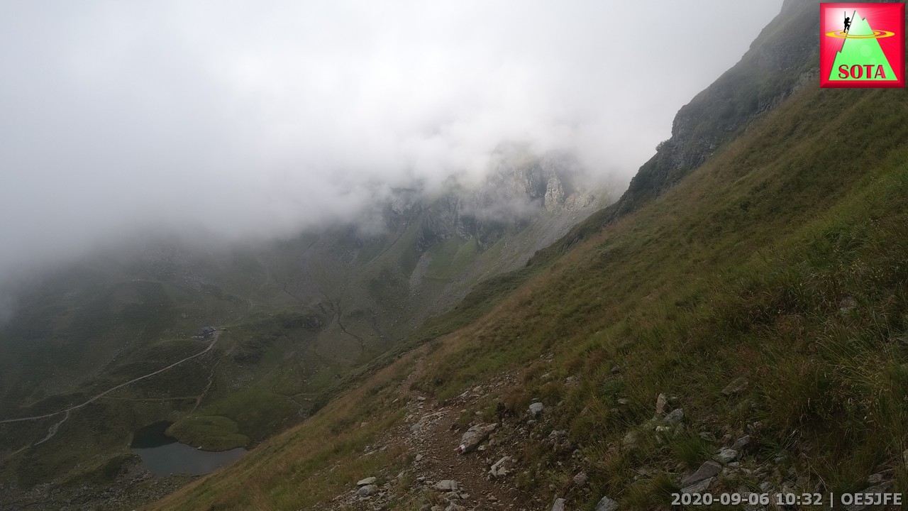
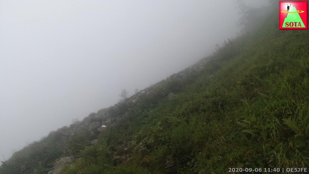
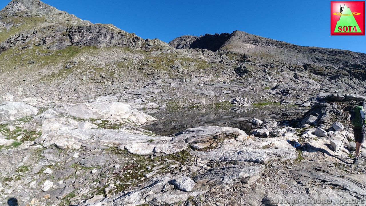
The wx forecast was predicting rain all day long so I was quite surprised to find a bit of cloud but also sections of blue sky in the morning. So I decided I might have a chance to first activate Vetternspitzen OE/ST-387 agains all odds. But after the breakfasts a cloudlayer moved in an after hiking for about 1,5 hours and reaching the Rotmandlspitze saddle were a potential path would lead to the summit I was stuck in the clouds. Visibiliy too bad to guess were the best approach could be as there is no official path to the Vetternspitzen. So I had to skip this one. I continued down and of course wx improved for some minutes but then walking by the Keinprechthütte (another overnight shelter) the rain begun and for the next 1,5 h I was hoping my weatherproofing concept for the 817nd was working. Continuous rain while scrambling up and down the Trockenbrotscharte ridge and finally reaching the hut Landawirrseehütte.
No activation that day but a good challenge overall. The oven in the center of the hut helped dry all humid cloth and shoes. A cosy afternoon passed drinking tea and watching more rain soaked walkers arrive.
Yep just before the rain stuck in the clouds
Looking down to Keinprechthütte. Can you find it?
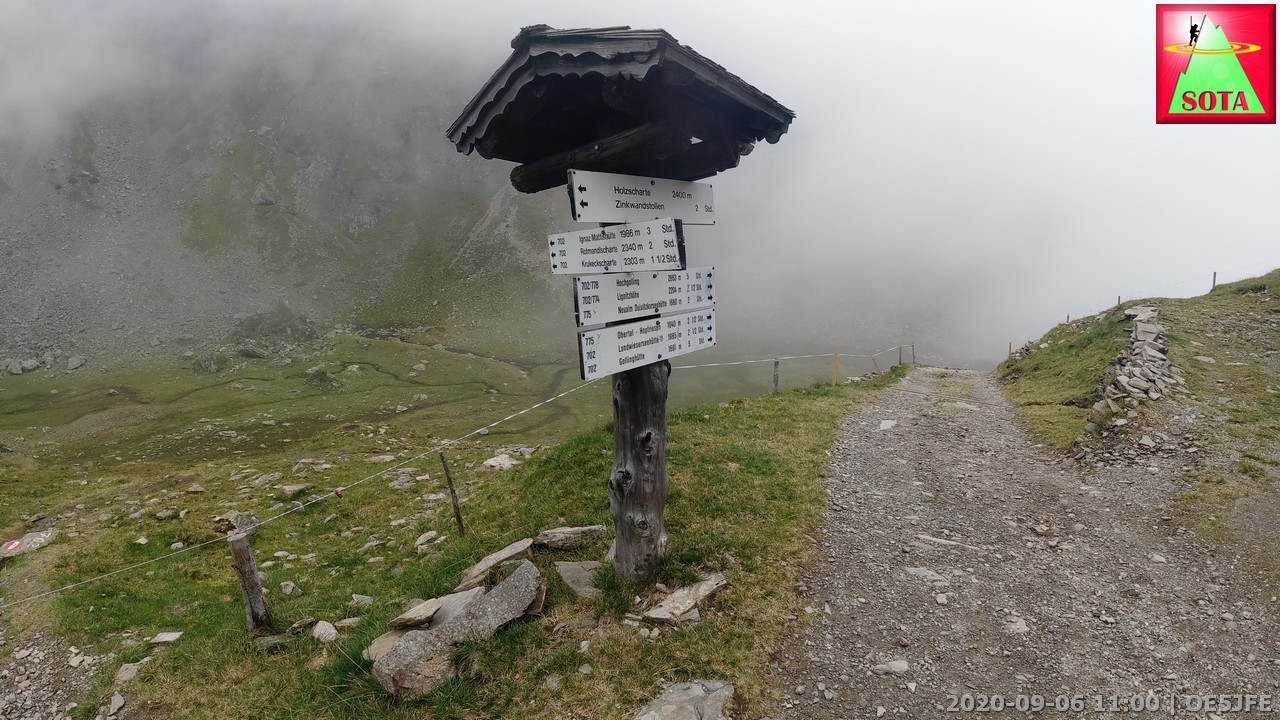
Signpost at the hut
Visibility is getting worse
Day 3
Start: Landawirrseeütte, Mountainhut
End: Gollinghütte, Mountainhut
4,9 km, Ascent: 488m, Descent: 840m, Time: 3h 07 min
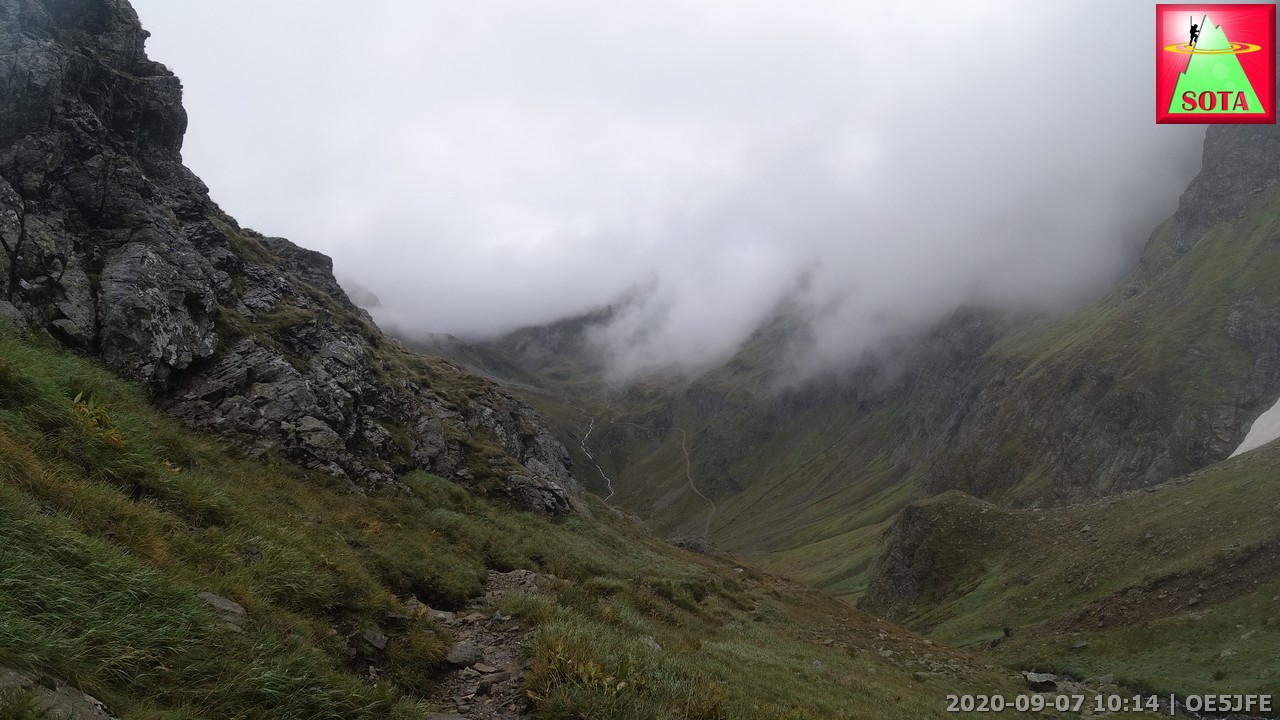
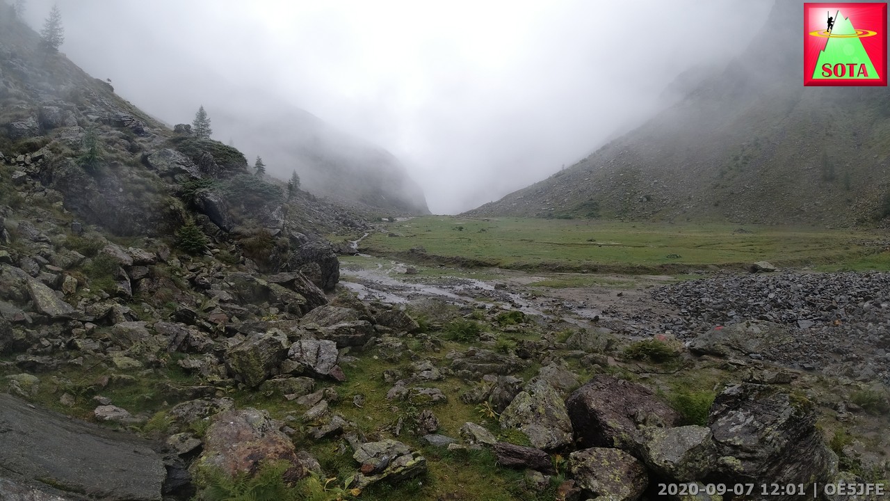
Weather was improving a bit this day. A dense cloudlayer was covering the valley like a lid on a pot. The summit planned for today was the Hochgolling OE/ST-001 - so the highest summit in the Styria region of Austria. The warden of the hut heavily warned against in such wet conditions. I was not fully convinced but after reaching the saddle Gollingscharte with about 20 m visibiliy I decided that I will follow the advice. On slippery gravel and steep zig-zacks I walked down to the high pasture area called Gollingwinkel and reached the Gollinghütte. A short day but a wild scenery to enjoy.
Relaxing in the afternoon and playing cards with other hikers made it a very good day.
At the Golling saddle
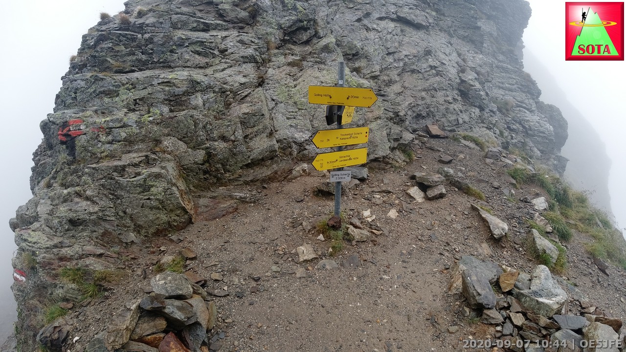
Hut in view
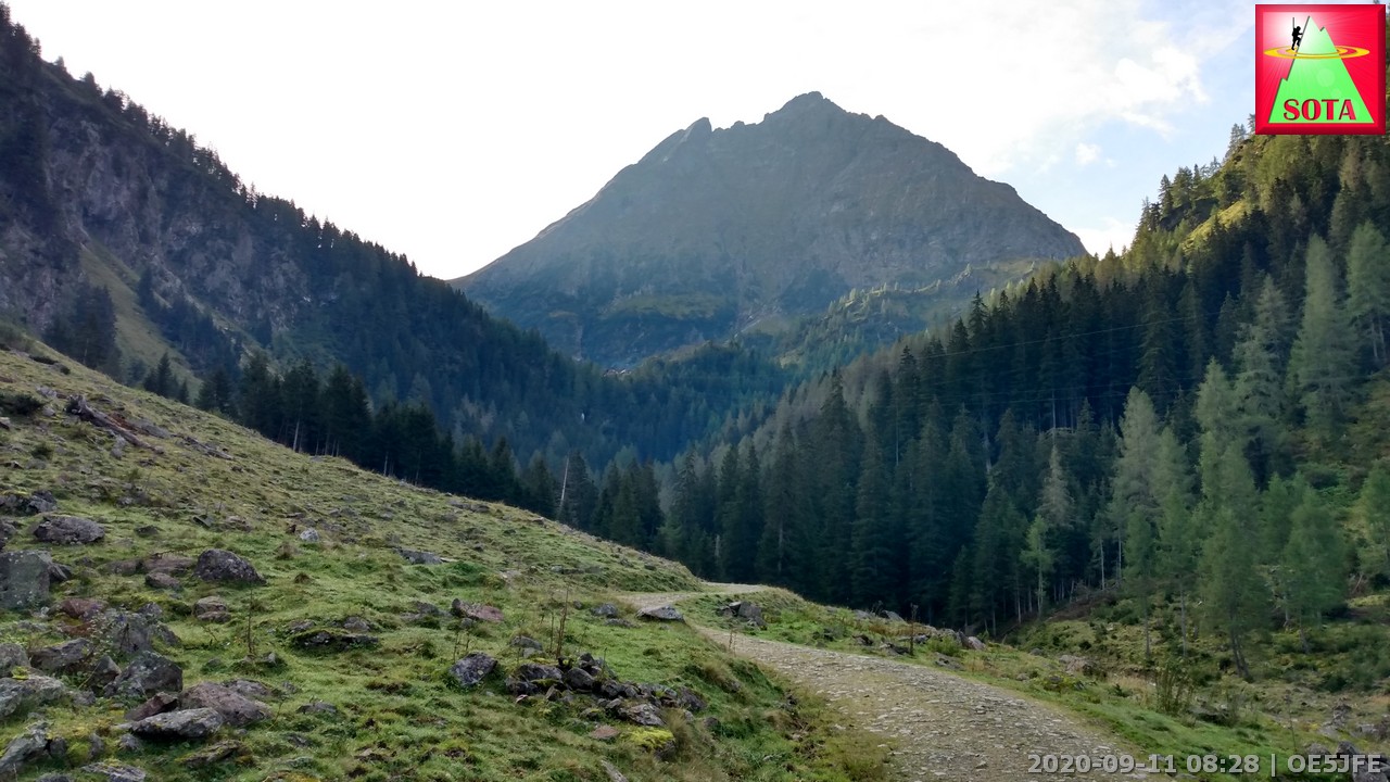
Day 4
Start: Gollinghütte, Mountainhut
End: Preintalerhütte, Mountainhut
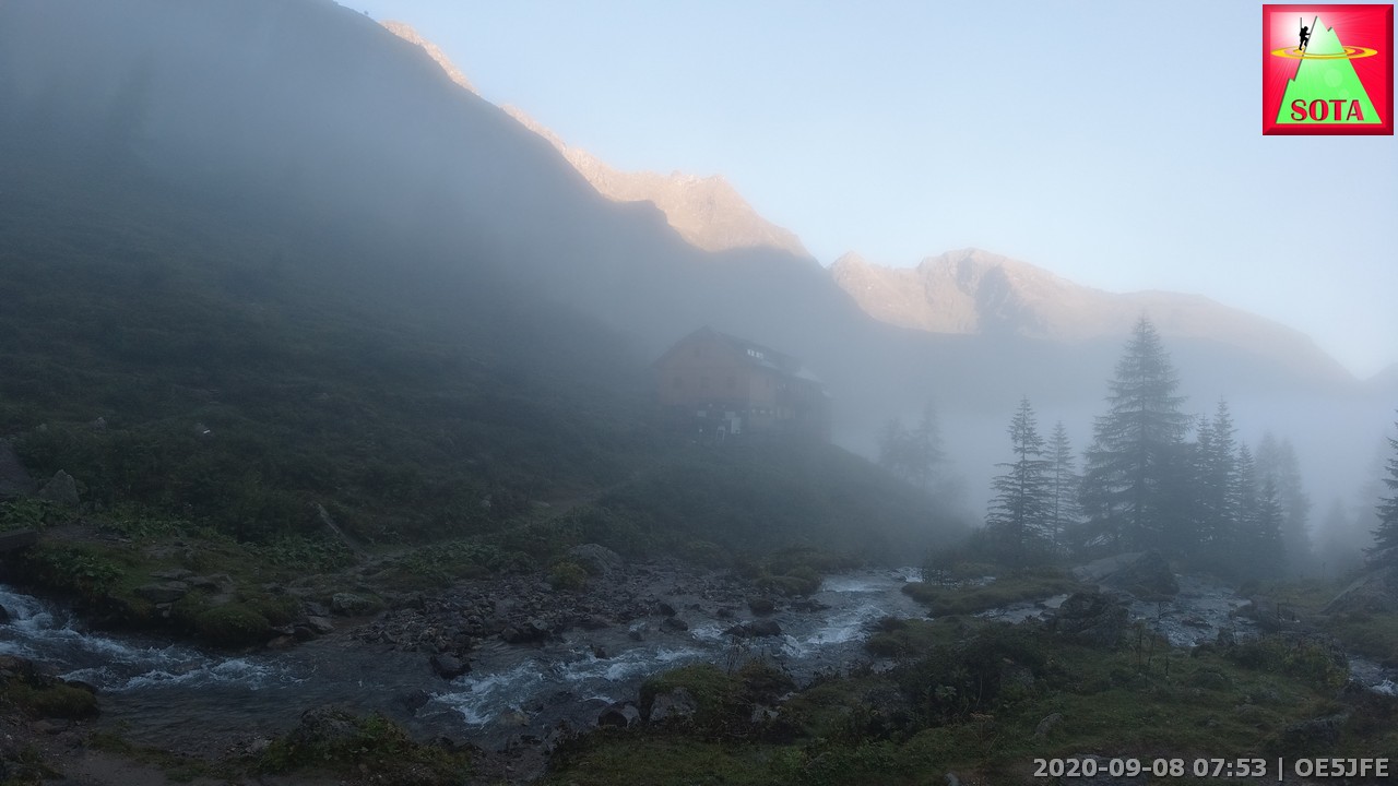
9,12 km, Ascent: 1094m, Descent: 1009m, Time (incl. activation): 8h 04 min
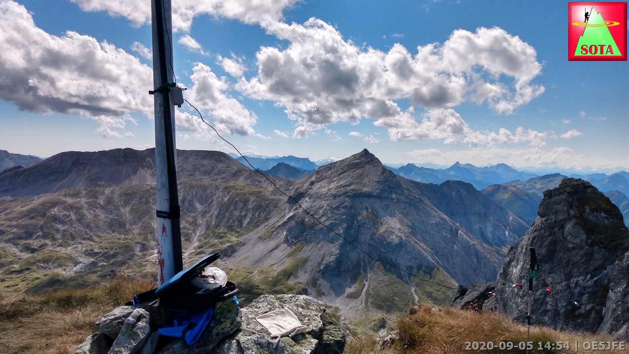
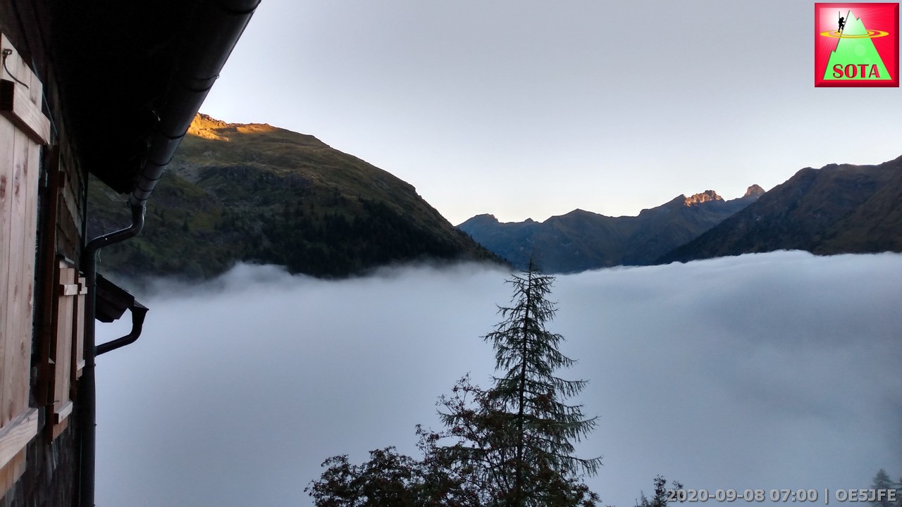
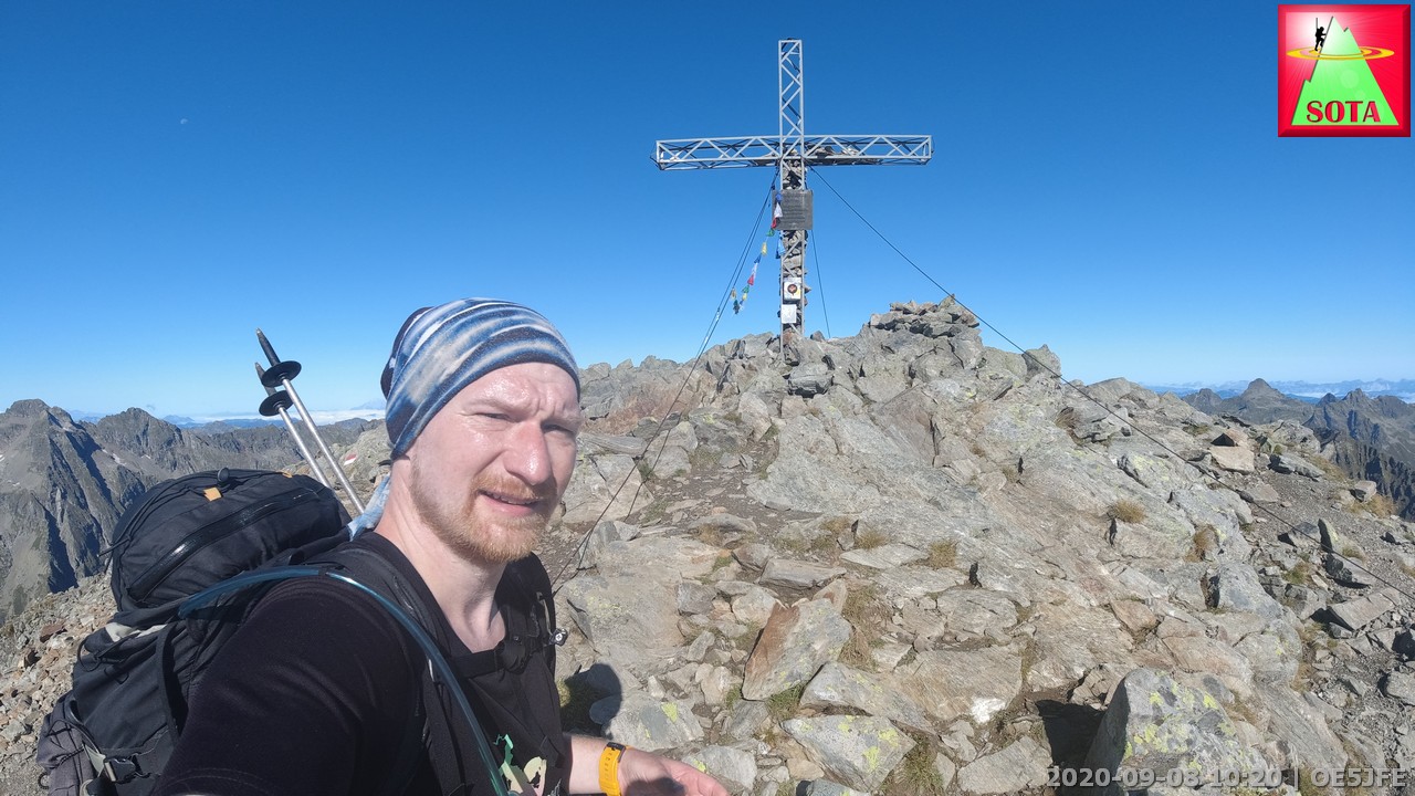
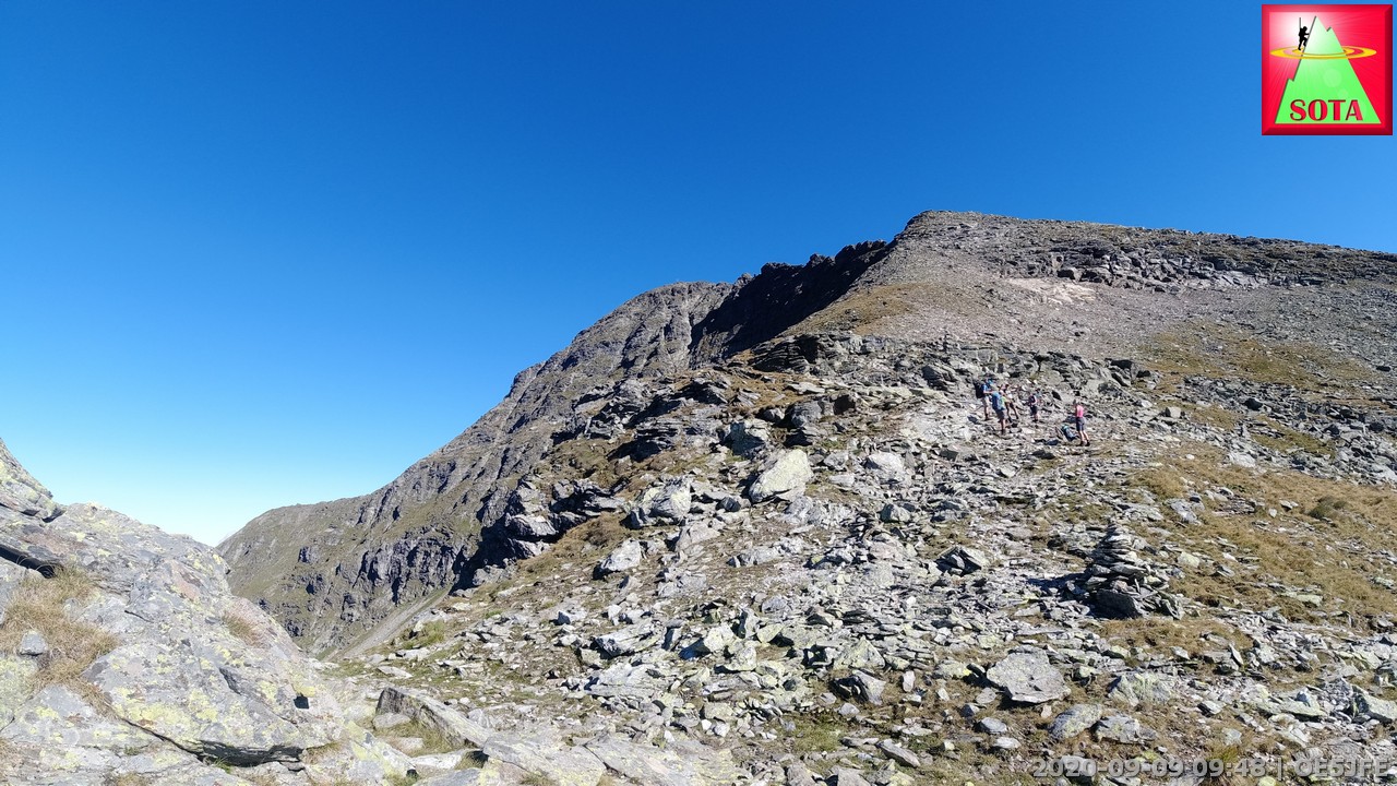
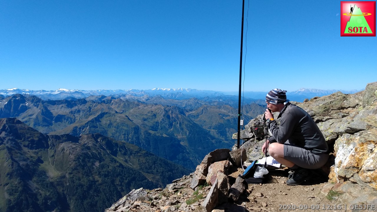
Looking outside the window at the bunkbed area gave hope for a great day. A layer of fog in the valley and blue sky above. After the breakfast at 7:00 I begun the 1000m ascent up to the highest point today the Greifenberg OE/ST-008. After the past two days I was full of energy and reached the summit in less than 2,5 h. The sign suggested 3h ![]()
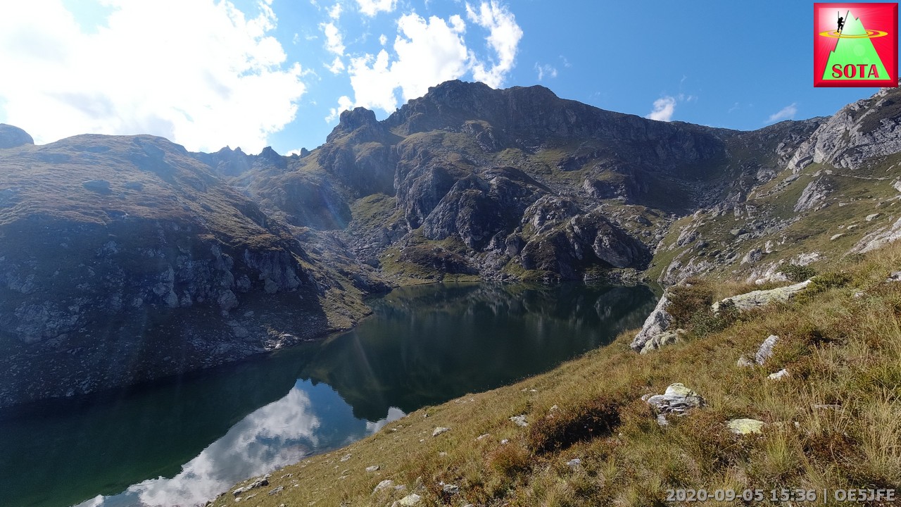
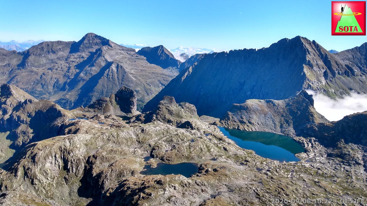
So far I was the only one on the summit but that changed quickly. I found a place using a big rock boulder to mount the 6m telescope mast and started on 2m FM. The J-Pole wire antenna again performing great made this activation a success which is not obvious on a weekday in OE/ST. 12 QSO on 2m FM were followed by 5 on 20m SSB. But apart from the fun talking to you guys on the radio the scenery was just magical. Fog in the valley like a hand spreading the fingers. Clouds swaping over mountain saddles and the blue lakes of Klafferkessel infront of me.
After some lunch snack I continued on to reach the bigger lake in the Klafferkessel. I found a small bay at the shore and and quickly went to a very cold naked :-o swim.
I used the break to connect the 8 W solar panel to my LiFePO4 5Ah battery and charge up to 14.4 V. At the same time a dual 5V USB adapter was charching my phone and GPS watch.
The steep path down to Preintalerhütte needed good attention but was no big problem overall. This hut so far was crowded the most. Keeping distance was very difficult but the hut warden managed a exact table and room management to minimize the risk in COV-19 times.
What a promising morning view:
Leaving the cosy hut
Greifenberg OE/ST-008 ahead
Greifenberg OE/ST-008, 2618 m
Klafferkessel lakes (kessel = eng. cauldron)
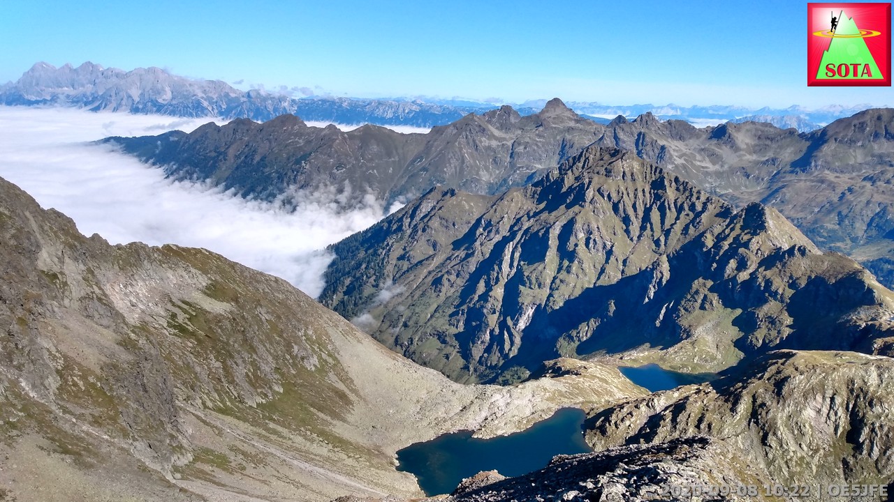
Looking back to Hochgolling OE/ST-001 - I will come back for you my rocky friend
Day 5
Start: Preintalerhütte, Mountainhut
End: Preintalerhütte, Mountainhut
7,7 km, Ascent: 1159m, Descent: 1159m, Time (incl. activation): 8h 46 min
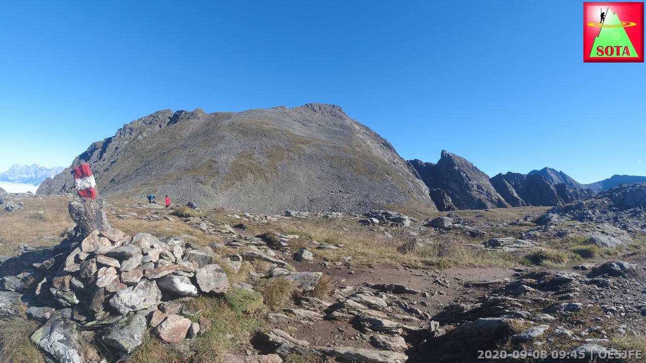
Day 5 was dedicated to the first activation of the Hochwildstelle OE/ST-002 the second highest mountain in Styria and the highest that is not sharing border with other Austrian federal states.
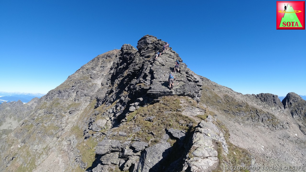
Originally I planned to ascent via the normal path but I decided to give the more difficult south-east ridgeline climb a try to do a full traverse of this summit. It is very exposed with no errors allowed.
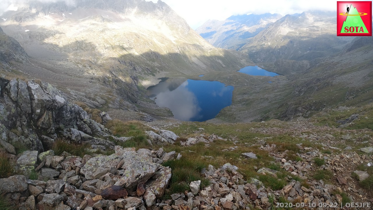
But the first part - that is the official long-distance hike to reach Breitlahnalm - was very well prepared and a great scenery walking up the valley to the saddle. Small lakes and grass covered areas alternating with some rocky sections.
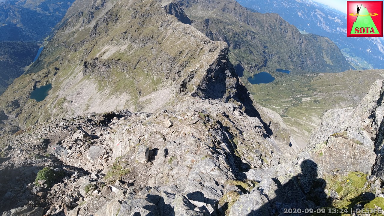
Just before the saddle the path splits and finally reaches a section of big blocks on the ridgeline. Steel clamps provide extra hand and footholds. A funny stomage feeling and week legs a likely to happen looking down some hundred meters from a narrow ridgeline.
The sketchiest part for me was a 7-8m long upward traverse without any support. This is definitly only recommended in perfectly dry conditions. Again errors are deadly here.
But my rock climbing experience and full focus let me reach the top. Underwear in prestine condition ![]()
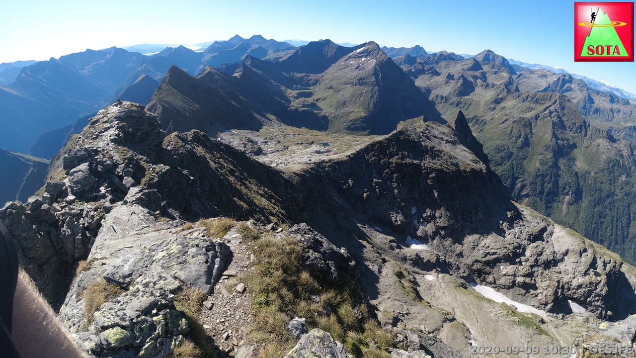
A the summit a number of people was enjoying the view and I found a big boulder to mount the mast. 2m FM was working great on such a high summit as you can imagine. ODX on 2m to S57UW with 308 km. On 20m SSB I was happy to hear the usual dedided chasers from all over Europe with Spain being very strong that day.
Weather was warm and stable and so I stayed 2,5 h on the summit. The descent required full focus again. Flat slabs but fortunatly rough required good shoes and trusting in the friction of the sole.
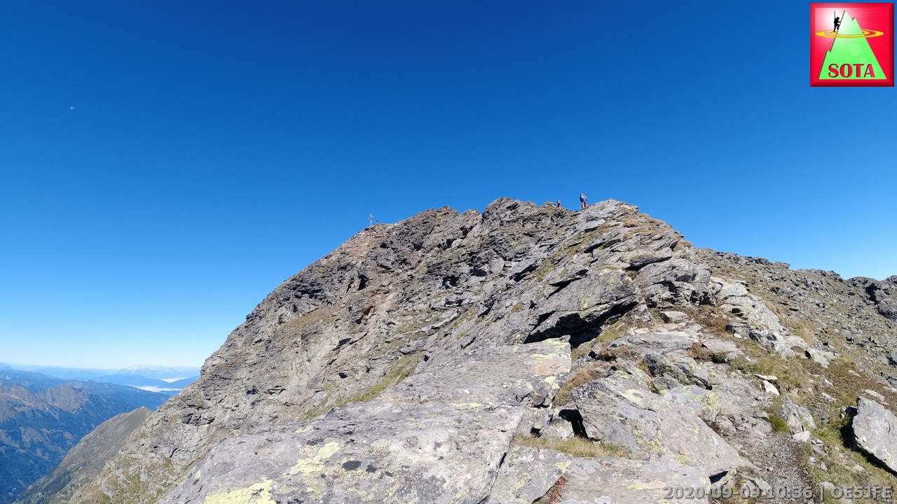
An ascent via the normal route is definitly a lot easier but definitly no walk in the park and required good balance and skills. After reaching the saddle between the Hochwildstelle and the Kleine Wildstelle things were getting easier.
The path from the saddle Neualmscharte is in good condition and I was again taking a break and solar charging my equipment. That’s why the total time is so long that day.
Ascent time was 3h 10 min from the hut. Descent time was 2h 30 min.
Preintalerhut
First view to south ridge climb (summit in the center)
Up on some gravel and then the climb starts
UIAA Grade 2+ difficulty free climb.
Looking back
An easier section inbetween
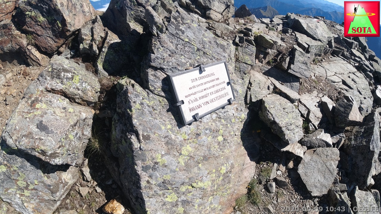
Archduke Johann of Austria memorial plate for his climb in year 1814
What a view on Hochwildstelle OE/ST-002, 2747 m
One of the best activation pictures in my collection
That the normal route down… FYI
Day 6
Start: Preintalerhütte, Mountainhut
End: Preintalerhütte, Mountainhut
Based on the recommendation of the hut warden I decided to go for the summit Waldhorn via the Kieseck traverse. Before a wet and dirt covered corner I decided that I am not in good enough moral condition for that type of climb. So I went back and enjoyed the view over the Sonntagkarseen and took a rest in the sun that finally showed up.
The cake and coffee at the terrace of the hut helped to cope with the failed ascent. I am on holiday so take it easy Joe ![]()
Sonntagskarseen
Day 7
Start: Preintalerhütte, Mountainhut
End: Hochwurzen cable car via Riesachfall parking, Shuttlebus back to car
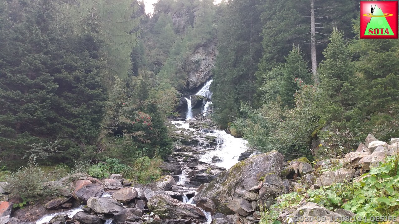
After the breafast and farewell to the crew of the hut I walked down along the forest road back the the waterfall Riesachfall were a good number of people already have been filling the carpark. I needed to wait about 50 minutes for the bus and enjoyed the views. The bus ride took about 25 min back to the startingpoint of day 1.
Good english resource on that section
Schladminger Tauern High Trail - 5 Day Hut to Hut Hike in Austria)
I contiued my trip even more and did 5 more activations on the following days.
You can find tracks and pictures already on sotl.as:
Kareck (OE/KT-330)
Speiereck (OE/SB-354)
Bauleiteck (OE/ST-021)
Süßleiteck (OE/ST-012)
Rupprechtseck (OE/ST-010)
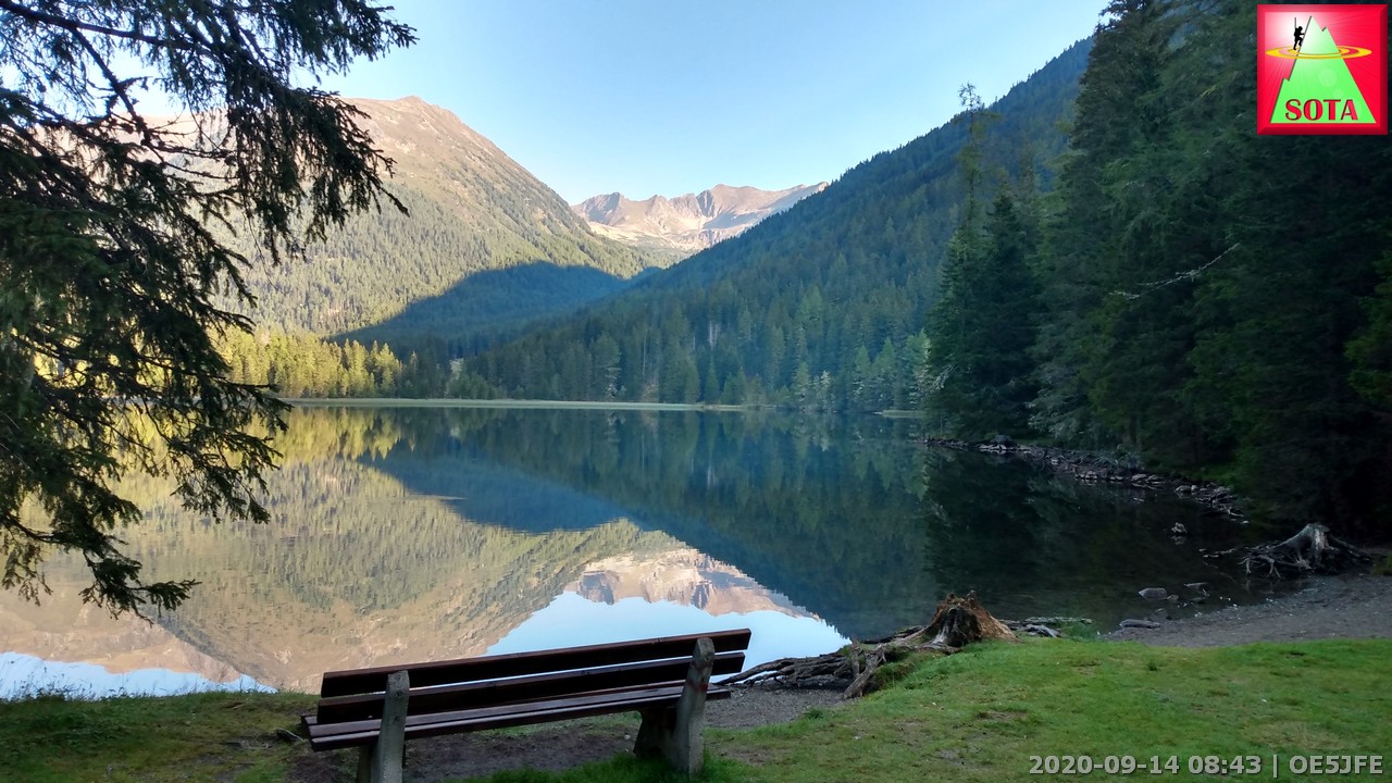
I can recommend visiting the Rudolf Schober Hütte at the Etrachsee and doing all three hikes (the last three links) there:
Etrachsee
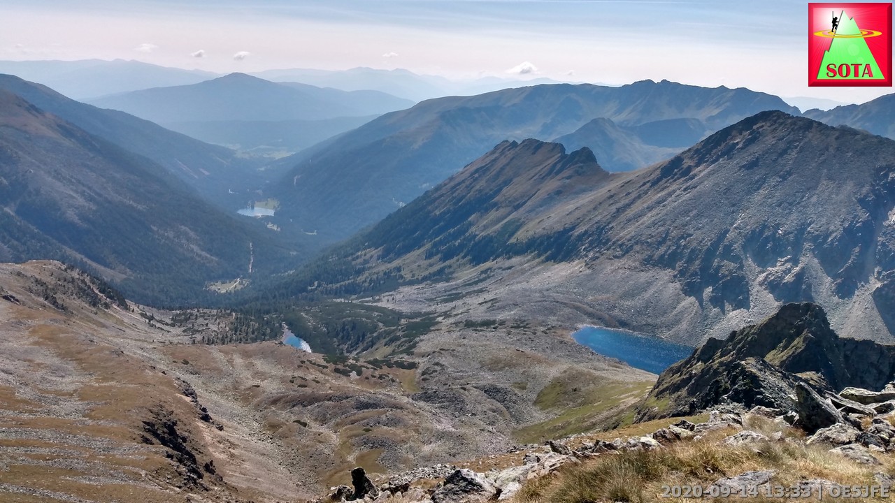
View from Bauleiteck OE/ST-021
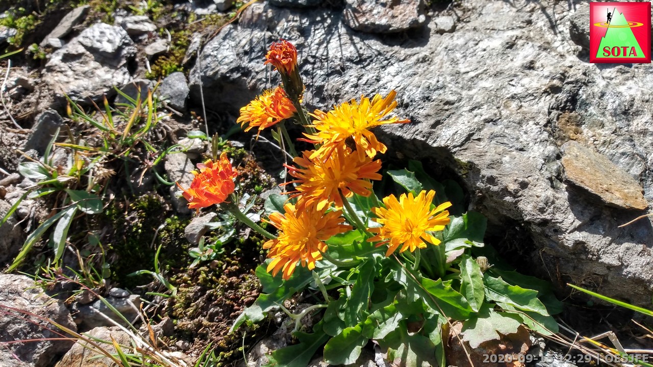
Flowers on the way to Süßleiteck OE/ST-012
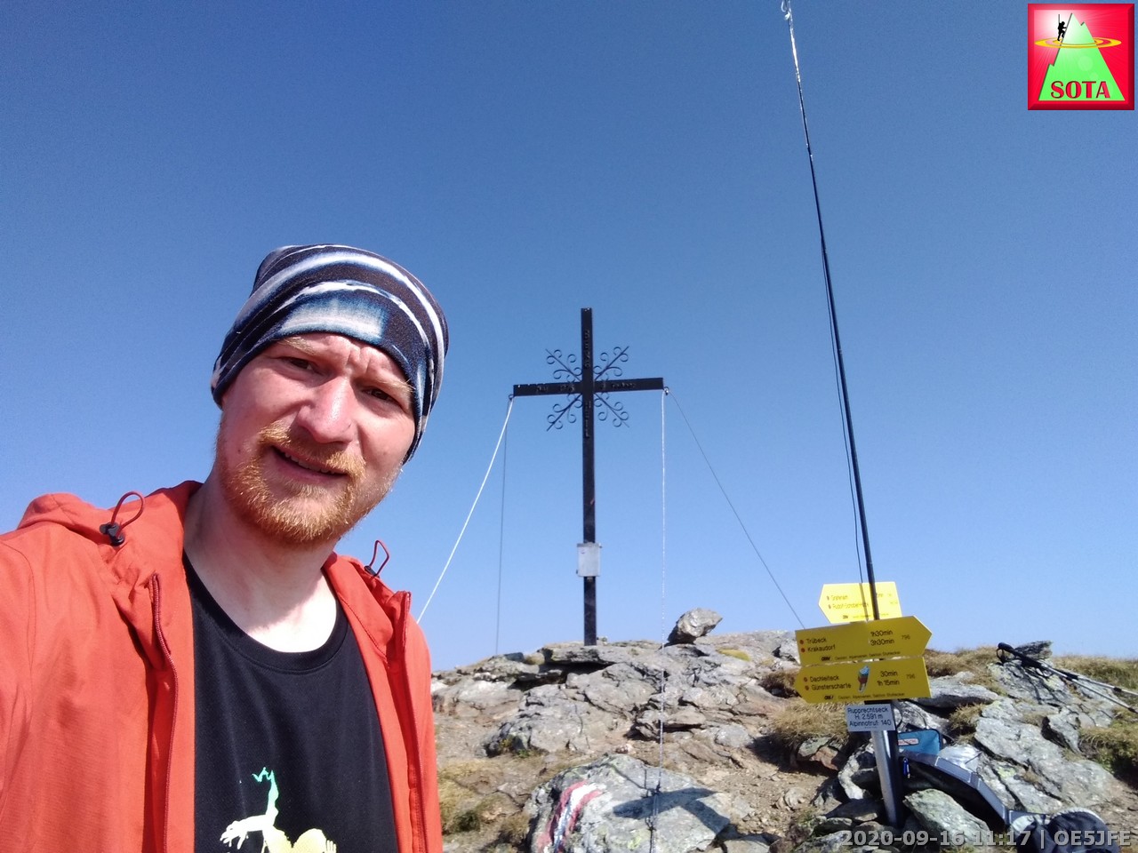
Perfect antenna mount at Rupprechtseck OE/ST-010
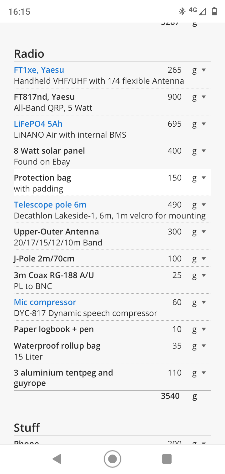
Equipment:
During the multiday hike and later to reach the hut I carried this along:
https://lighterpack.com/r/t1vfjp
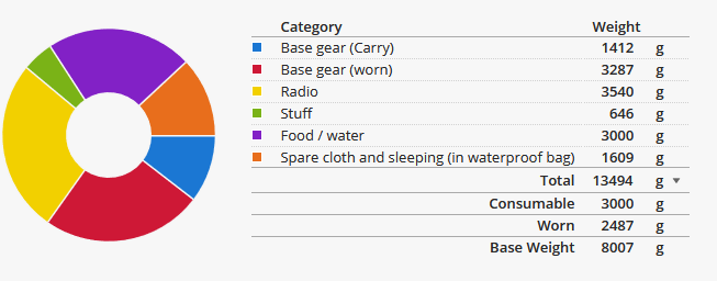
For the daytrips from the hut I of course only brought what I needed: Radio gear, snacks and water.
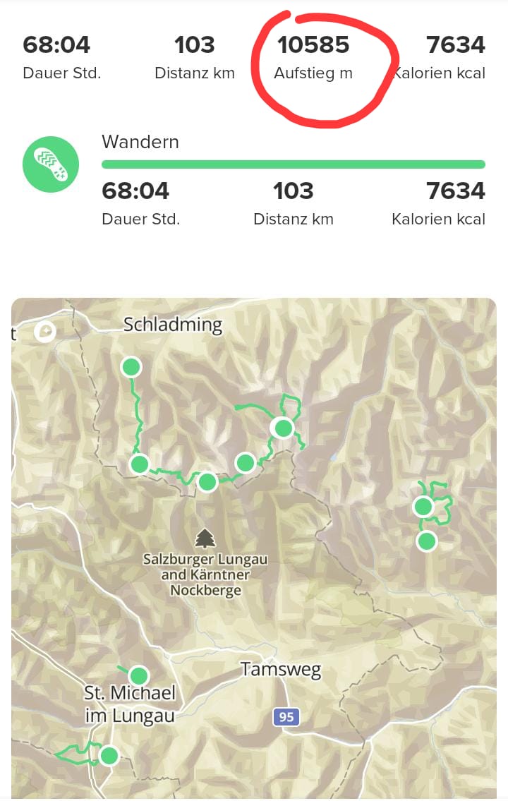
In total in those 12 days I activated 9 summits (5 were first activations).
In total I did 10585 m ascent (that is a quarter marathon up) and a distance of 103 km walked.
Thanks go out to all the chasers that helped me makes this adventure a lot of fun and rewarding in so many ways.
73 de Joe