Continuing the discussion from not.reliable.enough (Part 1) - #100 by MW0WML.
Previous discussions:
Continuing the discussion from not.reliable.enough (Part 1) - #100 by MW0WML.
Previous discussions:
Well what an interesting experience…
Today I’m on dog watch as Mrs. FMF is away sorting out her late mother’s house so no mountains for me. It was a fabulous day so I thought we’ll go to the beach and Crammond Island, there’s a causeway from Crammond, Edinburgh ( a posh suburb ). But the tide was only just hour past high tide so not possible to walk the causeway so we wandered on the beach which was available and later walked the promenade. After 4km out we turned back. The dog was loving this so many new dog smells!
On the way back there were 5 or so people standing around with their dogs. When I got closer I could see there was someone laying on the floor. It was a cyclist with all the gear (clip in shoes, helmet etc.) and he was laying still and looking very, very pale. A woman was talking to him to keep him calm and he was able to answer simple questions (age, name etc.) another guy was assisting the woman and the others were faffing with phones trying to find out exactly where they where. I checked that the ambulance had been called but all of them were concerned they weren’t sure of an accurate location. I pulled out my phone and dropped a waypoint in Orux maps and could see the lat and long. I took the guy’s number and said I’d walk towards the car park and would call in with the lat&long and call him when I found the paramedics etc.
I called 999 (112/911) for the ambulance and discovered that there is no way you can ring the ambulance dispatchers and give them extra information for an existing call. I had to repeat all the info they had before I could give more. Of course only trying to add info, I didn’t have the answers to most of her questions. We got to the location… “What’s the address?”, “There’s no address it’s Edinburgh Promenade midway between Crammond Car Park and Granton Point”, “Yes but the street address”, “It’s the promenade that runs from Crammond to Granton Harbour, there’s no buildings. I have a map reference.”
She asked for the reference but it was windy and I was under the flight path for Edinburgh Airport. There was a 737 coming in to land every 3 mins. I was able to get out of the wind behind a tree and dictate the map ref 55.9???N 2.5???W. “That’s not a valid map reference”. We did this 3 or 4 times and I said “well it’s just over 2km from Crammond Car Park going East.”. She was happy with that and said she could see it has been reported already and the crew was on the way. She told me she had no way of getting position information from 999 mobiles automatically.
I headed back to my car and saw an ambulance parked on the road about 200m back from the promenade. I saw 2 paramedics and A. N. Other. I checked they were for the guy off the bike, and showed them on Orux where we were and where the accident was and then called the guy and told him the paramedics were nearly with him.
OK, so panic over. I can tell you that when you have a 4 decimal place lat&long and the emergency services can’t use it and there’s no street address to give them, then it’s very stressful especially considering how pale that guy looked. Back at the car it was boots off, dog watered and we set off when I got a phone call. Scottish Ambulance service. They wanted to check info and I said I had met Paramedics making there way. “How did you know they were for this gentleman?” "I asked them if they were for the guy who fell of a bike and they said yes. " “Oh! That was good.” I asked him how do you give a location if no street address, why was the map ref no good. He told me it looked fine to him and they use map refs all the time.
At no point did they get automated location info from my phone. They never asked for What3Words. The call handler basically was out of her comfort zone once there was no street address. I’ve called in car crashes in the past (between J10 and J11 M56 Westbound, all 3 lanes traffic stopped), fires (kids have set the grass on fire at the local trains station, ambulance for a house address. This was the first time I’ve need to get emergency services to somewhere without an address. Not easy. Perhaps I should have said IO85IX and seen if that would have worked ![]()
I’m wondering now if they can only accept map refs in degree minutes seconds (55d 45m 30s N) and not decimal degrees. I can’t recall when I last used any computerised mapping software that offered me anything but decimal degrees.
Anyway, it was so unbelievably difficult to get more info to an existing call that I was thinking next time I’ll not bother. Apart from the fact next time it might be me on the floor, so I’ll always bother. But it shouldn’t be this hard with the tech we have.
Hi Andy,
Well that is almost exactly what happened to me in 2012 when I called in an ambulance request which came from an HF mobile (Terry VK3UP/m) on 40m. The location was about 400 km southwest of me, but I had the additional issue of not being the man on the spot, where there was no phone coverage, no street address and only HF mobile was capable of contacting the outside world. My first task was convincing them it was a genuine call. No-one from the immediate area was able to hear Terry.
It was a comedy of errors, except that if the injured motorbike rider had a more serious injury, he may not have survived due to the time it took to reach him with medical assistance, then extract him from the accident site.
There were issues of decimal degrees v. DMS format, map references I could not give them in their preferred format, radio coverage problems in the rugged forest for both the police and the ambulance, and their vehicles were actually incapable of reaching the accident site. Terry’s Nissan Patrol was outshining the emergency services in so many ways. And his presence of mind was a key factor in getting that rider to the help he needed.
Finally several hours later, when the patient was at the hospital being treated, the ambulance service called me one more time. It must have been someone who had not been involved, but she had worked out why it was so difficult. She told me if only I had given them a proper street address in the first place, they could have driven straight to the accident site. I didn’t laugh, but I did point out that I had given them the lat/lon and the approximate location relative to the nearest town, and that in the forest there are no street addresses.
But that happened within 5 km of one of the busiest highways in Australia, the Hume Highway, just 30 or so km north of Melbourne. It was in the Mt Disappointment area, for those who know Melbourne. It’s a SOTA summit!
It’s yet another example of fixed mindsets, “accidents always occur at an address which is on a local street map”. And “the caller is always onsite and can tell us whatever additional info we need”. Assumptions underlying an emergency service that fall down very quickly when the situation is quite unlike the “standard” format.
As you say, W3W wasn’t even considered as an option. Very telling.
Glad the cyclist was eventually treated and hope he is ok…
Andrew VK1DA/VK2DA
I’ll tell you what it is Andrew, it’s the feeling of helplessness you have when you can see a guy looking pale and unwell and you have the ambulance dispatcher on the phone and you have the location in a worldwide known format and you cannot get the information across. I certainly felt better seeing a team of three with a wheeled stretcher making their way to injured guy.
For about 10 years, digital radio has been used by the police (110) and a little later also by the emergency services (112). All control centres have been updated, are networked and are equipped with good map material up to aerial photography.
The vehicles have a quite precise GPS… and the handheld radios can also be used with it. Digital radio is available everywhere here in the southwest, even in the field with handheld radios. So GPS data is no secret…
At the moment, a system of defined rescue points is being installed…
And yet… there are still the half-brains at the other end of the telephone line…
73 Armin
I have used os grid references when reporting ti emergency services previously, it seemed ro be acceptable.
The effectiveness of any system depends on the everyday users, or that should be every everyday user, knowing it and being fully competent in using it. I think we are still in a state of transition from paper maps to digital navigation. Until every operator is sufficiently confident and competent, mistakes will continue to happen.
Andrew VK1DA/VK2DA
Emergency services call handlers are sitting in a relatively comfortable environment with technology at hand to help them deal with the calls they are trained to receive. Their systems should be able to deal with any recognised location system (OS grid; Lat/Long in DMS or decimal; postcode or street address) and translate that into whatever format the frontline responders need. They can’t expect the person on scene to do all that whilst dealing with whatever situation they are confronted by.
I know a lot of money has been invested into their mapping system to build a database of local place names (that might not appear on official maps). They will obviously have to clarify with you which “black rock” you are talking about ![]()
There are very, very few countries which have our system of grid lines, which enable anyone with a map to give an accurate grid reference to within 100metres.
I’d be most interested in what system of location other countries use in respect to hill/mountain walking where the person has a map, compass and wishes to report their position.
My Garmin GPS supports these mapping systems. https://support.garmin.com/en-US/?faq=lvWzTYlPsx6BvUDTyKfqC8
You can see from that there are all kinds of country specific grid systems such as the UK OS grid and Austrian, Dutch, German, Icelandic etc. and if all else fails UTM.
As a matter of interest, has anyone had to use the Garmin inreach service in an emergency? Is it reliable? Who answered the alert? etc,
I can believe that’s true. Not every control room (Police Ambulance/Fire etc.) have managed to upgrade their systems to take advantage of the Advanced Mobile Locate service, despite it being available in the UK since 2014. It’s not a great state of affairs.
From personal experience, Ambulance control rooms are poor with lat long or OS Grid. Police much better.
If you are struggling with wind noise it’s worth remembering that you can send an SMS to 999/112.
Edit: note there is the need to complete a one off sign up (free) before using the service. Best done from the comfort of your home, rather than on a wet and windy hillside when you have an emergency on your hands.
See this leaflet.
https://www.scottishambulance.com/media/kauleql2/about-sending-a-text-to-999-tracked-changes-031013.pdf
To my surprise I just noticed today that Google has started using W3W. Clicked on map in an area that Google has still to update and there it was.
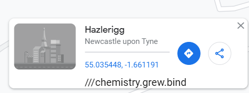
There are new houses being built here.
73 Jim