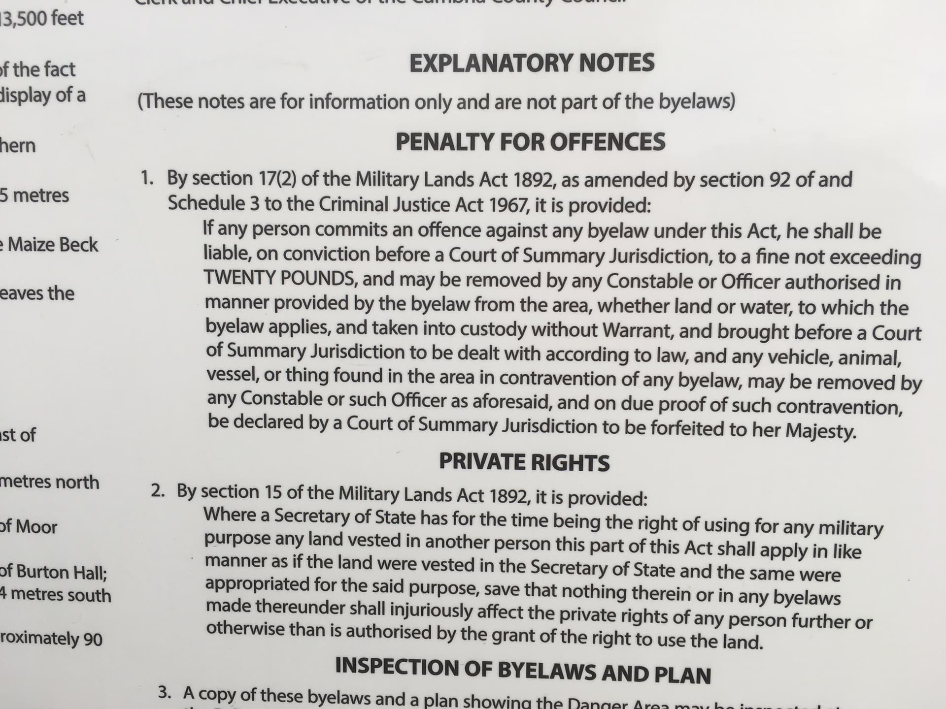
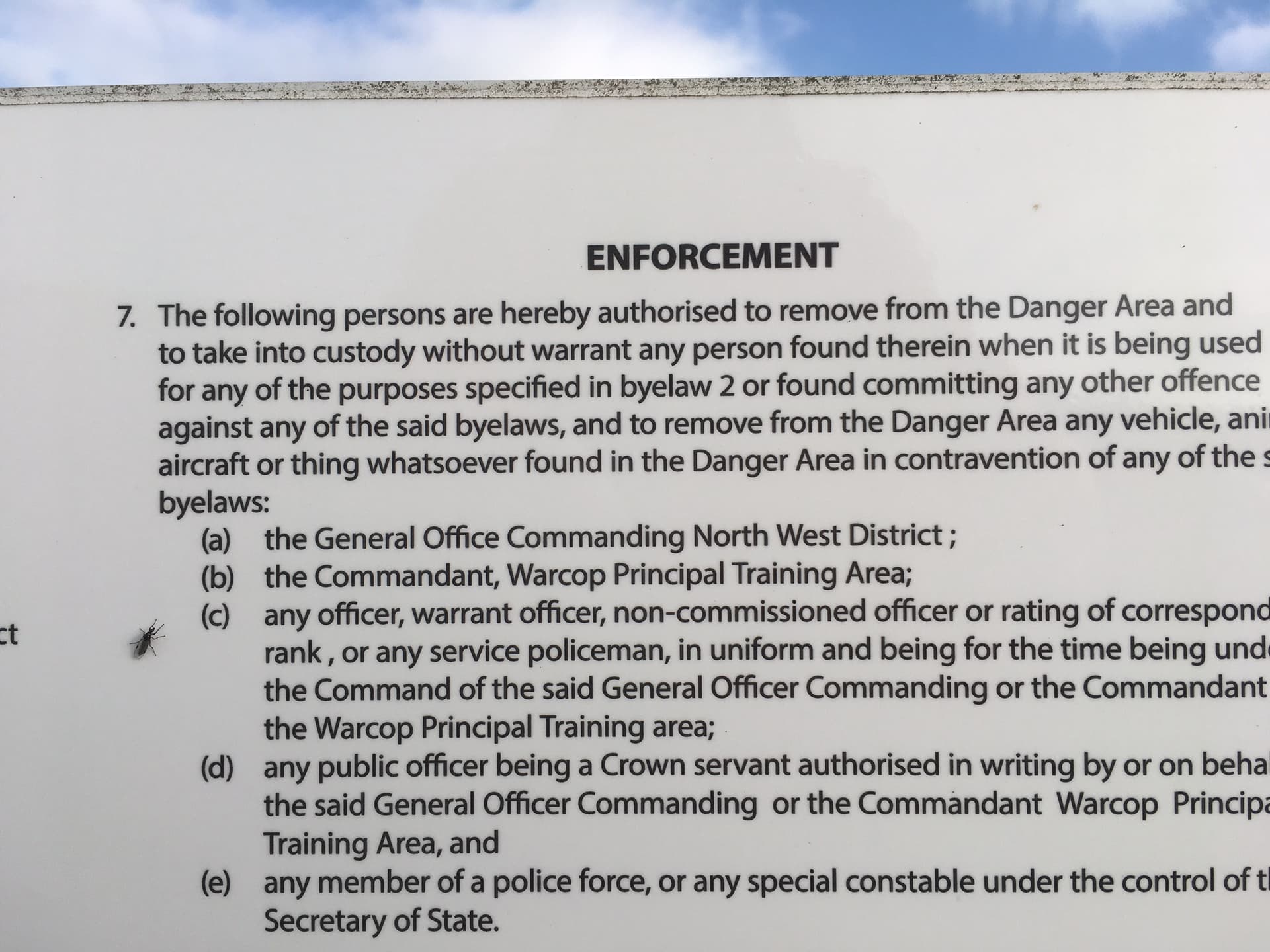
So I’d applied for my ‘permit’, from Warcop by e-mail, and received my permit 10 days later.
Thus armed I set off from the cattle grid on the Brough to Middleton in Teesdale road at 7:30am. The 'approved route basically involves walking along the county boundary line between Durham & the North Riding to the summit. There’s no obvious path, Even leaving the road isn’t obvious as there is a wall and a couple of fences to cross before you start your walk. But there is a public path a few hundred yards back along the road to Brough. This gets you a nice easy walk to Ley Seat and HewiIts. It was here I met a couple of walkers who turned out to be doing a bird survey. To my surprise they turned out to be the owners of much of the surrounding landscape. They’d only heard about the permit system and wondered if they’d need to apply. They also told me the army hadn’t used the area for live firing for some years.
Either way basically pick your way along the east side of the wire fence marking the county boundary and walk over thick heather, peat banks, bogs and tussock grass and the odd bit of quad bike track. There are a couple of bridges where needed.
About half a mile after setting off I got my first view of Mickle Fell. My heart dropped. It looked much, much further than it did on the map.
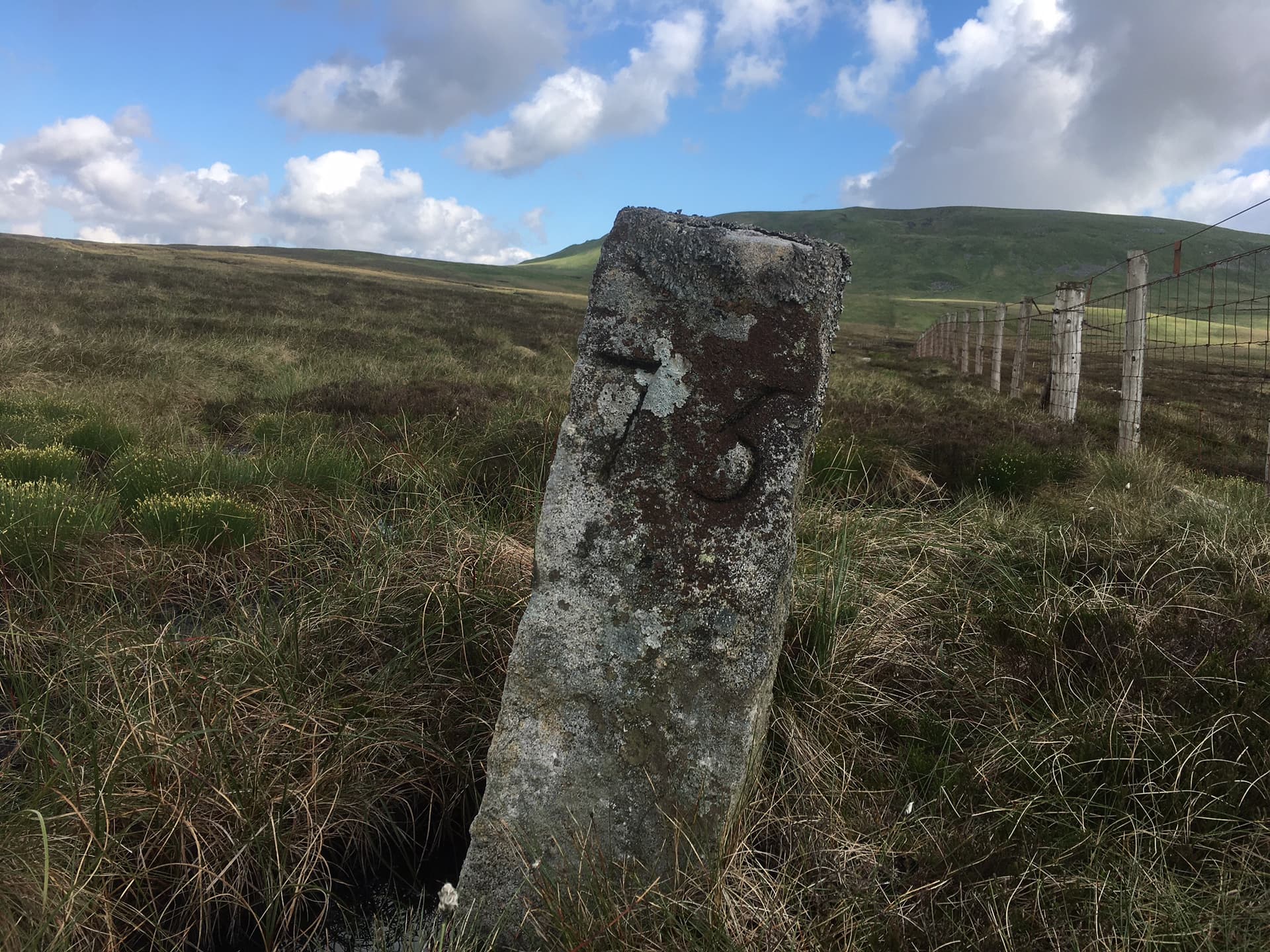
One of the many stone boundary markers along the fence. They are numbered and are about 100yds apart, but many appear to have sunk beneath the peat. Mickle Fell in the background.
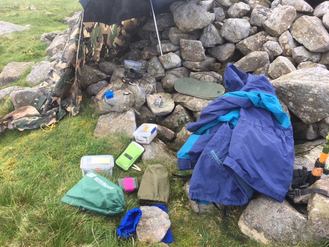
I made it the summit cairn 2 hrs 15 minutes later. The final slope to the top turned out to be the easiest bit of the walk as it was all on relatively short grass. It was 10c on the summit and a fairly brisk wind from the SE. I was glad I’d packed my warm belay jacket and a goretex jacket as I set up office behind the summit cairn protected from the wind by my umbrella and an army poncho.
The Office - What can I say? - I do like as much comfort as I can squeeze out of the summits. ![]()
I self spotted on 7mhz / CW and immediately received my first chaser, GB2WAR a special event station (Military/war) 20 minutes later I had 9 contacts in the log before my CQ Sota calls went unanswered. 10mhz / CW produced a further 11 callers including G4BOK a fellow club member, in 20 minutes before that too went quiet.
I QSYd to 14mhz. It was absolutely jammed with contesters and I struggle to squeeze myself in. Even though I self spotted I got absolutely no answers to my CQ SOTA. No doubt my 4 w was lost in the crowd.
My SW1B I was using only does 3 bands. I’d only been on the top for just an hour so I decided to bring out my old Hb-1b and rigged another band hopper linked dipole and gave a call out on 18mhz,
I think this was the first time I’d ever used that frequency band on a SOTA activation. Much to my pleasure I worked another 6 contacts, including W2WC, and another club member, G4ZAO/p activating G/SB-006.
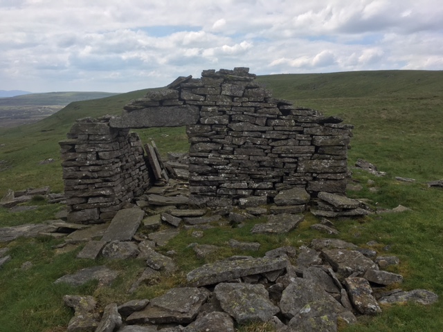
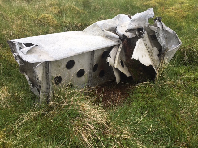
2 hrs on the summit and It was time to pack up, but not before I went to look for the ruin I’d spotted and close by the ever dwindlng remains of the WW2 Sterling bomber crash site. Curiosity satisfied I made it back to the car about 2hrs 15 minutes later. Its no easier under foot going down and I was getting rather weary
The ruin. What on earth was its original function?
And finally a remaining bit of airframe - more information can be found on here, provided by SOTA stalwart , John Earnshaw/G4YSS Do you know the story of the ‘Mickle Fell Stirling’?
And if you want a good visual appraisal of the route to the summit here’s an excellent blog with lots of photos WTDWHD
There’s plenty of clean pure water along the way, so I wouldn’t bother waste your effort and bother carrying any.
Access notes.
There are only 2 official access routes. The southern route from the B 6276 And the northern route from Cow Green reservoir. You are expected to phone the Warcop ‘guardroom’, when you set off and tell them where you are parked along with the vehicle registration number along with your expected time of return. Upon leaving he hill you are instructed to tell them when you have returned so you can be ticked off their list… There’s little to no phone signal so I simply phoned them from Brough with my ETD and again on my departure.
There’s no bomb craters, broken ordinance or any other signs of warfare although I read that Mickle Fell was/is the 2nd back stop for live firing exercises. But as the couple who I spoke to commented, that there’s been no firing of heavy weapons for many years - and they owned a fair bit of moorland estate. In any case there are red flags along the road and there’s no firing anyway on the access days.
I asked the couple what would happen if you simply walked up the hill without a permit (on access days) . “Absolutely nothing”, was the reply. I have absolutely no idea what would happen if you had a permit and didn’t bother phone the ‘guardroom’, or what happens if you did phone the guardroom on going to the hill, but totally forgot to tell them when you returned? Do they end up trying to contact you?.
Just for info the access system I’ve mentioned is entirely run by and operated by a civilian company on behalf of the MOD.
That said, its no real hassle and as I mentioned earlier you can apply for several dates on the one access form in advance and phoning them up is quite simple - but do it before you get to the parking areas whilst you still have a signal.