I haven’t been up to Loch an Daimh (Lock of the stags) for a good 11 years. It’s an amazing place but a bugger to get to. It’s on a spur off Glen Lyon and Glen Lyon is Scotland’s longest dead-end glen at 29miles. This means it takes forever (about 1hr) to drive along as it’s narrow, single track, twisty and lots of blind bends and summits. There are two huge dams built in the 1950s as part of the Breadalbane Hydro scheme and you can drive to them and park by them for walking. You used to be able to park at Loch Lednock and the dam but the road is now gated. I was concerned that this may have happened here but I couldn’t find anything saying “no access any more” on the intarwebz.
You can imagine my horror when I found this about 1.5km from the target.
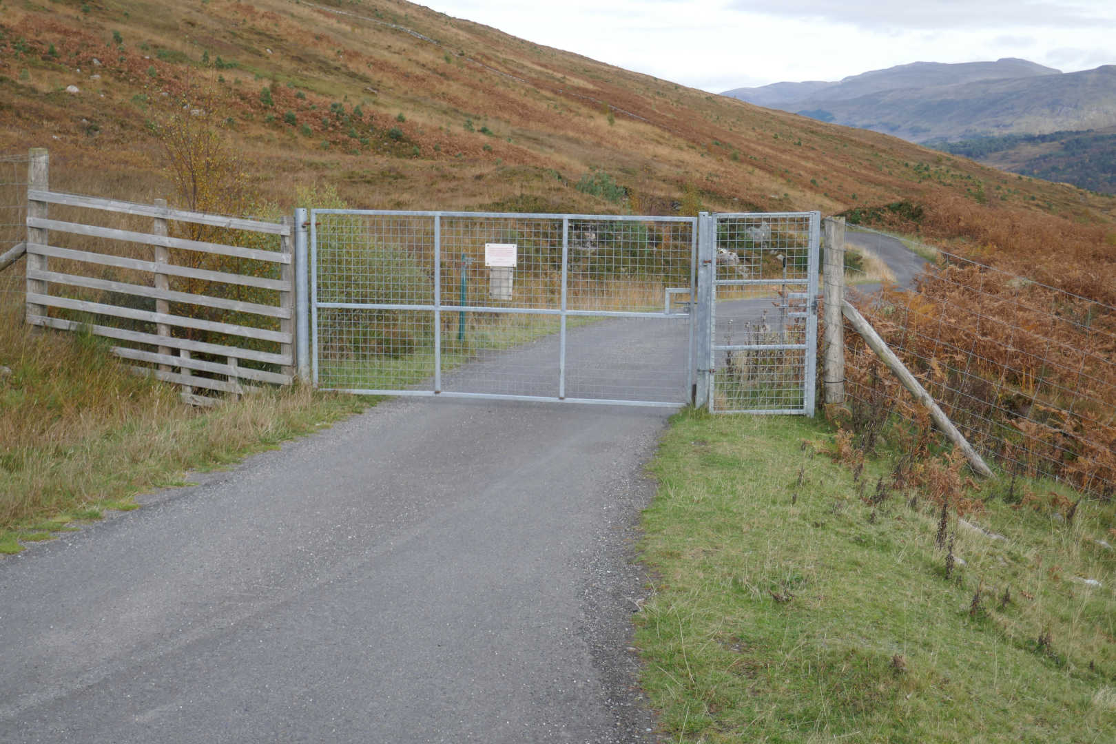
Inspection of the sign says essentially that they’ve done massive replanting of native Caledonian forest and the deer and sheep love eating it. So please close the gate after you have gone through and close it if you see it open. Phew! Not only are you still 1.5km from the normal car park but it’s a good 1km back to anywhere else to park.
The WX forecast was OK for Friday as it was very windy on Thursday. I’ve started using mountain-forecast.com along with the UK MetOffice website to get better forecasts, mountain-forecast.com is good. So a cold day, -3C with windchill on the tops but sunny spells predicted. That will do, but I added more Winter clothing to the bag.
Anyway, 2hr20 after leaving home and with the relief the gate isn’t locked, I parked up. 2 other cars parked. Meall Buidhe and Stucd an Lochan being 2 easy Munros climbed from here. It is difficult to describe just how beautiful Glen Lyon is, you have to concentrate on the road but the scenary is breathtaking especially as the rain showers had cleared and the sun was shining. The car said 6C and outside in the wind, not strong, it was damn cold. Boots on, bag packed and I was ready. I’d packed my big Down jacket and the artificially filled belay jacket and 2 fleeces. I had to stop and retrieve a second fleece from the bag as the windchill was that bad. Just the big Down jacket in the bag.
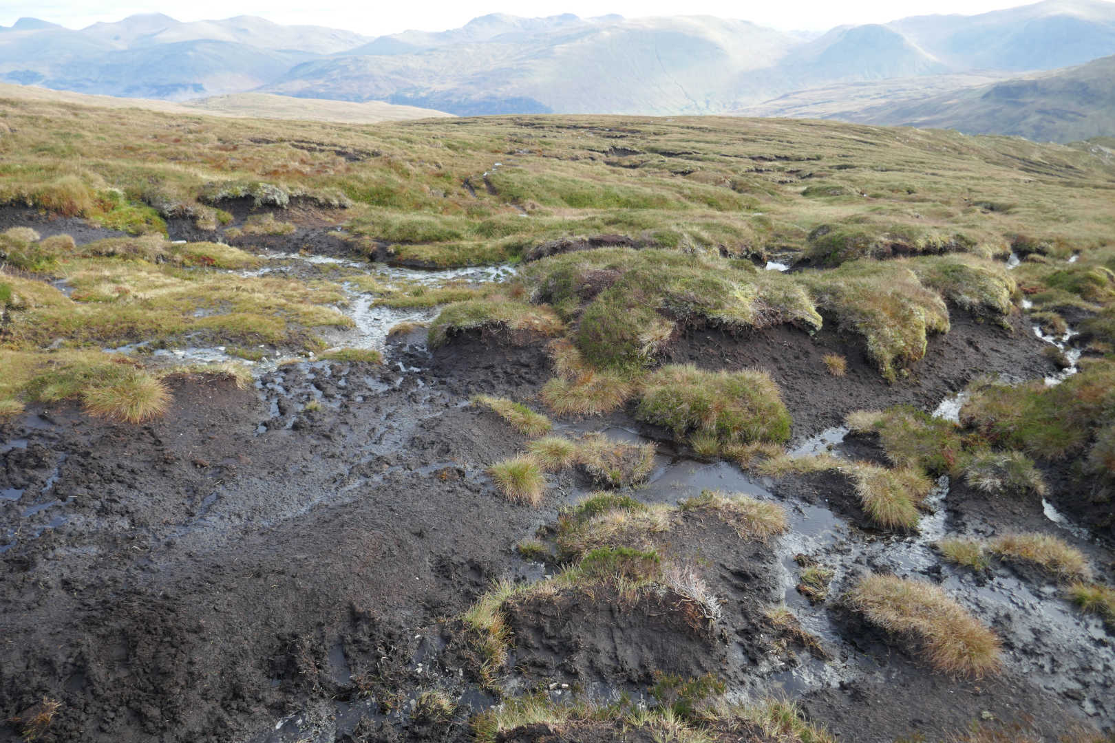
The route is simple, up the dam access track from the car park and then left and at the wee cairn turn off on to the path. I’ve done this summit in 2008 and didn’t remember the route apart from the big flat plateau. Anyway despite a very dry Summer, we’ve had a bit of rain recently and with so many people holidaying in the UK because of Covid, the path was a wet, muddy nightmare. Well not that bad but just sloppy. Nowhere was the mud deeper than a few cms. But it was just a squelchy trudge along. It’s very obvious and impossible to lose the path. Just before the final ascent you come across an area of Peat Hags. These were sloppy but nowhere was the mud deep enough to swallow a boot. It is possible to lose the path here.
You can see how far the hags extend. This is on the return route and I’m about halfway through them at this point. Yeuch!
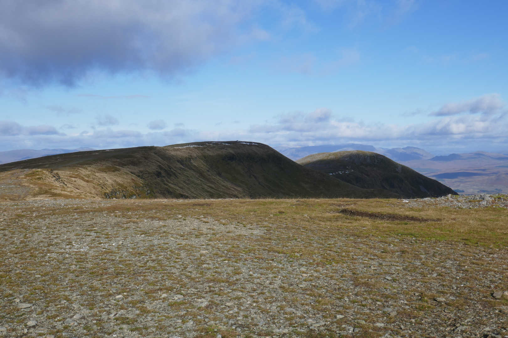
After this there’s a steeper bit and then you hit the final plateau. The views are really good from here and it’s a bimble to the true summit. With 2 fleeces on I was warm out of the wind but they did a good job on the plateau as the wind was blowing, probably only 15mph but it wasn’t half cold!
Just over a km to the true summit and easy walking. But yes, there are snow patches in October.
I set up just down the slope out of the wind and did 60m, 40m, 30m, 15m in that order. RF conditions were really good. 60m was excellent, plenty of NVIS and also no problem working up to 500km. After that, 40m SSB. The band was hard open for inter-G contacts and I worked plenty then it switched and I was working Sweden and Spain then back to inter-G. Then 30m, plenty of QSOs here. Having made the tweaks to extend the 40m section I went onto 15m and worked 2 French and 1 Greek station. It was now 1410 local. It took 1hr50 to get up and if I allowed 10mins for system takedown, 5 mins for photos and 1hr50 to get down it would be 1630 local. I did think about swapping the antenna for 20m and whilst I wasn’t worried about time I was damn cold. That was what made me stop. 930m ASL at 56N at the end of October does limit operation.
I packed up and came out the way I came. I was back at the car and boots off by 1615local. I drove back and was delighted to see the Bridge Of Balgie tearoom was open. They serve the best cup of tea in the UK. You used to get it in a pot with china cups but it was in a disposable mug now, probably because of COVID. I sat outside savouring the views and the tea and possibly the best sausage roll I’ve ever had as well.
Photo time:
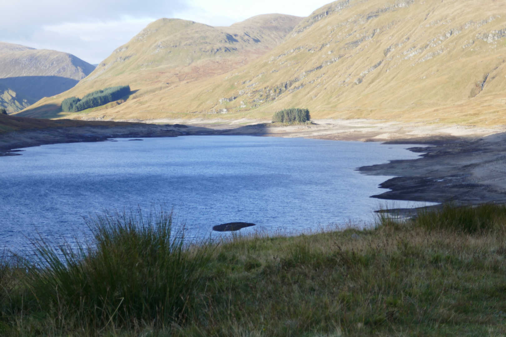
Looking up Loch an Daimh. The water level is abnormally low, we had a dry Summer but I wonder if they had dewatered the loch for maintenance?
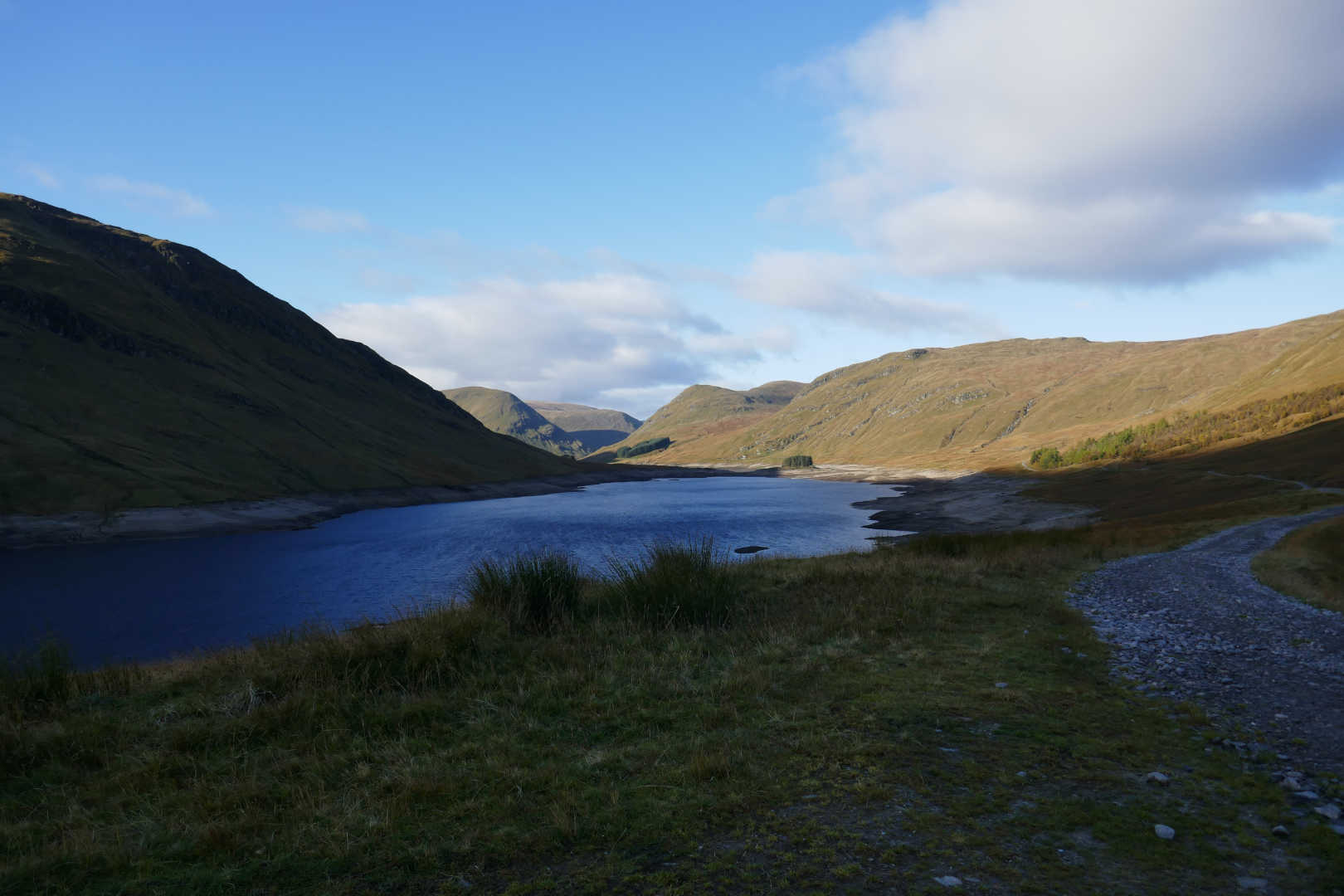
A zoom shows how much land is exposed that is normally covered.
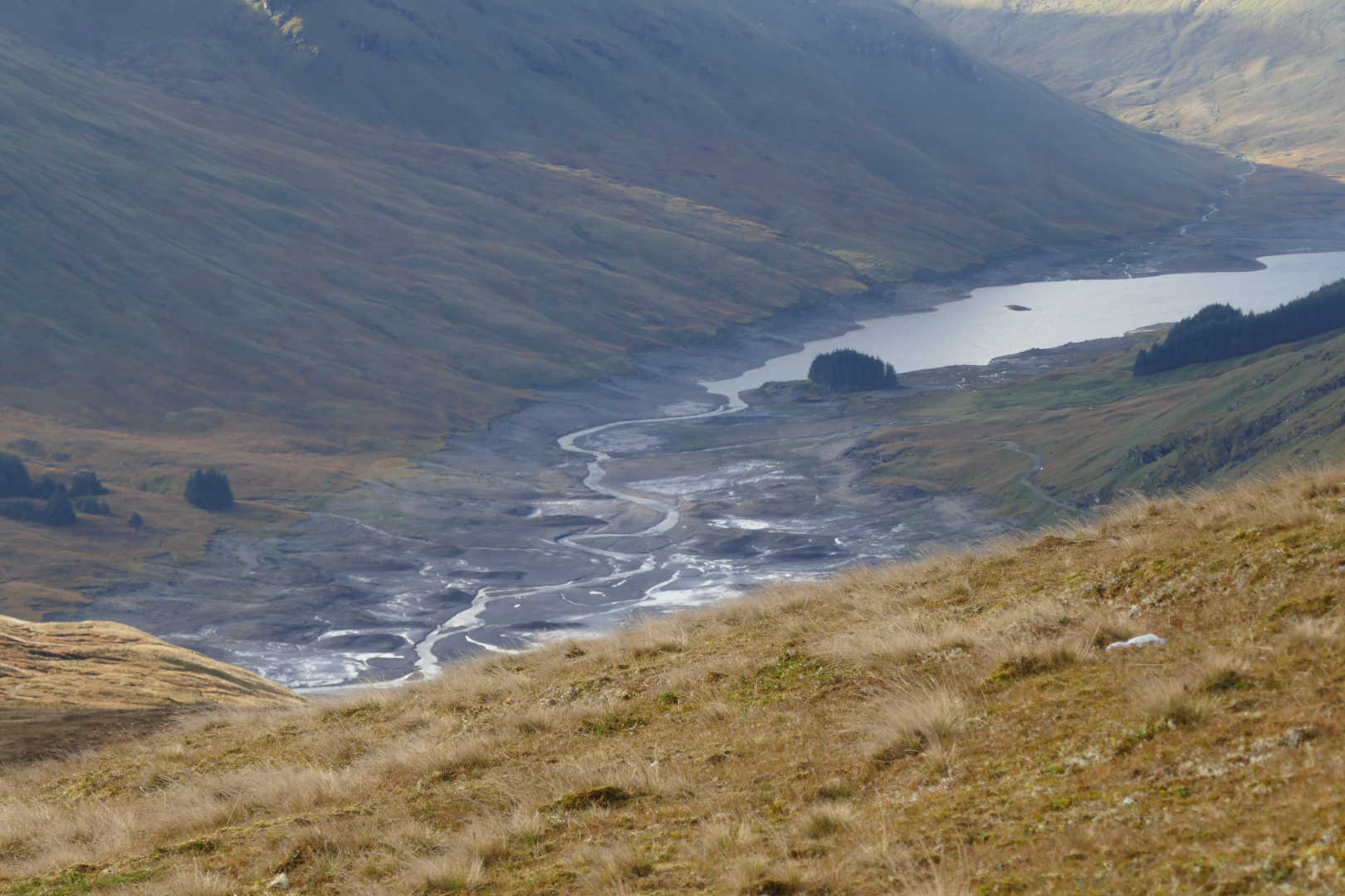
From much higher up you can see that the water is back to the pre dam levels. That loch is the old Loch Daimh and the previous is Loch Giorra. The original river between them hasn’t changed despite being under water since 1957.
Here’s the old 1956 pre dam map showing the lochs and river. (OS 1in to mile). The purple line is the rough location of the dam
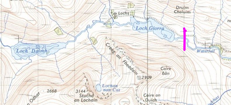
© npemap.org.uk
And the 2014 OS map
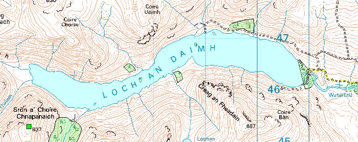
©Crown copyright 2021 Ordnance Survey. Media 018/21
Just coming onto the ridge, my first snow of season. The shapely hill is Beinn Mhainaich GM/CS-034 I think.
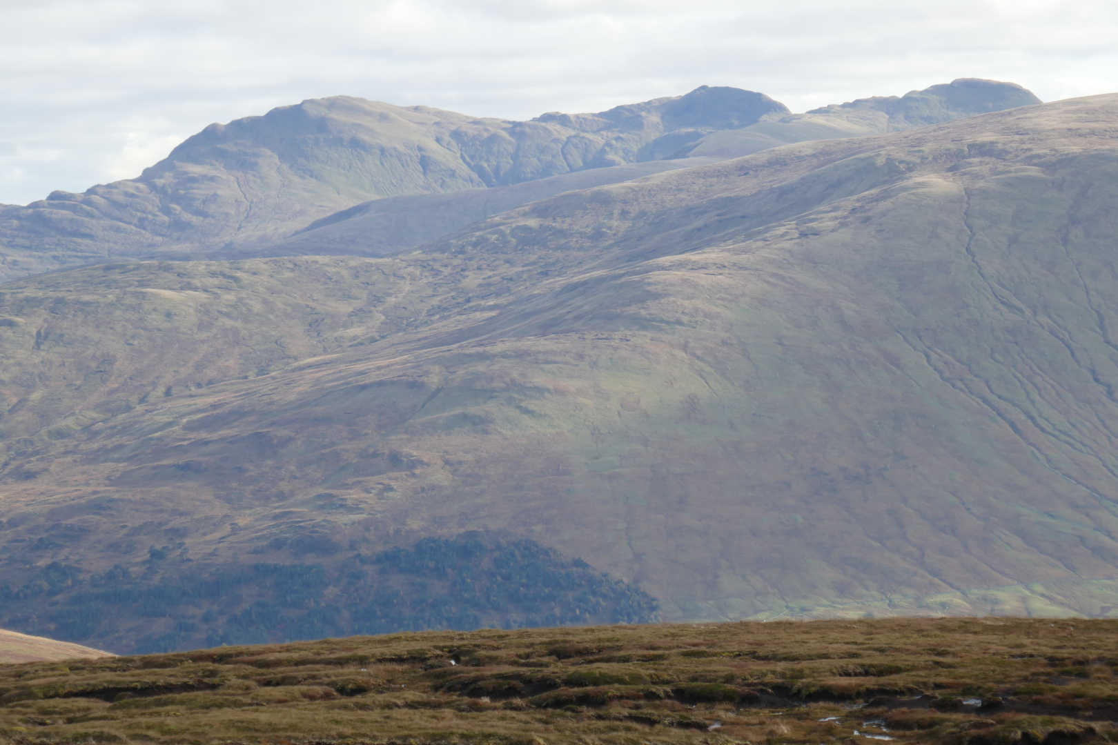
Ben Nevis GM/WS-001 and friends showing the early snow coverings.
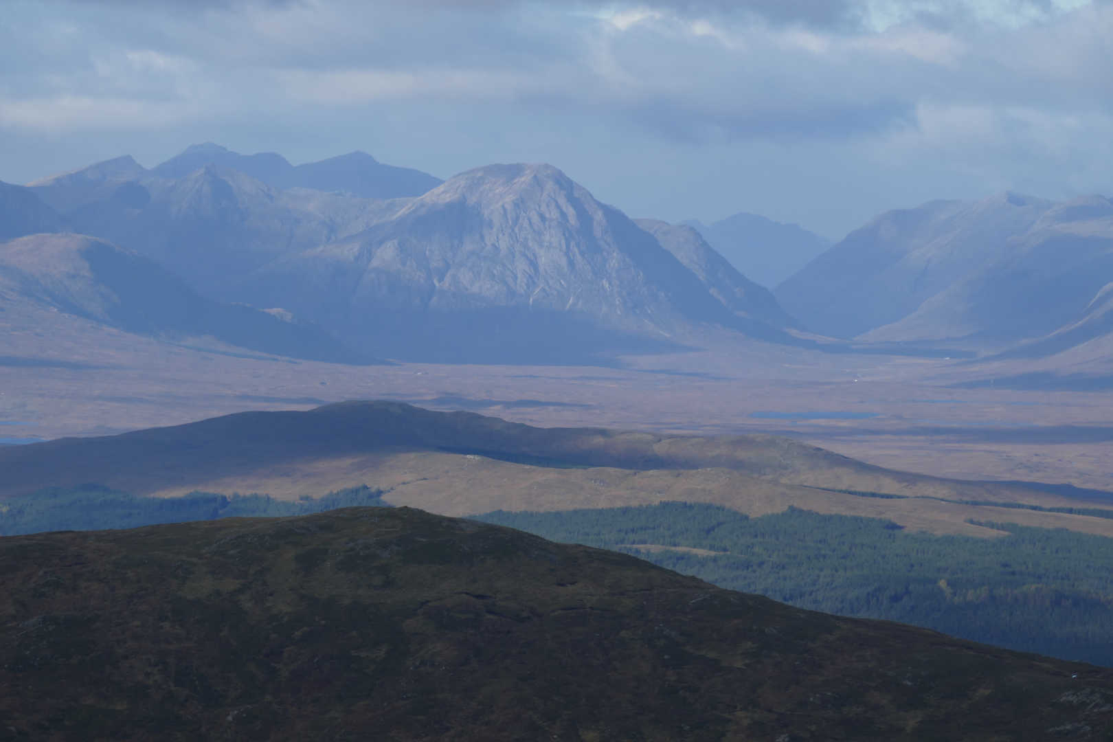
Buachaille Etive Mor GM/WS-004 and the entrance to Glen Coe.
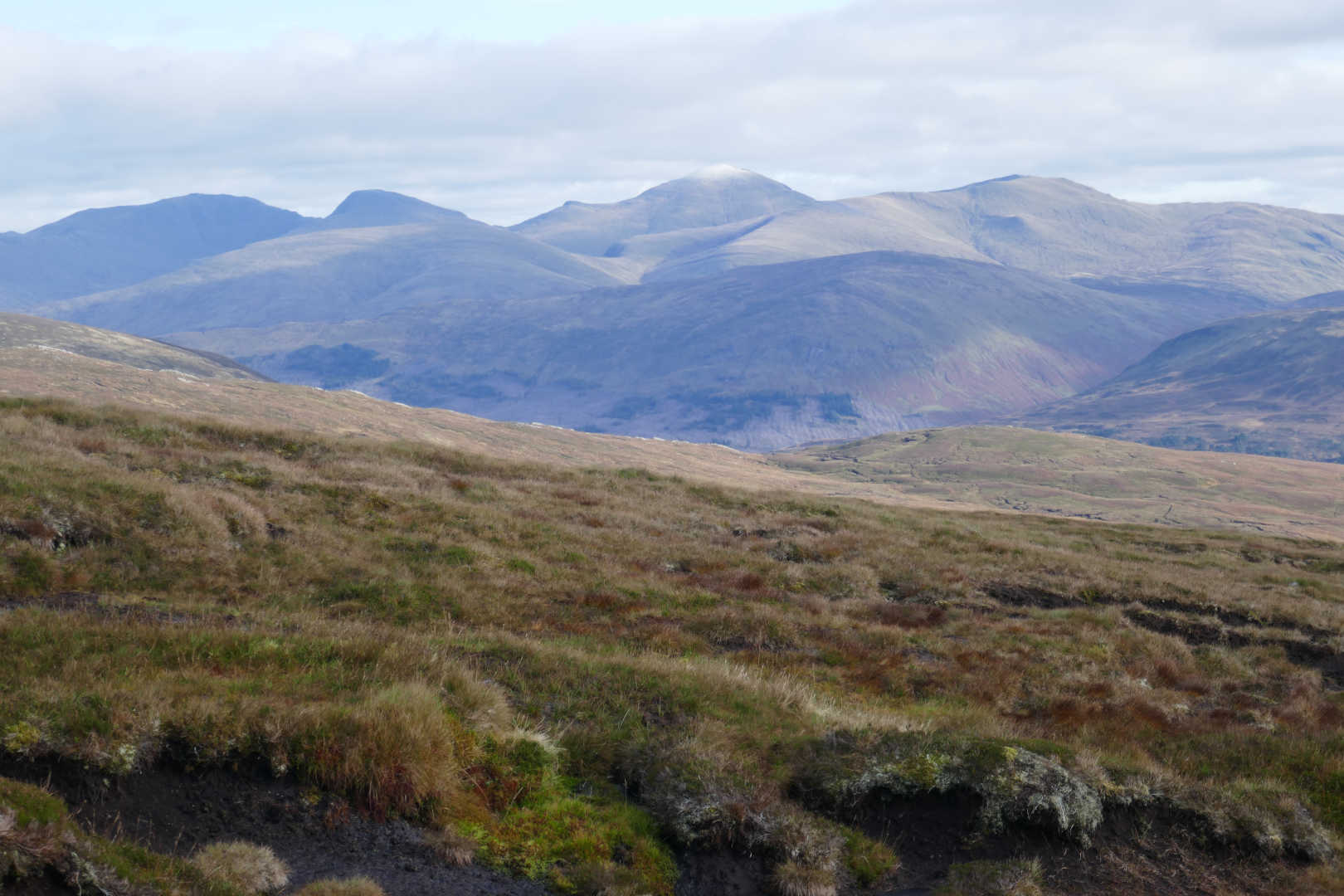
SW over Loch an Daimh. Stucd an Lochain GM/CS-032 (middle distance left), Sron a’Choire Chnapanich GM/CS-066 (end of the loch), Beinn Heasgarnich GM/CS-007 (behind CS-066) and the centre far distant hill in Ben Lui GM/SS-003.
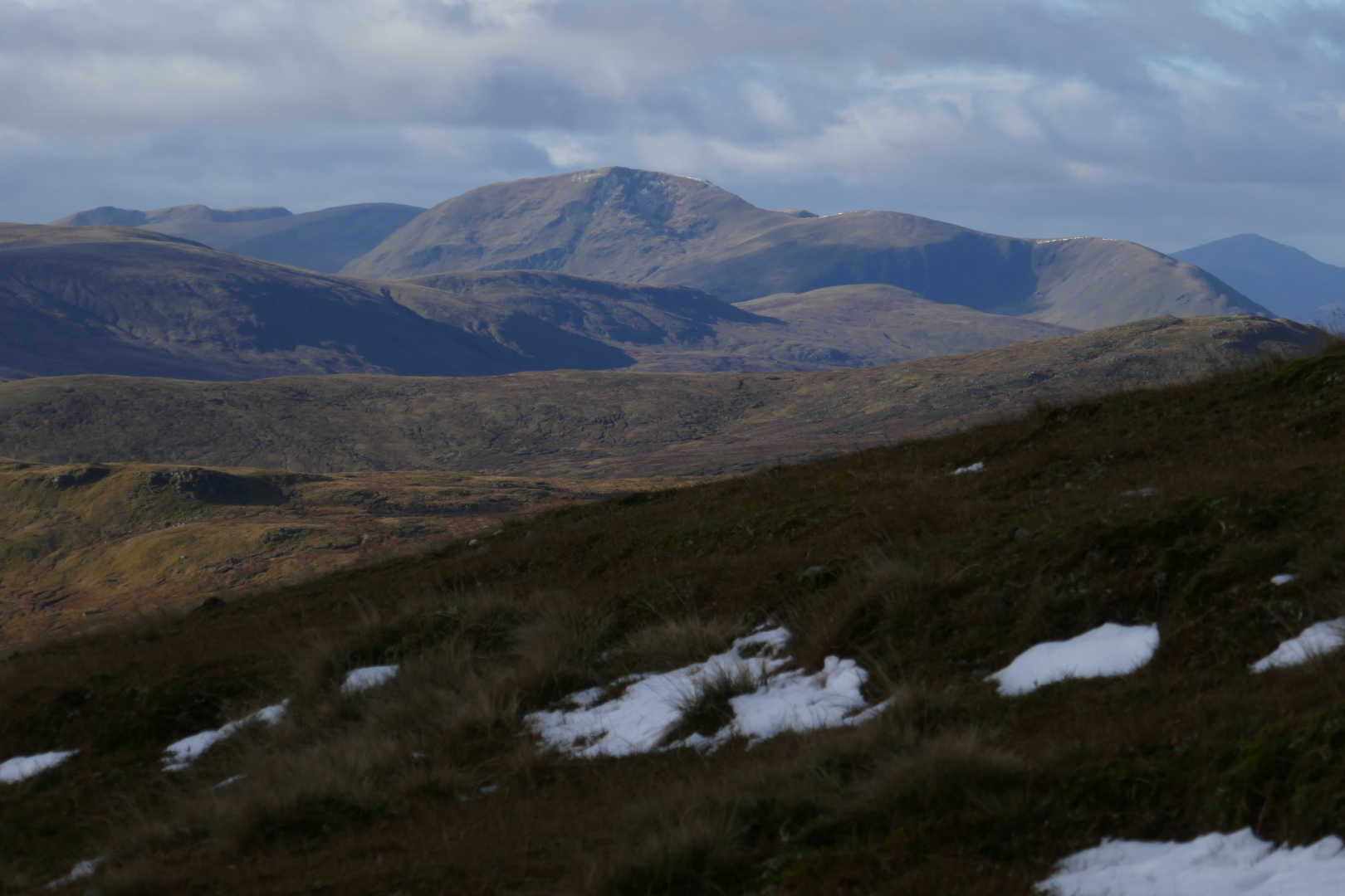
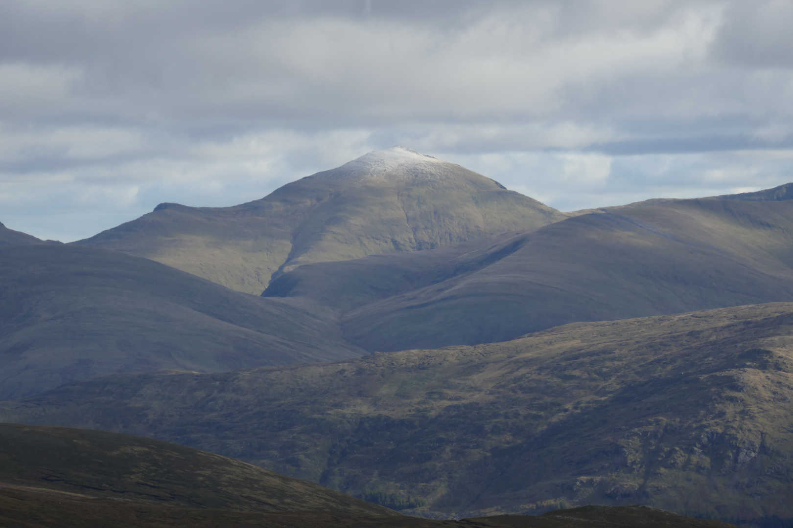
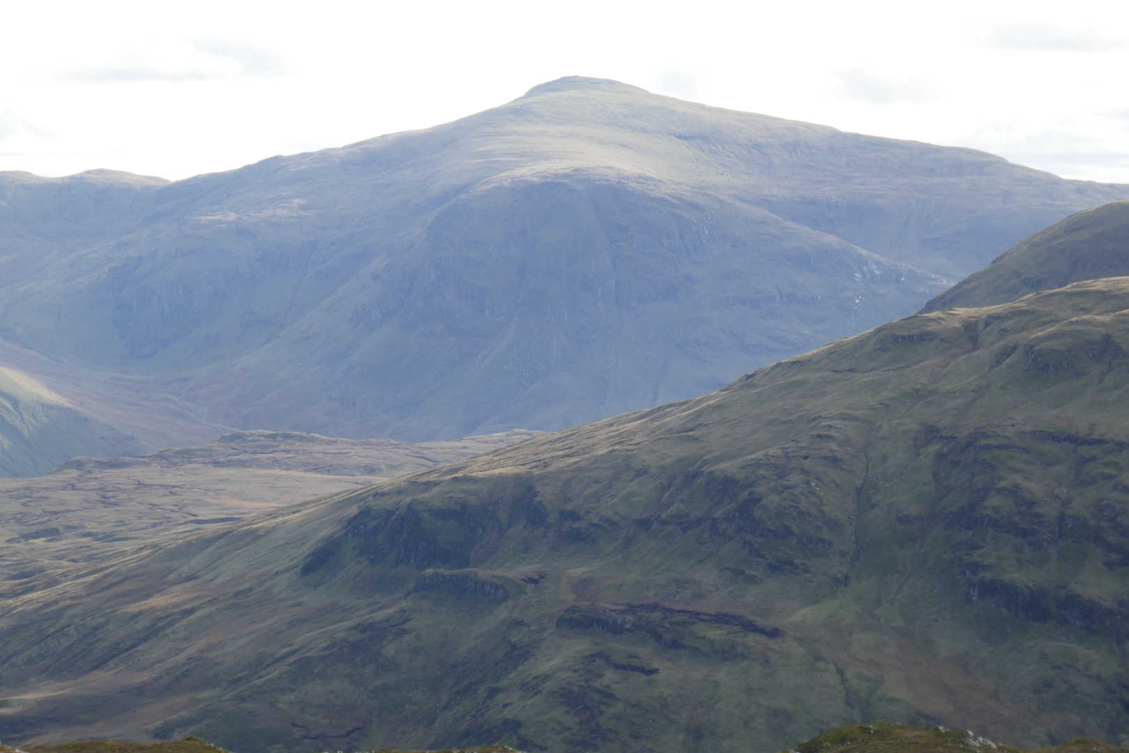
Ben Lawers GM/CS-001 with snow/frost on the top.
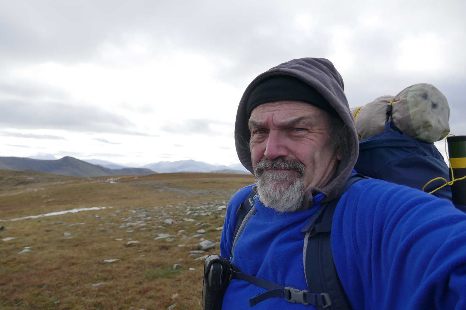
A very cold double fleeced MM0FMF. Two fleeces in October, unheard off!
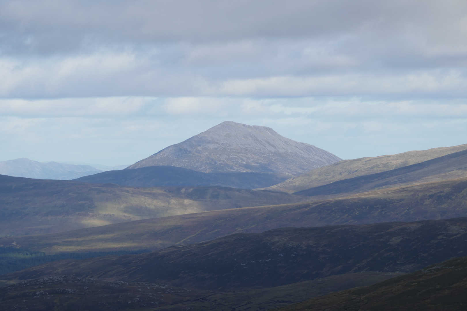
Schiehallion GM/CS-005
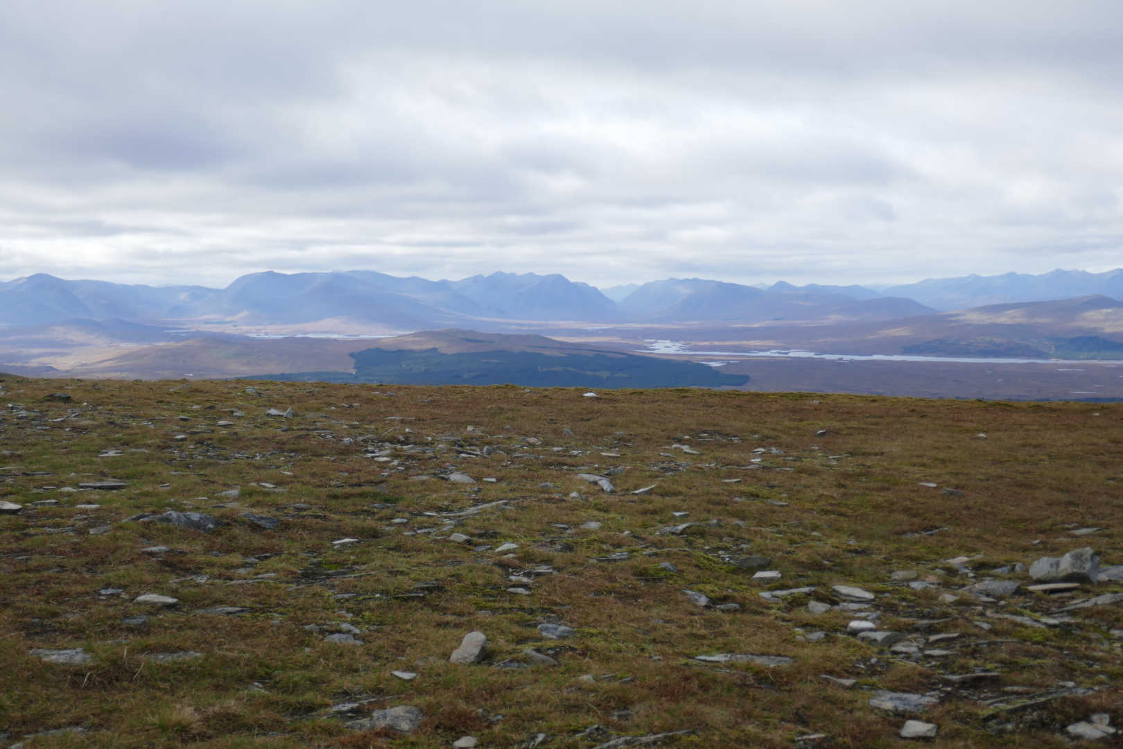
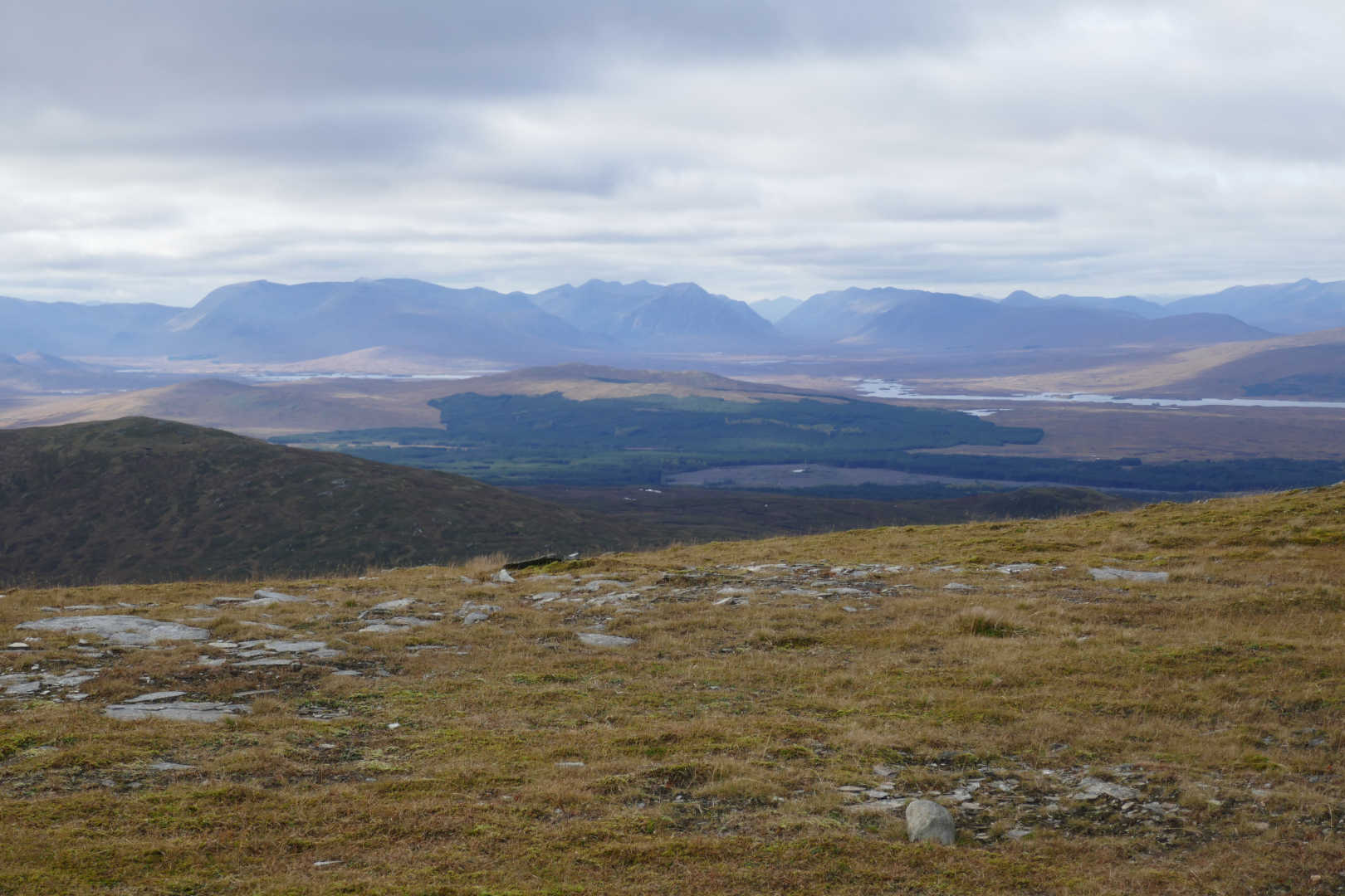
A view of Rannoch Moor to Glen Coe and the so many SOTA summits.
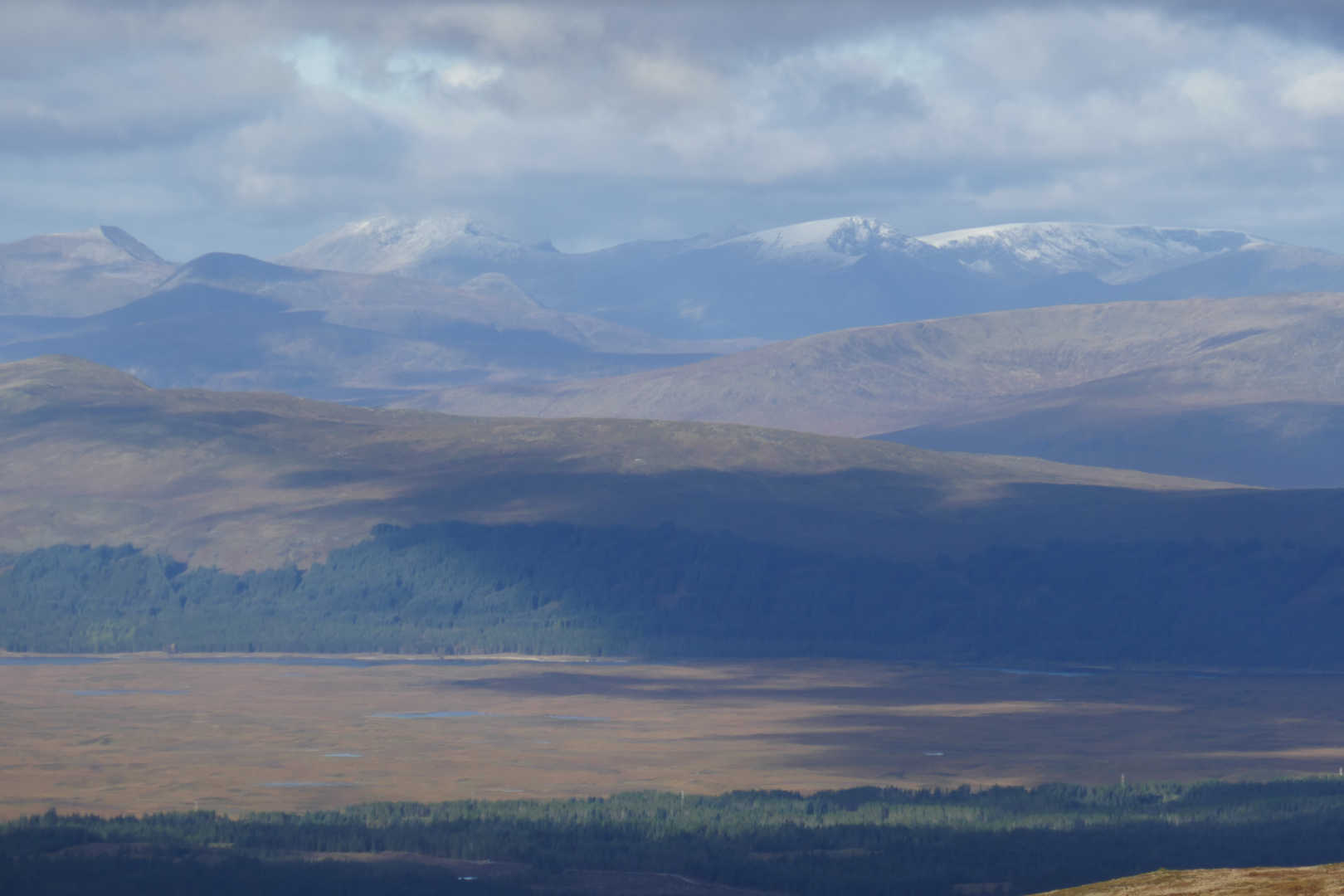
NE over Loch Rannoch. The distant Cairngorms had a good snow covering too.
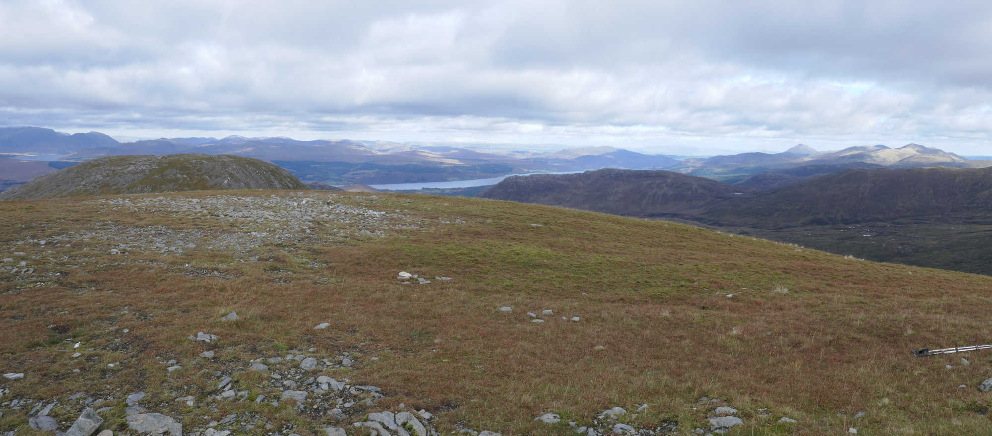
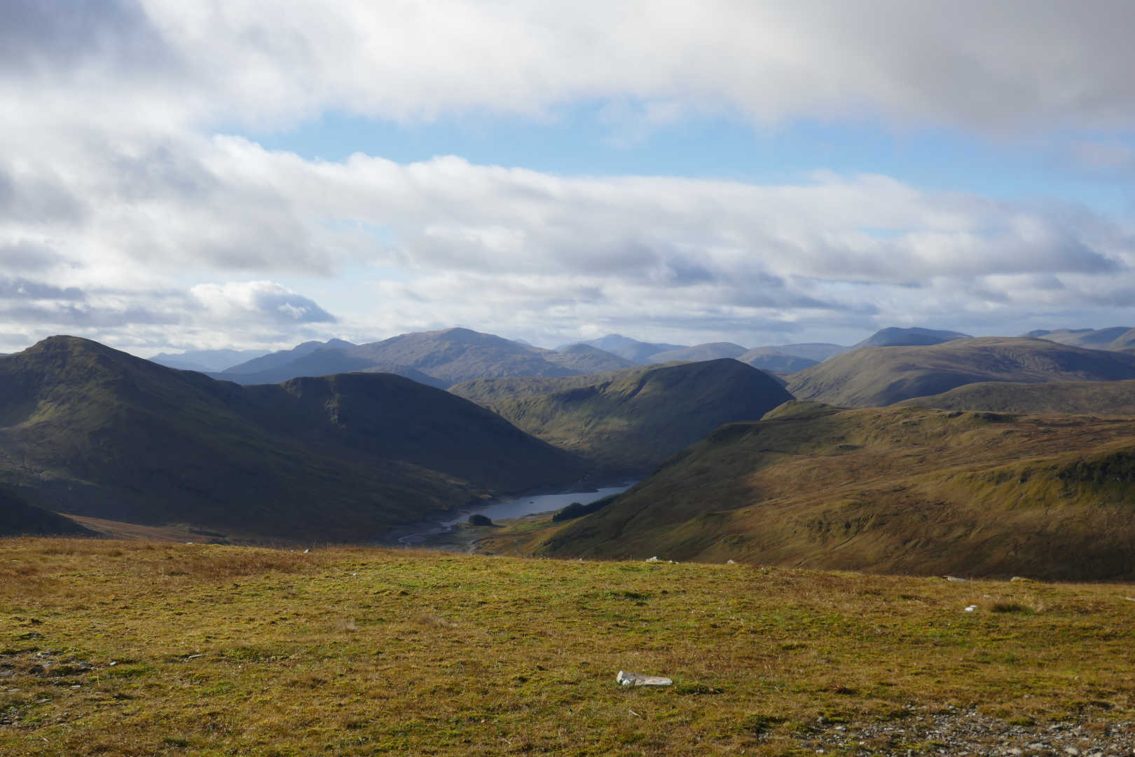
That view over Rannoch Moor never gets boring !
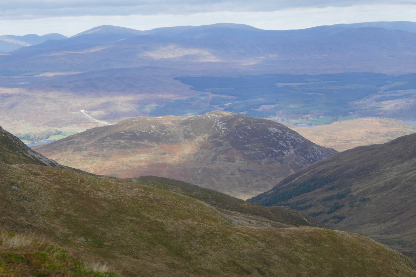
Leagag GM/CS-099. A lovely wee hill with great views. The Rannoch Hydro power station tunnel head is visibly in white behind Leagag. The tunnel ends here and the water drops down in the high pressure headstock pipes to the power station on Loch Rannoch.
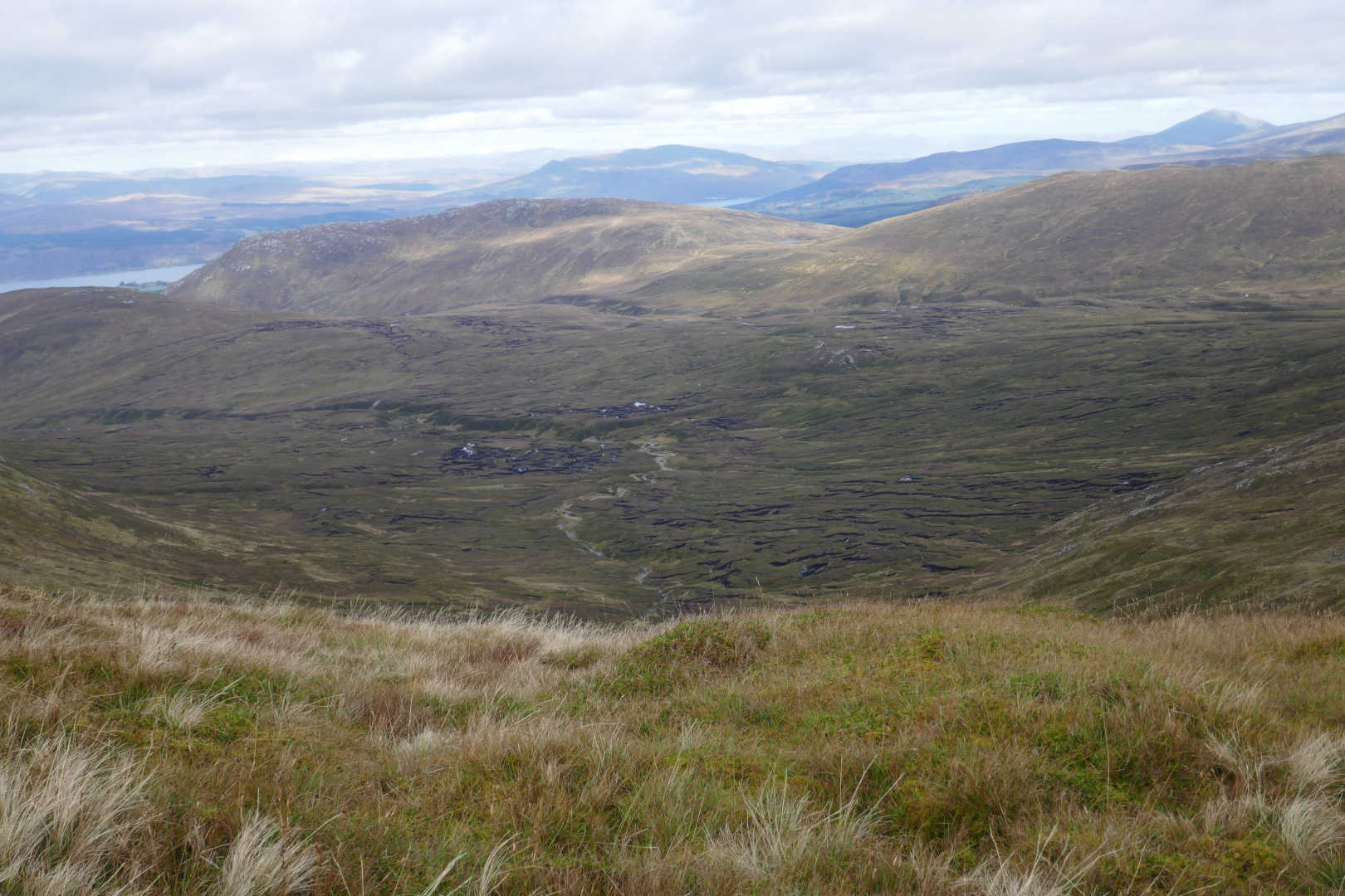
Absolutely horrendous Peat Hags in Glas Choire leading out to Leagag. Not the ground you want to have to walk over.
Meall nam Tarmachan GM/CS-015
Meall Ghoardiadh GM/ CS-017
A lot of SOTA including Meal Garbh GM/CS-004, Ben Lawers GM/CS-001, Meall Corrainaich GM/CS-010,
Meall a Choire Leith GM/CS-041, Meall nam Maigheach GM/CS-082
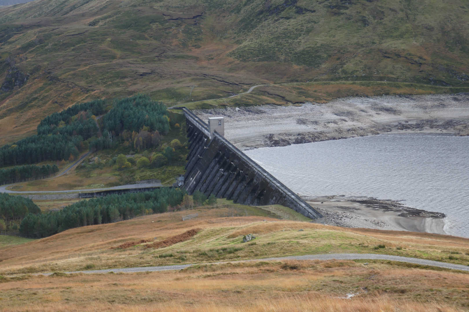
The Giorra Dam show just how low the water level is.
An absolutely splendid day out: good walking, good views, good radio and a good cup of tea. Winter is definitely on its way. I think I need to revisit some of the summits climbed from Glen Lyon again as it’s 10 years since I was out there.


