Longest walk for a single activation point?

I think I may have just made the longest walk for a single point. And by that I took a direct route from the car to the summit and back, not I did a big loop over all sorts of summits but only 1 was a SOTA summit.

I started at 122m ASL and finished 485m ASL, a 363m overall ascent. The track from the GPS overlaid onto the 1:25k map suggests a total ascent of 517m, which fits as it was very up and down all the way.

Finally the return length walked comes to 18.13km.

So is this the longest direct walk anyone has made for a single point? If it is I want an award.

(Bonus… it was so far I could scoff chocolate on the summit and a blood test now says it’s time to get the Whisky out!)

6 Likes

Carletheran from Todholes I presume. If so, my evaluation of the route must be somewhat short of the mark. Regardless of my calculations, I came to the conclusion it was only worthwhile doing in conjunction with Stronend in summer and from the north. Obviously I am less masochistic than you are. :grin:

No, Ballochleam Farm and the spout. Except you park at Baily Bow’s Bridge which adds an extra 1.5km to the round trip. The problem with Todholes is the path stops a long way short and the ground up there can be a bit fearsome especially if it has been wet.

Stronend. Stronend! Oh it looked sexy today in the nice weather but that hell-hole of a swamp has zero redeeming features. I will not be going there ever again. Done it, got the unique.

I wanted a 13cms complete and I’ve been ill all last week and not rowing… I wanted prolonged exertion to make up for the lack of rowing. I got that 2hr25 walk in and 2hr5 walk out.

We’ve done a 17km walk today that didn’t include a SOTA activation. So if I nip out and do The Cloud tonight…?

OK, OK, you anticipated such a tedious response and explicitly ruled it out, fair enough Andy. You’ve also precluded me mentioning my 71km three day circular backpacking walk of home - G/SP-004 - G/SP-013 - G/SP-015 - home, and my 268 mile Pennine Way trek with 8 SOTA summits - so I won’t mention any of those, I promise.

18.13km is a fair old walk, but doesn’t sound hugely unbeatable. Then again, off the top of my head, I don’t think I can think of any longer direct walk I’ve done for a single point. Jimmy @M0HGY ?

Good work Andy. It’s good when the exercise allows one to consume some treats without guilt or health implications! We had the most enormous afternoon teas at Tegg’s Nose Country Park today (the far point of our circular Mothers’ Day route). The calories contained therein were 50% more than my allowance for the entire day - but the calories burned from the exercise means that with the breakfast I already had, and a pint of ale en route, I’ve still got 1,159 calories left to guzzle today… (if I wanted to, which I don’t).

In 2014 I did a 3 week backpack of the John Muir Trail. It was a total of 211 miles with the only SOTA summit directly along my path was on the final day: Mt. Whitney. My rig that I had carried and used every day of my trek failed when I finally gained that summit. If it wasn’t for the spectacular sunrise from that highest summit in the lower 48 US, I would have been much more disappointed.

4 Likes

Just looked at our track for Carletheran: 18.40km. It looks like we took a slightly longer more southern route on the return, which I think had more track and less rough ground.

1 Like

Oooooooo! Edged out by only metres :slight_smile:

I didn’t think it was as sunny as it was… Mrs. FMF has pointed out I am quite pink from the sun… I had a Buff on as a beanie hat but the UV has come through.

2 Likes

I remember Tullybrack GI/SW-003 being a 16km circular walk and that was a 1 pointer. I can think of quite fews 1 pointers that we have done that require long walk, but I am sure this was the longer walk ever for a 1 pointer.

Jimmy M0HGY

1 Like

16km? Are you sure it wasn’t 18.14km?

Bah. You win Andy.

I seem to recall it saying on that tourist board that it was a 16km circular, however just realised that wouldn’t have included that detour to the summit, so it is that it could be been 18.14km or more if we take the walk to the summit and back into account.

Jimmy M0HGY

Circular walks don’t count.

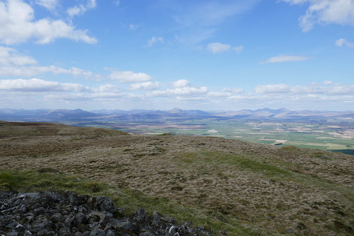
Much as my knees disagree, it was a nice day for a walk and I think the view was worth it. This is looking NW from the summit.

I reckon 40 or maybe 50 SOTA summits visible.

4 Likes

I reckon 40 or maybe 50 SOTA summits visible.

and you were the only person on a summit at the time? That’s stone breaking.

Andy,

Do you mean total length of the hike, ascent and descent, or just one way? This thread is going somewhere and we need to get that clarified…

73

George
KX0R

Interesting question.

Back in July 2013 Al VK1RX and I completed a joint activation of Sentry Box Mountain where the return walk was just shy of 32 km.

73 Andrew VK1AD

37km from train station to home via VC-030 for one point.

Gentlemen,

What does the term “return walk” mean to you?

Is that just the return walk, the exit, the descent? Or is that some kind of idiom meaning the TOTAL DISTANCE? Sorry - I need clarification, please. Not all English is the same.

We have UK English, Aussie English, and USA English…

I lived is Australia for almost 3 years, and I sure had to re-learn and avoid a lot of simple expressions I thought I knew! It was a wonderful experience!!

Some of you have longer distances, but I think I have you many times on the altitude gains…

73

George
KX0R

1 Like

OK,

The longest hike I’ve done for a single SOTA peak was September 21, 2015. The peak is Fairchild Mountain, W0C/FR-010. I have activated it twice by this long but efficient hike, and AD0KE has done it once, presumably by a similar route. This mountain is in the Mummy Range of Rocky Mountain National Park. My hike was a day hike. I drove up there in the morning, hiked most of the day, and drove home before dinnertime.

The total time for the hike and the activation was 11 hours and 10 minutes. I spent about 2 hours and 10 minutes on the summit, so the hiking time was about 9 hours total.

The GPS track is good, and it shows 18.0 miles total distance, in and out, ascent and descent. This means 9.0 miles each way. The entire route was the same both ways, and it was mostly on a rocky trail, except for the more challenging segment up high in the rocks, above 12,000 feet.

This is 28.97 kM, total.

The trailhead is at about 8631 feet, or 2631 M ASL.
The summit of Fairchild is at 13,502 feet, or 4115 M ASL.

The net gain is 4871 feet, or 1484 M. However, there’s a bit of up and down on the route, so the actual ascent was very close to 5000 vertical feet.

I’m sure many others have records way beyond these numbers. I have several other single-peak hikes that are over 16 miles total, with vertical feet gains near or above 5000 feet. Many of these were in 2015, when I did many longer day-hikes for SOTA peaks, including several first activations.

I think that Brad WA6MM has done the most high alpine SOTA activations in Colorado - his record is really incredible, since for a very long time he did only uniques, and mostly alpine peaks. Several others have done awesome SOTA activations, or have done them often. WG0AT can tell some tales! K0MOS! Many others!

Colorado is a great place if you aspire to do long, fine hikes and activations. Wyoming and Montana are almost untouched!! There are many un-activated peaks within a couple hundred miles of here, and all they need is a good day and a long hike!

I offer this as bait to get some of you to come forth with some more extreme numbers.

Last a warning - most people in good physical condition can’t expect to fly out here, do a long hike to well over 4000M, and actually enjoy it. It takes time to adjust to the altitude. The more you go high, the better it gets. I always do better later in the summer than early on. I live at about 5600 feet, but that’s nothing - I have to go up high, over 10,000 feet, several times a week to get into it.

There are some people out here who can run 100 miles in about one day, with much of the race at over 12,000 feet, and tens of thousands of vertical feet in the event.

73

George
KX0R

In this context Return Walk is the total distance walked.

Cheers

Andrew VK1AD

If I understand your original context correctly Andy, then circular walks don’t count if they arbitrarily add otherwise avoidable distance. In the case of GI/SW-003, the most direct route is around either half of the circuit, which were very equal to each other - so we descended on the other half to complete the circular without adding/saving any distance*.

*the error bounds of working out any difference would have been greater than the actual difference.