I come home from a fortnight working on Haast traplines eager with the news that we have no work for the next fortnight, and that an easy 4-5 day tramping / SOTA trip is in the offing. Find Sim - time rich and money poor these last few months - eager with the news that she’s got a new contract starting 1st November and keen to get away before work ties her down.
I’ve been happily contemplating another easy wander round the Snowdon Forest, 2.5 hours from home to pick up the summits I missed in poor weather over winter. But those plans are shelved and we head instead 700km north to Reefton and the Victoria Forest Park.
I’ve had my eye on the Victoria Forest Park for a while now as a potential winter tramping ground, with summits just 2-300m above the bushline and a selection of huts. From the map, it look the sort of place you can poke your head above the bushline and play on the tops before retreating to the safety of a warm cozy hut for the night.
Winter is more or less over now, with the snowline above 1400m, but I’m pretty tired after a fortnight on the Haast Range, and the prospect of some easy bush-and-ridgeline tramping appeals. Not to mention the excess of SOTA summits concentrated in the area: a density that should have had be eyeing those contour lines just a little more closely.
Sim meanwhile has plans for a few days easy pottering around the area in the motorhome.
The Plan
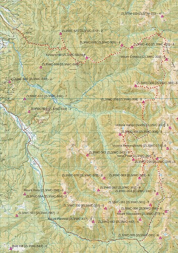
Actual route shown - original plan was to follow the main ridgeline further east
The plan, taking advantage of a dropper-offer and picker-upper, is a semicircular loop from Kirwans Hill, east to the Victoria Range, and then south along the ridgeline to the summit of the Reefton-Springs Junction SH7 road. This should allow 4 hut-nights along the way and pass over or near 14 SOTA summits including the 1749m high point of the range at Ivess Peak. A trip totaling 74 points. Backup option involve dropping west into the headwaters of the Waitahu to bypass the less certain sections of ridgeline.
Day 1: Kirwans Track to Kirwans Hut
Elevation gain: 1273m
Summits: ZL3/WC-570
Kirwans Hut is one of a frustratingly growing breed of ‘bookings required’ backcountry huts - generally triggered by the overuse resulting from instagram fame. However, I’m pleased to note that the track to the hut is closed due to extensive storm damage and unstable rockfall. Given that the remaining 90% of the trip is off-track, this fact does not deter me, and as a by-product near-guarantees an empty hut.
There has been some debate about whether the dog, Pip-squeek, comes too. ‘It’s an easy trip - take her’. Another kg of dogfood gets added to my 5-day tramping plus SOTA pack.
We set off in the first dripping, sweltering humidity of early summer, along old mining pack-tracks and into the range. About 3km in from the roadend, the track cuts through an old miners’ tunnel about 7m long. There is obvious rockfall in the tunnel and temporary barriers at each end. A 40 second scramble takes us over the spur, rather than through it, and we bypass the obstruction. The remainder of the track is in perfect condition.
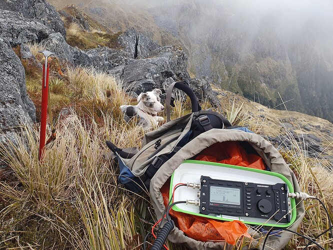
The gravy has been dripping off me, unaccustomed to this northern heat after a southern winter, and it’s a hard call to drop the pack at the saddle and head 2km west to bag our first summit on the way in. But I convince myself and do it. Good game trails lead along a well defined ridgeline through mossy open beech forest to the undefined summit of ZL3/WC-570. Activation is a case of finding an open straight line through the trees long enough for an EF40mHW somewhere on the large summit plateau. I make calls on 40m and 20m, eager to get the summit qualified and move onto the hut and dinner - netting 10 contacts and a couple of WWFF park-to-parks with VK3PF and VK2GOM.
Then we head back the way we came, grab the pack (was it always that heavy?) and climb the last 400m vertical along the pack-track to Kirwans Hut in the last warmth of the day.
View SW from Kirwan’s Hut [ZLH/WC-073]
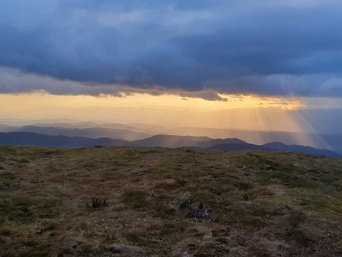
As expected, we have the luxurious 12-bunk Kirwans Hut to ourselves and soon have the billy on the boil and dinner cooking as we watch the sunset over the West Coast. Kirwans was once the residential settlement for gold mining centred 1km to the south, but the hut is the only structure remaining on the hill. An old endless-wire cableway leads down from the mine site to a water-powered stamper battery in the valley 800m below. But we make do with looking at the photos of it all on the hut wall, tired after the 1200m climb in unaccustomed summer heat.
Day 2 - Kirwans Hill to Wheel Creek Hut
Elevation gain: 865m
Summits: ZL3/WC-503, ZL3/WC-505, ZL3/WC-455
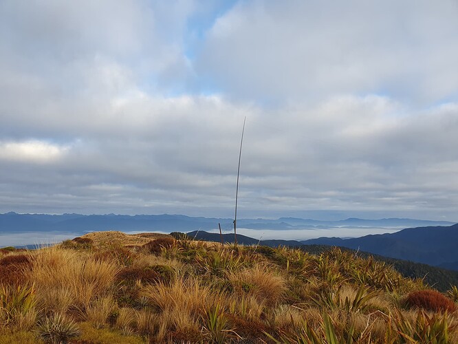
A brief 1km walk takes us along the last of the mining track that leads to the bushedge at Kirwans Hill, from where a further kilometer of steady climb puts us on the summit at 7:40am. A good early start meaning I can fish amongst the pre-start chatter on the 8am Mainland net for contacts if needed. But it turns out other SOTA chasers are up and around at this early hour and I manage 4 contacts on 80m and 40m without the need to trouble the net.
ZL3/WC-502 - Activating Kirwan’s Hill
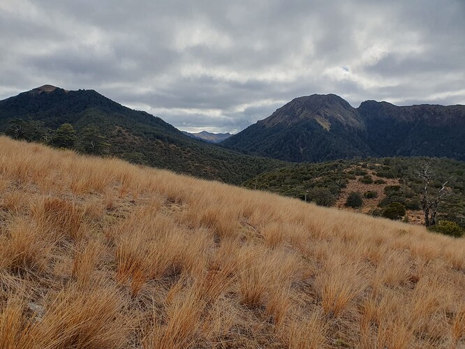
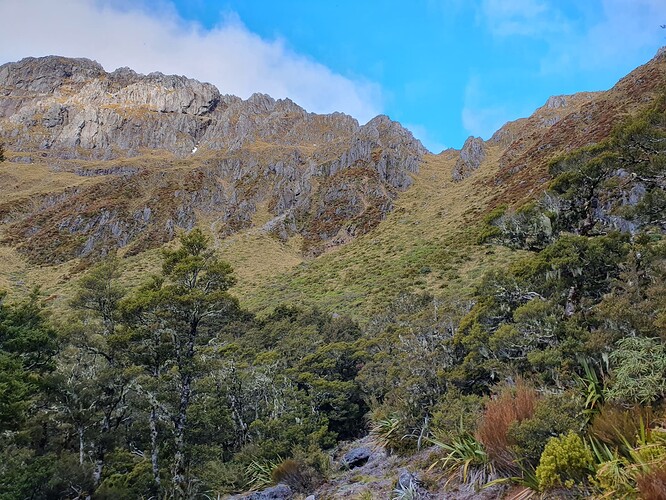
From Kirwans Hill, a long ridgeline leads east to the main Victoria Range, dipping in and out of the bushline, guaranteeing sections of slow travel in the stratum of subalpine scrub and stunted beech that guards the bush-tussock margin. But we have all day to cover 12km.
ZL3/WC-502 - Kirwan’s Hill - The way forward
The day’s remaining two summits are tight-bunched about half way along the range, separated by a steep, deep, scrubby gulch.
Approaching ZL3/WC-505 (left) and ZL3/WC-455 (right)
The usual VK and ZL chasers call in on 40m and 20m for the day’s second activation on ZL3/WC-505. 10m shows signs of life and a spot and call there brings a near immediate response from WY7N in Phoenix Arizona. Hopes of a good opening to the US fade as the following 10 minutes yield nothing more.
==
The saddle with ZL3/WC-455 is as bad as it looked - 40 minutes of scrub bashing, scrub climbing, scrub crawling and scrub-swimming to reach the safety of beech forest 100m below.
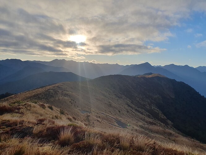
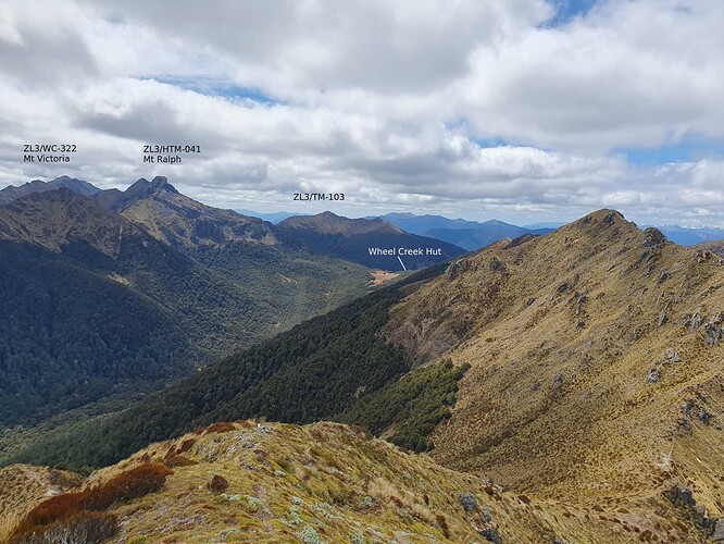
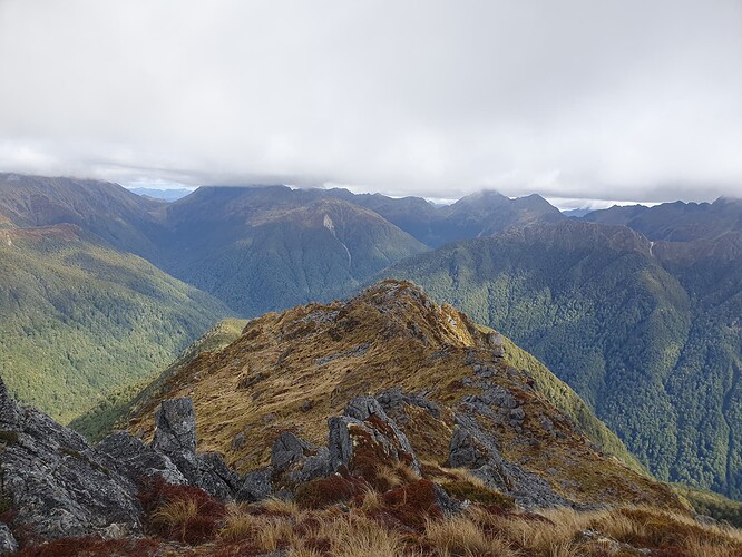
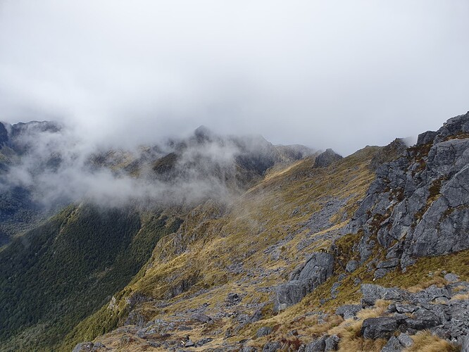
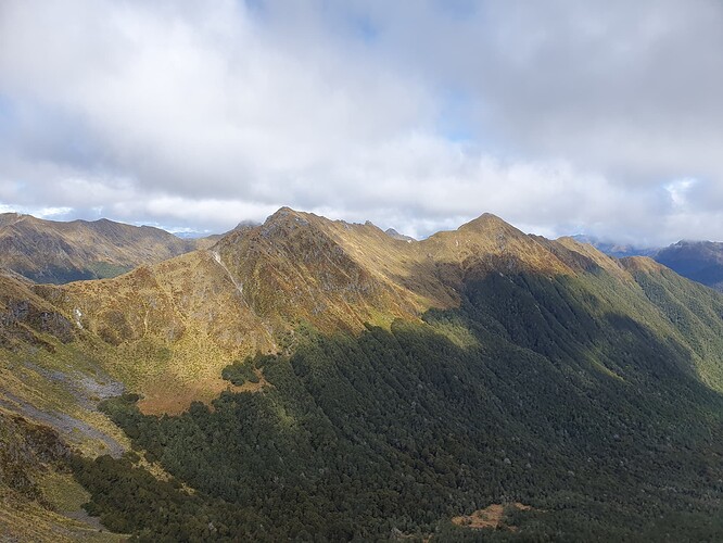
The main range has been in and out of cloud all morning, but our activation of ZL3/WC-455 gives the first good view of what lies north along the range, and has me dreaming of future trips from Wheel Creek north along the Victoria and Brunner Ranges. Ironically, the most (visually) prominent peak is the HEMA summit - Ralph Peak.
Activating ZL3/WC-455 - views to Larry Saddle and the northern Victoria Range
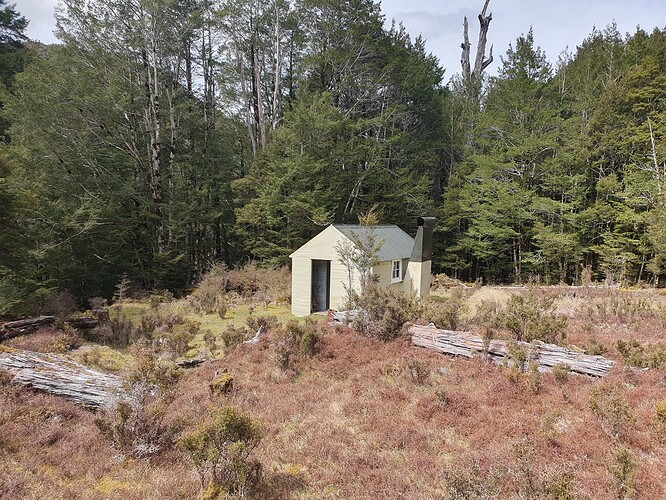
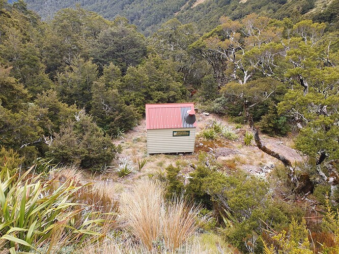
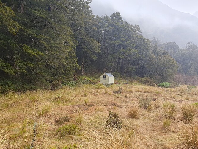
Wheel Creek Hut proves a gem - a box standard original 6-bunk SF74 NZ Forest Service Hut from the 60s-70s, but in perfect tidy condition. The hut is one of many maintained by Permolat - a volunteer-run charitable organisation set up to take on management of lesser-used DOC huts on the West Coast. Previous rounds of budget cuts saw DOC threatening to pull out or burn down many of these backcountry gems, and it was a relief to all when they loosened their strict policies and allowed external bodies to take on their management instead.
A slow pool proves not quite deep enough to soak in, but a refreshing splash and wash to take off the grime and sweat of the day’s heat. The hut receives less than a dozen visits a year - and needless to say we have it to ourselves.
Wheel Creek Hut - ZLH/TM-079
Day 3: Wheel Creek Hut to Top Waitahu Biv Upper Waitahu River Flats
Elevation gain: 2050m
Summits: ZL3/WC-333, ZL3/WC-380, ZL3/WC-358
The Permolat hut folio notes that travel south along the range from Wheel Creek starts straight-forward but becomes increasingly ‘demanding’ closer to Ivess Peak.
There are no accounts of anyone doing the traverse from Larry Saddle to Lake Stream Hut in the various hut books.
Wheel Creek Hut - REMOTE HUTS
So we set off on an early 6:30am start to get the ‘straight forward’ 800m climb over Mt Crosscut under out belt and give ourselves time and options for the remaining demanding section to Top Waitahu Biv.
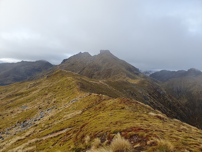
Approaching Mt Crosscut - ZL3/WC-333
Mt Crosscut proved well named - 3 distinct summits separated by sharp diagonal notches that takes some sidling and scrambling to pass. And this is the straight forward bit!
A quick activation of the summit on 40m and 20m nets the usual tally of 10 contacts in ZL and VK.
Activating Mt Crosscut - ZL3/WC-333
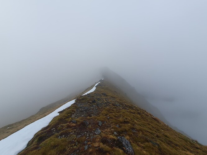
I’ve been toying with two options up to this point - continue along the main Victoria Range, bypassing the outlying peaks to our west, or start poking west down the side-ridges to make a clean sweep - even if it means we cover less of the range itself. Whilst it seems a shame to miss the iconic named peaks further south, it also seams really silly to leave the side-summits unactivated after all the effort to get into this remote area. The increasing clag on the range tips the balance for me, combined with the hut book route descriptions: I don’t really want to be playing routefinding in West Coast ‘demanding’ terrain in the fog.
So rather than traverse the first of many knife-edge sections of the Victoria Range north of Creighton Peak, we drop 700m to the lake in the headwaters of the Montgomerie and climb it all back to regain the side-spur leading to ZL3/WC-380. Despite the elevation loss, the decision proves the correct one with good open forest on the valley floor providing easy travel on well used game trails
Dropping the pack again provides some relief, but the 2km side-trip is hard to commence, not helped by the intervening surely-this-must-be-a-maralyn summit in between (LiDAR survey of the West Coast still to come - I’ll be watching this one when it does!).
ZL3/WC-380 looks completely dead on the scope, but brings in 17 on 40m, including a summit-to-summit with ZL3MR on the 1800m, 8 point, Mt Harper [ZL3/CB-313]. 20m yields calls from VK2IO, but no completed QSOs.
Activating ZL3/WC-380 - Clagging in on the Victoria Range
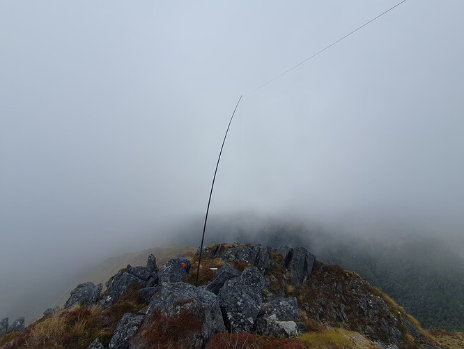
After activating ZL3/WC-380 we return 2km back east over the almost-maralyn, grab the pack and drop 200m into the headwaters below to top up exhausted water bottles. Cooling clag rolls in for the final ascent of the day to ZL3/WC-358. 20m has proved less than ideal on earlier afternoon activations, so I switch to 15m for this one, with better signals into VK, plus the usual 10-or-so in ZL on 40m.
Activating ZL3/WC-358
Continuing the policy of picking up the outliers, we drop North off ZL3/WC-358 into the upper Waitahu, bypassing the crux points of the southern Victoria Range and setting ourselves up to explore the remaining outlying ranges to the west.
Bypassing Victoria Range
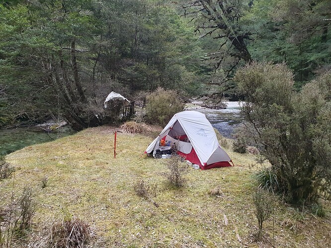
The 1km, 700m descent from the bushline to the valley floor proves more challenging than expected with multiple layers of bluffs to negotiate and much back-tracking involved. It’s 6pm by the time I hit the valley floor, so we abandon dreams of following the river up to Top Waitahu Biv and set up camp on the first flats we come to.
Waitahu River camp
Day 4 - Upper Waitahu Forks to Top Waitahu Biv the long way
Elevation gain: 2420m
Summit: ZL3/WC-308, ZL3/WC-294, ZL3/WC-363
From our campspot at 620m, deer trails lead 4km upriver to the last flats at the valley head, and then west up the side valley towards ZL3/WC-308. A few ‘airy’ scrambles are required to reach both the intermediate peak and the 1658m SOTA summit.
ZL3/WC-308 - after the clag cleared!
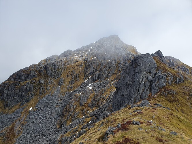
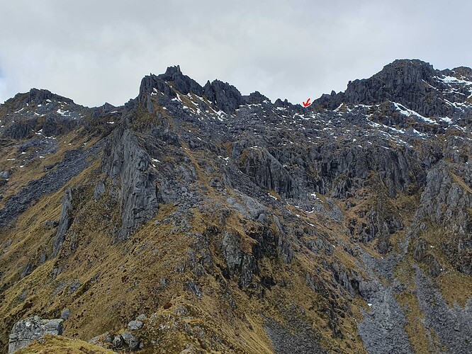
I had expected these western side-ridges to be more straight forward than the jagged main range, but has seriously underestimated them. Pretty much the entire 4km ridgeline heading back east was jagged, unnavigable rock. The lower slopes drop in sheer bluffs to the valley floor some 600m below. Which leaves you sidling the narrow line of tussock faces between the two, hoping that each gully, gendarme can be crossed and each spur and fold hides nothing that cannot be navigated.
Endless sidling below impassable ridgelines with sheer bluffs below
Thankfully well worn game trails hint at the secret scrambles through each gully, hidden weaknesses allowing passage through otherwise impenetrable strata of bluffs.
Ascending ZL3/WC-294
At 2pm I’m decided that ZL3/WC-294 will be the last for day - but the sight of the easy side-ridge to ZL3/WC-363 proves too tempting: the first easy walking in two days!
Easy going at last - the side-ridge to ZL3/WC-363
I set a cut-off of 5pm for the activation, and am almost foiled when the second caller wants nothing more than a good yarn, despite my increasing unsubtle attempts to end the QSO. A shame, as I normally prefer a good natter over the simple exchange of signal reports - but I’ve 4km of alpine ridgeline and one serious looking pass to go to reach the safety of the biv, and am really keen to get offa this mountain! After a further 10 minutes and with me close to pulling the pin we finally manage to wind it up, after which a further 4 quickfire contacts are more than enough to complete the activation.
Crossing back to Top Waitahu Biv
Peering down from the saddle into the sheer-sided basin it’s hard to imagine where you could put a biv in the upper Waitahu that it wouldn’t get wiped out in the first avalanche season. There’s no sign of the biv and I curse myself for not checking if it still exists - I’m relying on nothing more than a dot on a 2009 map. So it is with relief that I poke into the first of the bush end spot the cozy 2-bunk biv, it’s wall dominated by the Warning - Avalanche Prone Structure sign!
Top Waitahu Biv - ZLH/WC-146
I’m visitor number 3 to the biv this year, which makes this a bumper year as 2023 only had two visits in the book. The hut-book goes back to 1981 and is about 1/8 full despite many long-winded tails of hunting exploits. Unusually the biv boasts a tidy coal range, not needed on this warm summer night. The wire-mesh beds have not even had enough use in their 50+ years to start sagging!
Day 5 - Top Waitahu Biv to State Highway 7
Elevation gain: 450m
Summits: Nil
Another 3 SOTA summits were planned for day 5: ZL3/WC-334, ZL3/WC-373 and ZL3/WC-385, to exit ahead of forecast heavy rain on Wednesday night - Thursday morning. However, I wake to the hiss of drizzle on the roof and decide to focus instead on getting the hell out.
Two serious passes separate me from Lake Stream and catchments flowing towards the highway. The first, into Shaw Stream, I was able to spy out the evening before whilst dropping to the biv, and seems steep but straight forward, once you navigate the scrub lower down.
Pass into Shaw Stream - photo taken the day before in sunshine!
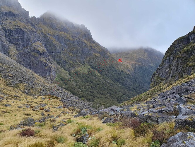
The second pass have been keeping me awake all night. The glimpses of it that I got the previous day from ZL3/WC-363 made access from Shaw Stream into the hanging valley look near impossible - nothing like the steep but straight forward beech forested slopes indicated on the topo map. Thankfully the hut book entries confirm that this hanging valley is indeed the ‘usual route’ into Top Waitahu Biv. From the various accounts and complaints I piece together a history of travel from ‘the boulder field’ to ‘the waterfall’ along the bushedge.
Boulderfields come in all shapes and sizes, and these are of the transit-van variety. So it is with relief that we reach the bushedge. The bush itself is stunted, scrubby and steep, so the relief does not last. A tricky line of bluffs where the map shows none keeps forcing us down, and many tries, retries and backtracks are executed before we finally give in and scramble branch-by-branch up near sheer faces to regain the scrub faces above which are thankfully no more than ‘very steep’. How the dog manages it all, I have no idea - she just keep appearing ahead of me.
Several hundred meters of horizontal bashing through impenetrable scrub whilst clinging onto it for dear life follow before we pick up the start of game trails along the clear drip-lines below bluffs above and follow them with relief into the hanging valley.
The normal route.
‘Usual Route’ from Shaw Stream to Lake Stream
Drizzle is intermittently alternating with rain as we pass the picturesque tarns where many parties report camping and swimming on hot summer days. I’ve been promising myself smoko at the top all the way up the nightmare ascent - but can’t justify stopping so plod on up the grassy spurs to the cloud-cvered tops above.
Finally good ridgeline travel between Shaw Stream and Lake Stream
The ridgeline along to the head of Lake Stream is thankfully straight forward, and the kilometer of boulderfield down into the valley head is just one more after so many. Boulders cede to boggy flats and we reach the shelter of the tidy, spartan 2-bunk Lake Stream Hut as drizzle finally passes and the rain start for proper. It’s no bigger than Top Waitahu Biv, so why it merits the title of ‘hut’, I have no idea.
It would be oh-so-nice to stop here for the night, but with serious rain forecast for the next day and god-knows how many river crossings on the way out, I limit us to 1 hour to eat and warm up, before heading off down the valley along the marked route. The last 2km of track to the road have even been cut. I could almost have run it if I wouldn’t have been early for my lift!
Lake Stream Hut - ZLH/WC-079 as drizzle turns to rain
Logs and stats to come
