G4YSS: GM/SS-020; Cobbler (Ben Arthur) 05-09-20
Issue-2 Changed Loch Lomond to Loch Long (tnx G1INK).
Issue-3 Added 2017 photo of local dog walkers (route info)
Activation of THE COBBLER (Ben Arthur) - GM/SS-020
5th September 2020
G(M)4YSS using SSEG Clubcall GS0OOO/P
HF - QRO on 40m & 20m. QRP on 2m & 4m-FM
All times: BST (UTC plus 1hr, UOS as ‘z’)
This was the first of two SOTA activations in our 2020 break at the Ardgarten Hotel, Arrochar 4th to 8th September. The second was GM/SS-018 Beinn an Lochain on 6th Sept. See separate report: G4YSS:GM/SS-018 Beinn na Lochain,06-09-20
EQUIPMENT:
FT817ND HF/VHF/UHF 5W Transceiver
MX-P50M, 50 Watt HF Linear Amplifier
Link dipole for 80m thru’ 20m on a 5m CFC/ alloy mast with 1m end-sticks
Home-brew tunable loading coils for 160m (not used)
5 Ah Li-Po battery (no reserve)
J-Pole for 2m FM
Extended 2m set-top helical for 4m FM
Reserves:
IC-E90, 4-band, 5W VHF H/H (used for 2m & 4m-FM contacts)
QRO pack: 9.7kg (21.4 pounds) including food, umbrella, Primaloft jacket, 0.75 litre drinks.
INTRODUCTION:
This was the first SOTA activation of this year’s trip to GM/SS. My XYL booked a 4-night (3-full day) holiday at Lochs & Glens Ardgarten Hotel from 4th to 8th of September 2020 at a cost of £399 for two people half-board. This was my first ever stay at this hotel built 2012, though my XYL has been before. The place is perfectly situated within a stone’s throw (literally) of the Loch Long shoreline in its own extensive grounds.
The staff are very welcoming, friendly, efficient and under covid-19 rules, diligent in minimizing the risk of corona virus transmission by limiting the hotel to half-full and providing hand sanitizers at all key points. Masks must be worn except in your own room and while dining or sitting in the socially distanced lounge.
In the current situation no coach tours were available so we were all self-drive and limited to 4-nights. Each room, once used will not be occupied for a further nine days and staff wear masks at all times in public areas and when serving.
The 275-mile drive from Scarborough on the 4th took only 7 hours gross, which included a one-hour stop at Thorpe Farm café on the A66, also observing covid rules. We tried Mainsgill café (also A66) first but it was far too crowded to feel safe; unsurprising as it’s now much more than just a café.
From the three available SOTA days, the mountain weather forecast was predicting one really good opportunity – Sunday 6th. Saturday 5th was to be 5C with showers and breezy and Monday was a complete washout all day. Since it was larger than life and framed right there in our hotel room window, it was not a difficult decision to choose The Cobbler for the first activation.
EXECUTION and ROUTE from the West:
Skipping my hotel breakfast, set time 08:20 was uncalled for. The older I get the less likely I am to put myself out. Those days are long gone I hope. Unlike some Shearings Hotels (now Leger), no early ‘night porter breakfast’ was available.
I wanted to try an unusual route which starts half way up the hill to Rest-and-be-Thankful at NN 2427 0598. I only found out about this back route up The Cobbler in 2017 and purely by chance. Seeing some locals walking their dogs there, I stopped the car to quiz them.
‘It’s a bit overgrown,’ I was told but there exists a path up beside the boundary fence, which leads to the 637m ASL col (NN2617 0710) west of Beinn Narnain (SS16). Here there is a path going south up The Cobbler. However, ‘You don’t even have to go that far.’ After about ¾ mile there is the choice to, ‘Turn sharp right and cut up beside the burn directly to the summit.’ At under 3km total, this sounded like the answer to a prayer and the shortest way up SS20. I’d be starting at 158m ASL too and I wouldn’t need to use the long path up from Succouth which is twice the distance and starts much lower!
My start point was just a 5-minute drive from the hotel, or so I thought but the best laid plans of mice and men etc… ‘Ah, that’s what the signs meant as we were driving to the hotel yesterday.’ The A83 was completely closed at an old military road and vehicles were being convoyed one-way up the latter. With the lights at red my first thought was, ‘This could take forever.’
My best option was to do a 180, park at the SE end of the military road, then walk up the closed A83 for one mile. Temporarily moving some cones, I managed to find a safe place to park my XYL’s posh car, up a side turn-off at NN 2467 0466.
I set off walking up the main road at 10:17 in overcast. Presently a lorry stopped, the driver telling me that, ‘You can’t get through; not even on foot as the road is closed.’ By then I had just 490m to go to where the path goes off to the right at what would have been the target parking place. After pointing out that I was there to do The Cobbler, his reply was. ‘Oh that’s alright then; you’re goin’ up the hill.’ The mile walk up the A83 took just 16 minutes so I was walking from the intended starting place by 10:33.
Here are the waypoints:
Park at the pull-off (but only after the A83 is re-opened) – at NN 2427 0598.
Stride over the fence or take the stile to walk left for a few metres inside it.
Find the path which passes through bushes at first and follow it ENE, paralleling the fence and the river via NN 2435 0604; NN 2453 0620; NN 2468 0630 and NN 2486 0647. At NN 2497 0655 you come to a burn that comes in from the right at around NN 2528 0663.
Turn right and walk ESE with the burn on your left. Sadly if there is a path I never found it; neither on ascent nor descent. I don’t think a path exists and the ground is steep and quite rough in places. This is the down-side of this route but you only have to bear this for 1km; that is until you hit the main path at NN 2605 0597. From there its turn right and 5 minutes to the summit.
Arriving at the summit weary at 12:14, the walk from the pull-off (the intended start point for this route) took 1hr-41min and from where I parked today at the A83 closure 1hr-57min. Ascent is 750m and distance walked 2.8km one-way. That’s quite a long time for such a short walk but the gradient combined with the poor surface going up beside the burn takes its toll in energy and sweat.
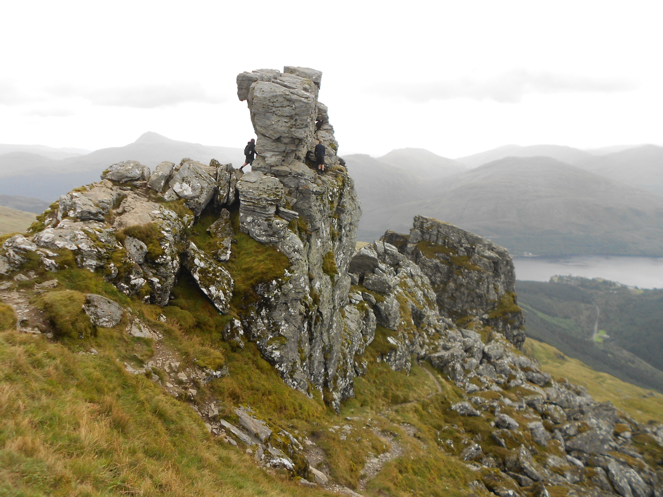
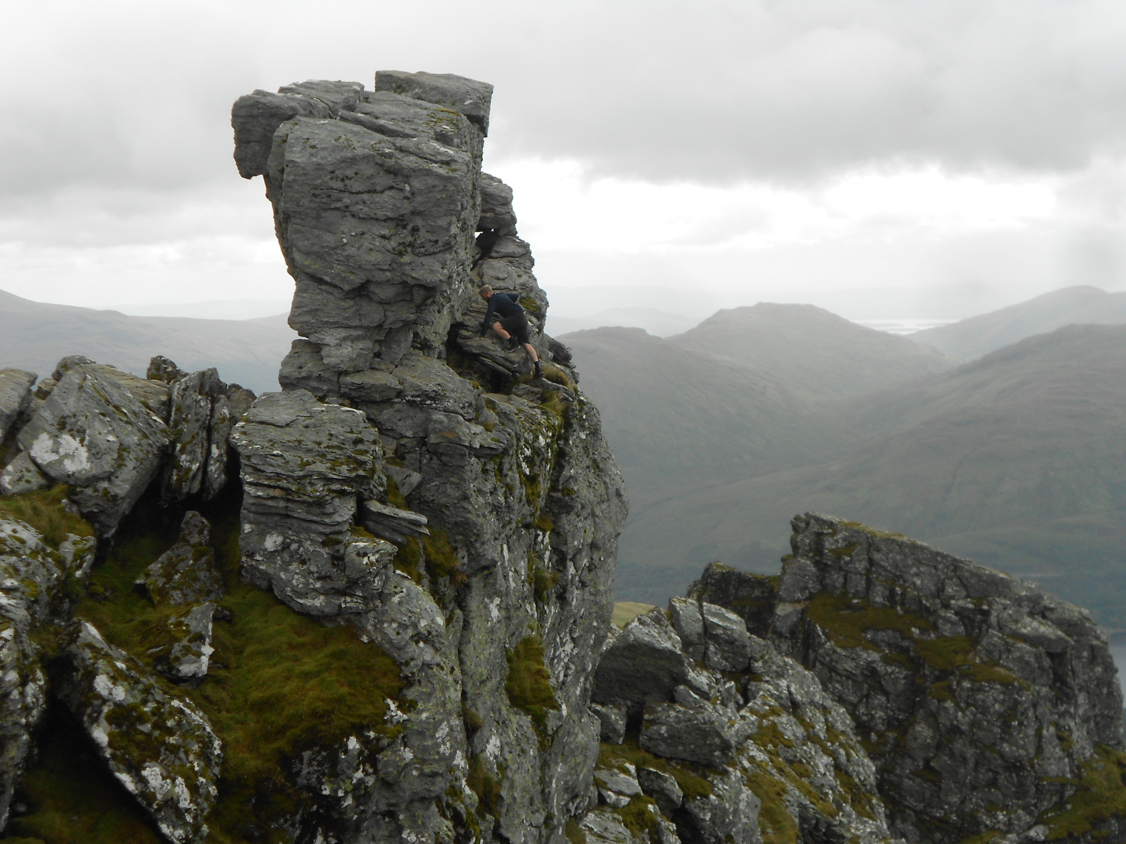
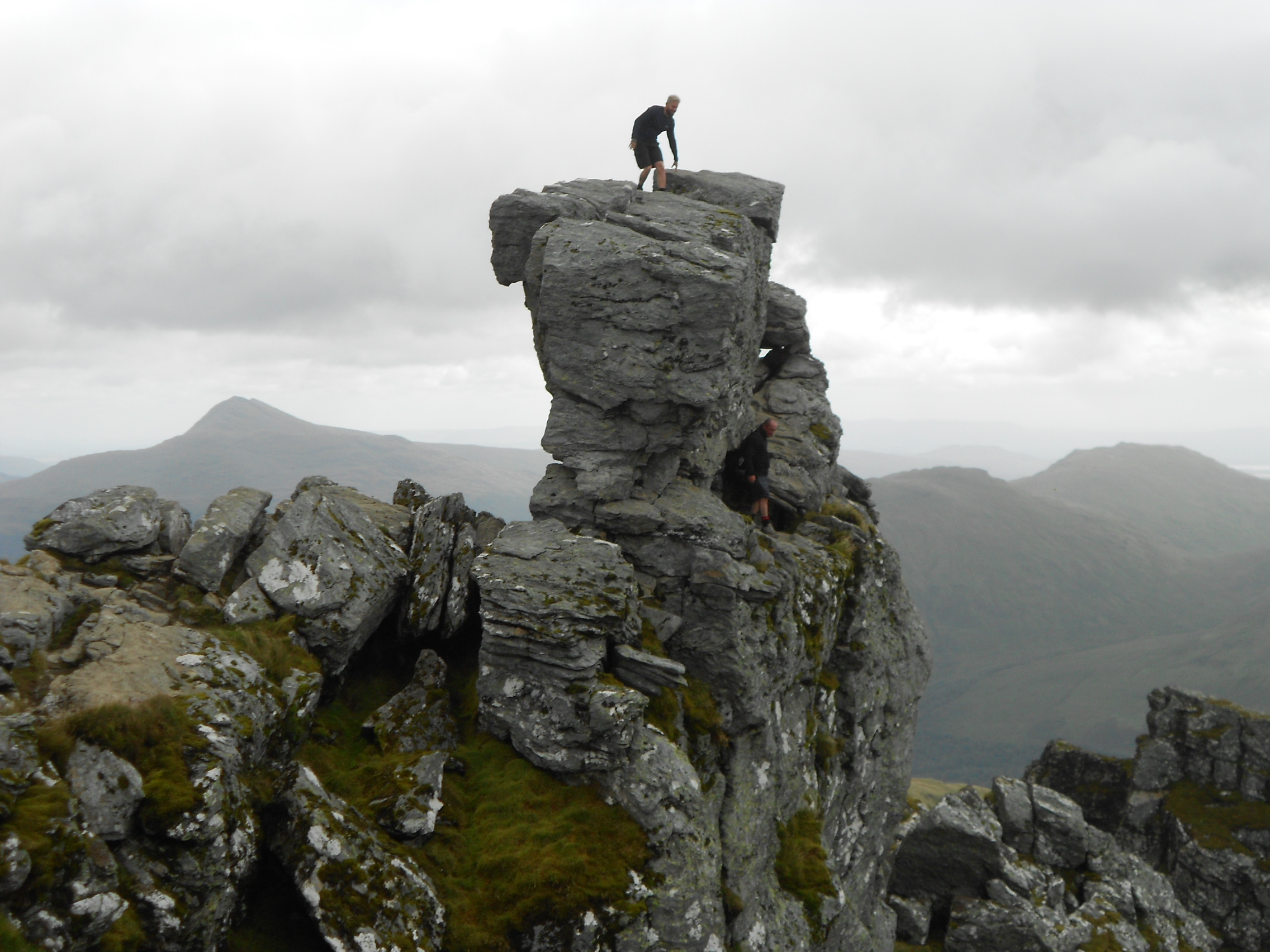
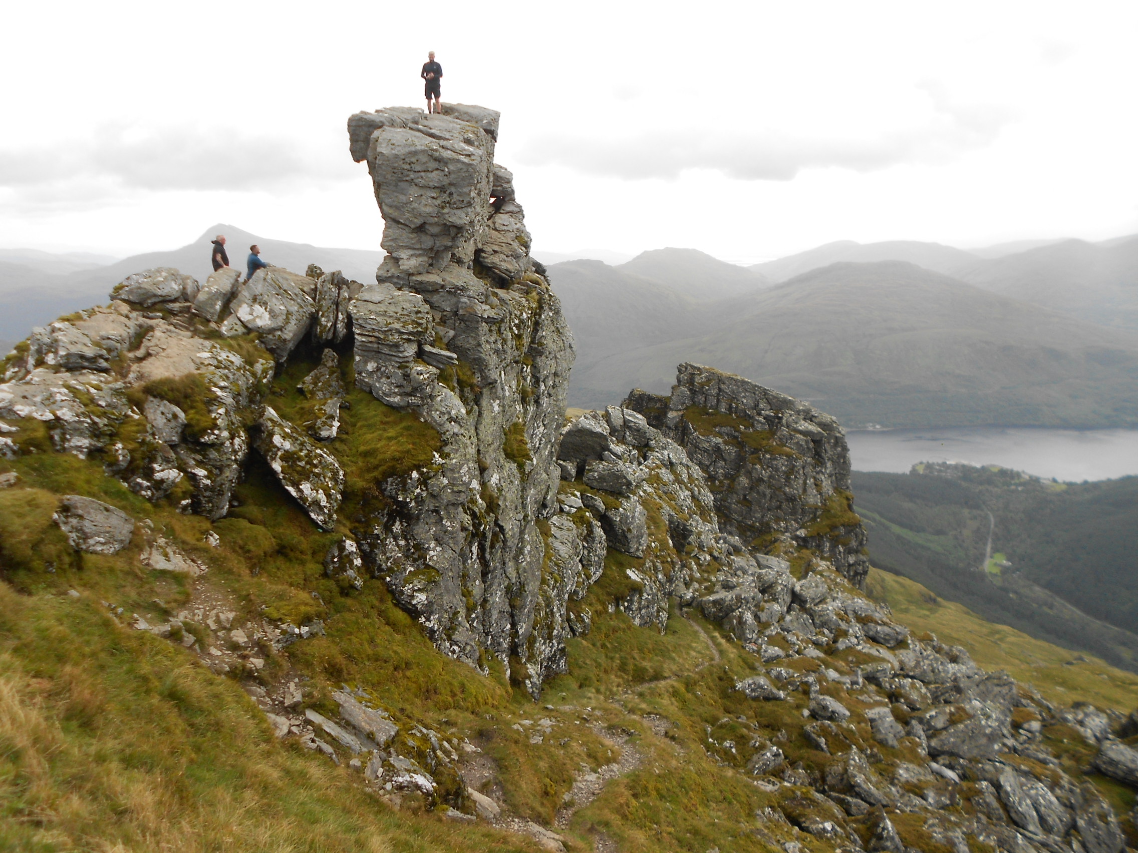
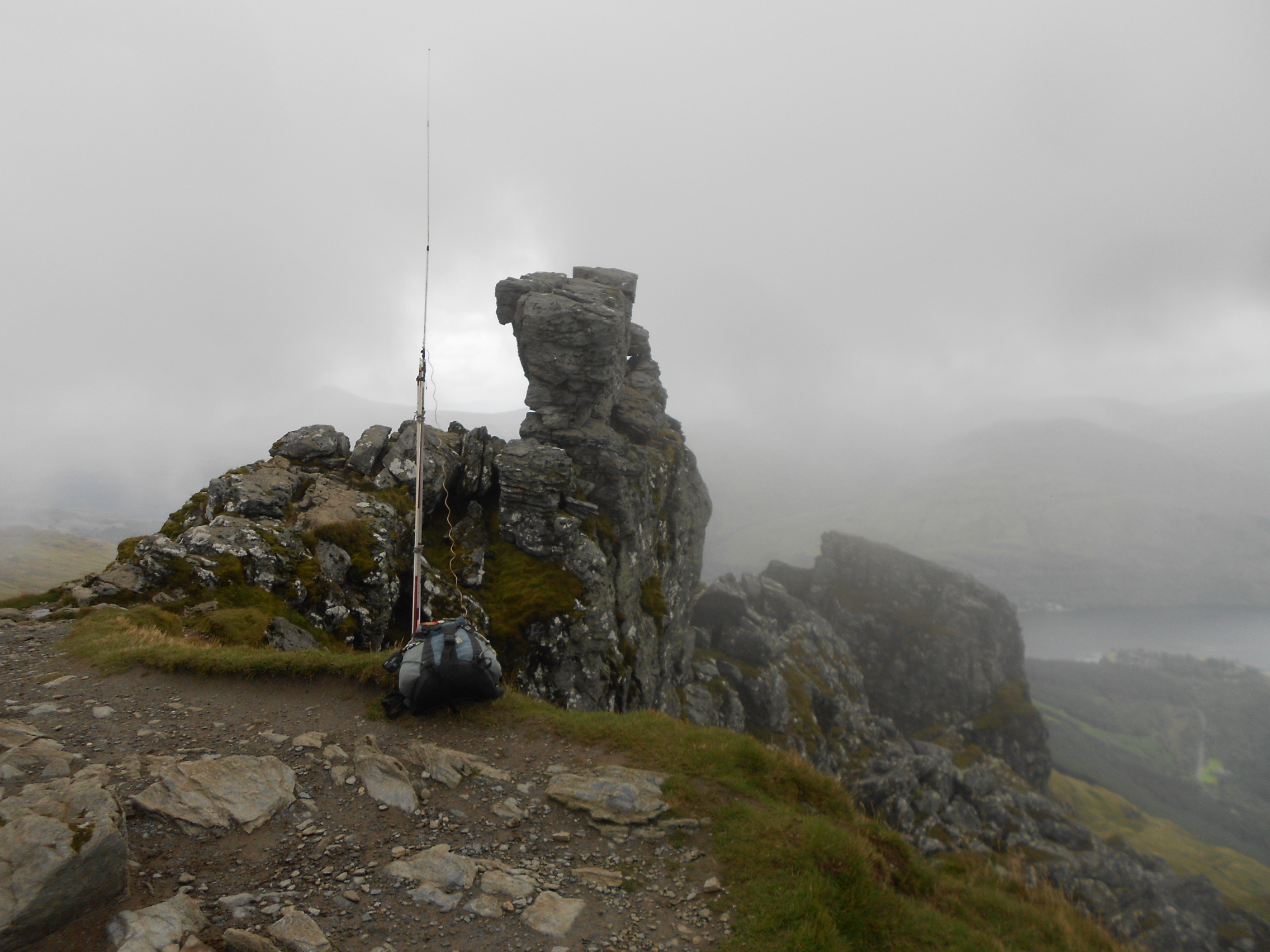
The first job was to admire the summit feature – something you can’t miss and take a few photos while I still could. One brave man crawled through an aperture at the base of the monolith, emerging at the opposite side. From here he negotiated a steep and very exposed ramp before disappearing round the back to eventually conquer it. He stood on top in the wind with his arms outstretched. Rather him than me and my heart was in my mouth. This isn’t exactly the In Pin but there was a certain amount of danger if the wind gusted.
Showers were forecast for midday and with them possible low-cloud. The hotel was clearly visible below and I managed to work my XYL on 446.006 MHz-FM (PMR Ch-1 at 59 both ways) as she stood in our room window. It’s line of sight but she couldn’t see me waving. She may have trouble getting that QSO past the SOTA MT!
Setting Up:
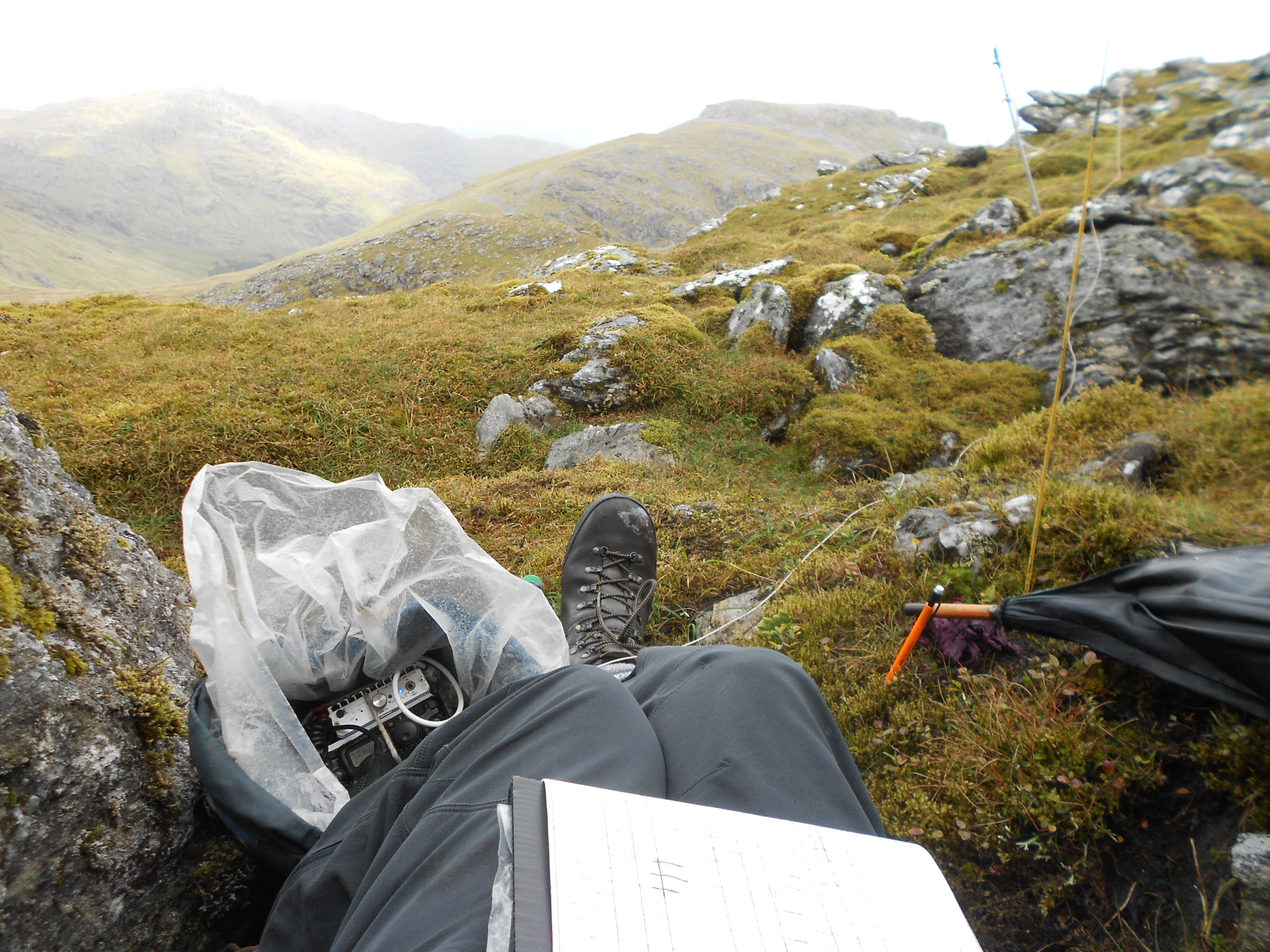
At first glance I thought I would have to either set up the dipole next to the SE face and risk sitting just over the lip or sit in the wind for a few hours. The former option was right where ‘the public’ were passing. Also I don’t like working on steep slopes. You can loose things including your life.
Pondering this for far too long and wasting valuable time I eventually found a place which was a lot more ‘private’ and mostly out of the wind at NN 2583 0589; 115m West of the summit. Here there are rocks and gullies where shelter can be had; though setting up a dipole entails a lot of clambering about. It’s not ideal for take-off either, especially on VHF.
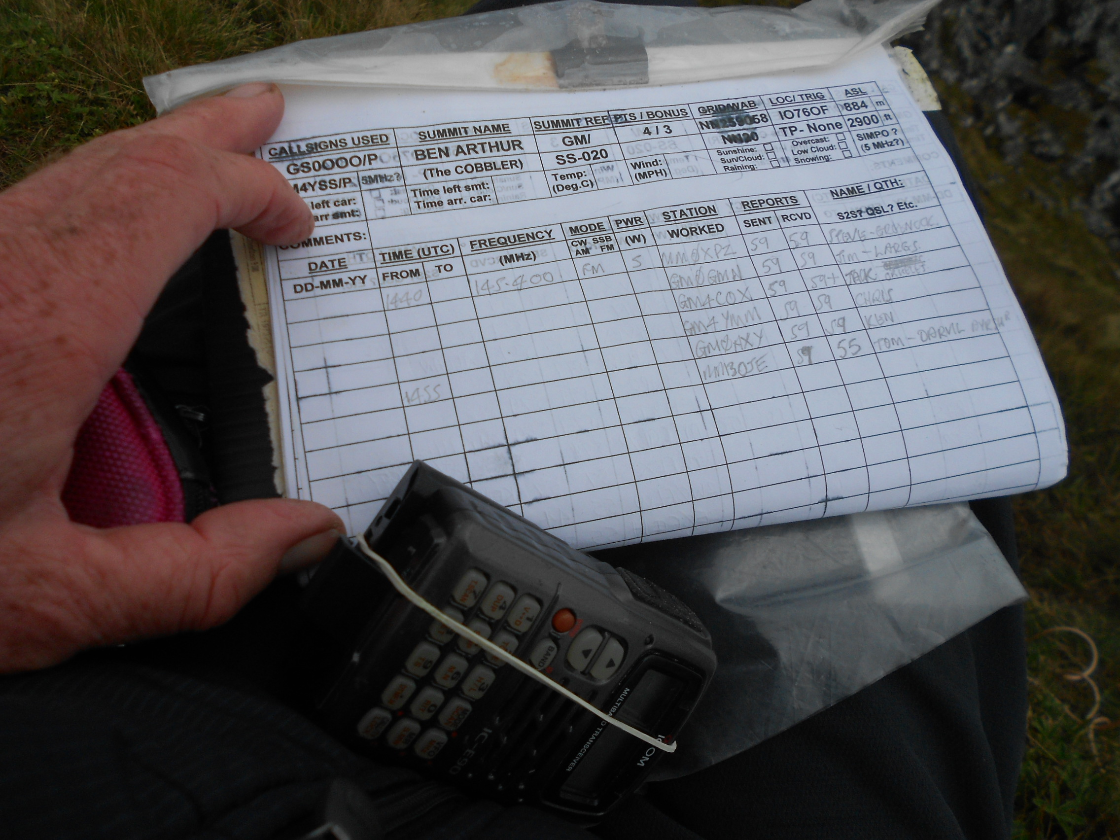
THE COBBLER (Ben Arthur) - GM/SS-020: 884m, 4 pts, 12:14 to 16:15. 5C and rising. 15 mph wind. Overcast with rain showers. Minimal low-cloud. Vodafone coverage but only at the summit proper. LOC: IO76OF, WAB: NN20 - No trig.
I put an alert on before leaving the hotel but I think few people see these late alerts. It’s natural to concentrate on spots once the day has begun.
7.033 CW - 7 QSO’s:
Unfortunately a component of the wind was blowing along the length of the low rock face I had chosen so I settled behind a big rock just below it. It wasn’t comfortable. I could feel sharp rocks through my sit-mat/ map case.
With no phone coverage at that QTH I called CQ several times before getting an answer from DL2DXA/P. Bernd gave his location as DA/SX-224 with an exchange of 559 both ways. More CQ’s were unproductive so I walked up to a place with some phone signal to self-spot. It worked and a small pileup ensued as follows:
G3VXJ Bob; ON4FI/P Karel; GW4VPX Allan; CT2IWW Tugidos; G4APO Rowland 599/ 579 and EA2DT Manuel 579/ 339. All other reports were 599/ 559 and the session took 12 minutes after the spot but 26 minutes in total. Power was 50 Watts at first then 30W.
When the showers came I had to fend them off with the umbrella; holding that at 45 degrees, the log on my knee and keying or writing at the same time. It’s no wonder there were delays, bad Morse and in this situation chasers often can’t understand when why I’m not responding. It’s the nature of activating where there are many other considerations than just radio to contend with. Of course the activators amongst the chasers will full understand this.
7.160 SSB (WAB frequency) - 7 QSO’s:
First QSO on here was an S2S from Martin on G/DC-007 – Watch Croft. The distance to Cornwall must have been just right to provide 57 both ways and a short conversation was possible. Martin was using 10W from a KX3 to a vertical antenna. A good start.
In the log following the S2S: G0FEX Ken 57’s; 2W0FLW Derek 55/ 44; 2E0FEH Karl 55/ 35; G0FVH David 57/ 44; MM0XPZ Steve in Greenock 59/ 57 and finally trusty Don G0RQL with 57 both ways.
My half of the final QSO was picked up by my son Phil G0UUU using the web RX at Nantwich, Cheshire ‘peaking 57’ but Don was inaudible in Cheshire. Power was 50W.
14.052.6 CW - 6 QSO’s:
The record shows a lack of CW activations for this summit. In fact there have only been two cw QSO’s. Neither does it show many QSO’s in any mode likely to have been heard outside the UK. There had been just nine on 20m and two on 40m.
A remote self-spot necessarily carried out up towards the summit again got the session underway and I could hear at least one ‘di-di-dah-dah-di-di’ even before I could struggle back into my corner. It took a while longer to reposition the sit-mat, brolly, log, pencil and CW key but eventually I was ready once again. Now there was a chance for the more distant stations.
In the 20m CW log: SM5LNE Jan 599/ 559; SM4CJM Hans 599/ 579; F8DGF Nic 599/ 559; OK1CHP/P Libor 559/ 339; EA2BD Ignacio 599 both ways and EA2DT Manuel 599/ 339. Power was 50W.
14.285 SSB - 5 QSO’s:
After yet another trip up the hill the 20m-SSB session was started off by Manuel EA2DT with 57/ 52. There followed: EA3BD Ignacio 57’s; HB9CGA Ulrich 57/ 55; EA1DHB Ricardo 57/ 55 and finally OH3GZ Jukka 57/ 59. Power was 50 Watts again and that was the end of the HF part of the activation.
It was now time for VHF but before that could take place I had to pack up and relocate to a higher point.
145.400 FM - 6 QSO’s:
The vertical J-fed half-wave was erected on the HF mast base section on the very edge of the drop towards Ardgarton. I almost lost the rucksack seated as I was, just over the ‘lip’ hoping to be out of the wind but not succeeding too well. I made a note to hold on to everything, especially the precious fruits of my labour namely the log and I did what I always do - photographed it just in case.
Just as I was about to press the PTT on my IC-E90 H/H, a group of German students and one girl from Alaska of all places, came enthusiastically over to ask, ‘What are you measuring?’ A detailed explanation was required as they seemed genuinely interested.
A CQ on S20 produced multiple responses so after a QSY to the working frequency, I wrote the first four callsigns in the log. It took a while and to avoid a slide I had to reposition myself a little further up the steep grassy slope. Underway after that second delay I logged the following VHF enthusiasts: MM0XPZ Steve in Greenock; GM0GMN Jim – Largs; GM4COX Jack at Carluke. Next came GM4YMM and GM0AXY - Christine & Ken in Edinburgh and finally MM3OJE Tom in Darvel, Ayrshire.
All reports were 59 both ways apart from Tom – 59/ 55. Power was 5W throughout and the quite chatty session spanned 20 minutes.
70.450 FM - 2 QSO’s:
After packing the 2m antenna away and unfortunately the log, I remembered about 4m. Using the 2m rubber duck and a short stainless steel welding rod extension to convert it to 4m, I stood up to call CQ on the ICOM IC-E90 modified to cover 70 Megs. Immediately Jack GM4COX came back reporting a lot of wind noise on my transmission combined with some intermittent local interference he was suffering. Still we made a good QSO with the 3-Watts available.
I could remember Jack’s QSO OK without logging but then there was a second caller in the form of GM4DHJ Jim in Renfrew. We exchanged with 59 both ways (as was Jack most of the time). I logged Jim on the palm of my hand using a pen and fortunately there were no further takers.
Descent:
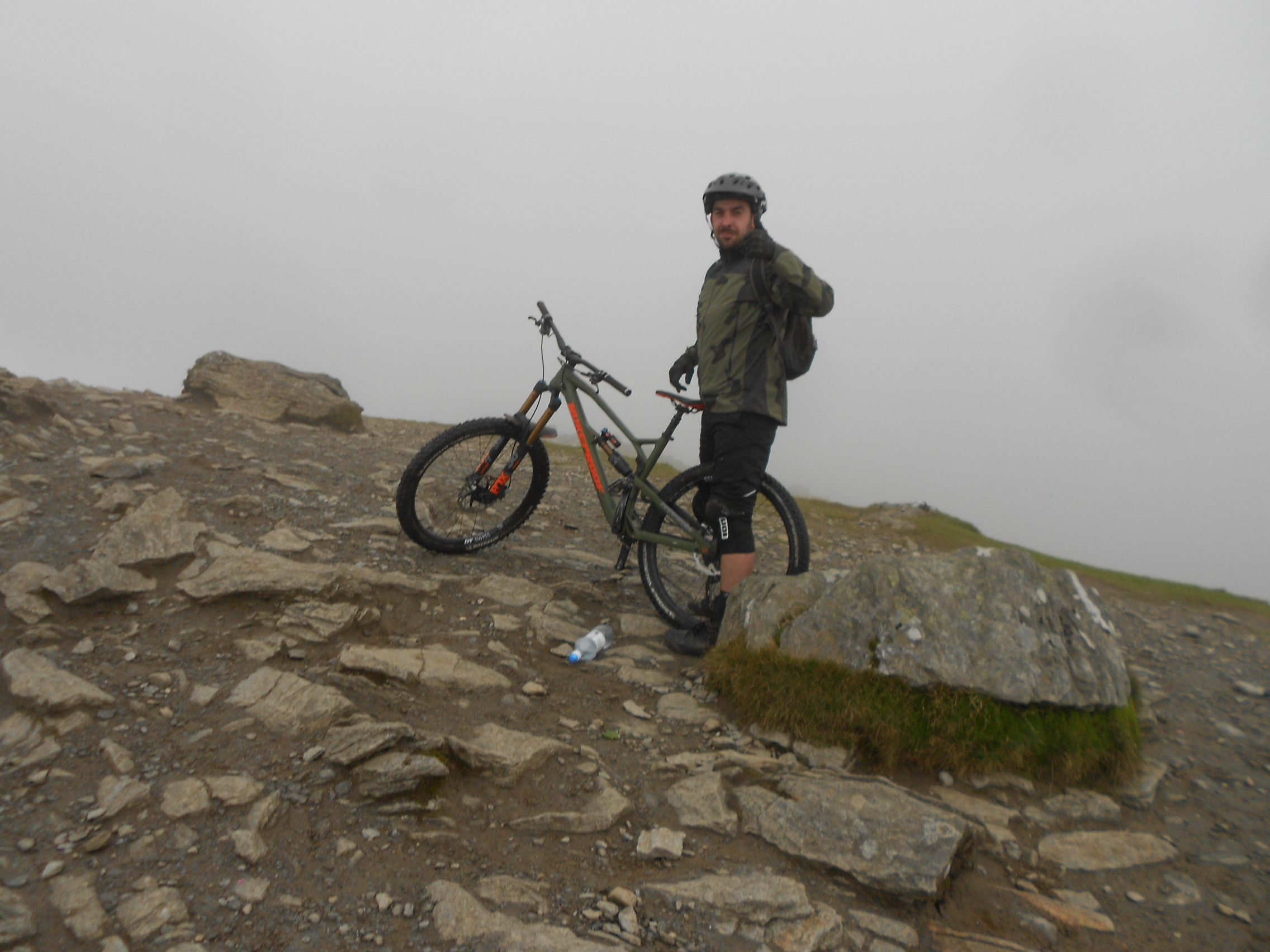
By now the mist had come down and the summit was deserted. Just as I was leaving at 16:15, a young chap arrived on a push bike. His story: ‘I was sitting in the office and suddenly decided I needed some exercise.’ ‘Some’ exercise! A lot of exercise more like but he did say his leg muscles were ‘burning up.’ That came as no surprise; my 726m walking ascent had been hard enough but he had come in from Arrochar, climbing almost all of The Cobbler’s 884m height! I walked down beside him until it was time to turn left down the burn but he wisely dismounted after finding grip was lacking on the rock strewn, muddy path. He came from England’s Lake District so he was used to rough cycling.
Getting down the 1km of rough ground to the path was a tedious toil, helped significantly by the furled umbrella. As stated earlier, no path was found on that section but once back at the fence the path and lesser gradient increased progress back to the A83 where I arrived at 17:18. A mile of road walking was added a second time but I was back at the car for 17:43.
It was then just 5 minutes drive back to the hotel and 10 minutes to a welcome shower.
It had been a successful day albeit quite a hard one. The ‘new’ route was in the GPS and QSO’s were in the log. Mission accomplished.
ASCENT & DISTANCE:
Today: Start point at 100m ASL due to A83 closure at Mil’ Rd.
Ascent 784m (2,572ft) / Distance 8.4 km (5.3 miles).
Note: If starting at the intended place NN 2427 0598 at 158m ASL, further up the A83:
Ascent would be 726m (2,382ft) / Distance 5.3km (3.3 miles)
CHRONOLOGY:
Walk started: 10:17 (A83 Mil Rd junc)
Passed intended start point: 10:33
GM/SS-020: 12:14 to 16:15
Passed intended finish point: 17:18
Returned to Car: 17:34 (A83 Mil Rd junc)
Walking times:
Ascent: 1hr-41min from planned start point/ 1hr-3min down.
(1hr-57min from A83 closure/ Mil Rd junc/ 1hr-19min down)
Summit time: 4hrs-1min
Time Car to Car: 7hrs-16min
QSO’s:
7 on 7.033 CW
7 on 7.160 SSB
6 on 14.052.6 CW
5 on 14.285 SSB
6 on 145.400 FM
2 on 70.450 FM
TOTAL: 33
COMMENTS:
Starting in the west, the route was chosen because it is shorter and the start point higher compared with Succoth/ Arrochar, which is the normal way in. The same applied to my Beinn Ime activation of 2017 and that turned out to be a mistake costing me a sore ankle due to walking across angled slopes. This was better but the final km up and back down beside the burn, where the ground was steep and rough, wasn’t pleasant or easy.
Every time I find myself toiling steeply uphill, I swear that this will be my last SOTA ever! Coming back down I’m buoyed up by the QSO’s gained in the log and the World seems a better place. Maybe I will try it again after all.
40m:
Propagation on this band has been reported to be poor recently. I have no idea about that as I have not tried to use it but it seemed satisfactory today despite QSB. I don’t doubt that there were a few ops in the skip zone who missed this summit but I had to make a choice between this and 80m, there not being time or battery power to do both.
Even without a net running the use of the WAB frequency is an advantage that often leads to a greater QSO count and I don’t think any mobile stations were blocked out in this case. At least I didn’t hear any. 40m was top scorer with 14 QSO’s.
20m:
This did what it normally does which is to drop a little further into Europe, giving countries in Germany and beyond a fighting chance if 40m doesn’t make it. In the afternoons there is often propagation into N. America but nothing was heard from there today.
2m-FM:
VHF brought in more contacts than I’m used to in Scotland but it’s much nearer to centres of population than the GM/NS region that I have become used to. Signals from the stations I worked were all armchair copy but I should remember to defeat the squelch occasionally.
4m-FM:
The two stations worked on here were two more than I expected. Thanks for coming up Jack and Jim on this interesting band.
160m:
Though the loading coils were in my rucksack, I didn’t try 160m for two reasons. Firstly I didn’t think I would have been likely to get even one contact and secondly my HF setup, being some 15m down from the summit, was in a place which relied on skip. 160m contacts in daylight are mainly line of sight. Relocating the HF dipole to the summit proper might have had a detrimental impact on other people.
General:
Even with the facility to self-spot, considering this was a Saturday, the QSO count of 33 was quite disappointing. That said, I hope a few people collected a ‘new one’ to make the activation more worthwhile.
THANKS:
To ALL STATIONS worked. To Spotters EA2DT; EA2BD and the SOTA phone spotting service. Thanks also to the unnamed dog walkers who told me about this route.
73, John G4YSS
Using Scarborough Special Events Group Club call GS0OOO/P.
Photos:
2017:98.
05-09-20:1-3-110-8-11-22-27-28-39-49-51-52-53-56-59-75-81-94-97-99-102-106-4
06-09-20: SS20 from Hotel Drive
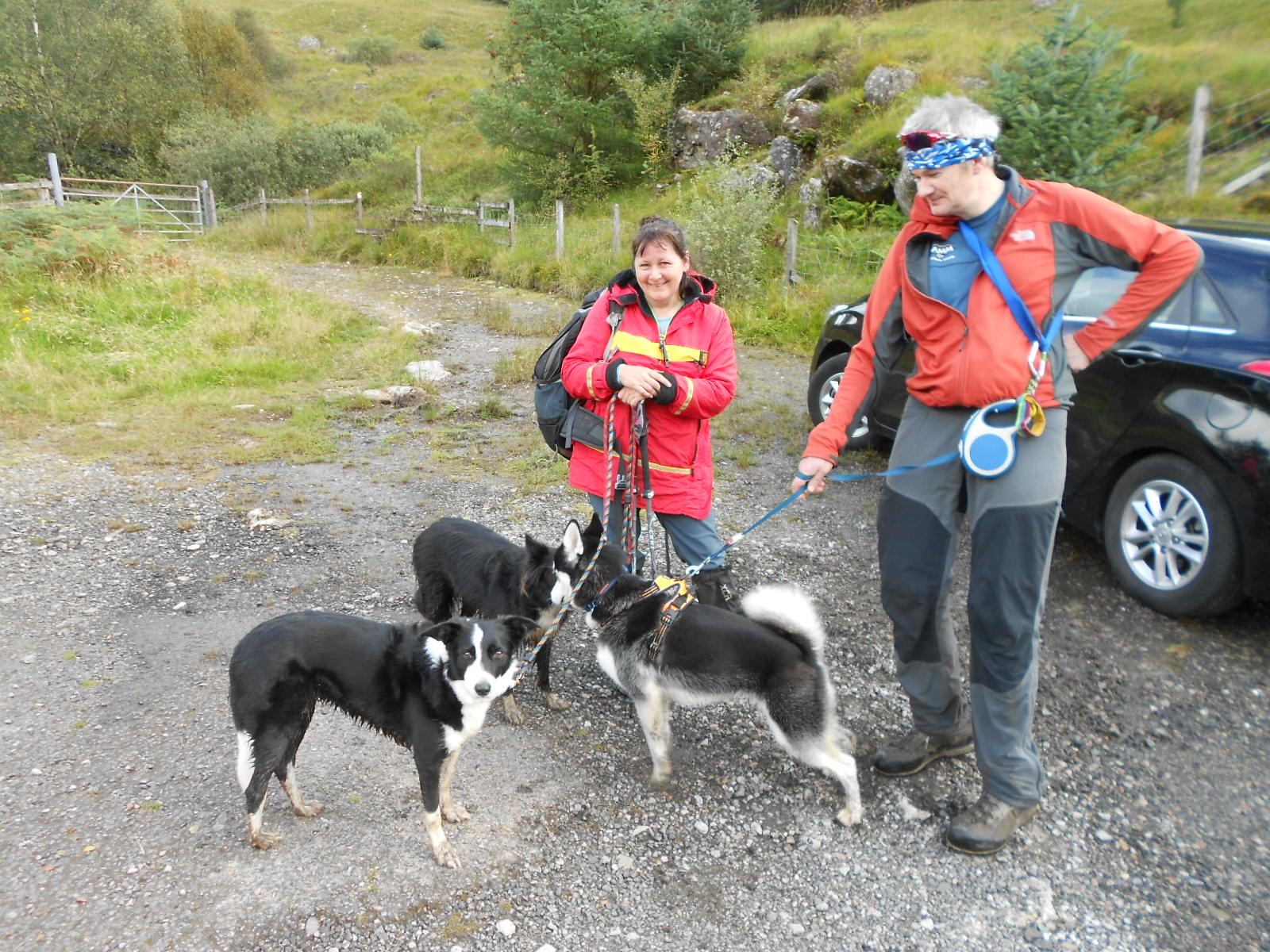
Above: 15-09-2017. Stopped to pick these local dog-walker’s brain’s about the back-route up The Cobbler from this pull-off, half way up the hill at NN 2427 0598 (A83)
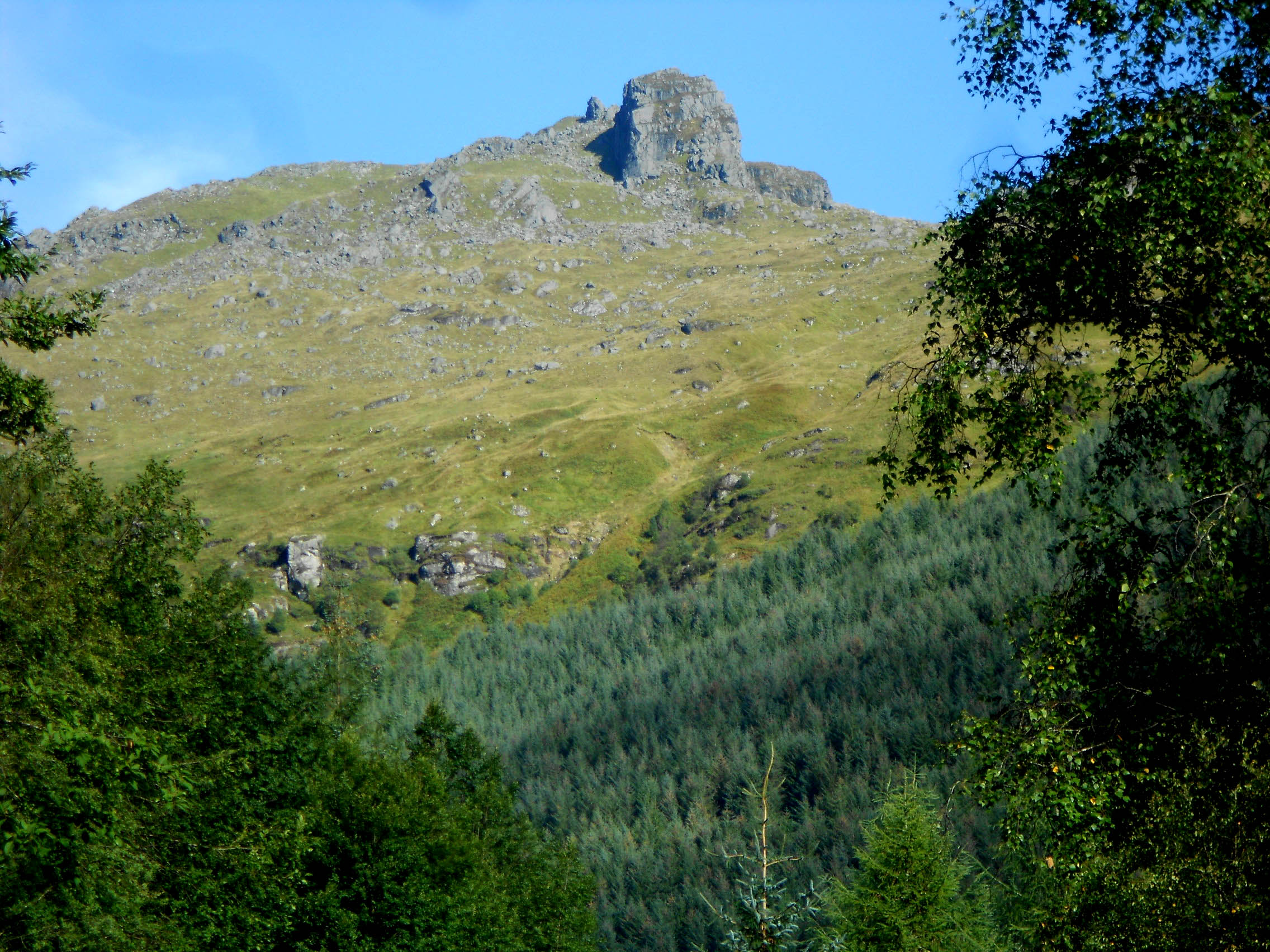
Above: The Cobbler from the Ardgarten Hotel drive; taken on a sunny day (telephoto)
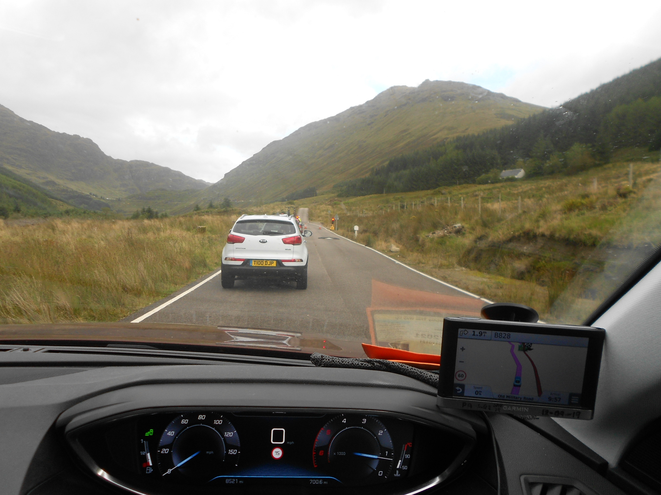
Above: Bypassing the A83 closure on the old Military Road. Aborted.
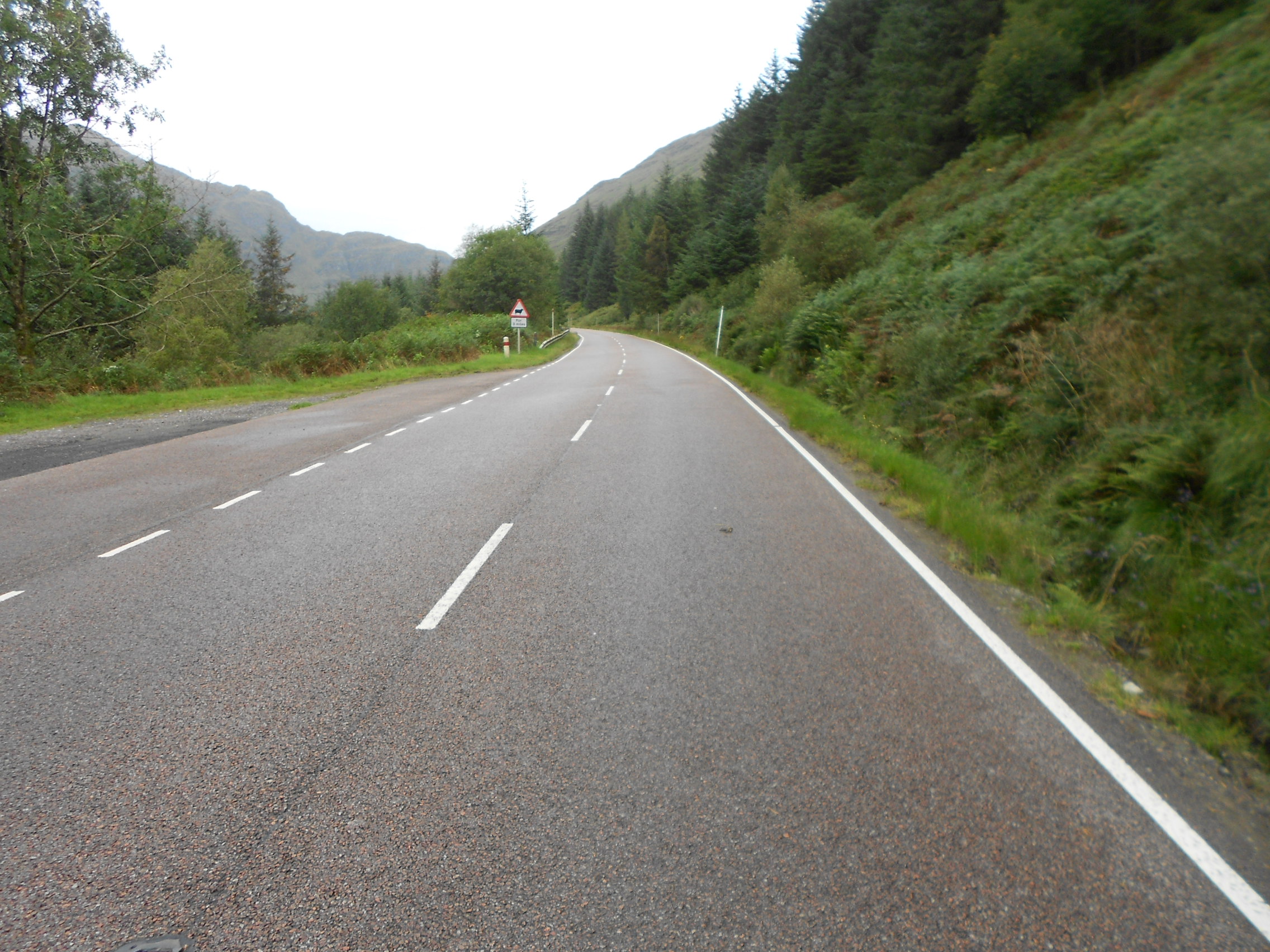
Above: Up the closed A83 on foot
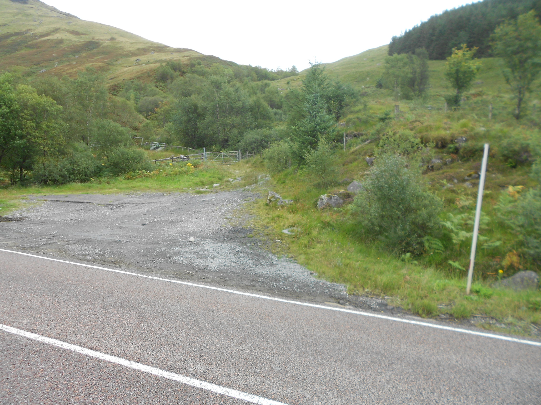
Above: The pull-off. The intended parking place and path start point
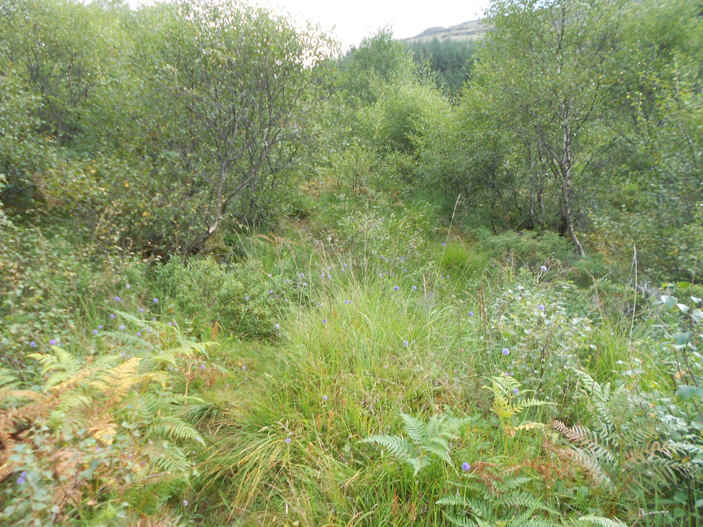
Above: First part of the path is quite overgrown
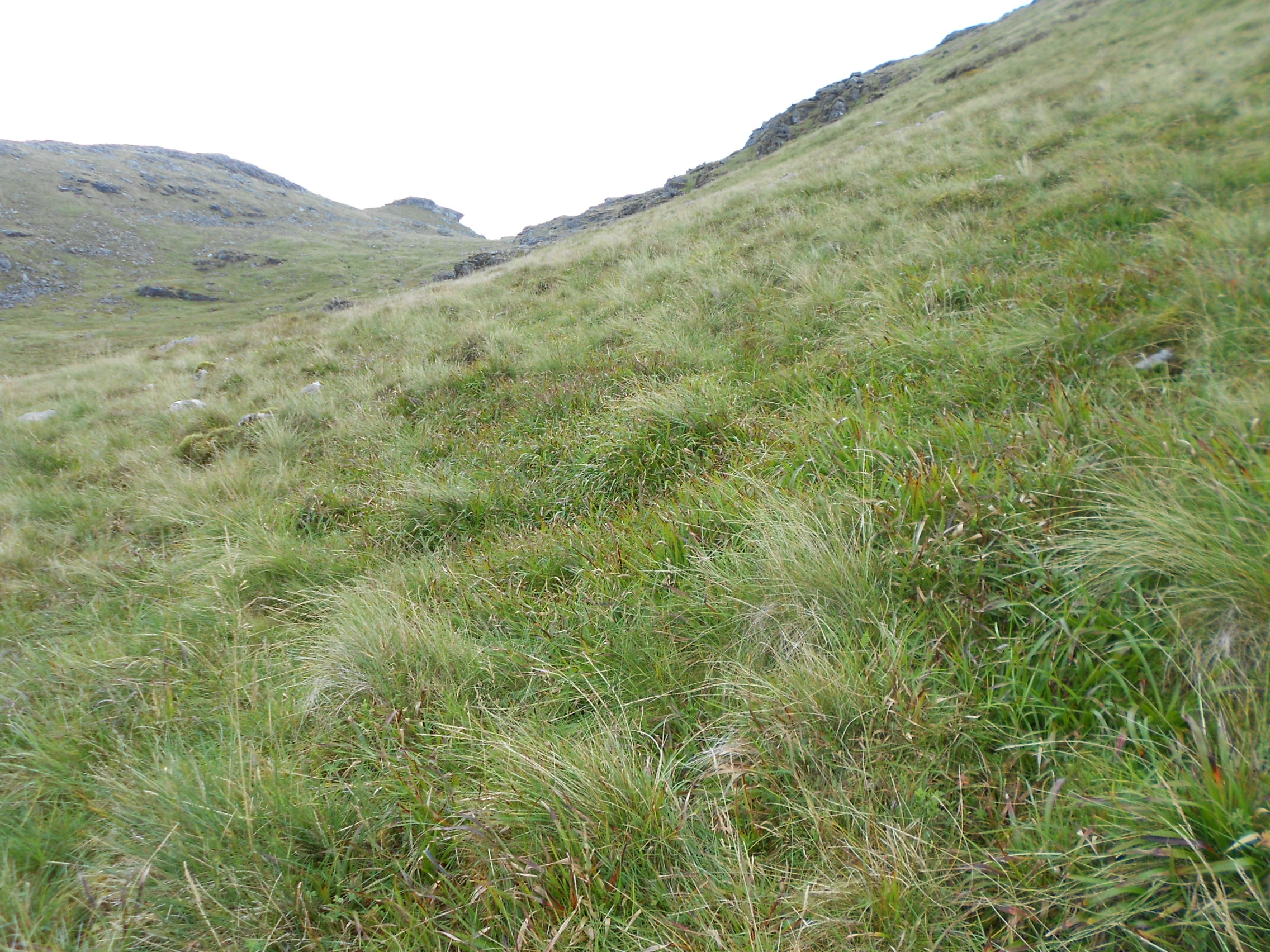
Above: Path going ENE - right foreground/ midground
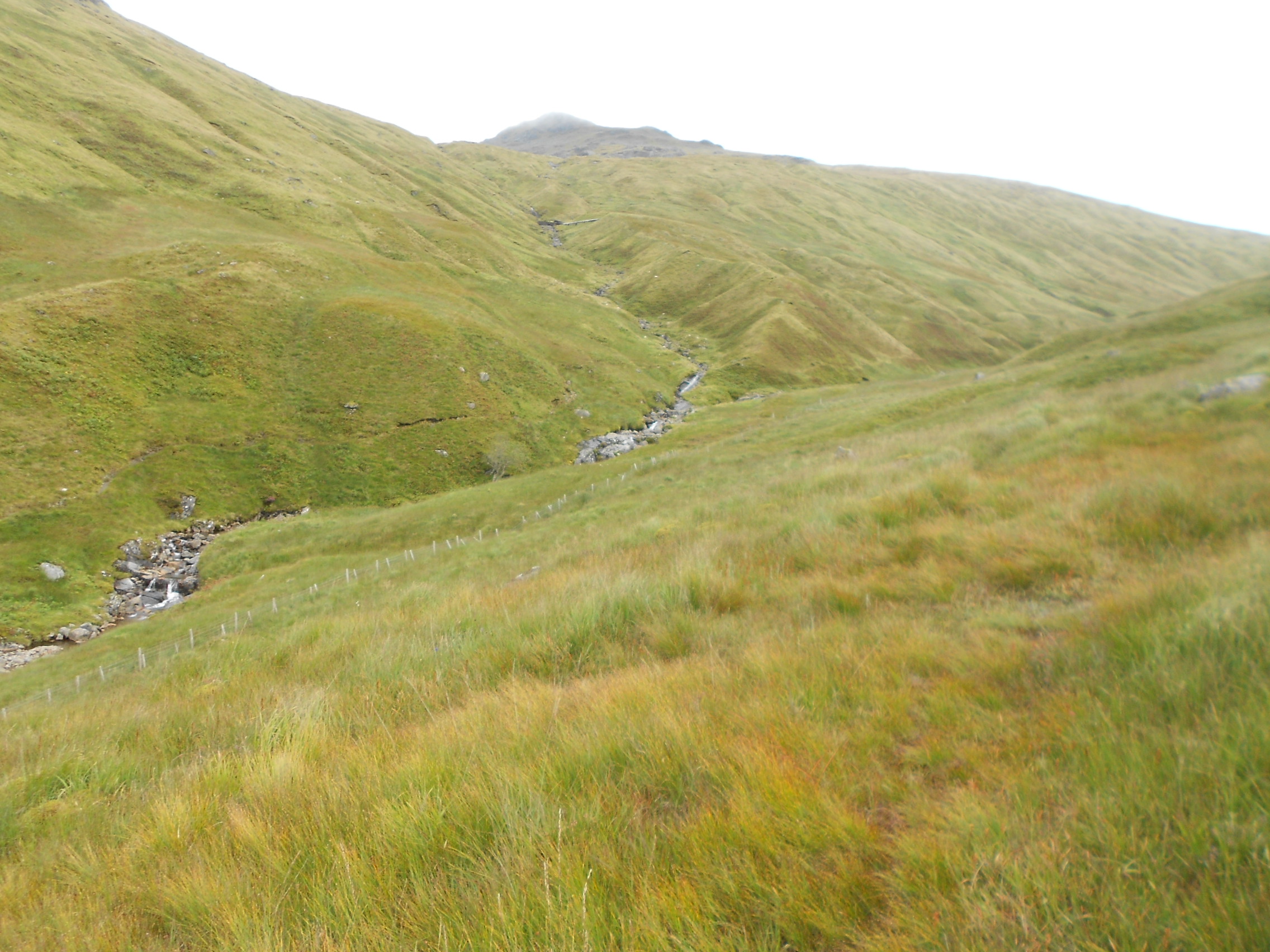
Above: Turn right off the path and go up beside the burn (stream)
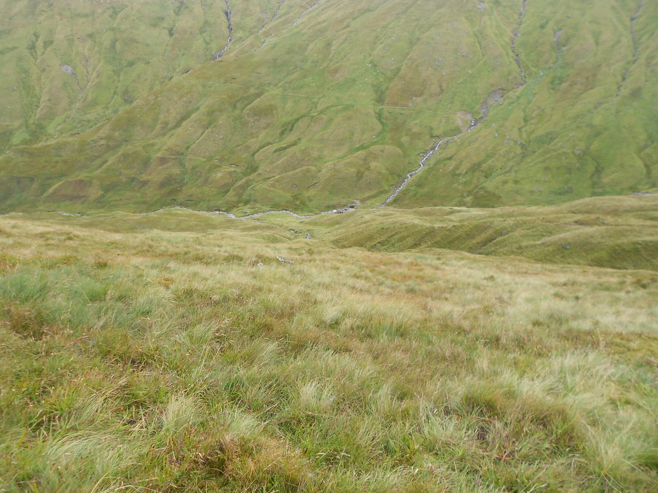
Above: Going up a pathless 1km parallel with the burn. Looking back - downhill
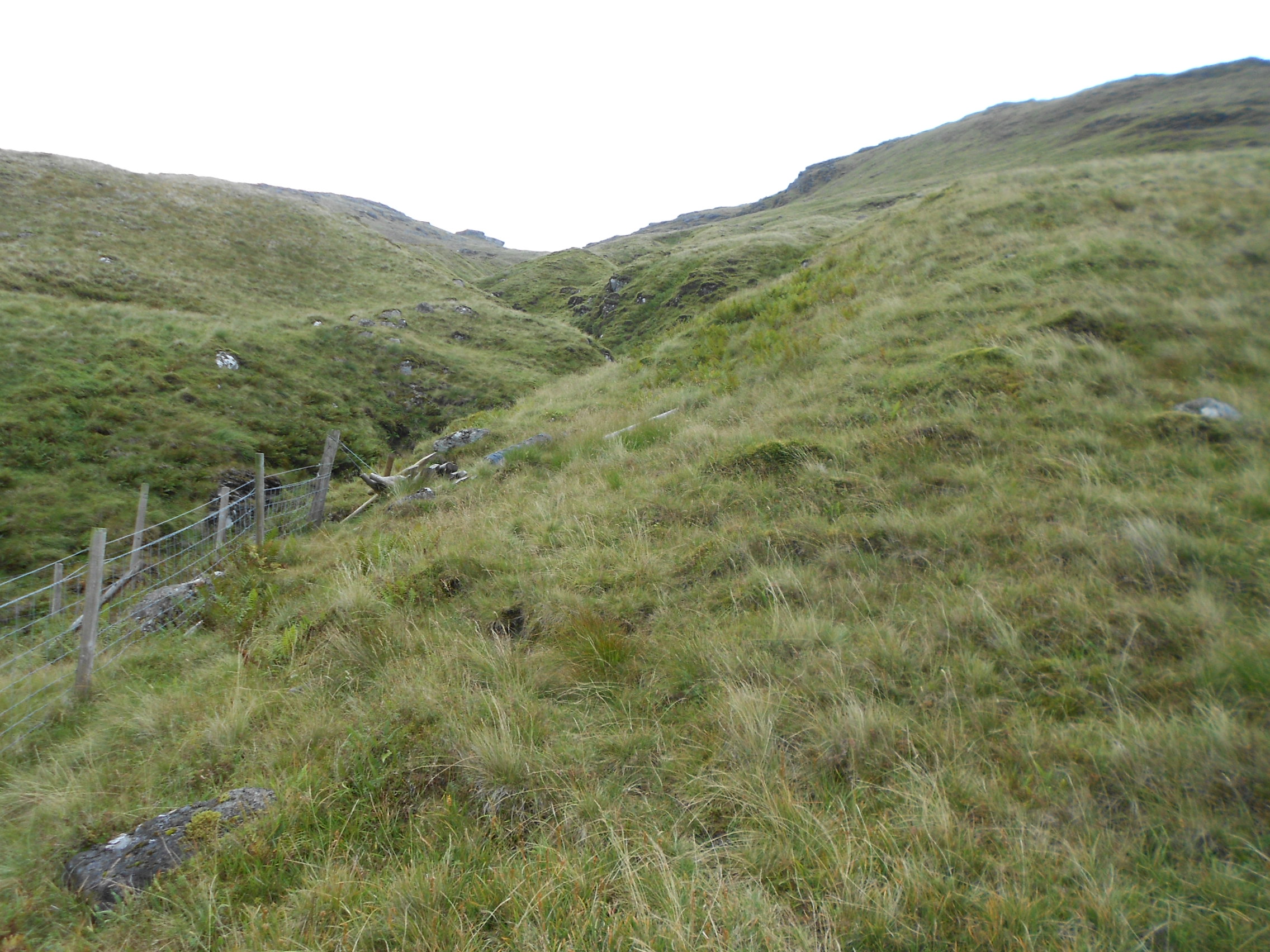
Above: Looking up the 1km slope
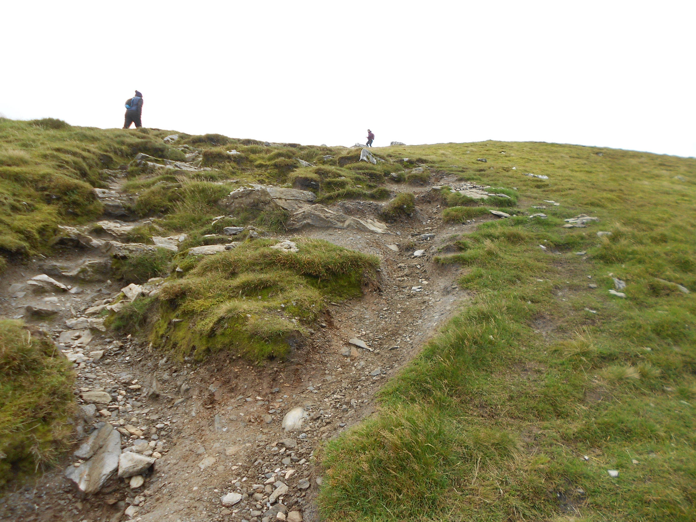
Above: The main path going up to the summit

Above: Looking down at the Ardgarten Hotel and Loch Long (telephoto lens)
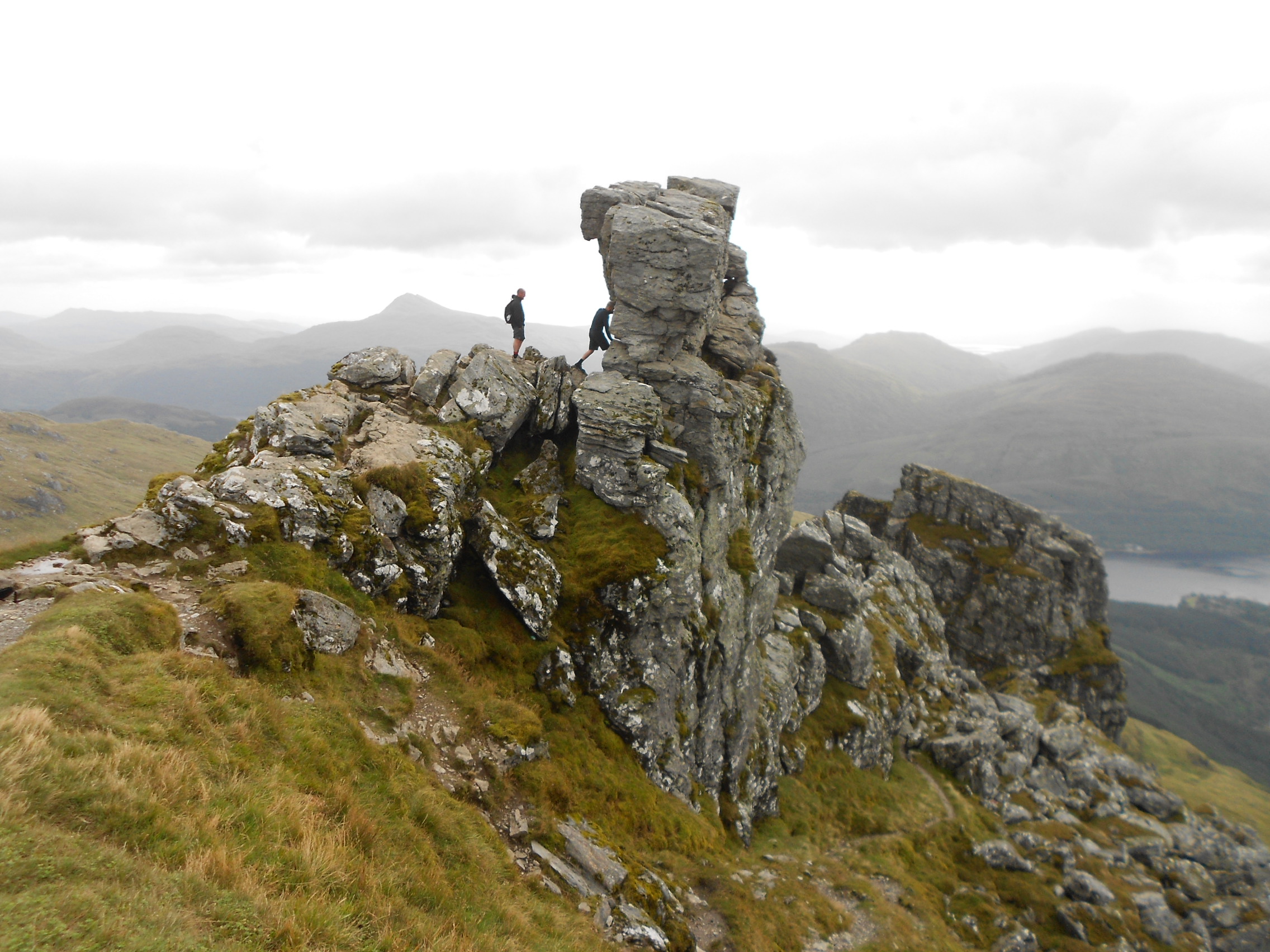
Above and next photos: Brave man climbs to the very top

Above: Activation of GM/SS-020 on 40m & 20m
Above: Activation of GM/SS-020 on 40m & 20m
Above: Activation of GM/SS-020 on 2m (& 4m position)
Above: IC-E90 4-Band VHF H/H
Above: Man, originally from Cumbria, having a change from the office. Summit of Cobbler.
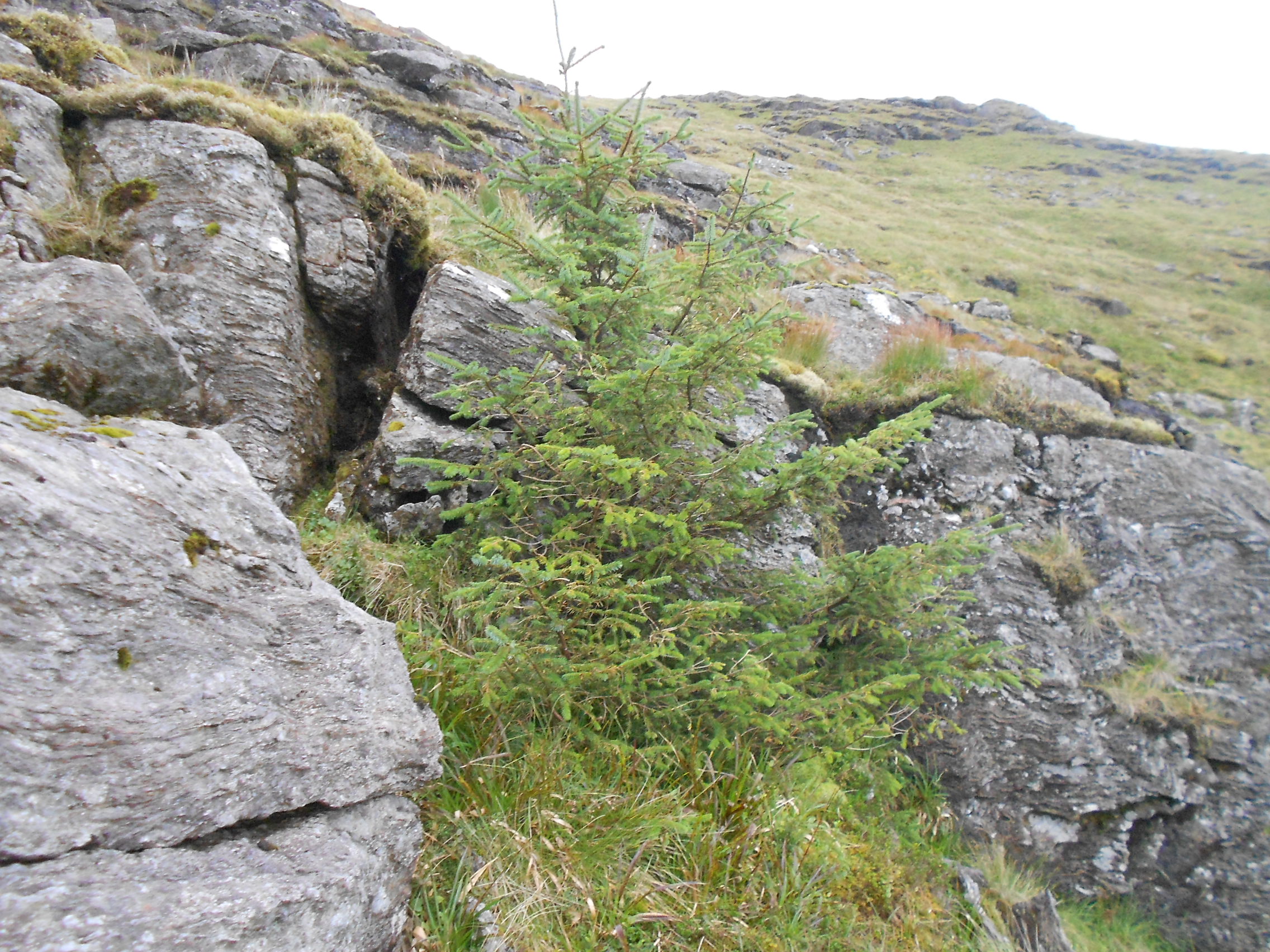
Above: A lonely Norway Spruce half way back down to the path
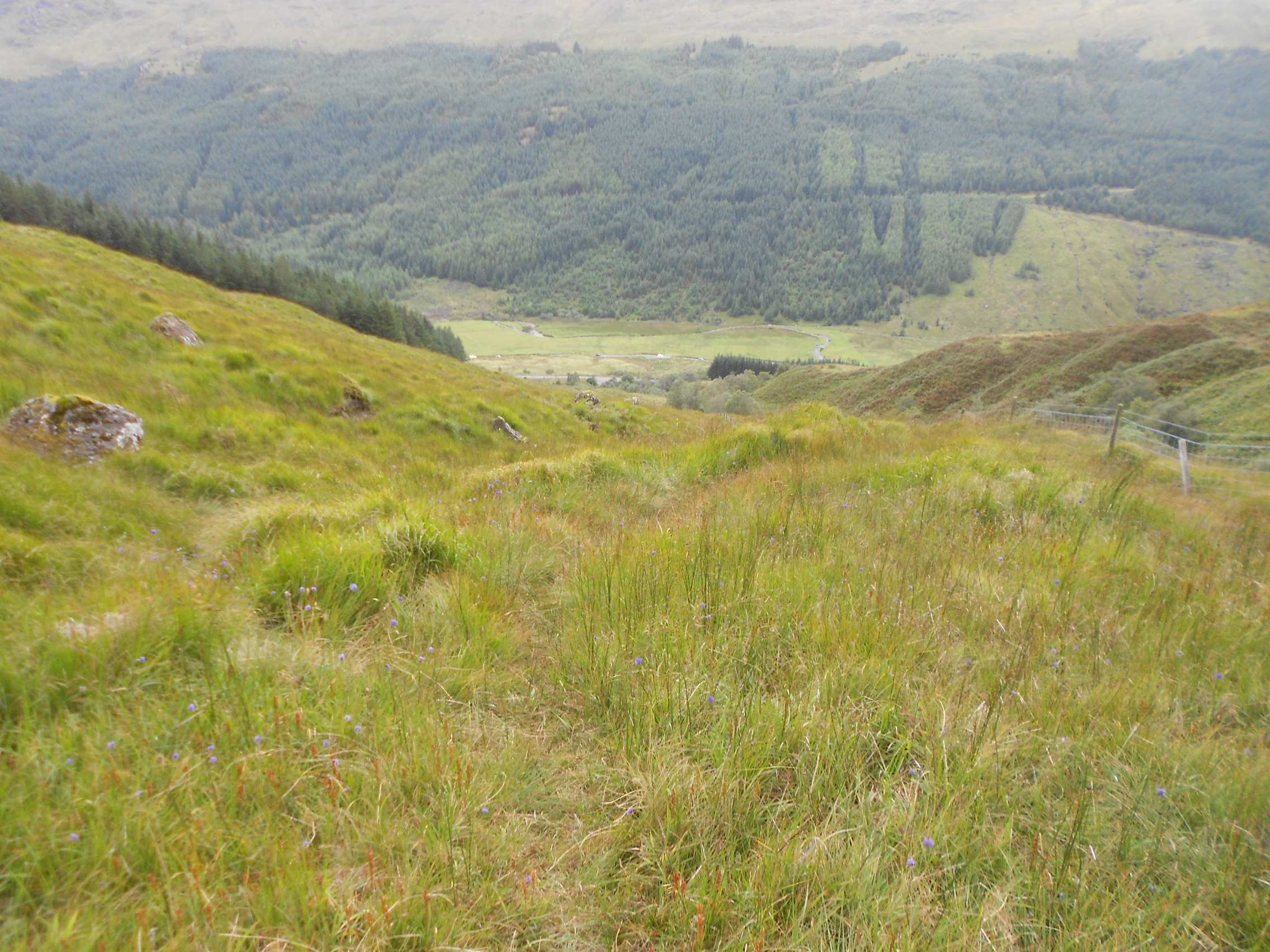
Above: Half way down the path to the A83
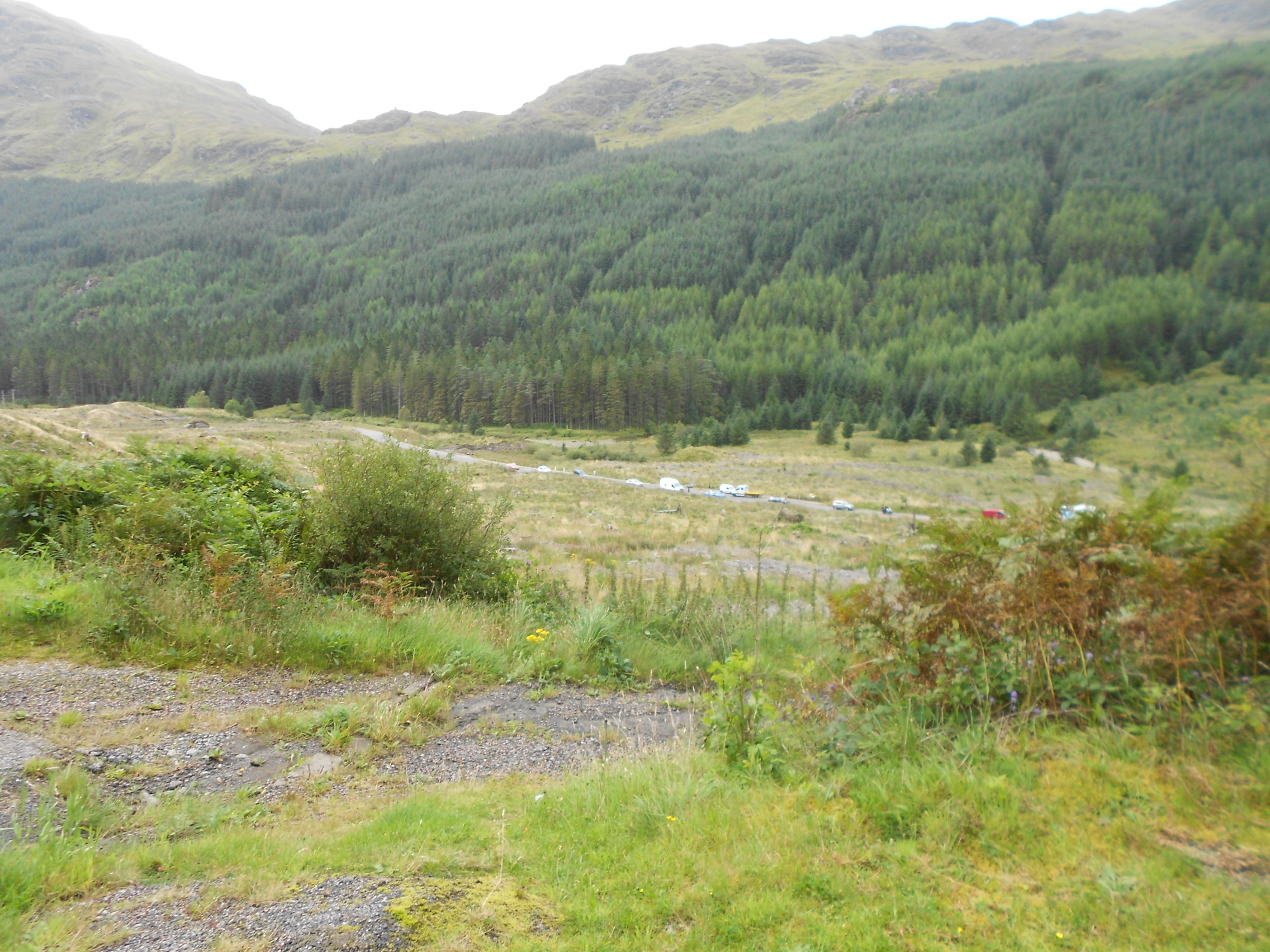
Above: Traffic bypassing the A83 closure on the old military road below
GM/SS-018 Beinn an Lochain activation report in a few days


