G4YSS: GM/SS-016 & GM/SS-020 on 18-05-22
Issue-1 (Pse rprt errors)
Activation of BEINN NARNAIN and THE COBBLER (Ben Arthur)
Using GM4YSS/P
VHF - QRO on 2m-FM only
All times: BST (UTC plus 1hr, UOS as ‘z’)
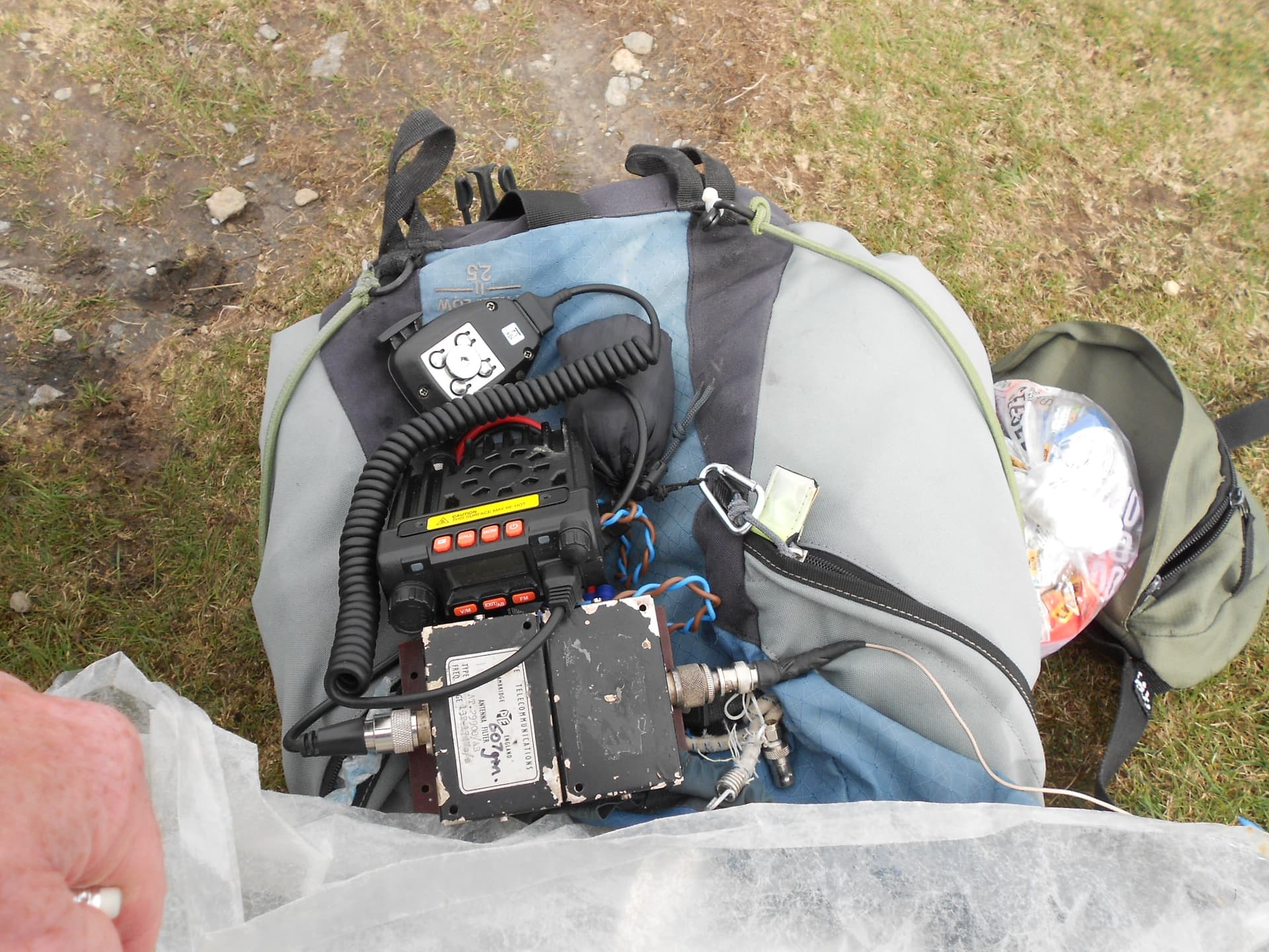
EQUIPMENT:
Moonraker MT270M, 2m/70cm, 25W Mobile Transceiver
PYE Cambridge Tunable Antenna Filter Type AT29908/AB, range 132-174Mcs (0.6kg)
Turnigy 11.1V, 2.2 Ah Li-Po battery
Sotabeams 3-ely Yagi (carried but not req’d)
3m x 2-section mast (carried for Yagi but not req’d)
J-Pole for 2m FM
Reserves:
11.1V, 2.2 Ah Li-Po battery
IC-E90, 4-band, 5W VHF H/H (not used)
Pack Weight: 9.1kg (20 pounds) inc. thermoball jacket & 0.75 litre drinks
INTRODUCTION:
This was the first SOTA activation of this year’s trip to GM/SS. My XYL booked a 7-night holiday via Shearings at the Tarbet Hotel from 16th to 23rd of May. This was our second time staying there, the first being 2017 (SS6 & SS1). Since then all the staff have changed and the cost has increased dramatically. The 2022 price is £61.43 pppn for half board whereas five years ago it cost just £29.80 pppn. Technically Shearings went bust and the hotels were all sold. Now Shearings don’t have much control over price.
The drive from Scarborough is normally 280 miles but an alternative route via Middleton-in-Teesdale and Alson got that down to 269 miles. Though it took a little longer it certainly made a pleasant change from the A66 and we found a good café at Hallbankgate on the A689.
After some nice weather over the past few weeks, the mountain forecast was mediocre. Early showers, 25 to 40-mph winds, 4 to 8C. However there was the prospect of an afternoon improvement.
EXECUTION and ROUTE:
In 2017, routes for Arrochar summits of interest; namely SS16, SS20 and SS6, were created. SS6 was done in that year and SS20 in 2020, which left SS16 and possibly SS25. Succoth more or less at sea level so all the mountain plus any re-ascent would have to be climbed. However routes from Succoth follow well-trodden paths resulting in easier navigation.
The earliest hotel breakfast option was 08:00. The chosen start point, the pay & display car park at Succoth, was just a 10-minute drive away. After paying for 8 hours at £1 per hour using a debit card, I set off walking at 09:39 in breezy conditions and dull overcast with only the one summit SS16 planned.
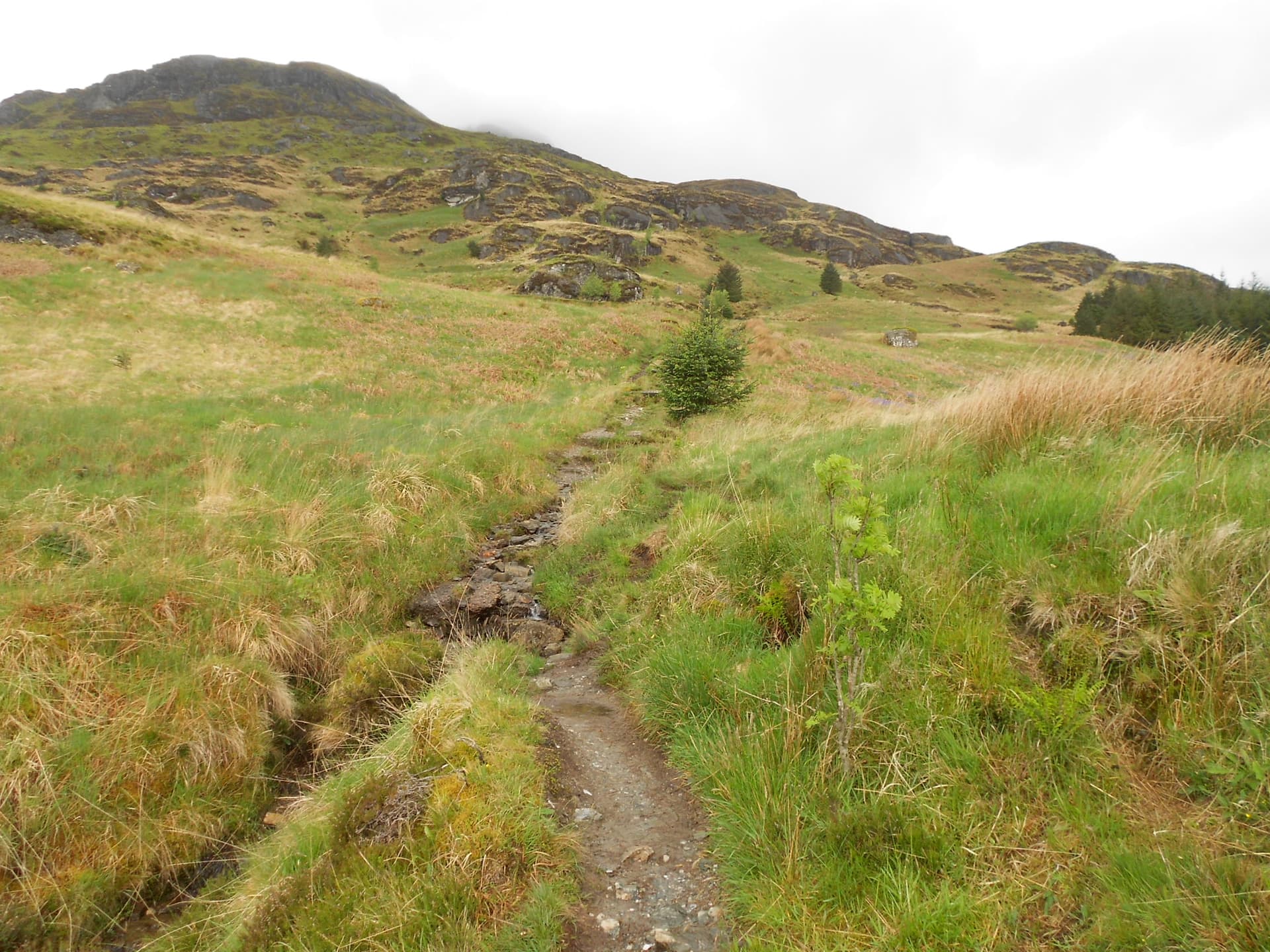
The path leaves the A83 at NN 2943 0484 just across from the car park and is sign-posted ‘Beinn Narnain and The Cobbler.’ However I wanted a direct route to Beinn Narnain and that requires a right turn off the path at NN 2937 0483, after just 60m. Here a muddy path goes steeply NW up through trees and is slightly confusing in places until you get to a stony burn which doubles as a path and climbs via NN 2922 0502 and NN 2905 0523 to a cross-track at NN 2874 0560.
I was walking in flowing water after rain the previous day. There are concrete blocks in the streambed; the remains of a cable railway used for dam building. I was carrying mast sections external to the rucksack so contortions were required to get under overhanging trees. Annoyingly this went on for what seemed like a long time. A stop was made to remove the fleece for the remainder of the ascent.
Continue straight up the hill and over a cross track to NN 2864 0576 where the path turns sharp left then right again at NN 2856 0571. The OS map disagrees somewhat here and would have you turning left along the track for a short distance.
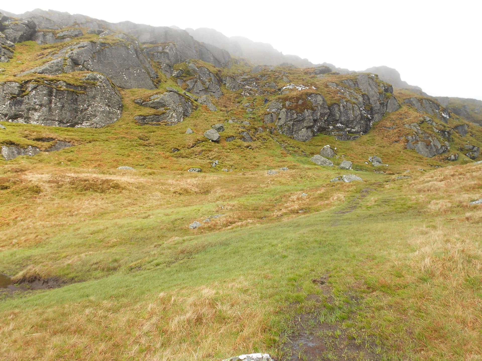
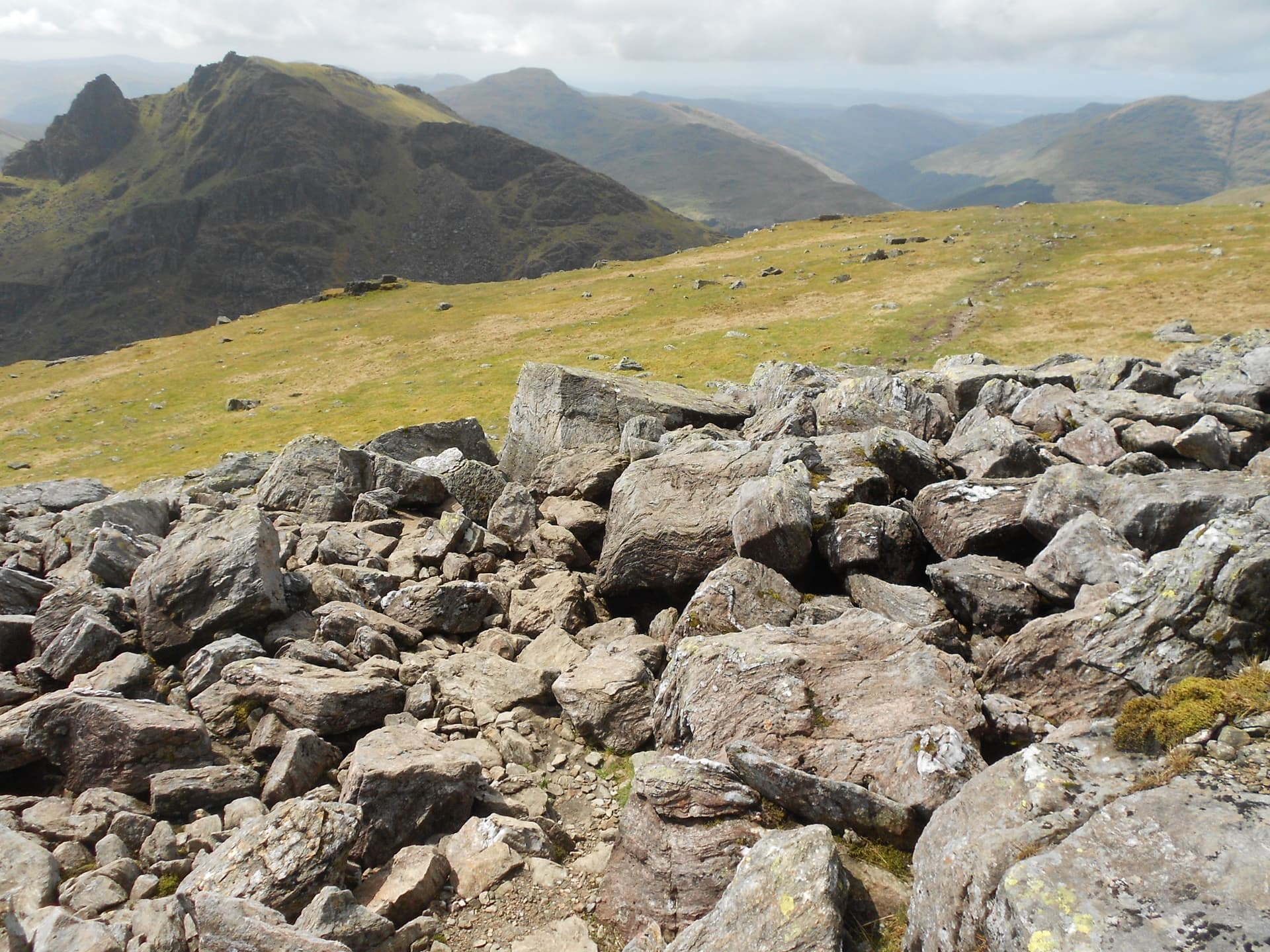
The way is easy to follow and climbs over three intermediate high points starting with Creag an Fhithich, then Cruach nam Miseag finally passing The Sprearhead to its right. Only minor scrambling is required but the route is quite steep throughout. Here are further waypoints: NN 2817 0591; NN 2781 0623; NN 2747 0647 and NN 2733 0662 where the final bid for the summit starts.
Most of the upper section was in low-cloud and I found I was following a man who I eventually caught up. He was from Bristol and had flown north to bag some Munros.
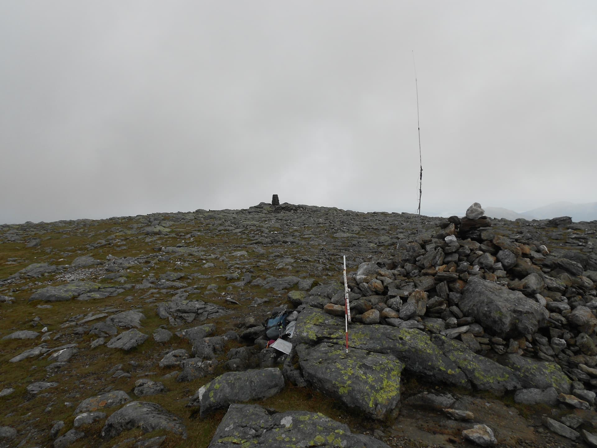
After 126 minutes of climbing the summit trig point revealed itself out of the fog at 11:45. The GPS/ altimeter gave a reading for the trig of NN 27174 06643 at 923 metres ASL. The map height is 3m more and that will be the reliable figure. Two young girls were at the summit when I arrived so we traded photographic duties.
Setting Up:
The J-pole was set up on the summit cairn but the stones were not stable enough to take the 3m mast due to the wind speed. For this reason the Sotabeam remained in its packed-up condition. It was mostly there for ‘emergencies’ anyway. I was able to sit behind a 2ft natural rock wall but I had to borrow a flat rock from the cairn to sit on.
BEINN NARNAIN - GM/SS-016: 926m, 6 pts, 11:45 to 13:14. 6C. 25 mph SSW wind with sudden strong gusts. Low-cloud at first then clear with hazy sun. Intermittent Vodafone coverage. LOC: IO76OF, WAB: NN20, Trig: TP-1224
145.475 FM - 9 QSO’s:
I put on an advanced alert for 2 & 4m FM but then went and forgot about 4. With 25W from the MT270M, filtered by the PYE box (or so I thought) I called CQ on S20 after trying but failing to self-spot. As part of the process I generally give out the working freq. but tarry a moment or two on the off chance that someone hasn’t got that particular channel, a leftover from the days when you had to buy a pair of crystals for each channel. Old habits die hard.
Steve MM0XPZ was listening in Greenock. We exchanged 59’s and ‘long time no see’ greetings and I didn’t have to wait long for a second QSO. In fact four stations called at once. After writing their callsigns in the log and asking if anyone ‘had a train to catch’ I ran them down as follows:
MM7SWM in Glasgow - thanks for the spot Stuart; GM0VEK Peter in NE Glasgow; GM7NZI Ray in West Glasgow; MM7DCD Doug at Clydebank; GM4ZMK Rick also in Clydebank; MM1HMZ Brian in a village called How Wood; GM3STM Scott at Auchinleck and MM7KIP Sean at Inverkip.
When I mentioned we’d crossed it to get here, Brian MM1HMZ told me that he’d operated from the top of an Erskine Bridge tower some twenty or more years ago. He’d been involved in the fitting/ maintenance of navigation lights on the bridge.
This was quite a leisurely session covering almost 20 minutes. Apart from Steve I don’t think I’ve come across any of these callsigns before so we had good conversations during which I was complimented on the strength of my signal, though I did point out that the receiver ‘wasn’t up to much.’ In fact it did behave itself throughout this activation. All outgoing reports were 59 as were incoming ones apart from Peter 57; Doug 58 and Scott 57.
An old acquaintance GM3PIL Ray was called on the Inverness frequency of 145.575 but there was no response. If Ray was monitoring, Nairn was too far away for my 25 Watt signal or there was high ground in the way. I tried a CQ there too without result.
It was looking like I’d logged all possible contacts for the time being so after announcing that I would be monitoring S19 or S20, I broke for lunch comprising a croissant from the hotel breakfast bar. Apart from a 500ml bottle of Ben Shaw’s shandy, this turned out to be the only intake of the entire outing.
One or two people came by while I was there and I had conversations with all of them. Some were going on to bag Beinn Ime and others The Cobbler. I told them that I’d be retreating down to Succoth the way I’d come up because that was the plan. After a final CQ I packed up and looking at my watch I noticed it was still only one o clock.
SS16 to SS20 Route:
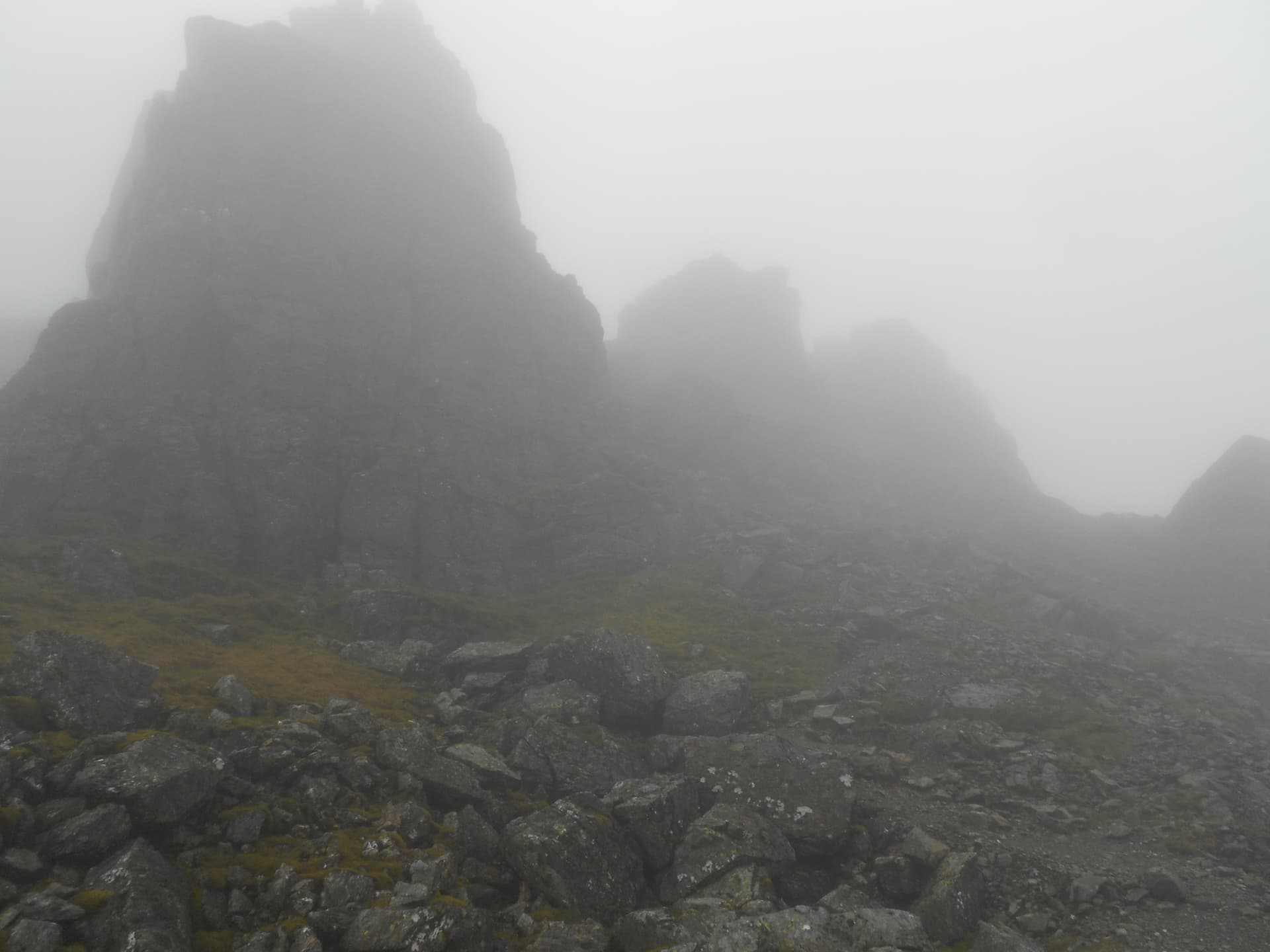
Thinking I would arrive back at the hotel in the middle of my wife’s afternoon nap (she has MS) the idea of activating The Cobbler gradually formed in my mind. The trouble was I had no knowledge of the path, it was foggy and I didn’t have the GPS primed with that particular route. Now the fog lifted and views opened up. I would be able to get to The Cobbler on ‘VFR’ and the GPS, in conjunction with the map I carried, would give my position. I also had an OS map on my phone though that was at 50k scale and didn’t show that particular path.
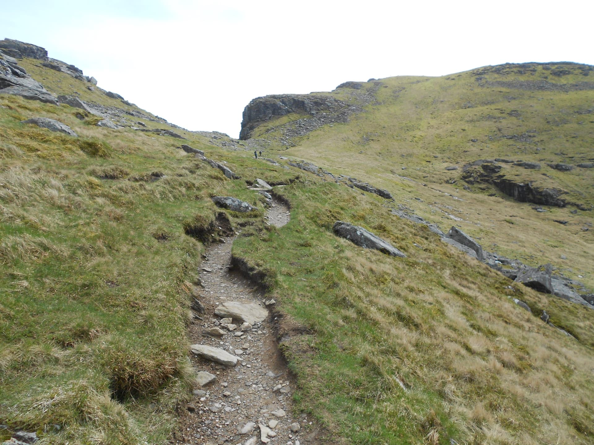
I set off down a poorly defined path and was soon crossing small boulder fields. At some point I found myself in the middle of nowhere. I’d lost the path and was left staring over a significant drop. Right or left? After some thought I went right and was relieved to regain the path within a few minutes. Waypoints as follows: NN 2708 0664 - unreliable; NN 2667 0679 - path regained; NN 2658 0686; NN 2638 0691; NN 2622 0687 - turn left here onto the main Succoth - Beinn Ime path which is perfectly made up and gravelled at this point.
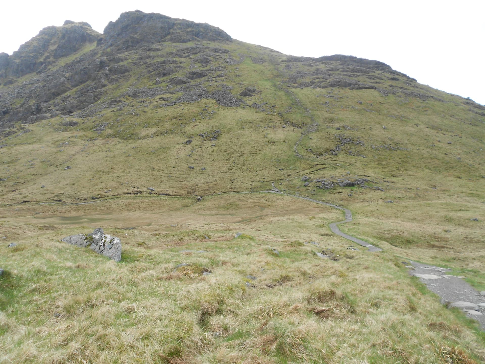
I walked south along it and slightly uphill to the point NN 2612 0659 which is the Cobbler ascent path junction. After a pause to work out times I decided to go up. The easy to follow stepped path goes via NN 2603 0640; NN 2602 0611 and NN 2605 0596 (where incidentally a steep path descends to join the main valley path near Narnain Boulders). Continue up via NN 2597 0590 to the summit which today was deserted, at least at first. The journey took an hour and a quarter, delayed by the navigational glitch, fleece off-on-off and hesitation in making a decision to climb SS20 or go back down.
THE COBBLER (Ben Arthur) - GM/SS-020: 884m, 4 pts, 14:29 to 15:26. 8C. 25 mph southerly wind. Hazy sun. Intermittent Vodafone coverage. LOC: IO76OF, WAB: NN20 - No trig.
145.475 FM - 7 QSO’s:
After walking around for some time wrestling with the contradiction of good takeoff versus high wind, I went for the grass about 3m back from the eastern edge. With no time for niceties the mast was put up with the unused beam and plastic tube still attached to it. As this activation was unplanned there was no alert for it and the self-spot failed again.
The moment the MT270M was switched on a very loud and nasty noise, accompanied by FSD on the S meter, burst out. This despite the in-line PYE filter. Pondering what to do about this; it hadn’t happened on SS16 in the morning, I decided to grin and bear it. There was always the option to use the IC-E90, which has better filters but with only 5 Watts I was concerned about qualifying in the time available.
MM7SWM was the first to reply to my CQ on S20. When the noise wasn’t present reports were 59 both ways and Stuart asked if I would like a spot. ‘Yes please.’ He came back to confirm it and further action soon followed:
GM3STM Scott at Auchinleck; MM0XPZ Steve in Greenock; GM4ZMK Rick in Clydebank; MM7GTS Graham in Ayr; GM7NZI Ray in West Glasgow and GM0VEK Peter in NE Glasgow. The session lasted 17 minutes with a few repeats caused by the receiver noise. Reports were all 59 except two 57’s from Scott and Peter and 57 both ways for the QSO with Rick. Job done thanks to Stuart’s spot and the other six chasers.
Final Descent:
A start was made at 15:26 but walking into a stiff headwind, it had taken an hour and forty three minutes to reach Succoth when I arrived at 17:09. There was the temptation to come off The Cobbler using a steep short-cut path, which goes east from just below the summit but a young couple who’d come up that way advised against it. I’d had enough of ‘steep’ in the morning so opting for the long way round I retraced my steps to the bealach and turned right. The Narnain Boulders were quite impressive but apart from those and passing a reservoir, it’s a fairly mundane roughly 6km walk back to Succoth with perhaps the worst bit at the end where incessant zig-zags take the path through the forest. A means to an end however.
ASCENT & DISTANCE (Start point at 4m ASL):
Ascent 1,288m (4,226ft) / Distance 11.7 km (7.3 miles)
The above data from mudandroutes.com but they use the short cut off Cobbler.
My GPS tracks add up to 8.3 miles
CHRONOLOGY:
Left Tarbet Hotel: 09:15
Parked: 09:22 (Pay & Display at Succoth £1 per hr = £8)
Walk from Succoth: 09:39
GM/SS-016: 11:45 to 13:14
Bealach a’ Mhaim: 13:52
GM/SS-020: 14:29 to 15:26
Bealach a’ Mhaim: 15:50
Returned to Succoth: 17:09
Drive back to Tarbet: 17:30
Walking times:
SS16 Ascent: 2hrs-6 min
SS16 to SS20: 1hr-15 min
Descent from SS20: 1hr-43 min
Total: 5hrs-4min
Summit times:
SS16: 1hr-29 min
SS20: 57 min
Time Car to Car: 7hrs-30 min
QSO’s on 2m-FM:
SS16: 9
SS20: 7
TOTAL: 16
Battery Utilisation: < 2.2 Ah
COMMENTS:
My intention was just to knock off Beinn Narnain (new to me) with no thought of going further until with time on my hands I ended up adding The Cobbler. I first activated the latter in 2020 coming up from the west. I was quite surprised when afterwards I discovered the ascent and distance for this round. It didn’t feel like almost the equivalent of doing Ben Nevis. I think it helped that it was a cool day with a strong wind blowing.
VHFM did a more than satisfactory job. One can never be sure to qualify GM summits with VHF but these two overlook large population centres. Not taking HF QRO helped to limit the pack weight as it’s always the final few pounds that go into the rucksack that make the difference. My observation is if my rucksack weighs less than 15 pounds I barely realize I’m wearing one whereas over 22 pounds feels heavy.
It was disappointing not to get Ray GM3PIL (Nairn) in the log. When in GM/NS I used to work him often and he helped a great deal with Top Band SOTA.
THANKS:
To ALL STATIONS worked and to Stuart MM7SWM for spots for both summits.
73, John G4YSS
Using GM4YSS/P
Photos: 2-5-8-13-15-31-36-43-44-47-49-52-56-66-70-74-81-84-95-97-100-102-107-109-113-115
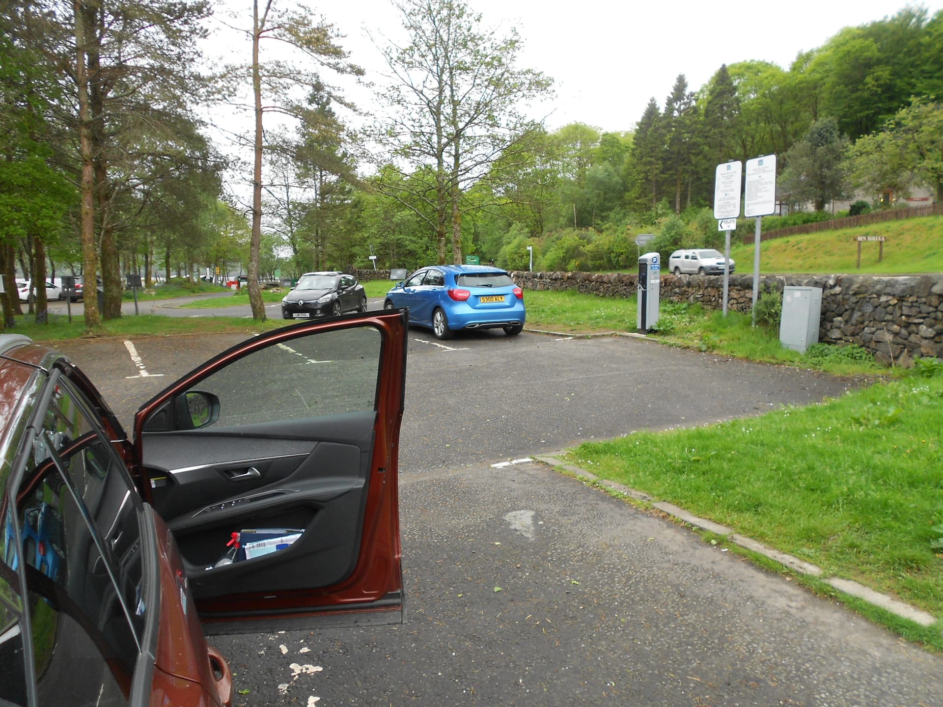
Above: Pay & Display car park at Succoth. £1/hr. Select number of hours and pay via contactless card or coin
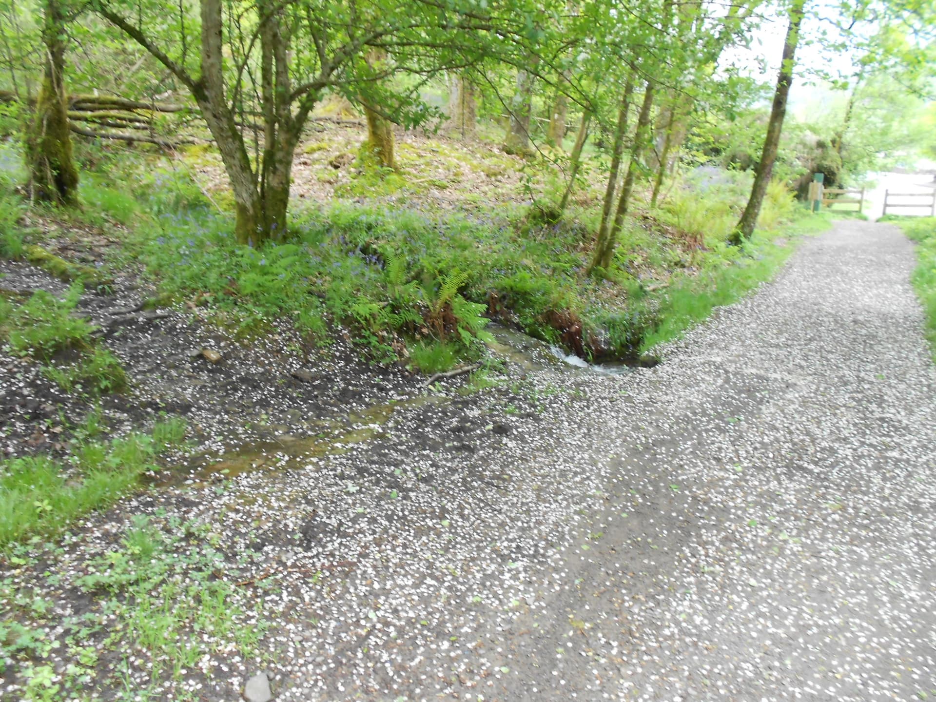
Above: Looking back to the gate at the start. After 60m turn right
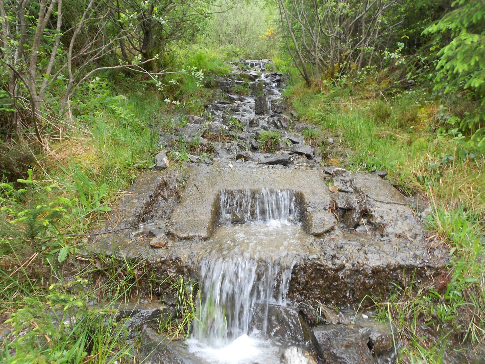
Above: Path or stream? Concrete block left over from an ancient cable railway
Above: Looking back. Trees left behind
Above: Coming up to Cruach nam Miseag
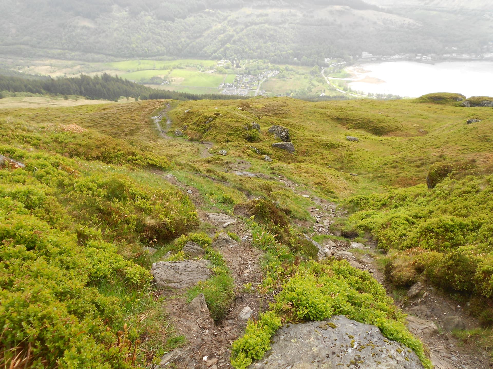
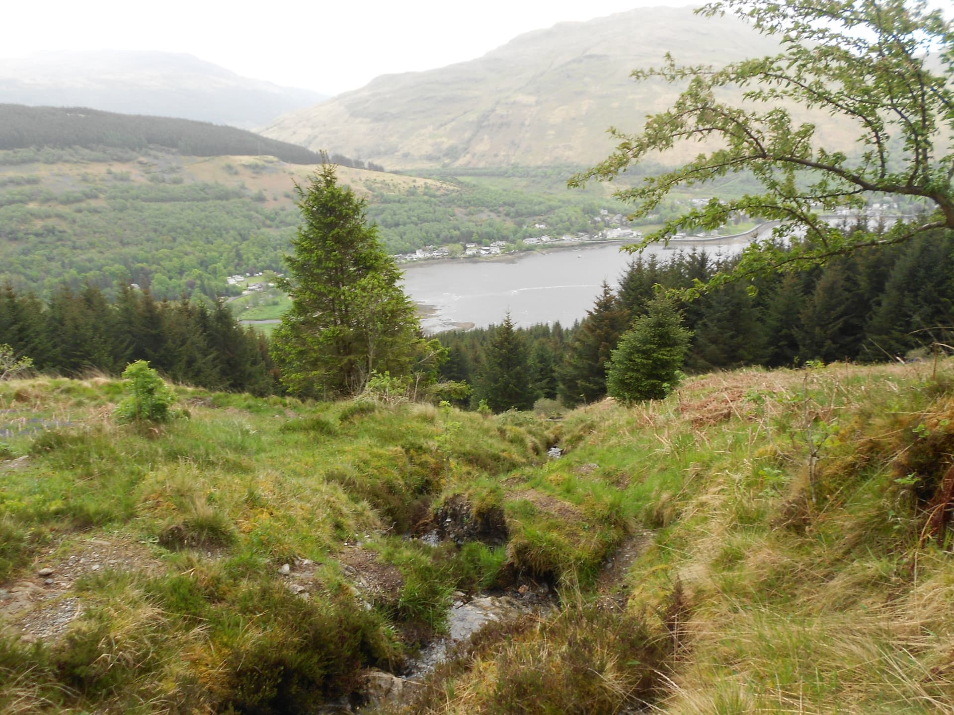
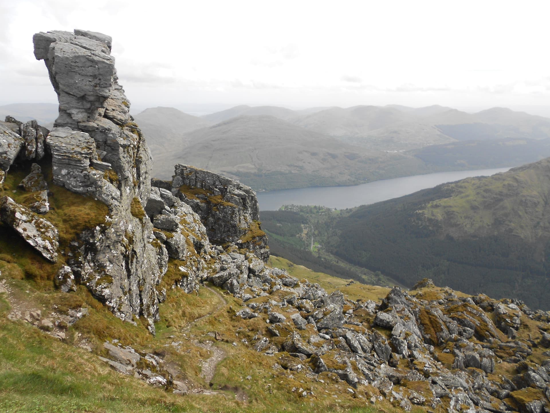
Above: Succoth view
Above: Path goes up at centre of photo. A walker ahead

Above: Skirting around to tackle The Spearhead
Above: The Spearhead. Go around to the right
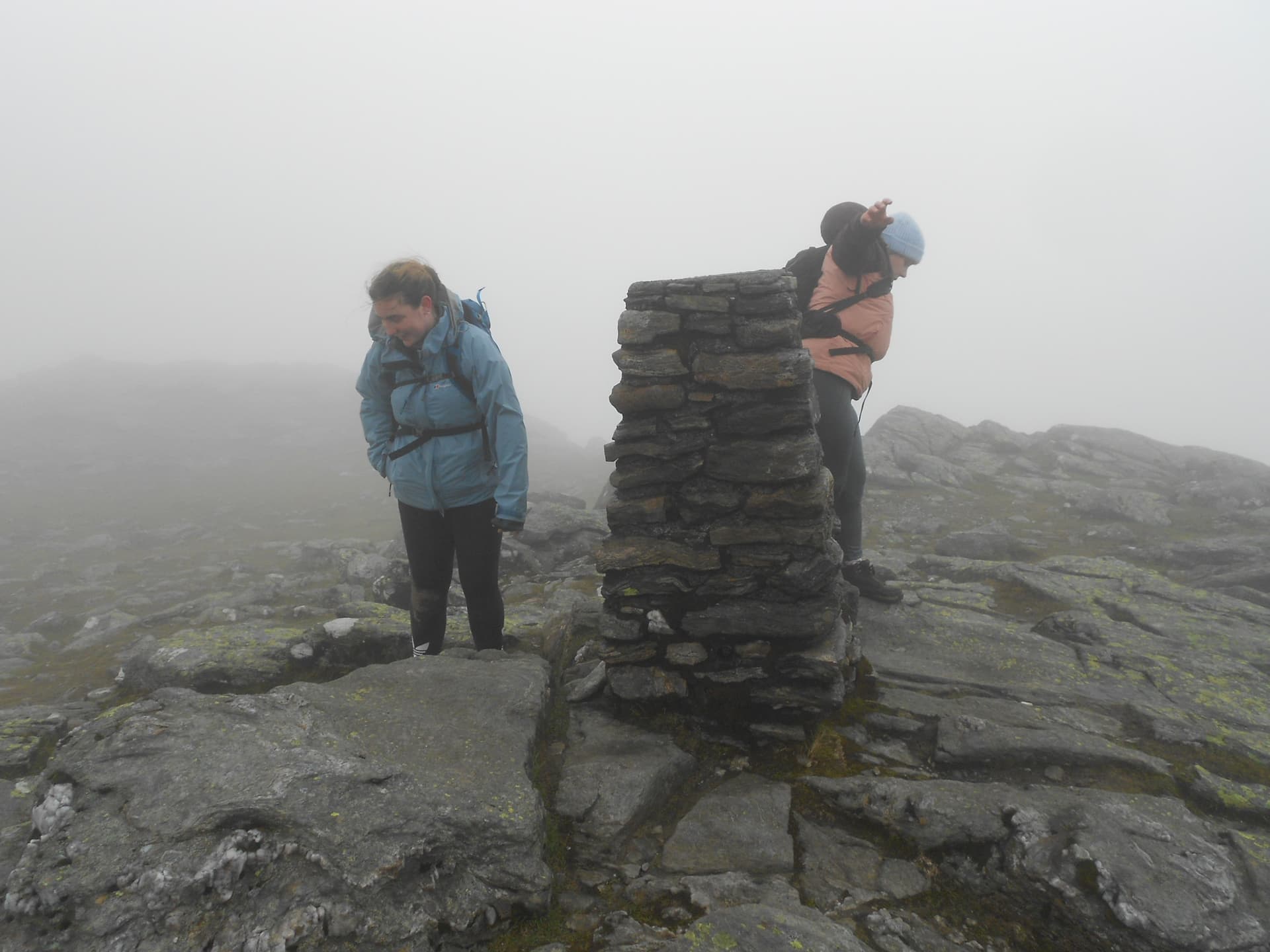
Above: GM/SS-016 Beinn Narnain and the two young ladies who arrived at the same time
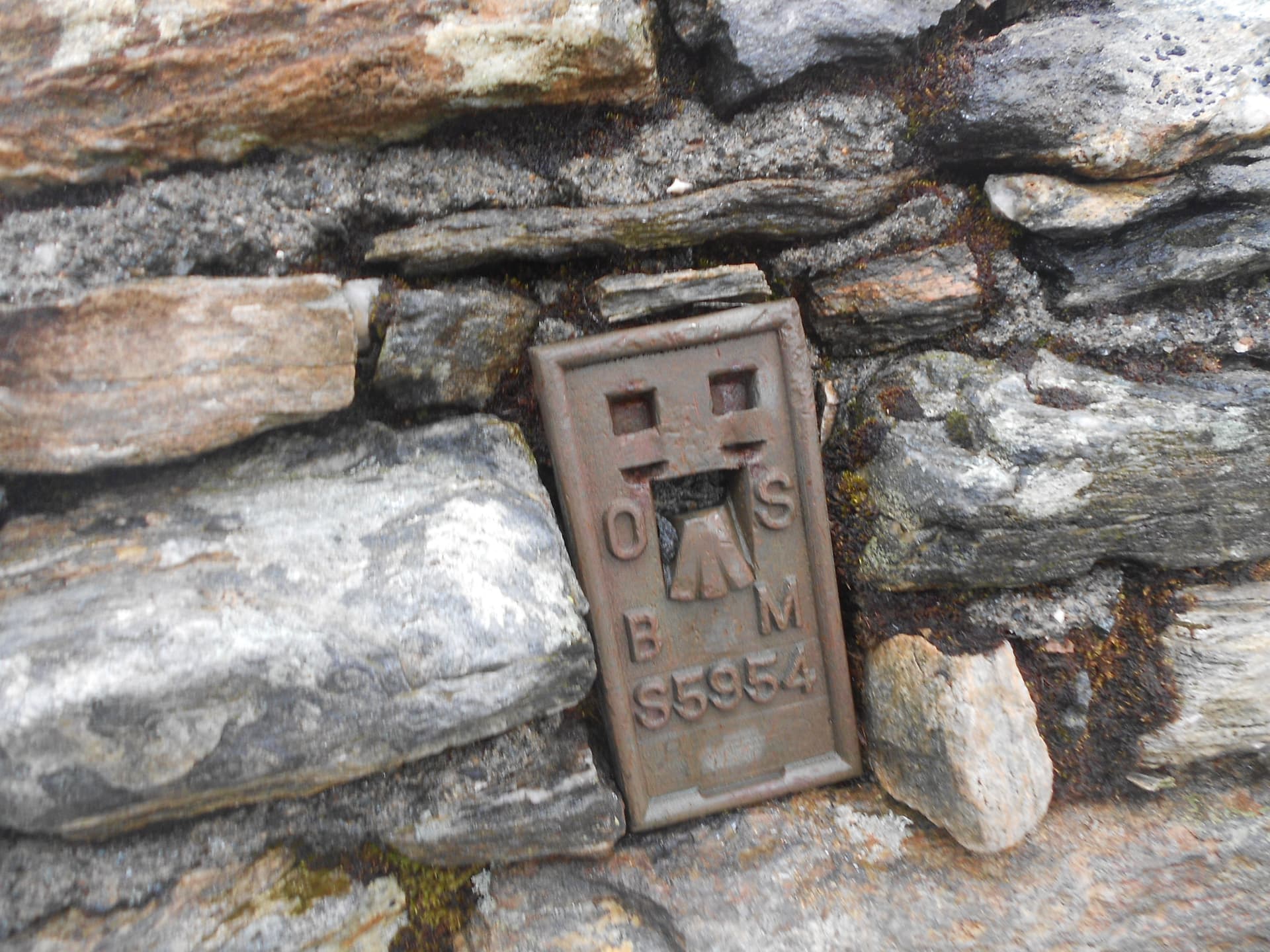
Above: SS16 Trig point. Worked-All-Britain call it TP1224
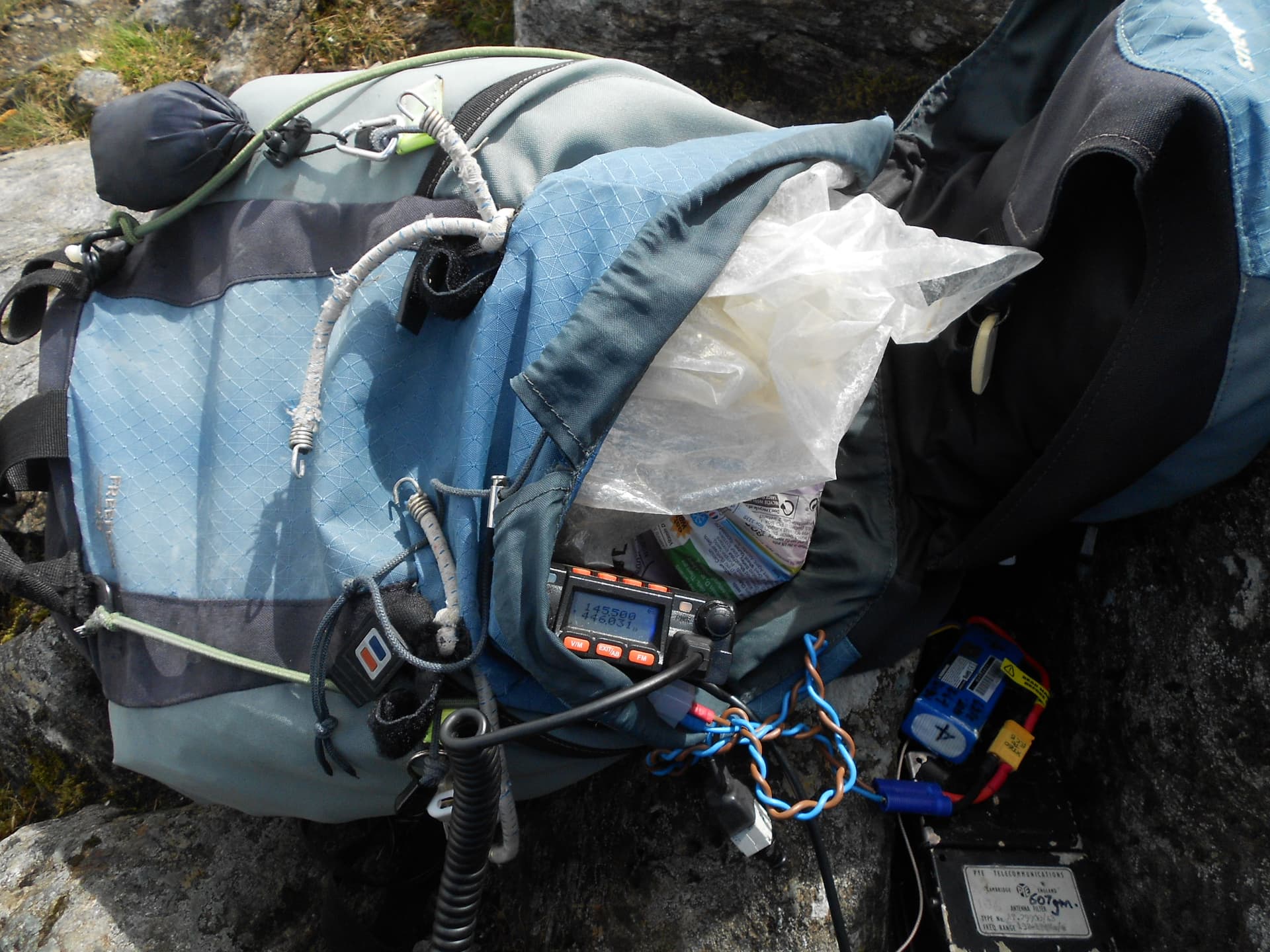
Above: Activation of GM/SS-016 on 2m-FM
Above: Leaving SS16 B.Narnain for SS20 The Cobbler seen left of photo

Above: Heading down to Bealach a’ Mhaim - the low point between the two summits. (The path for SS6 Beinn Ime can be seen exiting the top of the photo. SS20 is to the left)
Above: The Succoth - Beinn Ime path leading to the path up SS20 Cobbler
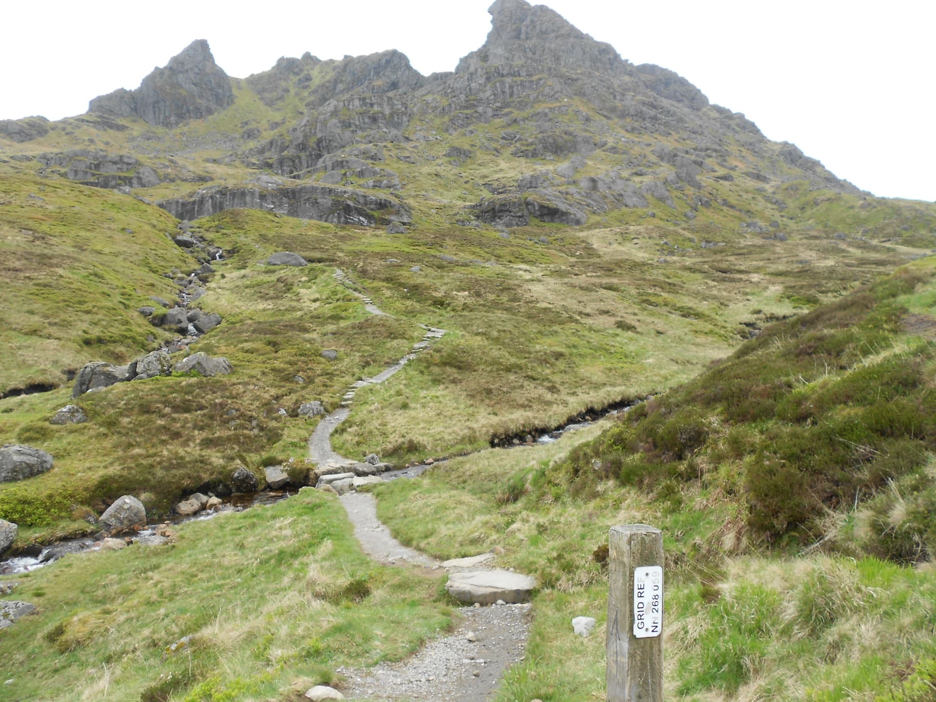
Above: The Path up SS20 Cobbler
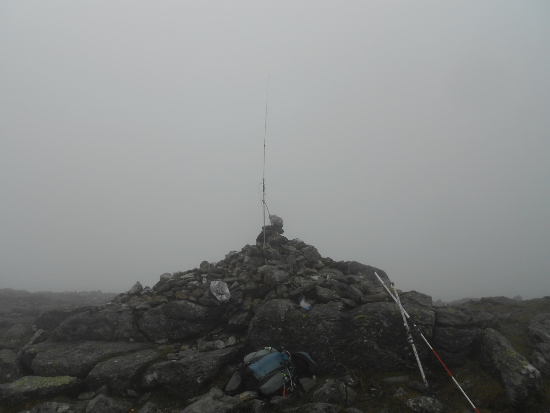
Above: GM/SS-020 The Cobbler summit. No I didn’t thread the needle!

Above: Activation of GM/SS-020 The Cobbler on 2m-FM
Above: Activation of GM/SS-020 The Cobbler on 2m-FM

Above: Looking east from SS20. Lochs Long and Lomond
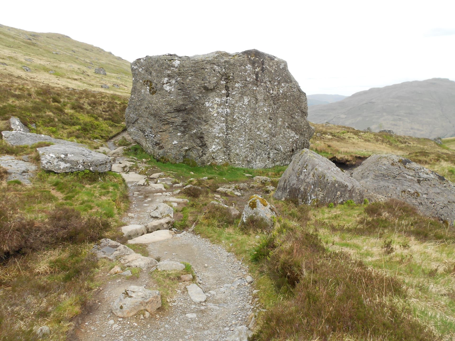
Above: Looking back at The Cobbler from the point where the direct descent meets the main Succoth path. Grid Ref on post - NN268059
Above: One of the Narnain Boulders
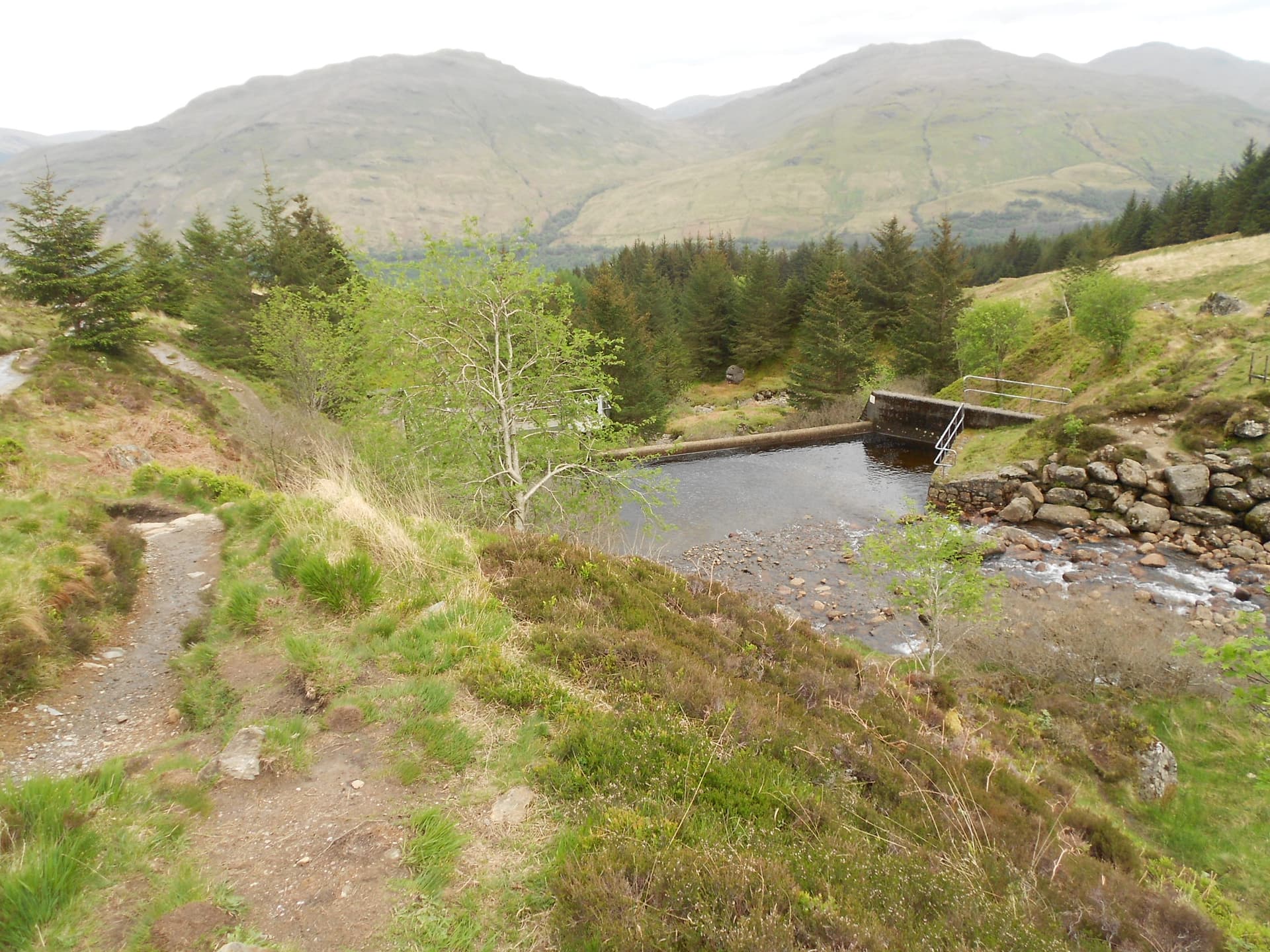
Above: A reservoir

Above: One of the zig-zags through the forest

