A brilliant SOTA expedition, climbing the classics, in the heart of the Snowdonia National Park. Five days of walking, 8 summits, 112 contacts, 9 summit to summits, 70 activator points and a spectacular inversion on the last day!
I’ll start with the last day because it was the best SOTA activation I’ve done and it was a perfect end to the expedition.
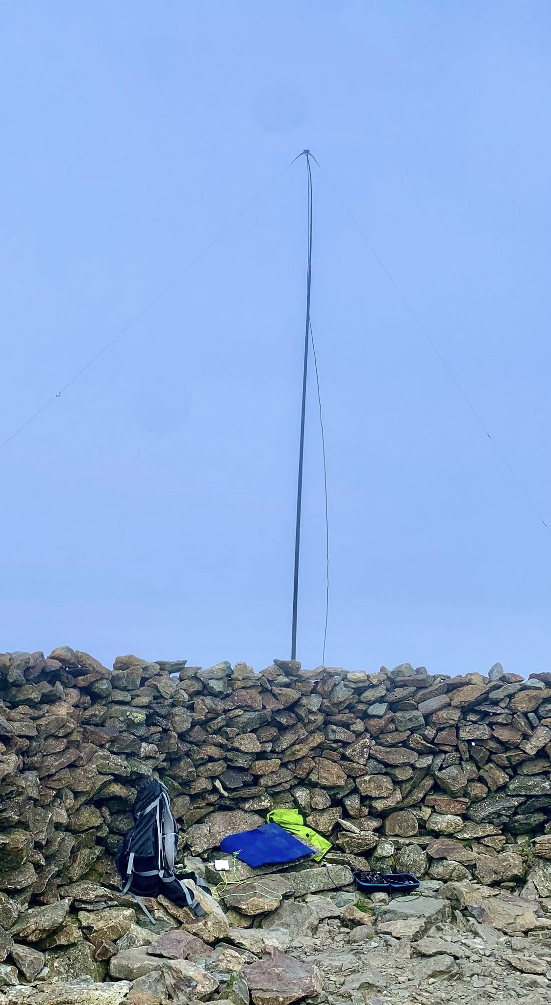
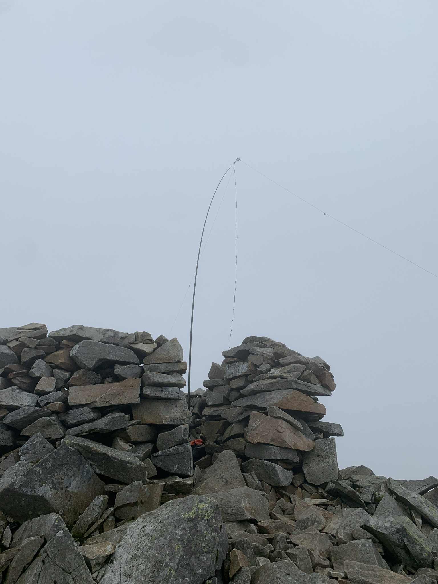
13 Aug 2025 - Day 5 - GW/NW-010 Moel Siabod - The day started misty. I parked the car in the free car park, behind the Joe Brown shop in Capel Curig, walked along road towards the lakes, then crossed the footbridge and headed up through the woods and onto the fell. The path heads South/South West up to the summit and is much more distinctive than the map suggests. There were a few short gaps in the cloud but the summit was shrouded in mist. At the summit is a substantial circular shelter which was perfect for the activation. I did not spend any time looking for the trig, as I could only see 30m in any direction because of the mist. I quickly set up my linked dipole for 20m, on my 5.5m mast, fired up the FX-4CR, spotted on SOTA Goat and quickly logged 14 contacts in 15 minutes. Result!
It was still misty but I was well ahead on time, so decided to have a go at 15m. I spotted on 15m and had three more contacts in the following 10 minutes, before it went quiet. It was still misty and decided to have a go at 10m too. Following another spot I logged three more contacts on 10m.
At this stage I packed up the HF kit and setup the FT-65 and Diamond RH770, ready to activate on 2m. I had a snack and drink and had a chat with a backpacker, who appeared out of the clearing mist.
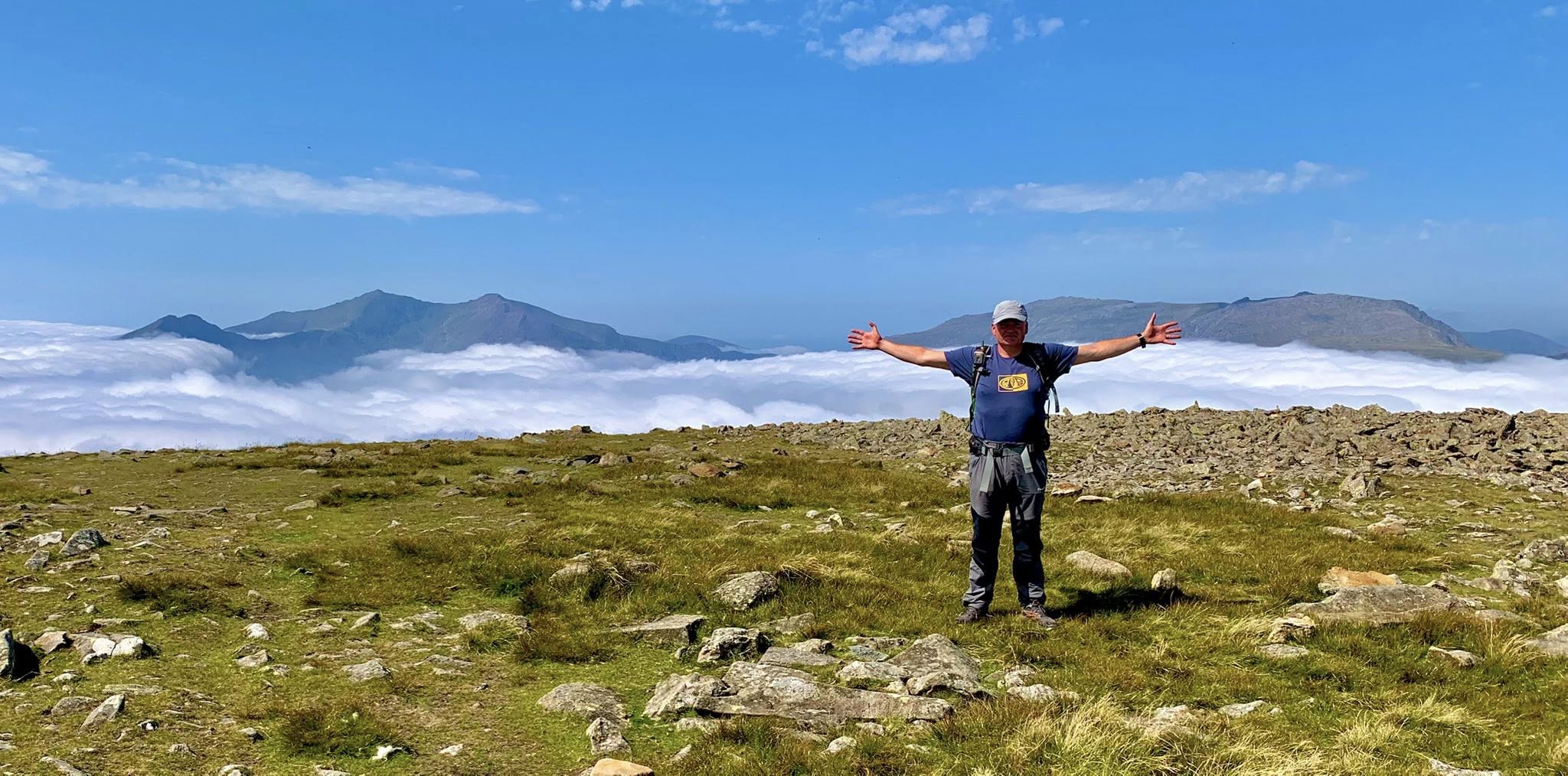
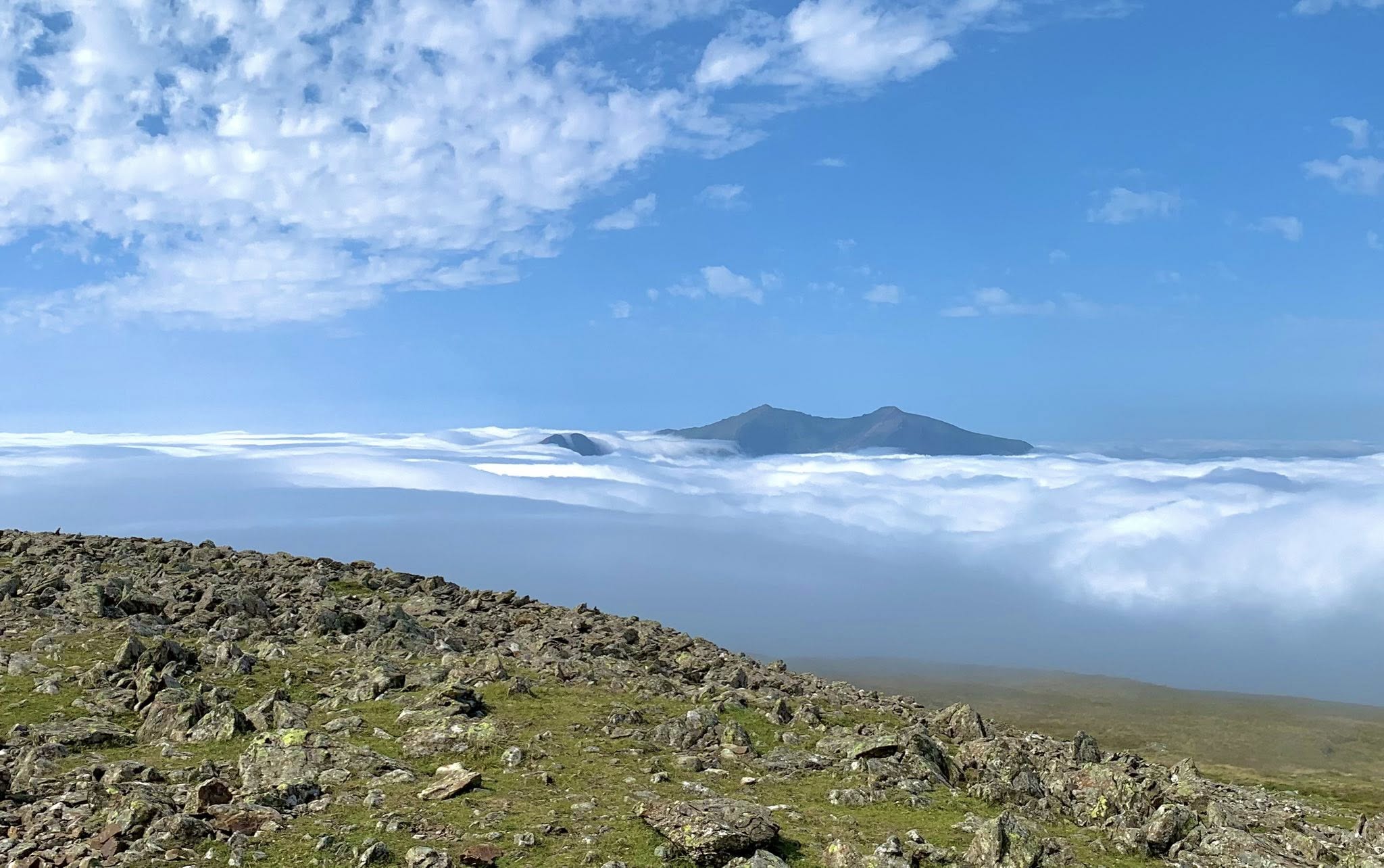
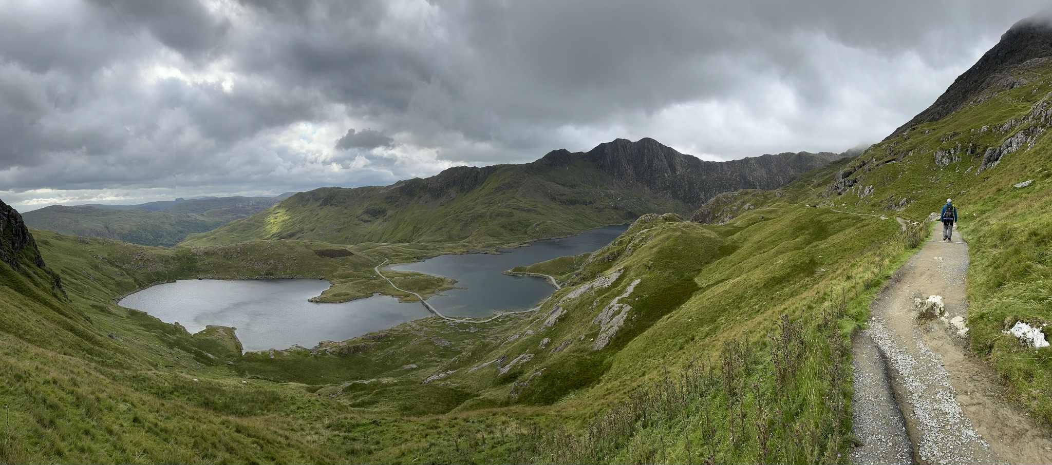
The next 30 minutes were amazing! The mist on the summit lifted completely to reveal a beautiful blue sky and thick fluffy clouds in the valleys all around. It was the most well defined inversion that I have ever seen for myself. Even more incredible was that only the peaks of the summits that I had activated on previous days were poking up through the clouds. For 15 minutes I forgot about radio and took as many photos as I could to capture this extraordinary moment.
After 15 minutes, and still excited, I went back to starting my activation on 2m. I logged 11 contacts in 25 minutes and was conscious that I was rambling and giddy but didn’t care, as the day which started so bleak and unpromising had turned into an epic and everything worked. In total I spent an hour and 40 minutes on the summit and then went down the way I came up, just a lot happier.
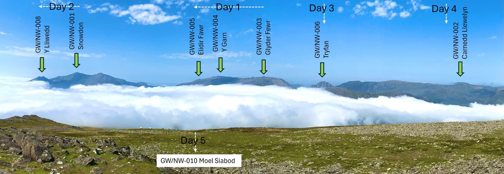
So lets go back to the start, now that we have the photo of the inversion, which shows the rest of the expedition so well.
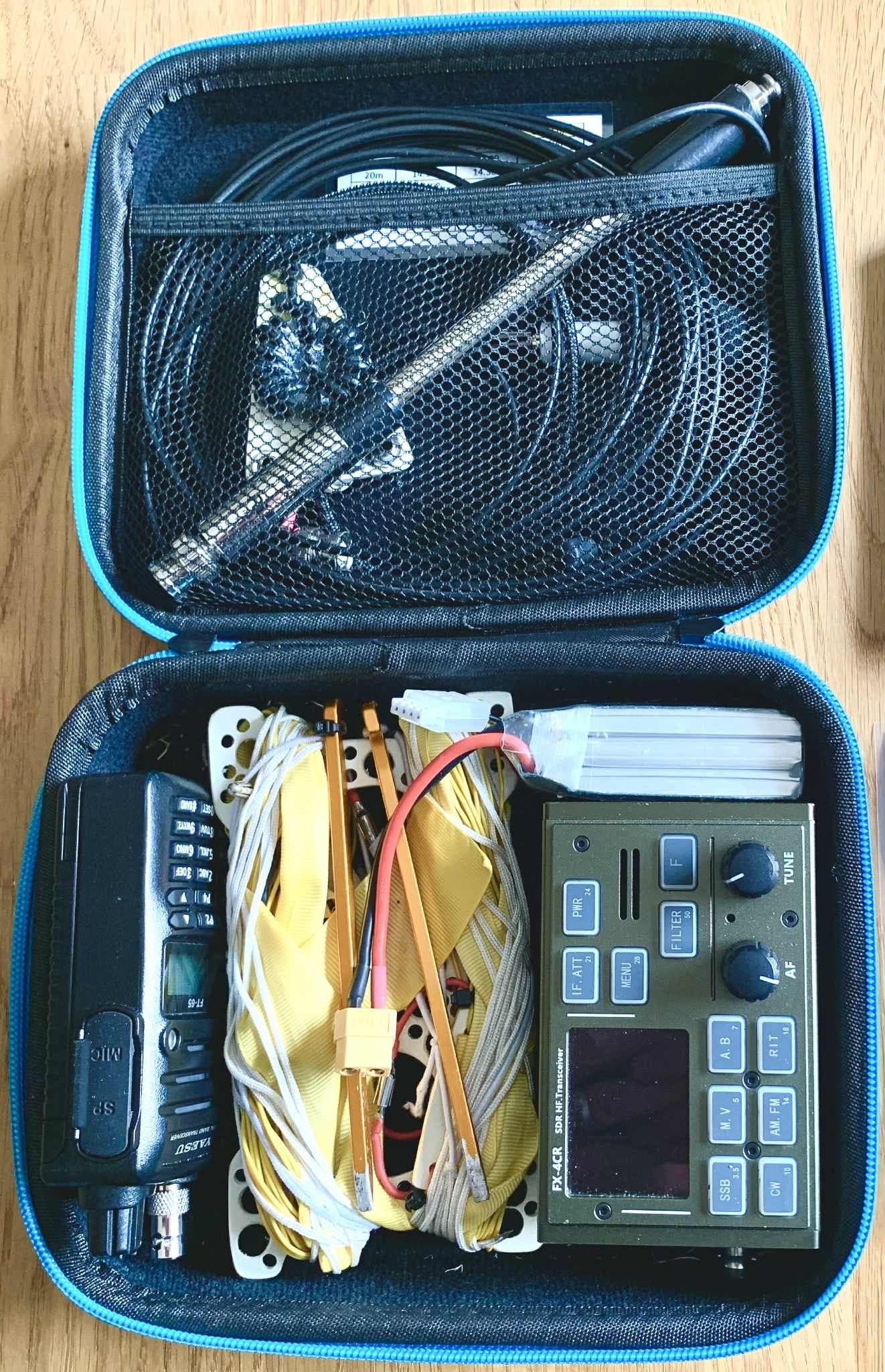
30th July 2025 - Day 1 - GW/MW-003 Glyder Fawr, GW/MW-004 Y Garn and GW/MW-005 Elidir Fawr. On day 1 and 2 I operated with my Nephew M7LWO Leo. He would be operating HF on his Xiegu G90 plus W3EDP or 20/10m linked dipole depending on space available, while I would be using my Yaesu FTM 3100 with 2m flowerpot + 7m feeder on 5.5m mast. The idea being that we could activate at the same time and act as backup for each other if there were any equipment issues or unfavorable band conditions.
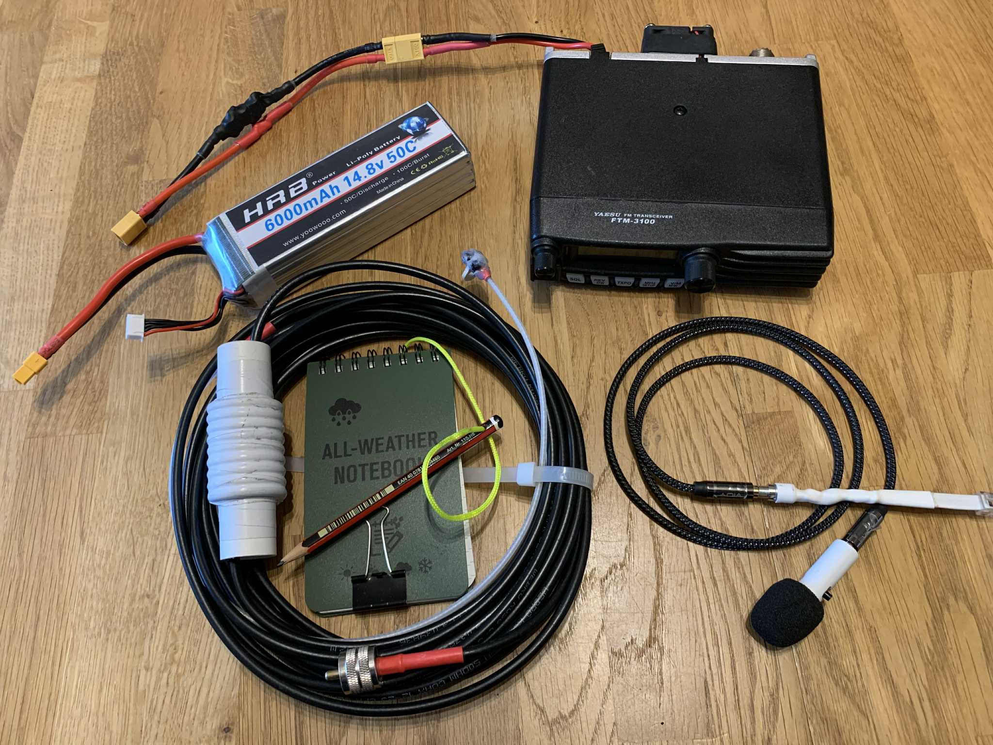
The FTM3100 setup is heavy, at 2.5kg for radio, battery, mic and flowerpot antenna but it is great when the conditions are poor, you are remote, not particularly high or you really want to make sure you are getting out! With 5/30/65W available you can put out more power than most chasers are using for FM. The receiver in this radio is excellent. It only does 2m FM but it does it very well.
We parked in the “park and ride” car park at Nant Peris and took the bus up to Pen-Y-Pass. The visitor center was shrouded in mist and there was light rain but only a light breeze, as we put on our waterproofs and prepared to set off up the “Cambrian Way” route, up to Glyder Fawr. It felt odd to be going in the opposite direction to all the people starting on the Pyg Track and Miners Path. The Cambrian Way heads off behind the Youth Hostel.
Visibility was poor all the way to the summit. With the grand title of Cambrian Way, I was expecting a well defined path but on the ground there was little more than muddy sheep trails, with occasional boot prints weaving up the fell. The fell is quite steep and consists of a series of rocky outcrops and buttresses, which are easy to get around and go over without any scrambling but it was still a tough haul in the mist, with visibility poor and down to 10m at the summit. It had stopped raining but the mist was thick, wet and cool.
I’m sure the top is stunning when you can see it! With it’s rocky boulder fields, towers and pinnacles it must have a lot of character. Leo and I set up our respective kit and agreed we would get about 10 contacts and then move onto Y Garn GW/NW-004.
I logged my 2m contacts and packed up and headed over to Leo, who was finding it hard to breakaway from the European pileup he had going on. Being a 10 point SOTA YOTA operator on 20m gets you a lot of attention! We packed up and headed off, a bit cool and damp.
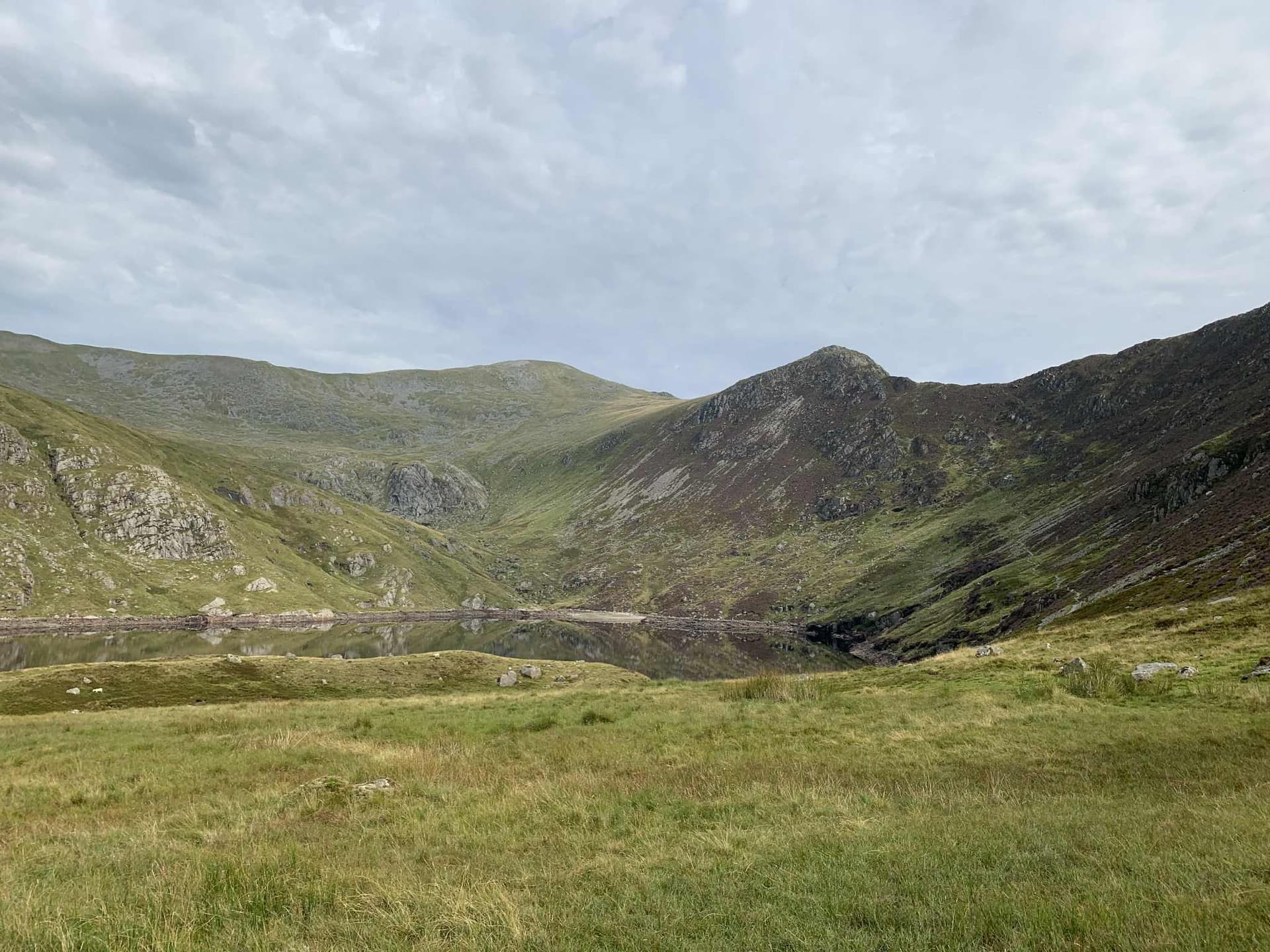
The walk over to Y Garn involved climbing down to a small tarn, via a more defined path, which was steep in places and involved a lot of loose scree. Good map reading in the cloud was needed to avoid the top of the Devil’s Kitchen path near-by. Once at the tarn the path becomes much more defined, easy to follow and kind underfoot. The cloud was also beginning to lift and there were occasional glimpses of the landscape around.
The Summit of Y Garn is much more of a gentle feature (as long as you stay away from the cliff!) and has a good shelter for activating from. Leo setup his HF kit from the shelter and I found a spot a few meters away for 2m.
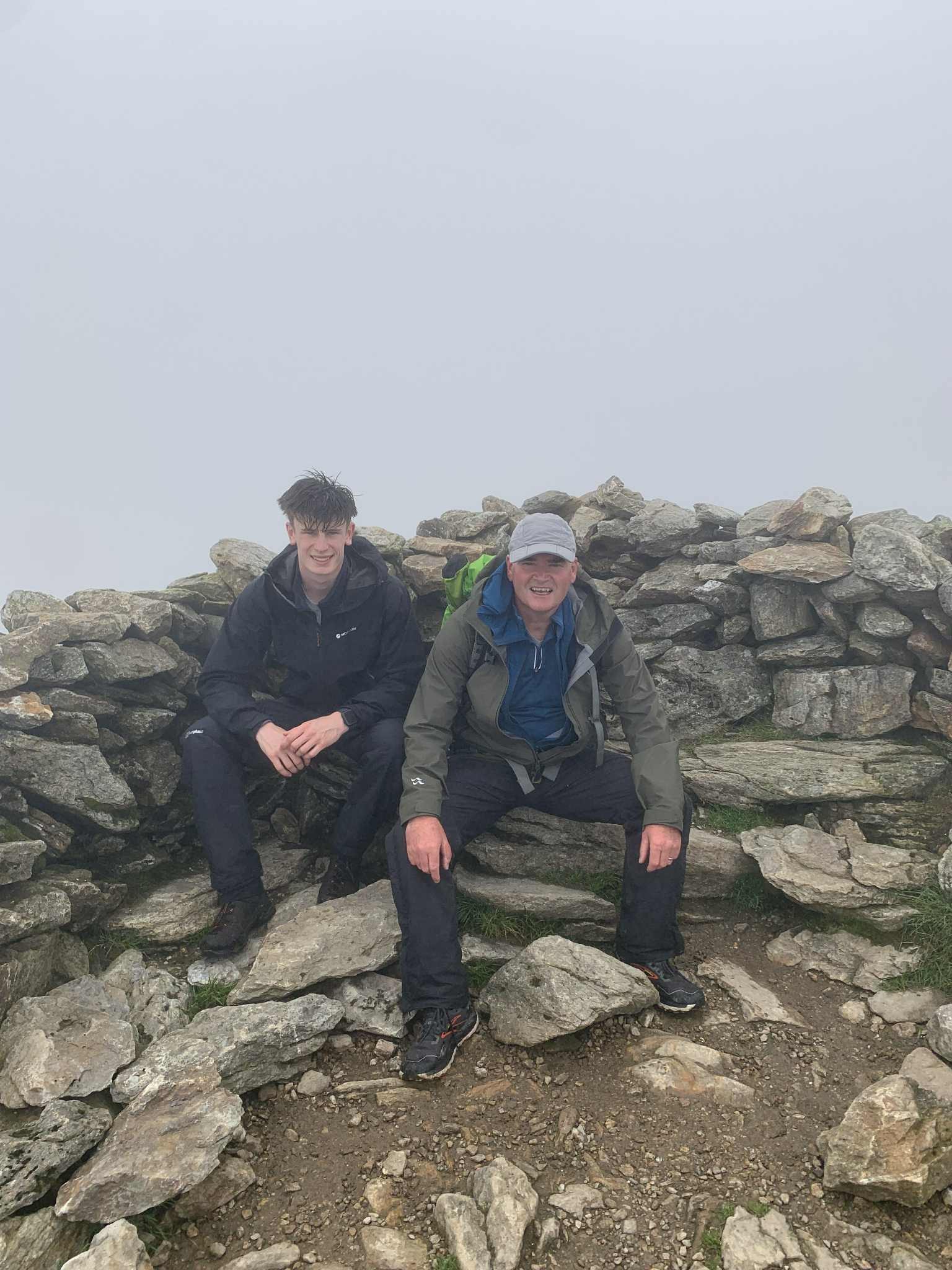
There was not much apatite for photos due to the lack of visibility but we did manage to ask a friendly walker to take this one before we did our activation. Our respective activations went well and we had accumulated 18 points each for the day, so far.
It was decision time! We had agreed that we would do Glyder Fawr and Y Garn before deciding if we would do Elidir Fawr. Our escape plan was to go back to the Tarn and go down the path down to the road. The problem with continuing to Elidir Fawr was that it was another 8 km on the day and the route down from it to Nant Peris looked like a very steep decent on wet grass. The people we talked to who had come up it said “the path marked on the OS map does not exist. the way we came up, we would not want to go down that way, we did see some people going on a path which looks good but is not marked on OS but is shown on my GARMIN”. The path they described was shown on my OS app but not on Leo’s!
We made and drank hot chocolate and ate garibaldi biscuits and chocolate coated raisins, in silence while we made our minds up. Re-energized we decided to do Elidir Fawr, using the logic that the weather was improving, we had loads more hot chocolate, biscuits and chocolate coated raisins to get us there and quoting a version of the line from Topgun “We’re here. Its there. It does not get to look any better than this”, we set off.
The walk from Y Garn to Elidir Fawr involves about a 250m drop in height and a 200m climb up to the summit, while contouring around below a ridge, over 4km in distance. This followed a clearly defined path, which was marked on the map. The ridgeline up to the summit looks quite intimidating but the light scramble is enjoyable and the views had opened up as the weather improved and were stunning.
Space at the summit was limited so we decided to set up one mast and do the 2m activation then to use it for the 20m dipole and HF. We successfully activated and packed up our kit, with 26 points each, in the bag for the day. ![]()
The 4km decent from the summit to Nant Peris park and ride car park was a long, steep slog down a rocky, then grassy slope. We did see some people descending some way ahead on the path that was on my map but not Leo’s, so it was encouraging that it did exist and we could see it. Part way down we did need more hot chocolate, biscuits and raisins but we eventually arrived back at the the car, happy and shattered. We had walked 17km in 9 hours of walking, ascended over 1000m and had successfully activated 3 big summits in one day.
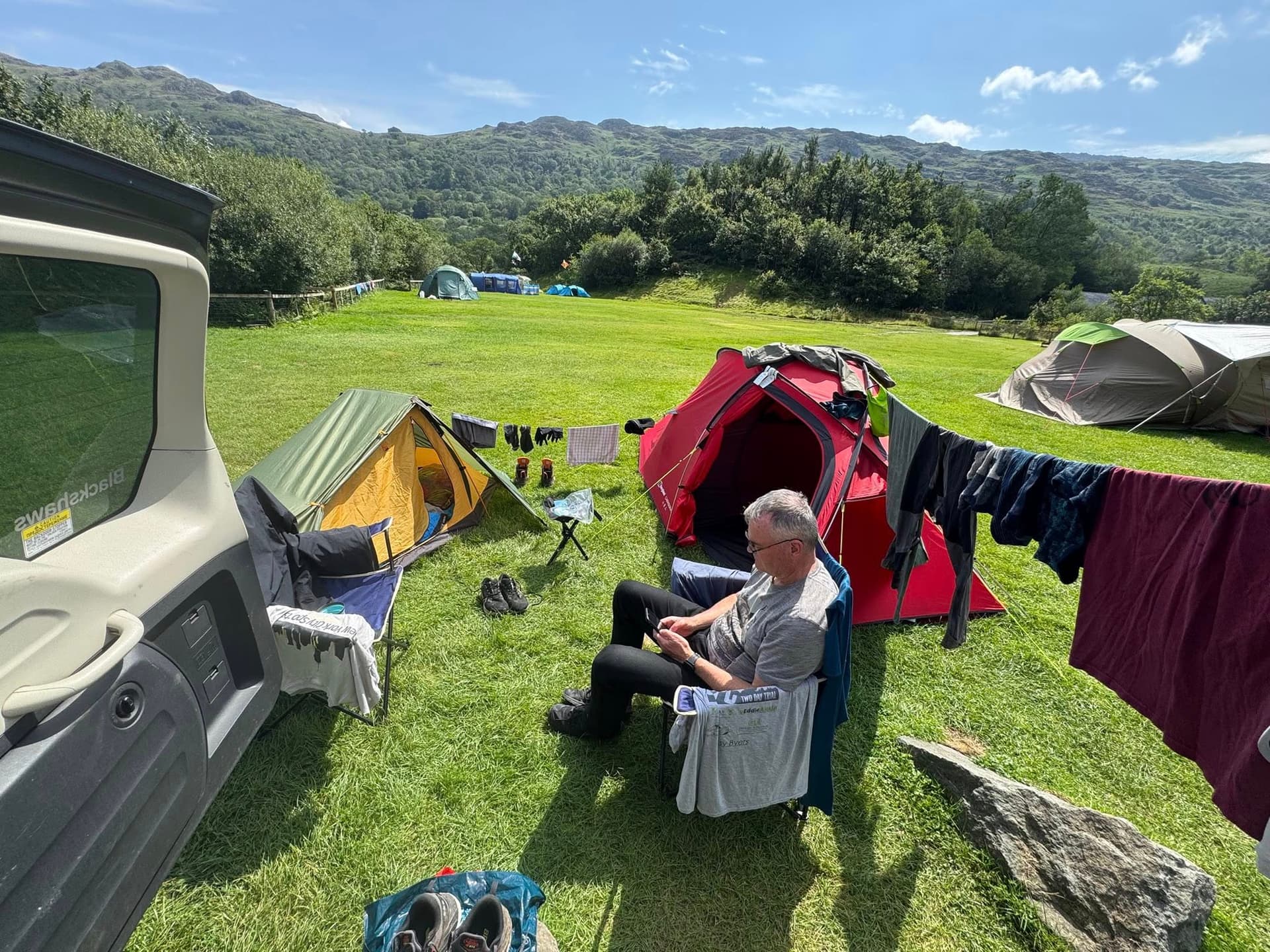
1st August 2025 - Day 2 - GW/NW-001 Snowdon and GW/NW-008 Y Lliwedd. After a day of rest and trying to get our kit dried out, at the near-by campsite, we planned to do a loop of Snowdon and Y Lliwedd, by following the Pyg track to the summit of Snowdon, then if the weather permitted, returning via the start of the Watkins path, over the twin peaks of Y Lliwedd and down to the Miners Path to Pen-Y-Pass.
We started the day at the “park & ride” at Nant Peris again and took the bus up to Pen-Y-Pass. It was a little misty but there was no rain and the wind was much better than the 18mph forecast. The walk up the Pyg track was pleasant and straight forward, with little or no map reading required to stay on the obvious path. It does require a sustained effort to climb the 700m ascent over 6km of distance but there is no outright scrambling to do. The clouds appeared to lift as we walked towards them and Snowdon itself was shielding us from the wind, all the way up to the railway track on the ridge near the summit.
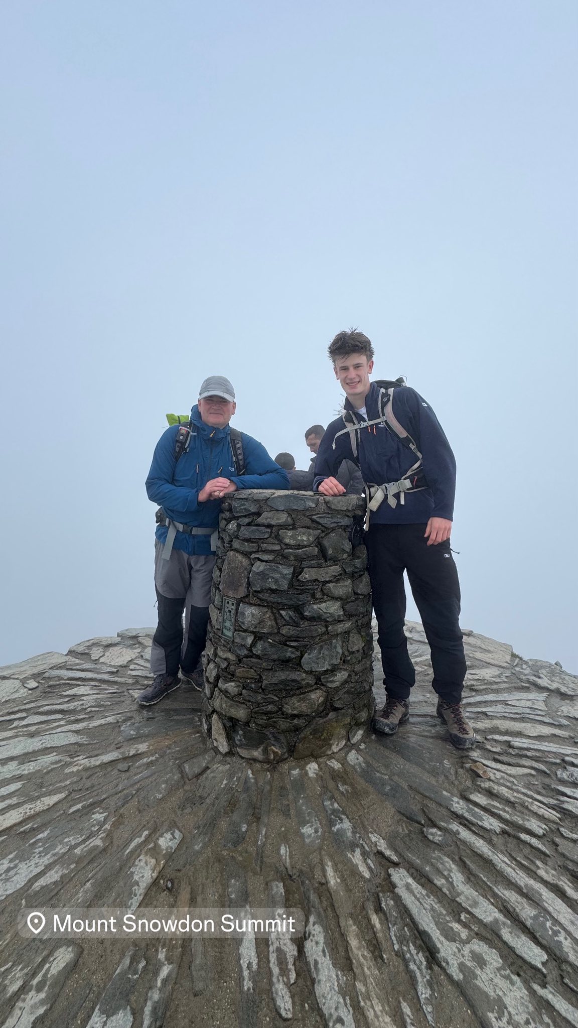
As we reached the railway line on the ridge it became clear that the mountain had been sheltering us from the wind all the way up. The cloud had not quite cleared from the top as we went up the summit tower and joined the queue at the one way system, for the obligatory photograph at the trig.
It was a little misty at the summit but the rain had held off. Leo and I did the, me on 2m, him on 20m concurrent activation of 10 ITL thing, in the lee of the trig tower, away from the wind. I spotted on SOTA Goat and had 14 contacts in 12 minutes. I’m sure I could have been there until my battery went flat but wanted to save myself and the battery for Y Lliwedd. Leo had another massive pileup going on across Europe and into America on 20m, which he was managing like a pro. The power of a skillful YOTA operator on a 10 point SOTA summit with 20W and a resonant antenna was impressive!
By the time we had finished our activations and packed up, the cloud had lifted and we could clearly see the path to Y Lliwedd. Down Watkins Path, along the ridge and then up onto Y LlIwedd. It looked intimidating but the weather was right for it and it was sheltered from the worst of the wind by Snowdon.
We made and drank hot chocolate and ate Garibaldi biscuits and chocolate raisins, before setting off. It took a little bit of time to find the start of the Watkins path, just to make sure. The 250m of decent is steep and does require a little bit of “hands on” but the new steps on the top section is a big improvement on the gravelly zig-zag path it used to be. Once on the ridge we had the scramble up onto Y Lliwedd to do.
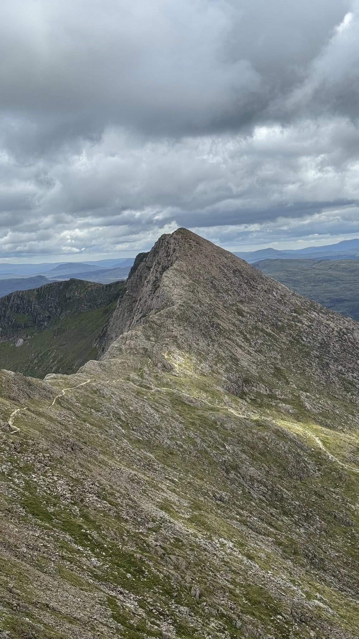
This is a scramble and definitely hands on in places. There is no one obvious path but involves working out a way of making progress by a series of steps over large jagged boulders. There are always plenty of jug handle size hand holds and places for good foot placement. I watched a really good Youtube video about this scramble, in which the advice was to “follow the line of cairns, the best you can”. This was really good advice and made the scramble straight forward, safe and fun.
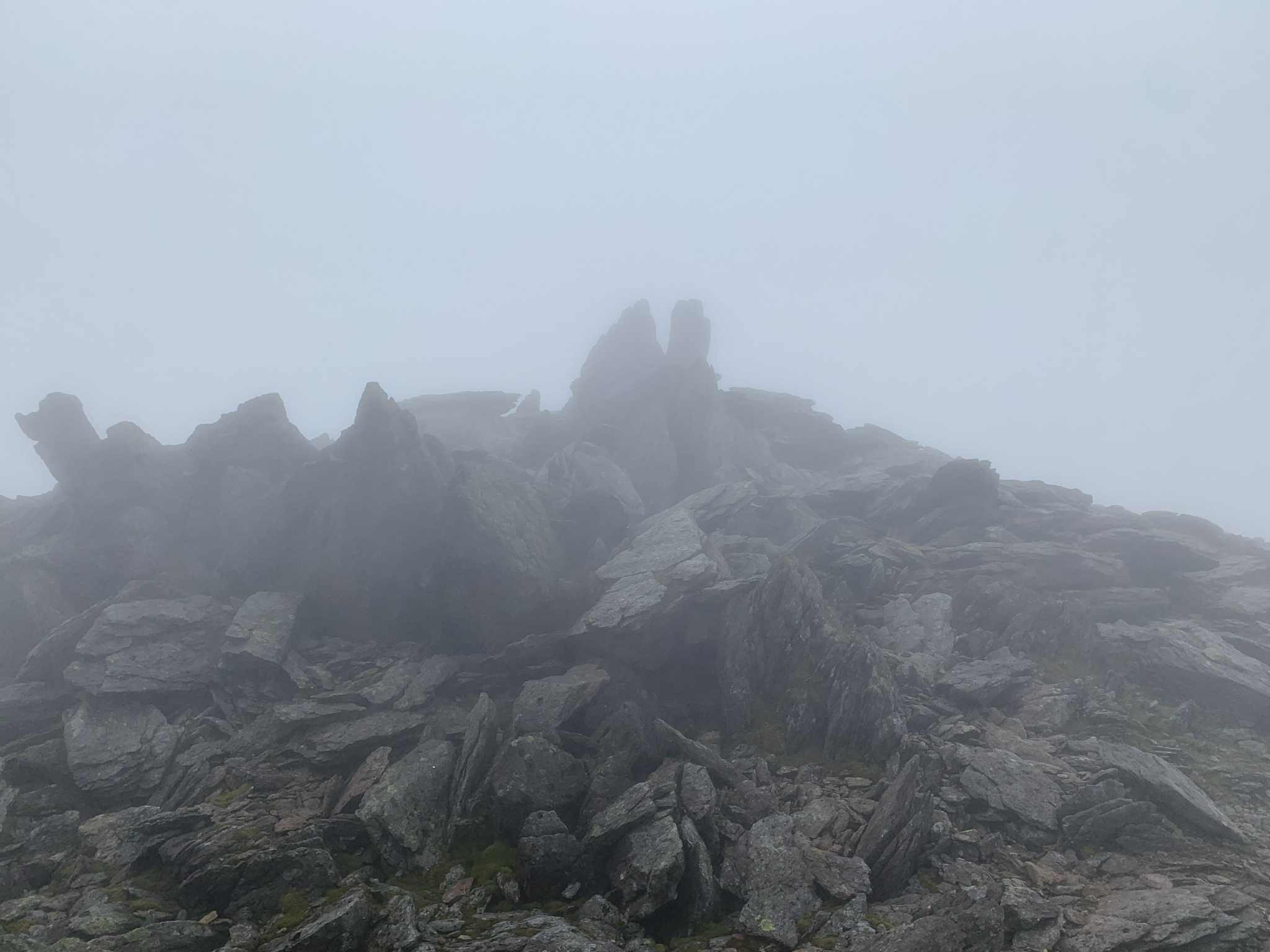
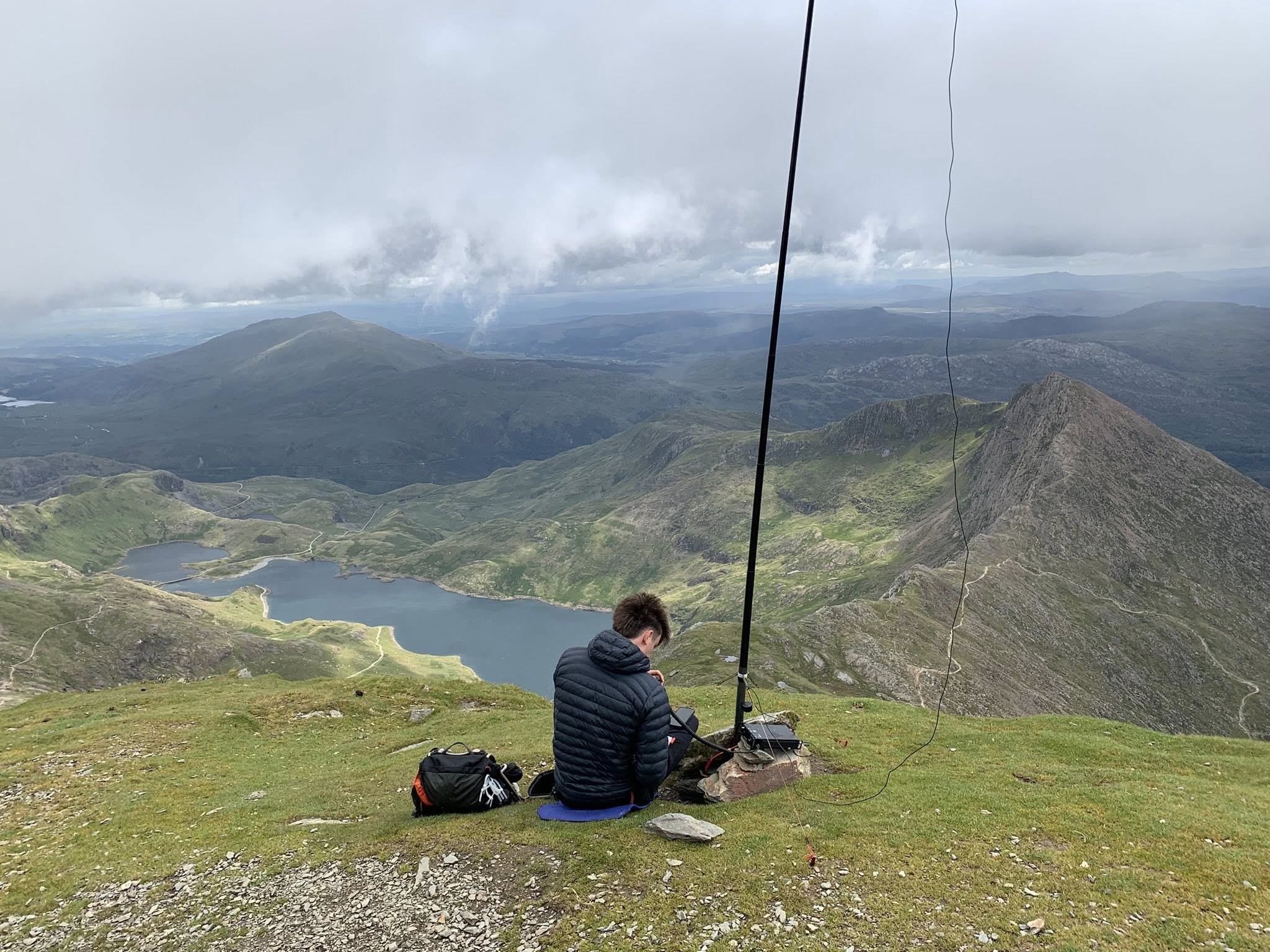
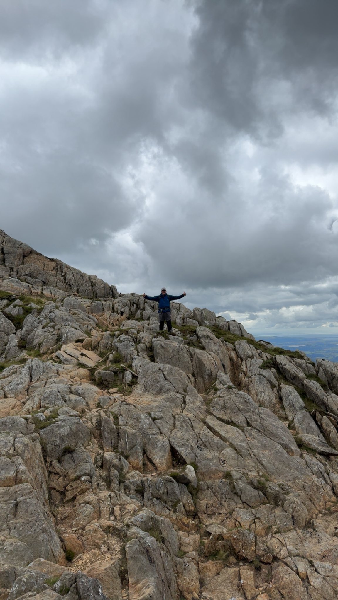
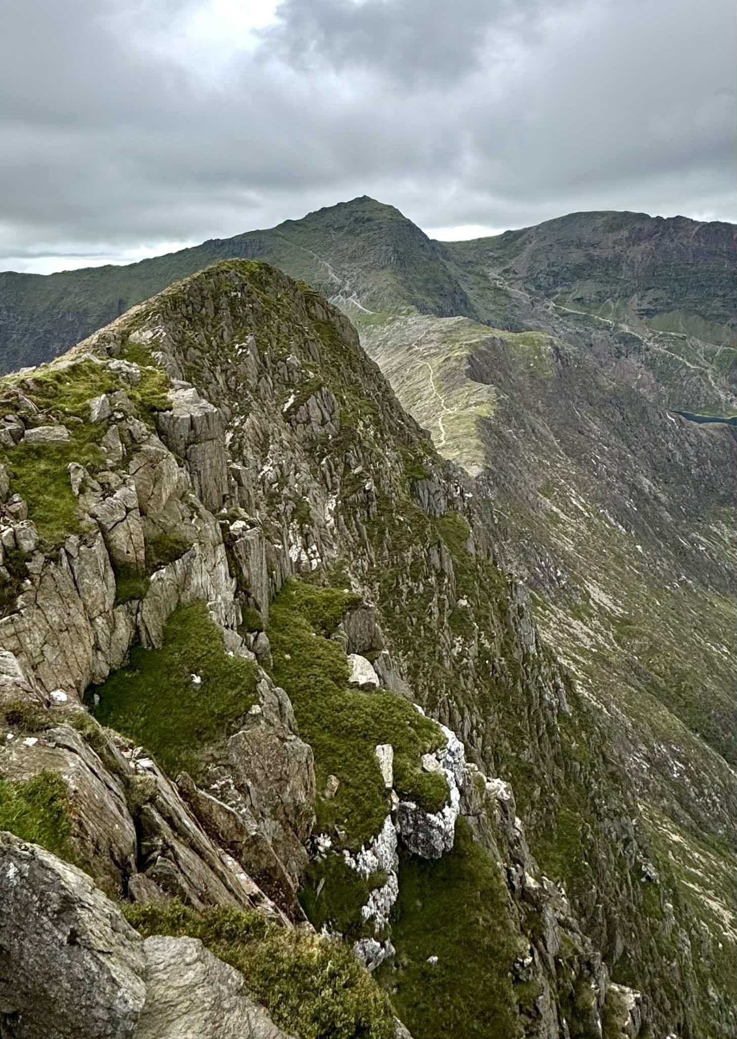
At the top the twin peaks of the summit are very distinctive and the views are amazing, although the operating area is a little precarious to move around on. This photo is taken from the West peak (the top) of the summit towards its East peak (only 5m lower).

With space limited at the summit we took turns at using one mast. I did my 2m activation and Leo did his 20m one. Within 20 minute we had our contacts logged to both qualify the summit. We packed up our kit and decided to get off the summit before our next chocolate/biscuit/raisins break, as it was getting a little blustery on the exposed peak.
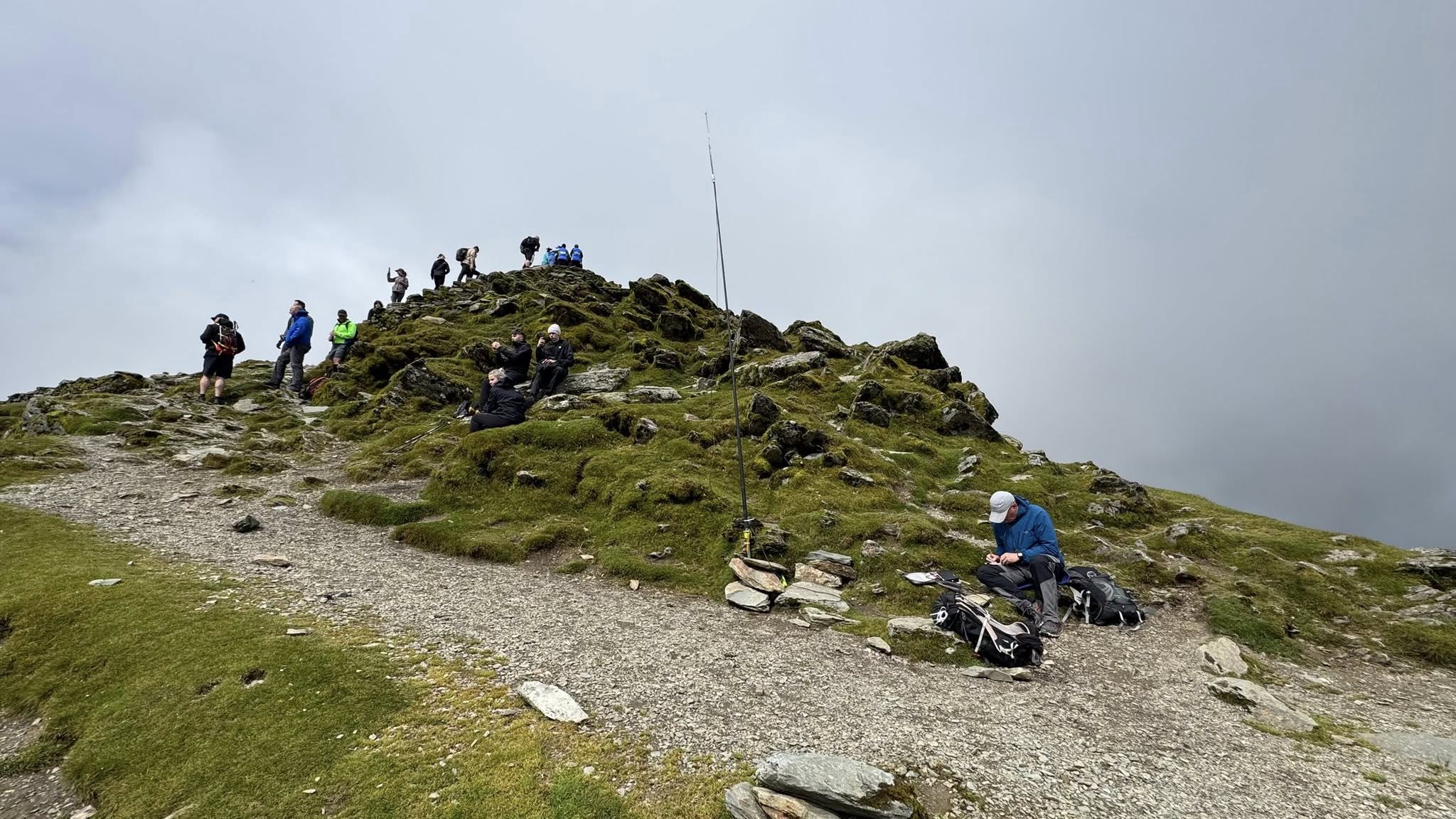
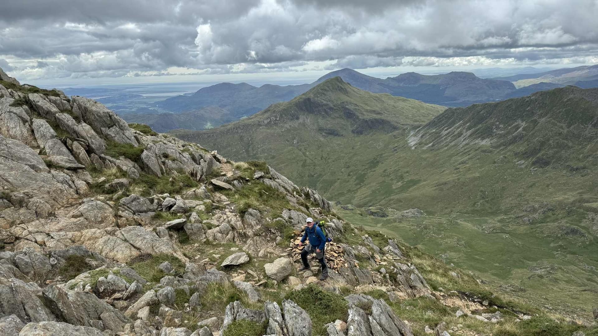
The walk down was easier than the scramble up to the summit but still required a lot of care and concentration. Looking back at the summit from the lower peak, Snowdon can be seen in the distance, with the watkins path coming down and the main summit of Y Lliwedd in the foreground. This photo gives a good feel for the exposure on the summit. ![]()
The walk back to Pen-Y-Pass from the summit, joins the Miners Path near to the lakes and is a little over 4km. We arrived at the bus stop at Pen-Y-Pass in time for the 5:45pm bus, which took us back to the car. We had walked 14km, ascended 1000m and walked for 7 hours. We had done a classic mountain route, done two top SOTA summits and had bagged 18 activator points in a day. ![]()
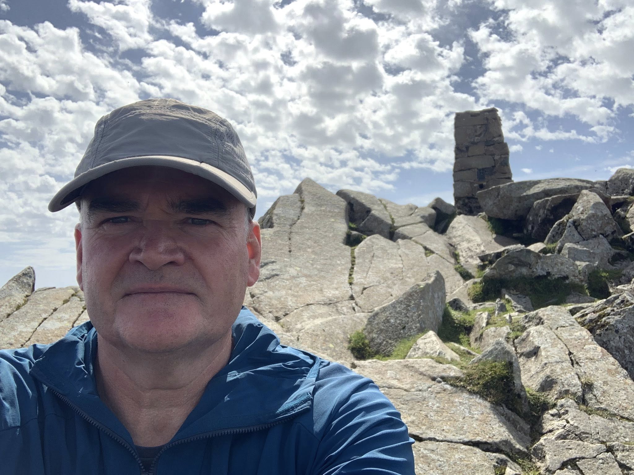
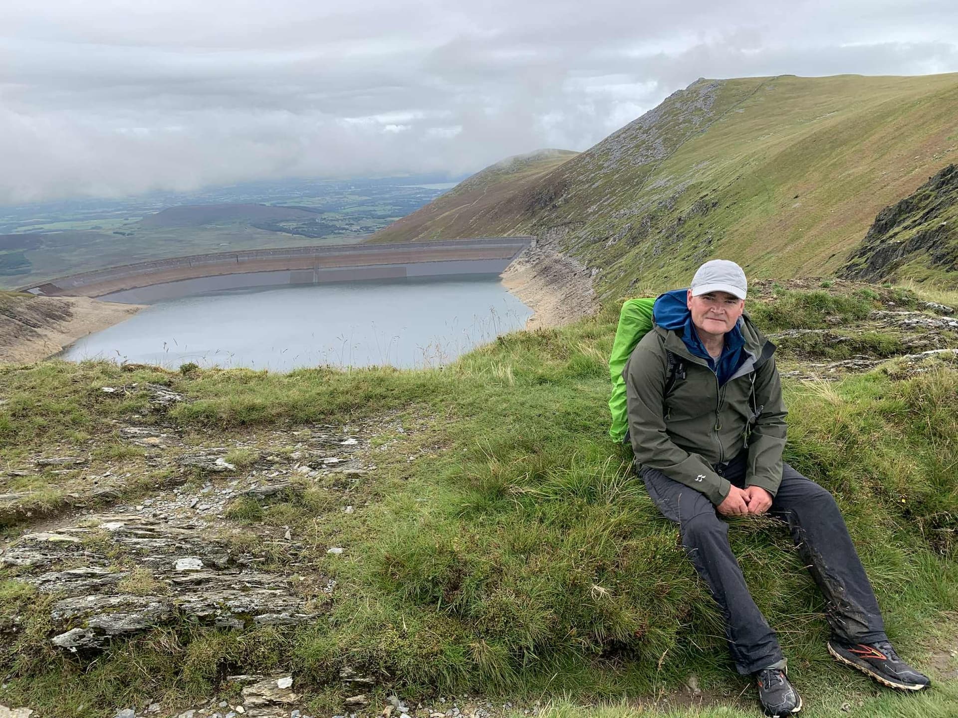
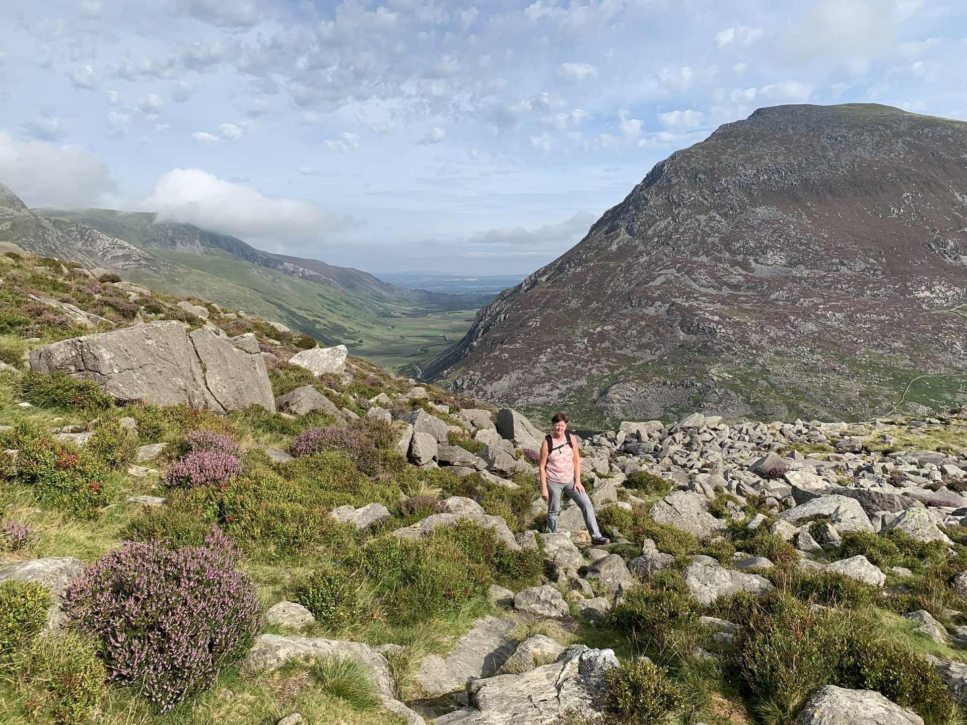
11th August 2025 - Day 3 - GW/NW-006 Tryfan With the first part of the expedition over I returned 10 days later, with my wife to see if we could tackle some of the other summits in Snowdonia. No camping this time but stayed in Betws-Y-Coed in some more wife-friendly accommodation!
I really wanted to do Tryfan but was a bit apprehensive about its reputation. I was very reassured by the response to the email that I sent to Gerald MW0WML about the best route up. Thanks Gerald for the advice, it was very useful and kept me and my wife Karen safe. ![]()
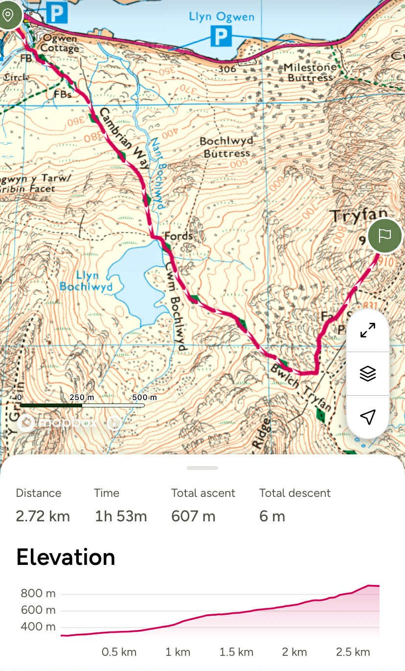
The start of the route involved parking at the visitor center at the East end of Lake Ogwen and walking up to (but not over) the style over the wall in the saddle of Bwelch Tryfan. About 30m short of the style we would turn left to face the South ridge of Tryfan and pick our way up the ridge to the Southern summit. This southern summit spot height is at 910m and well within the activation area.

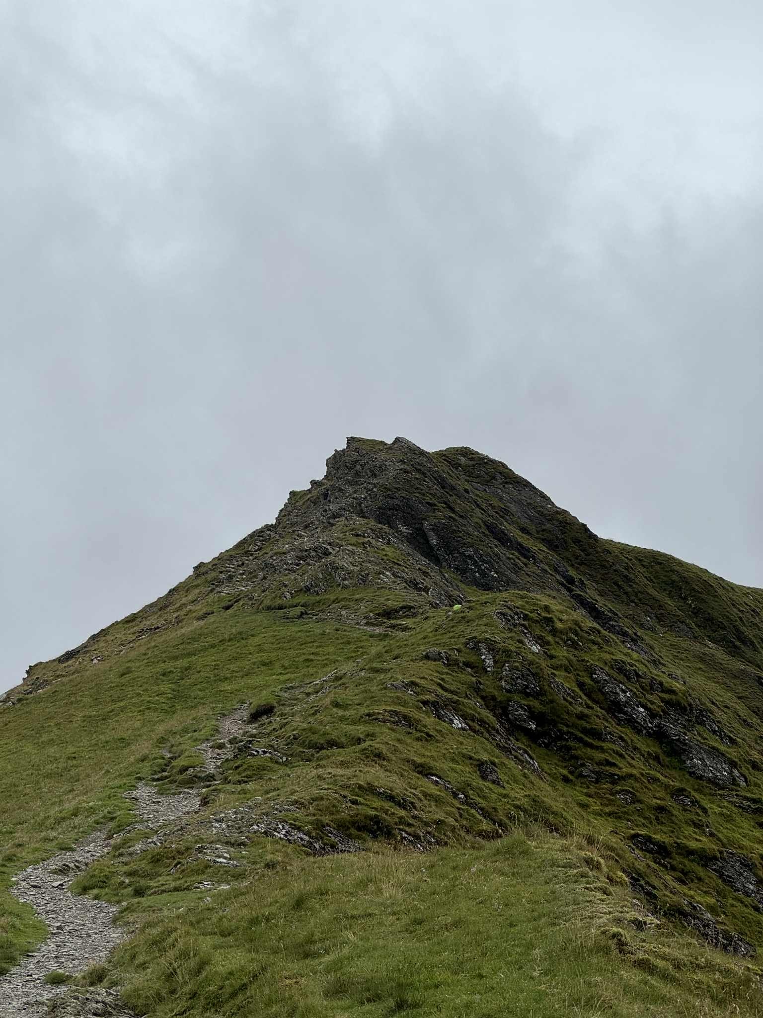
The route up to Bwelch Tryfan starts off with large paved slabs from the carpark but soon bares to the left away from this paved path, along the route of the Cambrian Way. The route continues up towards the tarn Llyn Bochlwyd and involves two hundred meters of light scrambling to reach the tarn.
Keeping the tarn to the right, the route continues along a well defined but rocky path up to the saddle. After reaching the saddle we turned up the South ridge of Tryfan and started to follow the most well defined path we could up the ridge, keeping away from the right side and the highest edge of the ridge.
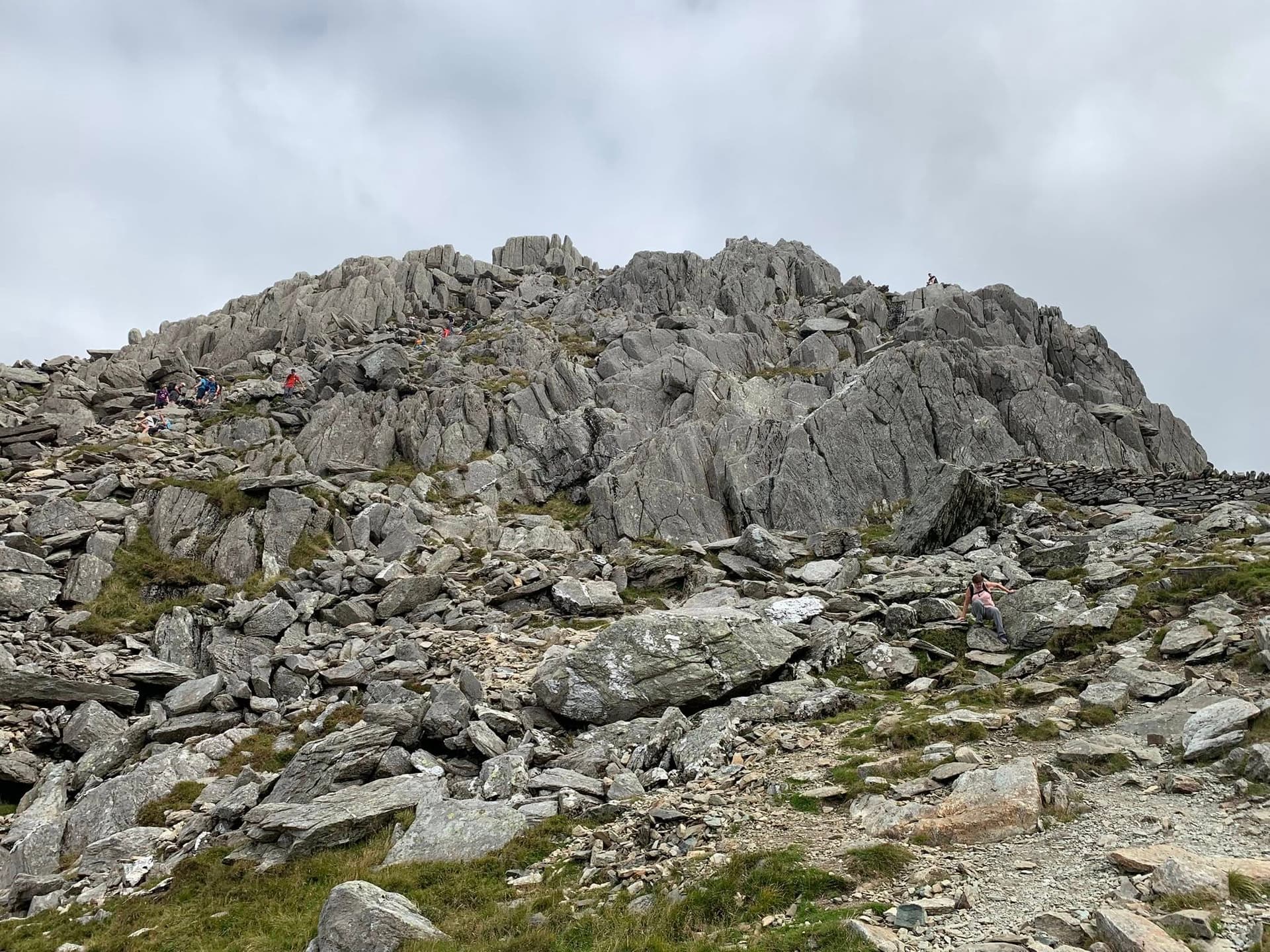
The hardest part of the scramble was climbing the gully of large boulders and steps for the last 200m or so of the ascent. Its certainly a scramble and involves some hands on but there is no exposure in this gully and there are always generous hand and foot holds at every part of the climb. There was a steady stream of people on the route and it was a lovely sunny day, which really helped to make it a straight forward but challenging scramble.
My plan was to activate using the FT-65 + RH770 combo on 2m and then set up the Xiegu FX-4CR with my linked dipole and activate on 20m as well. As we arrived on the South summit the people coming from the summit were complaining about the hatching of flying ants. This was not too bad at first and I managed to activate on 2m, getting a spot away and 10 contacts ITL in 20mins.
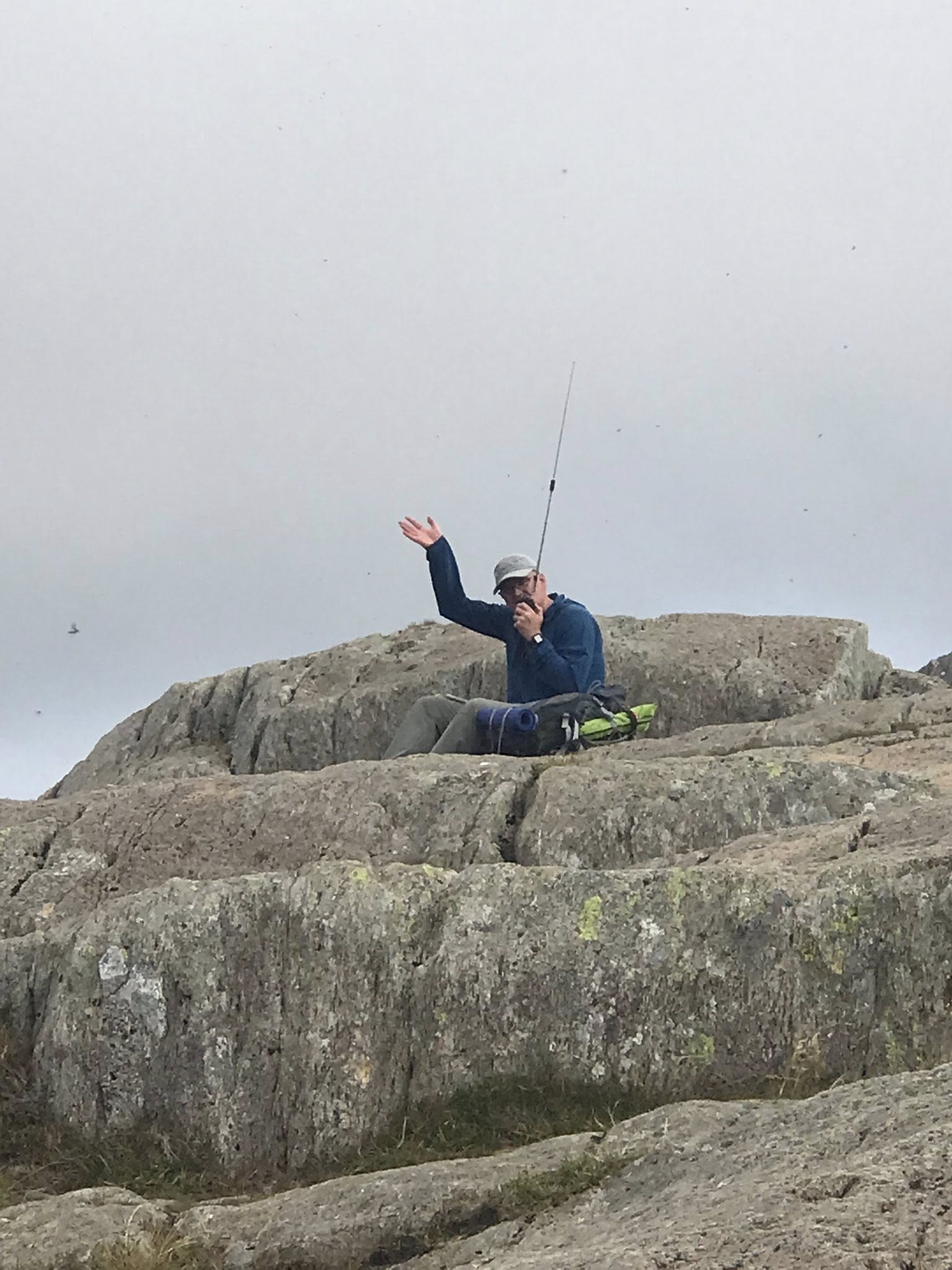
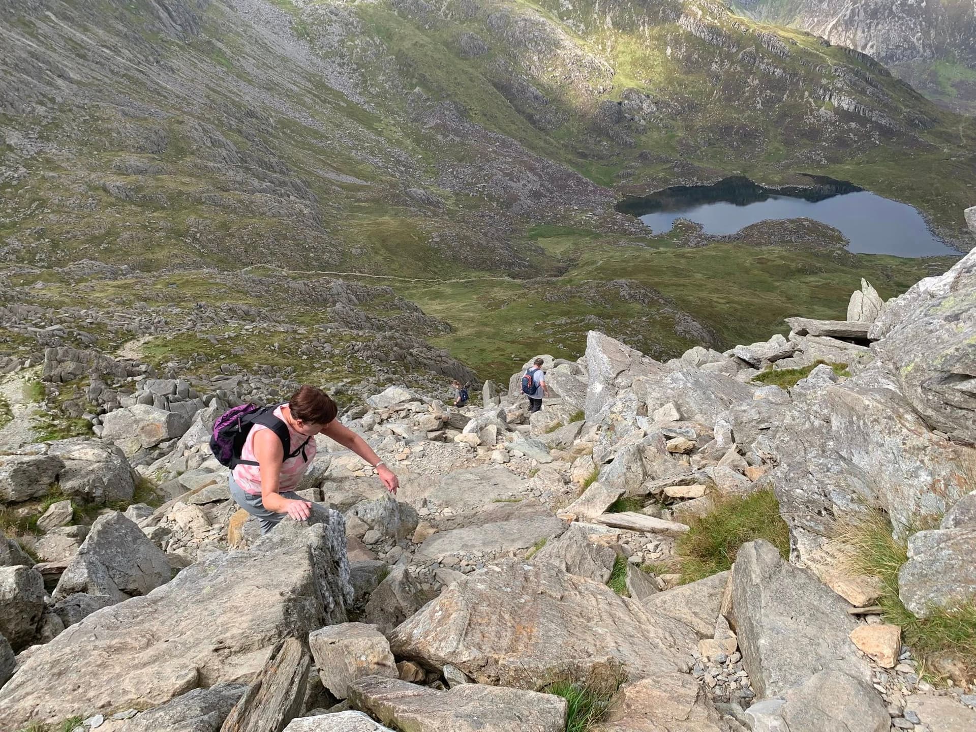
As I was considering how I was going set up the 5m mast and 20m dipole the flying ants became much worse and appeared in massive black clouds all over the summit. I decided to call it a day and get away from the flying ants. So pleased they were not biting insects but was also happy to have my 8 points with my handheld. I quickly found my wife a few meters further down, hiding from the flying ants and together we quickly descended down the way we had come up. After 50m or more of descent it was flying ant free and we had a snack and a drink.
We descended back to the car the same way that we had come up. It was slow going as even downhill required a lot of concentration and agility to clamber over the boulders and rocks all the way down. The short scrambly section just after the tarn seamed a lot easier after the scramble on Tryfan.
Although the route was only 2.7km and 600m of ascent to the top, the whole walk took almost 6 hours and was really quite exhausting but exhilarating. I would be happy to do it again next year!
August 12th 2025 - Day 4 GW/NW-002 Carnedd Llewelyn. I did not do as much homework for this summit as I had for the others and would be doing it solo, as Karen planned a rest and shopping day. The two Youtube videos I did watch beforehand both took the route up to the reservoir using the tarmac road, then up the zig zag path up to the ridge/saddle of Bwlch Eryl Farchog, then followed this ridge up to the summit. It looked quite straight forward on the map.
I parked at the campsite on the A5 at the start of the reservoir’s tarmac road and walked up to the reservoir, passing through three gates, along the way.
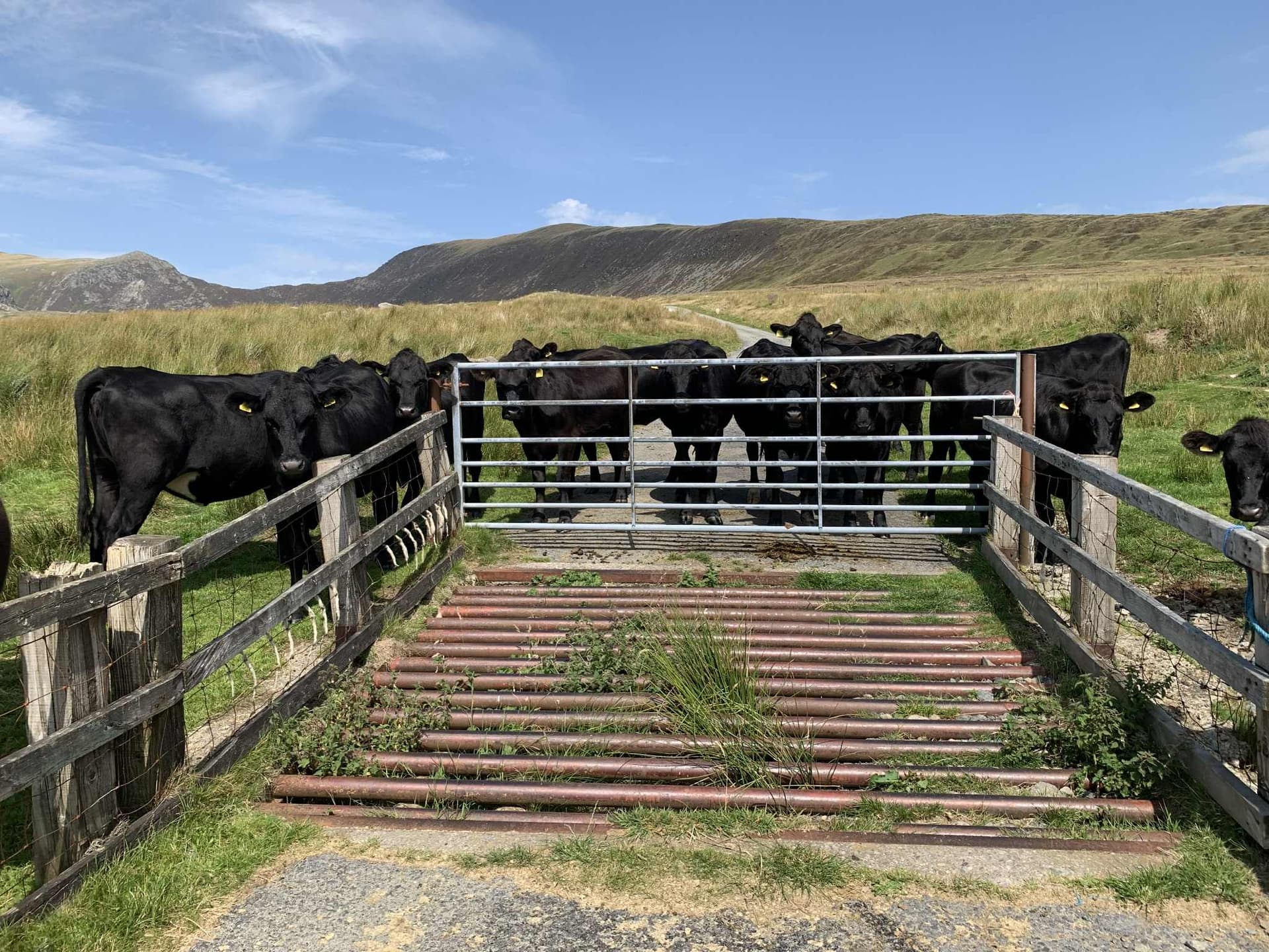
At one gate a herd of cows were waiting for me. I tried to talk to them to explain my plan but that did not appear to work! So had to find a way around them.
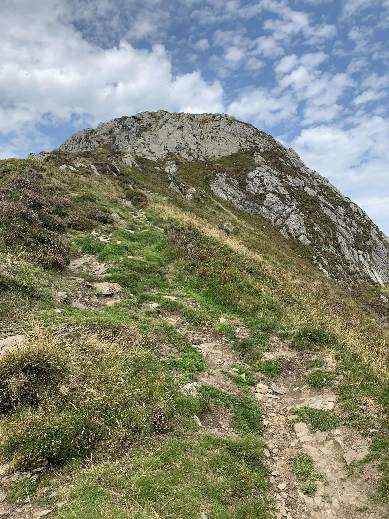
Once at the reservoir the route bares off the tarmac road and starts the climb up to the ridge behind the reservoir. The path is shallow at first but gets steeper as it gets higher and there are sections were there is a sense of height, with smooth rock and fewer jug handles to hang onto.
Once onto the ridge the route turns up towards the summit and there is a buttress of rock to scramble over. I found it quite intimidating doing it solo with no one else around but took my time and slithered my way over it.
Once over the short scrambly bit it is a straight forward walk up the the summit. There are a few options for activating from shelters and cairns on the summit but there was practically no wind and clear blue sky I picked a nice flat rock to sit on and setup my 5.5m mast, 20m dipole and FX4-CR.
I spotted on SOTA Goat and had 13 contacts all over Europe ITL in 22 minutes, including two summit to summits in Austria and a first for Faroe Islands. I then packed up the HF kit and activated on 2m. I spotted and had 7 contacts ITL in 10 minutes. I then tried 70cm to try to make a summit to summit with Vicki MW6BWA on UHF but did manage to make contact with G7WUK, which earned me a UHF badge!
This all took an hour on the summit before I packed up and retrace my steps back down to the car. Slithering back down the buttress, with 5 points of contact at all times and slide my way back down the steep zig zag path from the ridge.
Back at the car I was shattered. It had been a long day and hard work in the heat and with the stress of solo scrambling but I was happy with a good activation and another 10 points. ![]()
Summary - Epic Snowdonia Expedition
What a great SOTA adventure this had been. Five days of walking in the spectacular mountains of Snowdonia. Rugged, intimidating, challenging, exciting and beautiful. The radio kit worked. The bands were open and busy and the weather allowed some fantastic views on most days.
Thank you Leo and Karen for your company.
Special thanks to Gerald MW0WML for the advice on Tryfan, which kept us safe and to everyone who called in and made contacts or simply listened in. The chasers really do make activating SOTA possible and its great to hear you trying patiently to get through and show so much discipline and respect for each other. Thank you all for your support.
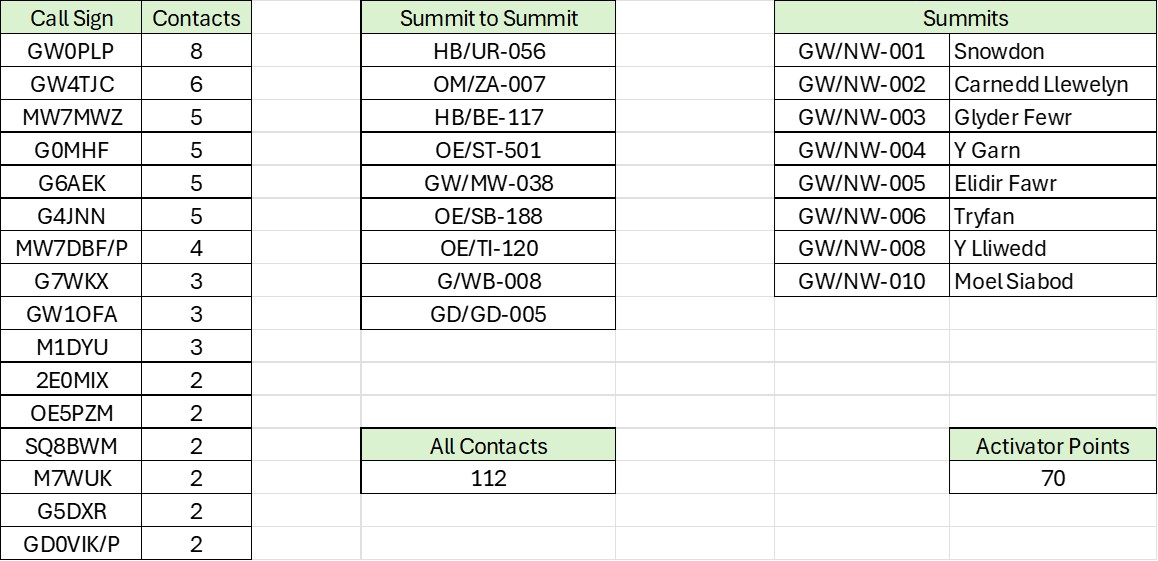
Here is my dashboard for the expedition for those who like that sort of thing!
73 MW0JIA/P Ian
(M0JIA)