A quick report/notes on my trip to Mallorca this week, following on from this thread: Antenna for EA6/MA?
I had a week off work and with the forcast looking atrocious for the UK I booked a cheap trip to Mallorca for some cycling. From previous trips I knew I wouldn’t be able to manage cycling the whole time so took my radio kit and did some hiking and SOTA while I was there.
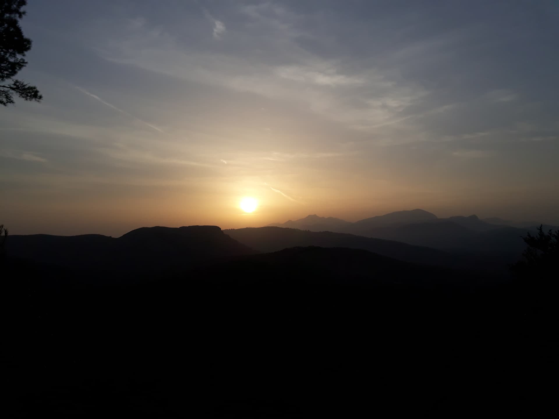
Weather was much hotter than expected, the forecast was saying ~28 degrees C daily although the pharmacy signs were saying it was 32 degrees on a couple of occasions in the towns.
Lots of text below with some pretty pictures in between. All summits were activated using an FT817ND on SSB putting out just under 5W.
Talaia d’Alcúdia (EA6/MA-040) and Puig de Maria (EA6/MA-052)
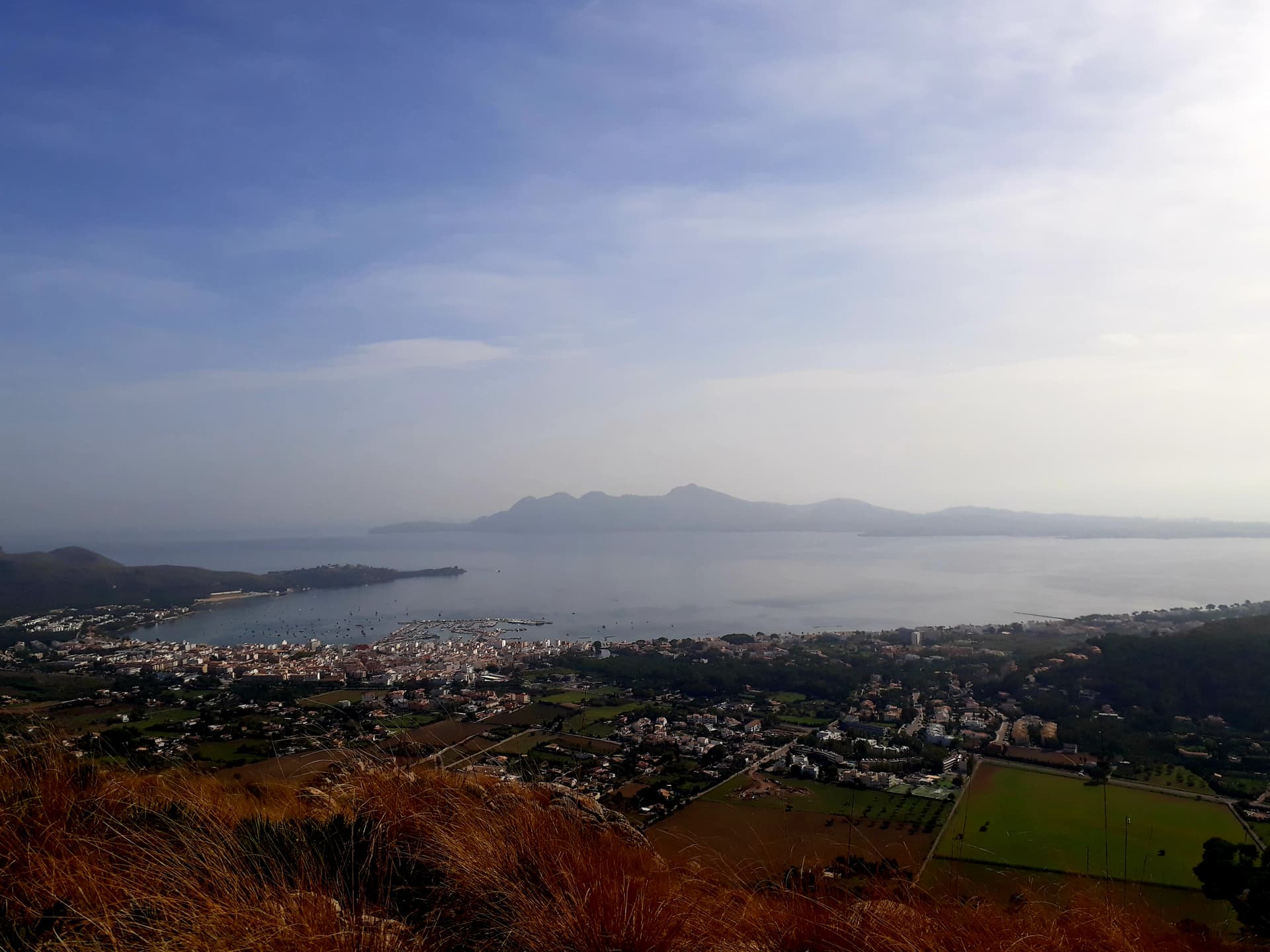
Day 1 was a walk into Alcudia to pick up my rental bike (the big orange airline still haven’t got back to me about taking my own bike on the plane). EA6/MA-040 wasn’t much further so after figuring out how to attach the 6m Decathlon travel pole to my backpack so it didn’t spear me or anybody else while riding I rode down the coast and up to the parking area at Mirador de la Victoria.
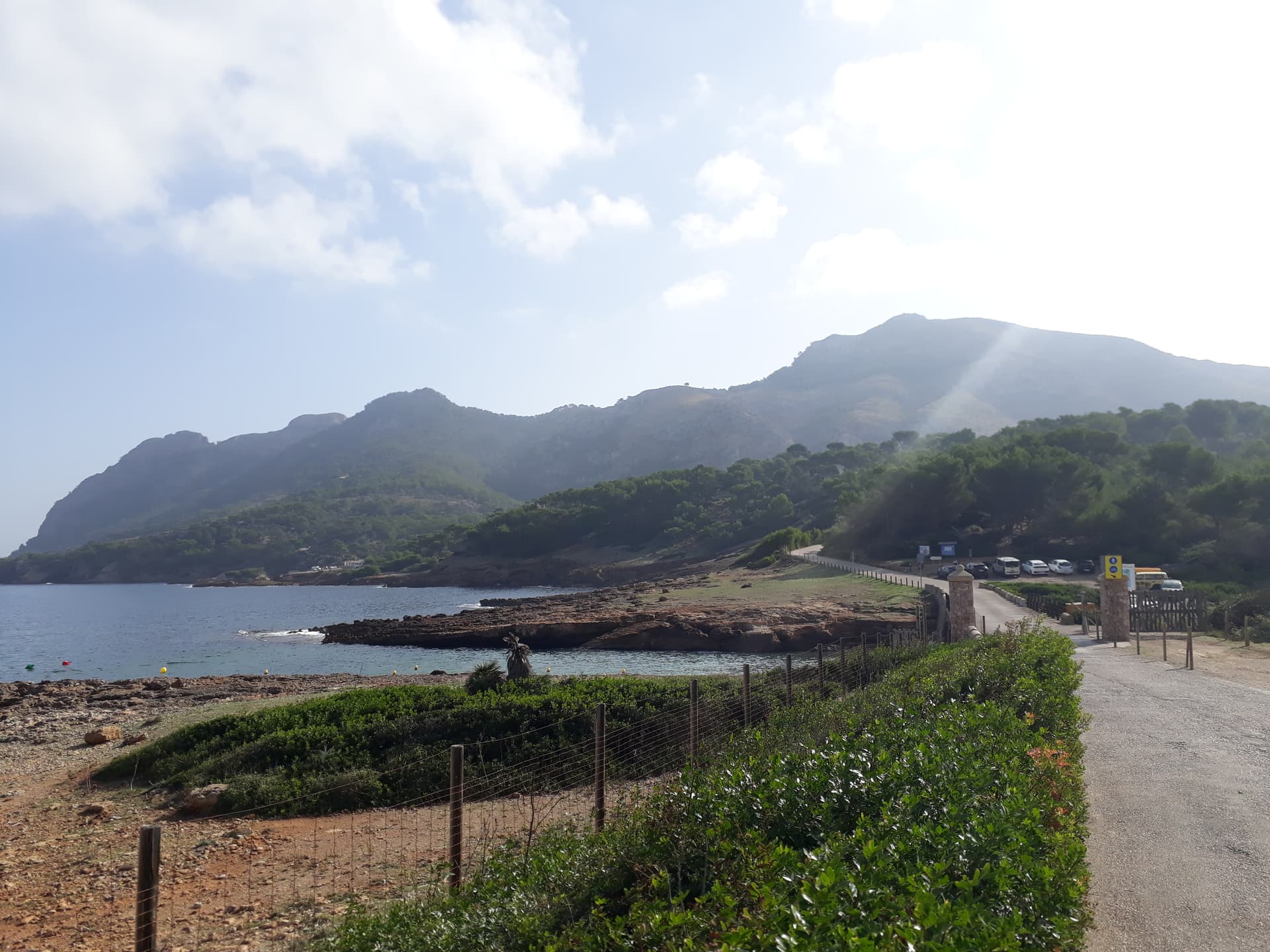
It was almost noon so thought I’d get something to eat at the restaurant however it is closed on Mondays and Tuesdays. Fortunately there is a takeaway kiosk nearer the car park where I got tea and cake which was just opening, and the toilets were open for refilling my water bottle.
There was bike parking at the car park where I left as much biking gear as I could before swapping into my trainers that I’d carried with me for the hike to the top.
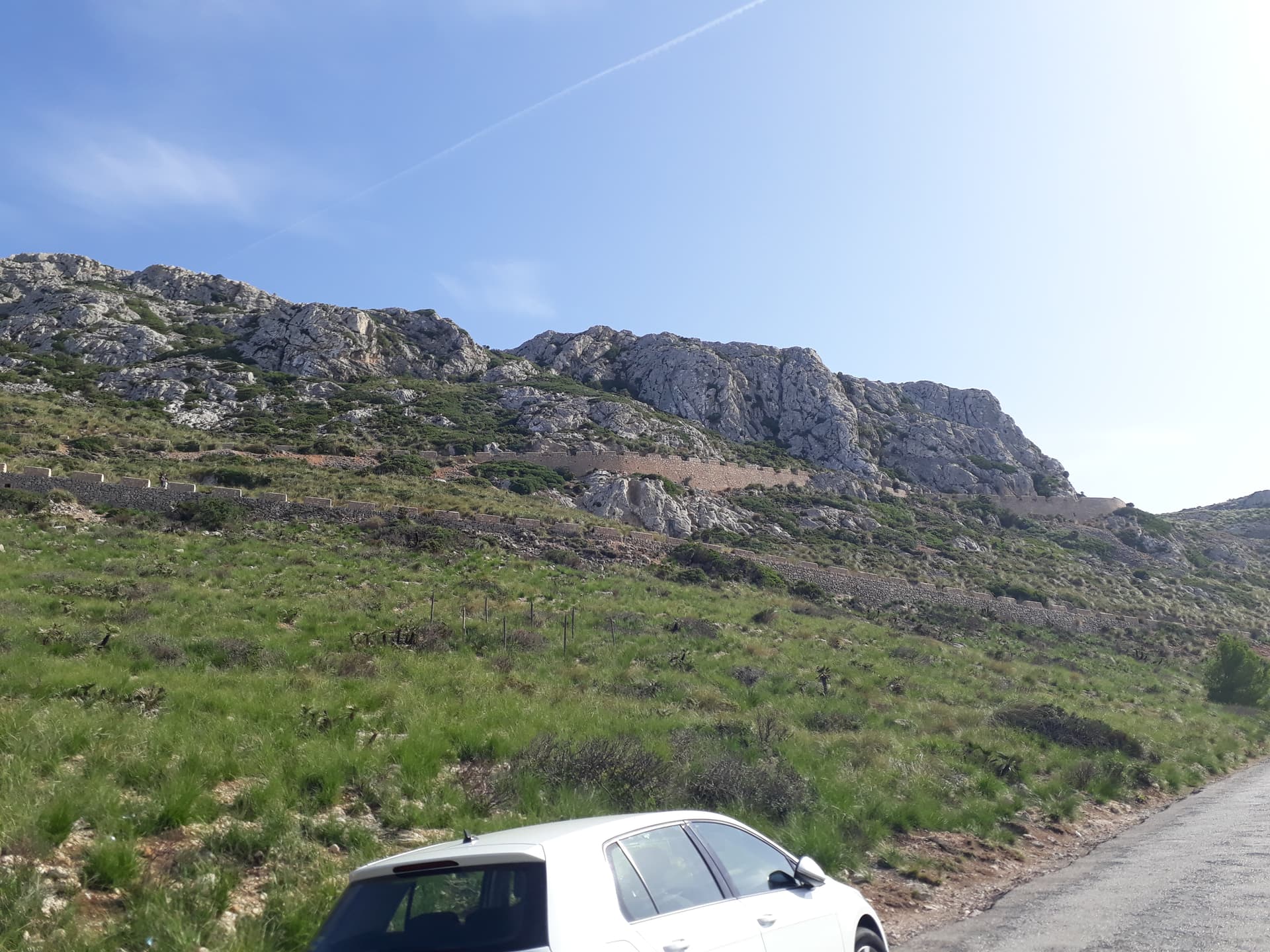
Upon leaving the car park there was a barrier across the track saying not to go any further due to recent landslides. Everyone was walking around it including big family groups with small children so I did the same, proceeding with caution.
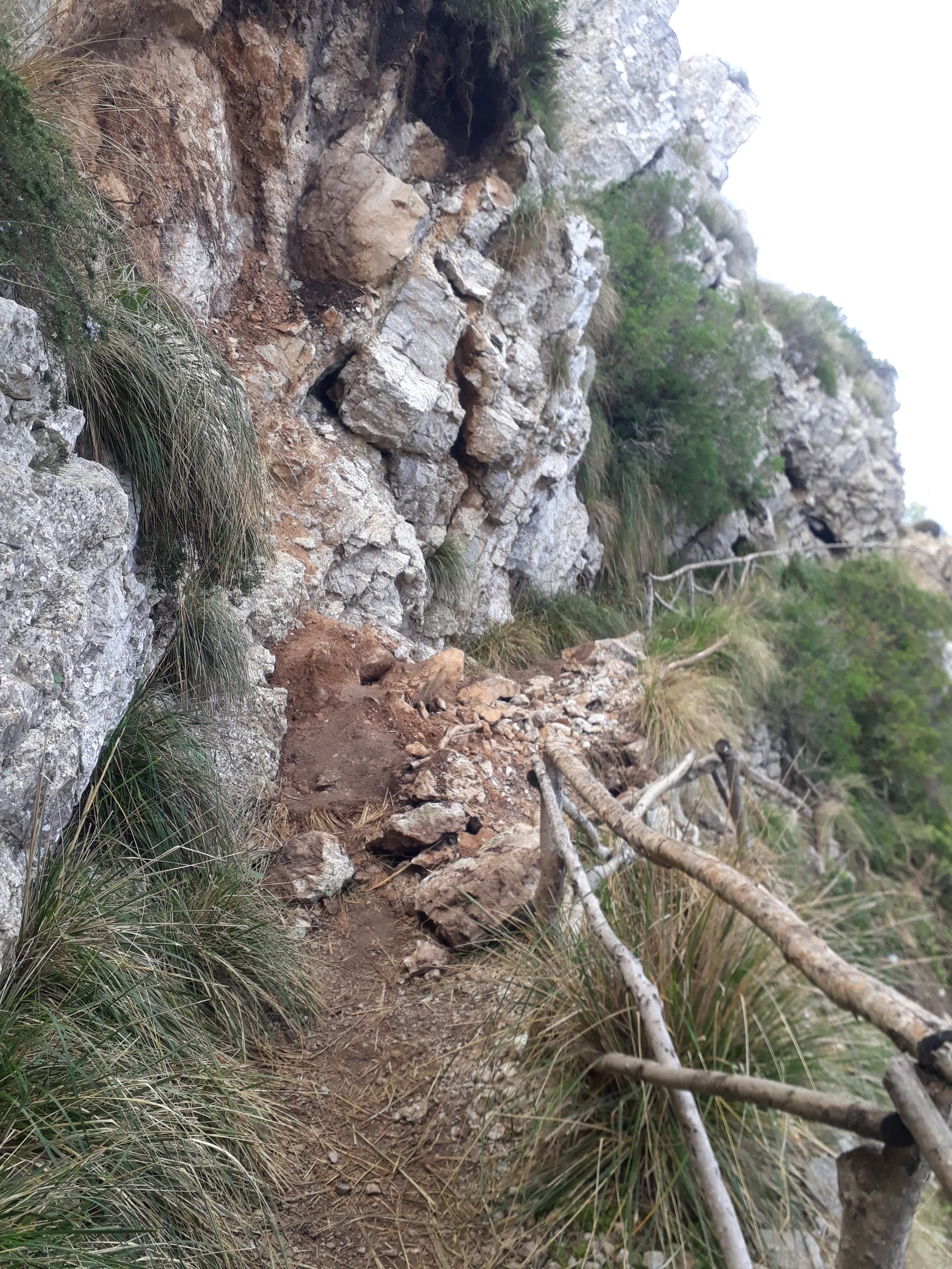
After following the wide stone forest track for a while and seeming to gain little height the imposing summit came into view and I was expecting some bouldering, however there is a zig zag path with a timber handrail up to the col.
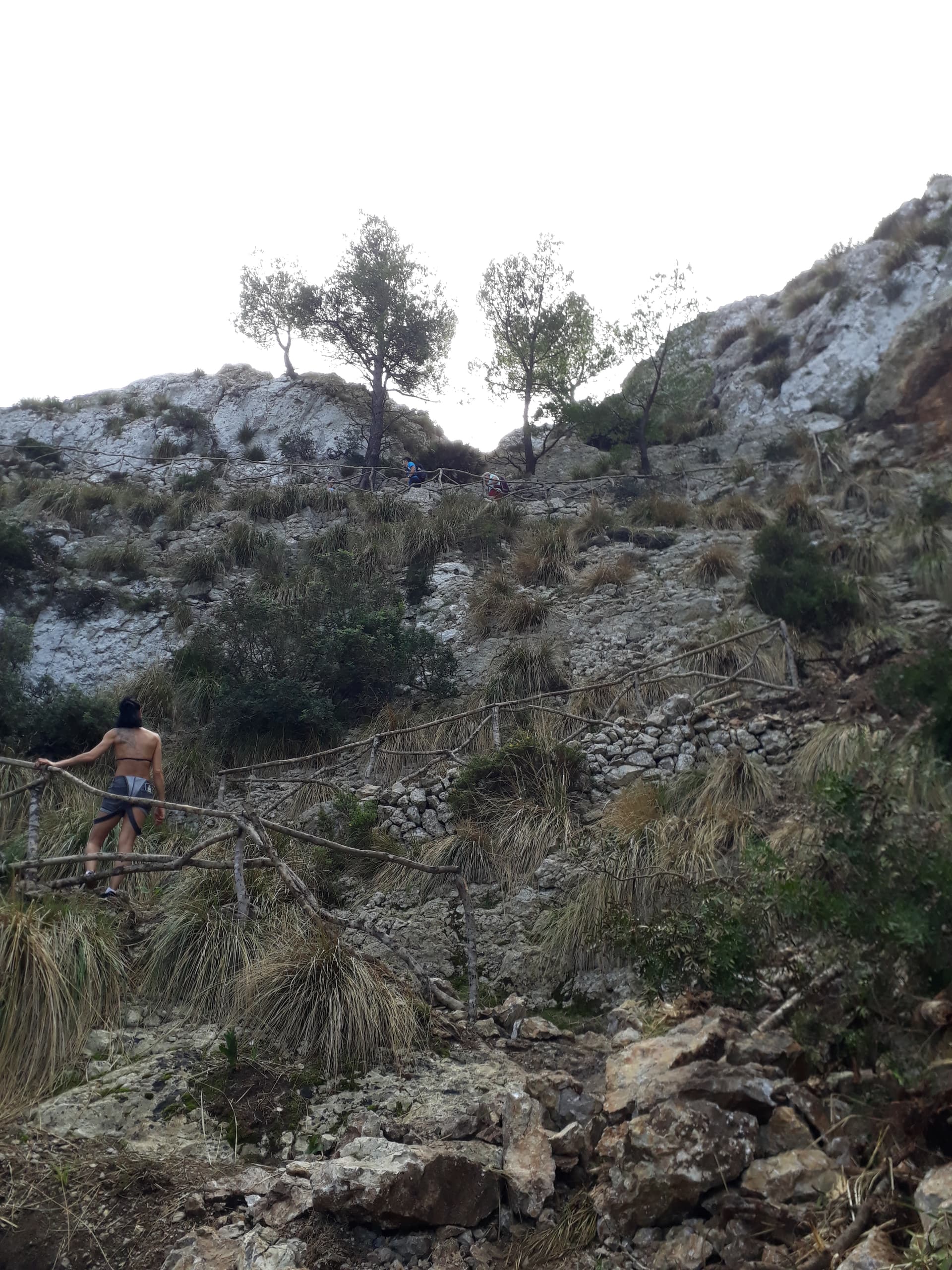
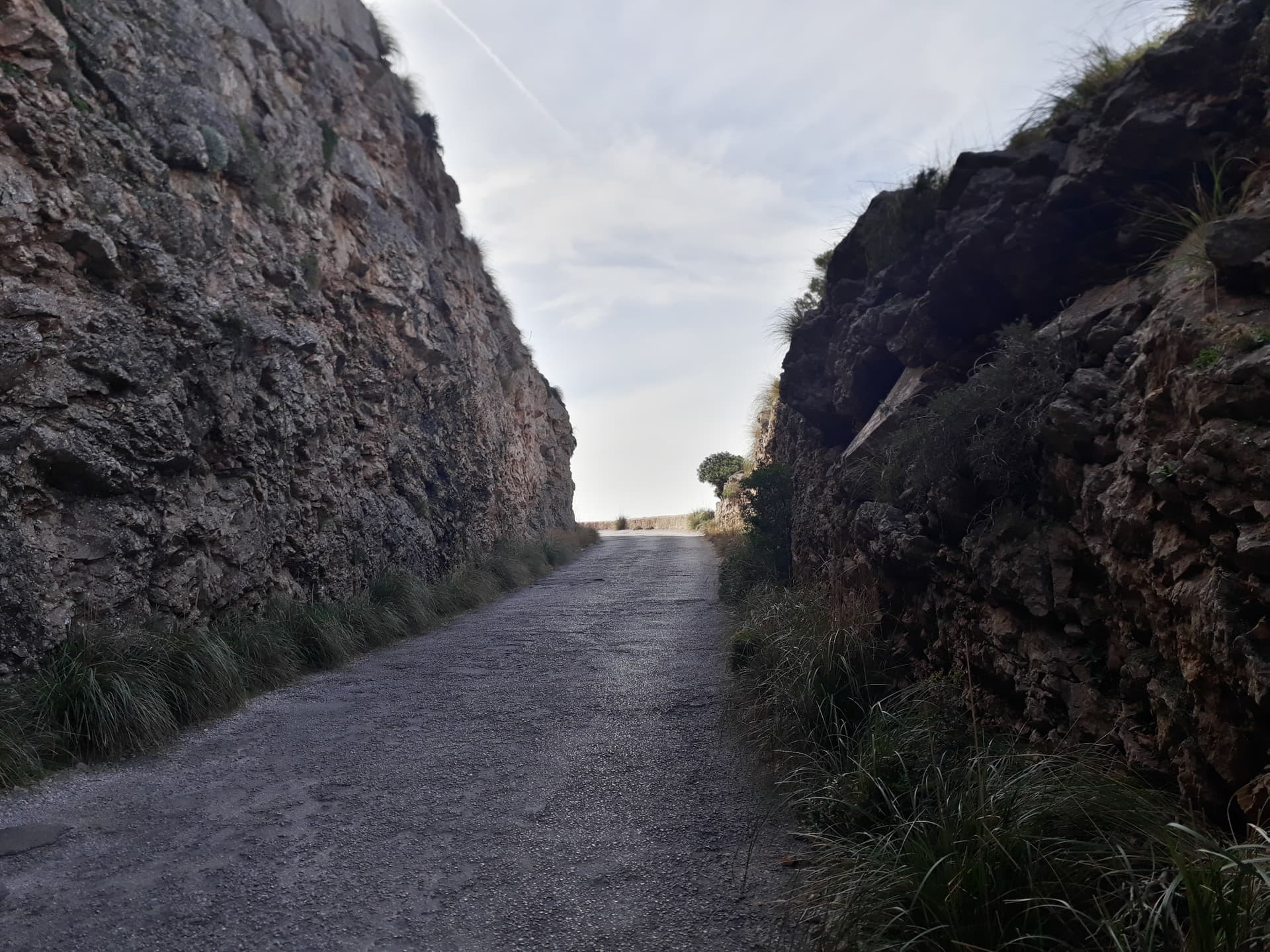
About 25 m before the pass, the path was buried under a landslide. This was passable with care, and if you didn’t look down. A french lady ahead of me saw the blockage and panicked and let me go ahead while she decided what to do, I tried to reassure her that it was easier than it looked but she decided to turn back which was a shame but I understand the feeling.
At the col I got stuck behind a slow moving convoy of Nordic walkers who had come up from the south west.
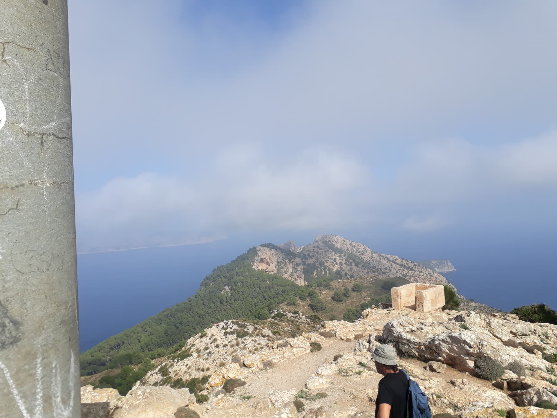
When I eventually got the summit it was extremely busy (GW/NW-001 approx. 10 years ago level of busy) with no obvious place to put up an antenna.
I ended up setting up next to the “shack” by the summit and strapping the antenna pole to the guy wires anchoring it down. This meant the antenna could not be fully deployed and the 40 m segments of the inverted V were on the ground, although disconnected at the link.
The summit was activated on 20 m although it was a struggle with high SWR showing on the FT817, probably due to the poor location and lopsidedness of the antenna.
As more and more people were arriving on the summit I packed up and headed back down the way I came, got another drink at the kiosk and refilled my water for the ride back.
I headed east towards the end of the peninsular but after dodging some free goats came to a barrier saying that this was a military zone and there was no access. Although you could easily get around the barrier I didn’t want to chance it so turned round and headed back west.
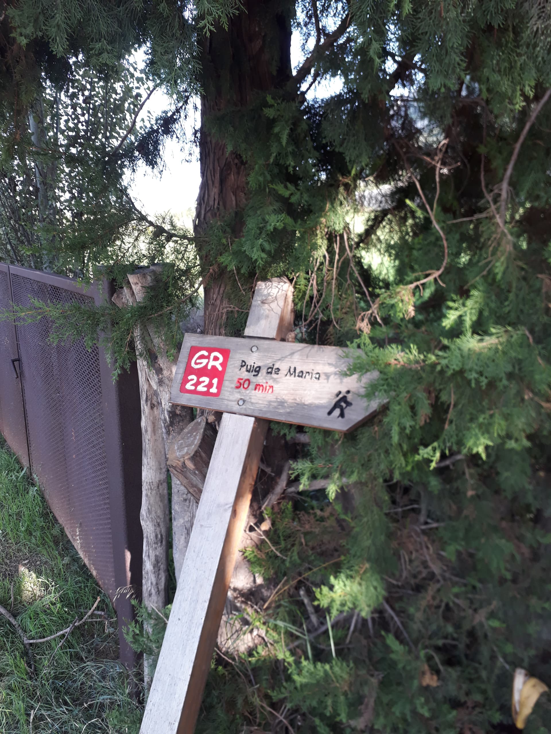
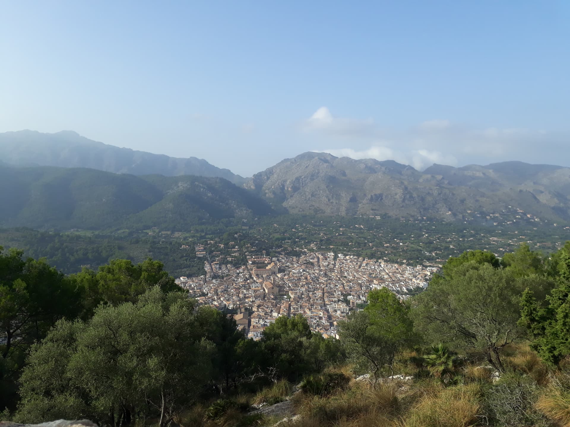
Not wanting to ride straight back to the hotel I headed along the coast around Pollenca Bay and after taking a few wrong turns ended up in Pollenca. I knew that EA6/MA-066 was here (and you can’t really miss it) so decided to try and activate it after stocking up on more supplies from one of the local shops.
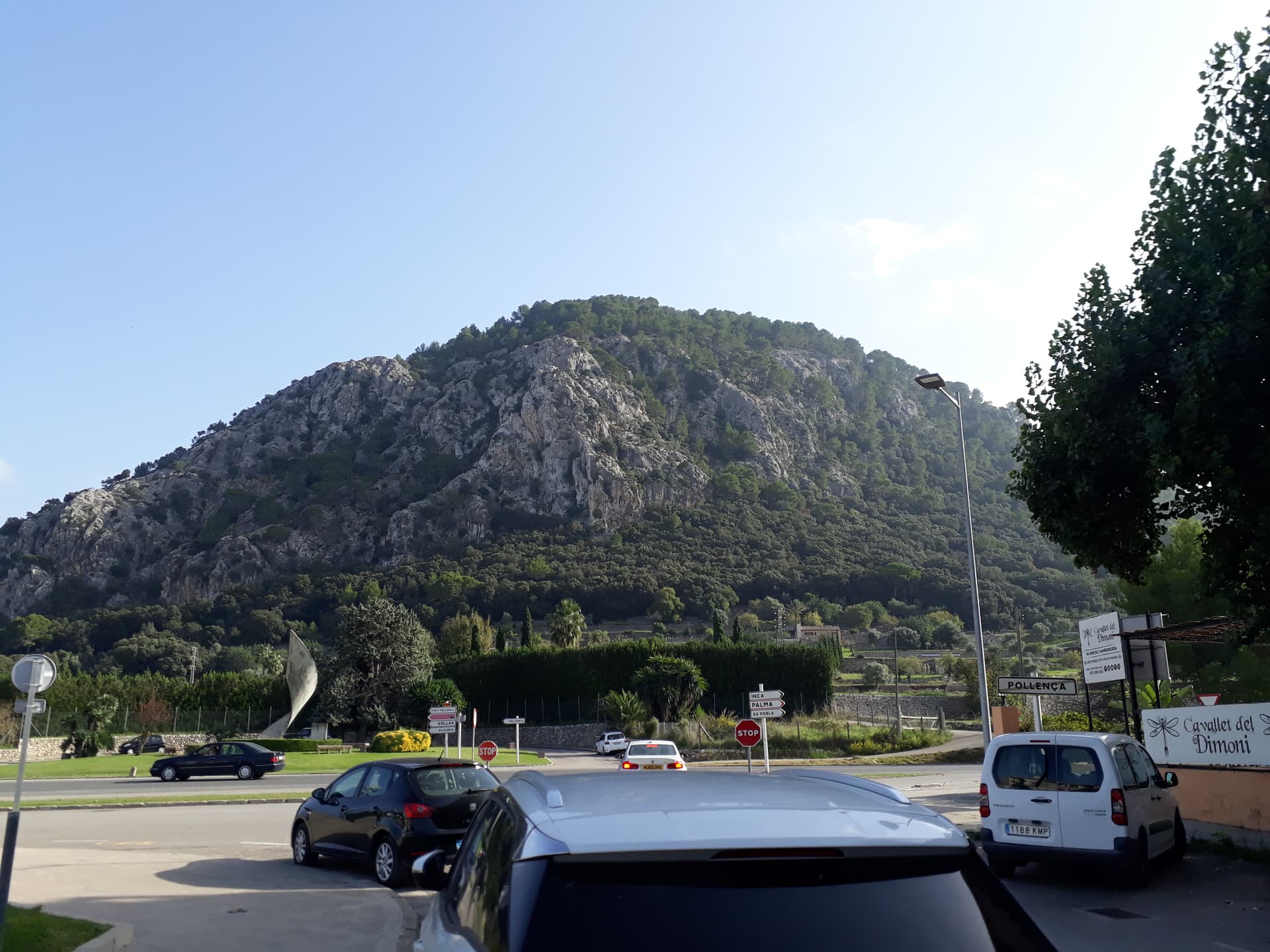
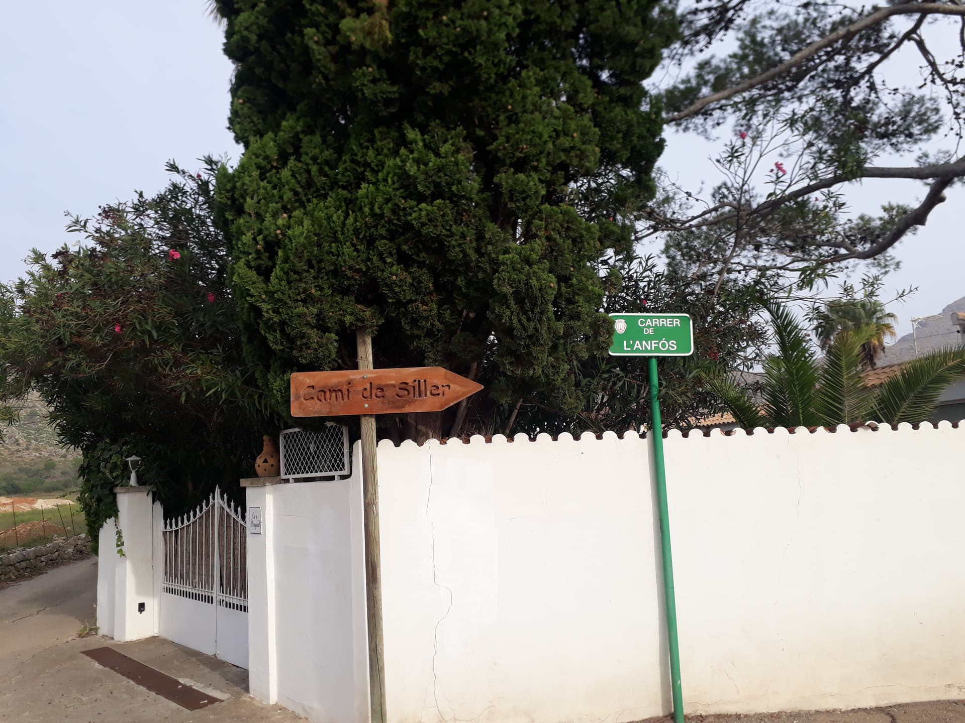
Shortly after turning off the main road, there is a sign saying residents only so I respected the sign and pushed/carried my bike up, not feeling comfortable leaving it around here. It turns out that after work the hill is very popular with cyclists and runners so I think I would have been OK riding up, as far as the cobbles anyway.

The cafe was closed as it was late and there were only a few people at the summit. I set up slightly down the hill outside the walled area, tying the antenna pole to a dead trunk and only managing to get one of the 40 m dipole legs out with the other chucked in the nearby tree. I probably could have got the full dipole out between the bushes with some effort but I was short of time, and in shorts.
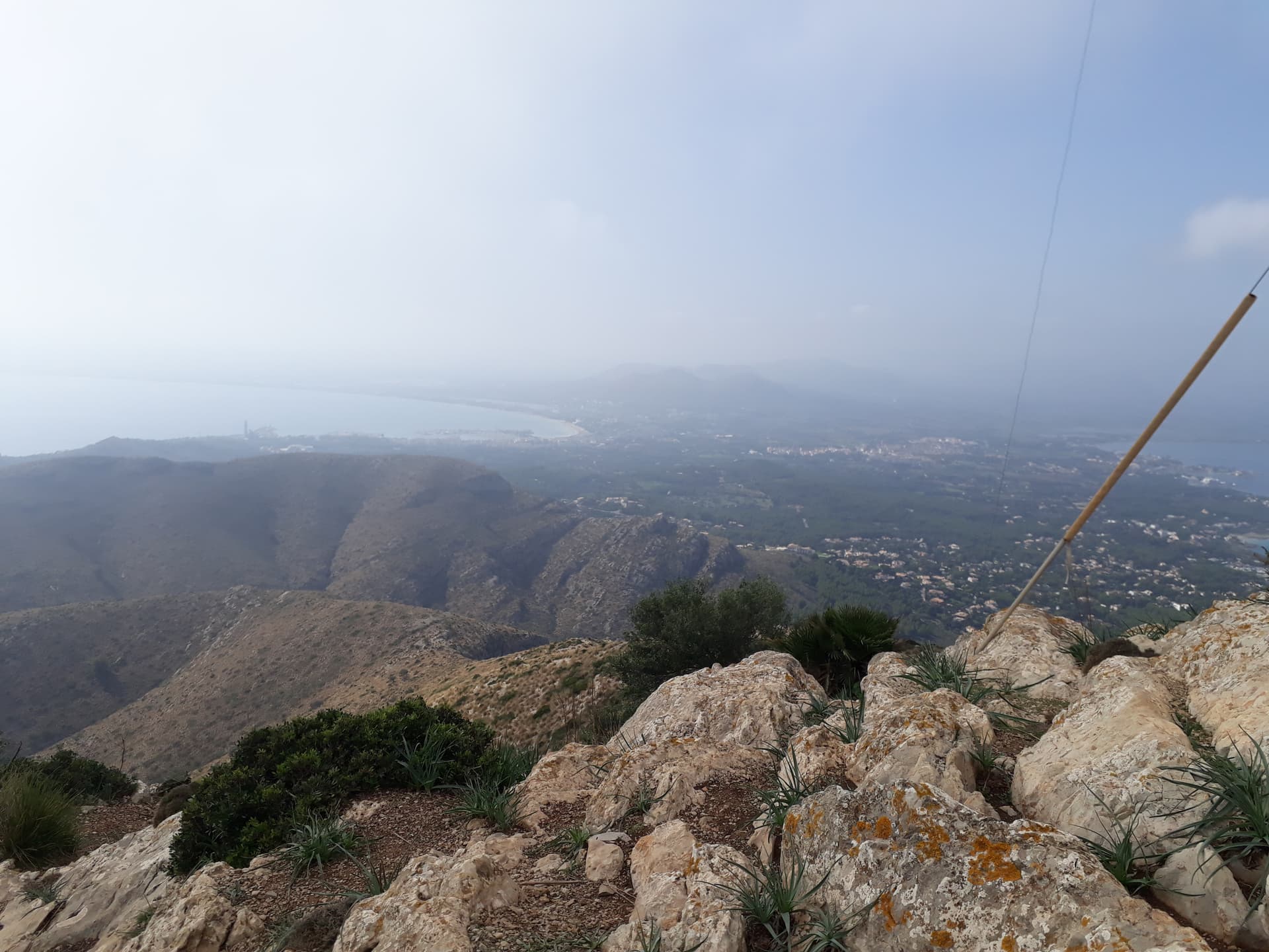
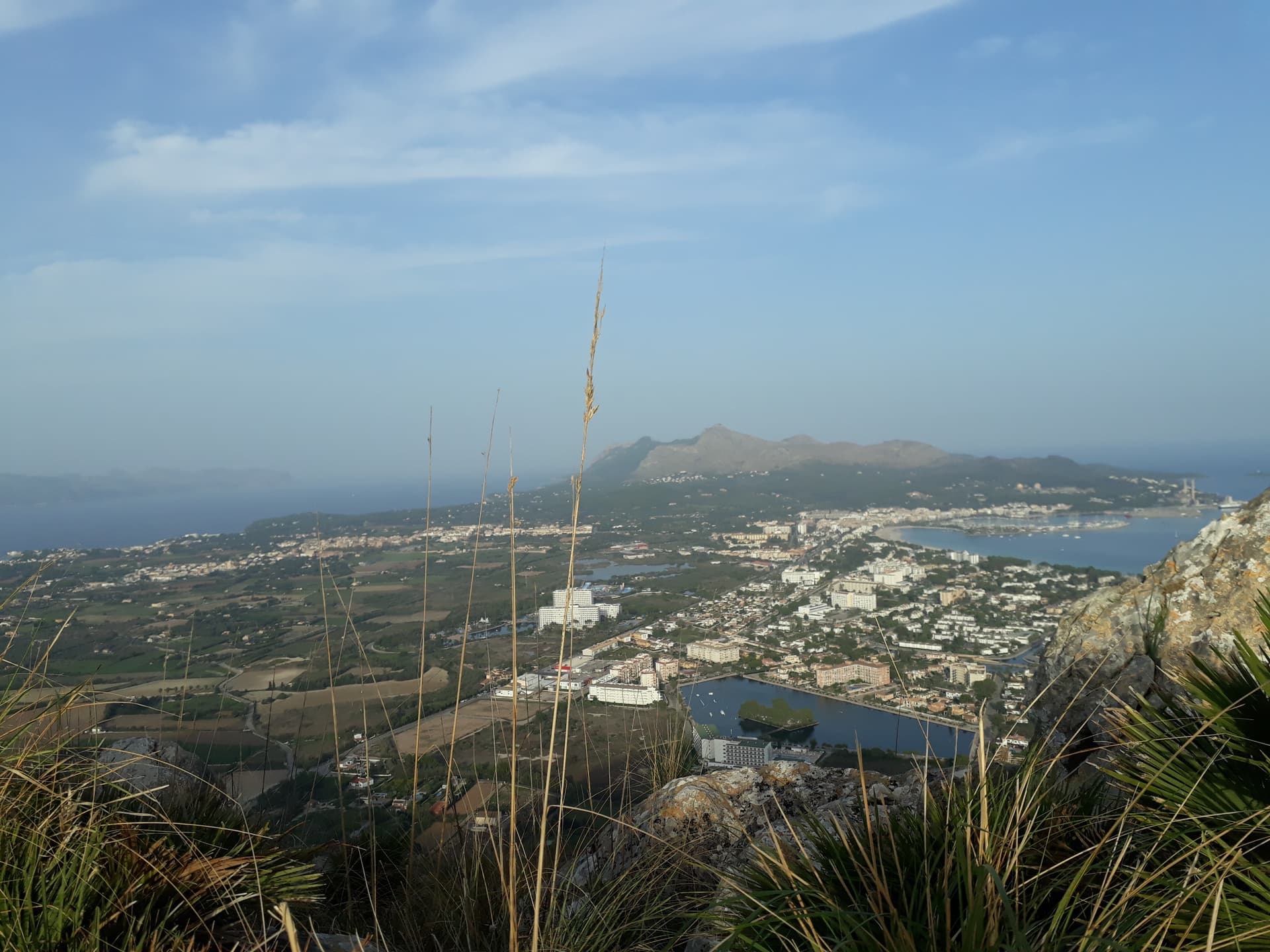
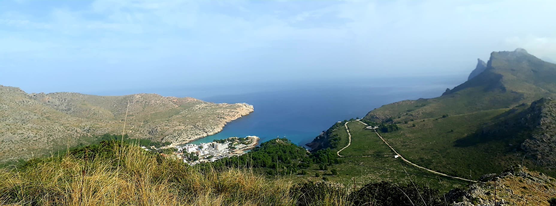
The operating spot has a great view over Pollenca.
After packing up I carried the bike back down the cobbles, rode down the hairpins and made my way back to the hotel through the hills getting back just before sunset. Total distance was 42 miles riding and 6.6 miles walking.
Puig se San Marti (EA6/MA-066)
This was located very close to the hotel so after a morning of cycling to Formentor and back I headed up late afternoon when it was a bit cooler.
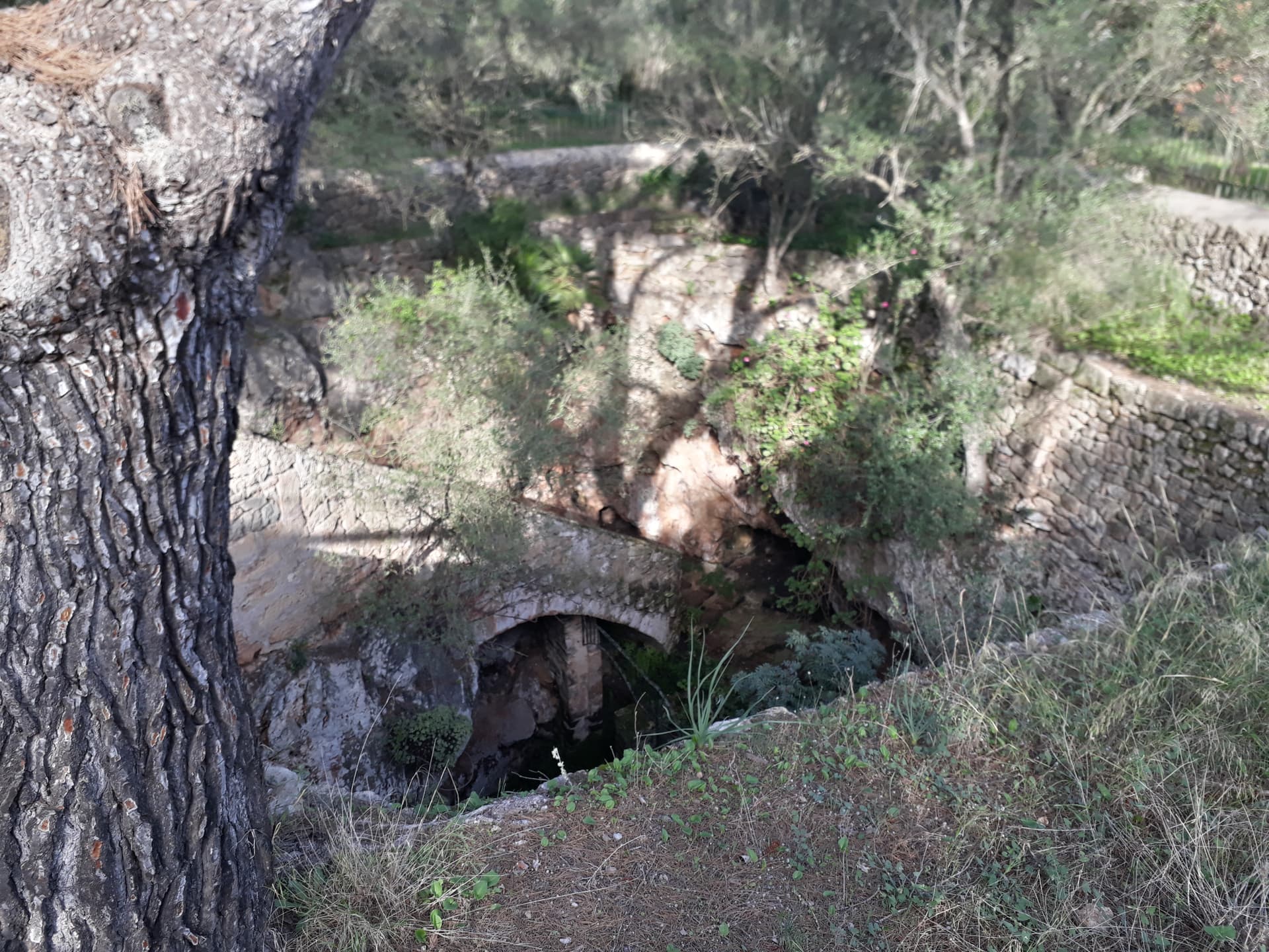
From Platja de Muro I headed north down the gravel road then turned left along a track/footpath to Cova Sant Marti which is an underground chapel from what I can make out.
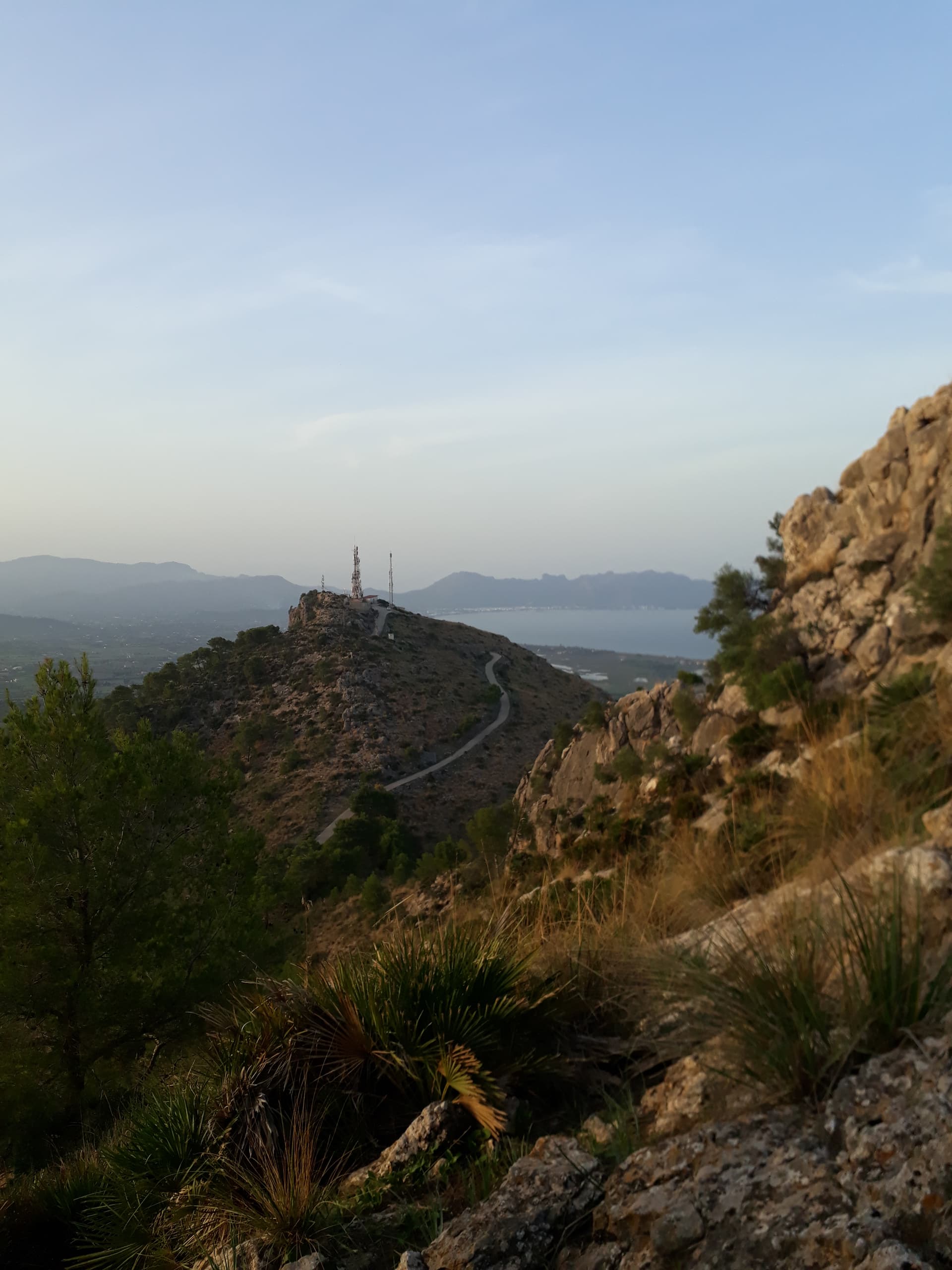
Carrying on along the track brings you to the main road (MA-3470) which you cross and follow the nice stony track through the woods to the tarmac road which leads up to the radio transmitters. The sign warns of lots of hazards ahead.

The sign didn’t warn about the imminent danger - mosquitoes. As the temperature was easing and wind was dropping they came out in force and due to the heat/humidity the repellent I had sprayed myself with earlier had all been sweated off and they thought their dreams had come true.
I survived the walk up the tarmac road and got to the widened area on the hairpin and took the well trodden path up the bank, however this proved to be a mistake as it faded out quite quickly and I wasted a lot of time searching for a route (and getting eaten) before retreating back to the road. The correct path is further up at an even wider layby just before you get to the radio transmitters.
The ascent was straightforward with a cheery hello to a group of scottish rock climbers having an argument about who was belaying who. The walk up the slightly polished rock slab was straightforward with plenty of footholds, but as I said to @G4OBK coming down is the difficult bit.
The summit was activated on 20 m and some of the operators mentioned that 10 m was open for DX so I tried that but didn’t get any replied. As the sun was setting I packed up as I wanted to get down before dark.
On the way down I spotted several small stone cairns which I followed hoping it would lead to an easier way down however these stopped very quickly and just brought me back to the rock slab. Although most of this was walkable with some thought I decided the fastest and safest way down was to slide on my backside down the steepest bits which worked well.
A long but beautiful walk back to the main road through the forest spoilt by the increasing number of mosquitoes meant that I decided to walk back along the main road to the hotel rather than along the footpath/gravel road to avoid any more bites - the passing traffic helped a bit by creating a breeze (coaches and lorries were a cause for celebration) but the courteous drivers on the island tend to give you a wide berth which wasn’t helpful in this case!
Total distance was just shy of 6 miles.
Serra de la Punta (EA6/MA-057) and Talaia d’Albercutx (EA6/MA-077)
Thursday morning was spent whizzing around the country lanes, checking out tea/coffee shops in the rural towns before dropping the hire bike off and lazing around on the beach in the afternoon. A day spoiled by a text from the holiday company saying that my transfer to the airport on Saturday would be at 5:30 am - 5 hours before departure ![]()
With no personal transport on Friday apart from my feet, and no summits within walking distance I decided to give the buses a go. Face masks are still compulsory on public transport, which made me miss the early bus as I had forgotten mine and had to go back and fetch it from the hotel room.
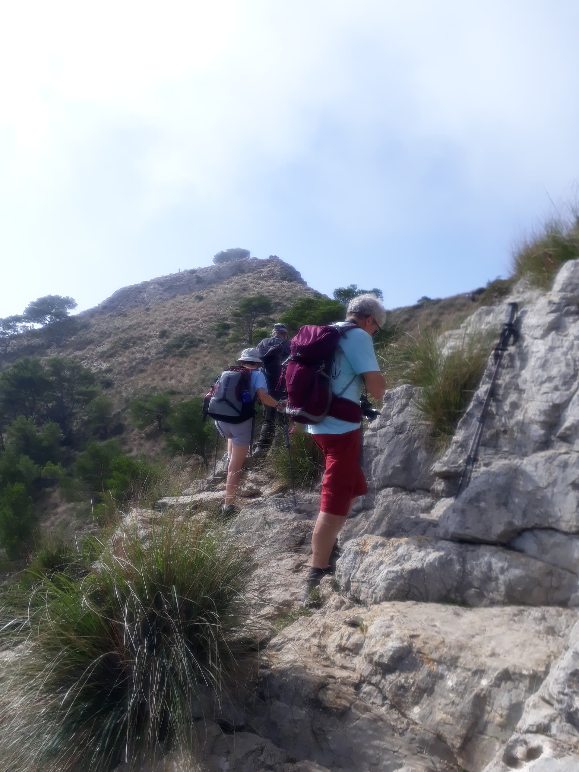
The bus system seems really well set up there, with a simple zonal ticket system which lets you change buses and pay using contactless card. I headed to Port de Pollenca, changing buses in Alcudia for a walk up Col de Siller and Serra de la Punta. A short walk along the road led me to the start of the pass which was initially a tarmac road, then a stony track before turning into a rocky path.
I thought I was following the route from SMP that @G4OBK added however I ended up starting along the “path” shown on OpenStreetMap which was vague on the ground and I ended up going off course many times. Every time I got back on route the path I was following took me off route again. There were stone cairns for a while, then they disappeared, only to reappear later on.
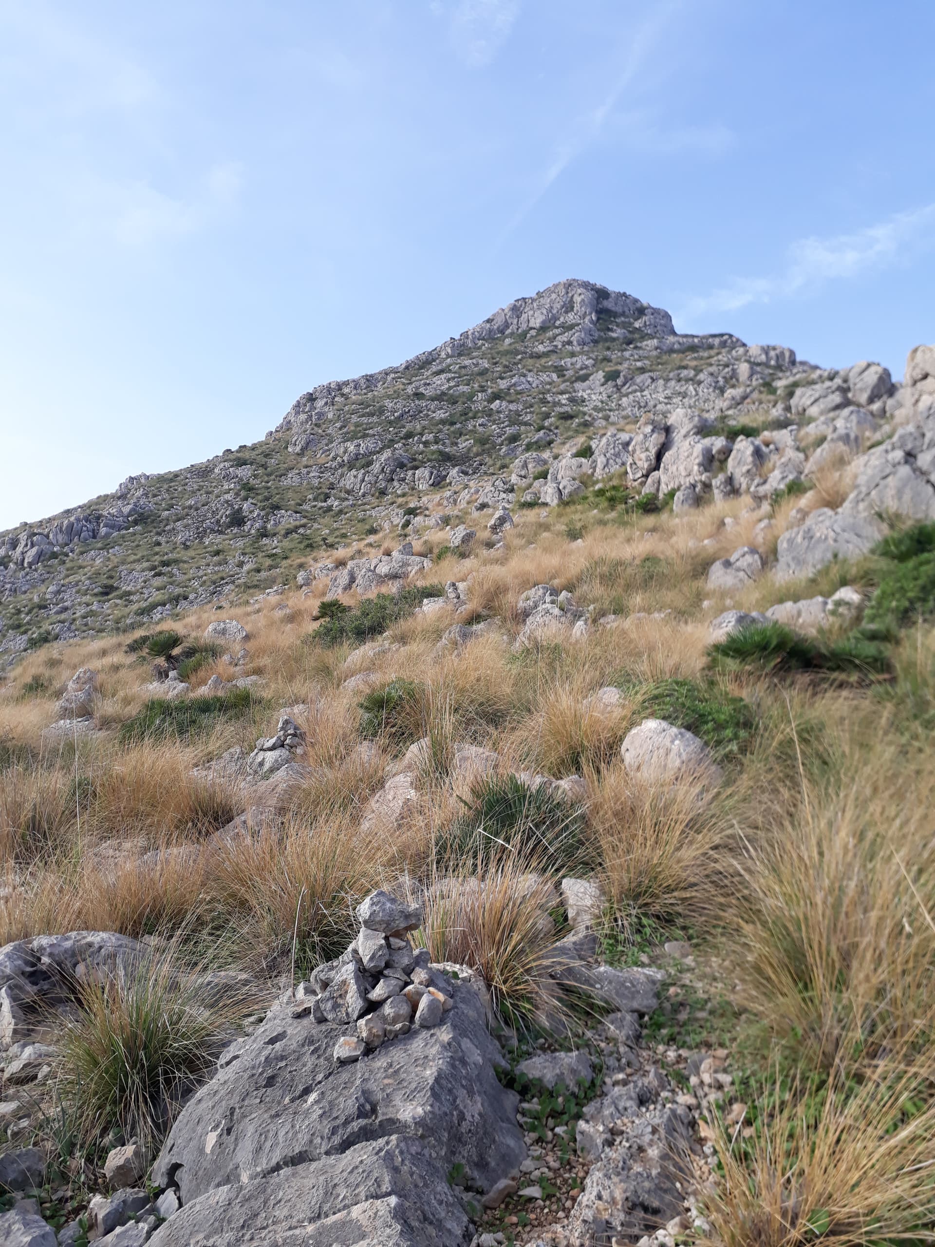
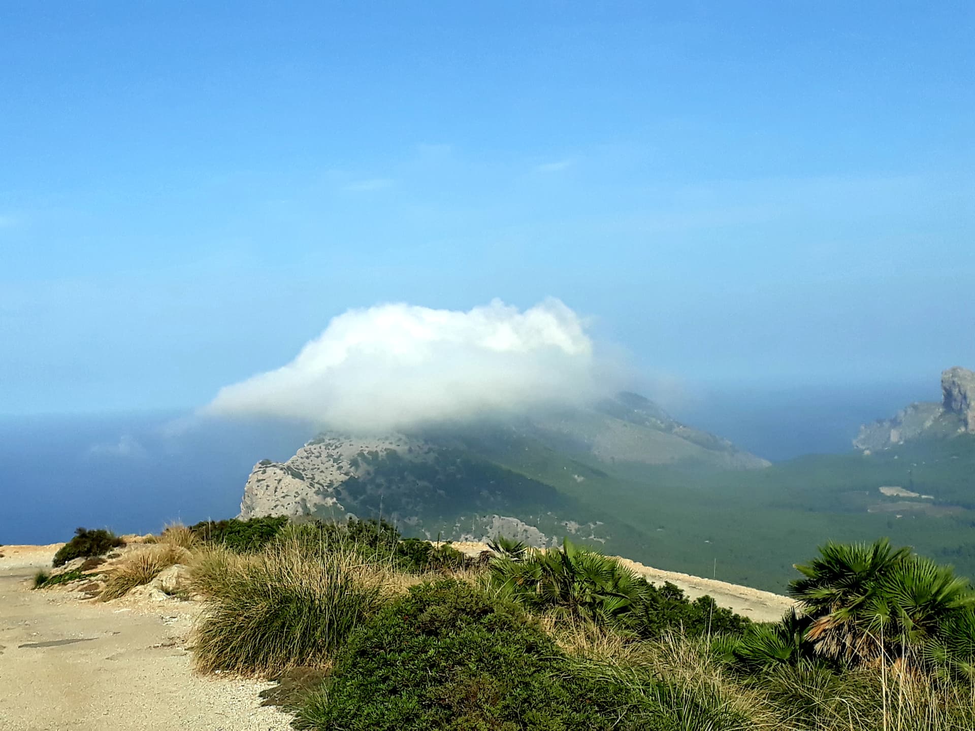
The going was hard work, climbing from boulder to boulder with the odd bit of narrow gravel path between. Following the stone men took me around the north side of the summit, doubling back on myself and bringing me to an almost vertical climb. Unsure if this was the correct route, and no confident I could easily climb back down if necessary I backtracked and descended a bit to find another route from the more gentle south side up to the summit which had stunning views all round.
There was plenty of space on this summit for the antenna with the pole wedged in a crevice in the rocks, and contacts were made on 40 m, 20 m and 15 m.
I tried to find a descent route down the south face but there was nothing obvious. I was unable to find the route I had originally come up so had to carefully find a new route back to the ridge and the stone cairns, and find my way back to the col.
I had run out of water part way down the mountain so found a supermarket on the outskirts of Port de Pollenca where I got more supplies and planned what to do next. As it was only 2 pm, and there was a bus due shortly I found my way to the bus station on hopped on the 334 bus which runs to Formentor Beach for the short trip up the pass to Mirador del Colomer, from which it is a short 1.5 mile walk up the road to the top of Talaia d’Albercutx.
I set up on the summit slightly down from the tower which several people climbed into while I was there (i didn’t - I didn’t know you were allowed to).
Initially I set up the pole between two rocks and lashed it to them however just as I was putting out the second leg of the dipole, the pole fell and I had to wind everything back in and set up slightly further down the hill where I was able to use some stones to wedge the pole in the crevice as well as lashing it on. Unfortunately, this again meant that I couldn’t get one of the 40 m legs out so 20 m and 15 m were used for the activation.
After calling CQ for a while and getting no more replies I packed up and saw there was a bus back in 40 minutes time which was perfect. I marched back down and got to the bus stop with about 10 minutes to spare. Total walking distance for the day 7.5 miles.
I went to the kiosk to buy an overpriced drink just as the bus pulled in, 10 minutes early.
Fortunately I was able to jump on the bus as the driver didn’t wait as his clock was 10 minutes fast! After changing in Alcudia again I was back at the hotel for 6 pm which was ideal and rounded off a good week away and I don’t seem to have lost/broken anything which counts as a success for me.

