Lucerne is located in central Switzerland and is a gate from the central parts of the country to the alps. One of my first questions when preparing for SOTA back in spring 2017 was: “Where are the next real SOTA summits?”
The just installed SOTA Goat app provided some clear hints: Mount Pilatus (Tomlishorn, to be precise, HB/NW-011, 8 Swiss points) and Matthorn (HB/OW-015, 8 Swiss points).
It took me more than one year to visit them – until yesterday, October 6, 2018. Both can be integrated into a trip of one or two days. There is an excellent infrastructure for getting to and stay on Mount Pilatus, since this is one of the top hot spots for tourists in Switzerland and is included in most “Switzerland within 3 days” trips. Be aware: it is Swiss, so the prices are also Swiss, but I consider the location excellent from a SOTA and a touristic perspective.
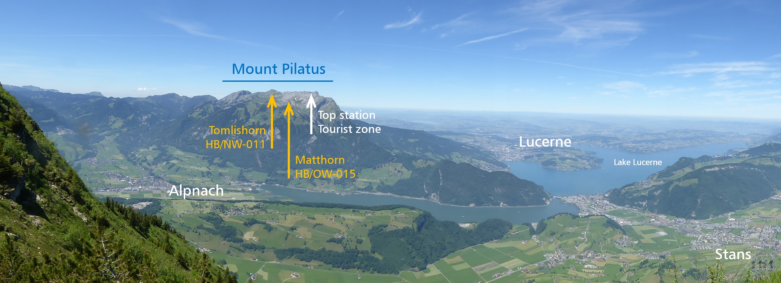
The ridge of Mount Pilatus seen from the south from Stanserhorn, HB/NW-015.
Mount Pilatus can be accessed with a cogwheel train from Alpnachstad and by a gondola with two sections and a new cable car to the peak from Kriens. Both together is sold as the “Golden Round trip” resp. the “Silver Round Trip” since you can select for the trip back or to Alpnachstad among the boats of Lake Lucerne or the narrow-gauge train. There are even two hotels on the peak, both renovated recently. The old style “Berghotel Pilatus-Kulm” from 1890 has modern rooms now and offers overnight packages with a dinner in their great historic hall.
It is recommended to start a SOTA Pilatus trip early, so the overnight stay might be an interesting option for a special experience – good weather provided on both days. I recommend doing Tomlishorn first and Matthorn second because of the tourist floods on the quite easy Tomlishorn. Each summit and its hiking trail from Mount Pilatus gondola/train top stations can be seen clearly from the other summit; this helps preparing the ascents or look back to the just lived hiking experience.

View from the 1st section of the gondola: Kriens (left), Lucerne (right and background) . . .
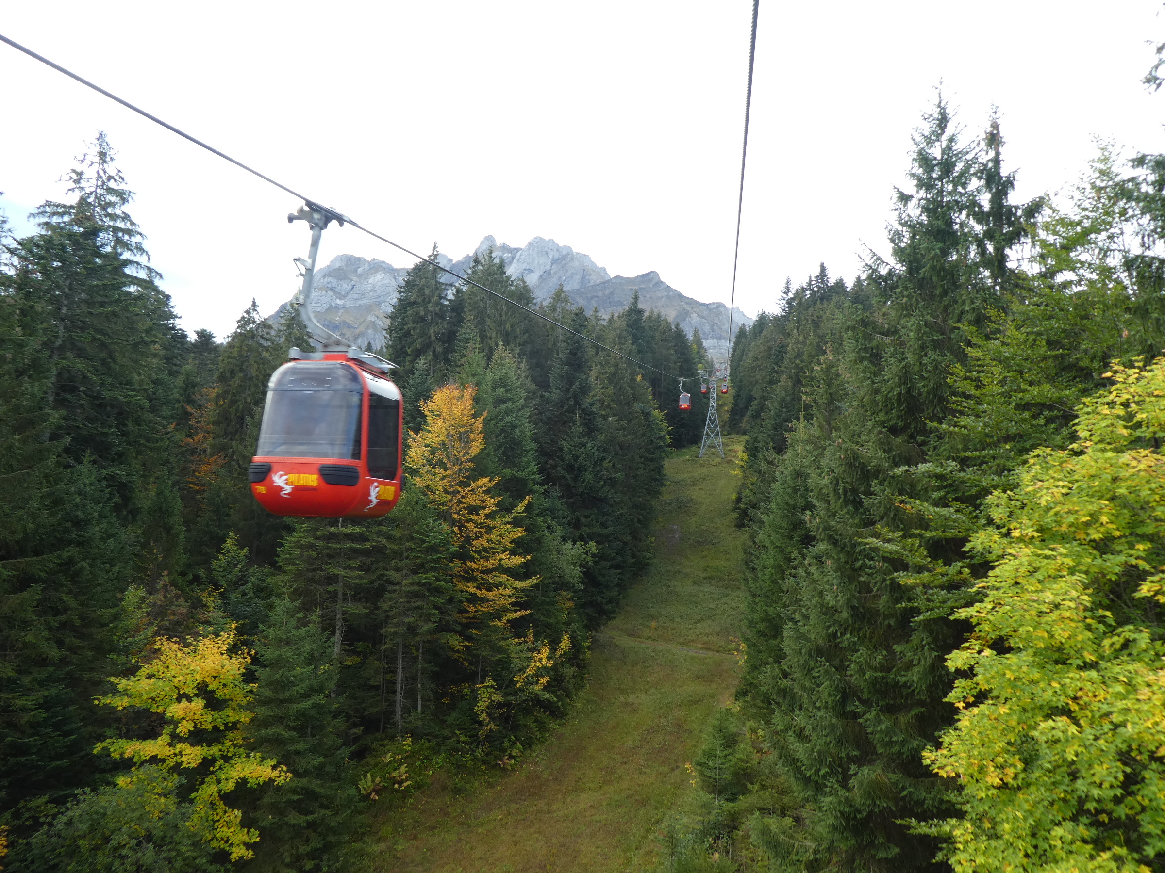
. . . and still far away from the summit in the background.
My characterizations of the two summits:
- Tomlishorn, HB/NW-011: for hiking tourists, flat ascent of about 35 minutes with an easy final short zigzag trail up to a small summit area, good outlooks to both the Alps and the hilly Swiss Mittelland, T2 grade hiking, good hiking boots not mandatory but recommended (no flipflops please, hi).
- Matthorn, HB/OW-015: for hikers, descent and ascent of both about 200 meters taking 65 minutes, secluded, silent, good outlooks to the Alps. T3 grade hiking because of a short section with steel ropes through some rocks – take regular care there, the steps are very well prepared and viable. Good hiking boots mandatory, hiking poles useful.
Both trails start on the big terrace/patio just outside the station building, between the two hotels.
Part 1: HB/NW-011, Tomlishorn
To be clear: the SOTA summit Pilatus is not the peak Esel (donkey) just beside the top station where the antenna of the 70 cm FM repeater is installed. This peak is too less high by 10 meters compared to the peak Tomlishorn. This fact extends the time needed for an activation by at least 1 hour. But the hike to the SOTA summit is a nice hour with magnificent outlooks!
So follow the shoe sign “Tomlishorn 40 minutes” – it will take you probably only 25 to 35 minutes. There is a marvelous trail for everyone, suitable even for a stroller or a good walking frame in the first part, hi. The second part is really T2, after a staircase, because of the uneven trail ground. You can see the Tomlishorn summit there for the first time. Don’t get afraid of it, the summit platform and its access from the main trail have been well designed decades ago. But it is small, with four wooden benches on it. A lovely place!
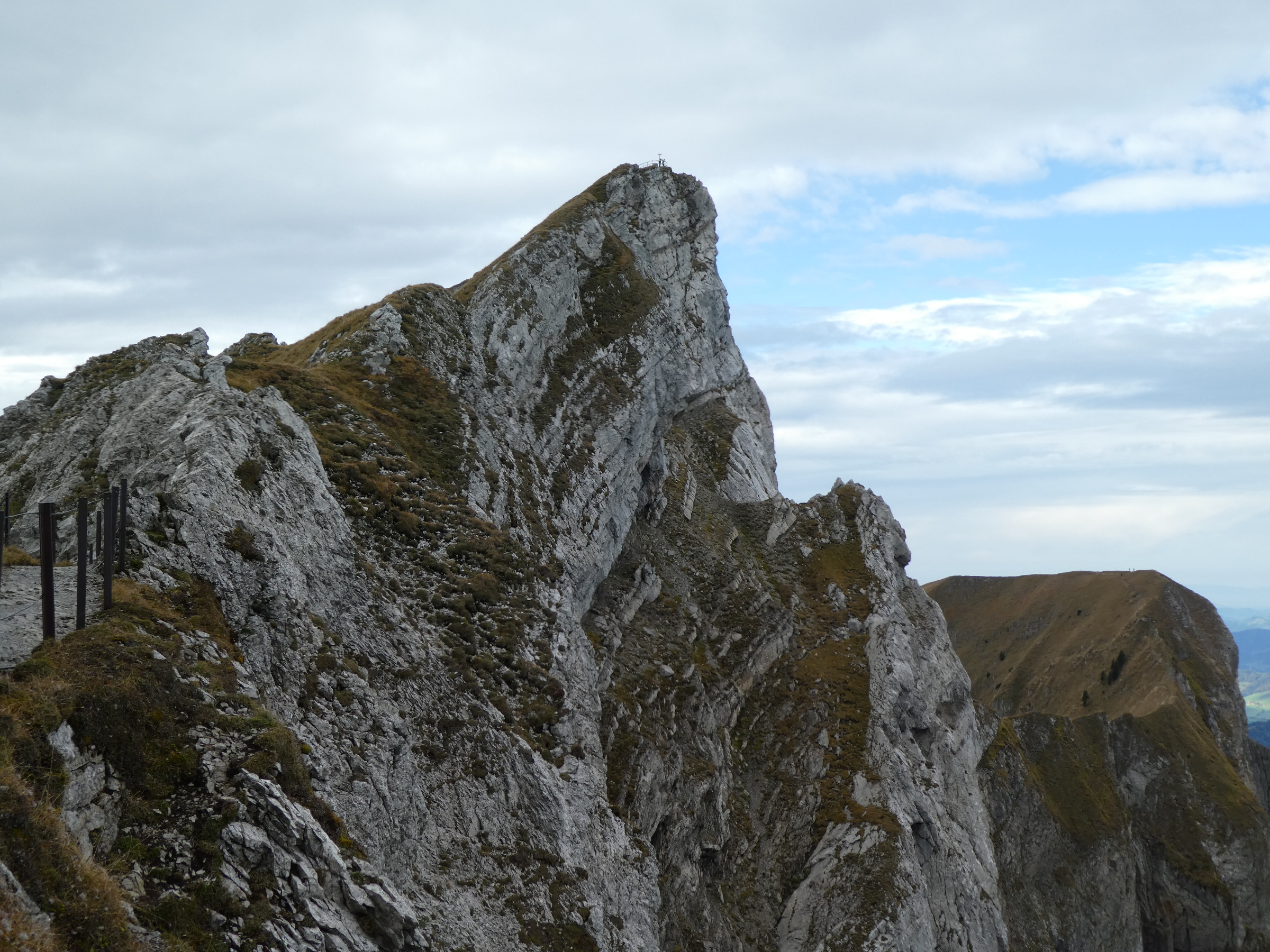
First view of Tomlishorn – impressive, huh?!
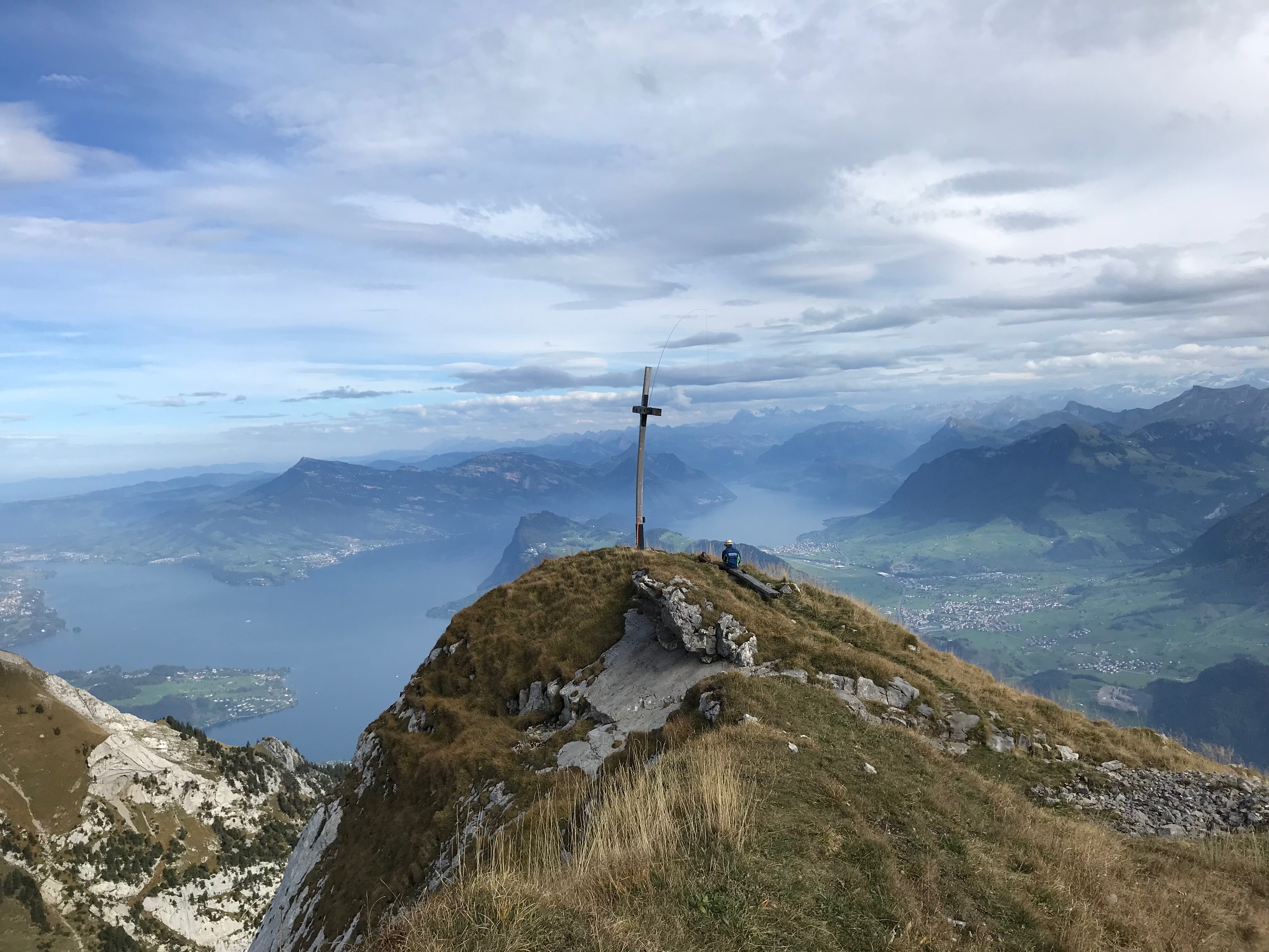
I was early enough and the tourists were not yet there, only some domestics used to get up early. So I just sat astraddle on one of the benches, and this was very comfortable. Tomlishorn is an extraordinary place because of the outlooks on both sides of the Pilatus ride: to the south into the Alps, to the north onto the Swiss Mittelland plateau. This may be promising for a 2 m or 70 cm VHF activation which are more difficult in Switzerland than e.g. in Germany or Austria.

Klimsenhorn summit, Klimsenhorn chapel and the main railway station of Lucerne, seen from our first summit Tomlishorn.
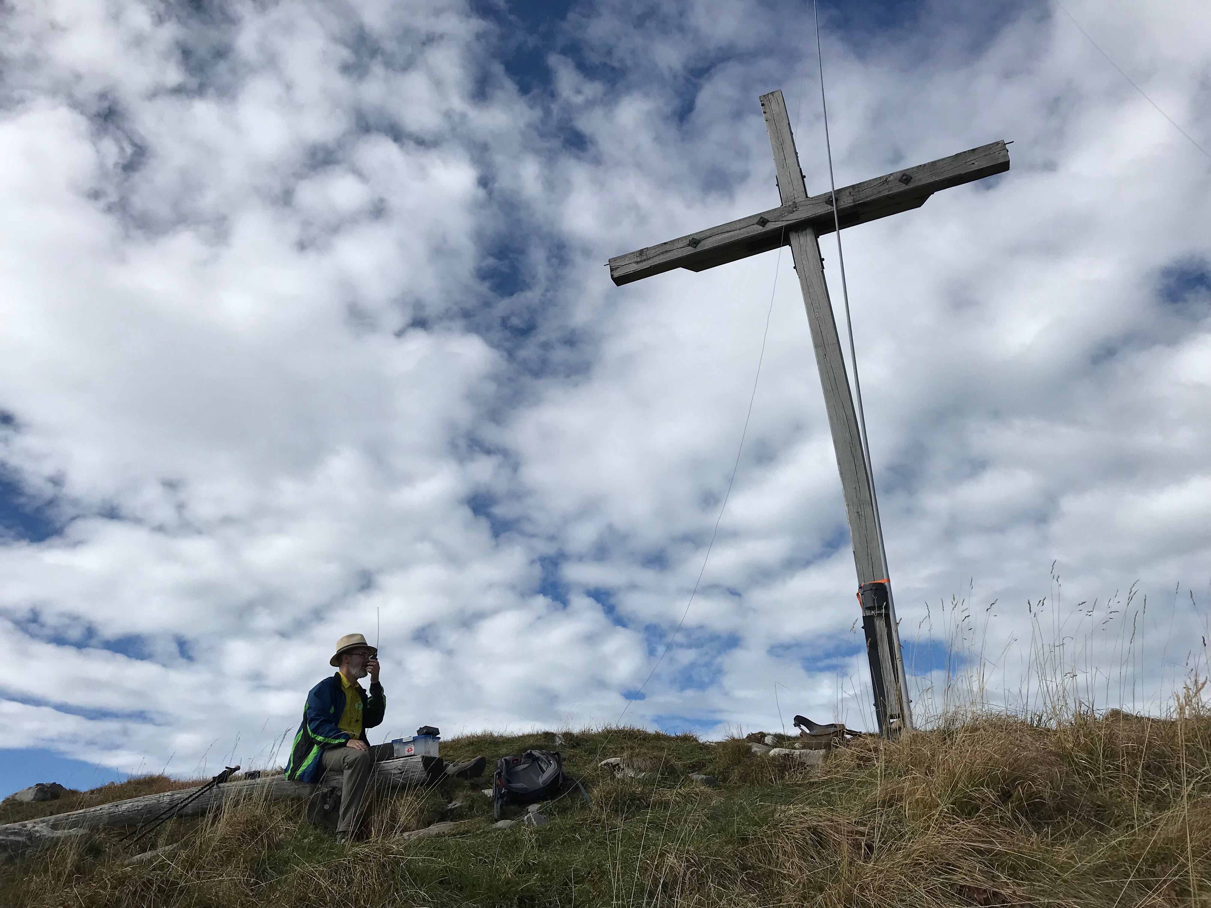
We attached the 10 m pole to the corner pole of the railing, and the EFHW 20/40 did a good job. My partner took care that the tourists didn’t walk into the antenna and answered questions. It was a beautiful Saturday with numerous S2S contacts. The first one even on VHF to Christian, HB0/HB9GIN/p on Kuegrat, HB0/LI-008, a summit in their first, western row of mountains.
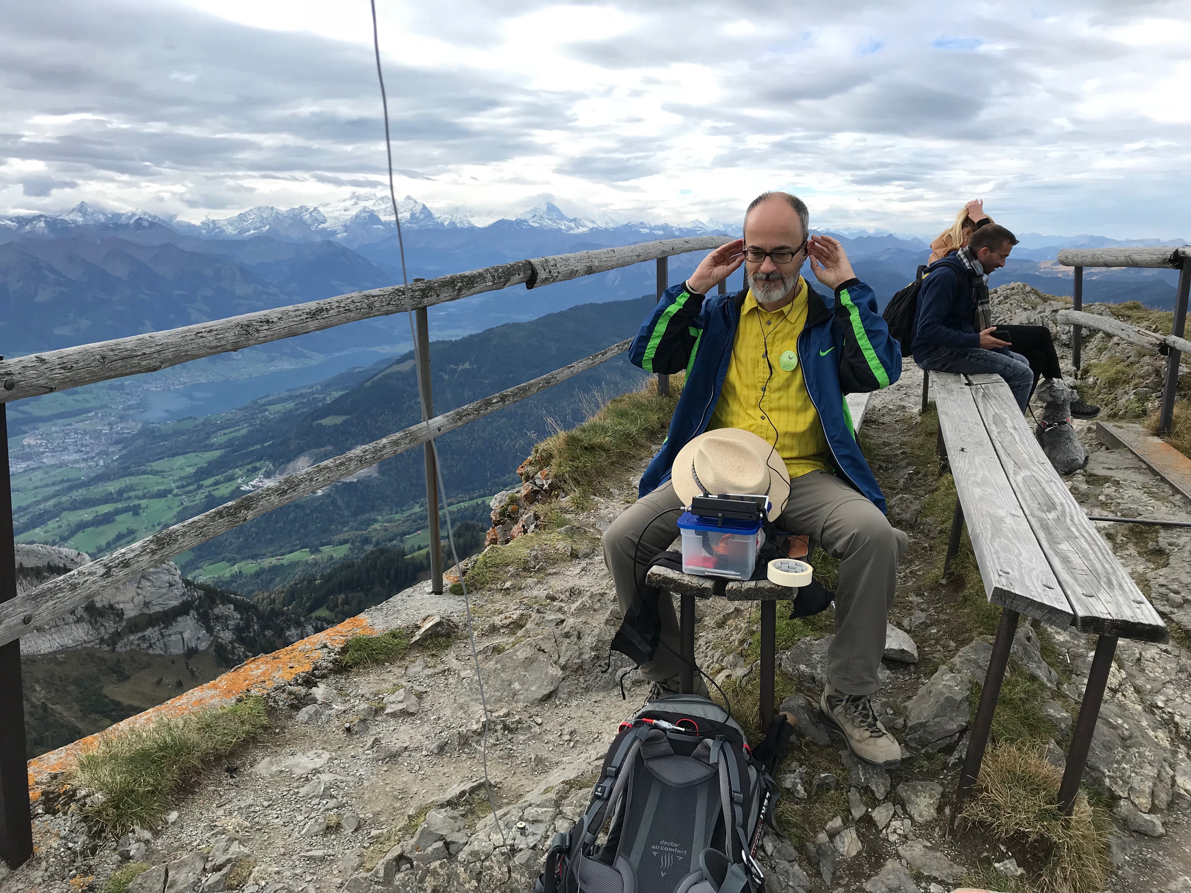
No . . . I’m not listening to your SOTA signals but preparing the Shure earphones.

The nice summit zone of Tomlishorn and very few hikers, just at noon local time.
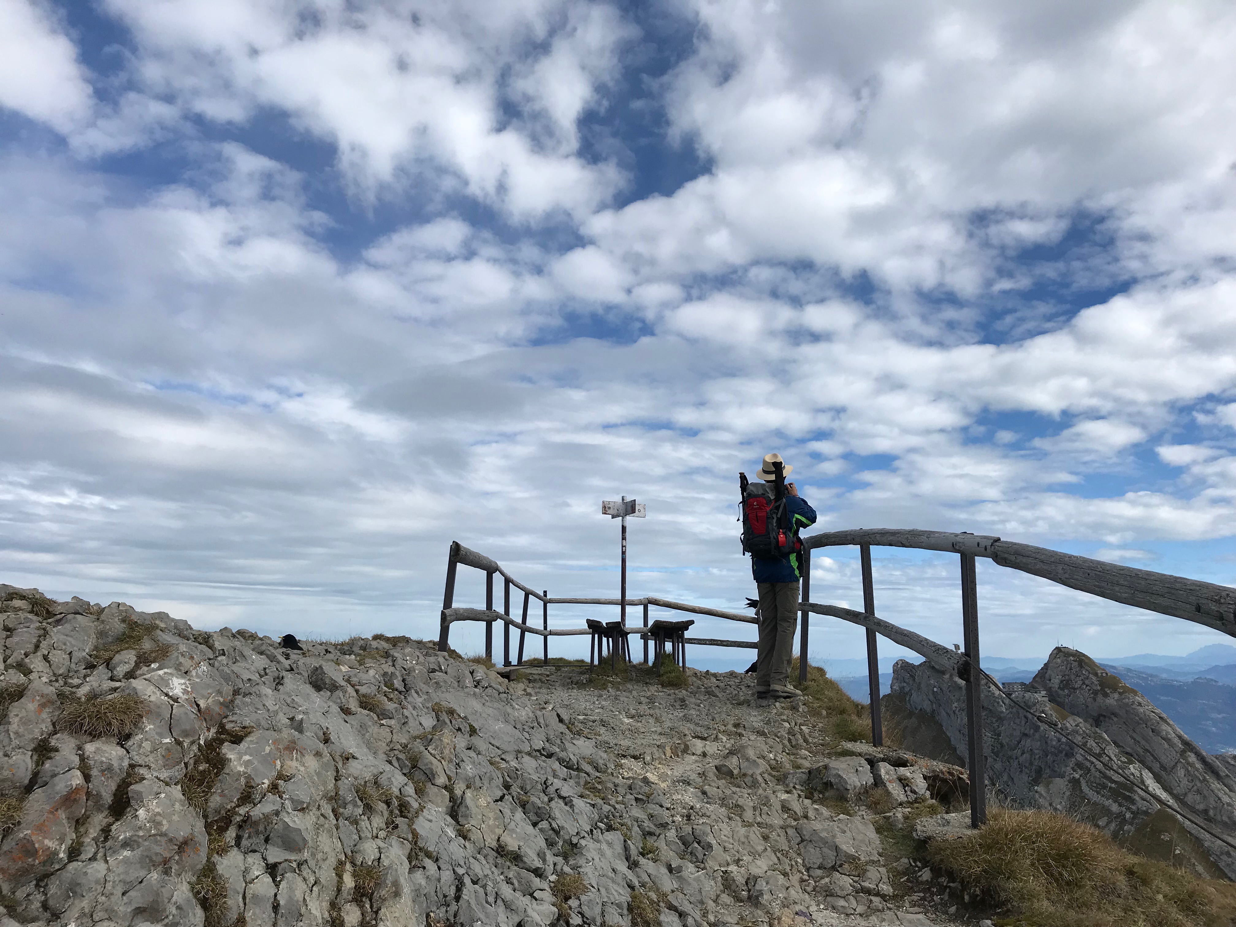
HB9DIZ leaving the Tomlishorn summit - no visitors for some minutes.
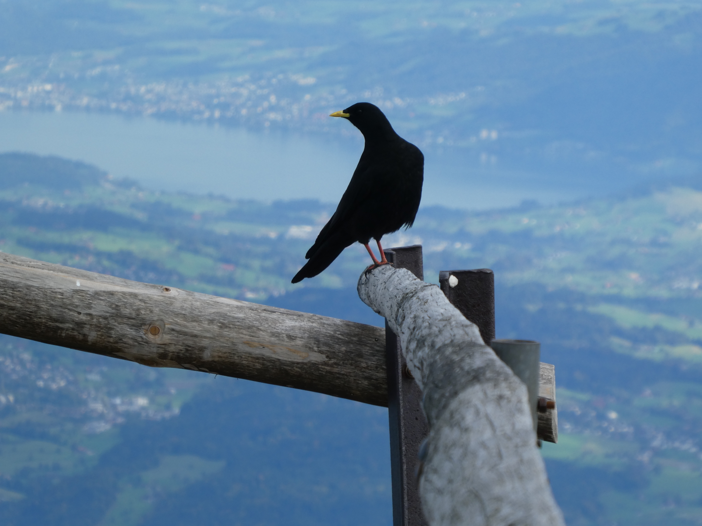
Alpine jackdaws, always very curious and always on forage for food.
Signing off shortly after noon, we went back to the station and had lunch at the self-service restaurant – “Älplermagrone mit Öpfelmues”, a traditional meal with pasta and cheese sauce, a good base for the second hike to Matthorn!
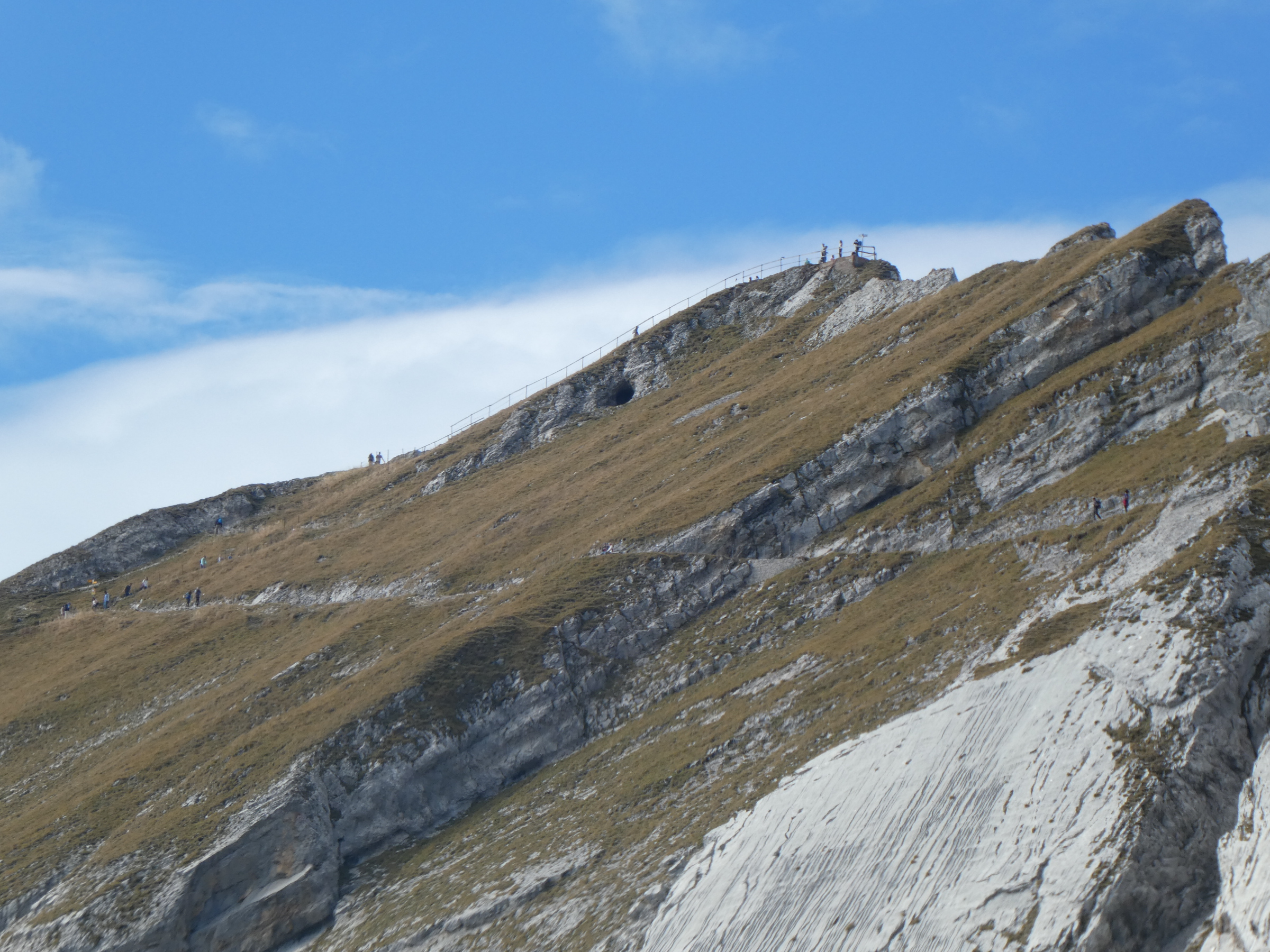
And a glimpse on the second peak and the trail:
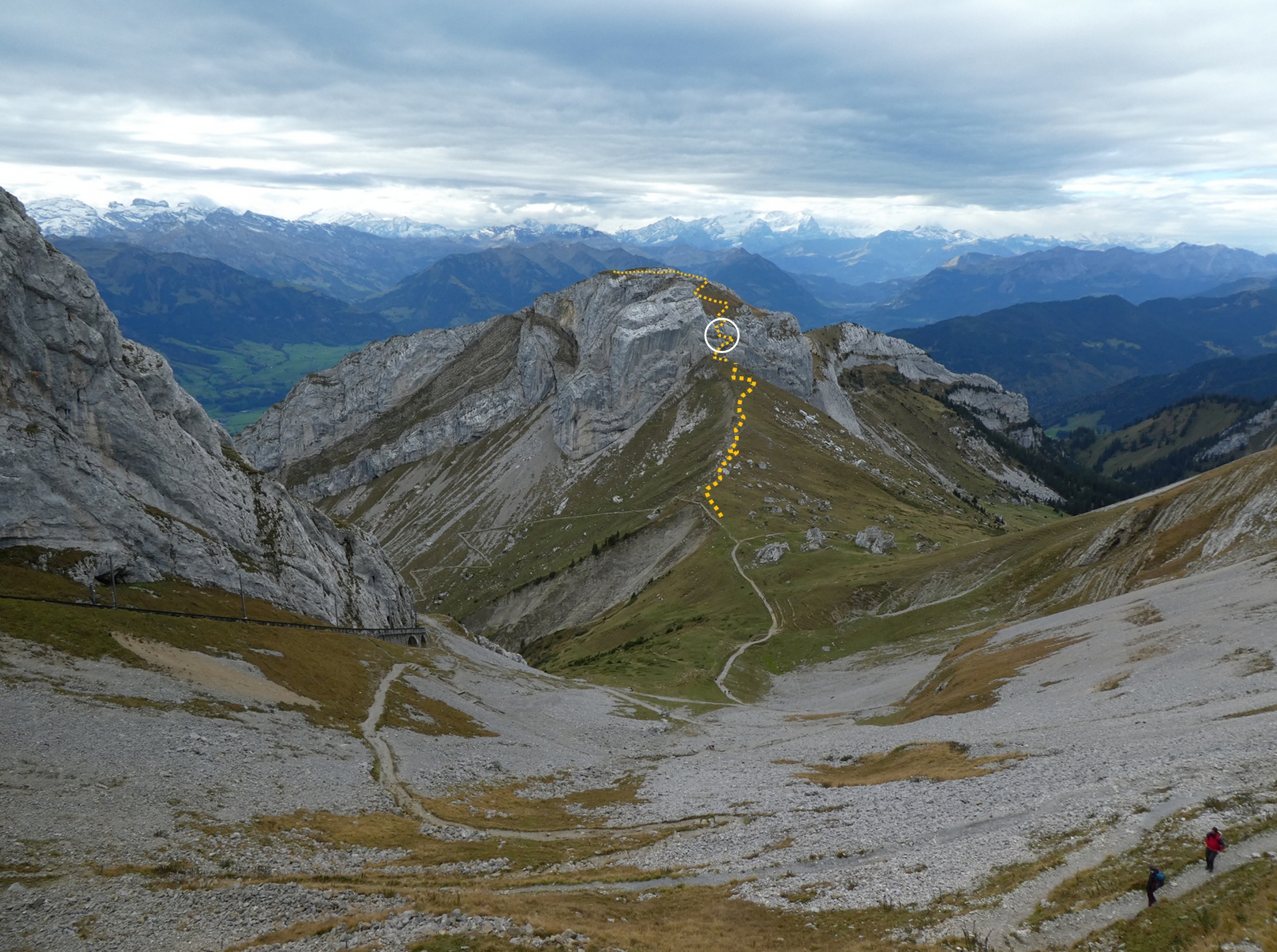
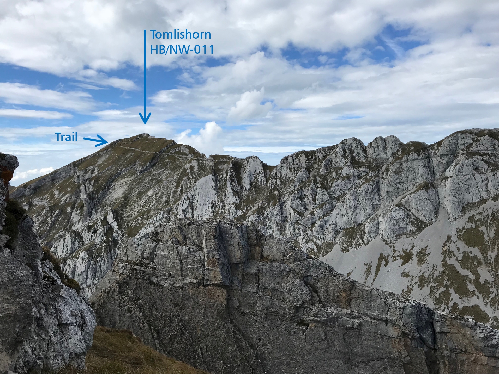
General view, Matthorn seen from the trail head. See details for the secured part (circle mark).
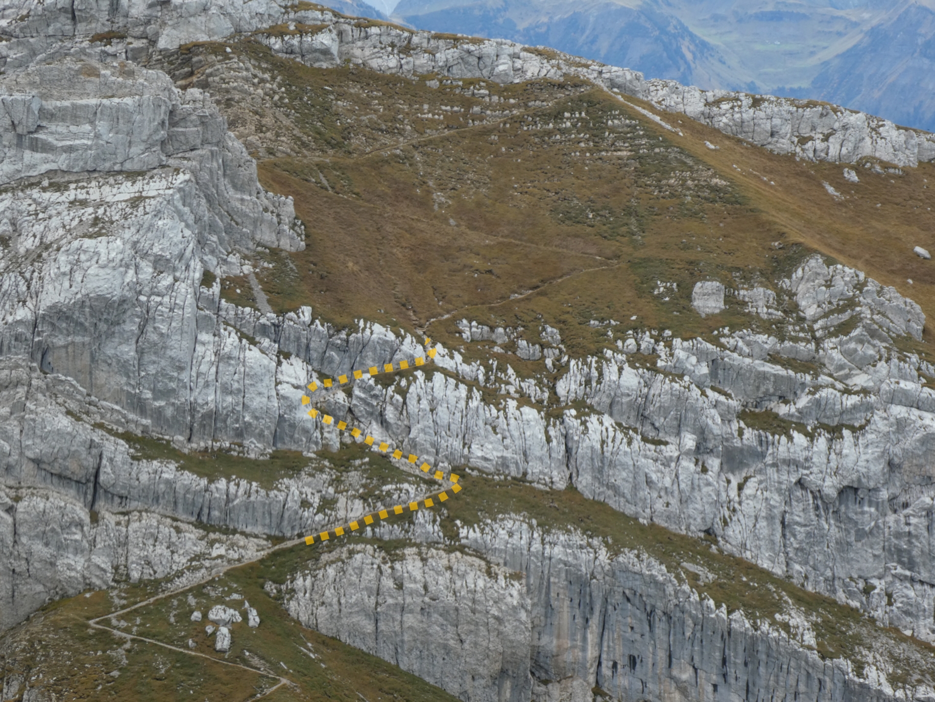
It certainly looks terrible, but it’s well viable for experienced hikers.
Part 2: HB/OW-015, Matthorn
The best preparation is to view the ascent trail already from the Tomlishorn activation. You have good insights from above, even on the short section with steel ropes.
The second trail starts also on the big terrace. Take the two staircases at the railing and descend on the wide zigzag trail southwards down to the saddle between the Pilatus ridge and the Matthorn summit named Chilchsteine, at 1865 m.a.s.l., around 200 meters lower than the train station. You need your hiking boots and likely your hiking poles. The ground is covered with gravel and not easy-going.
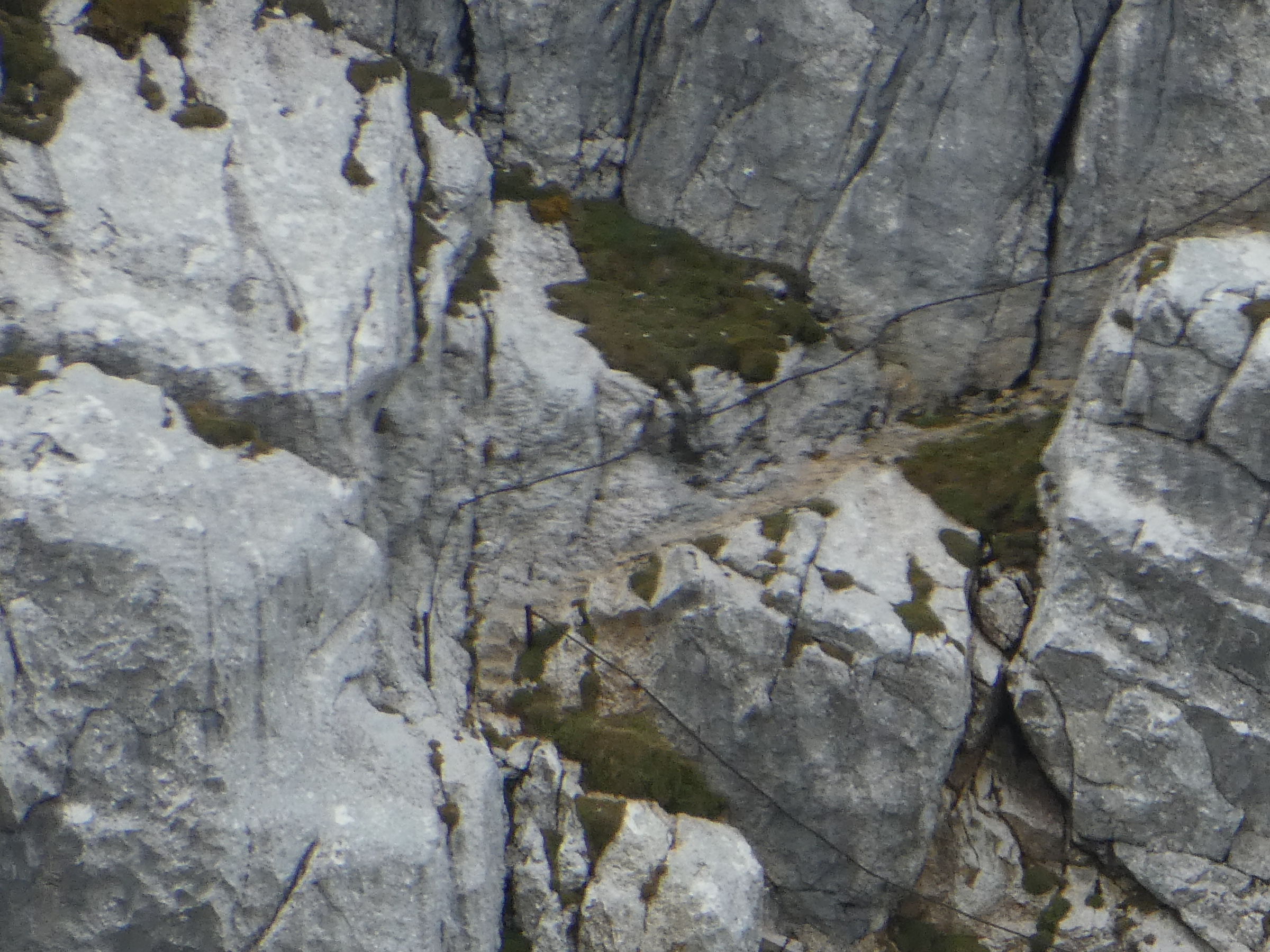
It is impressive now to look back . . . and up to the Pilatus ridge with the station, the air control radar and to the hiking motorway to the Tomlishorn summit, busy now with lots of tourists. And you can’t imagine that you had been hiking there – in this wall! Someone played alphorn up there, and this was an overwhelming moment. Check out the scenery between the two SOTA summits, the layout of the steep cogwheel railway line, the rock waste. We saw various chamois and even young alpine ibices.
Take care not to miss the trail to Matthorn after the saddle since there is no sign post for Matthorn. Simply ascend on the above resp. western part of the fence, and you can see the path immediately. Ascent this zigzag way up to the wall where the rope starts. The secured section forms an “S” letter. Take it slowly, they have prepared this section well and made even viable steps into the rock. It was well viable for me. The remaining path is narrow but always well viable.
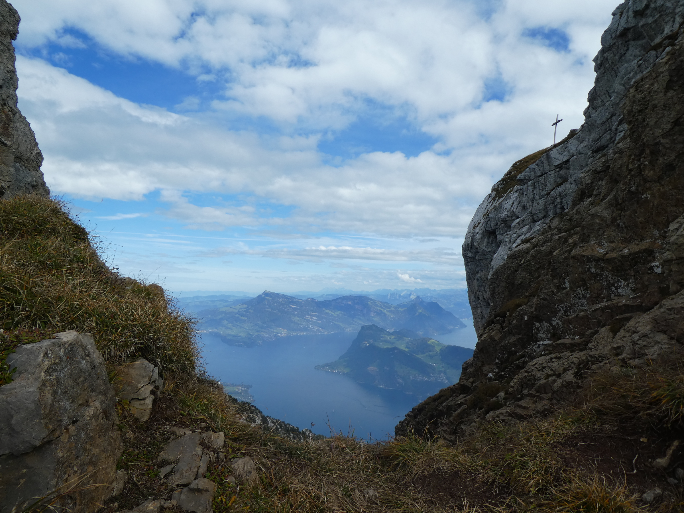
The summit cross is close: marvelous outlook from the second last turn to Lake Lucerne and SOTA summits Rigi (HB/SZ-021, left side in the background) and Bürgenstock (HB/NW-019, right side, in the foreground).
The last section along the ridge to the summit leads you to the southern exposition of this huge summit top with avalanche constructions and free sight to the valley on the airfield of Alpnach and the state of Obwalden where Matthorn as a HB/OW summit belongs to.
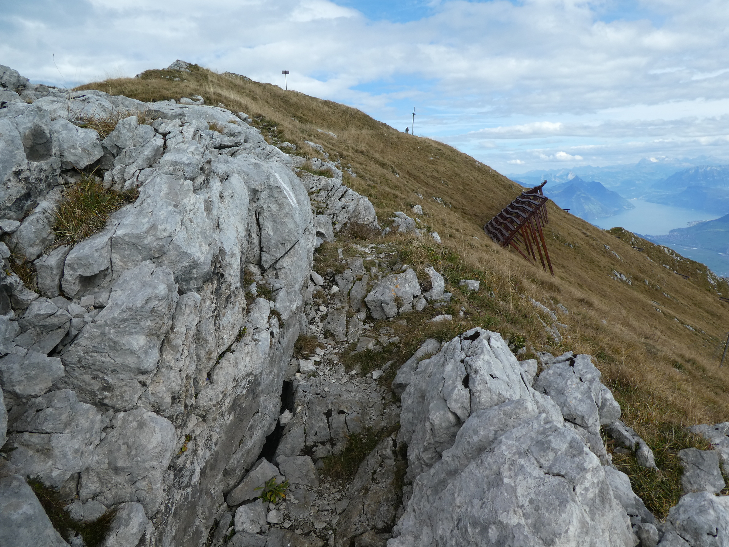
Last part of the trail to Matthorn summit.

View down to the main valley from Lake Lucerne to Col Brünig: the state Obwalden (HB/OW) with Lakes Sarnersee and Lungernsee reflecting the sun.
We used the summit cross to attach the mast, there is also a compass sign, but the cross is in a good distance from the bench, and operators like to use available benches, hi. VHF is a bit limited compared to Tomlishorn since the main ridge of Pilatus covers the north. So I catched Christian on their second HB0summit only on shortwave. And Mark, HB9DBM, retracing my footsteps to Biet, HB/SZ-016, and Stock, HB/SZ-027, offered me two completes – thanks!
Trying a second contact on VHF with Christian, HB0/HB9GIN/p on HB0/LI-011, his second summit. No success this time, but later on shortwave 40 meters.
Doing the common task: activating on shortwave, but this time in front of a little paradise – Lake Lucerne from above.
And: don’t miss the last train resp. the last gondola! We headed back the same way.
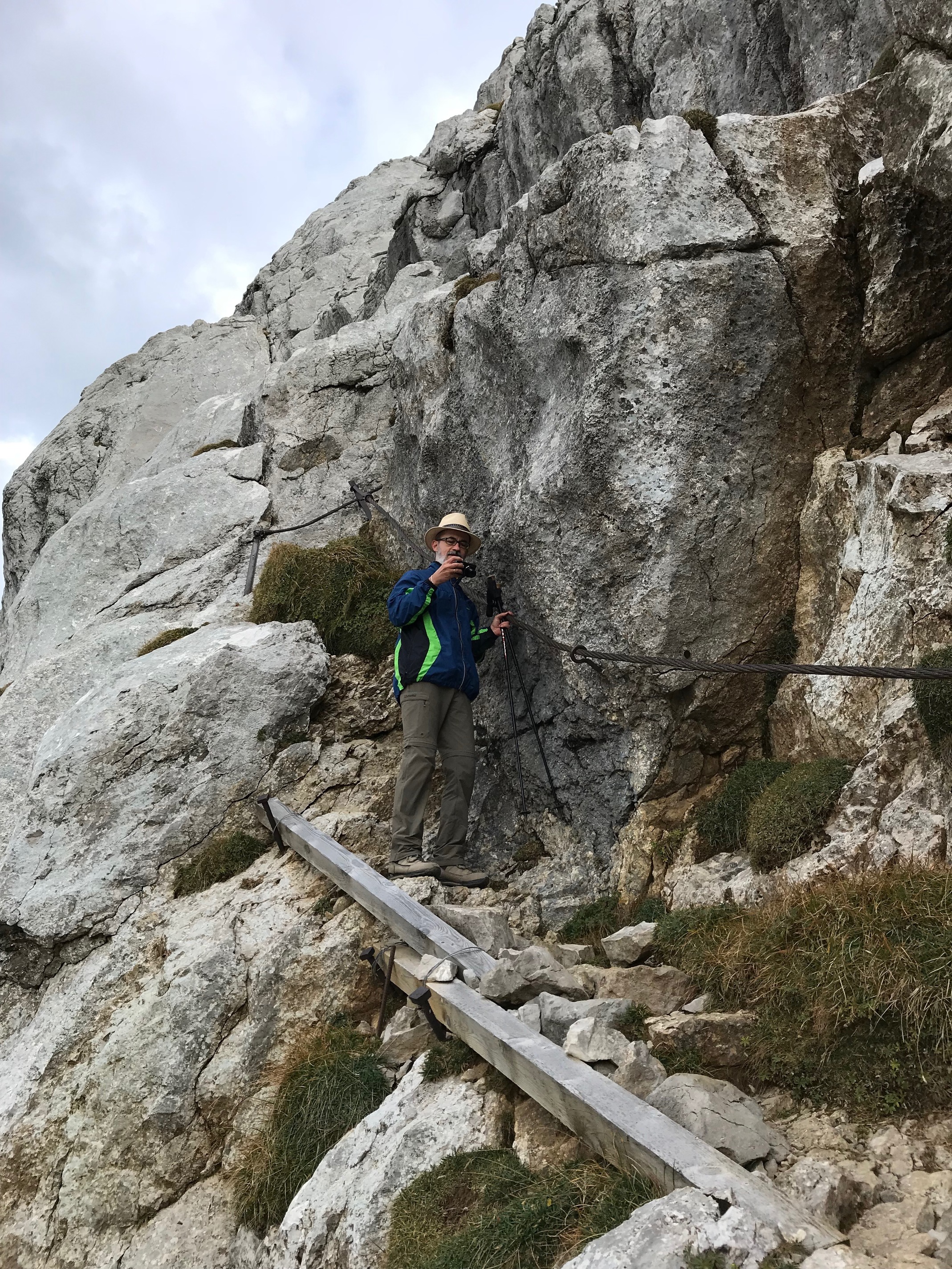
Being careful but already a bit experienced from the ascent: HB9DIZ, taking pictures, and the rope.
Here again looking back to the first peak and the trail:


Close-up of Tomlishorn summit and the last visitors of this beautiful day.
Important Disclaimer: In no case will the author of this report be liable for any direct or indirect damage resulting from the use of information of this report.
Vy 73 de Markus, HB9DIZ