Persistent wet and stormy spring weather over the Southern Alps has been disrupting things the last couple of weeks, resulting in repeated short-notice breaks from work. With winter bonus season still in swing, and anywhere west of home off the menu due to the weather, this has provided the ideal impetus to head east and pick up some of the more challenging 2- and 4-pointers in Coastal Otago.
Trip 1: Silverpeaks
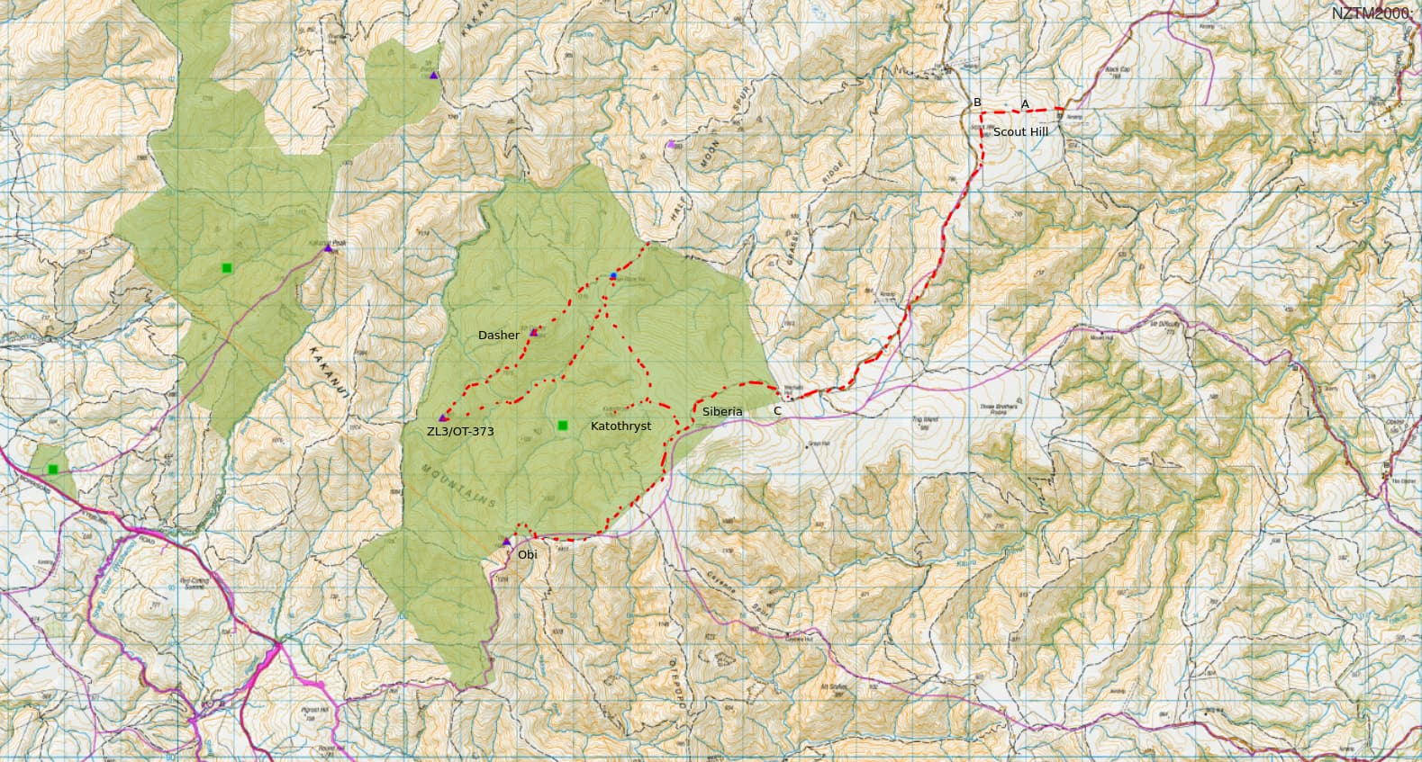
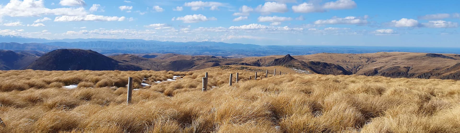
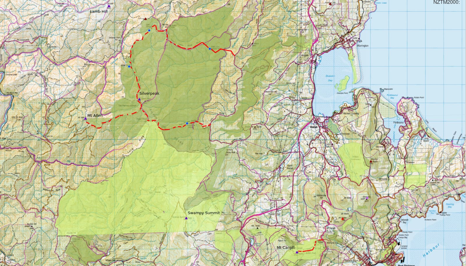
The Silverpeaks form a low range of hills dividing the Dunedin coast from the Strath Taieri. With their highest point (Silverpeak - ZL3/OT-436) at just 767m and thus only worth 2 points, they have always seemed a good winter SOTA target. However, only 2 of the 4 summits lie on maintained walking tracks; the tops of the entire range are covered in swampy, stunted, impenetrable scrub; and any realistic trip would require an overnight backcountry stay (or two day-trips from commercial accommodation) - all of which has led me to seek greener pastures elsewhere in the past. Time to put that to rights.
Day 0
I head over the Pig Root on a clear, still Friday evening and drive up the northern end of Mountain Track to the PJ Cox roadend. About 4km from the start of the walking track, a locked forestry gate across the council-maintained road brings me to a halt. Sure enough, the formed roadline departs from the legal road corridor for 50m and the forestry company have taken advantage of the fact to close access.
Returning to the coast I take the southern end of Mountain Track and 30 minutes later am back on the ridgeline, 4km from the start of the walking track, and faced by another locked forestry gate. Maps reveal the same scenario - a brief divergence of the legal road and formed road has allowed the forestry company to take the letter, rather than spirit, of the law and block access (in both cases they’ve planted out the legal crown-owned roadline in pine trees - so no letter of the law where it suits them, note!).
I park up, as I should have done 30 minutes ago, and start the additional 4km walk along the forestry road to the carpark.
The night is warm and still, and despite my mutterings abut ‘when it suits them’ forestry companies, I soon find myself enjoying the walk. The lights of Waitati / Blueskin Bay twinkle below me, the distant fairy-light chain of traffic along State Highway 1 joined further out by those of ships approaching the Dunedin Harbour mouth. The warm optimism of spring.
It takes just 40 minutes to reach the carpark and start down the PJ Cox track by torchlight. The PJ Cox Memorial Hut lies on the next ridgeline west of the forestry road, and we drop gently on soft beds of pine needles to the river before entering regenerating native bush and slippering up the clay-mud walking track back to the tops.
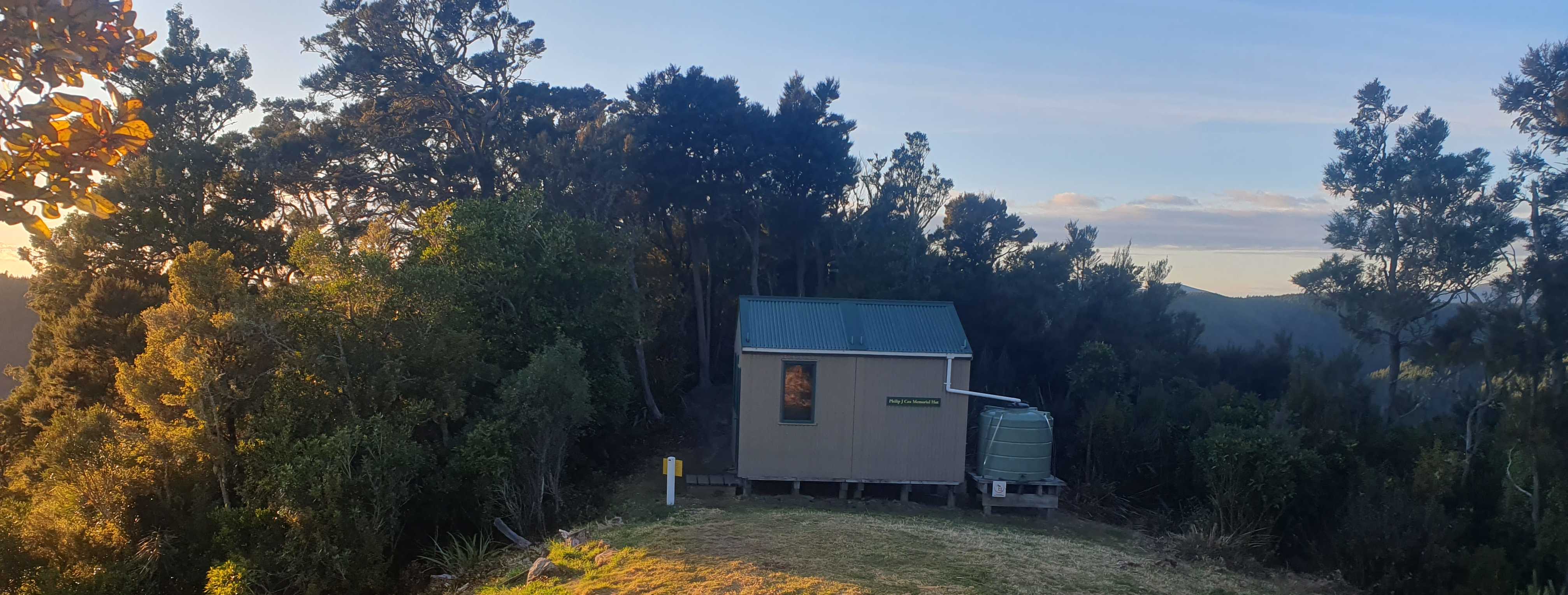
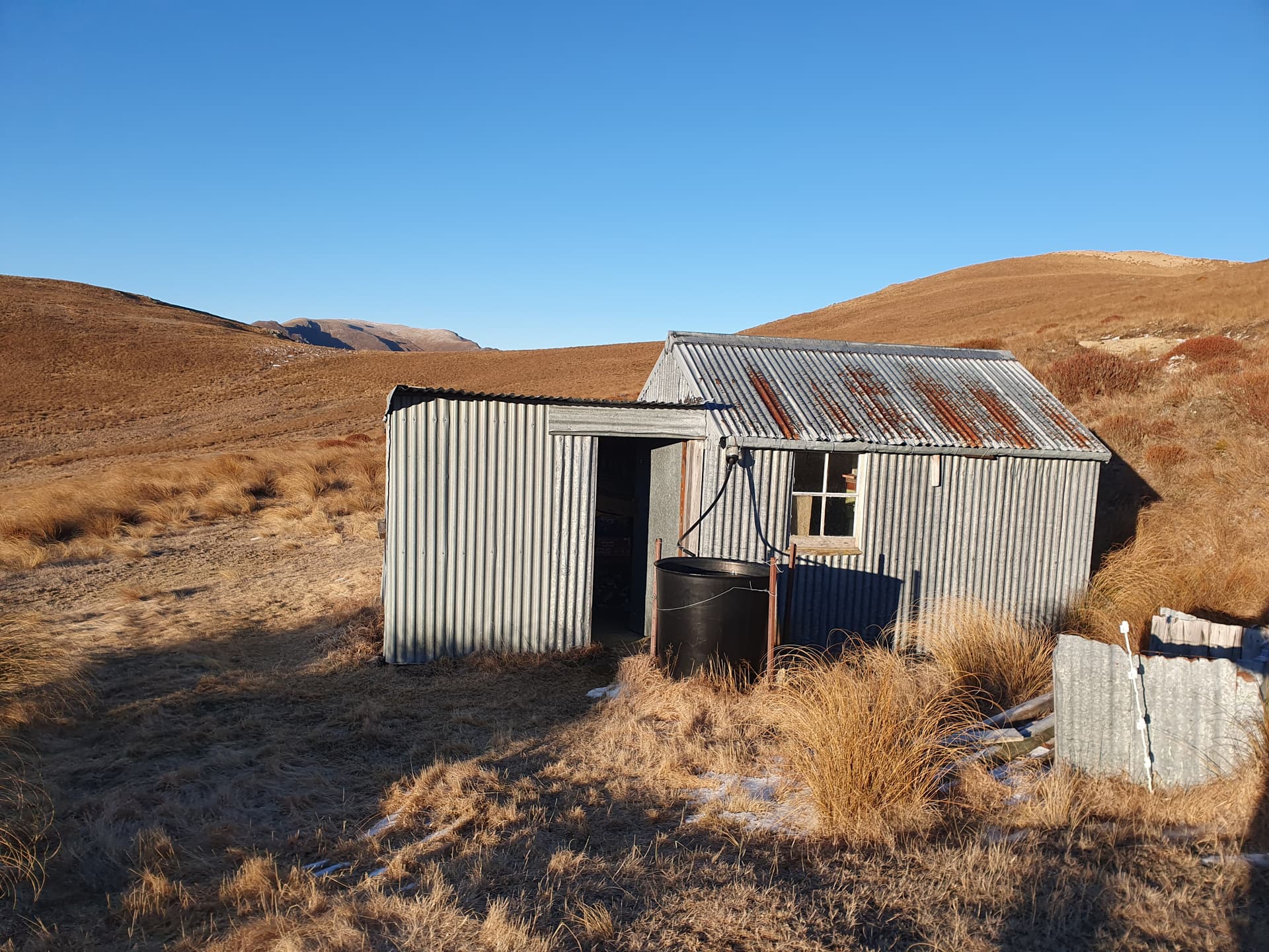
PJ Cox Memorial Hut (ZLH/OT-067), at just 2km (make that 6km) from the carpark is mostly used on Friday nights by those making the 2-day circuit of the Silverpeaks loop track, and wanting an early start. I’ve brought the tent just in case, but the hut is empty upon arrival and soon the EFHW is erected in the SOTApole outside, the billy is on the stove and dinner is underway. A newly-licensed local ham in my home town of Alexandra is working towards his DOClands award (DOC - Dept of Conservation, manage most conservation land in NZ) and requires contacts with 5 backcountry huts as part of that, so I’ve arranged to put the hut on the air as I cook dinner. 40m proves to be open to the Australian east coast, and I pick up five contacts with VK1, VK2, and VK3 as well as five with ZL1 thru ZL4, with 5/5 being the worst report. Things are working well.
Day 1
The plan for Day 1 is to activate Lamb Hill, ZL3/OT-439 and maybe a couple of HEMA summits ZL3/HOT-028 and ZL3/OT-029 before dropping to Jubilee Hut to camp for the night. These summits lie beyond the park boundary, but can be accessed via an unmaintained legal road the runs from The Gap just west of PJ Cox Hut. I last worked in the area in about 2004 and recall a rough 4WD track across vaguely scrubby tussock tops.
Things have changed. North of the park boundary the tussock tops have been burnt off, ploughed in an sown into pasture, the former 4wd track that followed the legal roadline is gone with them. Despite the elevation and exposure, the grassy tops are dotted with ewes. Now, legally, that changes nothing. The legal roadline is the legal roadline, and with the boundaries on my GPS I’m perfectly capable of following it across flat tops paddocks whilst remaining on the crown land. But I have the dog with me, we’re a week or two from lambing, and it’s not really the time to be exercising legal rights. I turn around and return to the walking track: Day 1 just got cancelled.
Morning smoko finds me at Jubilee Hut for a quick cuppa and a chat with a walker making the loop trip in the reverse direction to myself. The large hut drew much ridicule 15 years ago when it opened - a waste of money, beds never going to be filled - but the walker informs me that it is fully booked for this Saturday night. Build it an they will come. Sometimes.
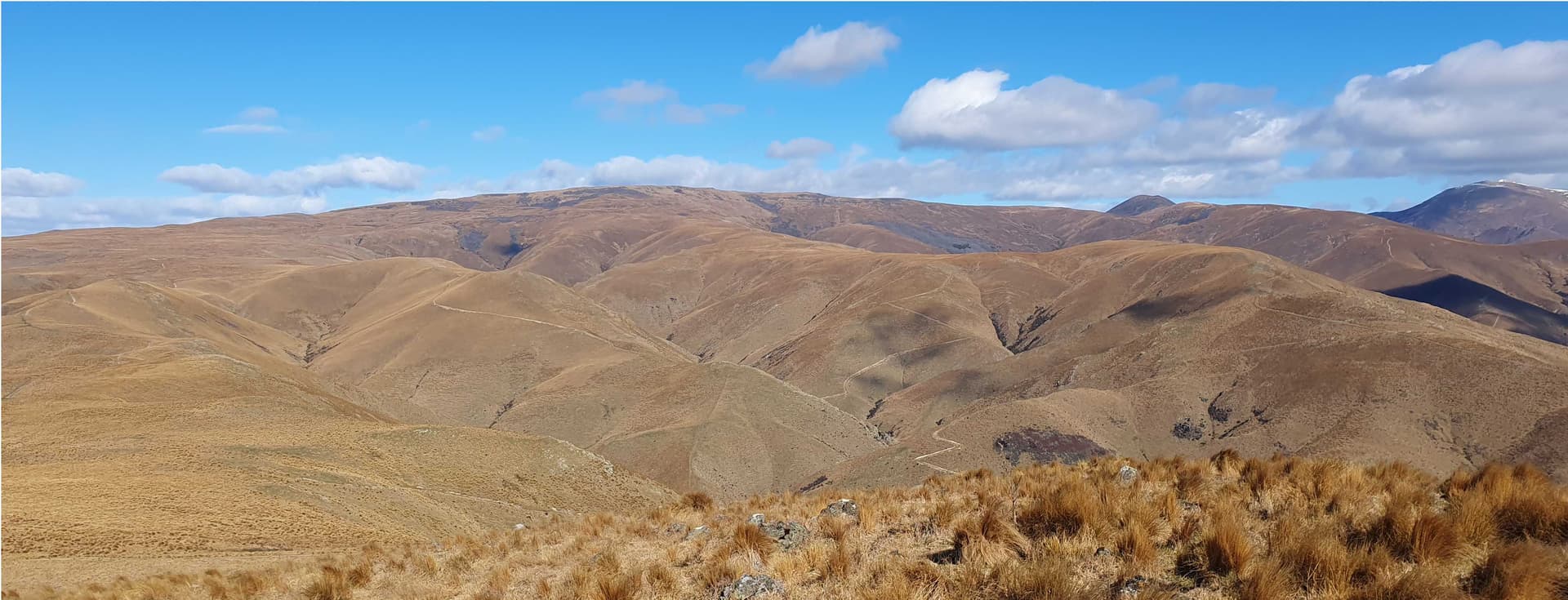
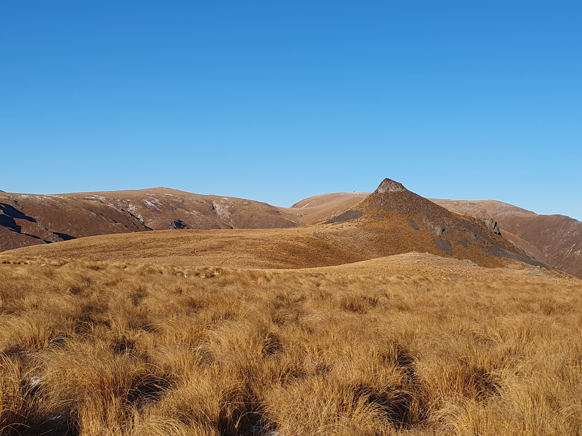
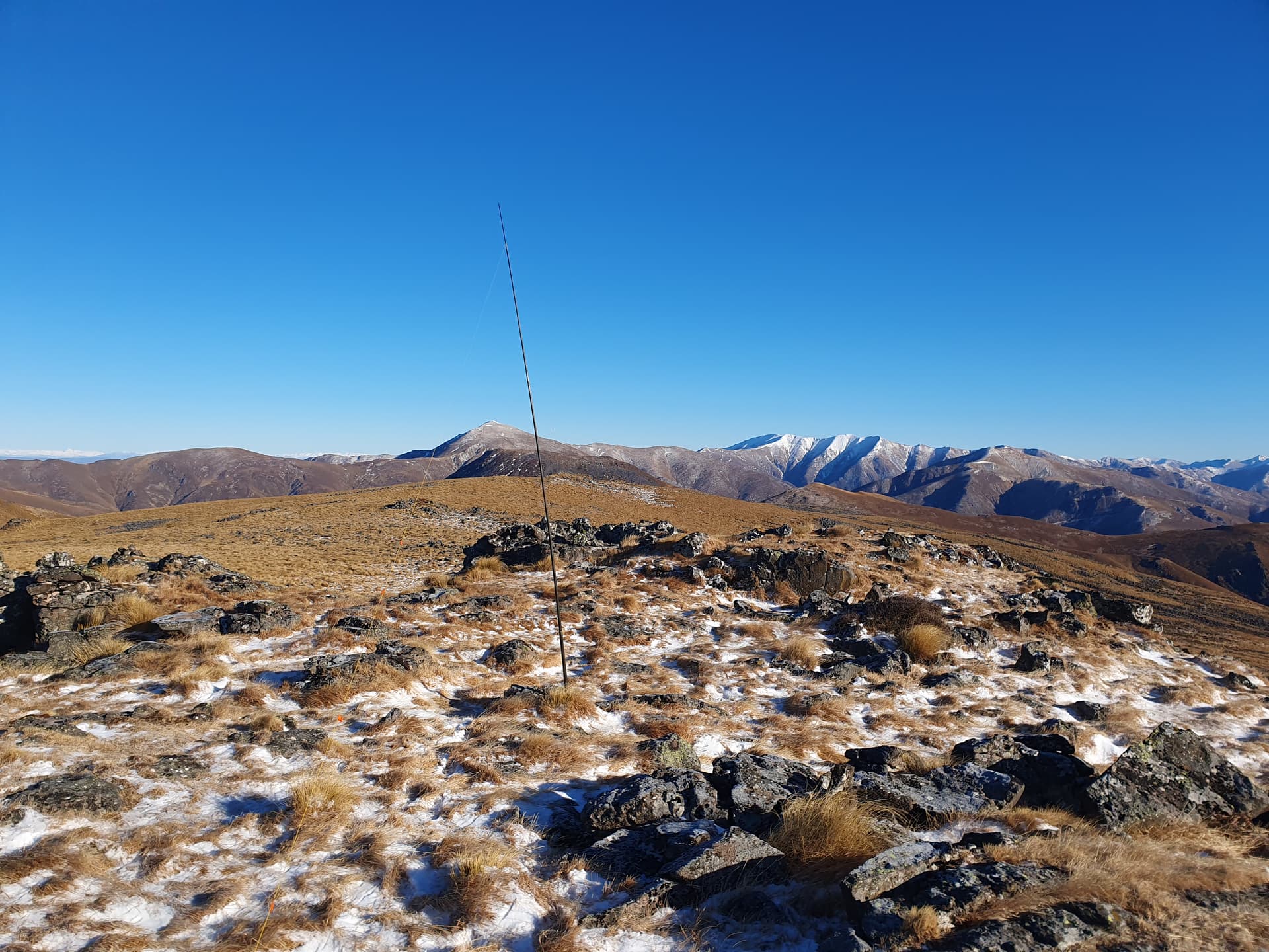
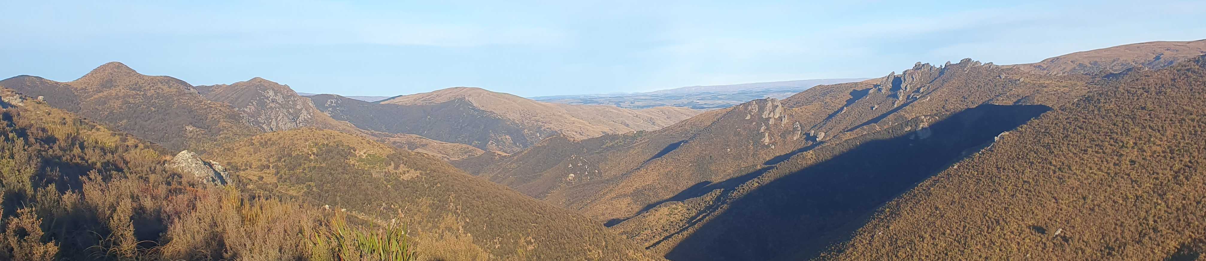
I leave Jubilee Hut 22 hours early (or 2 hours late), and make the quick 400m climb south up the spur known as the Devils Staircase (oh how we laugh at these lowlanders!) to the park’s high-point at Silverpeak (ZL3/OT-436). Since passing The Gap the lush green regenerating bush of the coast has been replaced by a dense-packed, aromatic scrub of manuka and turpentine, the track a narrow corridor between its walls.
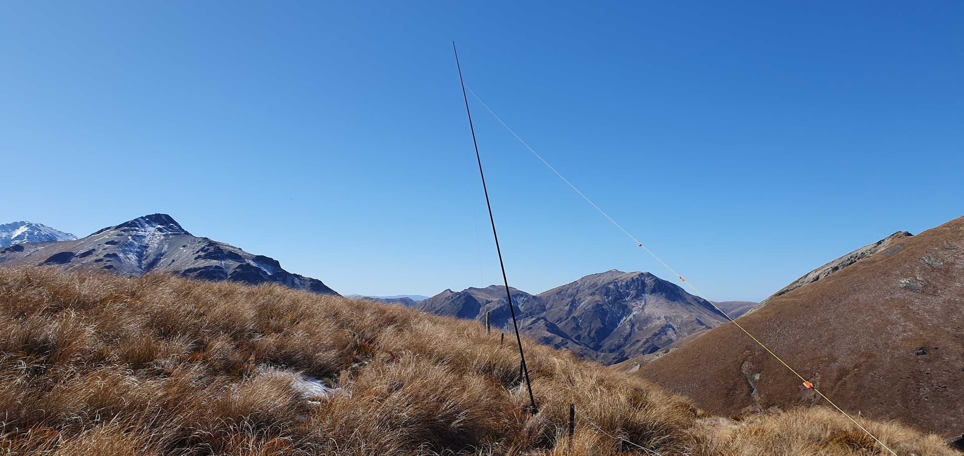
The activation of Silverpeak is straight forward - antenna stretched along the track, tied to bushes at each end, SOTApole held upright by simply jamming it into the scrub. Twelve contacts, all intra-ZL, including 4 SOTA summits, a POTA park and a lake - the bonuses of a weekend activation.
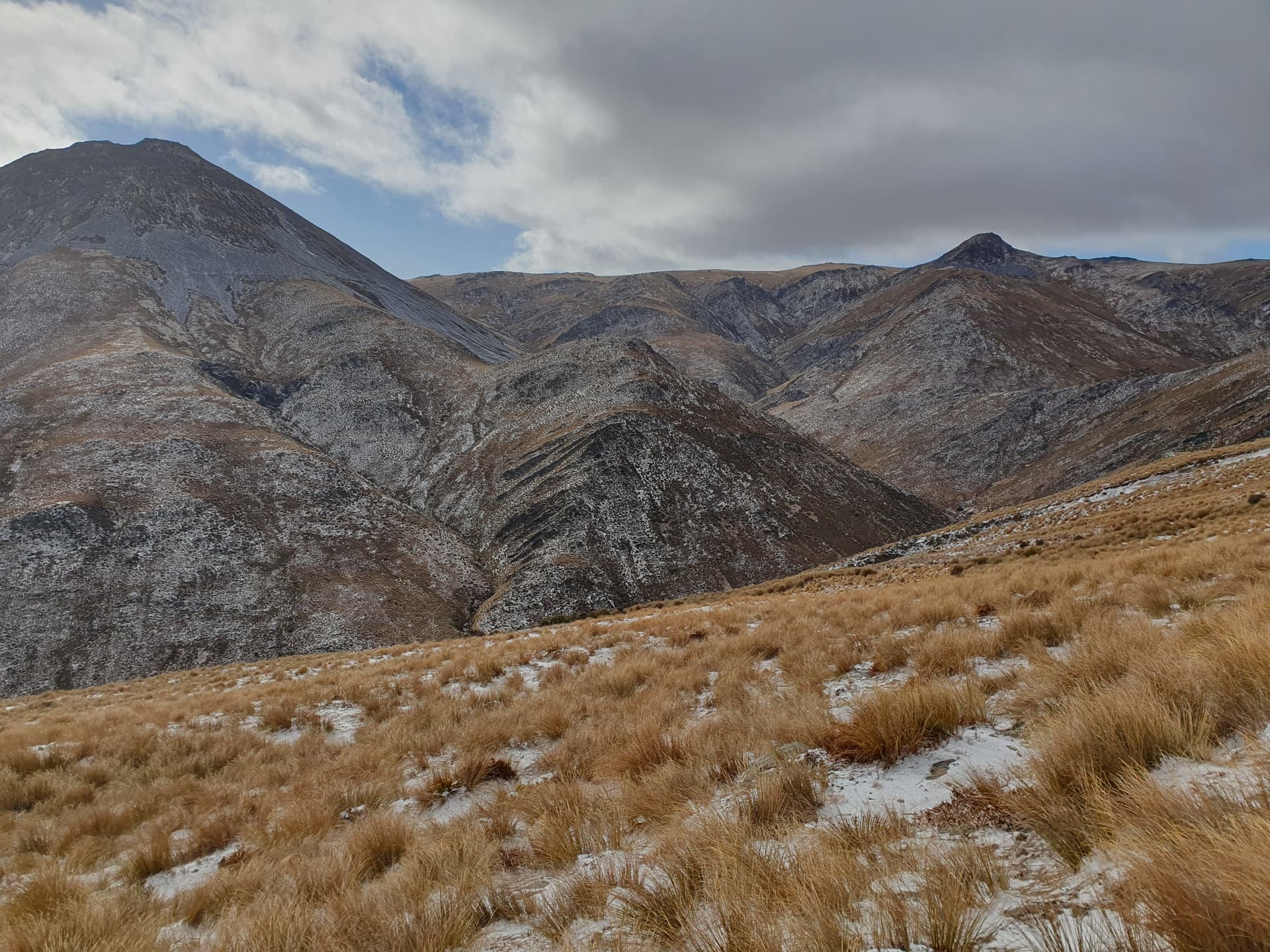
Mt Allen (ZL3/OT-446) lies just 4km west of Silverpeak on the boundary with commercial pine forests, topo50 maps show a 4WD track running along the ridgeline that joins the two.
I stand on Silverpeak and stare west towards the deep green boundary of pine trees. The continuous dun colouring of manuka / turpentine scrub is bisected by a stark yellow line of gorse flower: our track. Dropping all but essential activation gear at the saddle, we start west: maybe it will improve.
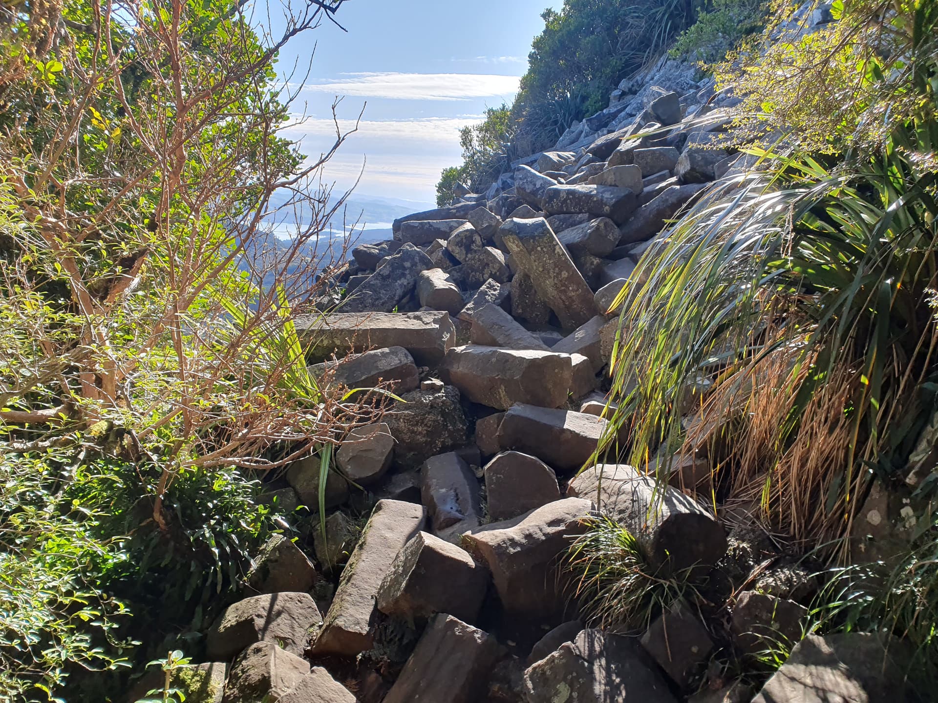
It takes 2 hours to cover the 2km to the start of pine trees, alternating between crawling beneath the 3m tall gorse, and forcing our way through the dense-packed turpentine. I’m reduced to continuous crawling and at the point of giving up when we reach the saddle between the two peaks and stumble upon a freshly cut track, green debris still littering the ground:
- That better not have been there all along and I’ve missed it - my first thought
- I hope that’s been there all along and I missed it - my second thought as I realise I have to return by the same route.
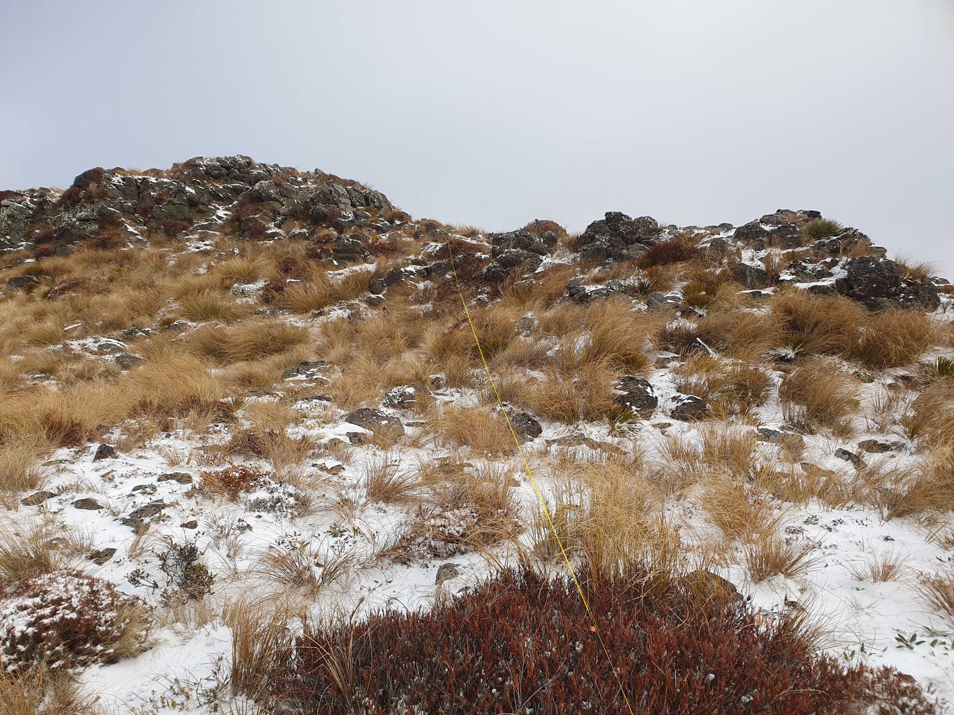
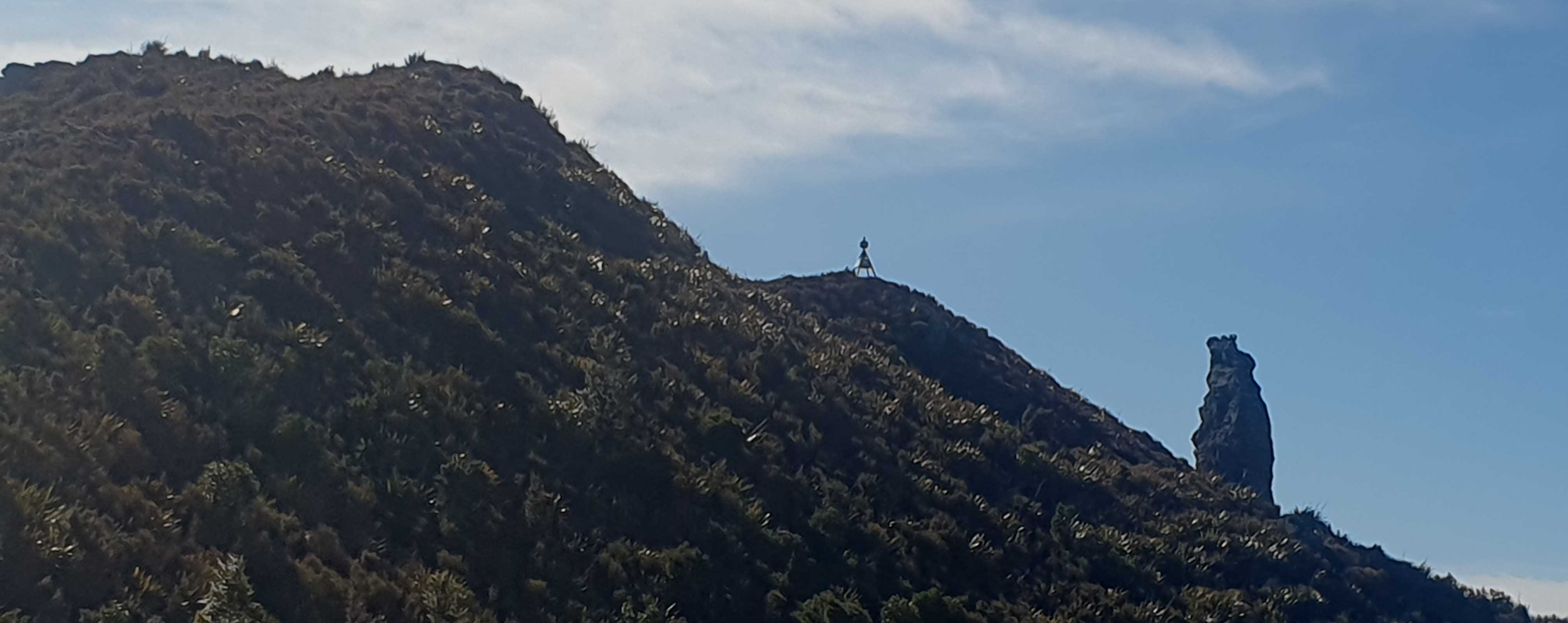
The narrow hand-cut track leads to the start of the pine trees, beyond which the old roadbed shows evidence of occasional vehicle traffic and the gorse / broom is reduced mostly to knee height. The track ends just short of the summit at another wall of impenetrable gorse, but a quick check of the maps shows that we are, thankfully, within the AZ of Mt Allen peak.
I linger long on Mt Allen, postponing the inevitable return trip as long as I can - netting 17 chasers between 40m and 20m.
The return trip is agony - legs red-sore from their previous gorse-encounters complaining the whole way. The hand-cut track runs a mere 10m beyond where I found it, and does not offer the relief I hoped for. Even the dog is on strike - her usual backtracking ability mysteriously deserting her whenever we come to thick, painful sections of gorse. Finally, back on Silverpeak, I am rewarded by retrieving my overnight gear from its stash, loading the pack back up to full weight, an continuing my way along the thankfully-well-cut walking track.
We have time to return to the truck before dark - effectively completing the full loop plus side-trip in a single day, but I don’t fancy the 200km drive home fatigued, so drop instead to the historic Possum Hut, 1.5km before the forestry road and carpark.
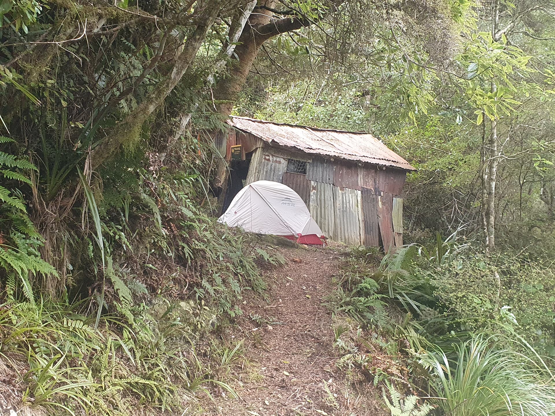
A sign above the door of Possum Hut states ‘Derelict Structure, Do Not Enter’. The floor is of packed earth, there are no beds and the roof clearly leaks in places, so I pitch the tent outside. But shortly afterwards unforcast, heavy, sleety rain commences, wind thrashing the trees above. I make the quick decision to pull the pegs and move the tent indoors. There are a few drips, but inside the tent we are warm, cozy and have a pleasant, quiet night.
Day 2
It’s barely breakfast time by the time we reach the truck on the forestry road above, still-dry tent packed and stowed. There’s a sleety slush on the ground, but the road is thankfully still driveable.
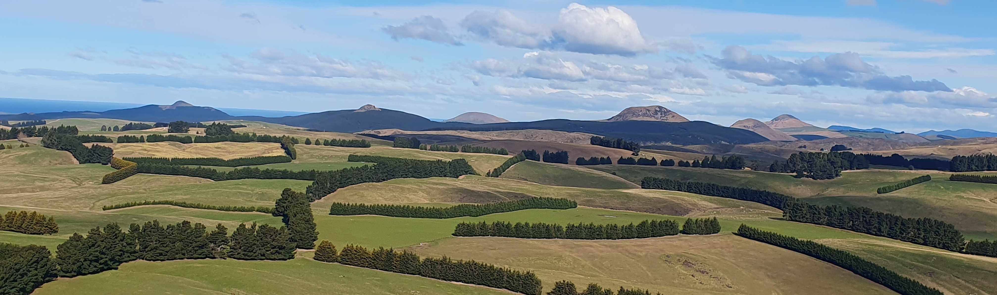
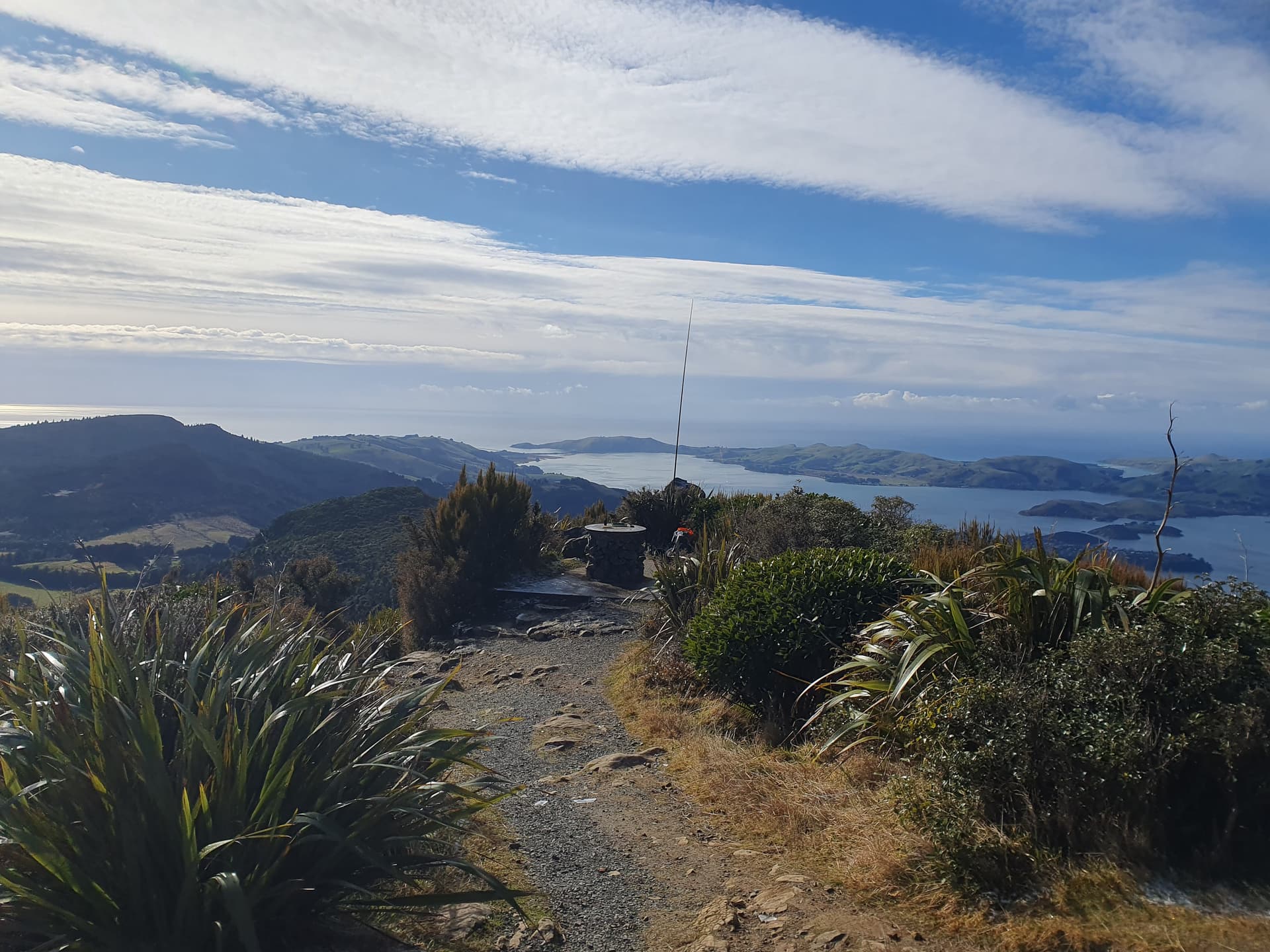
I decide to pick up a couple of 1-pointers on the way home to make up for the loss of Lamb Hill. The Dunedin Volcanic Field stretches out below us: conical peaks dot the coastline to the north, ZL3’s very-own Glasshouse Mountains (just 40 degrees cooler than the genuine VK4 article). To the SW the vast collapsed crater of the Dunedin Volcano forms the Dunedin Harbour, it’s high-point at Mt Cargill a landmark for the transmission tower that dominates the city skyline.
Mt Cargill
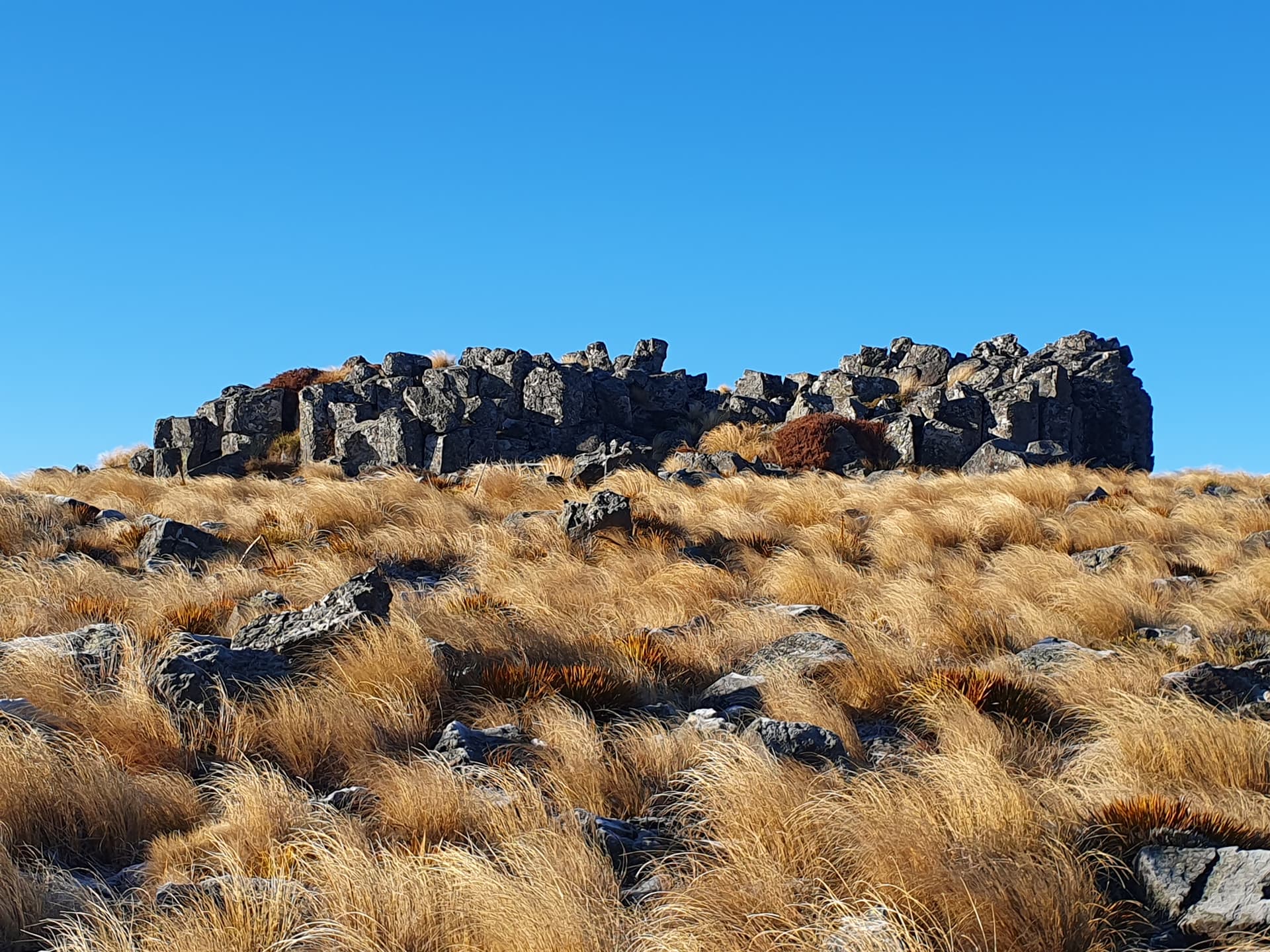
An easy gravelled / board-walked walkway climbs to Mt Cargill from the road saddle to its east, passing below iconic basalt organ-pipe towers and geometric rubble.
Thirty minutes of pleasant walking finds me at the picnic table on the summit. I eye the tower suspiciously, having encountered ice-shedding in similar circumstances, but it seems to be free of rime.
A very enjoyable 30 minutes of SOTA ensues; warmed by the morning sun, looking out over the city and harbour below. Interrupted only occasionally by the platelets of ice that flutter, rather than fall from the tower above. VK’s are still in bed, with the exception of VK4NH, but we make 18 contacts within ZL, including a good long natter with ZL1CNB. An increasing stream of walkers and joggers makes the call to head down - let others make use of the table, and let us seek out a good strong cup of morning coffee.
Hikaroroa / Mt Watkin

The dry-weather Ram Rock Road connects the coast at Wakaouiti with the Strath Taieri via the northern remnants of the Silverpeak range. Late winter is not really the time to drive it, but we follow the first few kilometers to the base of Hikaroroa / Mt Watkin. This iconic volcanic cone is one of many that dot the North Otago landscape and make up the majority of the Dunedin Volcanic Field. Active 15-18 million years ago, they don’t present the excitement of the current-day North Island volcanos, but are still dominant geographic features,
A council-owned reserve climbs the eastern flank of Hikaroroa / Mt Watkin from the road to its summit. From a distance the extents of this reserve are clearly visible: it’s that bright-yellow block of solid gorse amongst the otherwise tidy rough grazed pasture. We park up at an old quarry, and nose up the western fenceline - which is thankfully mostly still clear of gorse. There is no track, and it is a hard, slow climb up the steep loose volcanic rock through a mixture of roly-poly tussock waist-high scrub.
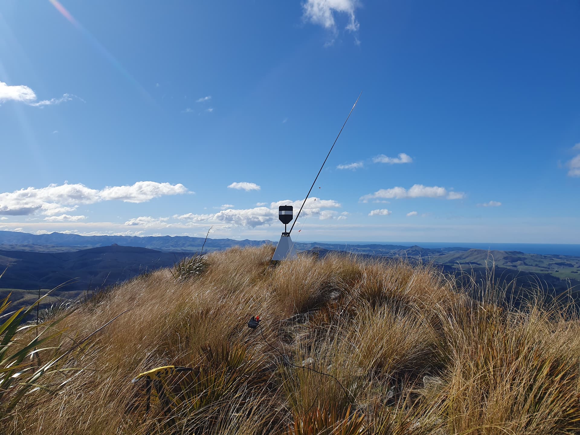
The usual TX500 + EFHW + SOTApole does a fine job and we get 24 in the log in a lazy half-hour - VK’s now thankfully awake and out activating.
Dunback Hill
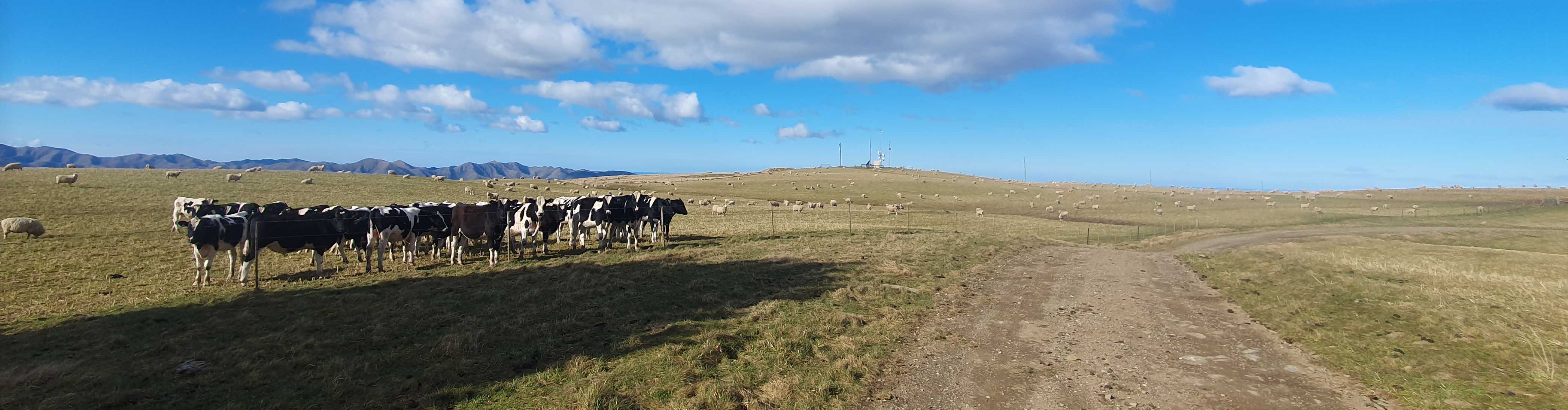
A final drive-up HEMA summit rounds off the trip. Golden Bar Road has been cut-off by the Macraes gold-mine at it’s western end, but the eastern end still gives access as far as the summit of Dunback Hill. 15 contacts include 3 VK parks.
All said and done, my trip to the East Coast didn’t exactly go to plan, nor was it filled with enjoyable iconic tramping. The Silverpeaks are Dunedin’s back-yard and classic tramping for people of the city. But their scrubby, post-logging nature means that they really are restricted to on-track tramping - limited to the few loop tracks that have been established. Silverpeak, and Swampy Summit (previously activated) both would make good SOTA day trips from their respective roadends, and the overnight loop was an unnecessary extravagance. Mt Allen - for those really keen, would be best activated with permission from the forestry company from private forestry roads - I would not recommend following in my footsteps (hand-steps, knee-steps, elbow-steps).
The trip did however, open my eyes to some new country and when I get too old or tired for SOTA, I can see myself spending an enjoyable week in the motorhome picking off all those volcanic cones for the ZL Volcanos award.