Background
I’d always fancied having a look at the “Great Moss” and I had long had a desire to stand astride one of Scotlands greatest rivers (and my local one) The River Dee - just before it spills off the cliffs of the high Cairngorm plateau.
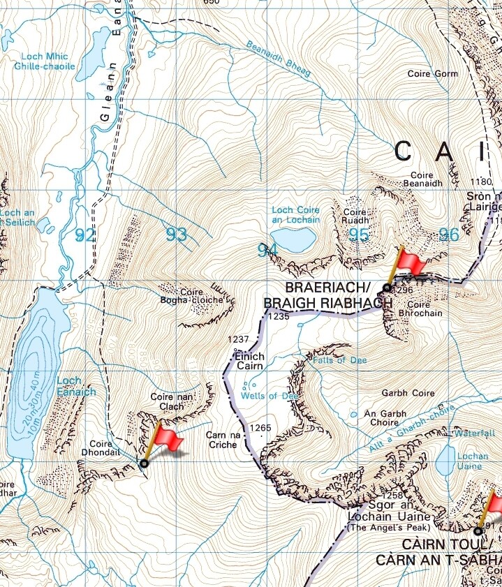
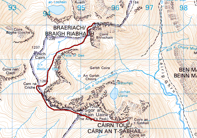
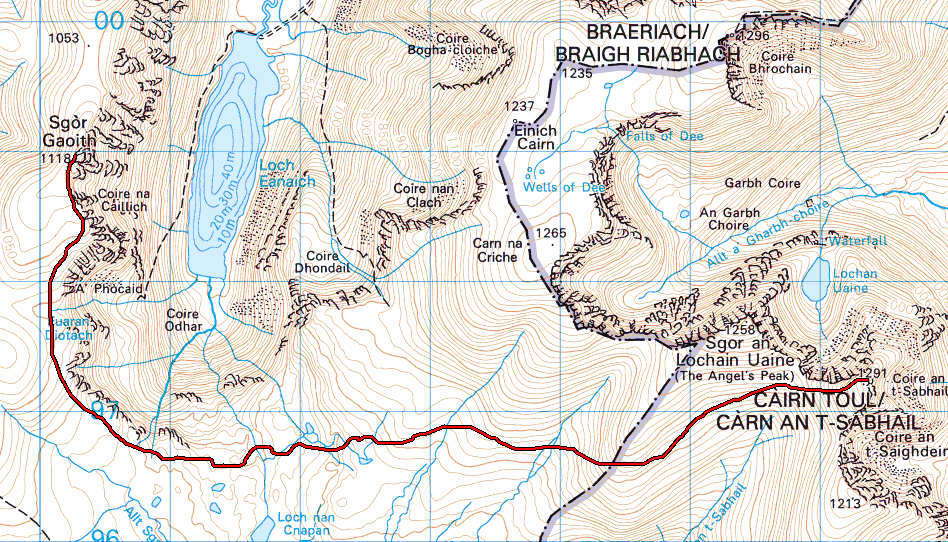
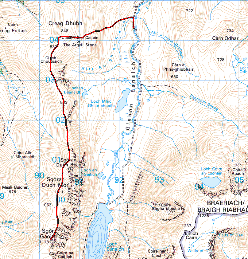
GM/ES-002 Braeriach and GM/ES-003 Cairn Toul are considered to be mountains of the Lairig Ghru, the great cleft that rips the highest group of mountains in Britain down the middle (Ben Nevis excluded). And then we have Sgor Gaoith, a Glen Feshie mountain. sotl.as showed me that they were the three remaining un-activated (by me) 10 point peaks in my area. My OS map showed me that they could be linked in a big loop, using the Great Moss at the southern end and starting the hike from Whitewell just a few km south of Aviemore.
I’d planned this back in May, initially as an overnighter, but never had the chance to do it. I then grew confident that I could do it in a long day. However, with the days growing shorter, time was running out. Tuesday was my day off, with high winds forecast. Monday looked better and despite working until 9pm on Sunday night, I decided to go for it.
Whitewell to Braeraich
I left the car at 0700 and soon joined the vehicle track that heads south all the way to Loch Eanaich. It was the second time I’d left the car that day, having left my GoPro on its roof the first time!
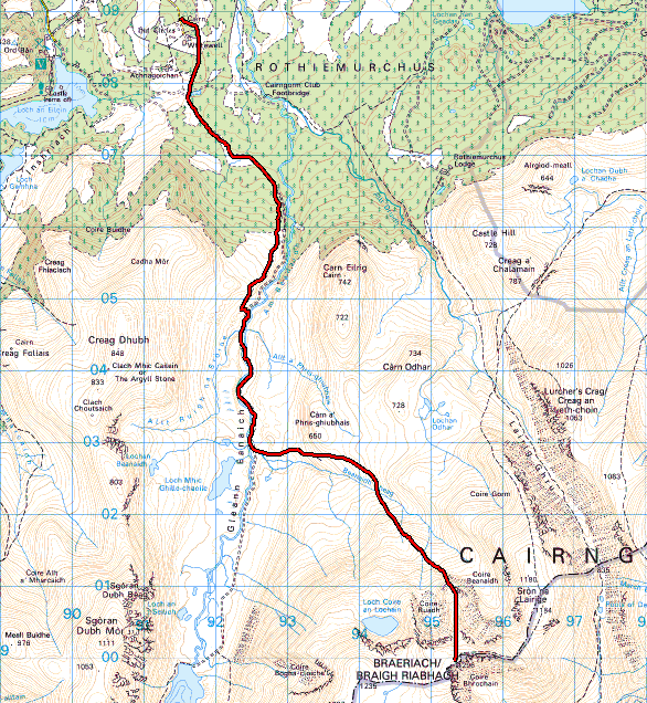
It’s reasonable easy cycling and it took me 20 minutes to reach the point where I would dump the bike and proceed on foot. If everything went to plan, I’d drop off a hill to the west of this location and land right beside the bike. It was fairly windy in the glen.

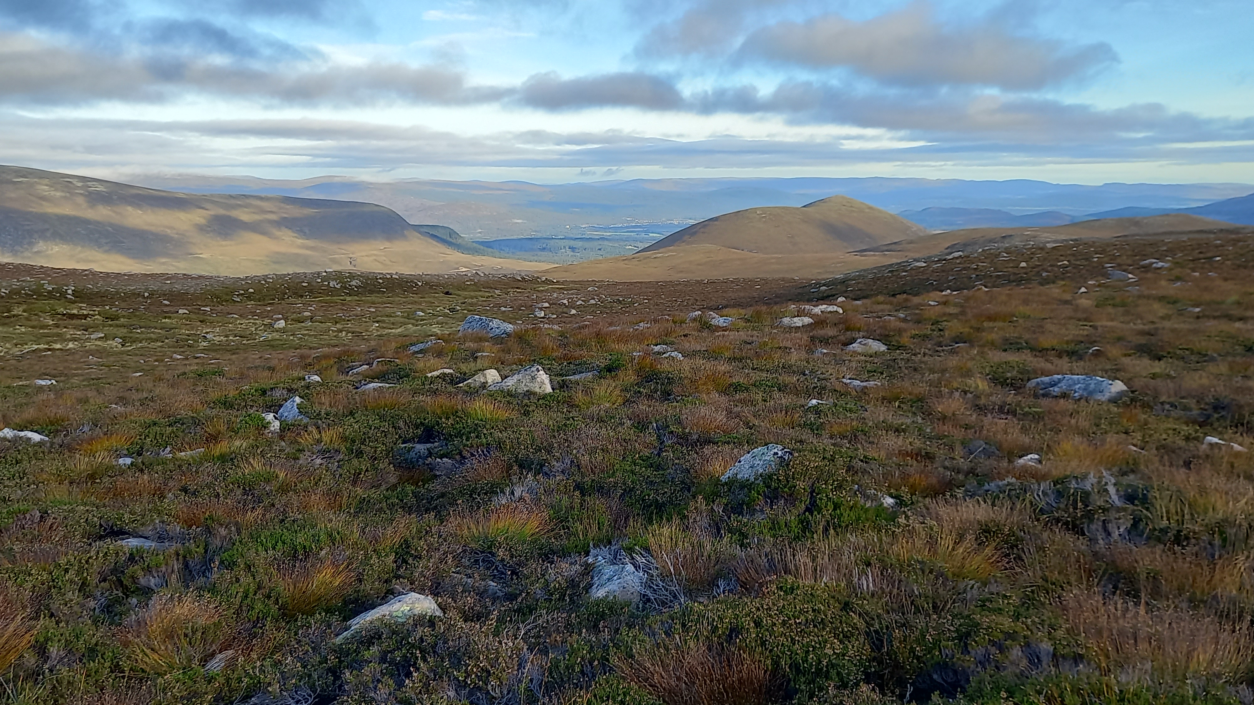
Sunrise over Sgor Gaoith
I followed the track for another 1.5km until it met the Beanaidh Bheag burn. I didn’t cross the burn but instead took a faint stalkers path near its north bank, heading towards the ridge that runs between two of Braeriachs great northern corries - Coire Ruadh and Coire Beanaidh.
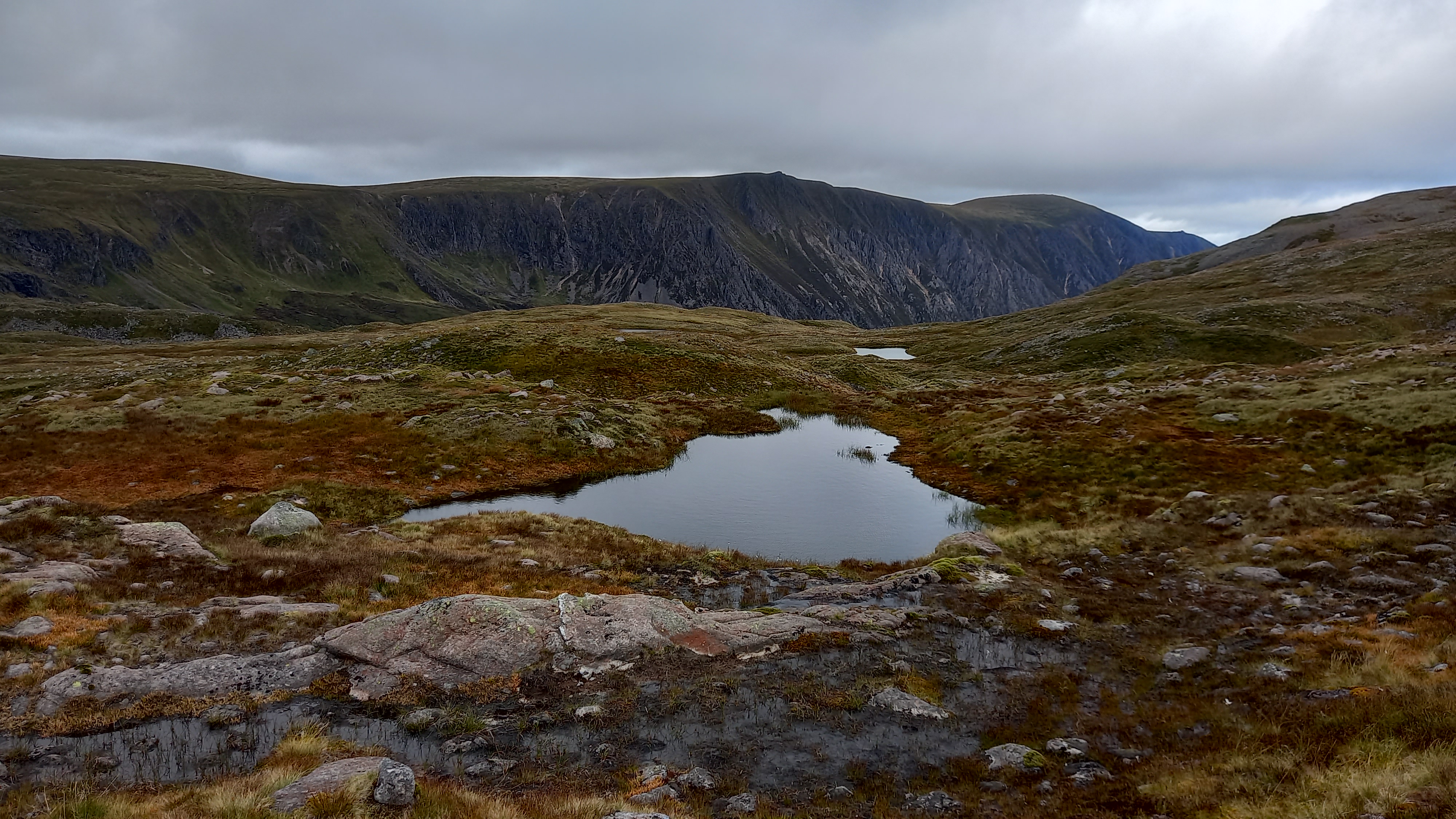
I was soon on pathless ground and clambering over rocky heathery slopes to the foot of the ridge.
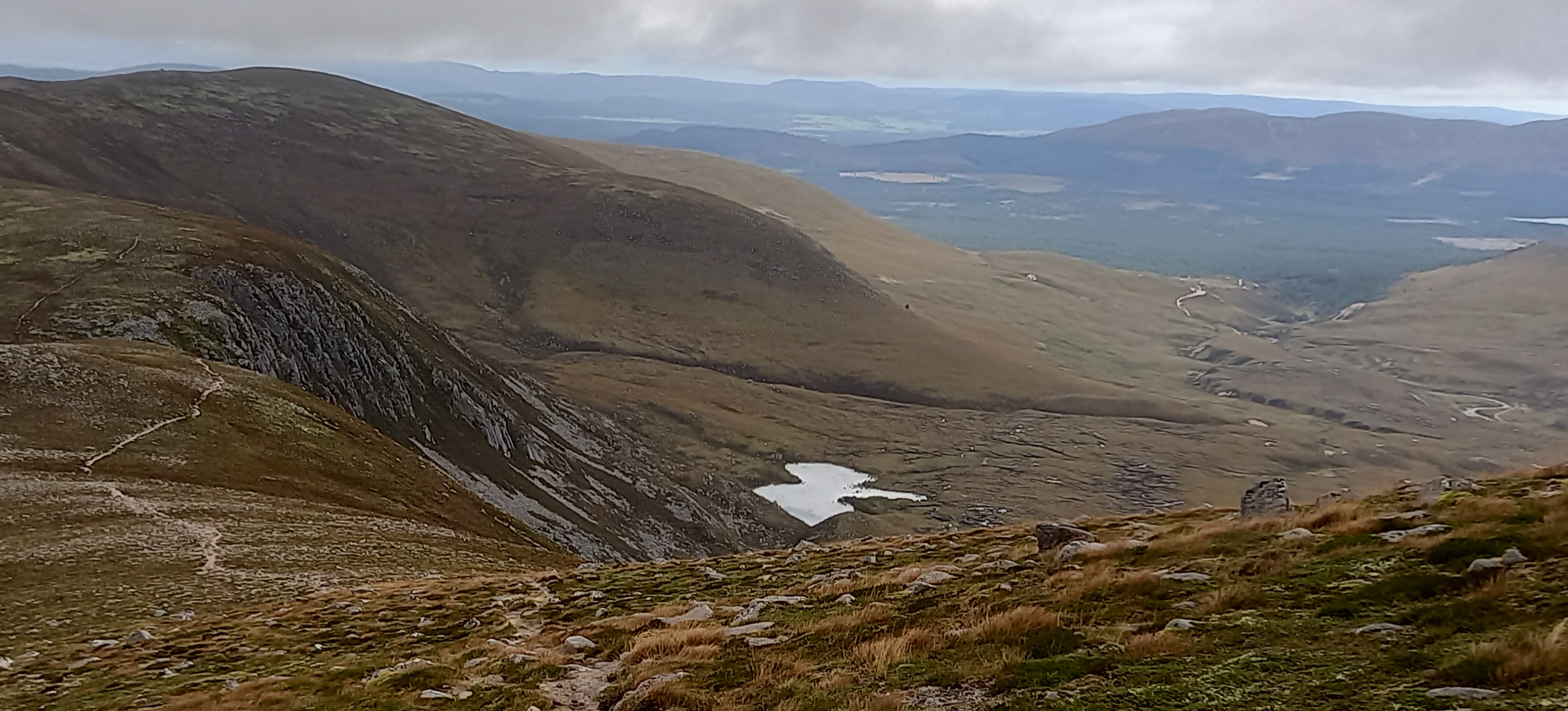
looking back down to Glen Eanaich
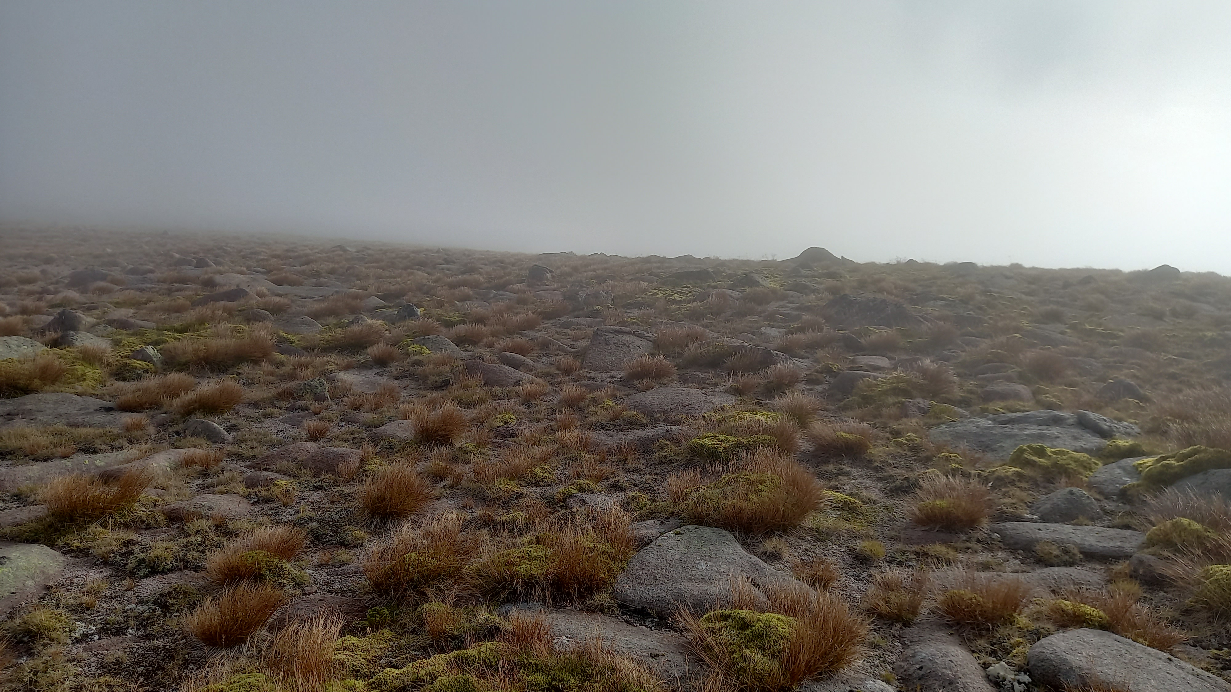
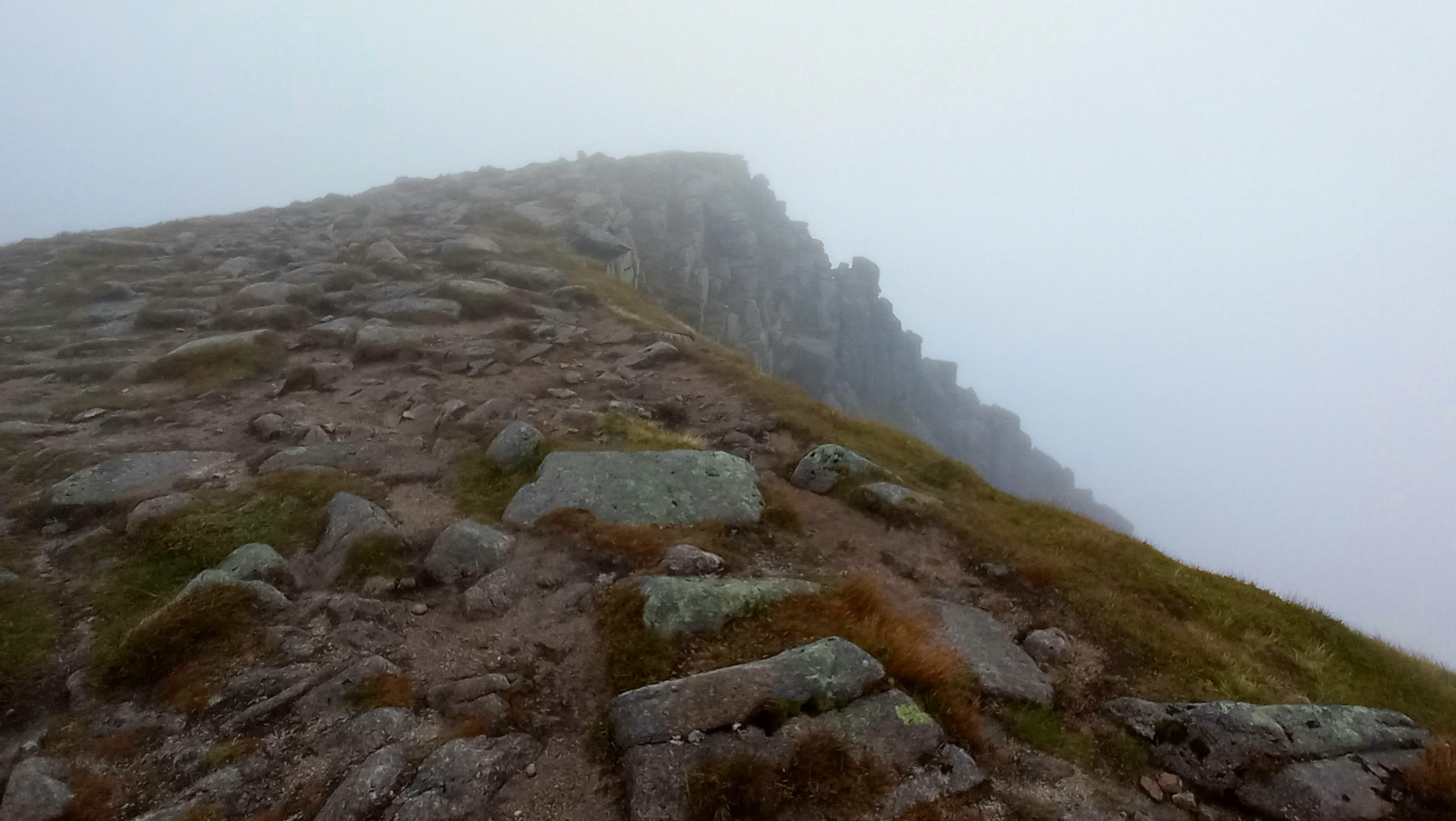
The initial climb up the ridge was over large boulders. Unfortunately as the angle eased, these were replaced by smaller rocks covered in wet moss. By now the strong westerly breeze was concerning me, as was the cloud blowing in across the tops…
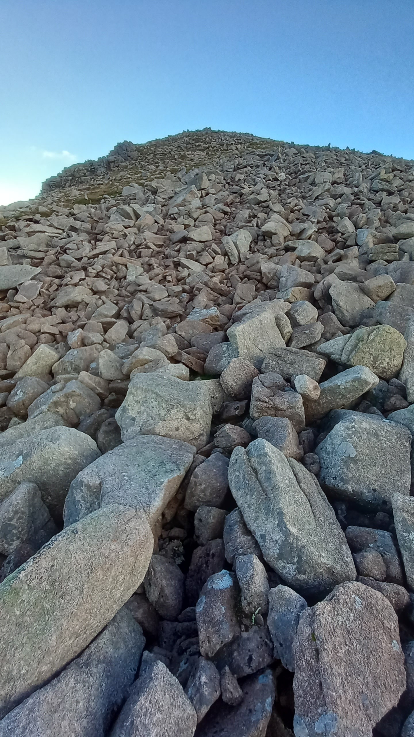
Initial ascent
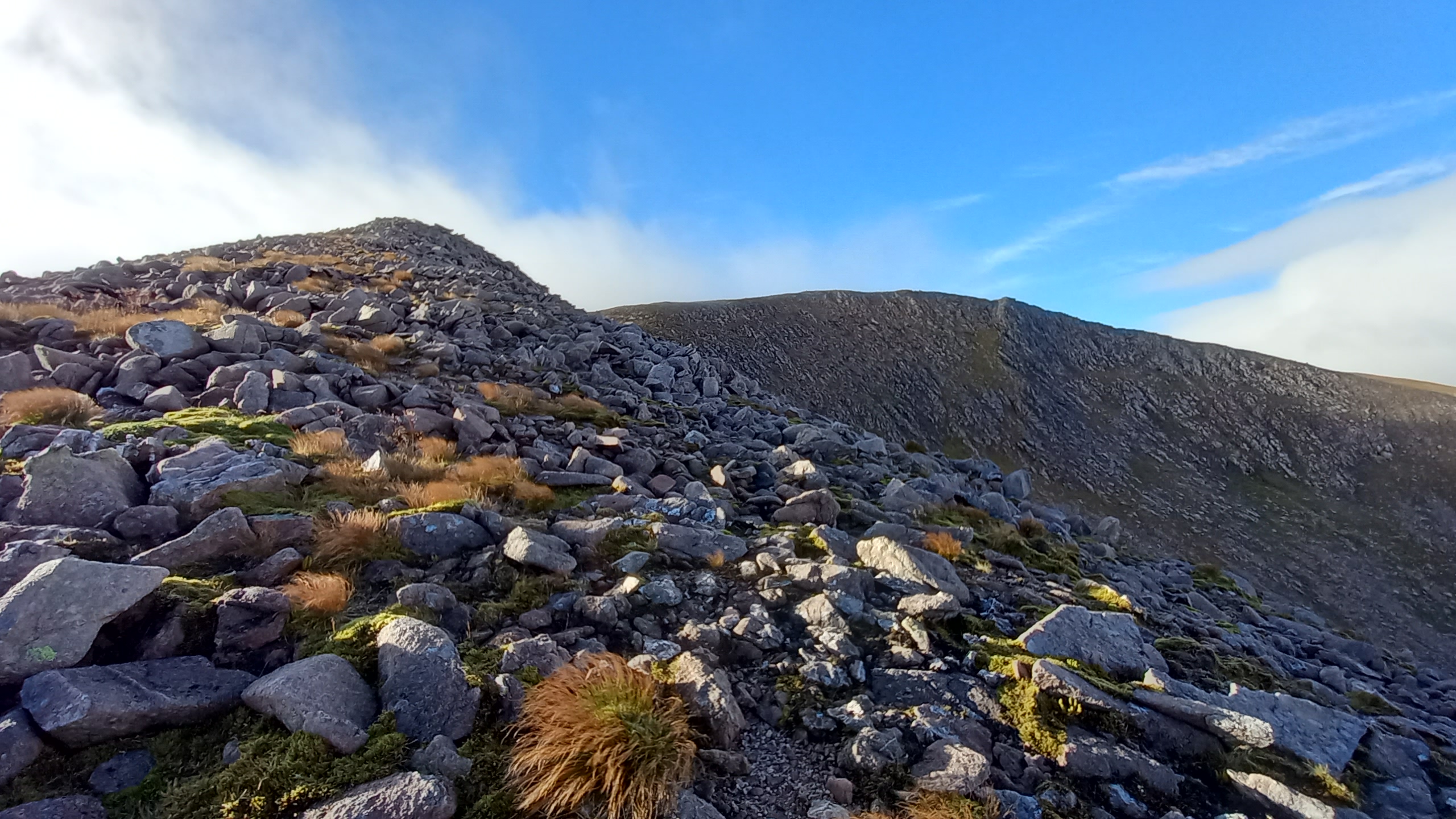
improving, with the summit area in sight
A narrower section of ridge led to the summit slopes and I popped out to (in my opinion, and although partially obscured) one of the best views anywhere. I was actually feeling a bit low at this point, despite the views. It had been a tough grind, I was tired and probably only just sensing the enormity of the task ahead. I’d been on the go for 2.5 hours and it was now 0830z.
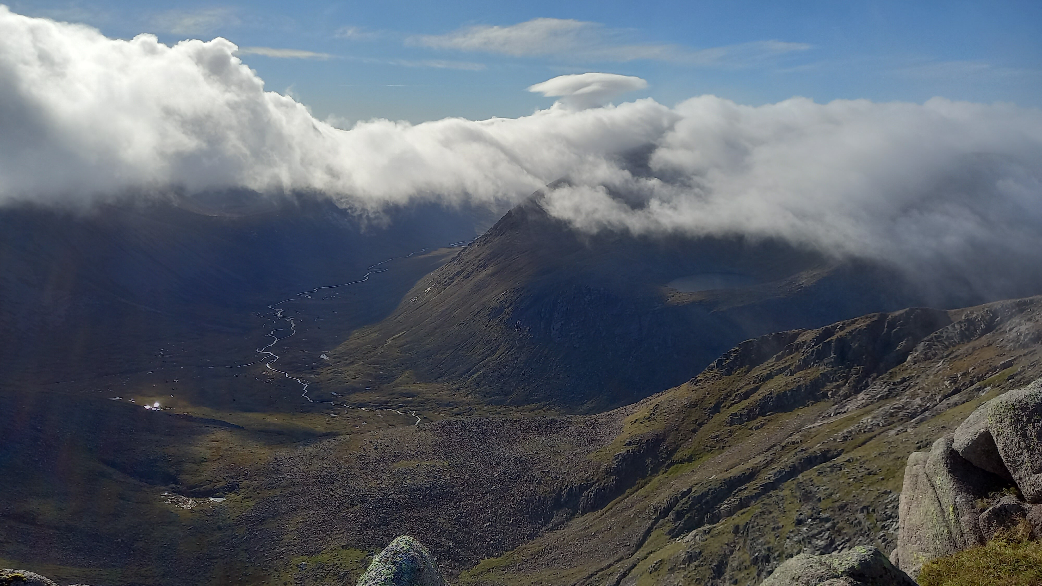
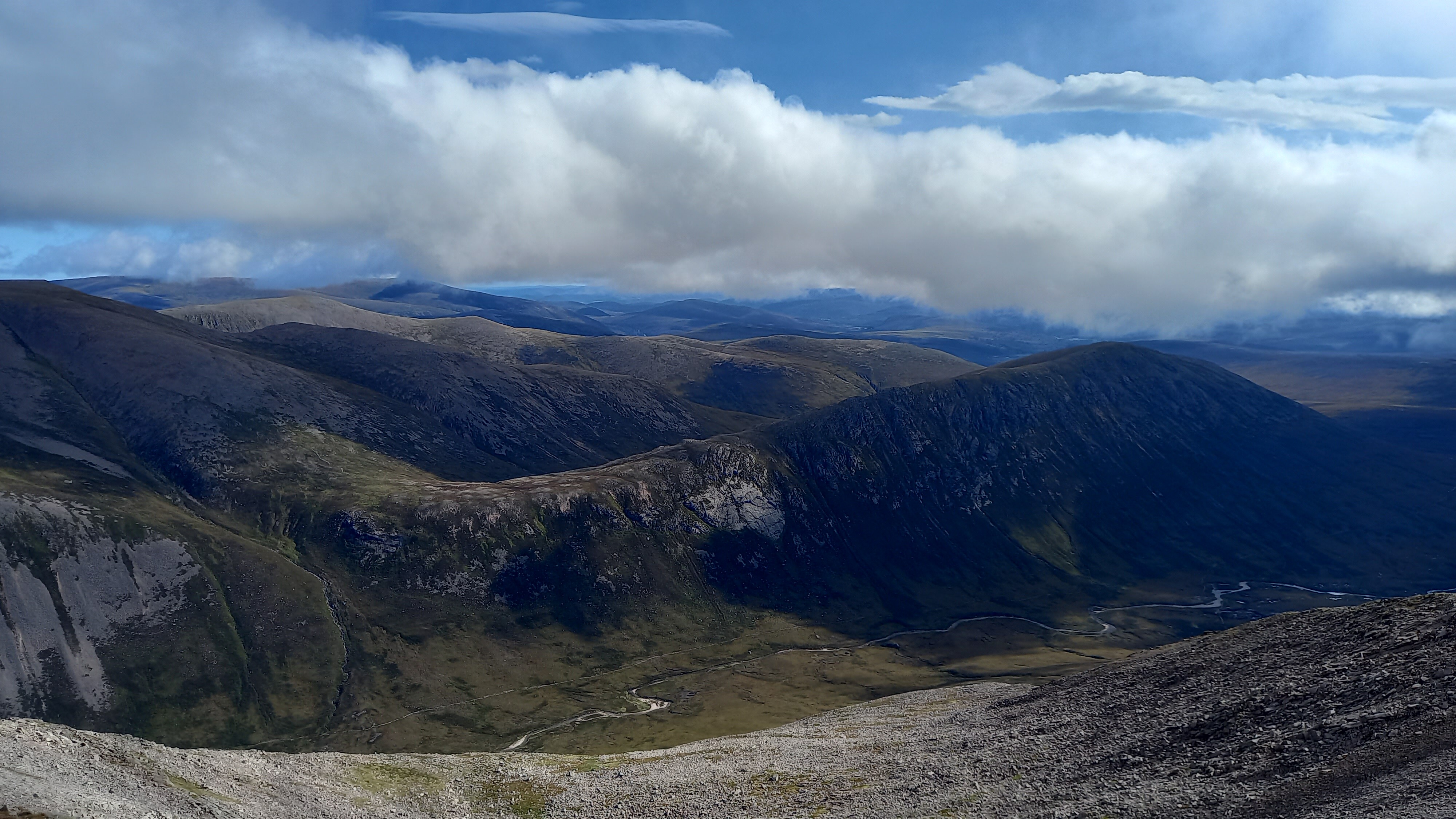
Cairn Toul and Angels Peak in the clouds, the River Dee runs through the Lairig Ghru
Braeraich
GM/ES-002 Activation
I’d promised a couple of chaps up in Elgin that I’d give them a call on 2m. One of those was Peter 2M0SQL. If you’re into LEO satellites you may have heard of him. Anyway this was the casual part of the operation but I alerted my presence using 4G and sotl.as.
MM7LOX answered my first call and he was in Edinburgh! 3/3 from the Yaesu ft-3d and a whip over a distance of 130km. Peter came on next and then asked if I wanted his Dad on. The answer was “Yes”. Well there I was with three contacts on 2m in as many minutes. Then @GM3GAV Gavin called! Weak but workable. I was now massively back on track in terms of morale, energy and time. On to the next one!
On to Cairn Toul
A little bit of descent and I was soon on the way south to my next summit. The cloud was all-covering now but the breeze had died down a little.
Braeriach to Cairn Toul
The way to Cairn Toul
It was a 6km walk but after 2km I bumped into the very infant River Dee. I refilled my bottle here and did the “one foot on each bank selfie”, just because…
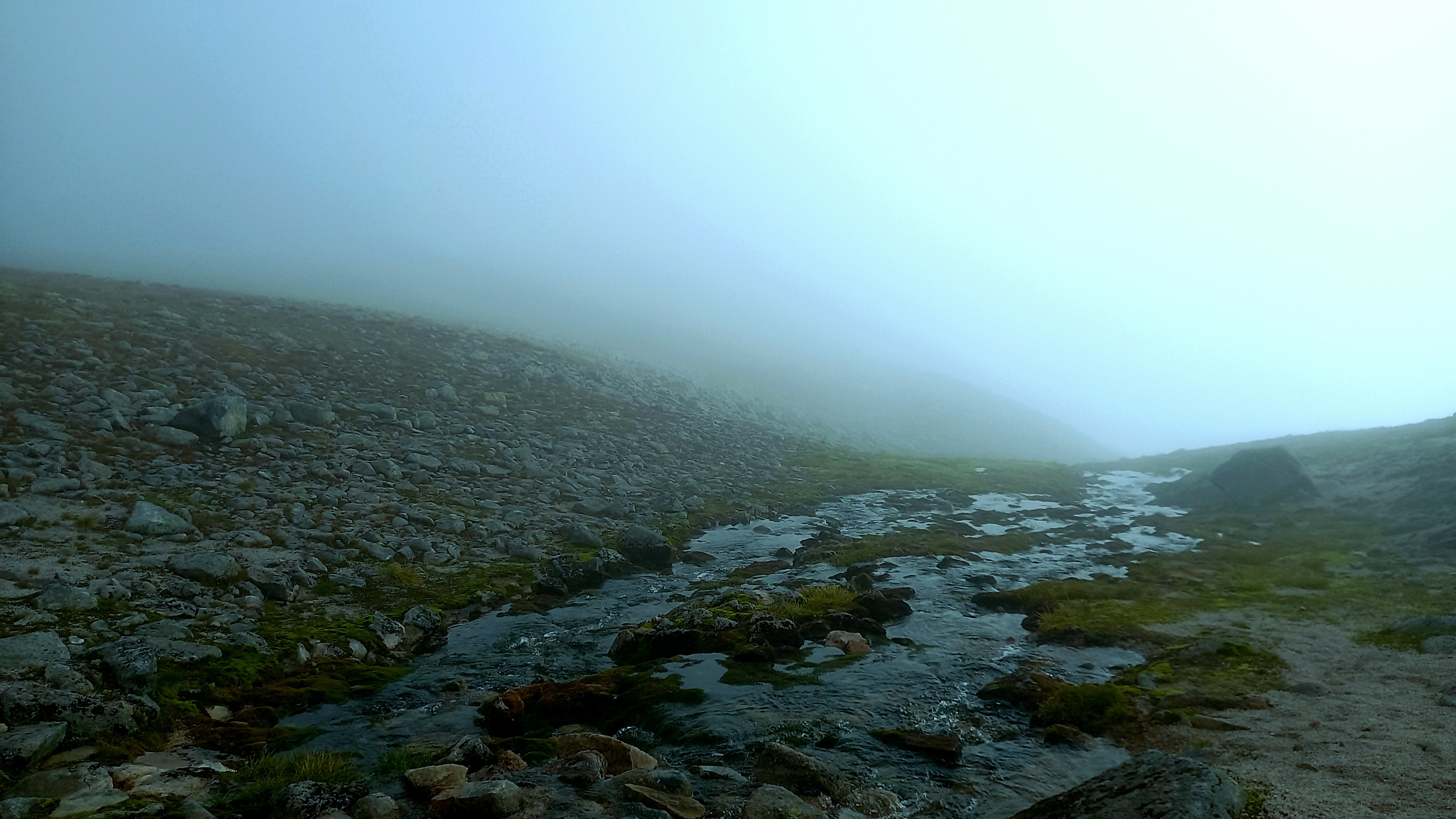
The infant River Dee about to spill over the plateau edge
I decided to traverse around the bottom of Angels Peak but I would have been as well climbing it, as it had a path. The traverse did not. However, soon enough I was climbing through bands of boulders to arrive at the top of Cairn Toul. This leg had taken just over 1.5 hours.
I sat down in the crescent shaped stone cairn and chilled for a bit, making sure I got some food and a drink. When I got going again I jammed the mast in the walls of the shelter and strung out the inverted V, unlinked for 20m.
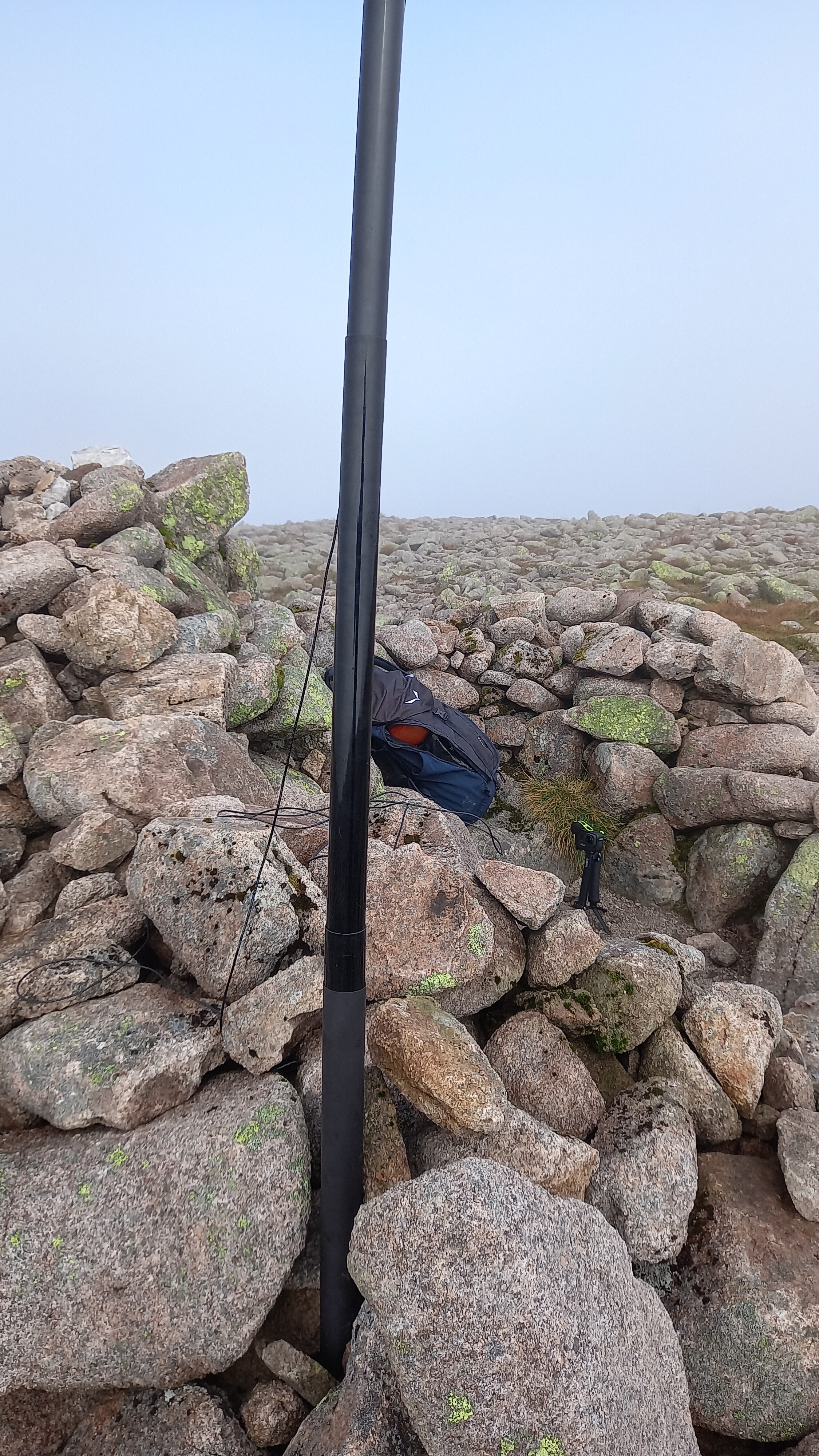
Heat-shrink sleeve protection on the lower mast, a tip from the reflector community
GM/ES-003 Activation
I was on the air exactly at my planned time of 1100z and fairly quickly worked EA7GV, EA2DT, F4WBN, F5JKK, SV2RUJ, @EA2IF AND F/DL1MP. All SSB, with 10 watts from the KX-2. There was some fading, particularly with SV2RUJ, but the whole session took just 6 minutes.
Two down, one to go. One very far away one…
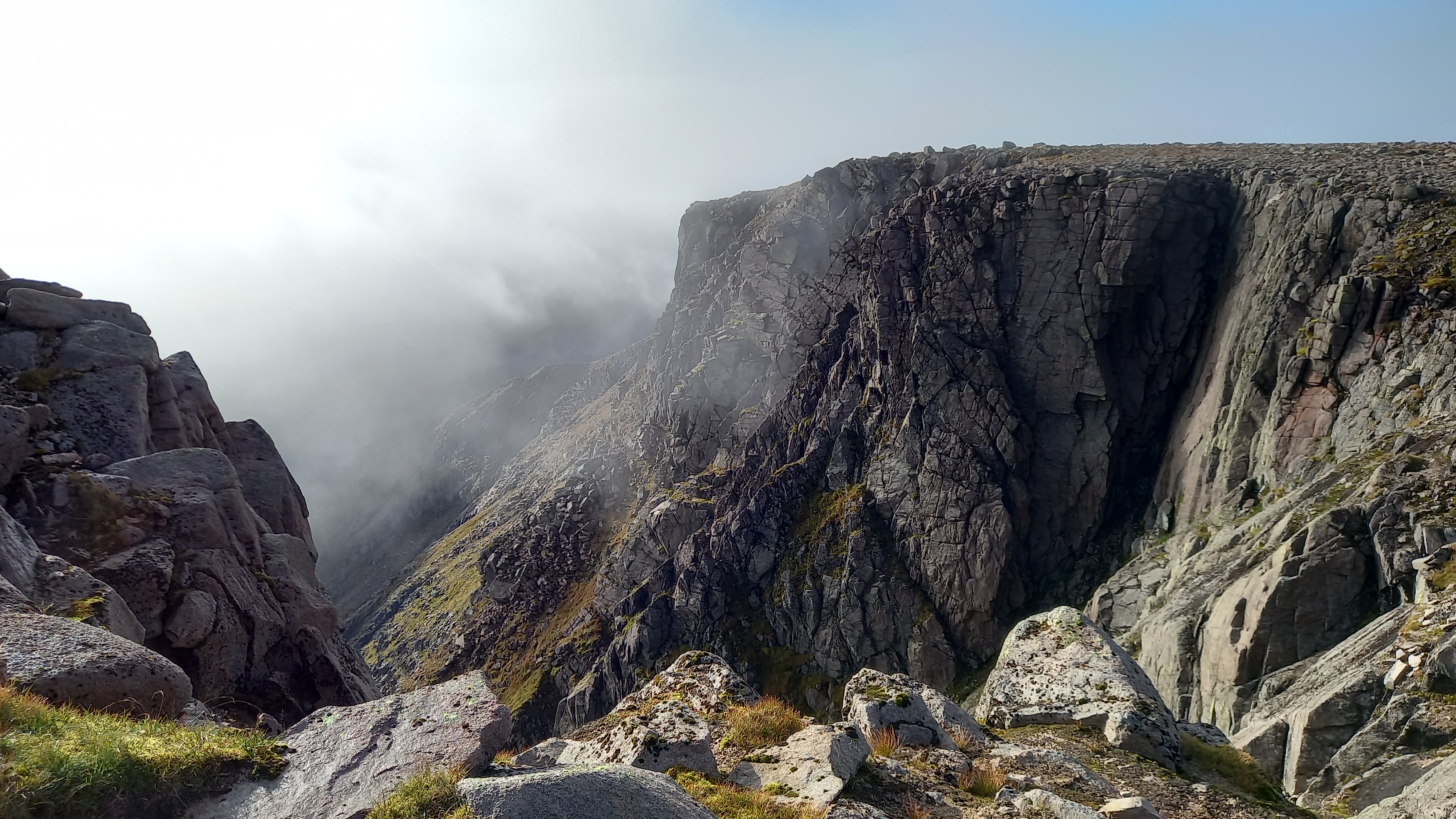
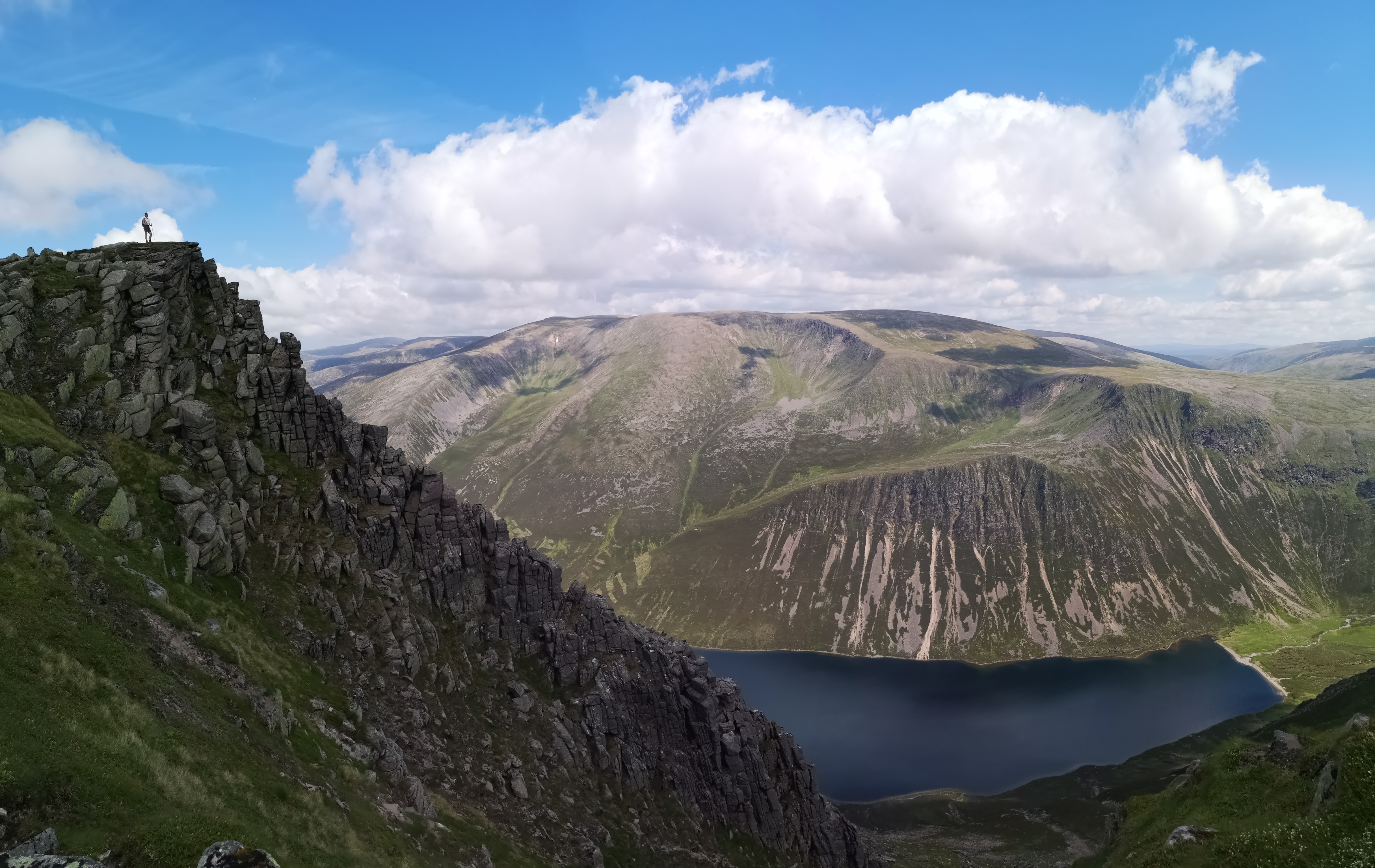
The cloud had actually cleared, so when I popped out of the shelter I was greeted by incredible vistas.
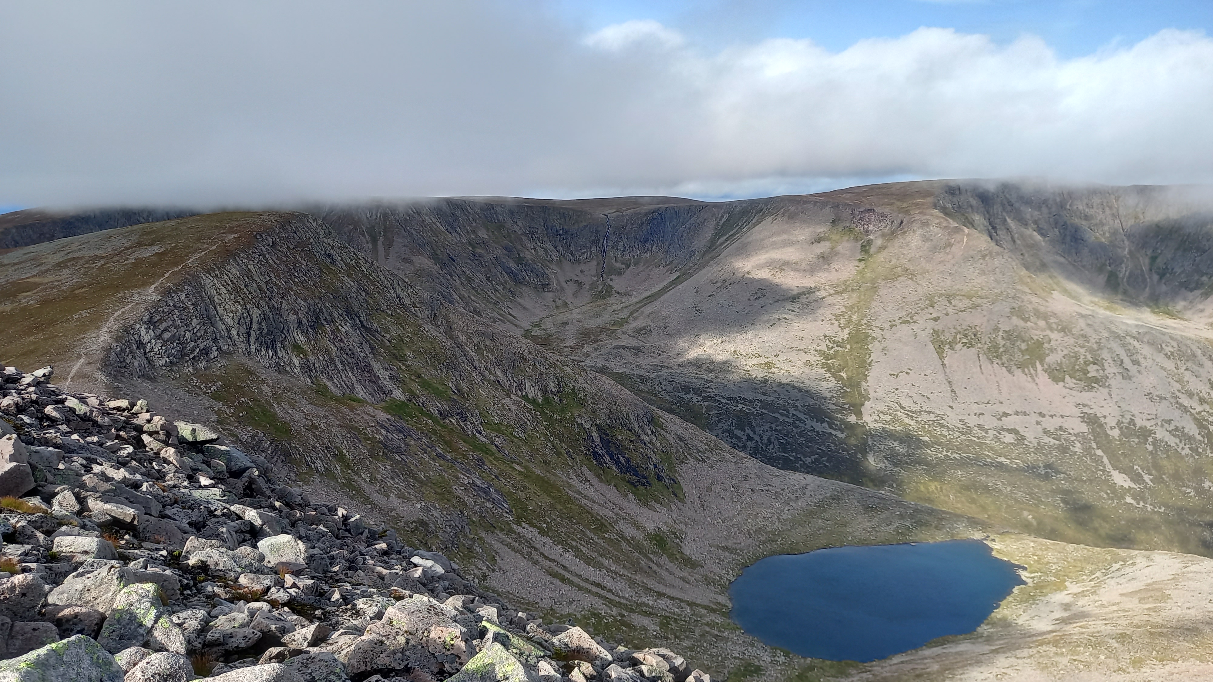
Looking back north to my approach route
Across east the Lairig Ghru to Carn a Mhaim GM/ES-013, sloping up to Ben Macdui GM/ES-001 to its left
I pulled out the handie and managed another QSO with Peter and his dad up in Elgin. Improved signal reports, despite greater distance and more lumps of mountain in the path.
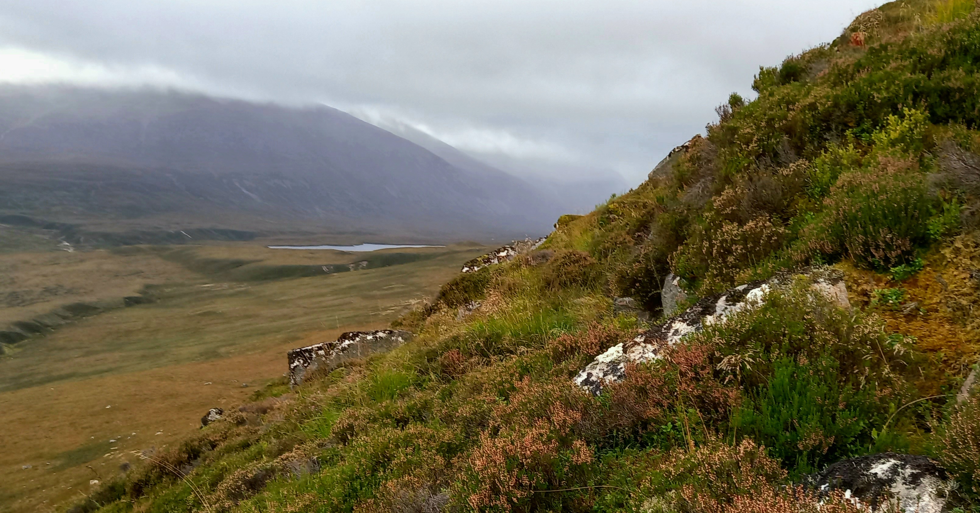
Across the Great Moss to Sgor Gaoith
This was the longest leg at 8km, however I was heading over to the lowest mountain of the round. The plan was to skirt around the southern slopes of Angels Peak, maintaining some height. This would hopefully allow me to pick a line across the high plain.
Across the Moss
Angels Peak obscuring the Great Moss
Initially the Moss was grassy with rocks in places. Numerous burns were crossed. Eventually the ground started to become generally wetter and the sections of bogs longer. I decided to move north towards the top end but not quite as far as the lip of the corrie above Loch Eanaich…
Sgor Gaoith was always close, but far away
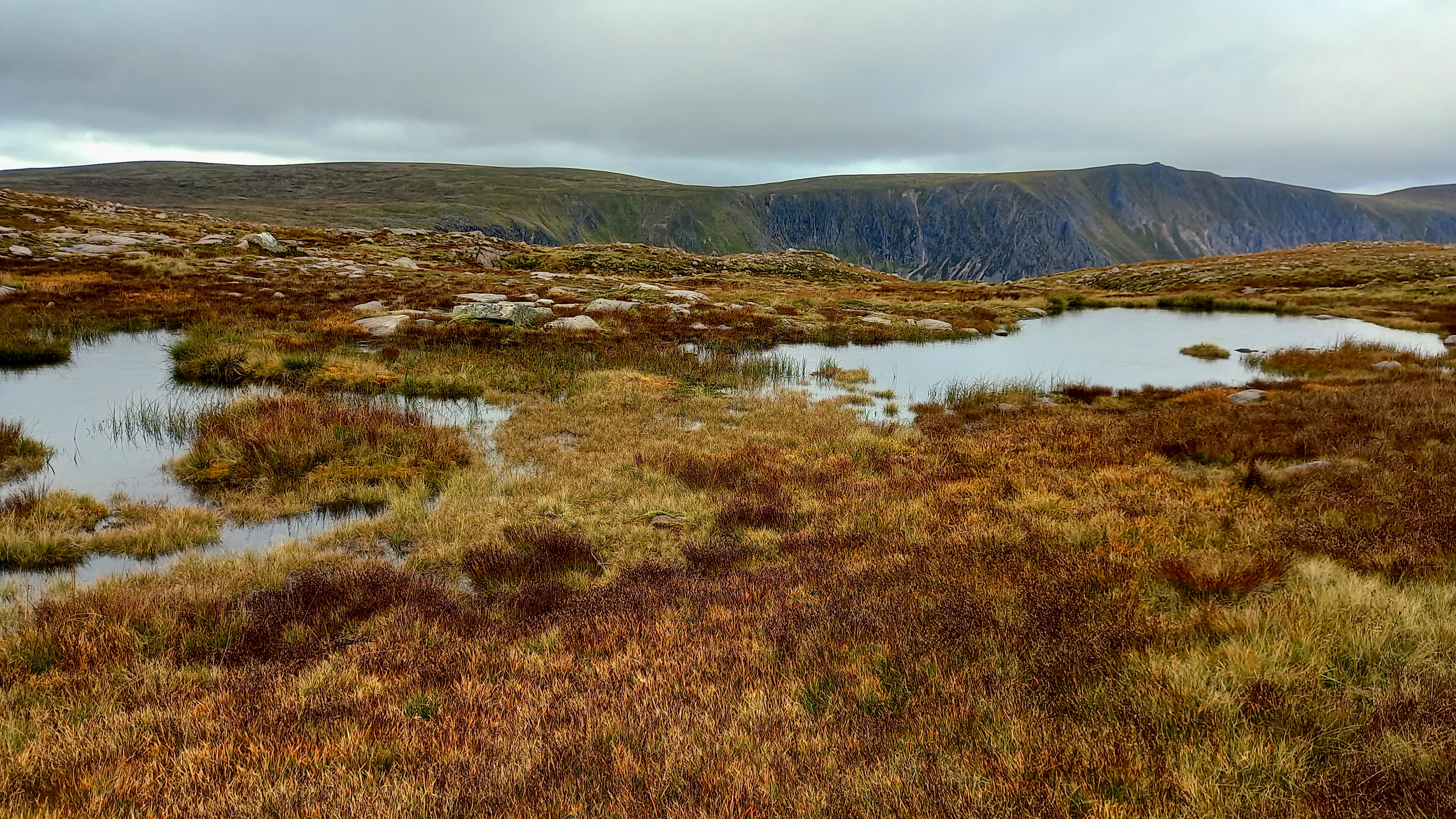
One of many pools or lochans
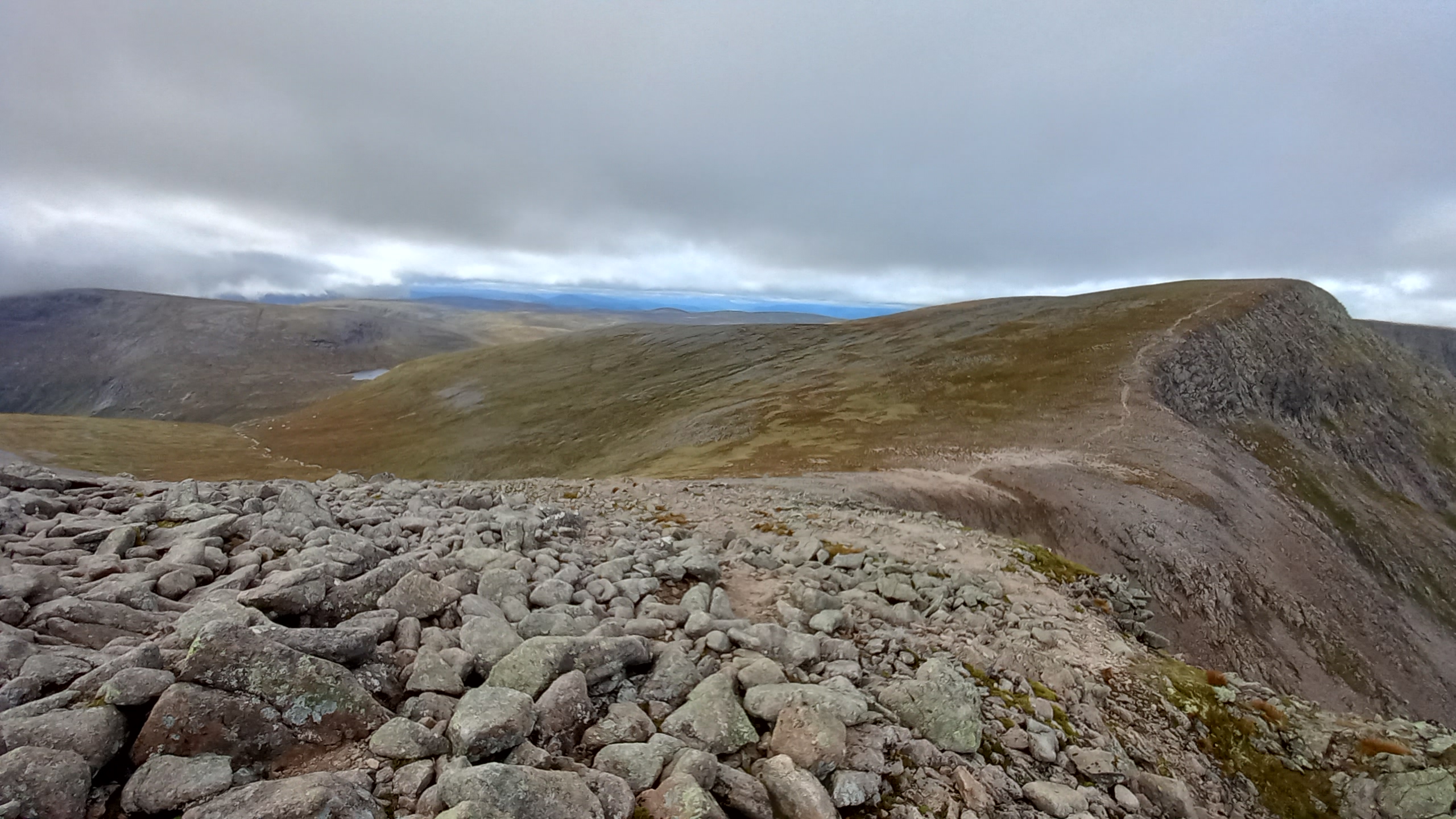
The going got really rough. It was like a glacier had been along here and emptied its garbage. Although rocky with a grass top it reminded me of the Badlands of N.America. I slowly picked my way through the numerous hillocks, dips and bumps, interspersed with burns, bogs and sometimes rocky bases, eventually reaching the western edge, before finally a path was in sight, leading north to the top of my third summit, Sgor Gaoith.
The path hung precariously close to the eastern cliffs of the ridge and by now the wind had picked up again, always pushing me towards the drop. Now the cloud moved over and it was carrying moisture this time. By the time I got to the summit I was quite damp and getting wetter by the minute. It was 1515 and I was 15 minutes behind schedule, having taken 2.75 hours to cross the Moss.
Sgor Gaoith GM/ES-009
The same summit taken by me in July 2018
Now, the summit is perched on the cliff edge with no shelter, so I kept going for around 100m, found a grassy patch and tried to get my thin summer waterproof jacket over my wet fleece, desperately holding onto it in the gale.
I was 50/50 at this point, but went ahead and assembled the mast, guys and pegs on the ground, then strung out the inverted V. I had the mast up and then it telescoped down, do doubt to the wet poles. The guys were a terrible mess. I had to strip everything down and start again.
Then it telescoped again. Then fell over once re-erected. This was the last chance. Everything went together with an extra twist and I knocked the pegs into the poor stony ground. It held.
Activating GM/ES-009
I got out the bothy bag and awkwardly clambered into it, laying my rucksack against the other end and using both walking poles to stiffen it. Only when I was sure everything was going to remain in place, did I take out my radio, notepad and phone. It was nearly 1600z and I was nearly 45 minutes behind my planned activation time.
The 4G spot went instantly, despite my seated position and as soon as I called CQ on 40m SSB, Manuel EA2DT came straight back with a 5/1. I’ve never been so glad to hear his voice! Then G0RQL, F4WBN and SA4BLM in calm and steady order. Summit qualified! I will be eternally grateful to those guys - those Pro Chasers who answered my calls that afternoon.
I packed the radio carefully but everything else was rammed into the bag, then the bothy bag, guys and aerial. I couldn’t find the mast rubber cap, so that was strapped into a side pocket upside down and I was gone. (Cap found back home.)
The route back
I had to follow the continuation of the ridge for some 5km before I was able to drop east to the glen floor. This was initially due to cliffs, then steep rocky slopes and laterally due to the glen floor being a geological mess (or geography teachers delight).
The descent route
I’d planned to walk as far as The Argyll Stone, which was marked on the map. This meant some re-ascent, but there was a narrow but well defined path all the way along the ridge. I ran for the first fifteen minutes in order to warm up a little.
Soon, dropping from the cloud and the rain easing, I saw the way ahead. It didn’t inspire me, however the gradients were reasonable and I was soon at the Stone.
A long way to go
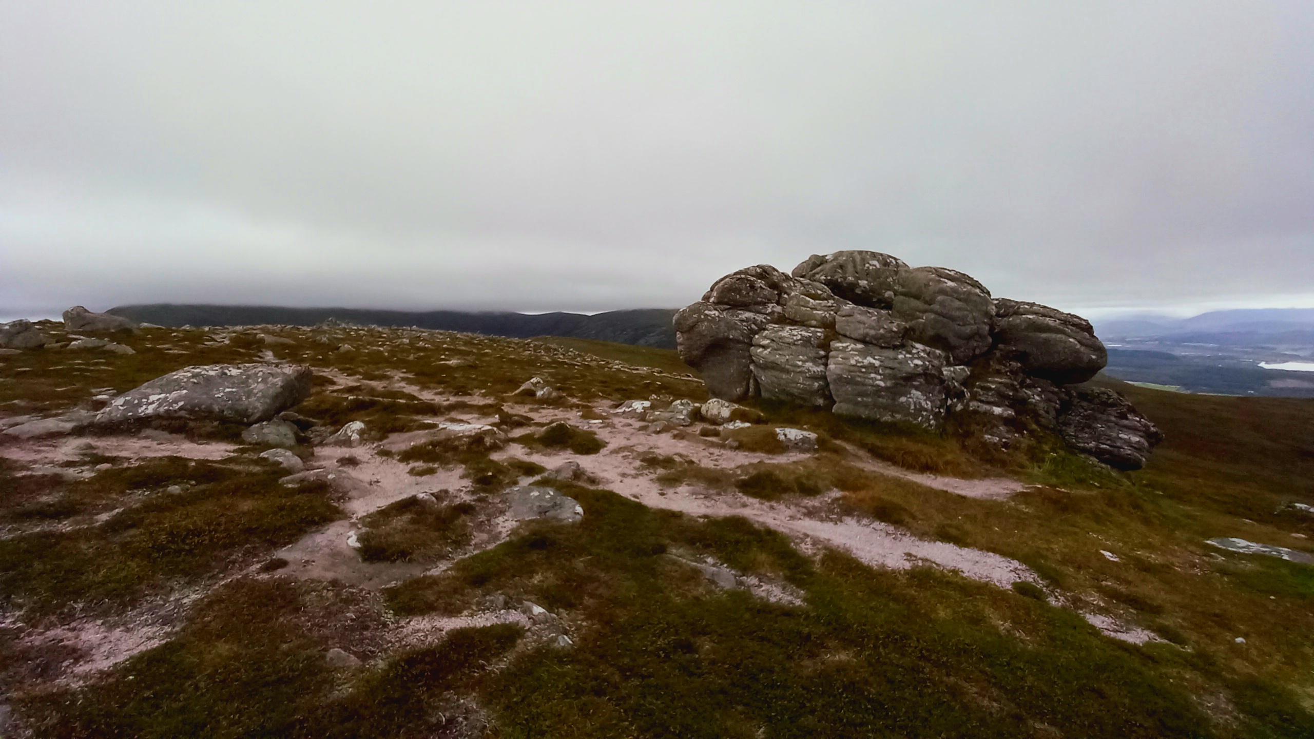
At the Argyll Stone
I headed straight downhill, passing through the various bands of florae that change with altitude, eventually ending up on a very steep rocky and heathery slope which I picked my way down carefully, having ran out of humour by this point.
Nasty terrain for tired legs
A short walk across the glen floor left me 300m further north than I wanted to be due to a lateral moraine running down from the loch. However it was a simple matter of walking up the track a bit to retrieve the bike. I was back at the car some 15 minutes later at around 1840, still 45 minutes over schedule. So, around a 12 hour day on the hill.
Summary
I’d packed a few extras in the bag, it being a longer and more remote hike, with shorter days and changing seasons
- a lightweight down jacket
- my bothy bag
- extra batteries for the GPS and headtorch
- power pack for the phone
- a proper hat and gloves
Needless to say I wouldn’t have been activating Sgor Gaoith without the bothy bag.
Including the cycle, the route was 40km/25 miles and with 1800m/6000’ of ascent. That was pretty much what I’d planned for. I’d expected rough ground on the approach and climb of Braeraich, but wasn’t ready for the terrain on the Great Moss.
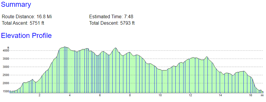
Route profile from the map planning tool, excluding the cycle section
As for the activations, well I felt guilty leaving Braeraich with just four contacts on 2m, but it was the right thing to do. Cairn Toul was fun but in some ways Sgor Gaoith was the most satisfying. Just being able to pull it off, and only just at that!
Anyway, I made a video. I had fun shooting and editing the footage. I hope you enjoy it, should you choose to view it.

73, Fraser


 The best use has been in places like EA8 where you cannot get tent pegs into the rock and the pieces of lava you can pick up to use are incredibly sharp. Likewise, Fraser’s use showing rocks from the cairn repositioned around the pole is another time when the protection offered is extremely valuable.