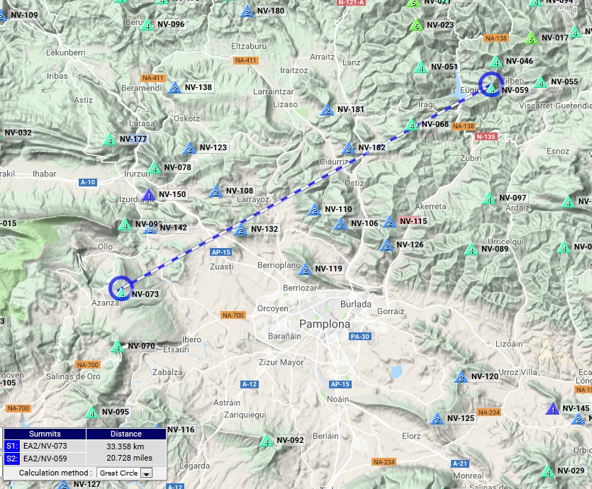
Almost everything went as planned, I woke up at 5h45 utc and my friend JAP and I met this morning at about 7h utc in the small village of Eugi to hike and activate these two 4 points summits which I had never activated before and were nearly new uniques for most of the international SOTA community, as they had only been activated on 2m (both) plus on 12m (only one).
- EA2/NV-059 on 12m (3 QSOs) and on 2m (15 QSOs).
- EA2/NV-046 only on 2m (6 QSOs)
>Casi todo fue según lo planeado, Me desperté a las 5h45 utc y mi amigo JAP y yo nos encontramos esta mañana a eso de las 7h utc en el pequeño pueblo de Eugi para subir y activar estas dos cimas de 4 puntos que no había activado nunca antes y eran practicamente nuevas referencias para la mayoría de la comunidad SOTA internacional, pues solo habían sido activadas en 2m (ambas) y también en 12m (solo una).
- EA2/NV-059 en 12m (3 QSOs) y en 2m (15 QSOs).
- EA2/NV-046 solo en 2m (6 QSOs)
My initial idea of driving that zigzagging mountan road you can see in the map below starting from the village of Eugi up to the point where it meets the red GPS track, couldn’t be exactly like that, as I wrongly took a different way and this wasn’t actually a mountain road but a mountain track with stones and ground instead of a proper road pavement. With the help of the 4x4 and the gear-reductor applied, I managed to drive up to a point where the track became too steep and muddy and my car wheels couldn’t get anymore grip. So I had to let the car descend backwards down to a point where my friend JAP found a small place to pull the car out of the track, just in case of the highly unlikely situation of another car wishing to pass.
>Mi idea inicial de conducir mi coche por esa carretera de montaña zigzagueante que podrán ver en el mapa más abajo empezando en el pueblo de Eugi y subiendo hasta el punto donde se encuentra con la ruta GPS roja, no pudo ser exactamente así, pues erróneamente tomé una vía diferente y ésta no era realmente una carretera de montaña sino una pista de montaña con piedras y tierra en vez de una carretera propiamente pavimentada. Con ayuda de mi 4x4 y la reductora conectada, conseguí subir hasta un punto donde la pista se puso demasiado empinada y barrosa donde las ruedas de mi coche no pudieron traccionar más, así que tuve que dejar descender el coche hacia atras hasta un punto donde mi amigo JAP encontró un pequeño sitio donde dejar el coche apartade de la pista por si se diera la muy improbable situación de que otro coche quisiera pasar.
Once the car got parked, we started our hike and it was about 8h utc by then.
>Una vez aparcado el coche, empezamos nuestra subida y eran sobre las 8h utc para entonces.
The temperature was around zero degrees C but there was no wind and no rain, so it was a nice morning to hike. We could see just some very few and small traces of little snow on the ground here and there.
>La temperatura era de unos cero grados C pero no había viento ni lluvia, así que era una bonita mañana para subir por el monte. Podíamos ver algunos pocos y pequeños rastros de poca nieve en el suelo aquí y allí.
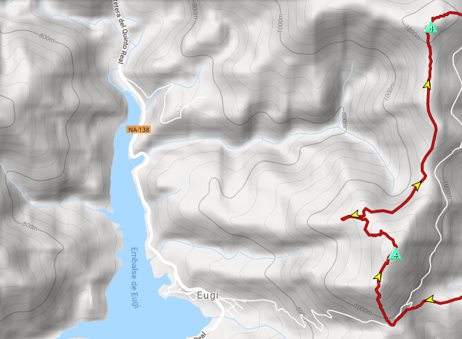
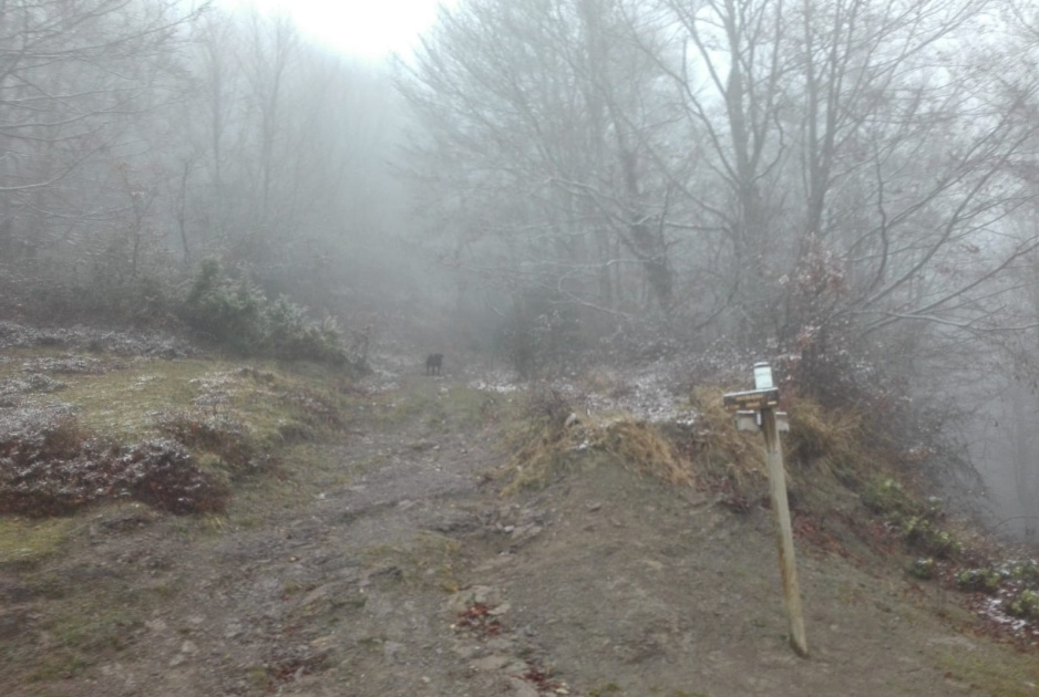
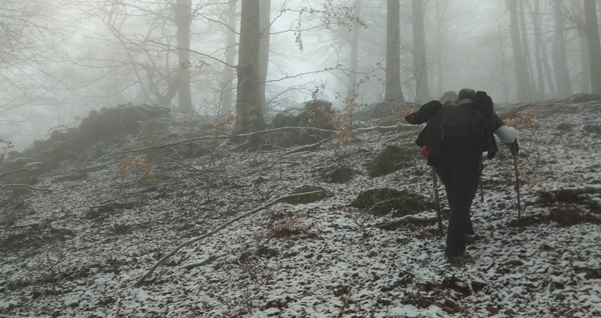
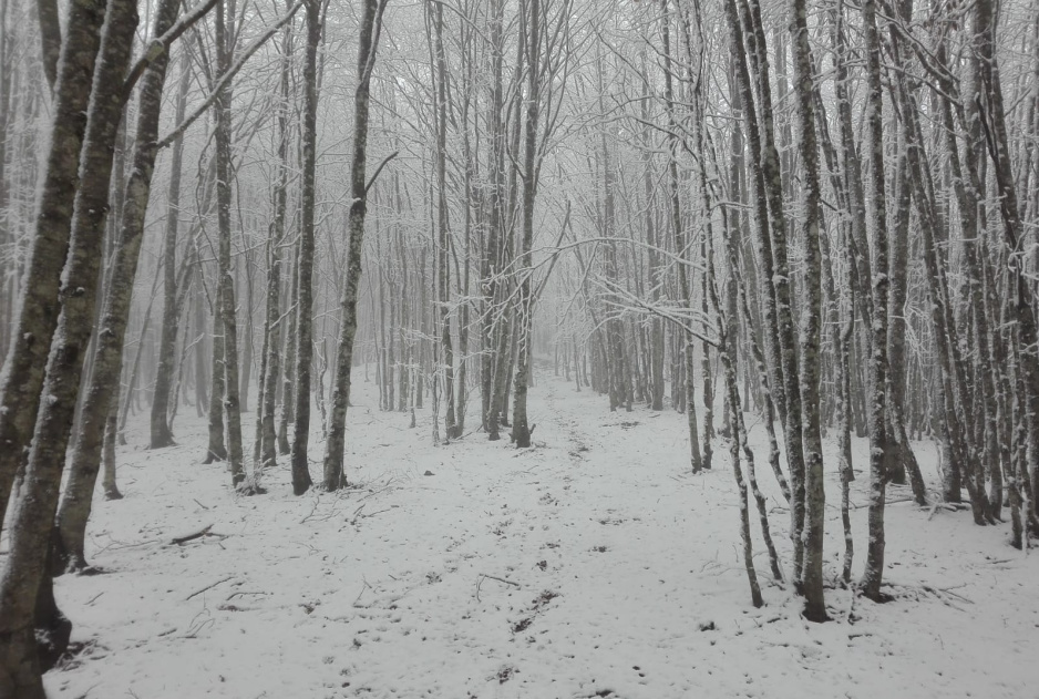
After a while hiking this now impossible to be driven in my car track, we finally got to the point where this track met the GPS track I had with me and we continued our hike through this track you’ll see in this image below:
>Después de un rato subiendo por esta pista ahora imposible para mi coche, llegamos finalmente al punto donde esta pista se encontraba con la ruta GPS que tenía conmigo y continuamos nuestra subida por la pista que verán en la imagen aquí debajo:
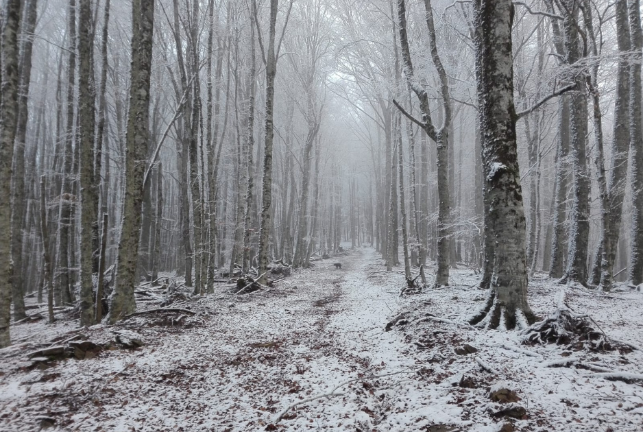
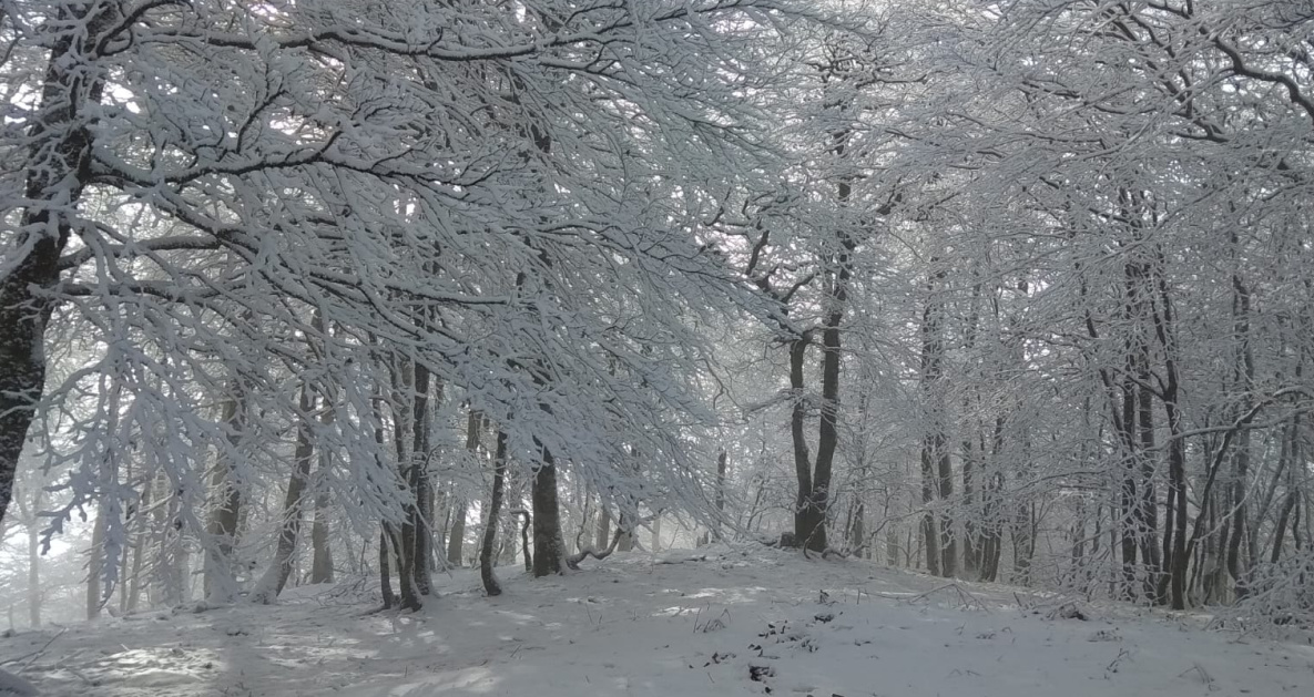
We walked through nice easy sections like this nice bleech trees forest:
>Caminamos a través de bonitas y fáciles zonas como este bosque de hayas:
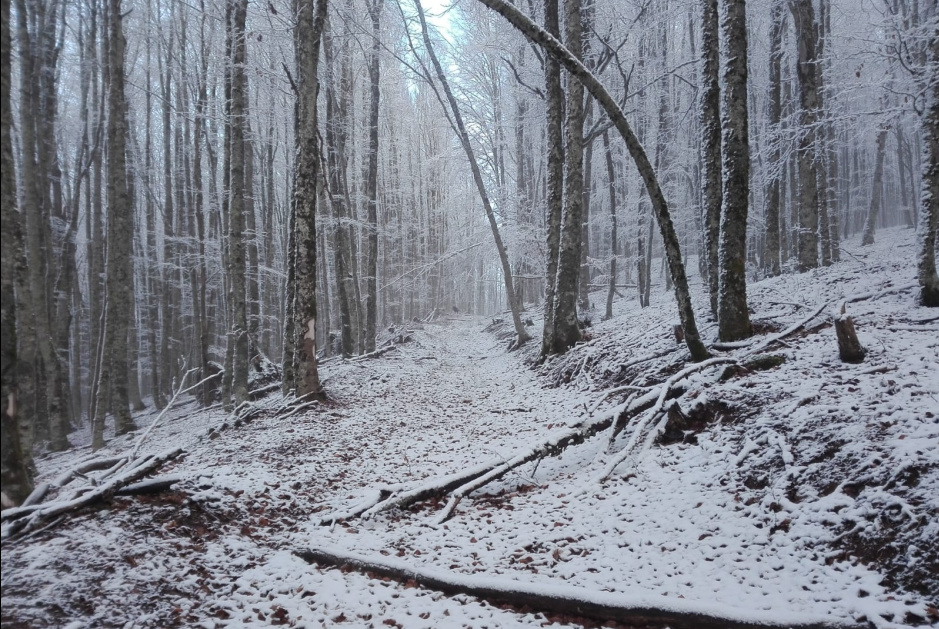
And this other one:
>Y esta otra:
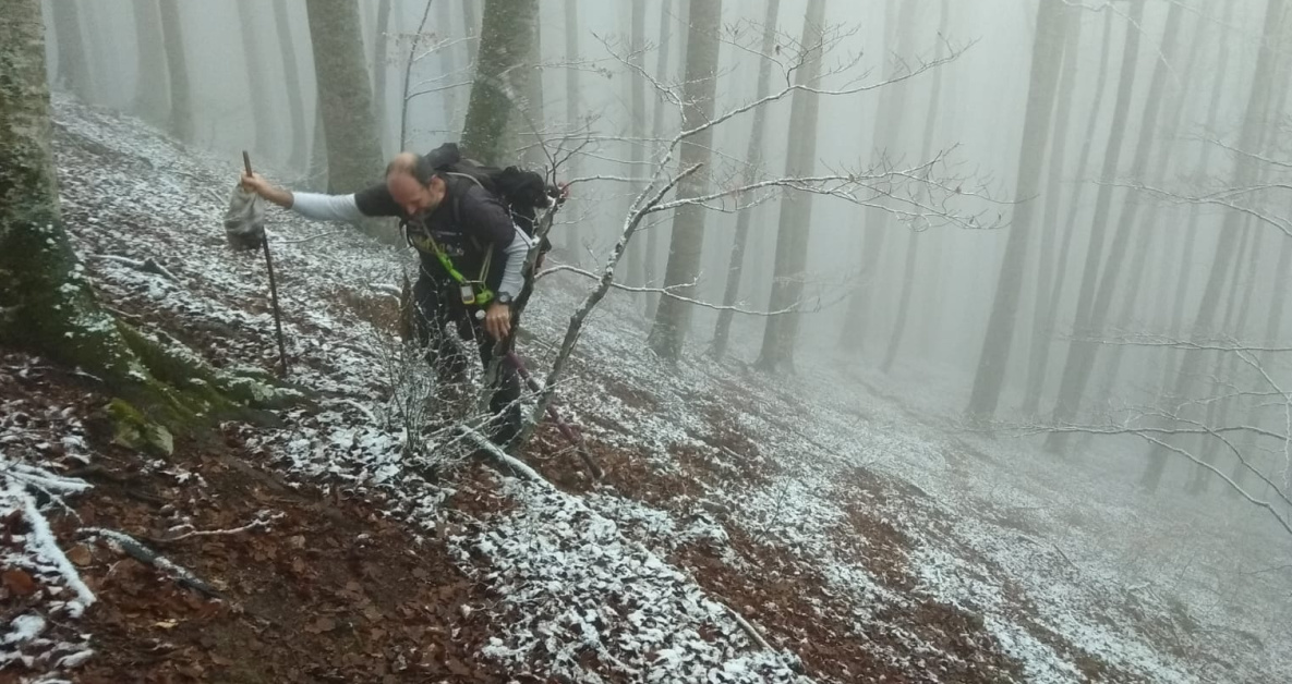
until we realised at one point that we had missed the right track with so much nice chatting we were having and we had to make a shortcut through a not so easy to hike area in order to take again the GPS track we were supossed to be following.
>hasta que, a un punto, nos dimos cuenta de que nos habíamos desviado de la ruta GPS con tanta agradable charla como estábamos teniendo y tuvimos que hacer un atajo a través de una zona no tan fácil de subir para reencontrarnos con la ruta GPS que se supone debíamos seguir.
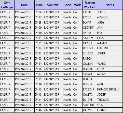
We finally got to the summit of Mt. Iremendi EA2/NV-059 by 09h04.
>Finalmente llegamos a la cima de Mt. Iremendi EA2/NV-059 para las 9h04.
I setup with the good help of my friend JAP and started my activation:
>Instalé la estación con la buena ayuda de mi amigo JAP y empecé mi activación:
We were behind schedule, so after having collected this log of 20 QSOs, I decided to only activate on 20m CW and make QRT to head towards the second summit of the day.
This is the log where the highlights were:
- a QSO with John ZL1BYZ in New Zealand.
- a S2S with Ignacio EA2BD in Mt. Mortxe EA2/NV-073.
I confess everytime I reach ZL from a summit with my FT-817ND at 5 watts, I feel really amazed…
>Íbamos retrasados respecto al plan, así que tras haber completado este log de 20 QSOs, decidí activar solo en 20m CW y hacer QRT para dirigirnos hacia la segunda cima del día.
Este es el log y los sobresalientes fueron:
- un QSO con John ZL1BYZ en Nueva Zelanda.
- Un Cumbre a Cumbre (S2S) con Ignacio EA2BD en el monte Mortxe EA2/NV-073.
Confieso que cada vez que llego a ZL desde una cima con mi FT-817ND a 5 vatios, me siento realmente alucinado…
This is the S2S log:
>Este es el log Cumbre a Cumbre (S2S):

Once everything got packed up, we headed towards the second summit and seen that the terrain was pretty clear and easy to hike with no bushes and just the bleech trees forest, we decided not to follow the GPS track I had downloaded from the Wikiloc web page and improvise our own way straigh ahead.
>Una vez empaquetado todo, nos dirigimos hacia la segunda cima y en vista de que el terreno era bastante despejado y fácil de subir sin arbustos y solo el bosque de hayas, decidimos no seguir la ruta GPS que había descargado de la página web de Wikiloc e improvisamos nuestro camino todo recto.
We did so because the GPS track I had included a severe descent from this first summit down to a place where there is a dolmen, but we were not interested nor had the time to visit it.
>Hicimos esto porque la ruta GPS que tenía incluía un fuerte descenso desde esta primera cima hasta un lugar donde hay un dolmen, pero no estábamos interesados ni teníamos el tiempo para visitarlo.
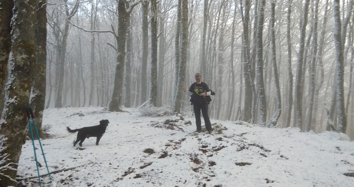
In this picture, we were almost reaching the second summit of the day:
>En esta foto, estábamos casi llegando a la segunda cima del día:

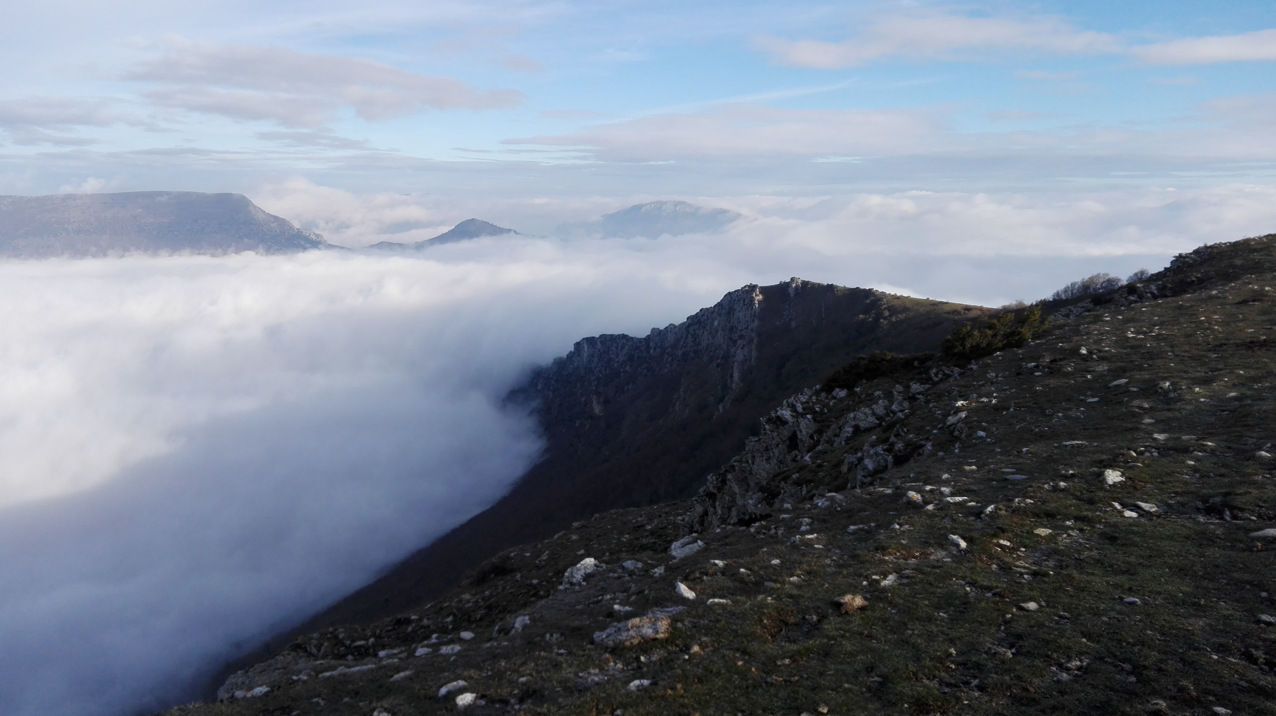
And we finally got to the summit of Mt. Zotalar EA2/NV-046 by about 15 minutes before 11h utc. It was just a beautiful scenery…
>Y finalmente llegamos a la cima del monte Zotalar EA2/NV-046 unos 15 minutos antes de las 11h utc. Era símplemente un escenario precioso…
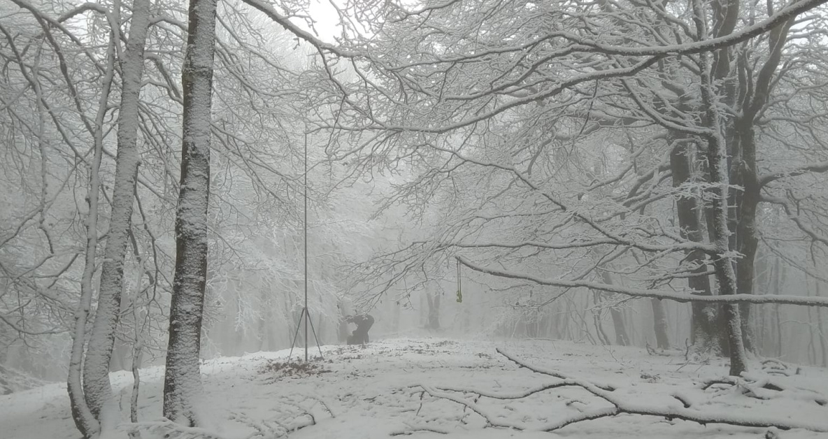
Here you can see my setup:
>Aquí pueden ver mi instalación:
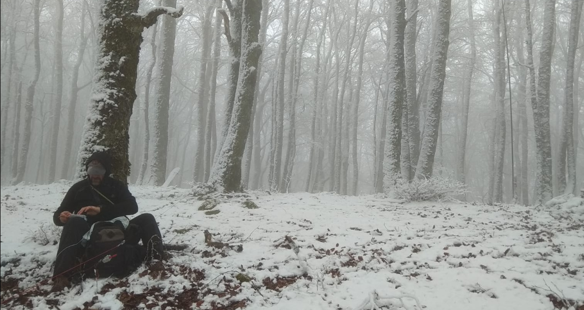
And this is me while operating:
>Y este soy yo mientras estaba operando:

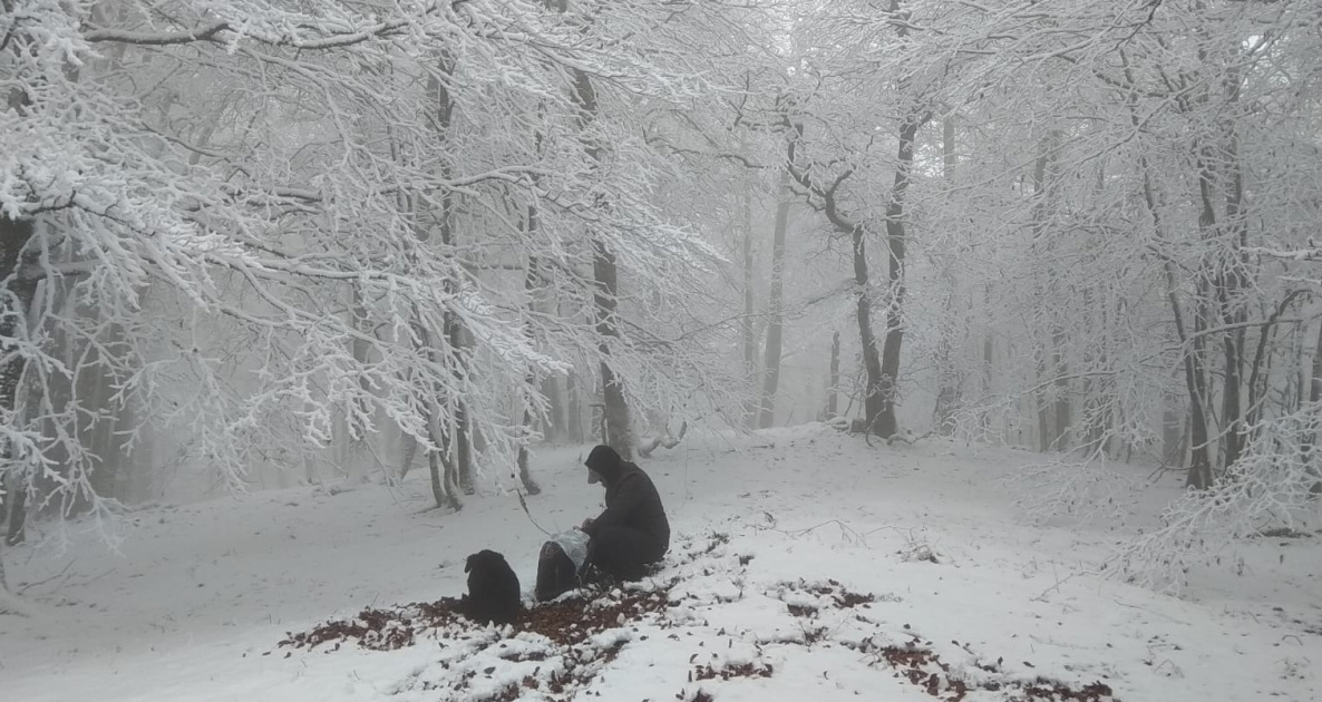
Again I operated on 20m CW only due to timing constrains and also the fact that I saw my dog Lucho shivering, thus indicating me it was a bit too cold with the snow on the ground.
I only logged 8 QSOs and when nobody else came back to my CQ calls, I decided to QRT for a quick pack up and descent.
>Nuevamente operé solamente en 20m CW por restricciones de tiempo y también por el hecho de que ví a mi perro Lucho tiritando, lo que me indicó que tenía demasiado frío con la nieve en el suelo.
Sólo anoté 8 QSOs y cuando nadie más respondió a mis llamadas CQ, decidí hacer QRT para recoger rápidamente y descender.
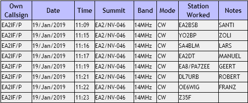
This is the log:
>Este es el log:
On our return, we didn’t follow the GPS track back to the starting point and we descended to the white track you will see in the map above, as it goes parallel but down at the base of the mountain. It was very straightforward and a pleasant walk albeit very muddy most of the time.
>Durante el retorno, no seguimos la ruta GPS de vuelta hasta el punto de inicio y descendimos a la pista blanca que verán en el mapa más arriba, pues discurre paralelo pero abajo al pie del monte. Fue un paseo fácil y agradable aunque con mucho barro casi todo el tiempo.
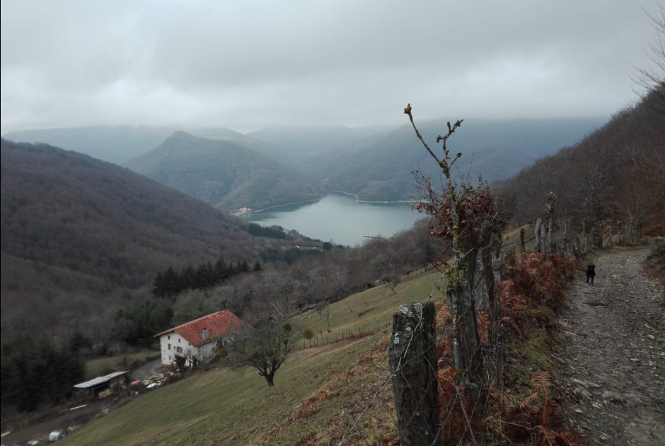
As we were descending the track I had initially planned to drive up with my car but I couldn’t, I took this picture where the water reservoir of Eugi can be partly seen. This is where an important part of Pamplona’s population drinking water comes from.
>Según estábamos bajando la pista que inicialmente había planeado subir con i coche pero no pude, tomé esta foto donde puede verse una parte del el pantano de Eugi. De aquí viene una parte importante del agua potable que consume la población de Pamplona.
We finally got home in time for lunch with our respective families and so again managed to do SOTA while keeping our wives and kids happy.
Thanks dear chasers for your calls and QSOs and I’ll be looking forward to copying you again soon from some other summit.
>Finalmente llegamos a casa a tiempo para comer con nuestras respectivas familias y así, otra vez conseguimos hacer SOTA mientras tuvimos contentas a nuestras esposas e hijos.
Gracias queridos cazadores por sus llamadas y QSOs y espero volver a copiarles pronto desde alguna otra cima.
73,
Guru